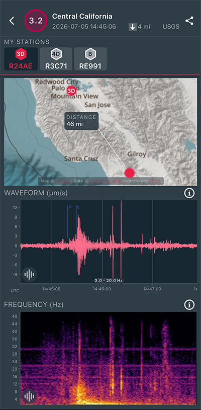
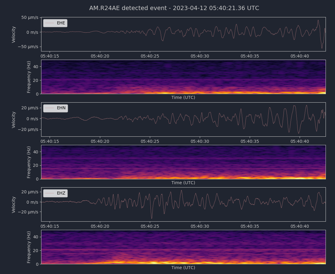
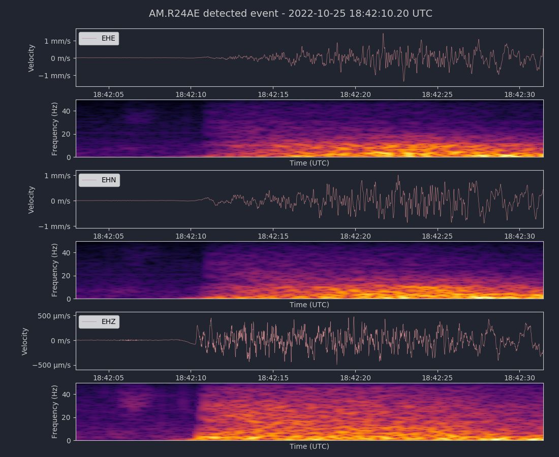
Magnitude 7.5
Depth 6.2 mi
17 mi SE of Yumare, Venezuela
10.435°N 68.472°W
June 24, 2026 22:05:11 UTC
|
North/South Sensor
|
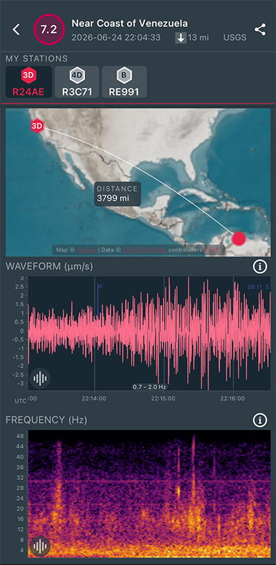
Magnitude 7.2
Depth 12.6 mi
14 mi SE of Yumare, Venezuela
10.436°N 68.528°W
June 24, 2026 22:04:33 UTC
|
North/South Sensor
|
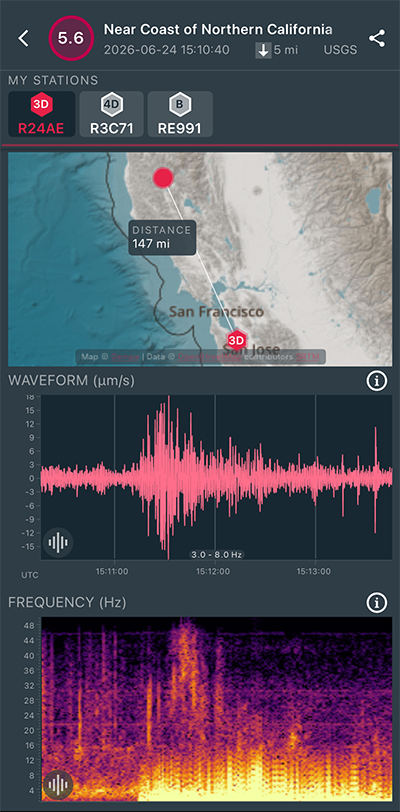
Magnitude 5.6
Depth 5.0 mi
7 mi N of Redwood Valley, CA
39.364°N 123.229°W
June 24, 2026 15:10:40 UTC
|
North/South Sensor
|
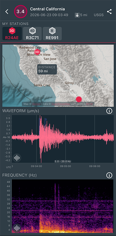
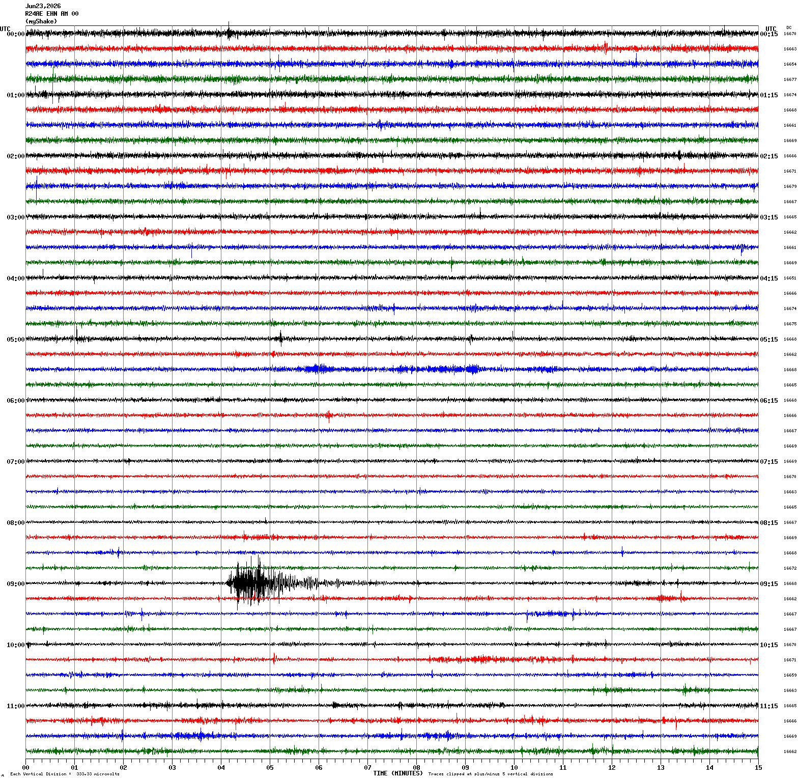
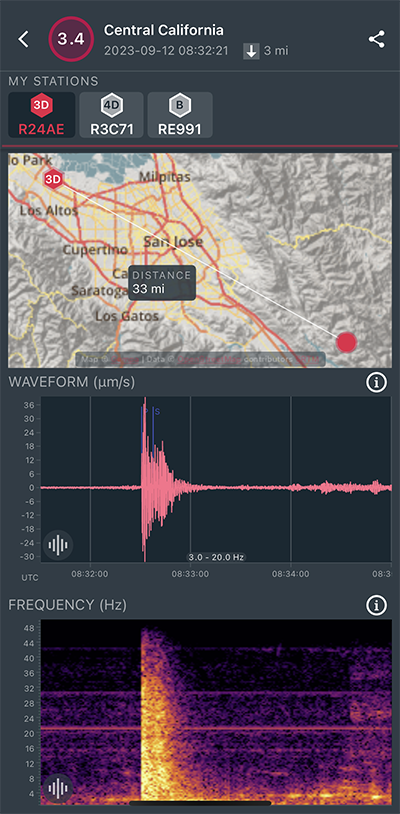
Magnitude 3.4
Depth 4.7 mi
3 mi SW of Ridgemark, CA
36.781°N 121.399°W
June 23, 2026 09:03:49 UTC
|
North/South Sensor
|
Magnitude 3.4
Depth 1.2 mi
5 mi NW of The Geysers, CA
38.834°N 122.816°W
June 14, 2026 08:16:33 UTC
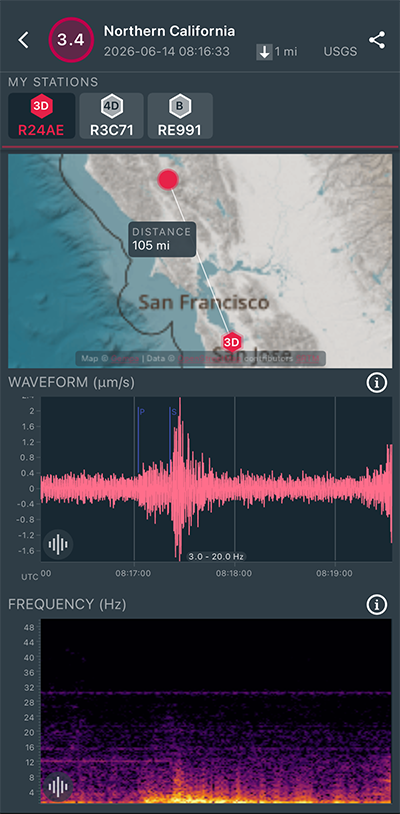
|
North/South Sensor
|
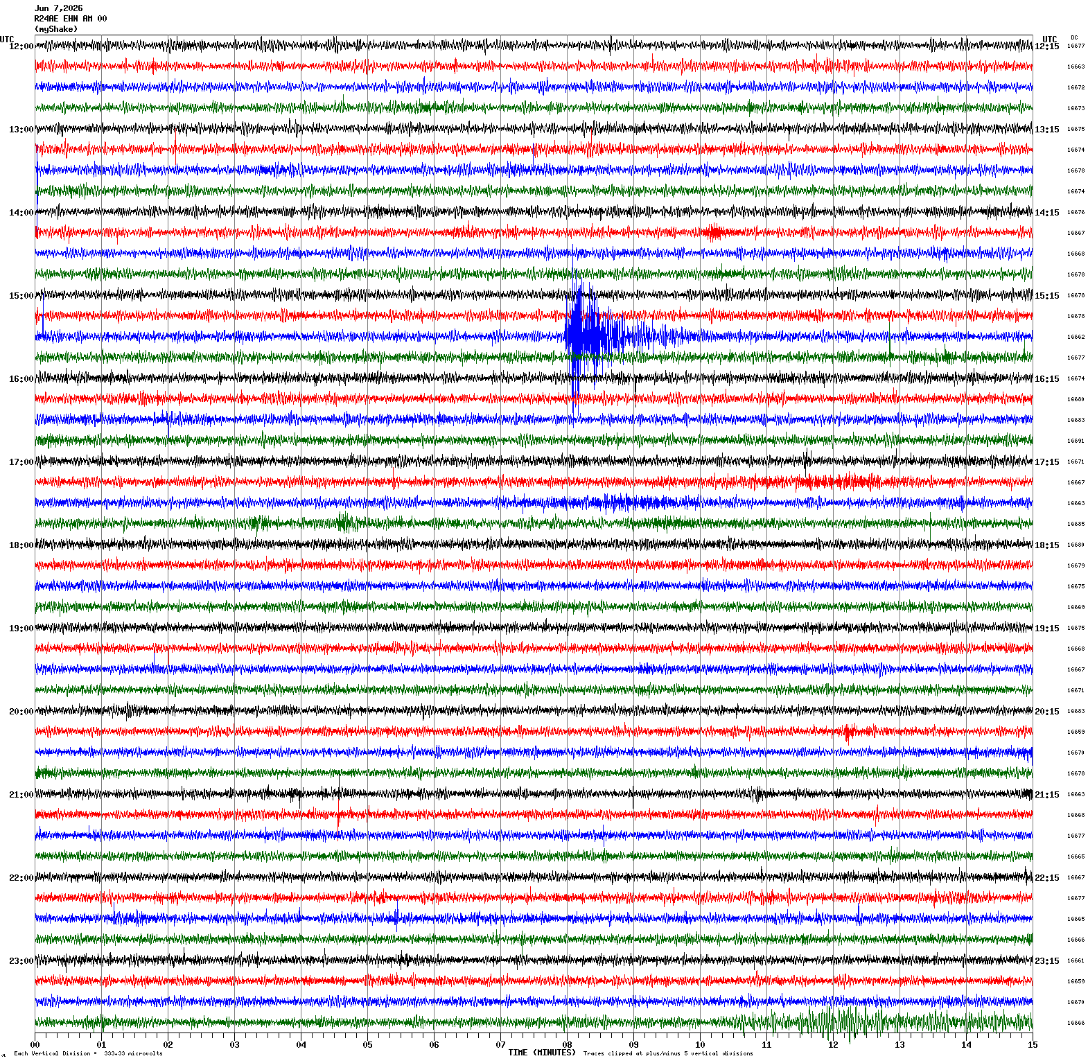
Magnitude 3.6
Depth 9.1 mi
1 mi SW of Alamo, CA
37.838°N 122.045°W
June 7, 2026 15:37:48 UTC
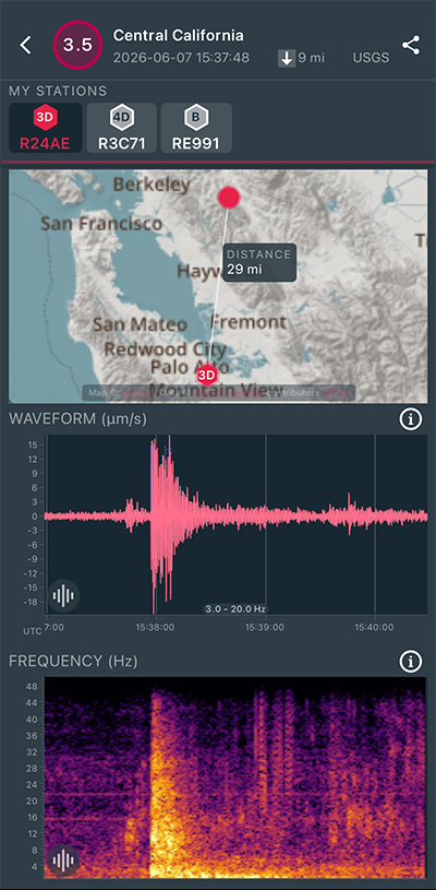
|
North/South Sensor
|
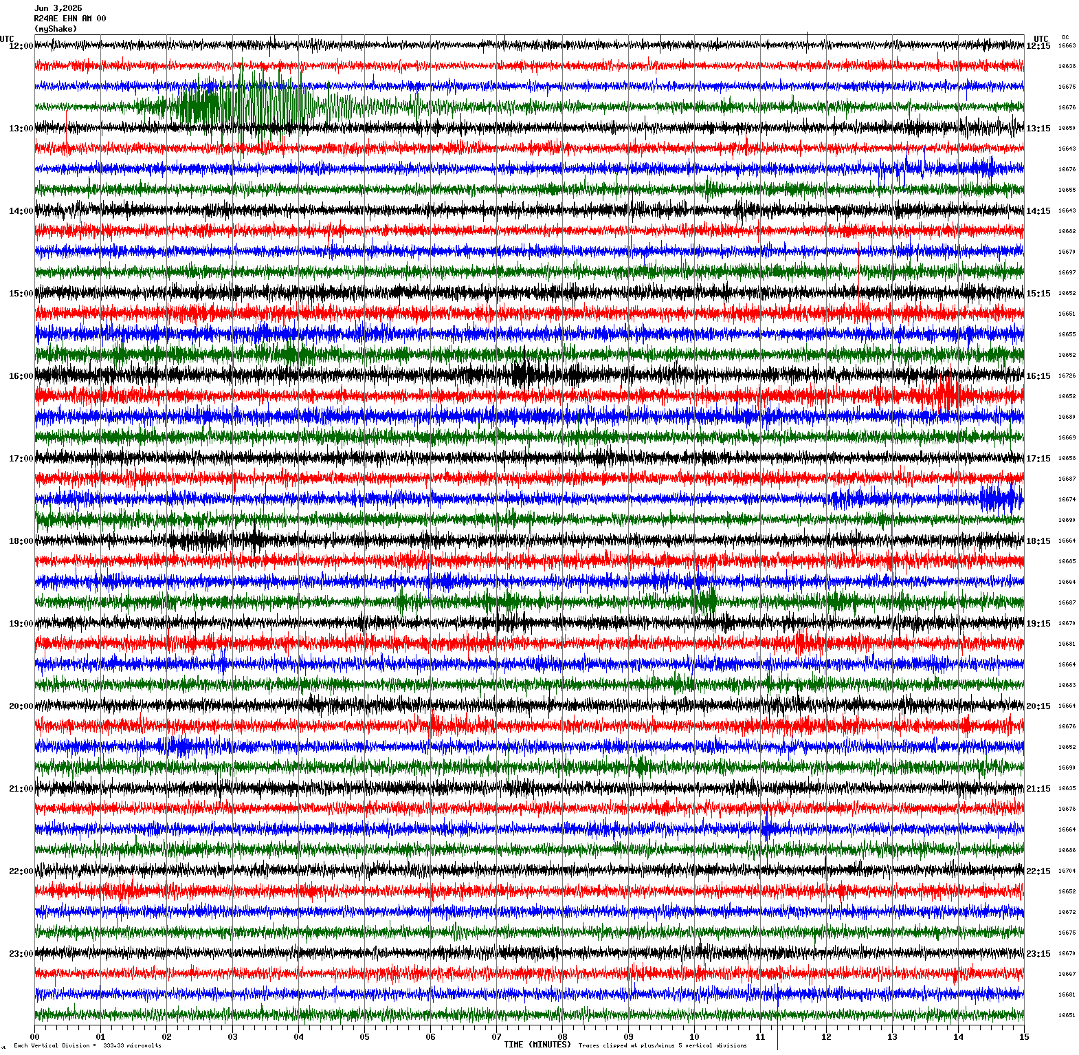
Magnitude 5.1
Depth 0.1 mi
40 mi W of Petrolia, CA
40.360°N 125.045°W
June 3, 2026 12:45:35 UTC
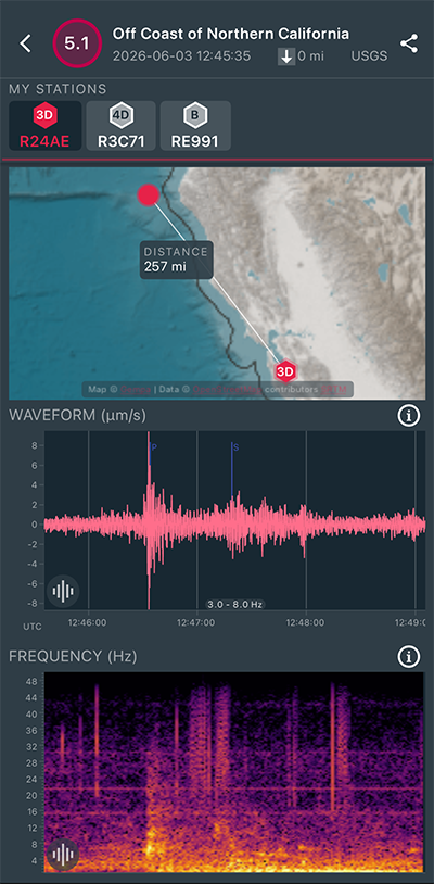
|
North/South Sensor
|
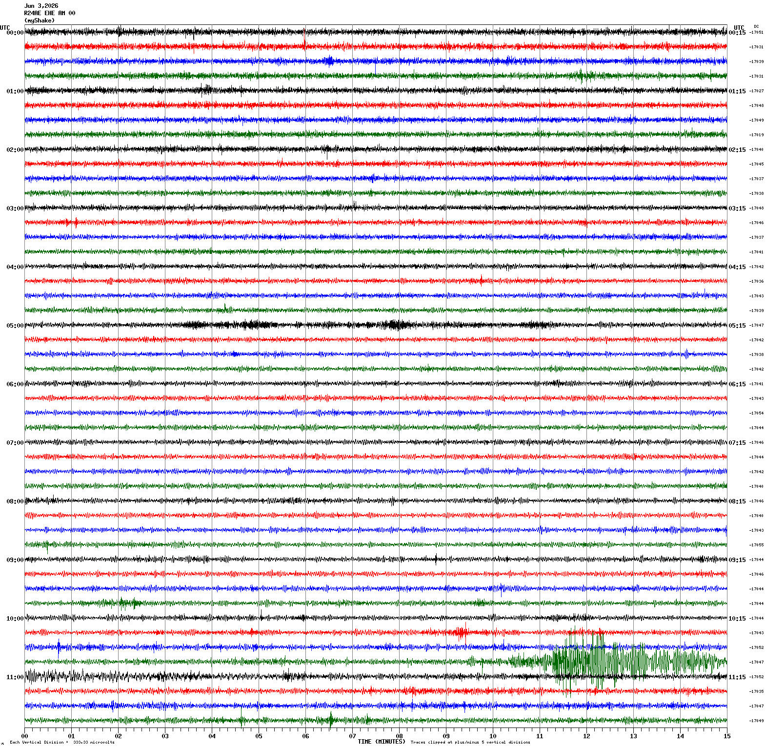
Magnitude 5.7
Depth 6.2 mi
96 mi WSW of Pistol River, Oregon
41.897°N 126.186°W
June 3, 2026 10:53:54 UTC
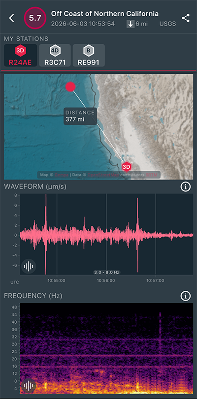
|
East/West Sensor
|
Magnitude 6.9
Depth 67.7 mi
18 mi ENE of Calama, Chile
22.388°S 68.642°W
May 25, 2026 21:52:20 UTC
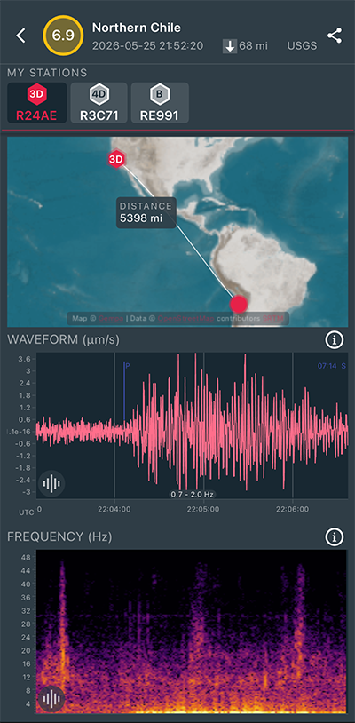
|
North/South Sensor
|
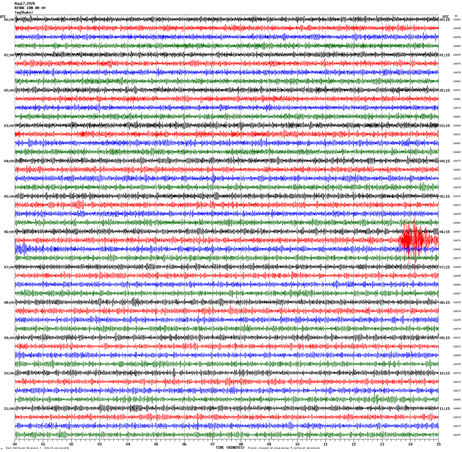
Magnitude 3.6
Depth 4.5 mi
1 mi ENE of Ridgemark, CA
36.820°N 121.352°W
May 17, 2026 06:28:15 UTC
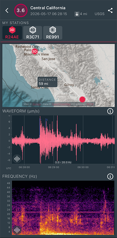
|
North/South Sensor
|
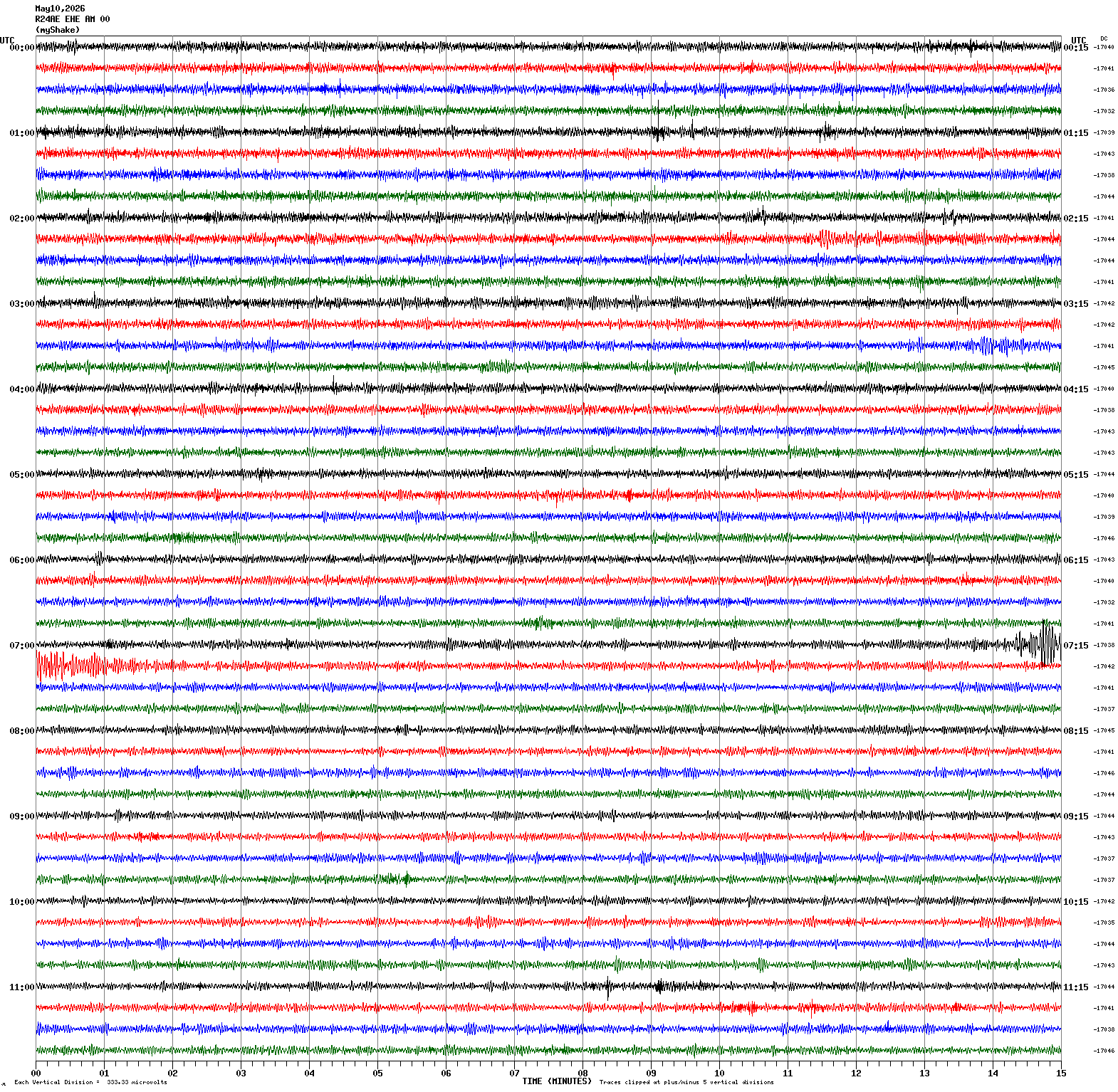
Magnitude 4.1
Depth 3.7 mi
11 mi SE of Silver Springs, Nevada
39.277°N 119.096°W
May 10, 2026 18:22:13 UTC
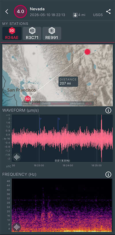
|
North/South Sensor
|
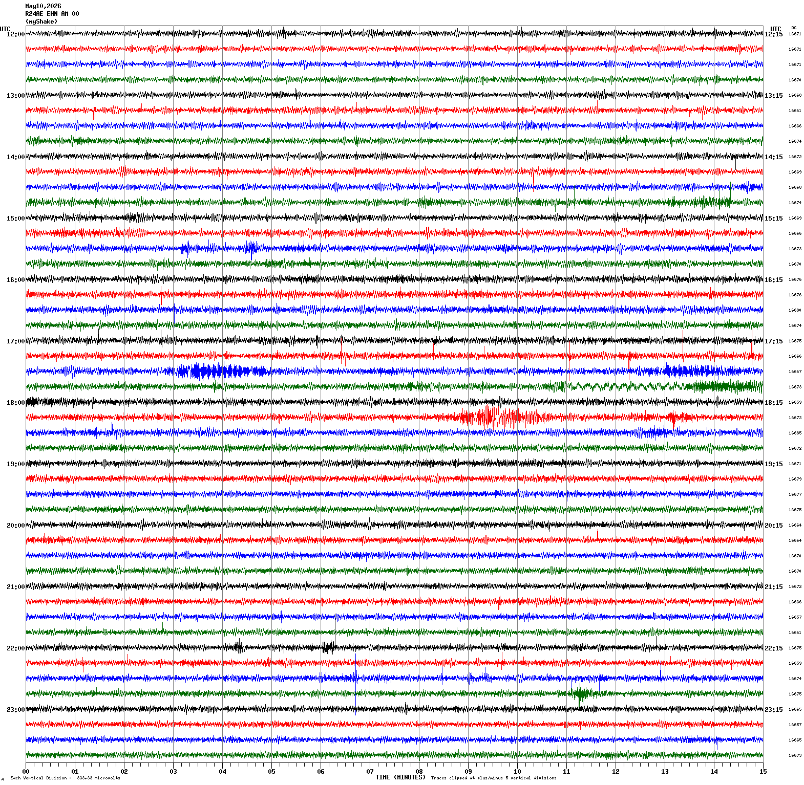
Magnitude 4.7
Depth 9.0 mi
2 mi WSW of Brawley, CA
32.971°N 115.562°W
May 10, 2026 07:10:21 UTC
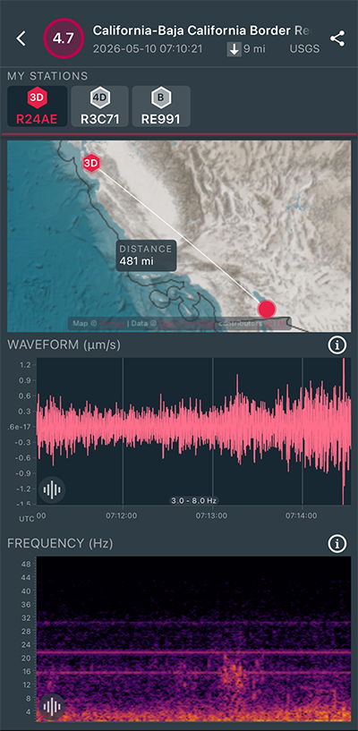
|
East/West Sensor
|
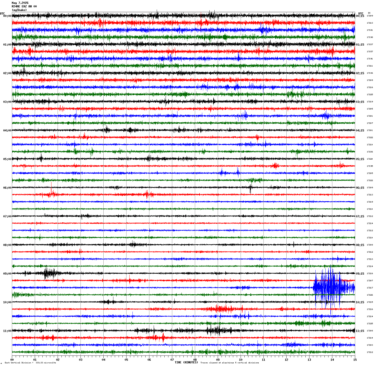
Magnitude 4.4
Depth 2.3 mi
1 mi NW of The Geysers, CA
38.791°N 122.777°W
May 7, 2026 09:42:43 UTC
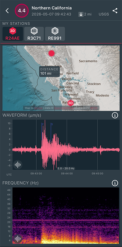
|
Vertical Sensor
|
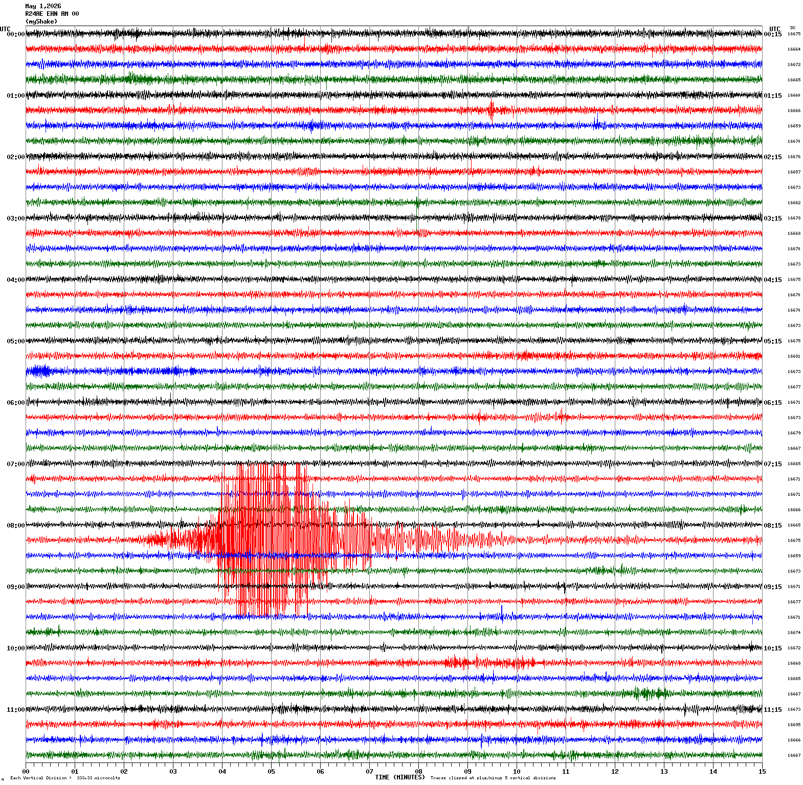
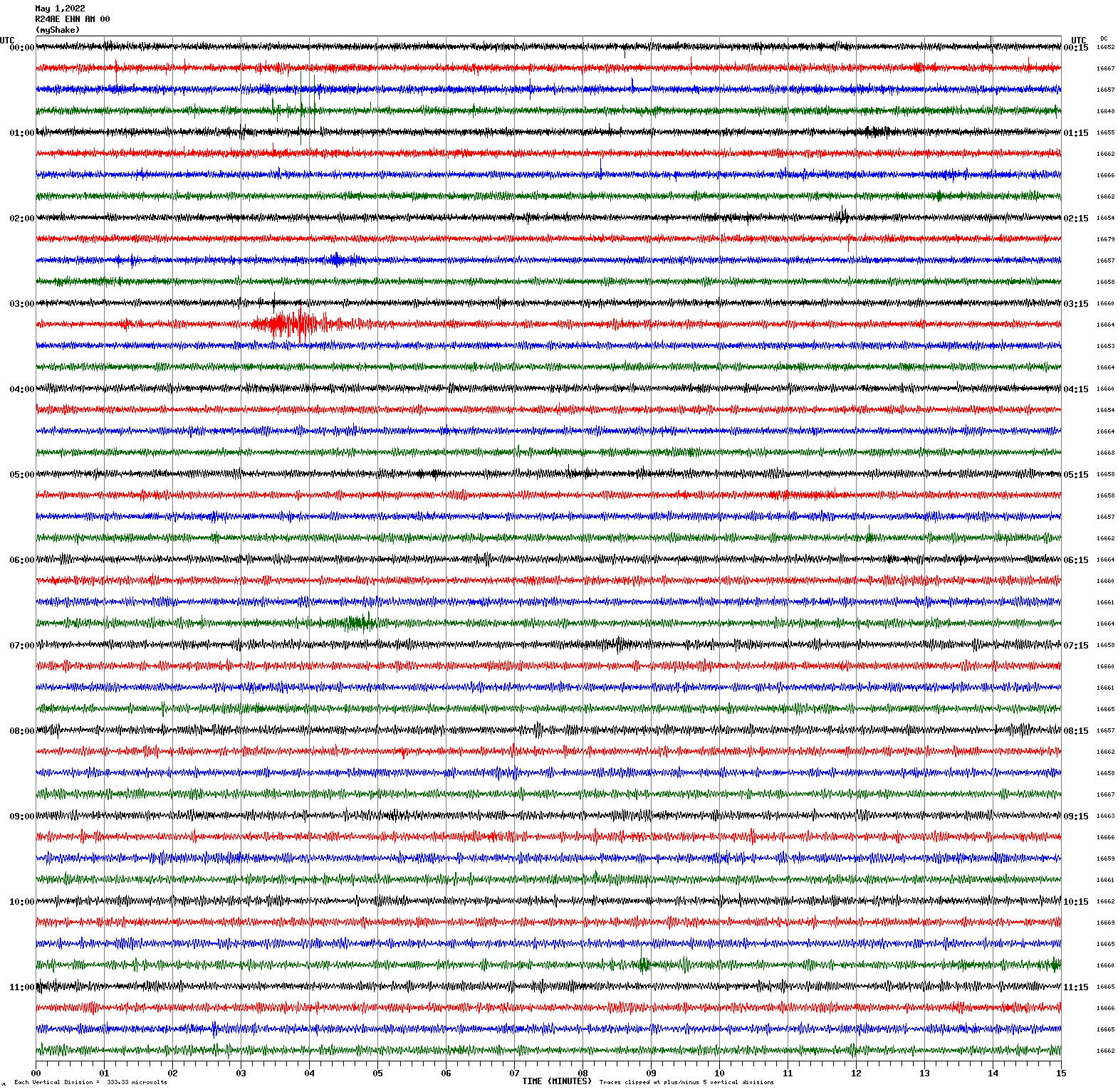
Magnitude 5.2
Depth 3.1 mi
12 mi SE of Silver Springs, Nevada
39.307°N 119.047°W
May 1, 2026 08:17:19 UTC
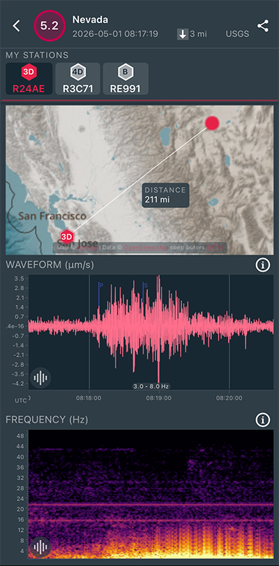
|
North/South Sensor
|
Magnitude 2.8
Depth 4.0 mi
9 mi N of Morgan Hill, CA
37.256°N 121.630°W
April 30, 2026 22:43:37 UTC
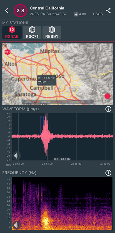
|
North/South Sensor
|
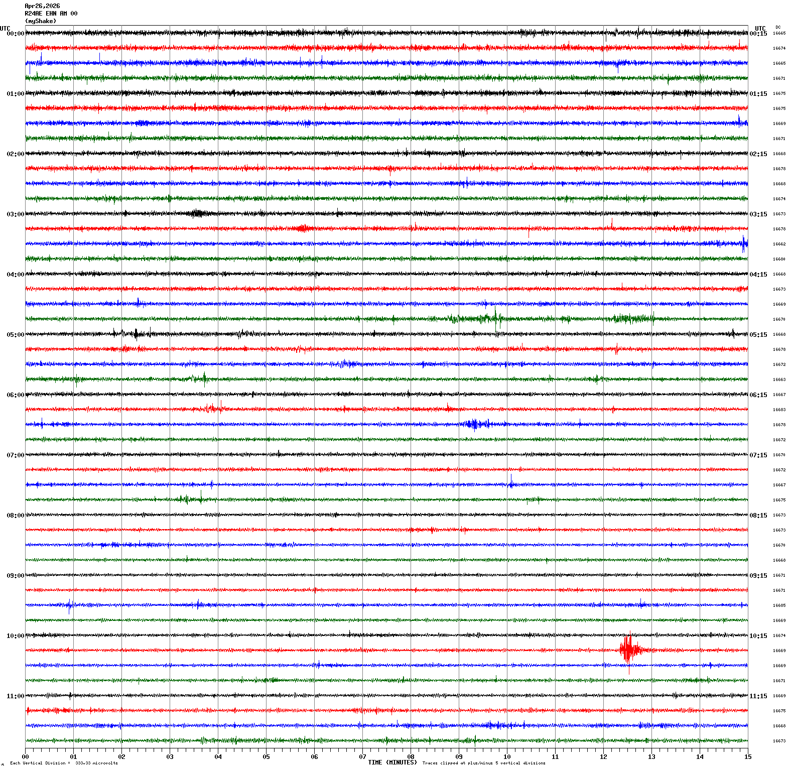
Magnitude 2.7
Depth 4.1 mi
10 mi E of Seven Trees, CA
37.288°N 121.659°W
April 26, 2026 10:27:11 UTC
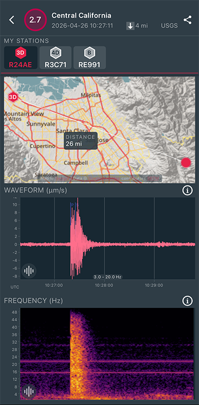
|
North/South Sensor
|
Magnitude 2.7
Depth 4.3 mi
2 mi SSW of San Francisco Zoo, CA
37.703°N 122.519°W
April 25, 2026 23:41:56 UTC
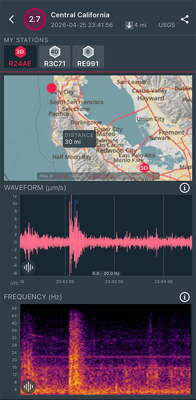
|
North/South Sensor
|
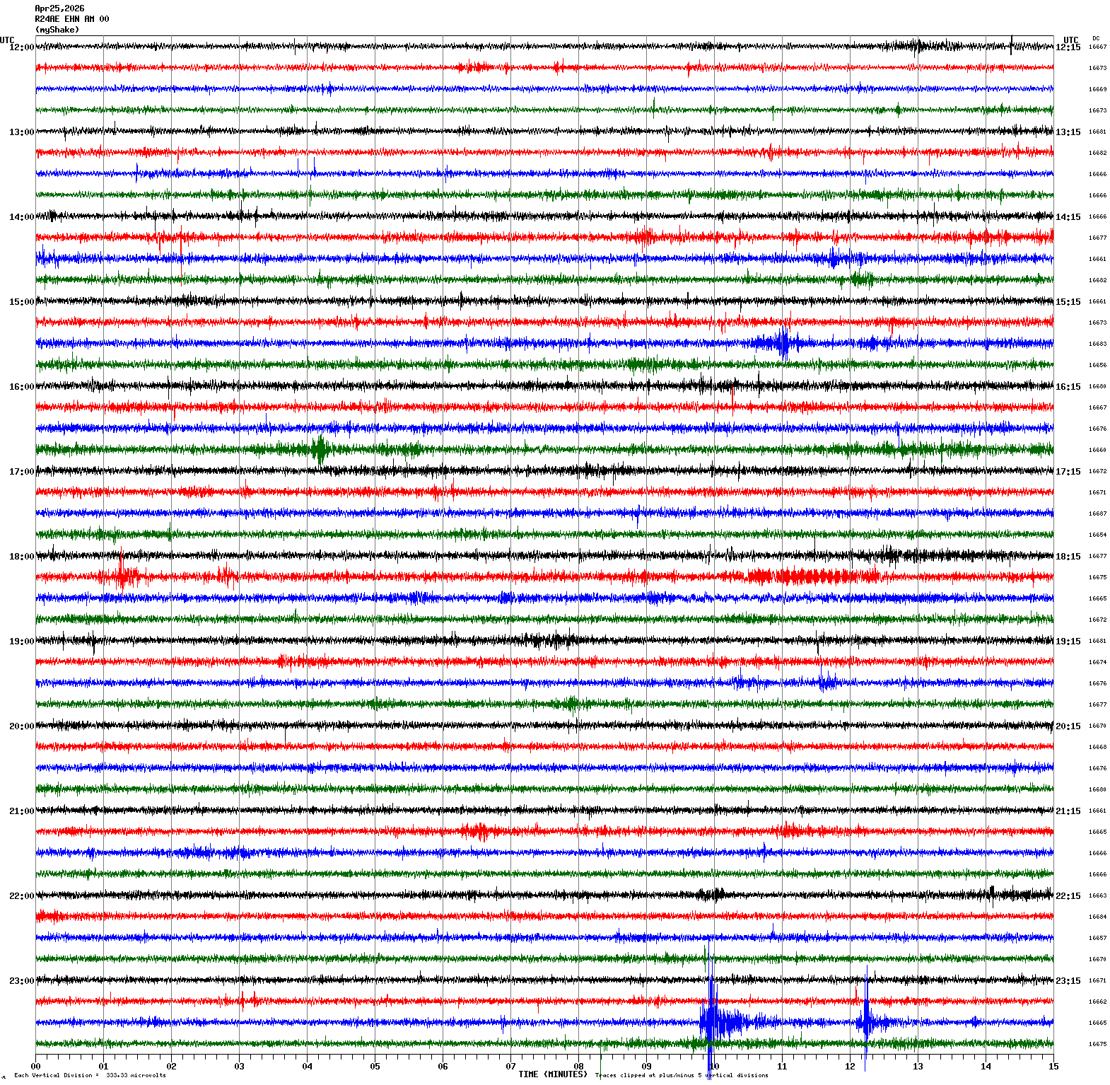
Magnitude 3.0
Depth 4.3 mi
2 mi SSW of San Francisco Zoo, CA
37.704°N 122.518°W
April 25, 2026 23:39:38 UTC
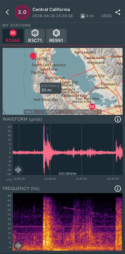
|
North/South Sensor
|
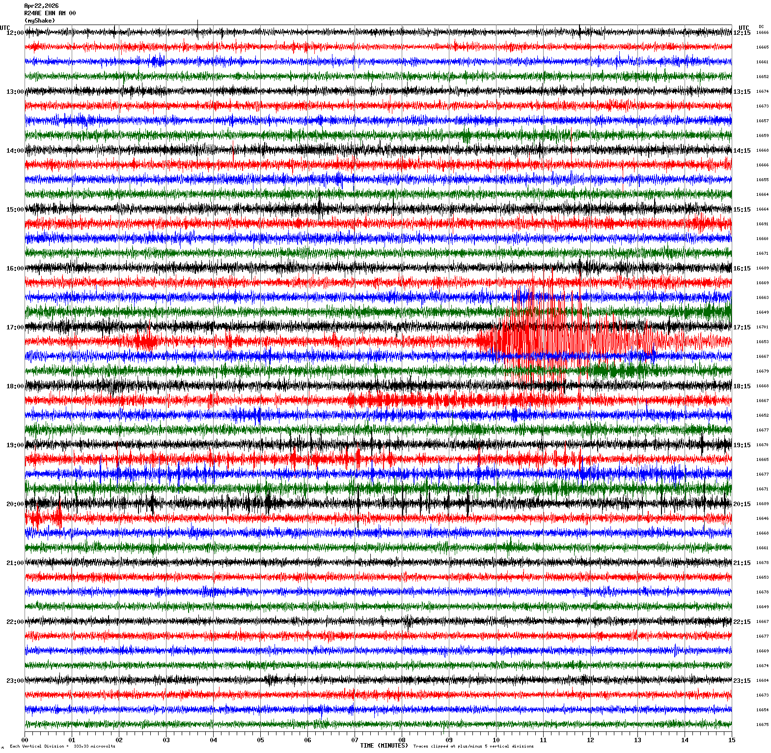
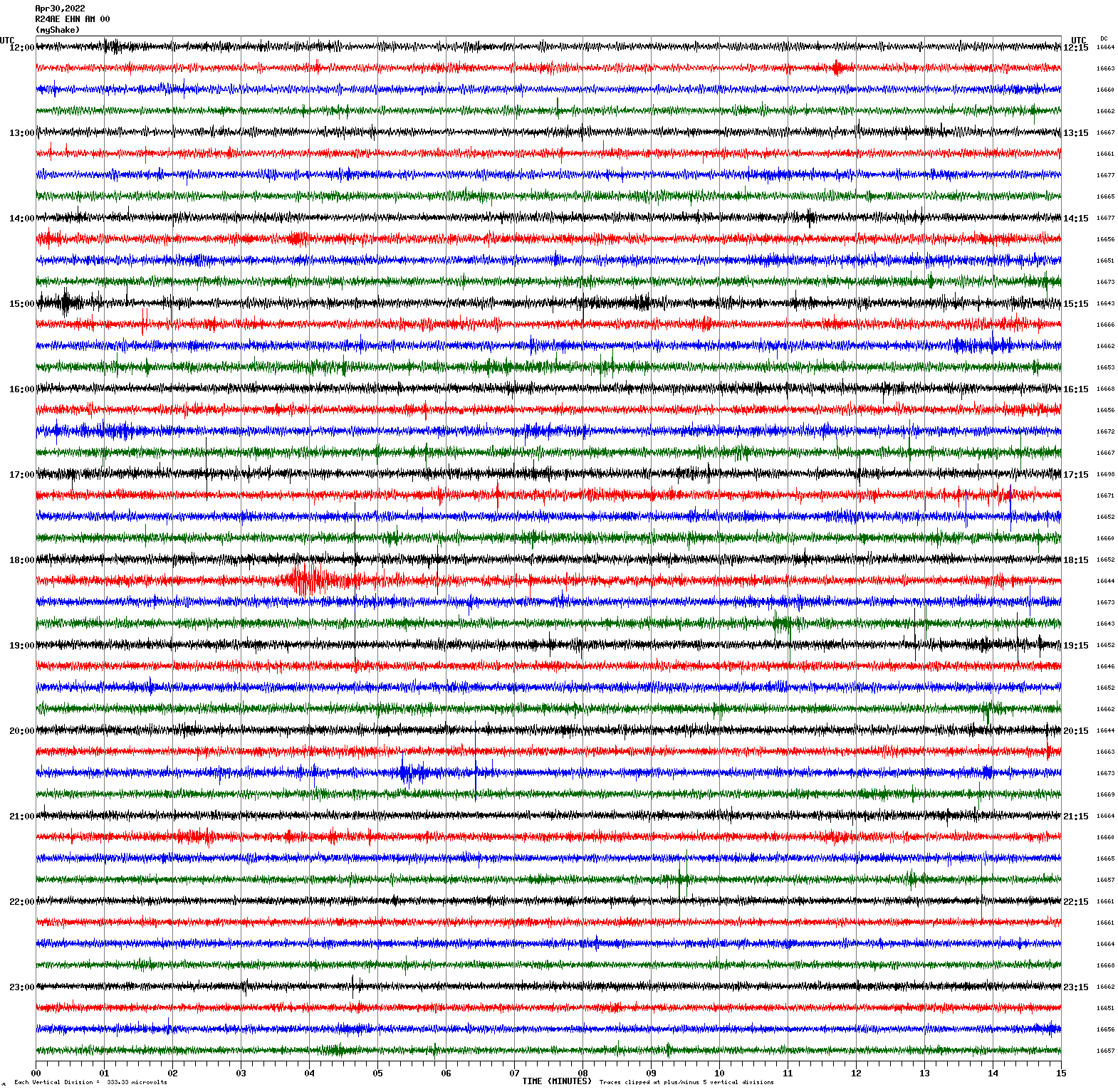
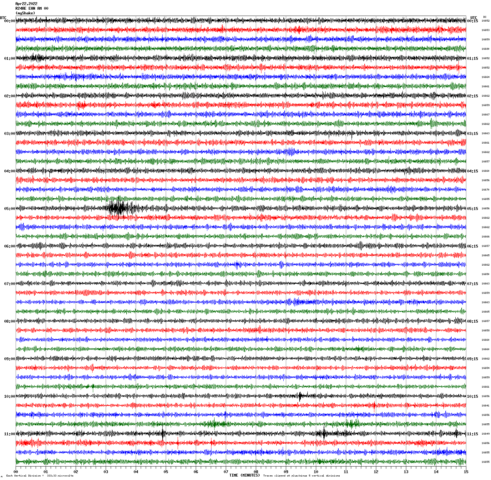
Magnitude 4.8
Depth 1.9 mi
12 mi SE of Silver Springs, Nevada
39.276°N 119.096°W
April 22, 2026 17:23:37 UTC
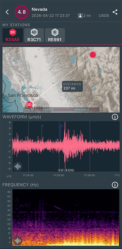
|
North/South Sensor
|
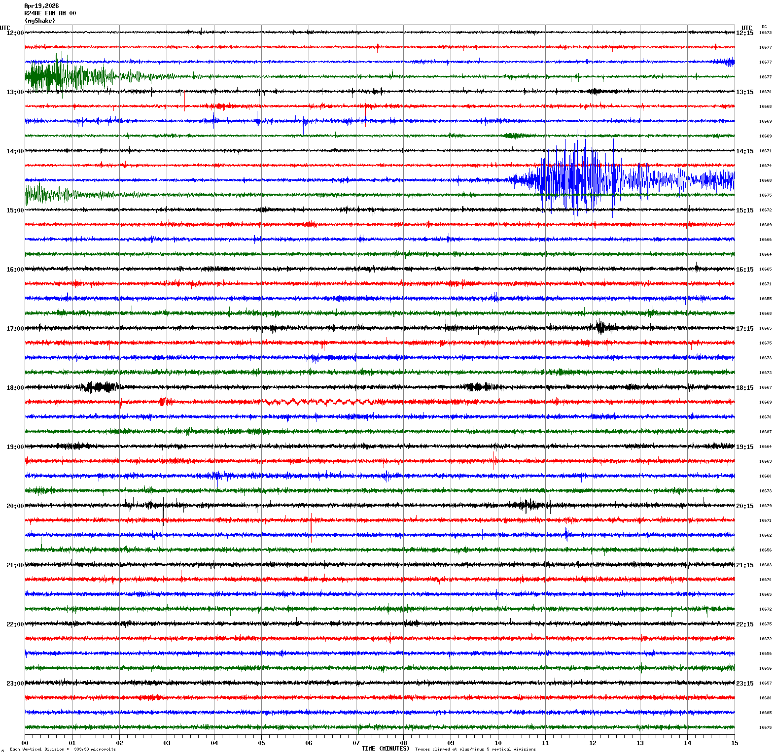
Magnitude 4.7
Depth 3.7 mi
12 mi SE of Silver Springs, Nevada
39.269°N 119.086°W
April 19, 2026 14:39:16 UTC
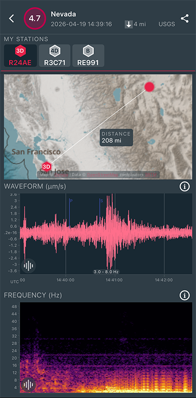
|
North/South Sensor
|
Magnitude 3.8
Depth 9.9 mi
9 mi N of Dyer, Nevada
37.811°N 118.052°W
April 19, 2026 12:44:49 UTC
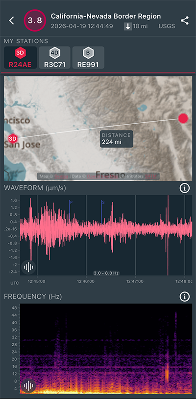
|
North/South Sensor
|
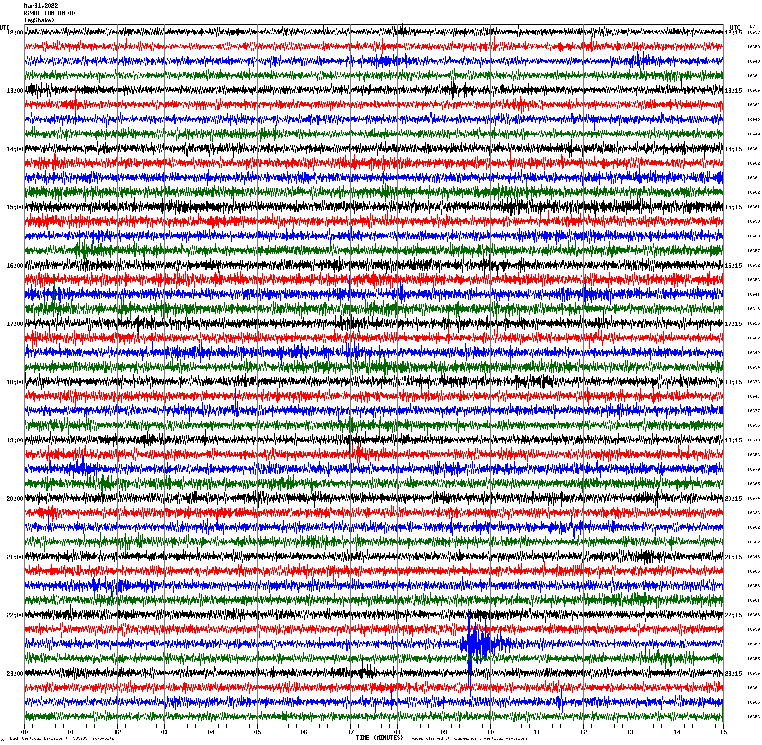
Magnitude 5.7
Depth 3.1 mi
12 mi ESE of Silver Springs, Nevada
39.335°N 119.008°W
April 14, 2026 01:29:12 UTC
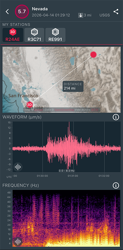
|
Vertical Sensor
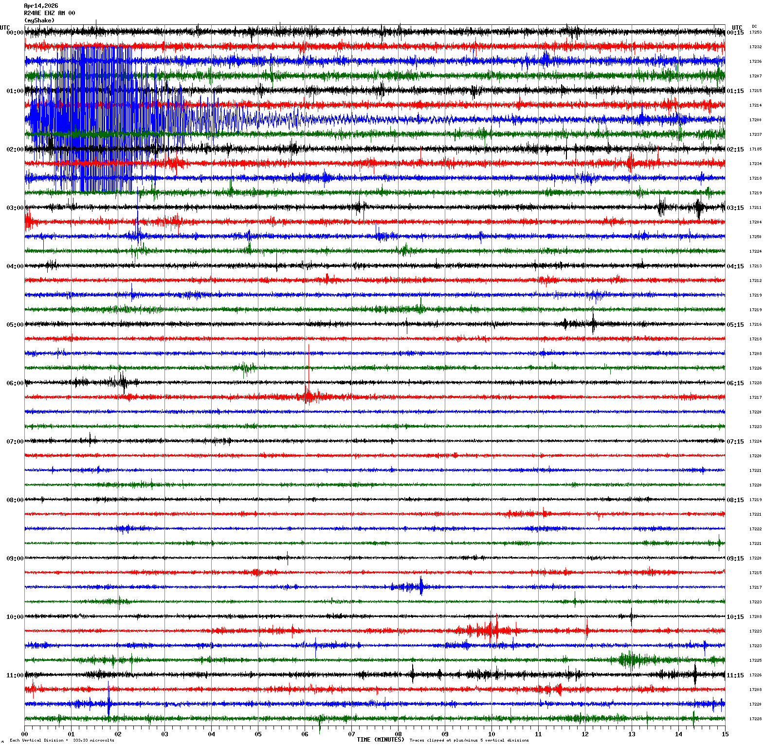
|
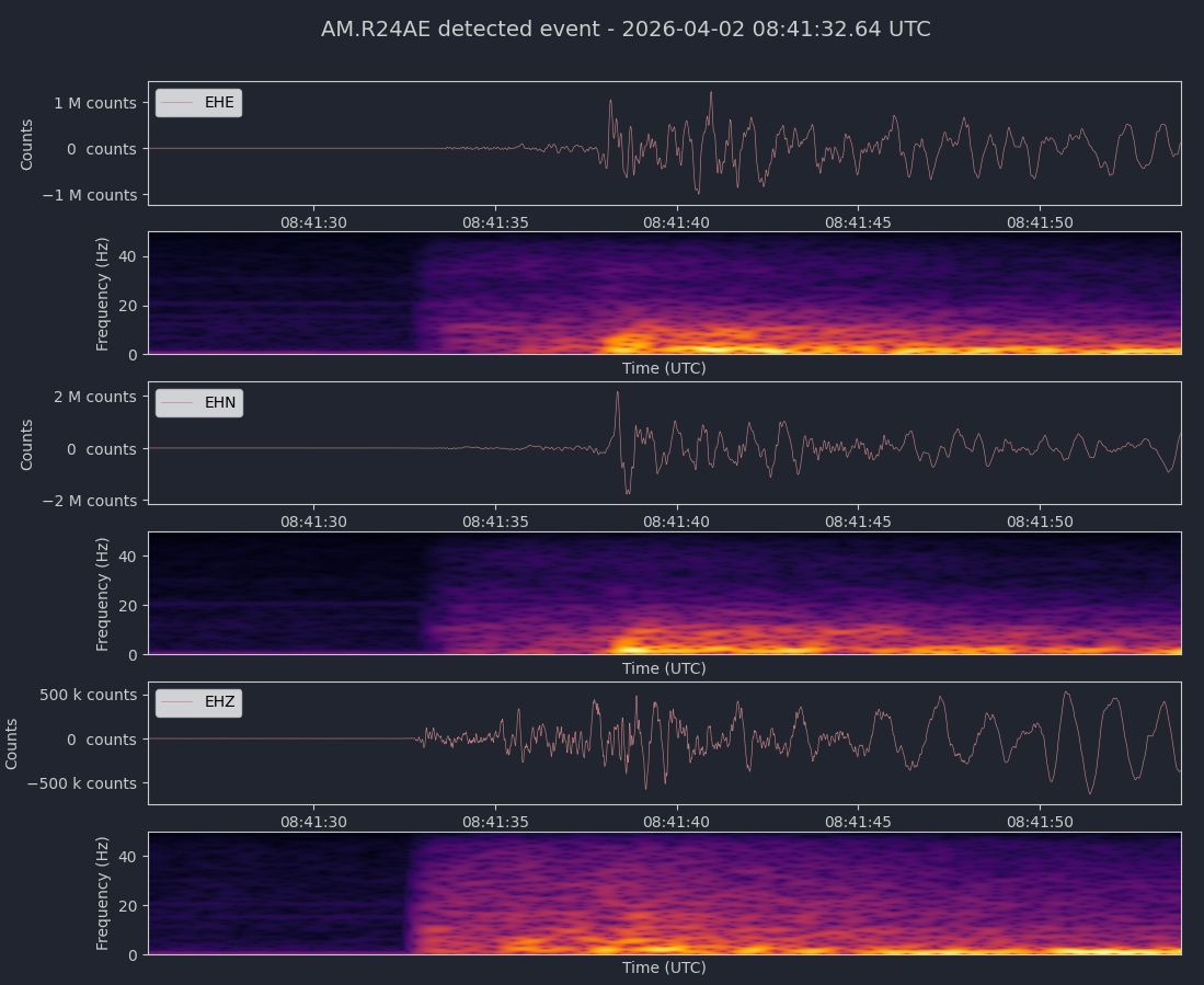
Magnitude 4.6
Depth 6.7 mi
1 mi ESE of Boulder Creek, CA
37.122°N 122.107°W
April 2, 2026 08:41:25 UTC
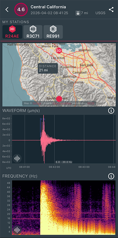
|
Vertical Sensor
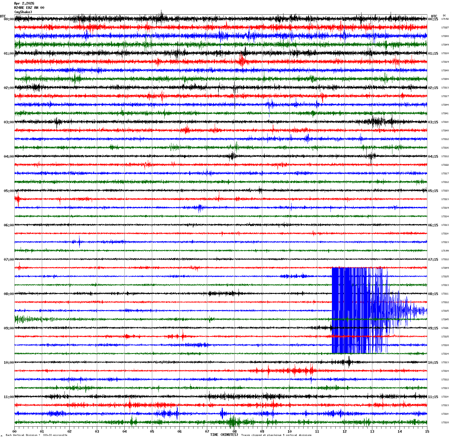
|
|
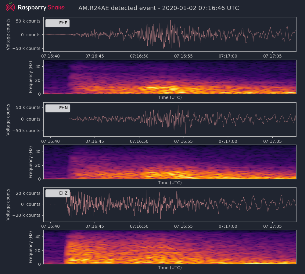
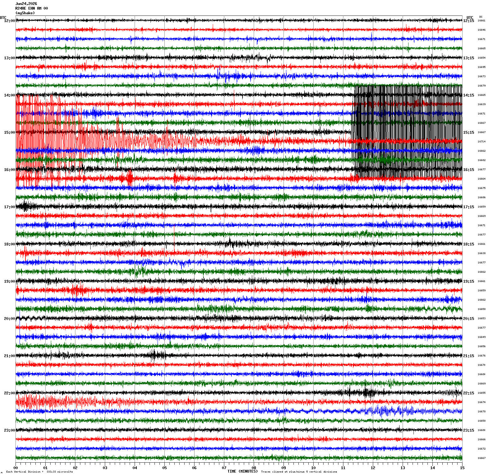
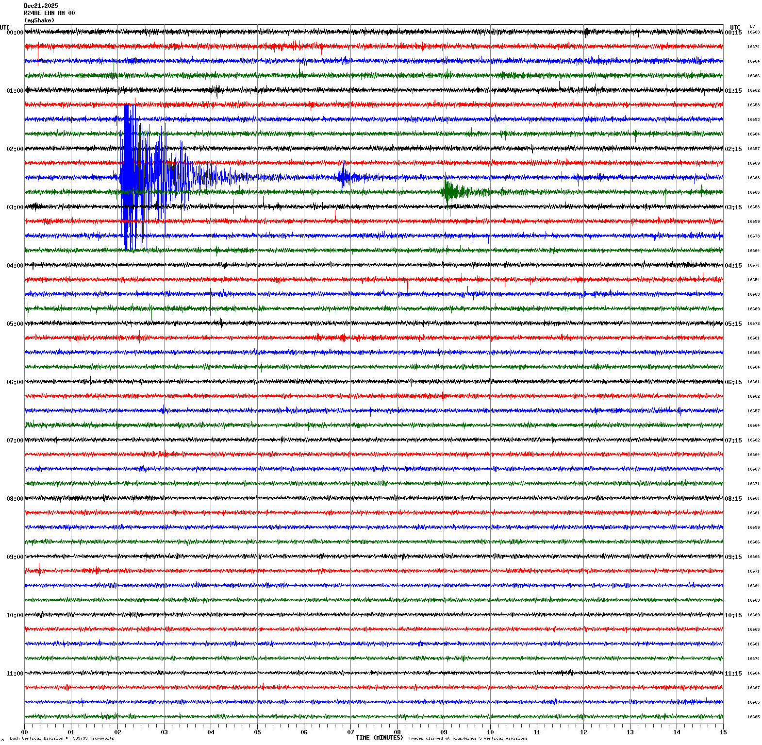
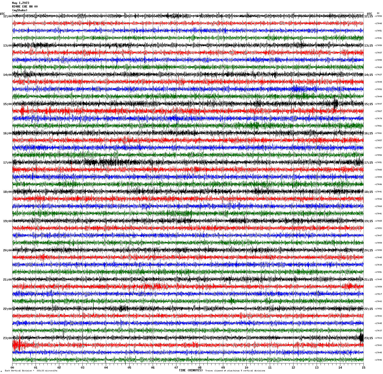
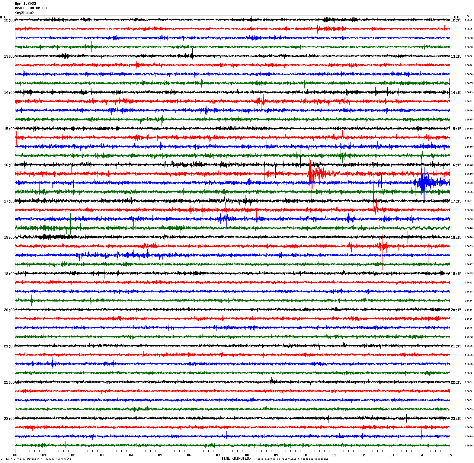
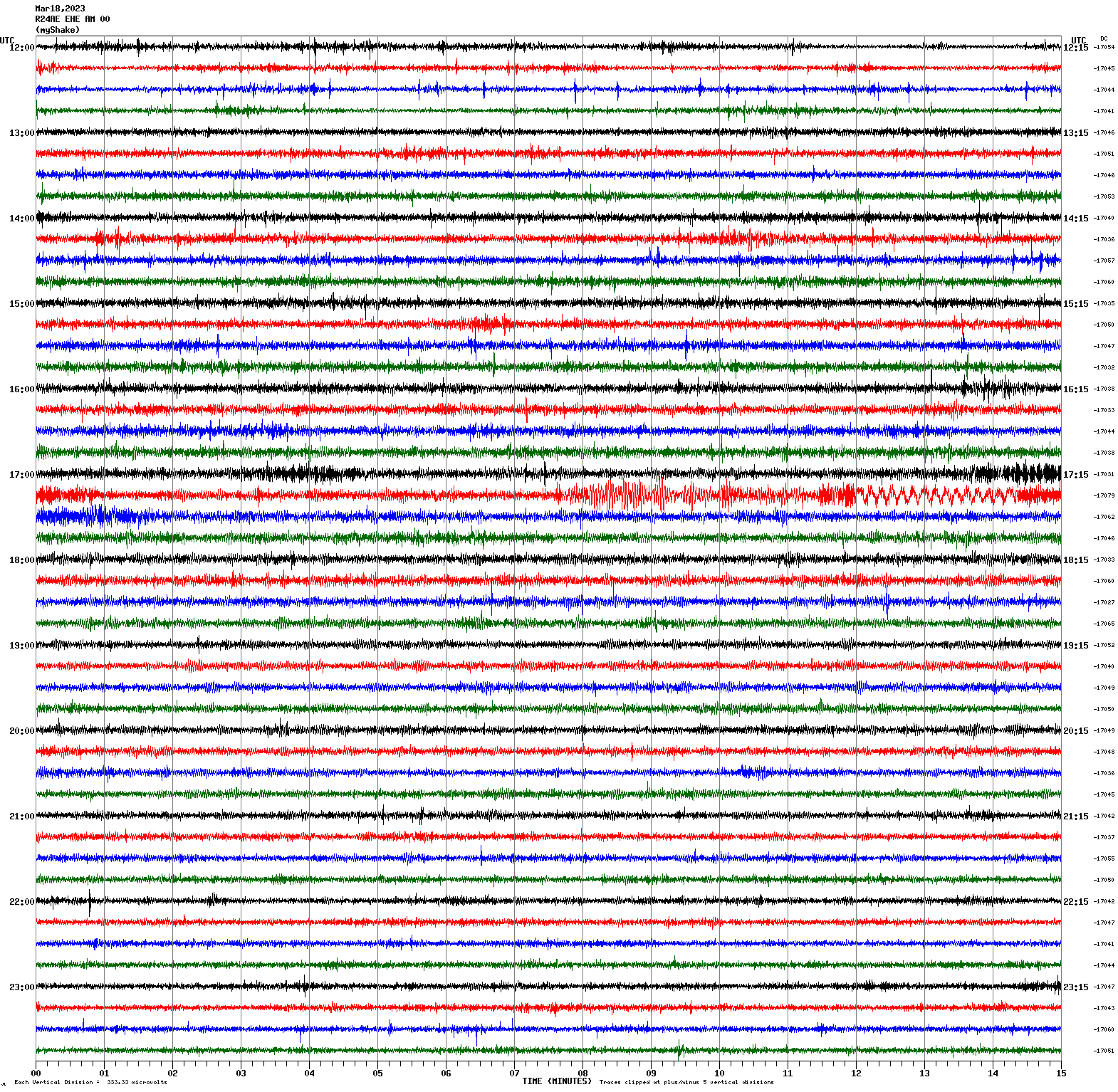
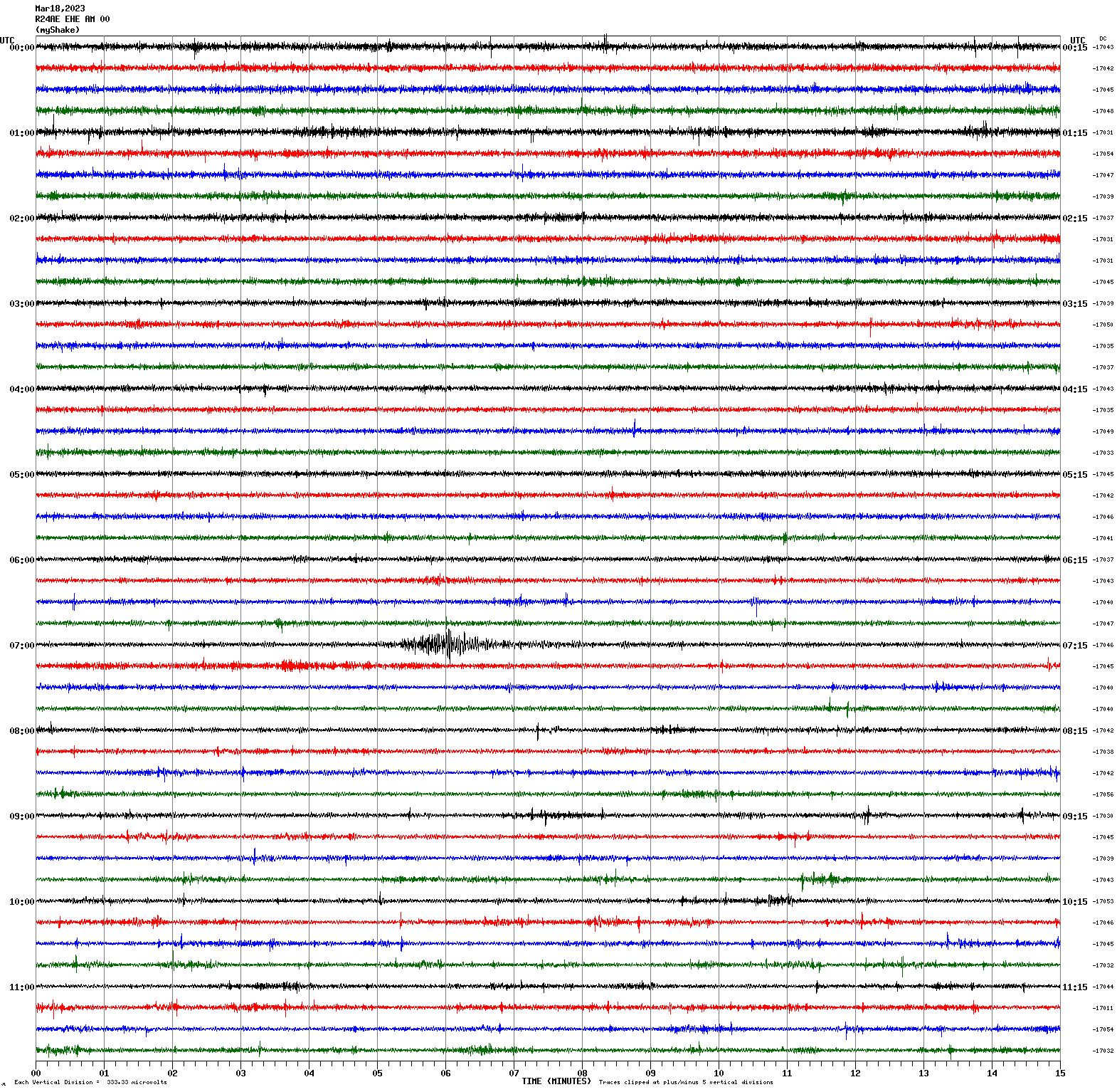
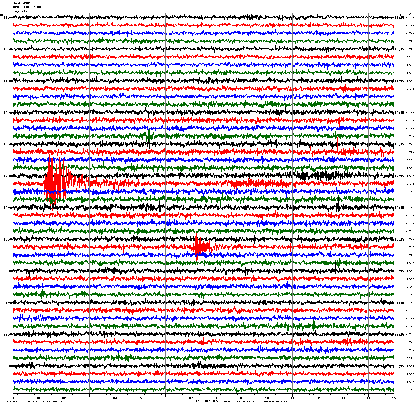
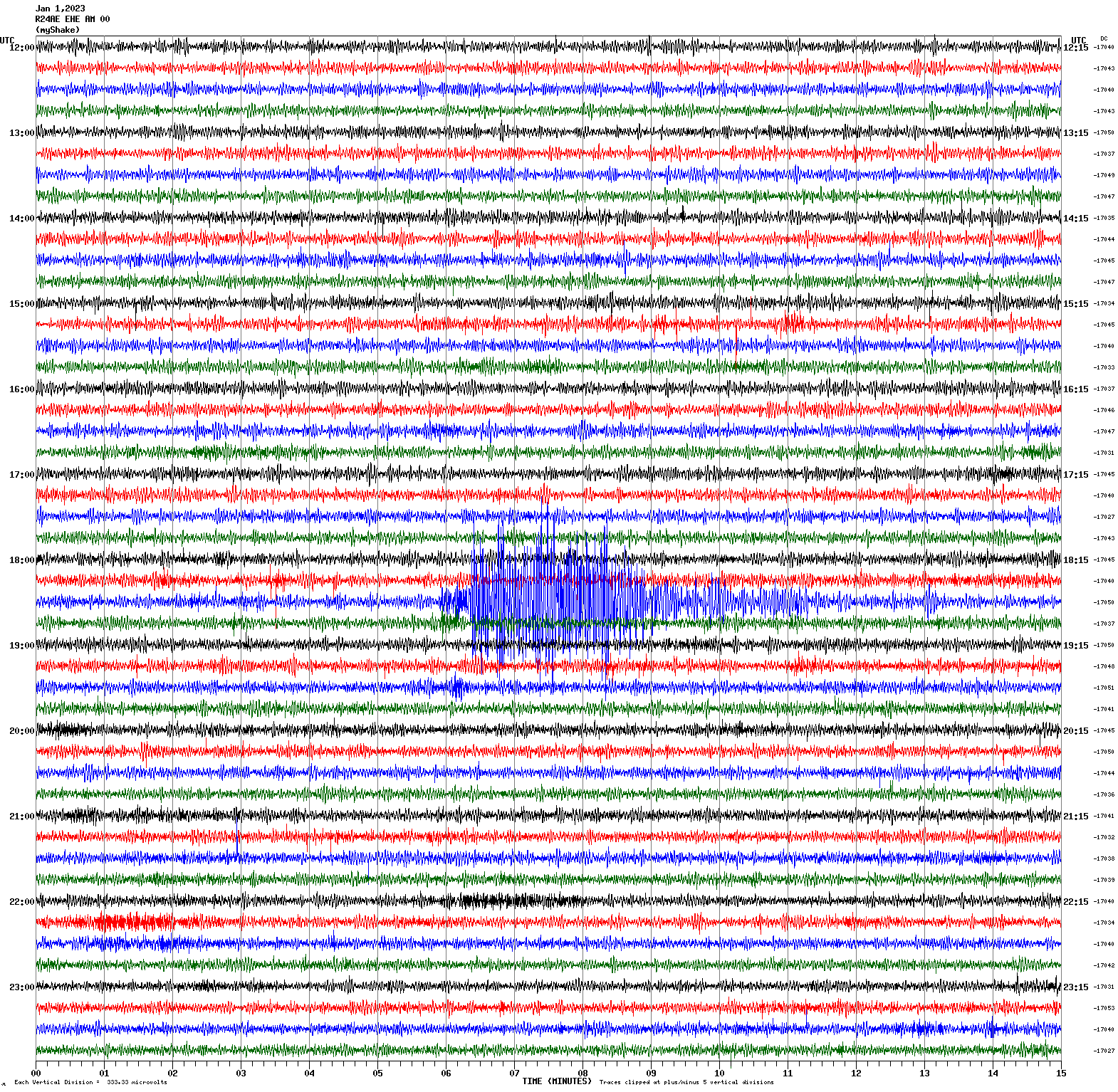
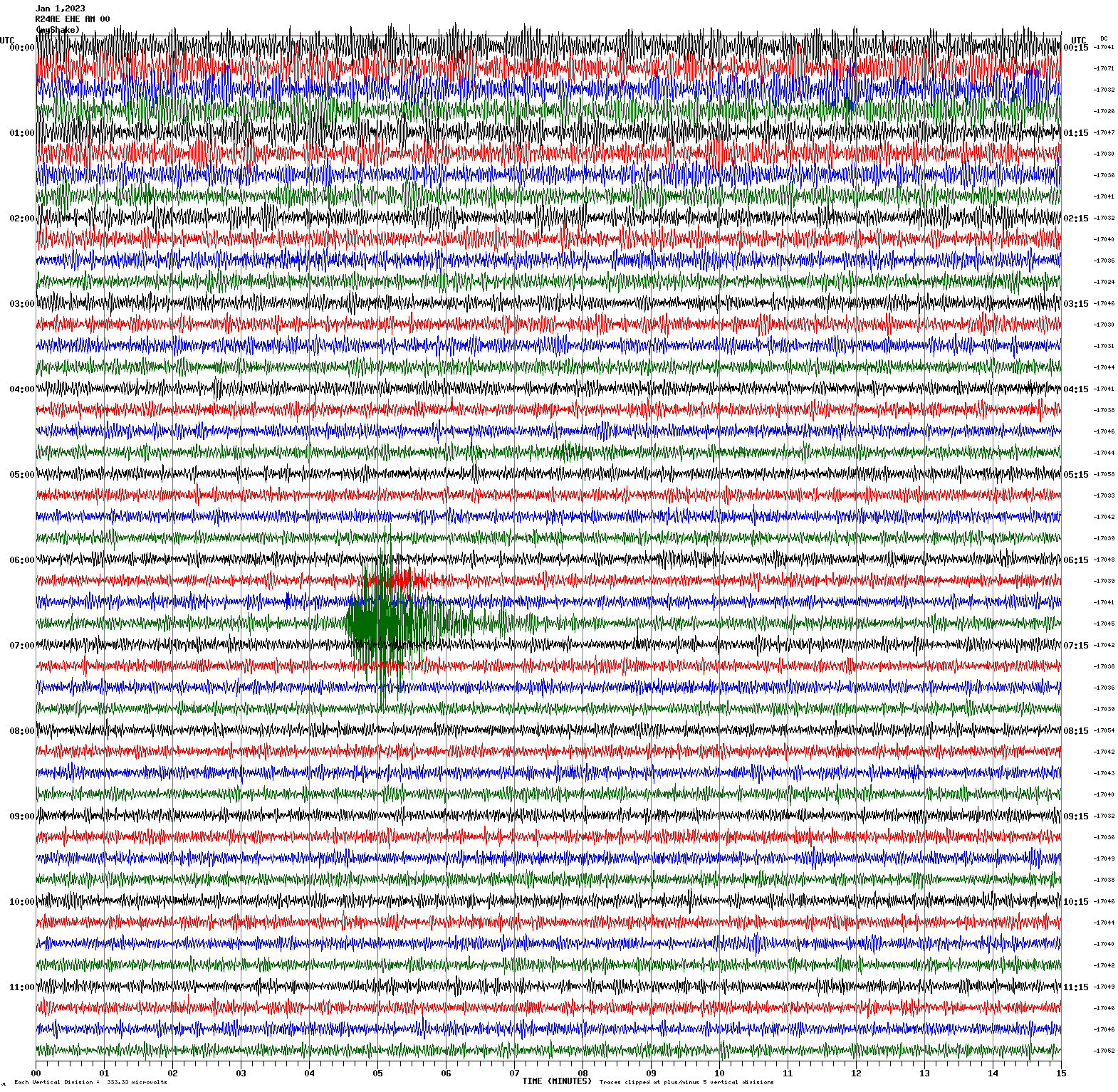
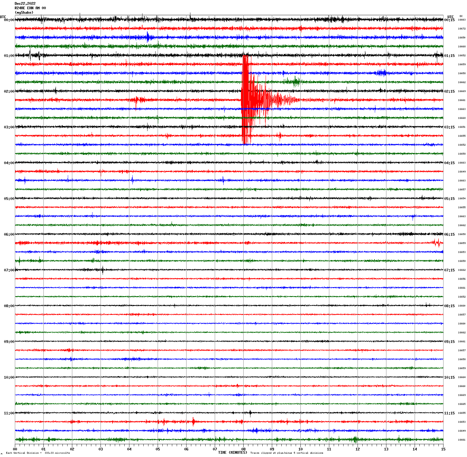
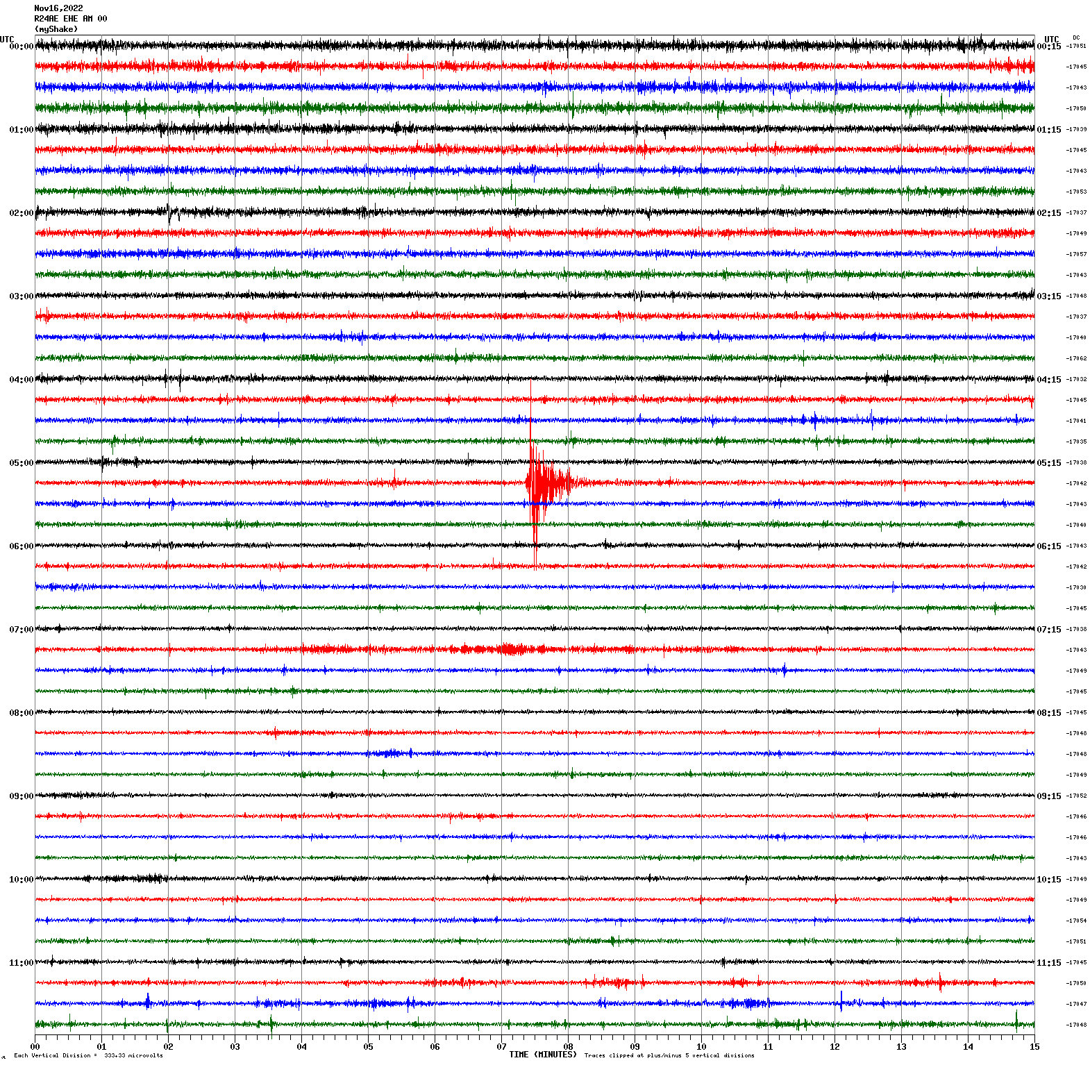
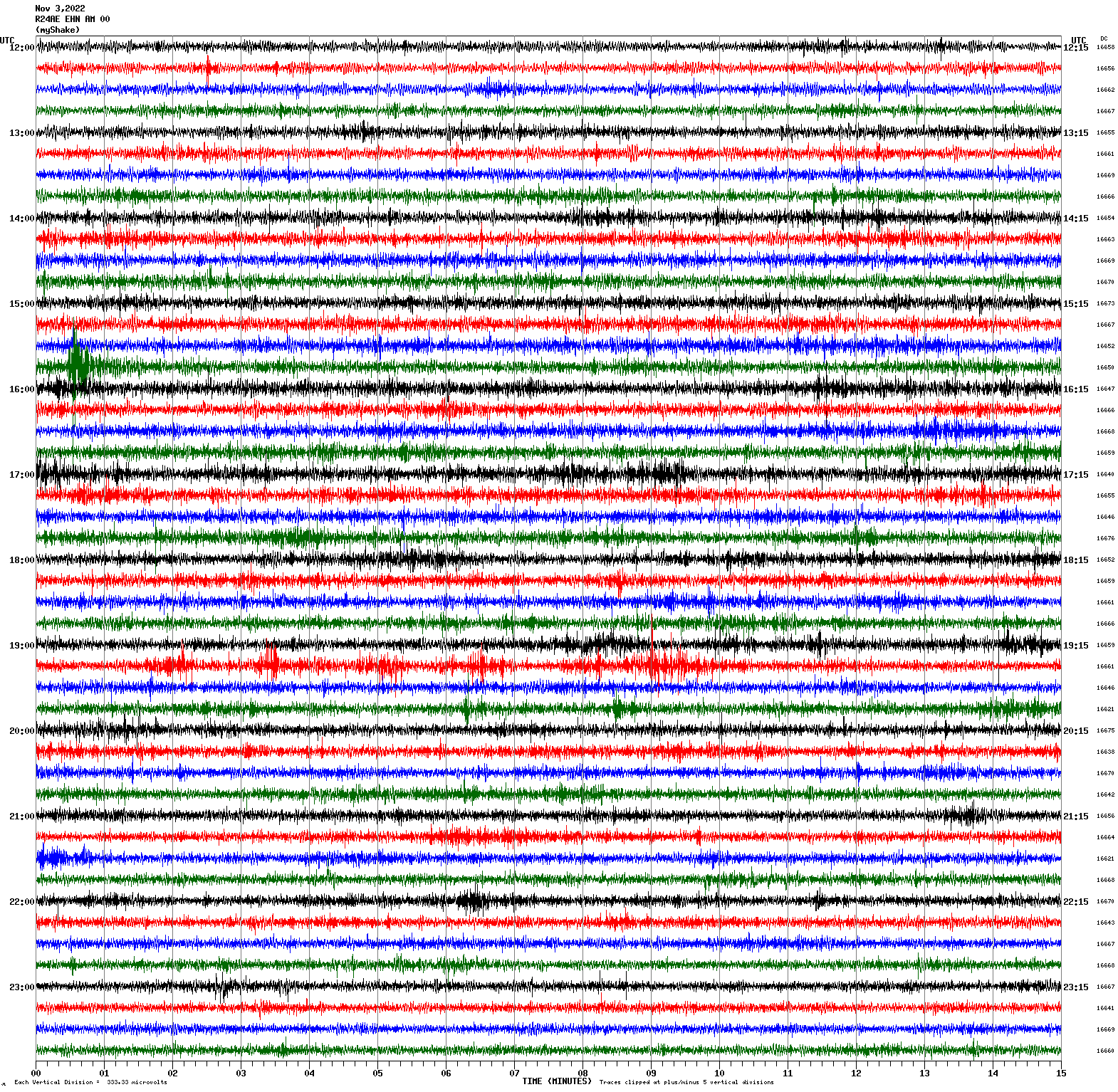
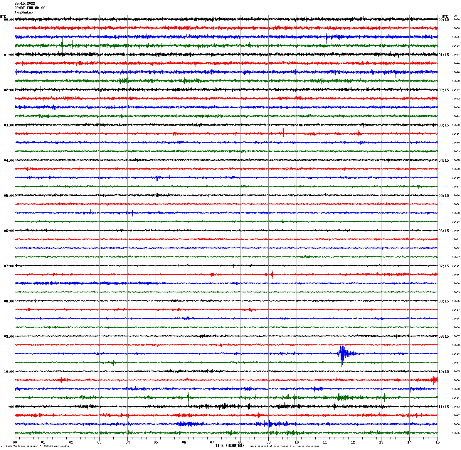
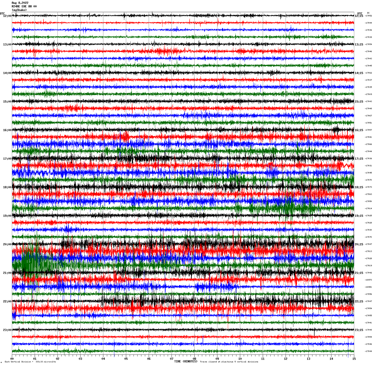
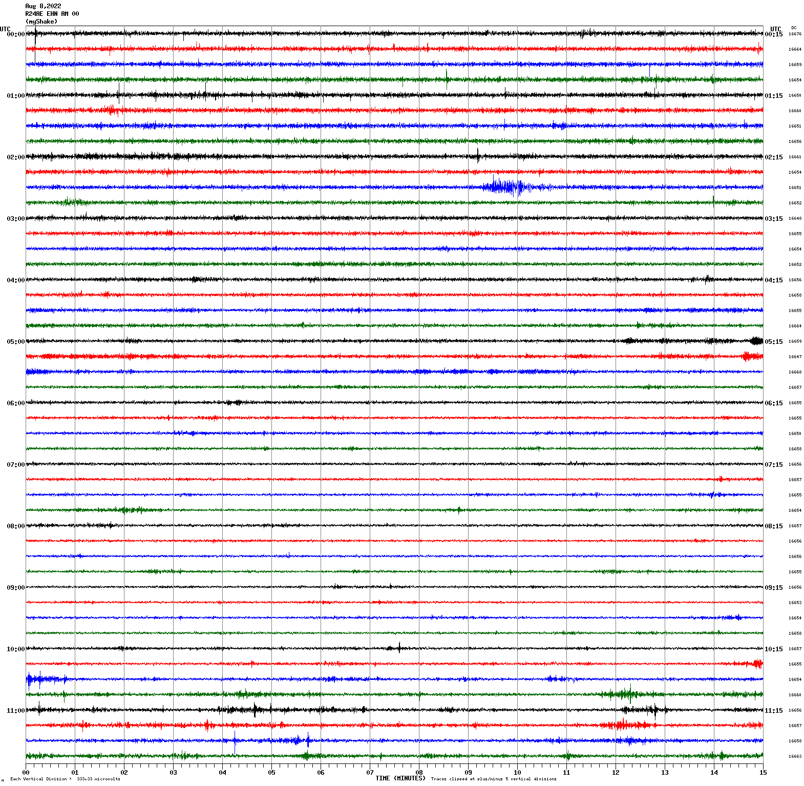
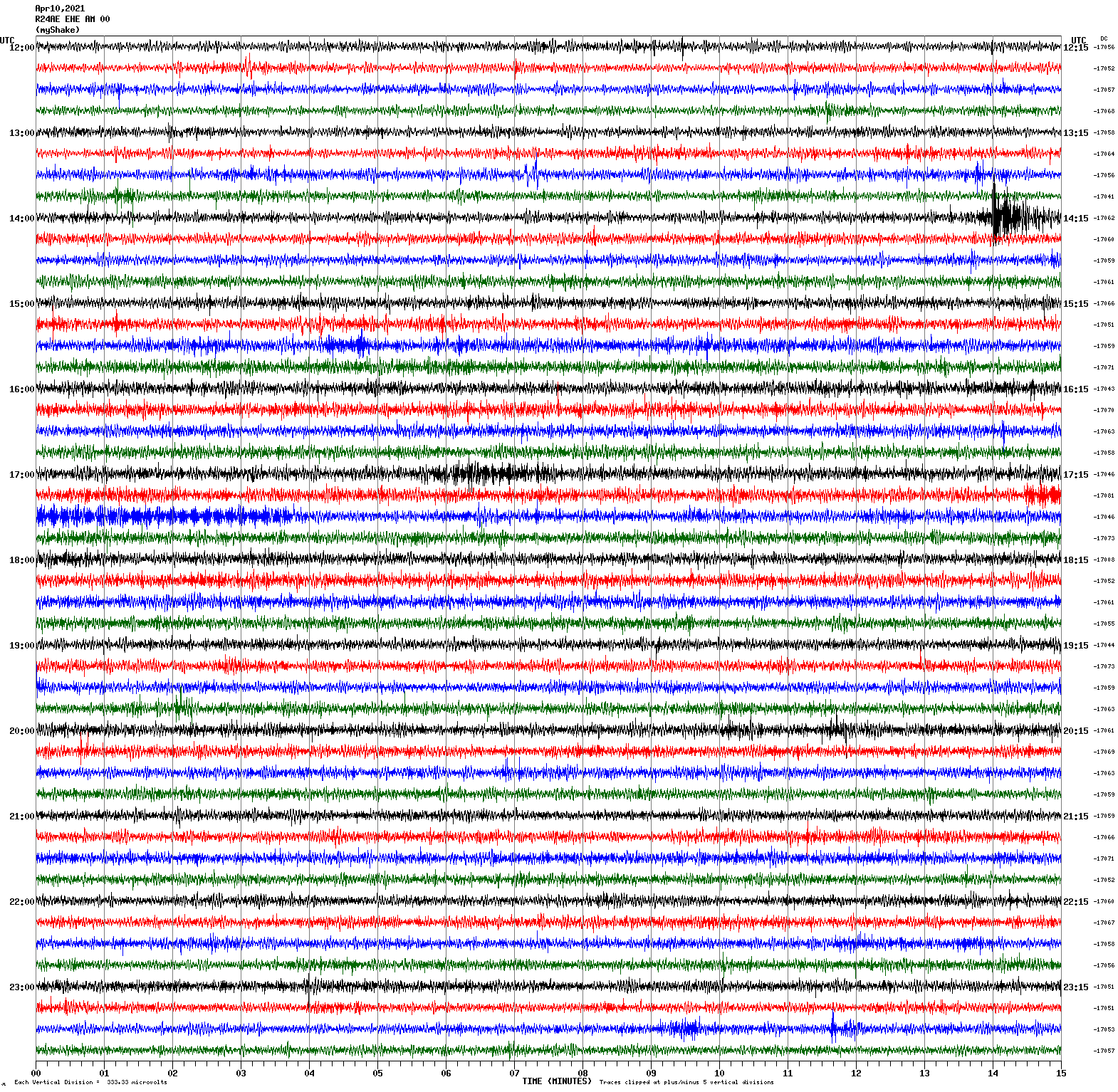
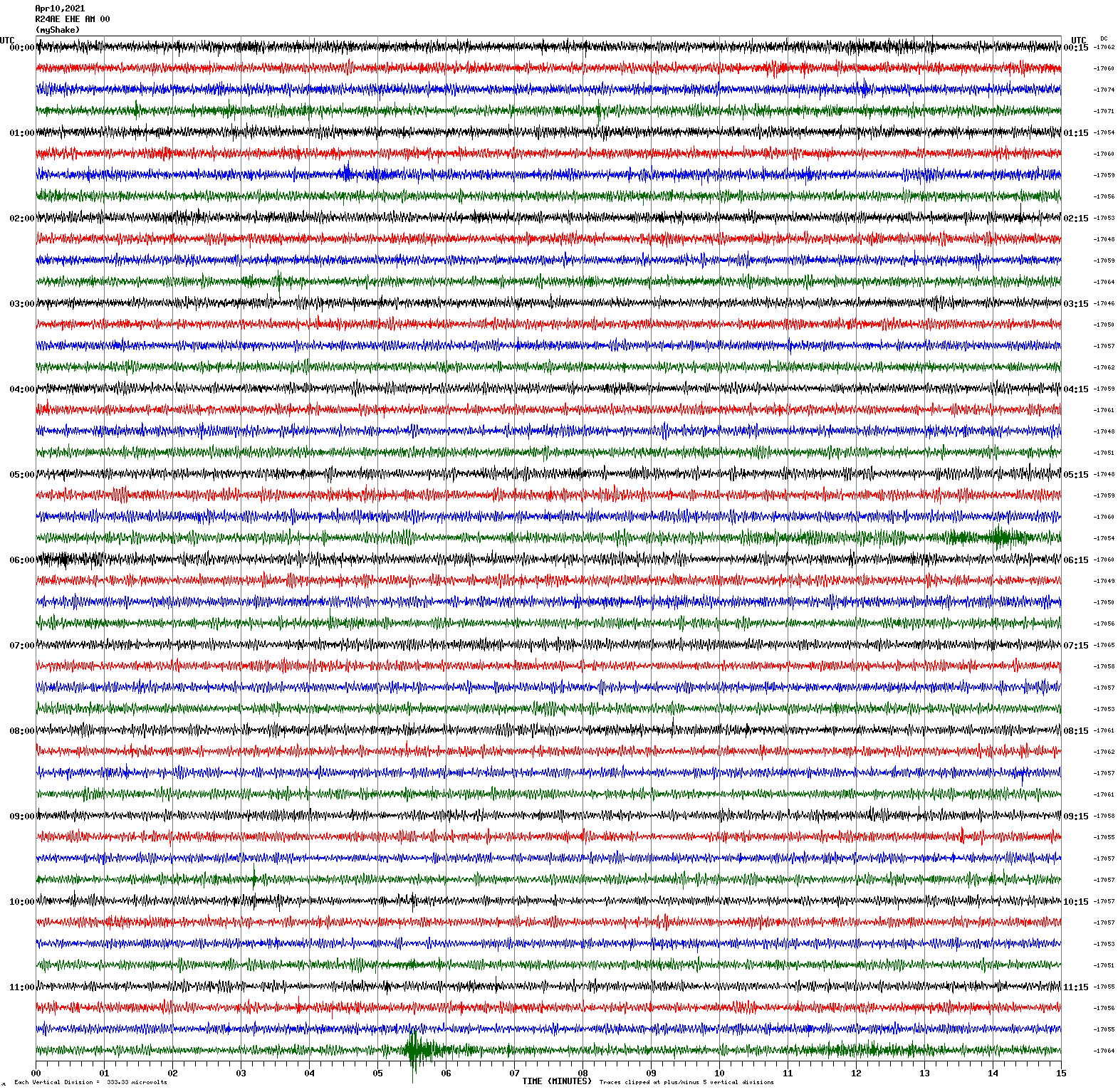
Voltage Counts & Frequency for All Sensors (Magnitude 4.6 Earthquake)
|
Magnitude 7.3
Depth 75.4 mi
30 mi ENE of Luganville, Vanuatu
15.314°S 167.562°E
March 30, 2026 08:44:13 UTC
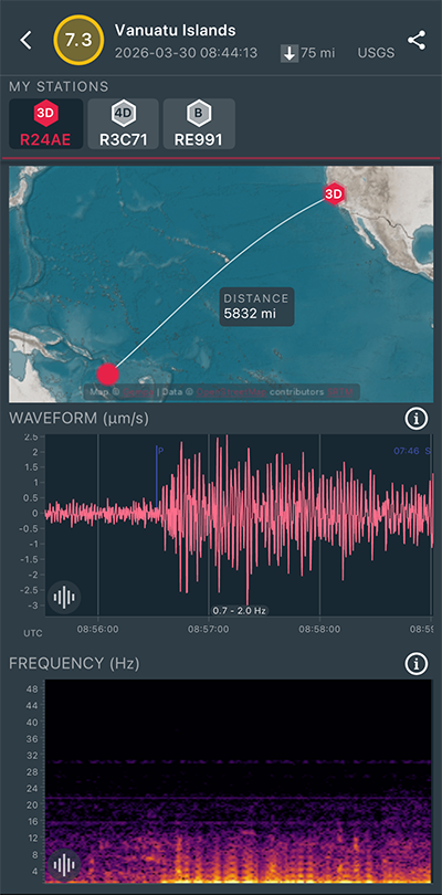
|
North/South Sensor
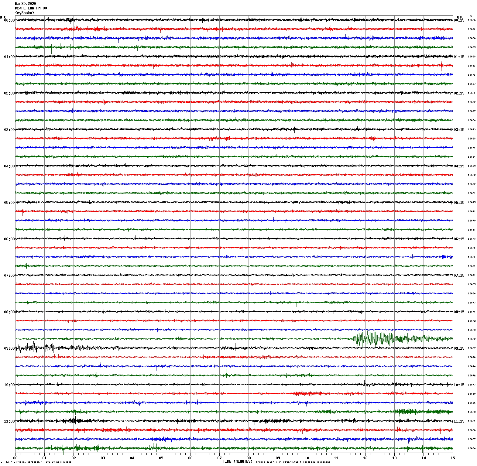
|
Magnitude 2.8
Depth 5.3 mi
2 mi ESE of San Ramon, CA
37.764°N 121.946°W
March 24, 2026 07:31:47 UTC
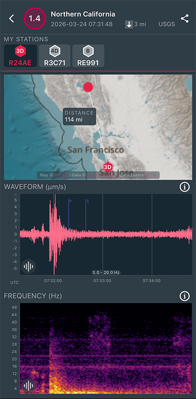
|
East/West Sensor
|
Magnitude 7.5
Depth 142.6 mi
103 mi W of Neiafu, Tonga
18.668°S 175.560°W
March 24, 2026 04:37:50 UTC
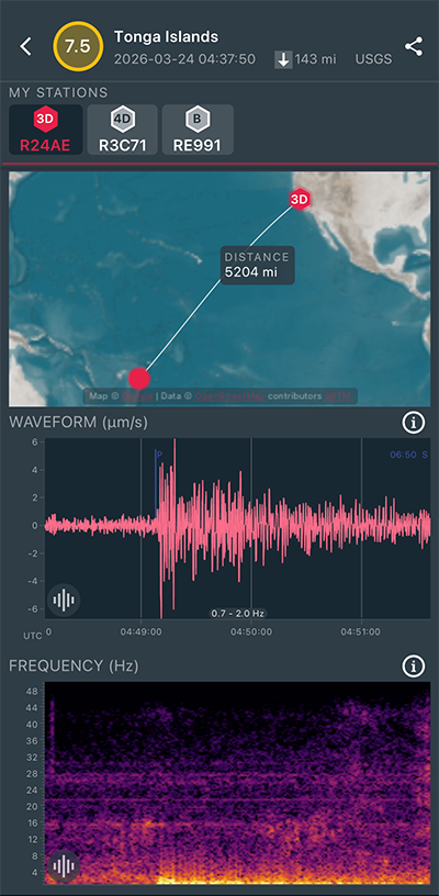
|
East/West Sensor
|
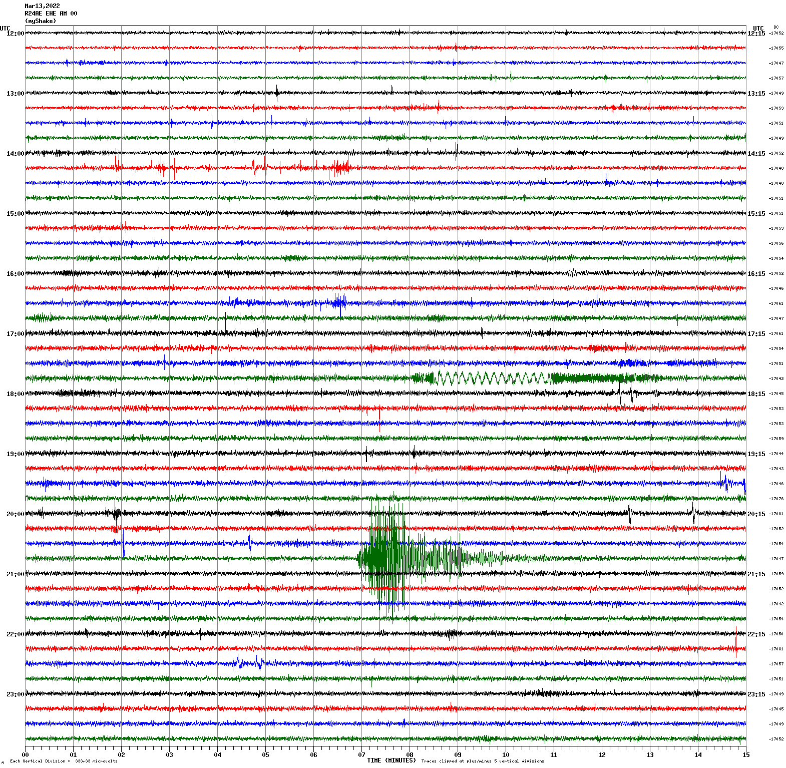
Magnitude 3.4
Depth 4.3 mi
5 mi ENE of Gilroy, CA
37.041°N 121.495°W
March 17, 2026 13:48:36 UTC
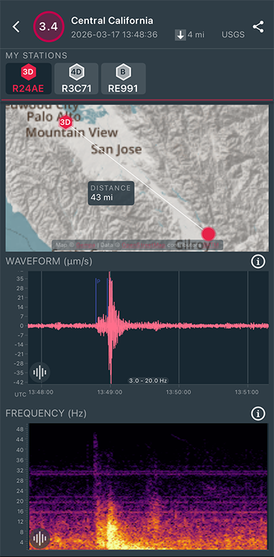
|
East/West Sensor
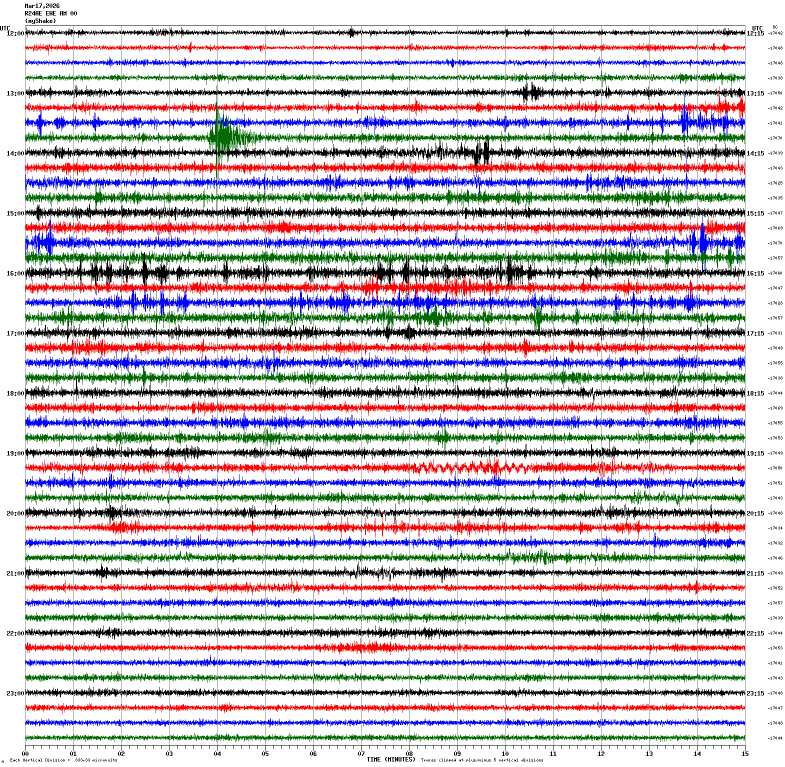
|
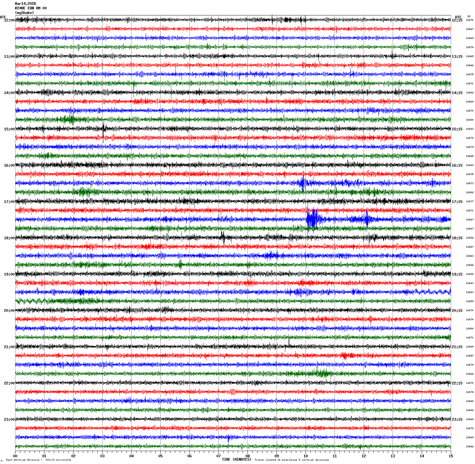
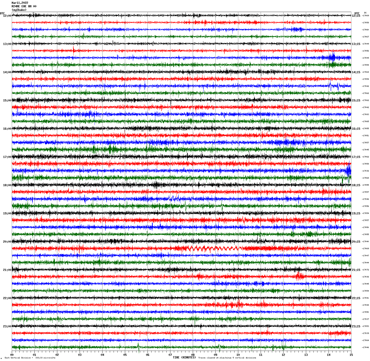
Magnitude 2.6
Depth 2.1 mi
3 mi WSW of Portola Valley, CA
37.363°N 122.282°W
March 14, 2026 17:39:56 UTC
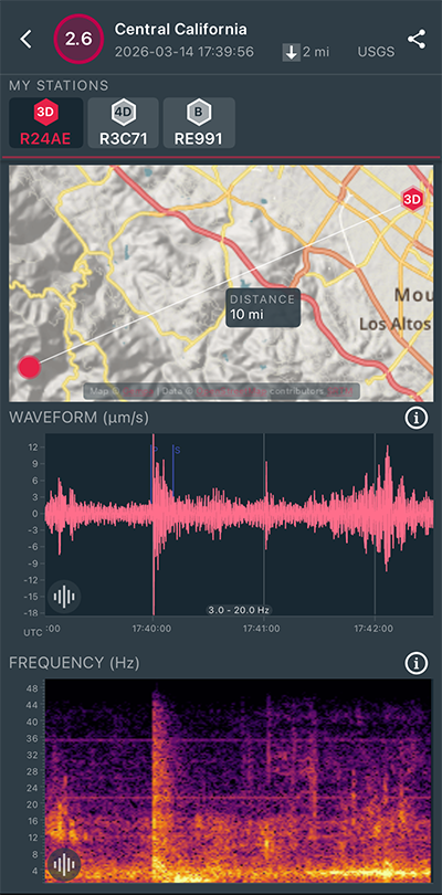
|
North/South Sensor
|
Magnitude 2.4
Depth 1.9 mi
3 mi WSW of Portola Valley, CA
37.362°N 122.282°W
March 13, 2026 19:25:39 UTC
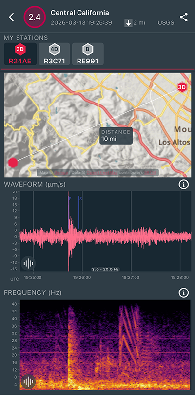
|
North/South Sensor
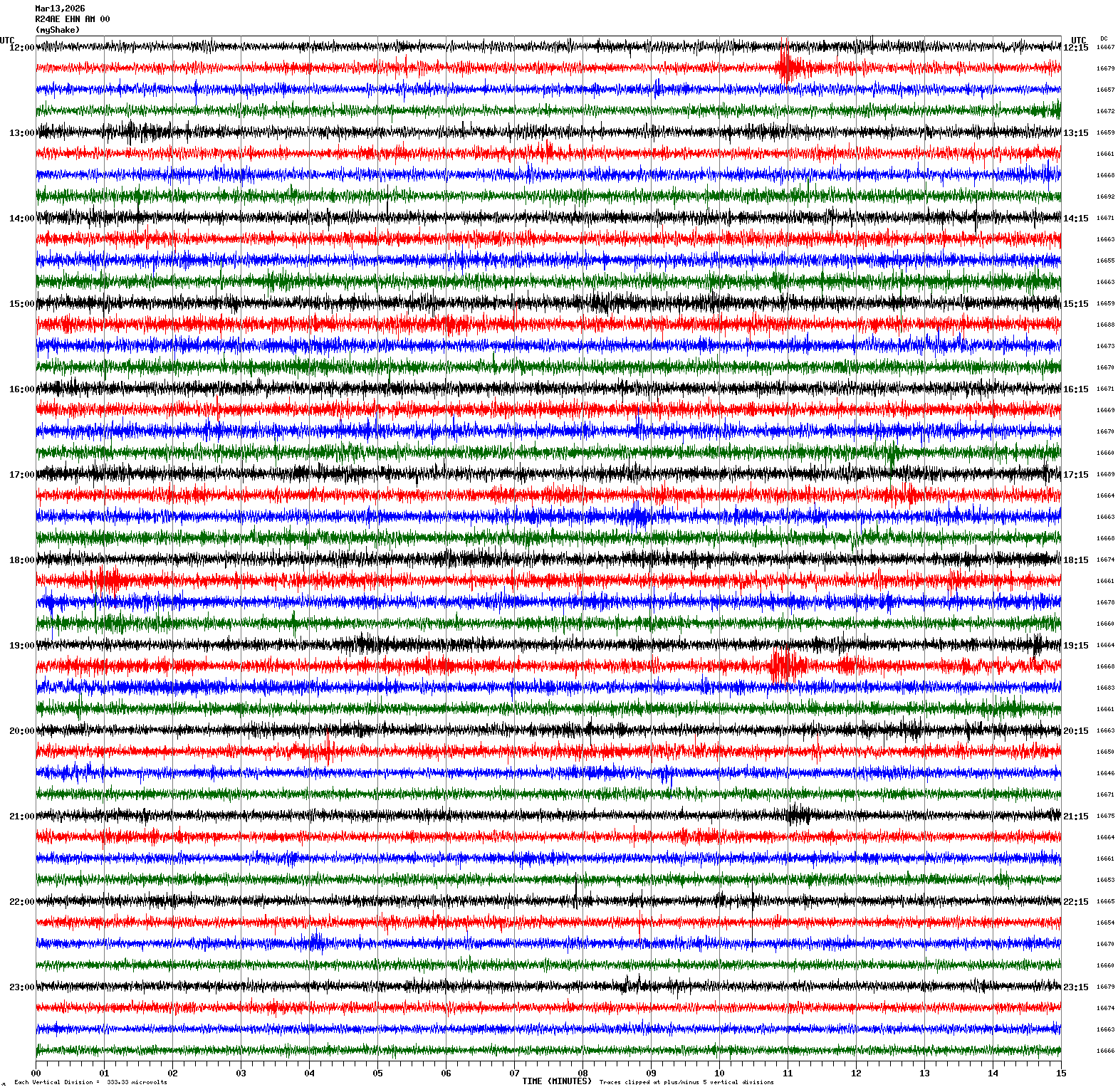
|
Magnitude 2.8
Depth 4.7 mi
3 mi SE of San Ramon, CA
37.751°N 121.939°W
March 13, 2026 12:25:39 UTC
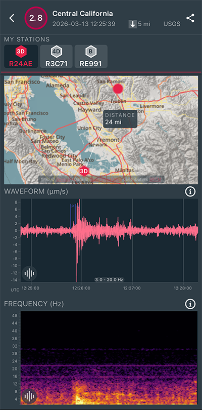
|
North/South Sensor
|
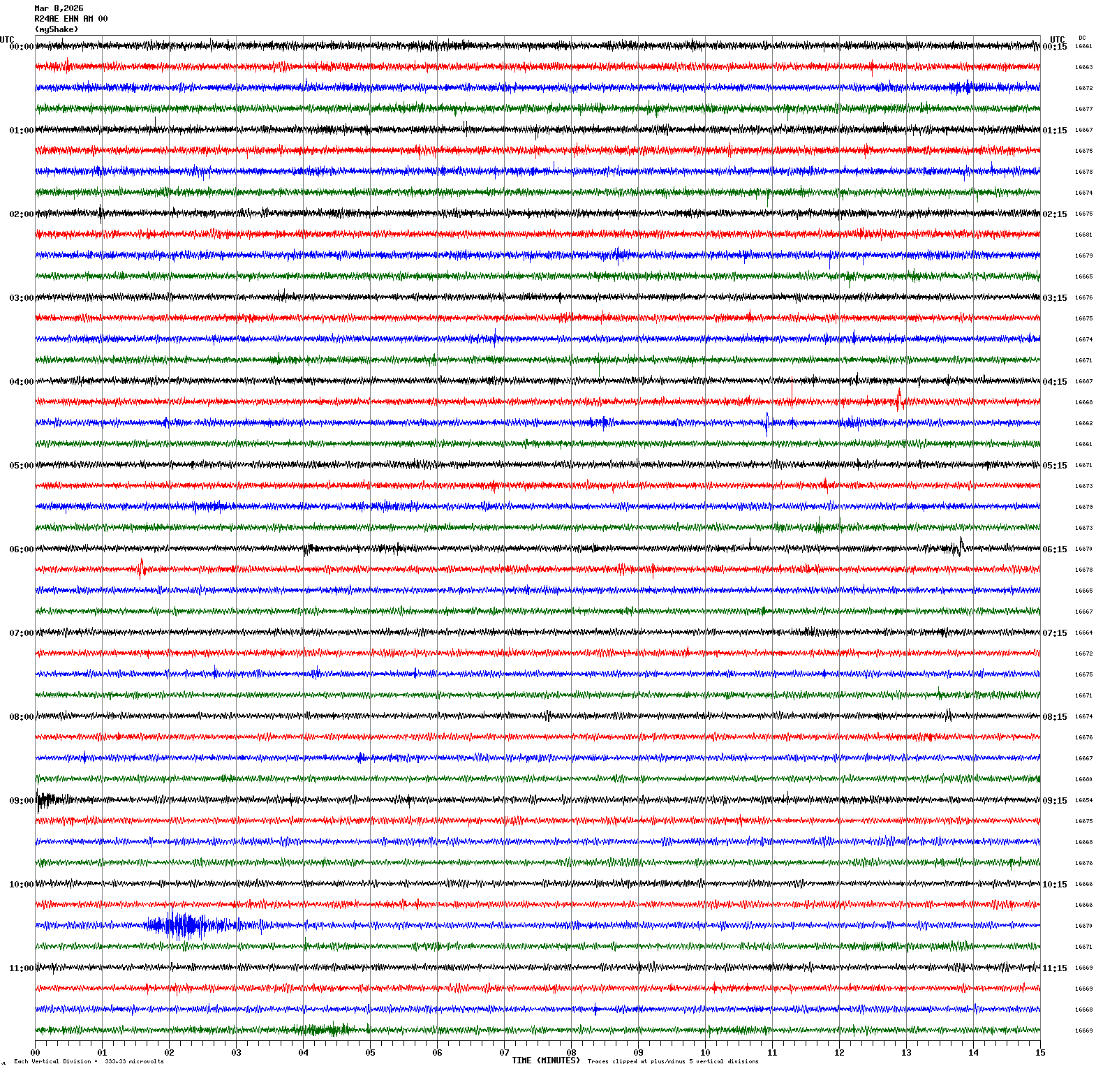
Magnitude 3.6
Depth 2.2 mi
3 mi WNW of The Geysers, CA
38.795°N 122.815°W
March 8, 2026 10:31:07 UTC
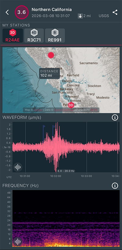
|
North/South Sensor
|
Magnitude 2.6
Depth 2.5 mi
1 mi ESE of San Ramon, CA
37.775°N 121.954°W
March 8, 2026 08:59:46 UTC
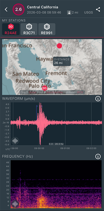
|
North/South Sensor
|
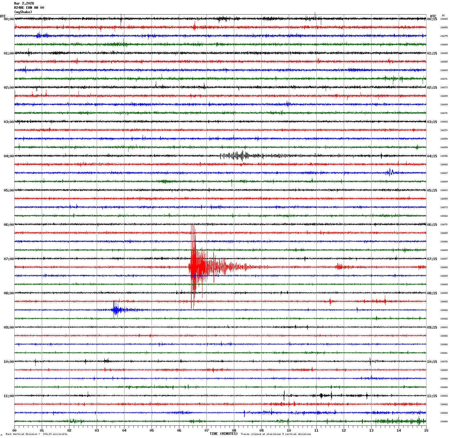
Magnitude 3.2
Depth 4.5 mi
2 mi SE of San Ramon, CA
37.753°N 121.944°W
March 2, 2026 07:21:12 UTC
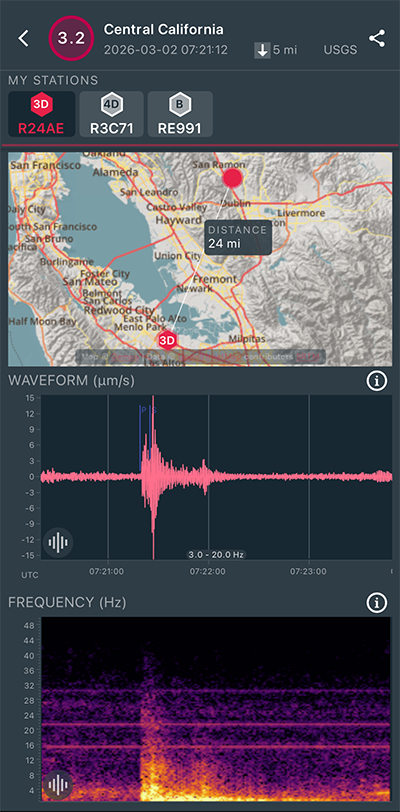
|
North/South Sensor
|
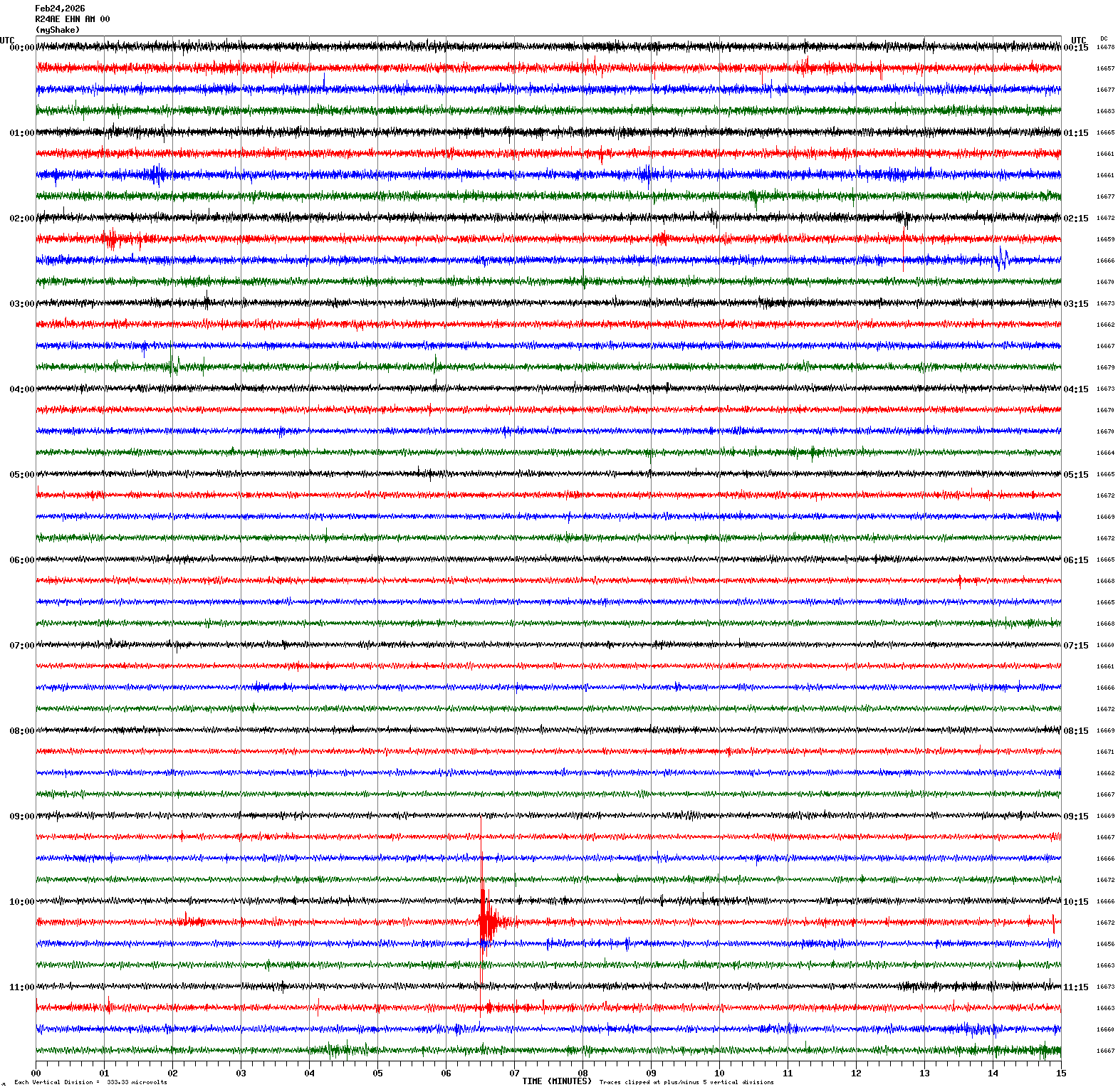
Magnitude 2.6
Depth 4.6 mi
6 mi NE of Milpitas, CA
37.499°N 121.843°W
February 24, 2026 10:21:21 UTC
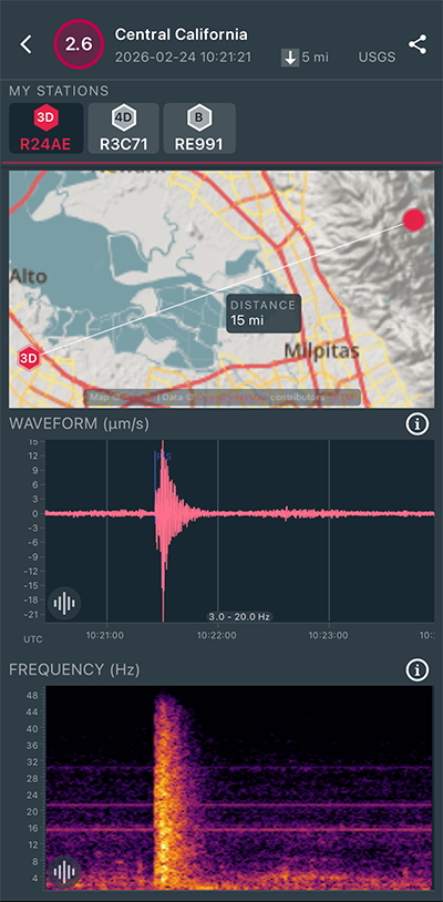
|
North/South Sensor
|
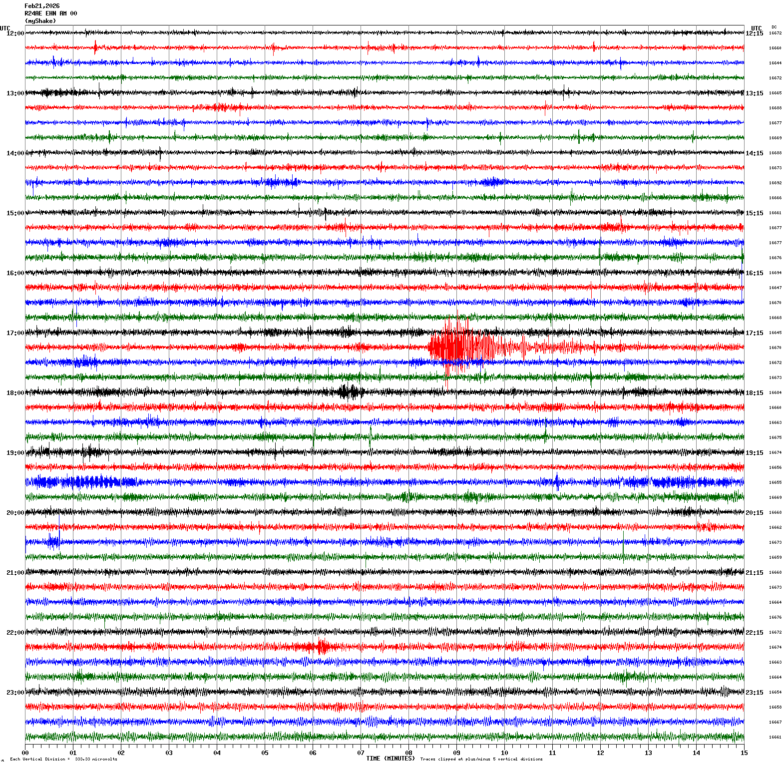
Magnitude 4.1
Depth -0.6 mi
4 mi NNW of The Geysers, CA
38.823°N 122.791°W
February 21, 2026 17:22:55 UTC
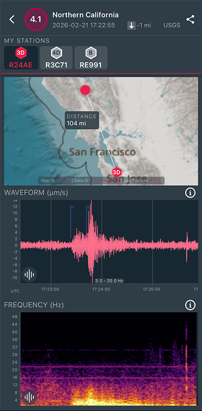
|
North/South Sensor
|
Magnitude 2.7
Depth 2.9 mi
2 mi SE of San Ramon, CA
37.756°N 121.941°W
February 3, 2026 07:47:33 UTC
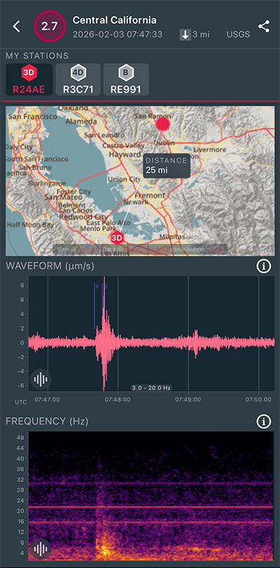
|
North/South Sensor
|
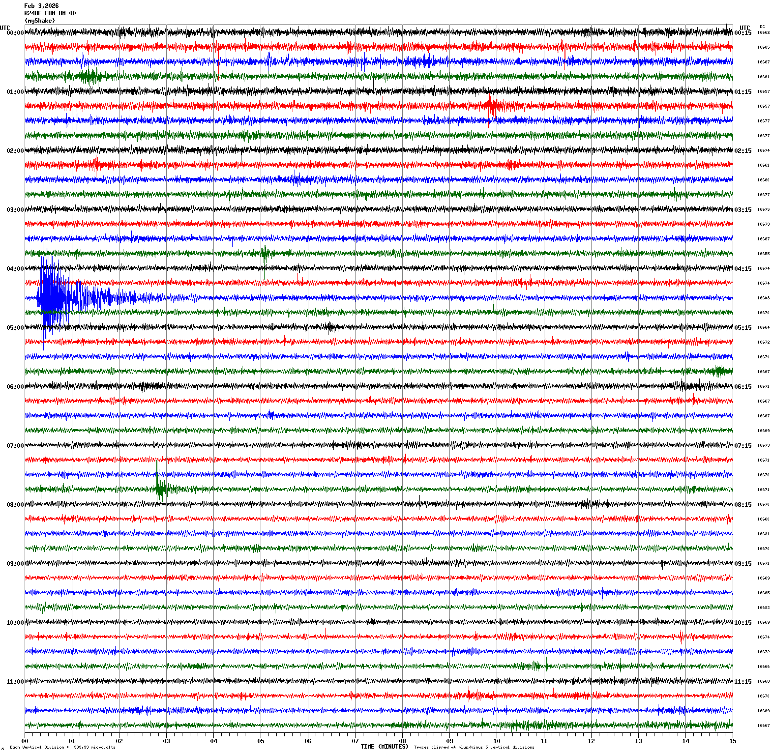
Magnitude 3.4
Depth 5.3 mi
3 mi SE of San Ramon, CA
37.750°N 121.937°W
February 3, 2026 04:30:06 UTC
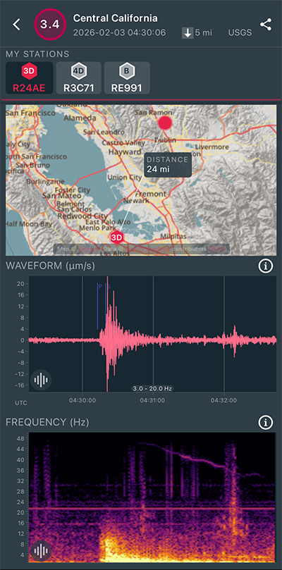
|
North/South Sensor
|
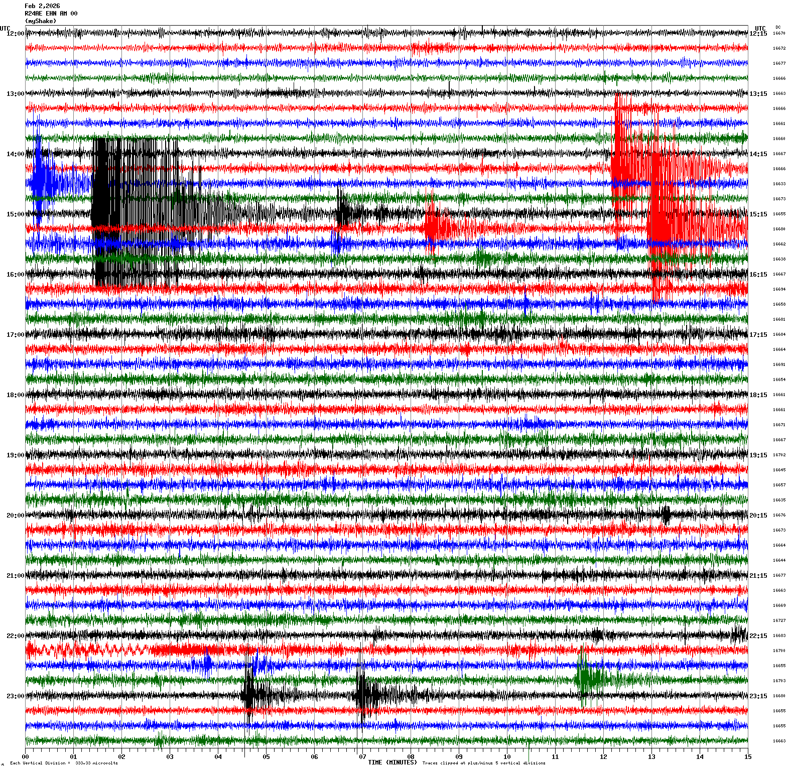
Magnitude 2.9
Depth 4.6 mi
3 mi SE of San Ramon, CA
37.755°N 121.936°W
February 2, 2026 23:06:38 UTC
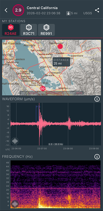
|
North/South Sensor
|
Magnitude 3.0
Depth 5.2 mi
2 mi ESE of San Ramon, CA
37.763°N 121.935°W
February 2, 2026 23:04:18 UTC
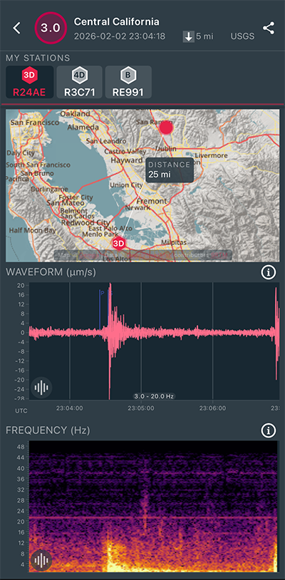
|
North/South Sensor
|
Magnitude 3.1
Depth 4.9 mi
2 mi ESE of San Ramon, CA
37.765°N 121.937°W
February 2, 2026 22:56:13 UTC
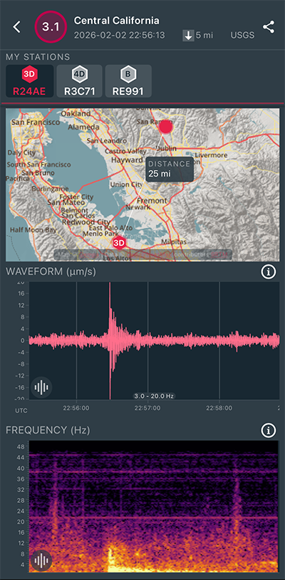
|
North/South Sensor
|
Magnitude 3.8
Depth 5.4 mi
3 mi SE of San Ramon, CA
37.749°N 121.938°W
February 2, 2026 15:27:45 UTC
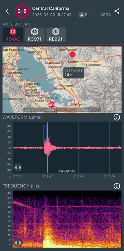
|
North/South Sensor
|
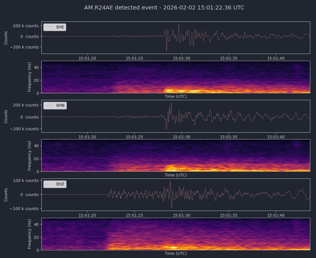
Magnitude 4.2
Depth 5.8 mi
2 mi ESE of San Ramon, CA
37.760°N 121.937°W
February 2, 2026 15:01:13 UTC
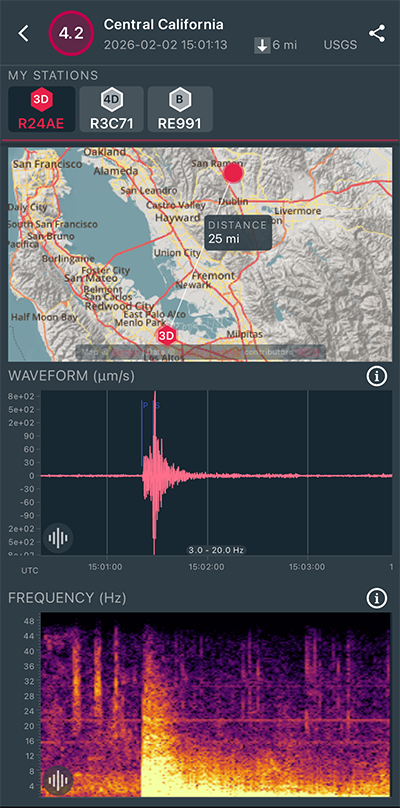
|
Vertical Sensor
|
|
Voltage Counts & Frequency for All Sensors (Magnitude 4.2 Earthquake)
|
Magnitude 3.3
Depth 5.0 mi
2 mi SE of San Ramon, CA
37.754°N 121.940°W
February 2, 2026 14:29:56 UTC
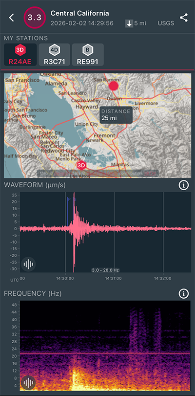
|
North/South Sensor
|
Magnitude 3.9
Depth 5.9 mi
2 mi SE of San Ramon, CA
37.754°N 121.944°W
February 2, 2026 14:27:00 UTC
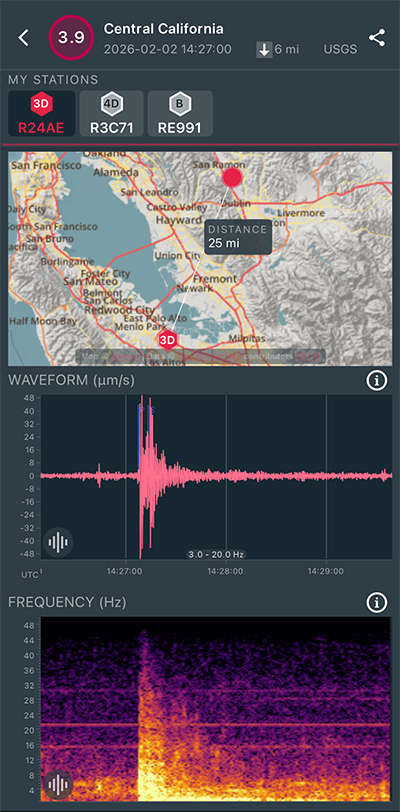
|
North/South Sensor
|
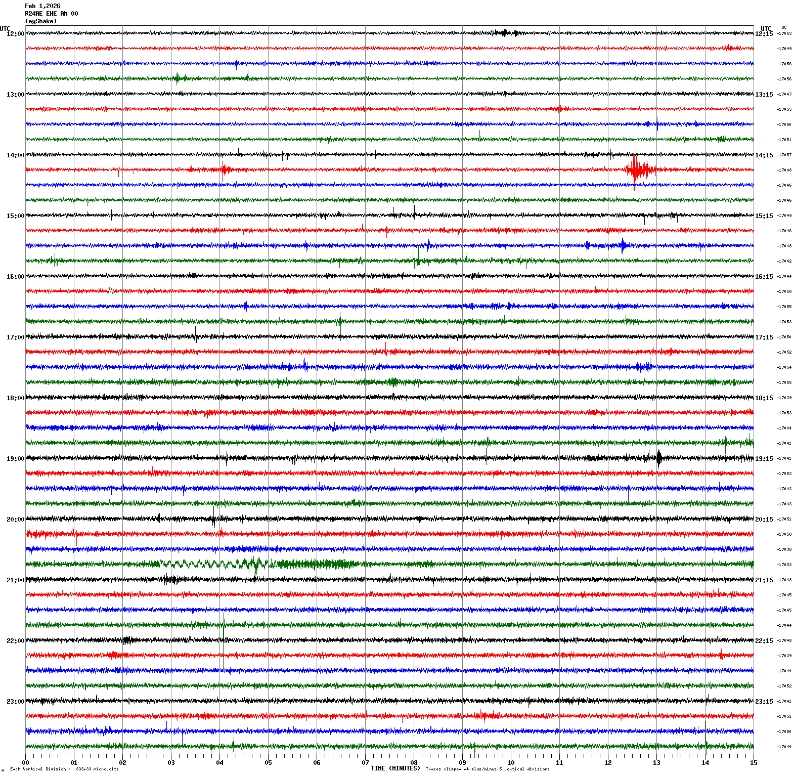
Magnitude 2.8
Depth 4.9 mi
4 mi SSW of Gilroy, CA
36.956°N 121.593°W
February 1, 2026 14:27:08 UTC
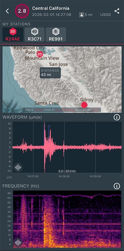
|
East/West Sensor
|
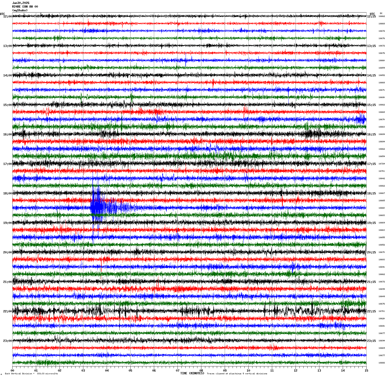
Magnitude 3.4
Depth 5.8 mi
2 mi SE of San Ramon, CA
37.750°N 121.948°W
January 30, 2026 18:33:09 UTC
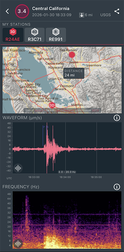
|
North/South Sensor
|
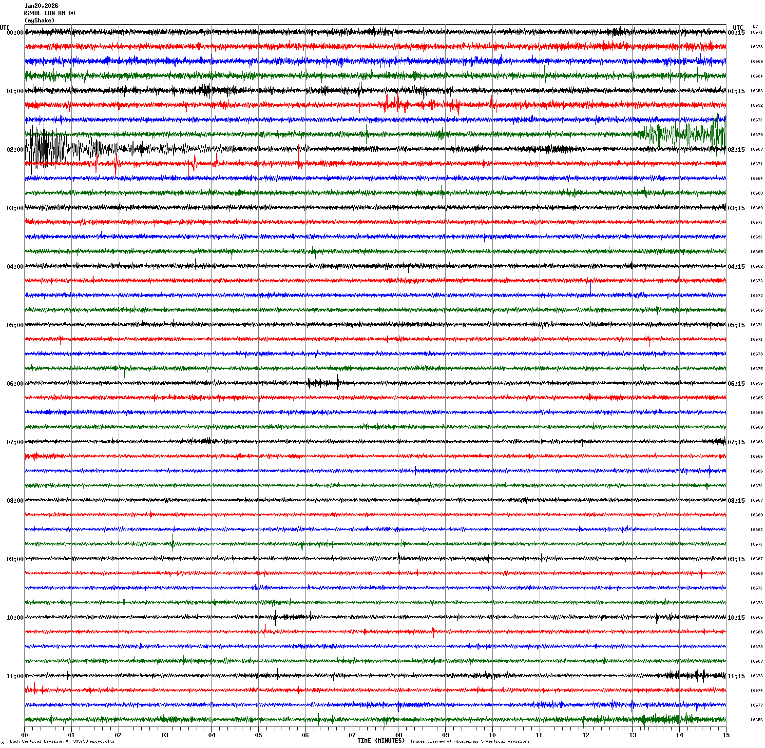
Magnitude 4.9
Depth 1.9 mi
12 mi NNE of Indio, CA
33.894°N 116.169°W
January 20, 2026 01:56:14 UTC
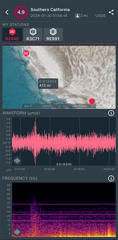
|
North/South Sensor
|
Magnitude 3.3
Depth 4.5 mi
9 mi S of Tres Pinos, CA
36.657°N 121.307°W
January 17, 2026 13:53:24 UTC
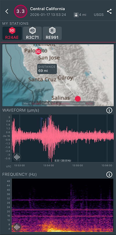
|
East/West Sensor
|
Magnitude 6.0
Depth 6.2 mi
183 mi W of Bandon, Oregon
43.543°N 128.009°W
January 16, 2026 03:25:52 UTC
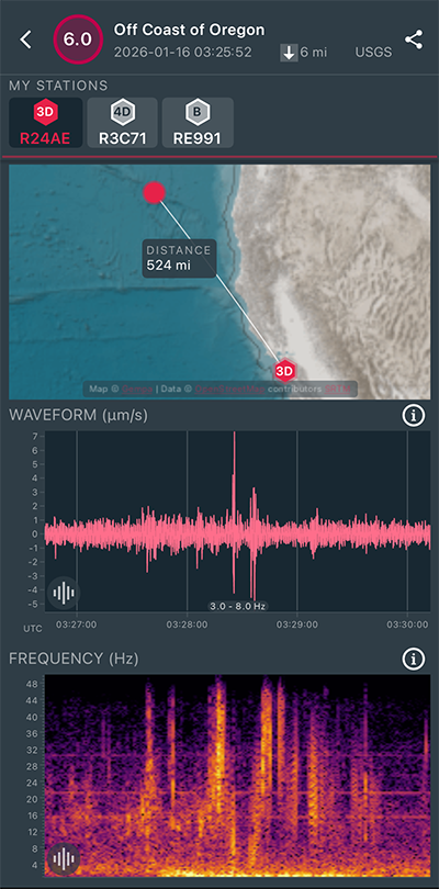
|
East/West Sensor
|
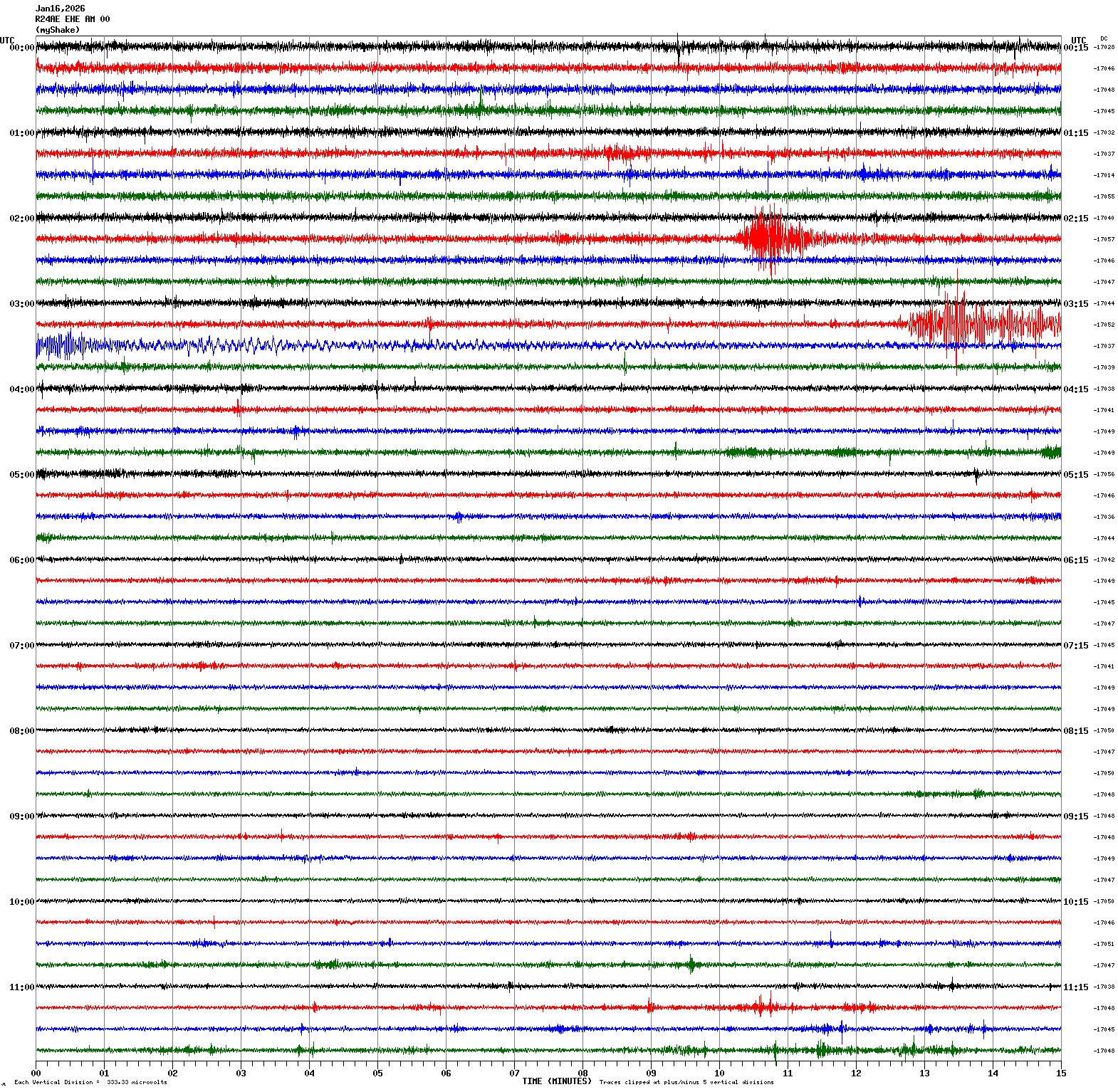
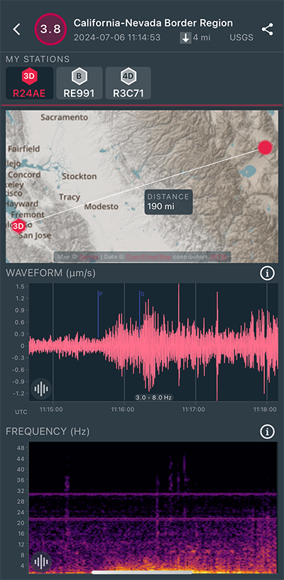
Magnitude 3.4
Depth 3.7 mi
9 mi S of Tres Pinos, CA
36.667°N 121.302°W
January 16, 2026 02:24:54 UTC
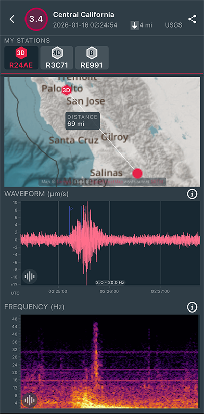
|
East/West Sensor
|
Magnitude 3.0
Depth 5.5 mi
14 mi ENE of Alum Rock, CA
37.466°N 121.596°W
January 15, 2026 03:25:52 UTC
|
East/West Sensor
|
Magnitude 2.9
Depth 4.5 mi
2 mi ESE of San Ramon, CA
37.772°N 121.939°W
January 11, 2026 04:21:07 UTC
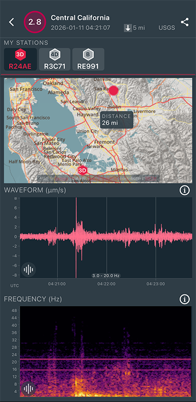
|
North/South Sensor
|
Magnitude 2.9
Depth 5.0 mi
2 mi ESE of San Ramon, CA
37.772°N 121.938°W
January 11, 2026 04:10:24 UTC
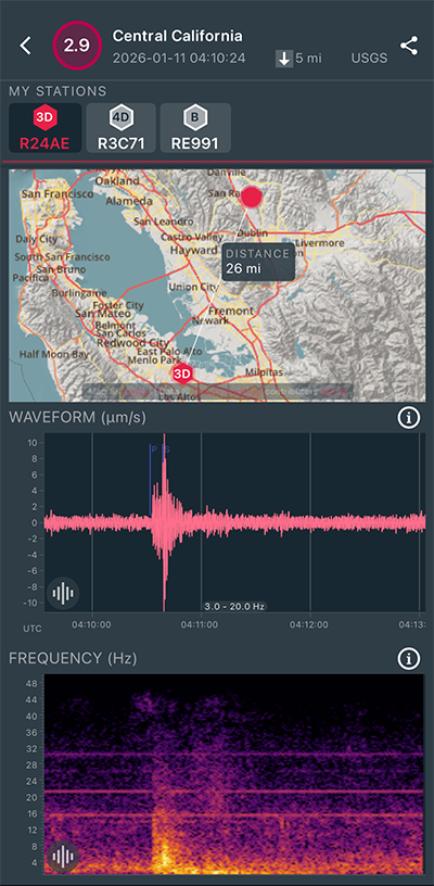
|
North/South Sensor
|
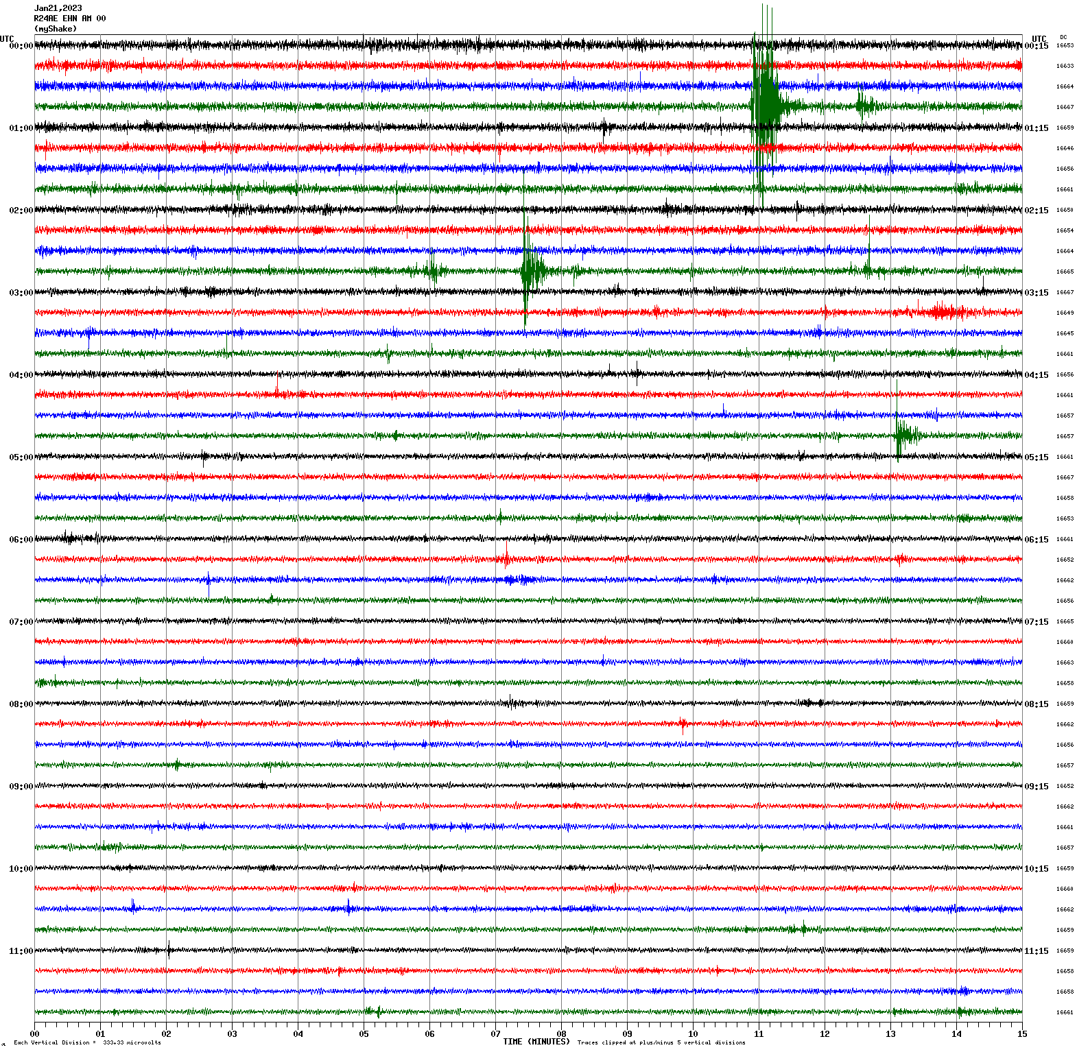
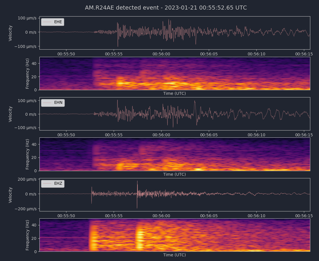
Magnitude 2.9
Depth 5.2 km
2 mi ESE of San Ramon, CAM
37.765°N 121.941°W
January 9, 2026 16:14:09 UTC
North/South Sensor
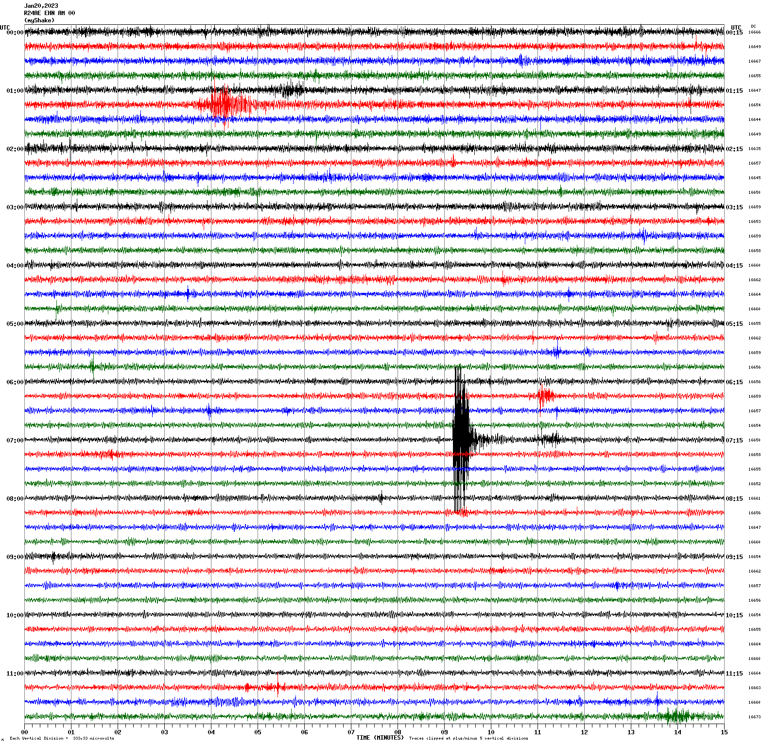
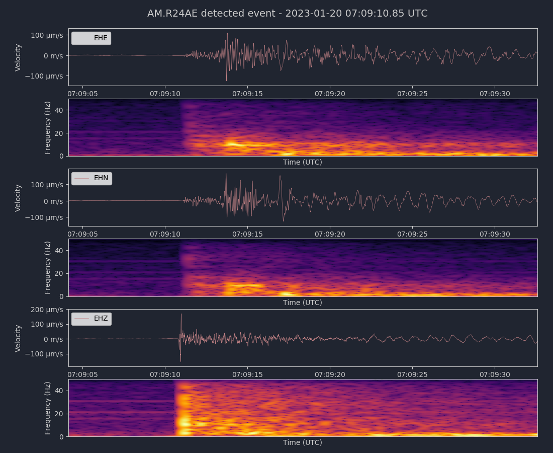
Magnitude 4.2
Depth 1.8 km
7 mi ENE of Cloverdale, CA
38.833°N 122.880°W
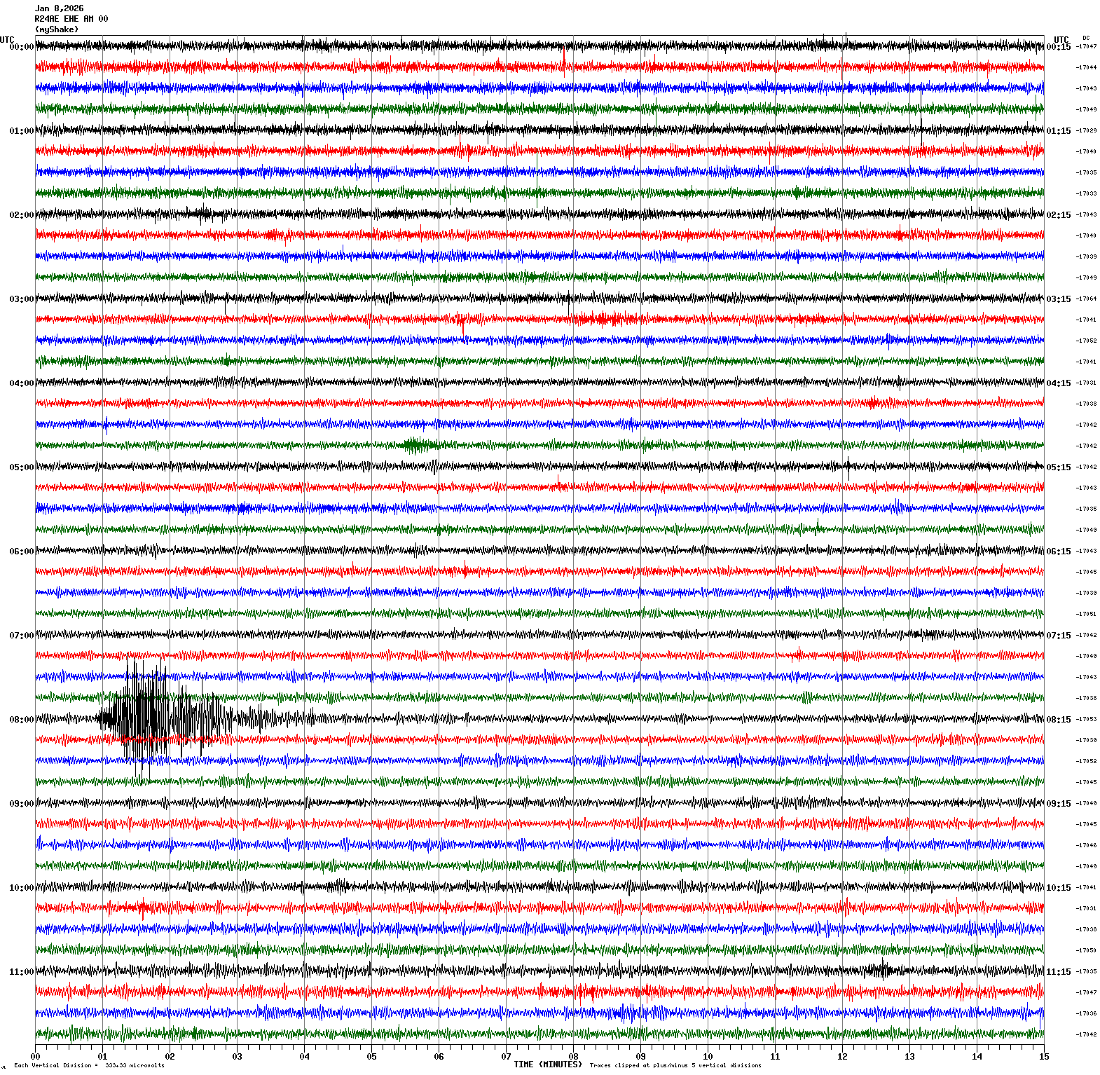
January 8, 2026 08:00:21 UTC
East/West Sensor
Magnitude 3.0
Depth 5.5 km
1 mi SE of San Ramon, CA
37.766°N 121.956°W
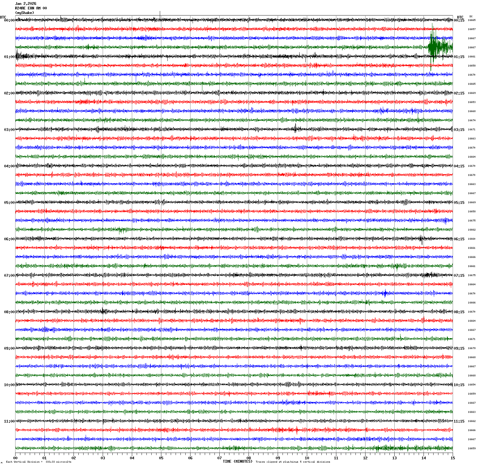
January 2, 2026 00:58:59 UTC
North/South Sensor
Magnitude 4.9
Depth 3.3 km
9 mi NNW of Susanville, CA
40.544°N 120.692°W
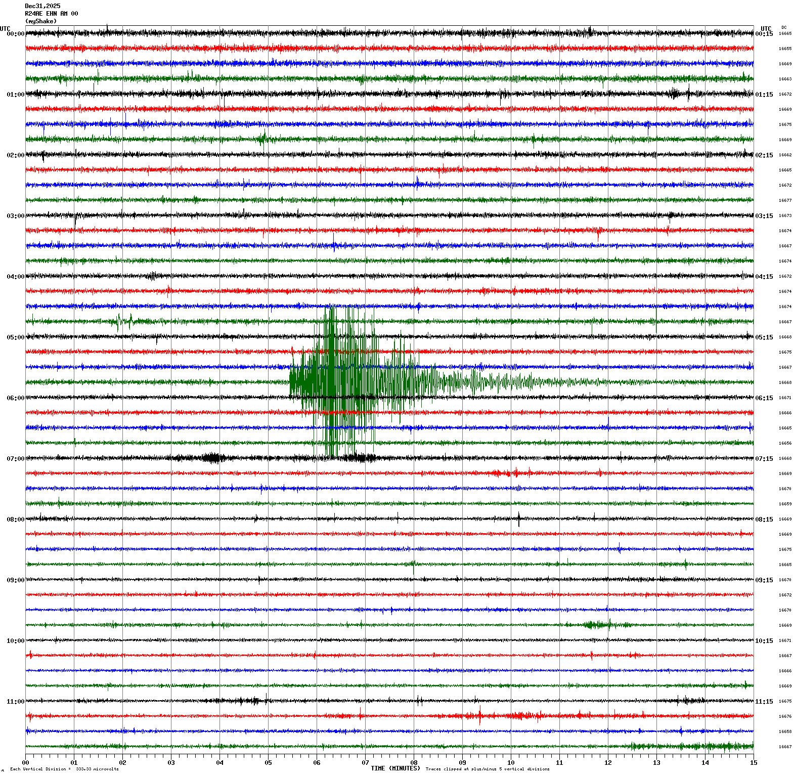
December 31, 2025 05:49:32 UTC
North/South Sensor
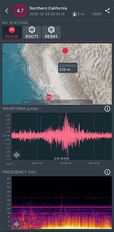
Magnitude 4.7
Depth 3.4 mi
9 mi NNW of Susanville, CA
40.545°N 120.692°W
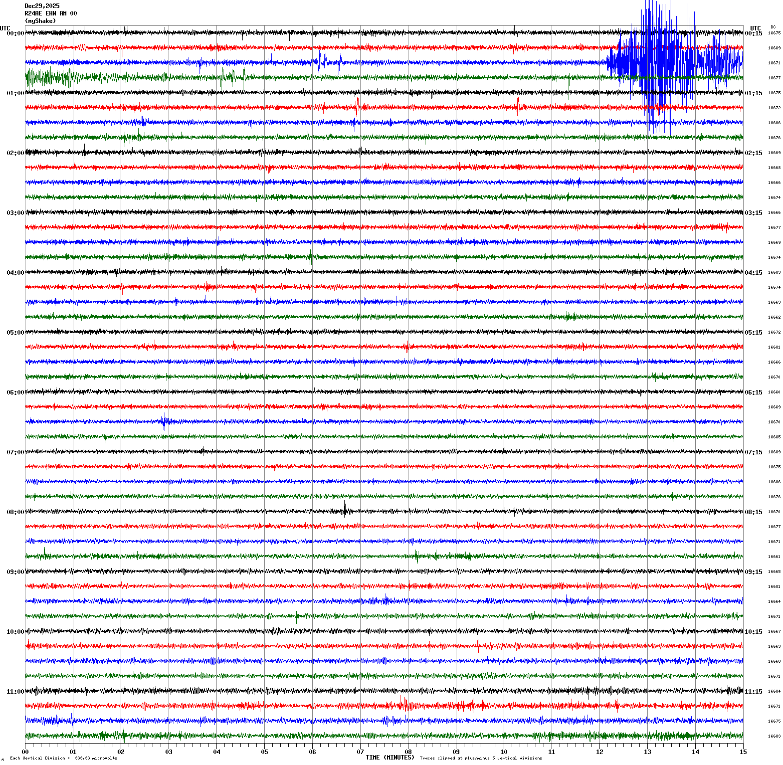
December 29, 2025 00:41:14 UTC
|
North/South Sensor
|
Magnitude 3.0
Depth 5.7 mi
3 mi NNW of Dublin, CA
37.743°N 121.950°W
December 24, 2025 19:36:54 UTC
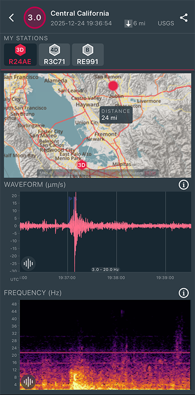
|
North/South Sensor
|
Magnitude 3.3
Depth 3.3 mi
10 mi S of Tres Pinos, CA
36.650°N 121.297°W
December 22, 2025 23:32:28 UTC
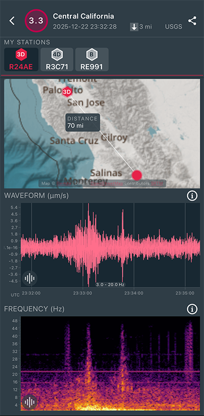
|
North/South Sensor
|
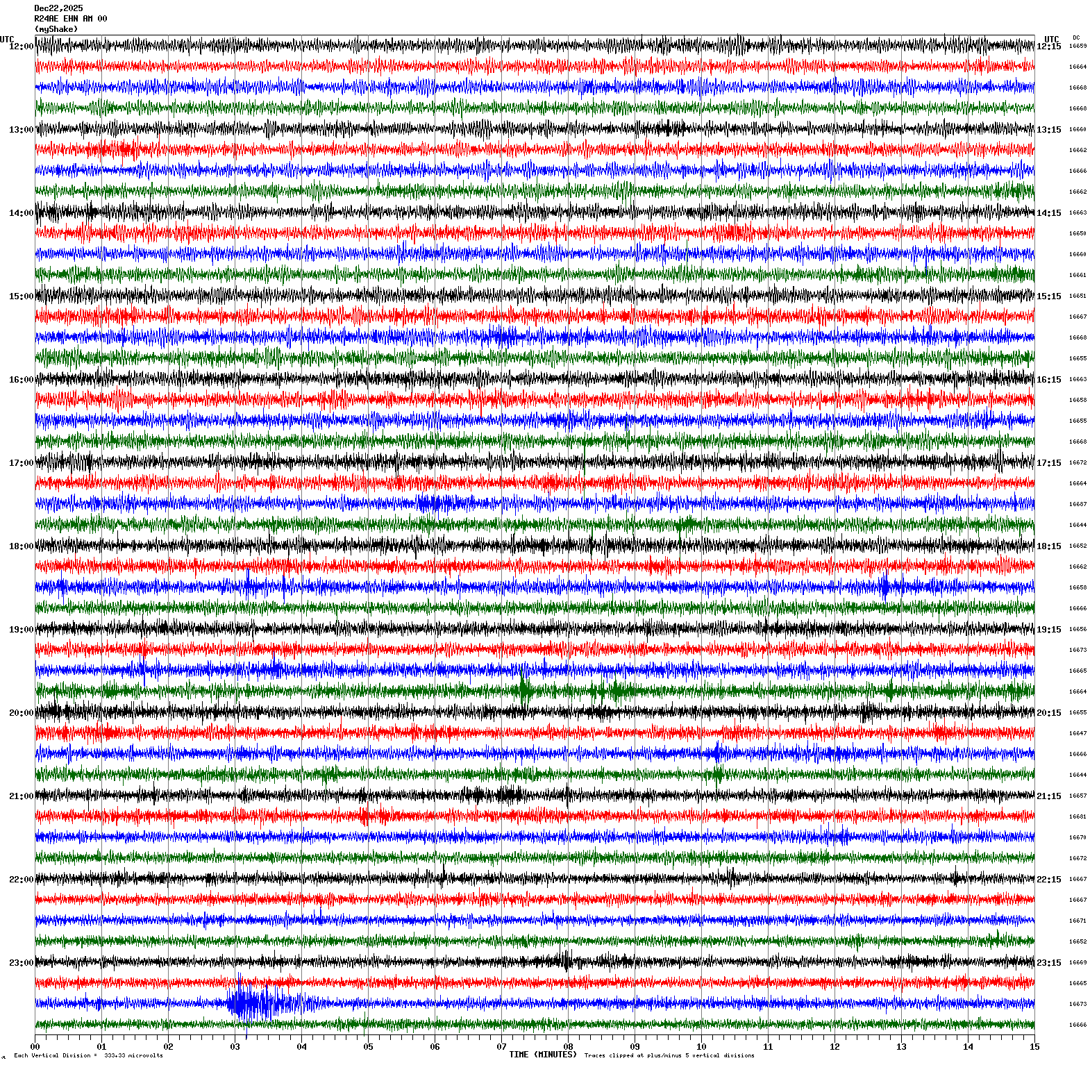
Magnitude 3.5
Depth 4.5 mi
3 mi SW of Ridgemark, CA
36.786°N 121.410°W
December 21, 2025 20:40:49 UTC
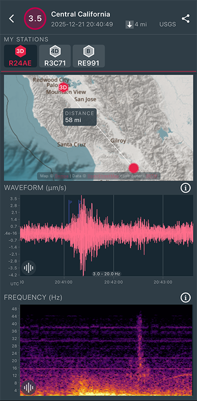
|
East/West Sensor
|
Magnitude 3.0
Depth 6.2 mi
2 mi SE of San Ramon, CA
37.751°N 121.944°W
December 21, 2025 02:53:47 UTC
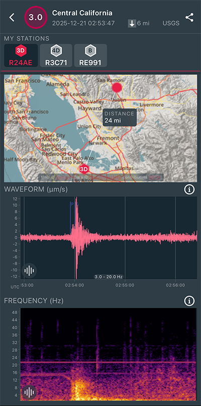
|
North/South Sensor
|
Magnitude 2.8
Depth 5.9 mi
3 mi SE of San Ramon, CA
37.750°N 121.941°W
December 21, 2025 02:36:34 UTC
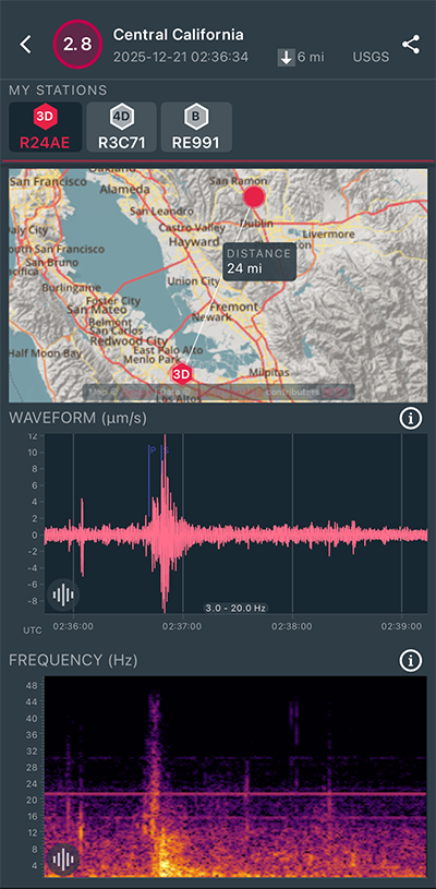
|
North/South Sensor
|
Magnitude 3.9
Depth 6.2 mi
3 mi SE of San Ramon, CA
37.747°N 121.946°W
December 21, 2025 02:31:54 UTC
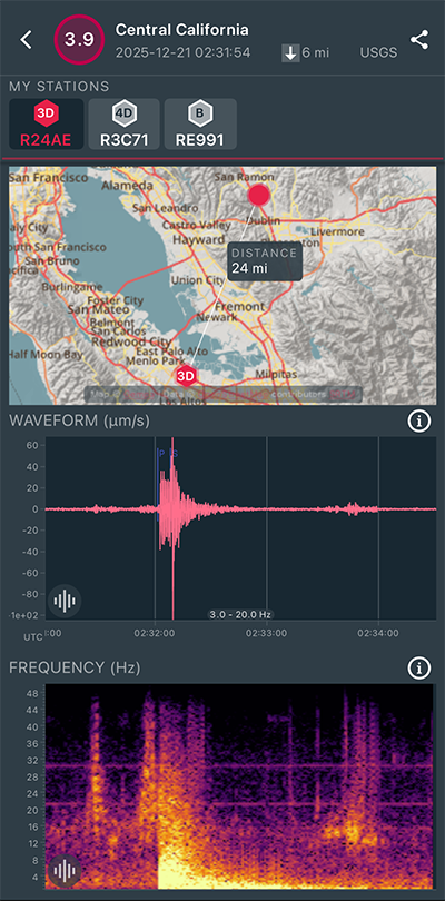
|
North/South Sensor
|
Magnitude 2.9
Depth 5.0 mi
2 mi SE of San Ramon, CA
37.749°N 121.949°W
December 20, 2025 04:10:00 UTC
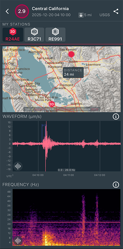
|
North/South Sensor
|
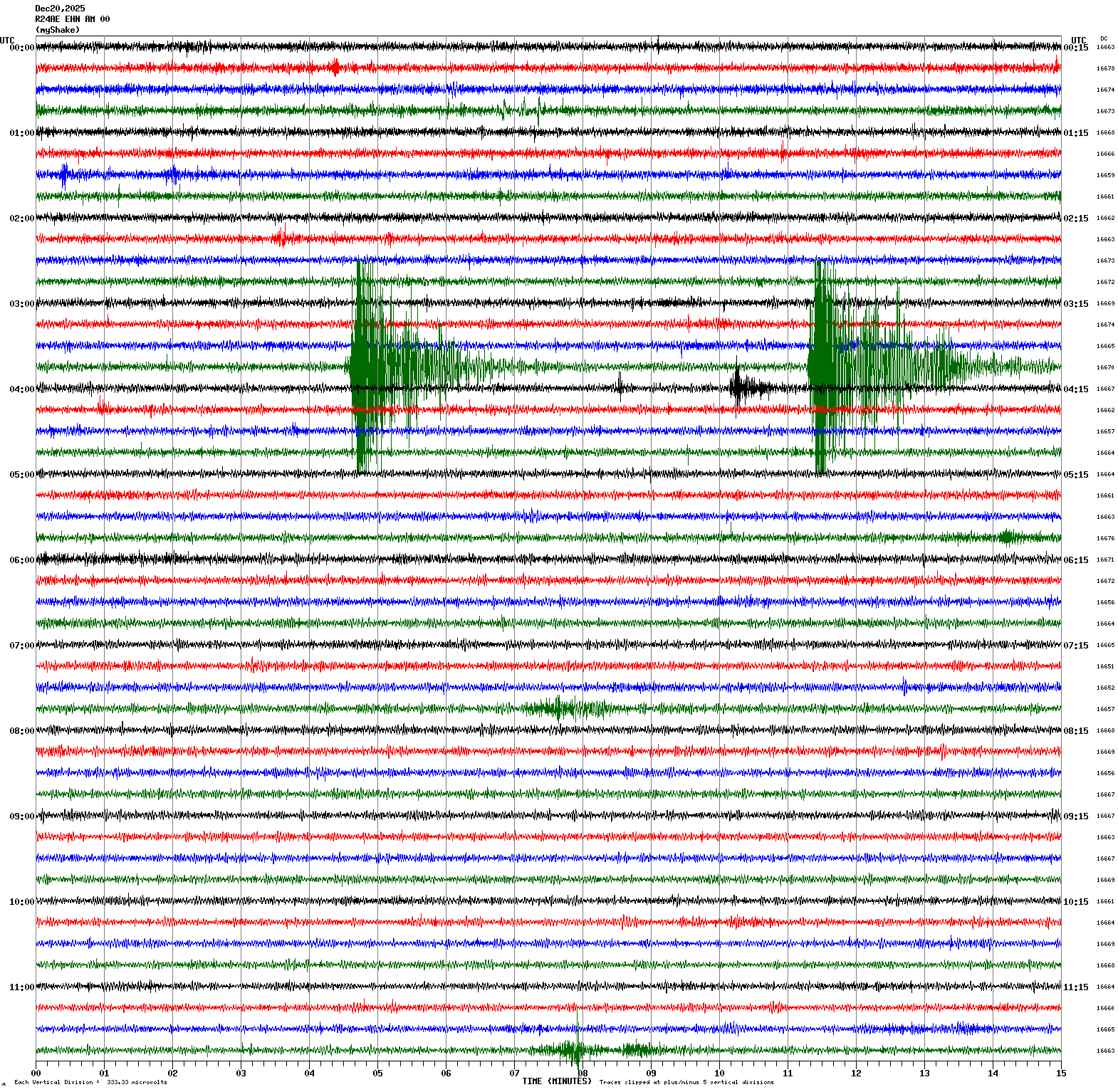
Magnitude 4.0
Depth 6.0 mi
3 mi SSE of San Ramon, CA
37.744°N 121.953°W
December 20, 2025 03:56:09 UTC
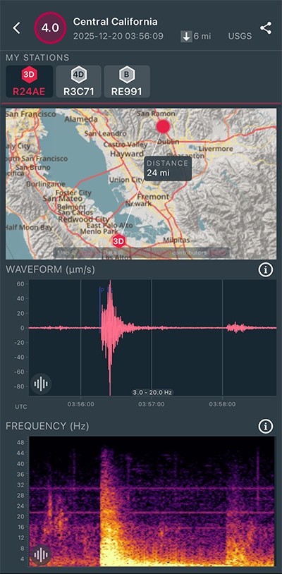
|
North/South Sensor
|
Magnitude 3.6
Depth 5.9 mi
3 mi SSE of San Ramon, CA
37.743°N 121.954°W
December 20, 2025 03:49:28 UTC
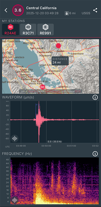
|
North/South Sensor
|
Magnitude 3.0
Depth 5.2 mi
2 mi SE of San Ramon, CA
37.751°N 121.949°W
December 17, 2025 06:11:34 UTC
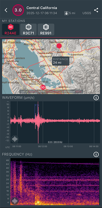
|
North/South Sensor
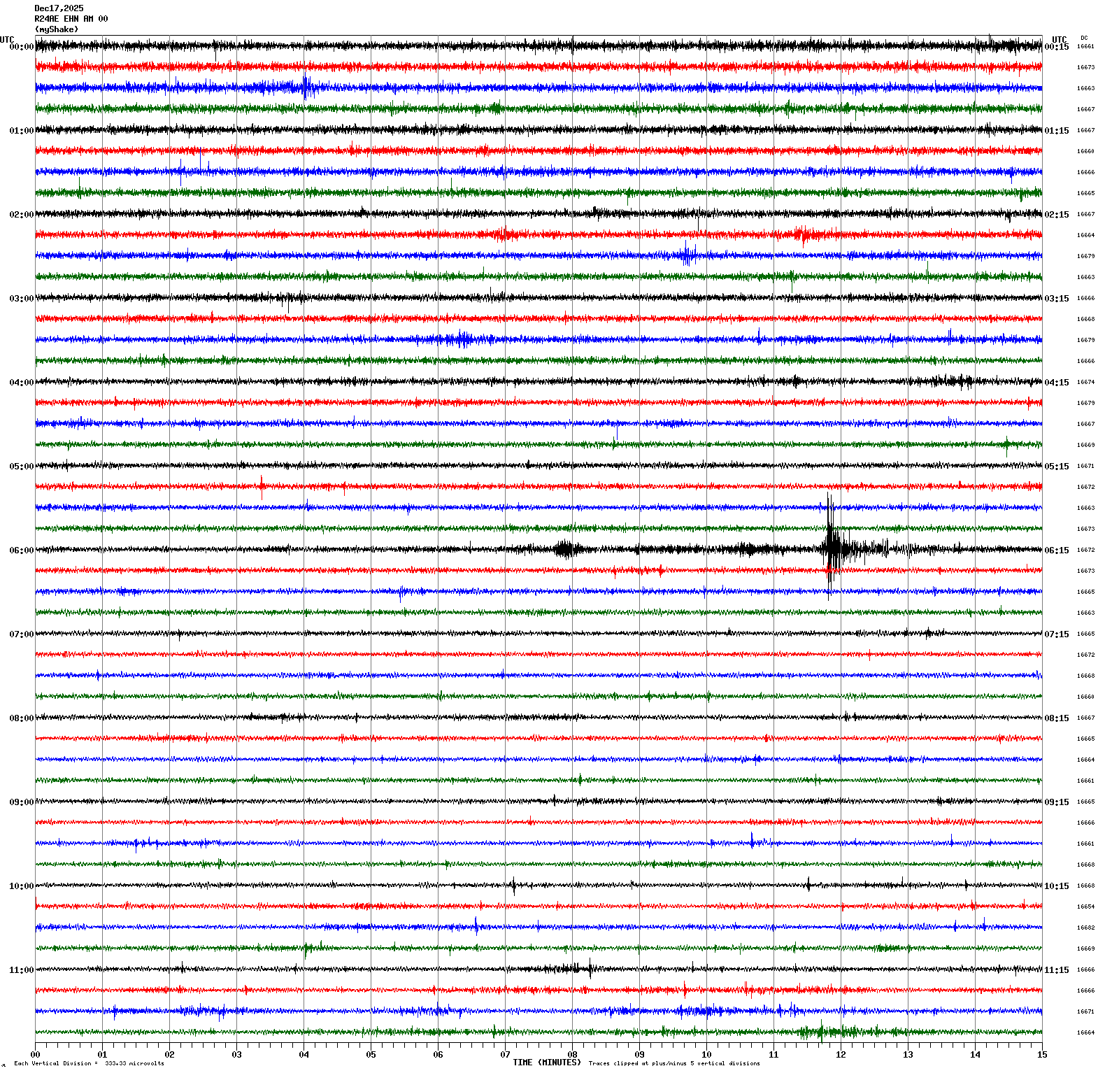
|
Magnitude 3.0
Depth 5.5 mi
2 mi SE of San Ramon, CA
37.750°N 121.949°W
December 16, 2025 13:53:27 UTC
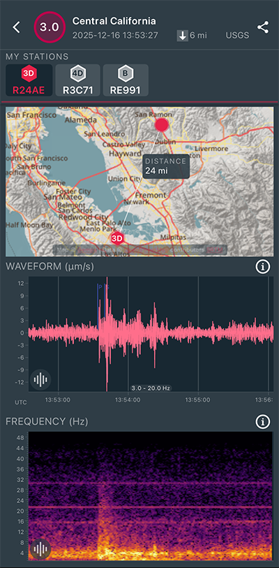
|
North/South Sensor
|
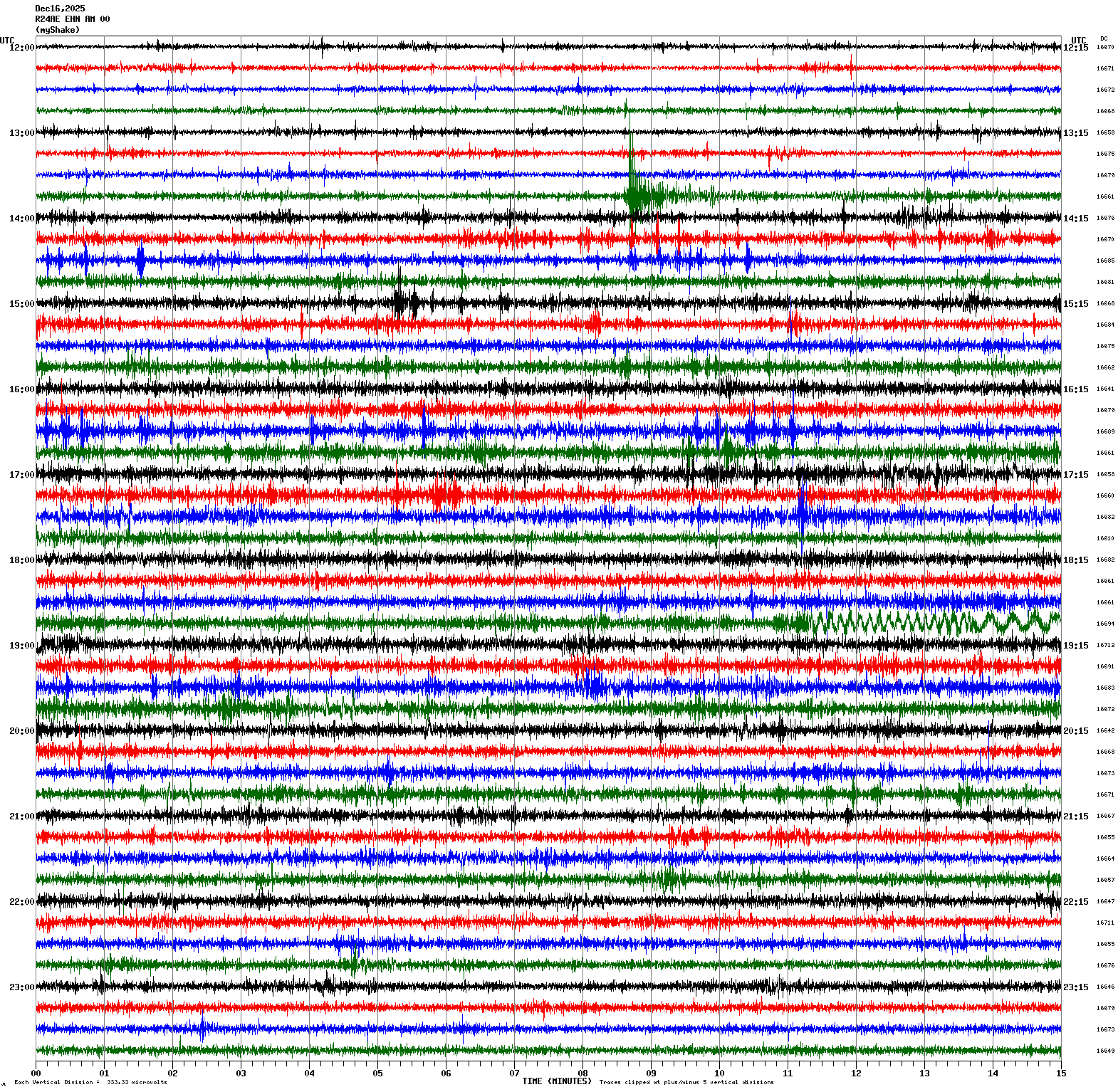
Magnitude 3.3
Depth 3.5 mi
4 mi SW of Kenwood, CA
38.379°N 122.605°W
December 15, 2025 00:04:20 UTC
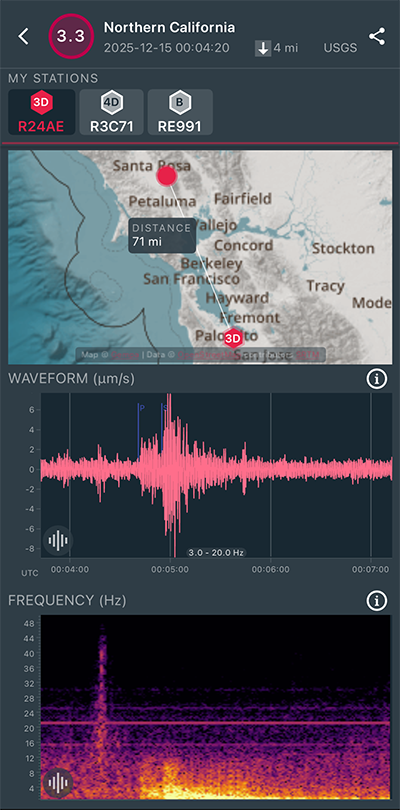
|
North/South Sensor
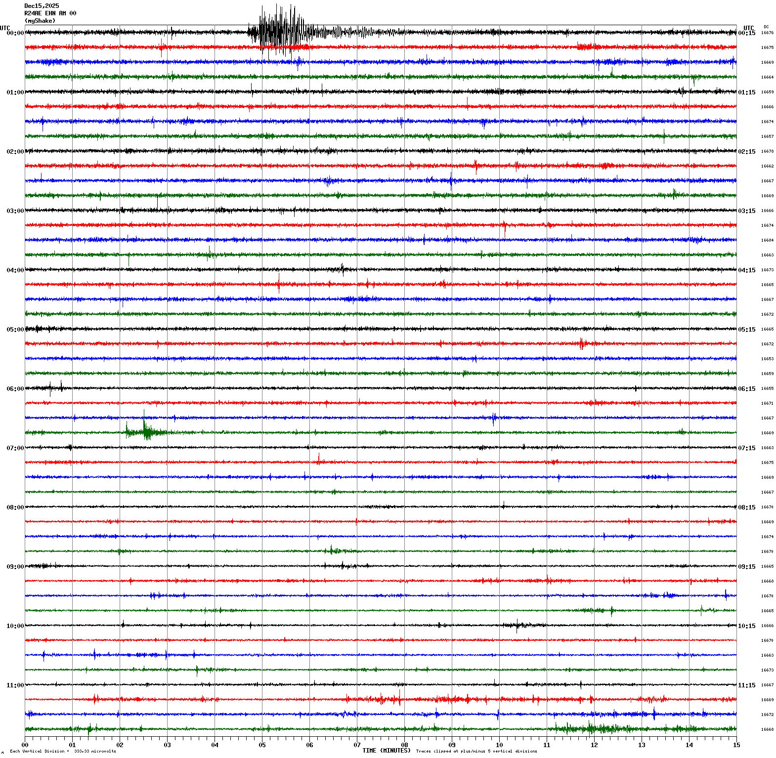
|
Magnitude 3.1
Depth 1.4 mi
4 mi WNW of Glen Ellen, CA
38.377°N 122.604°W
December 14, 2025 23:38:38 UTC
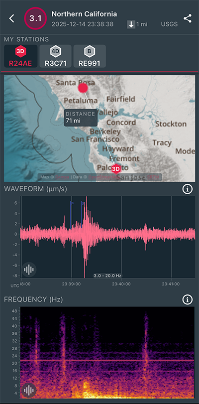
|
North/South Sensor
|
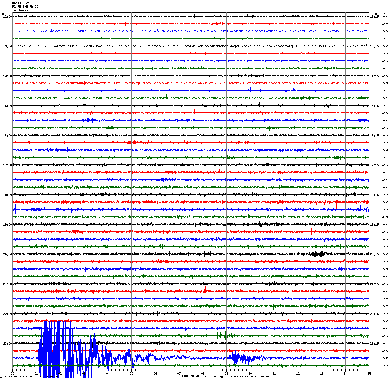
Magnitude 4.0
Depth 1.2 mi
4 mi W of Glen Ellen, CA
38.374°N 122.602°W
December 14, 2025 23:30:43 UTC
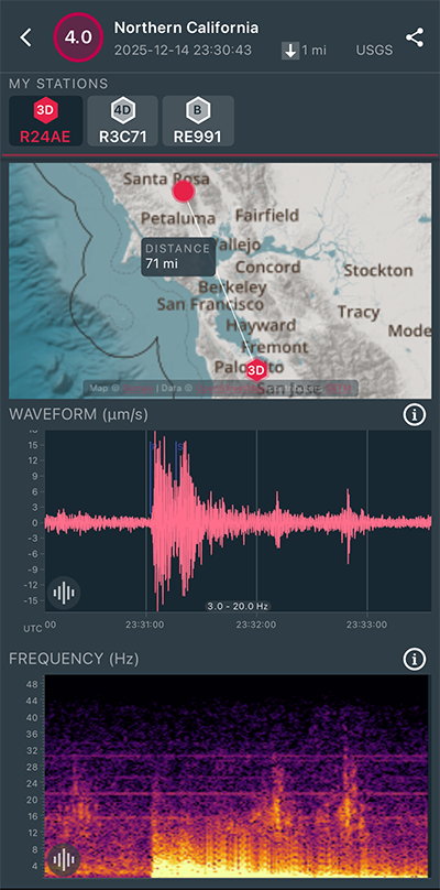
|
North/South Sensor
|
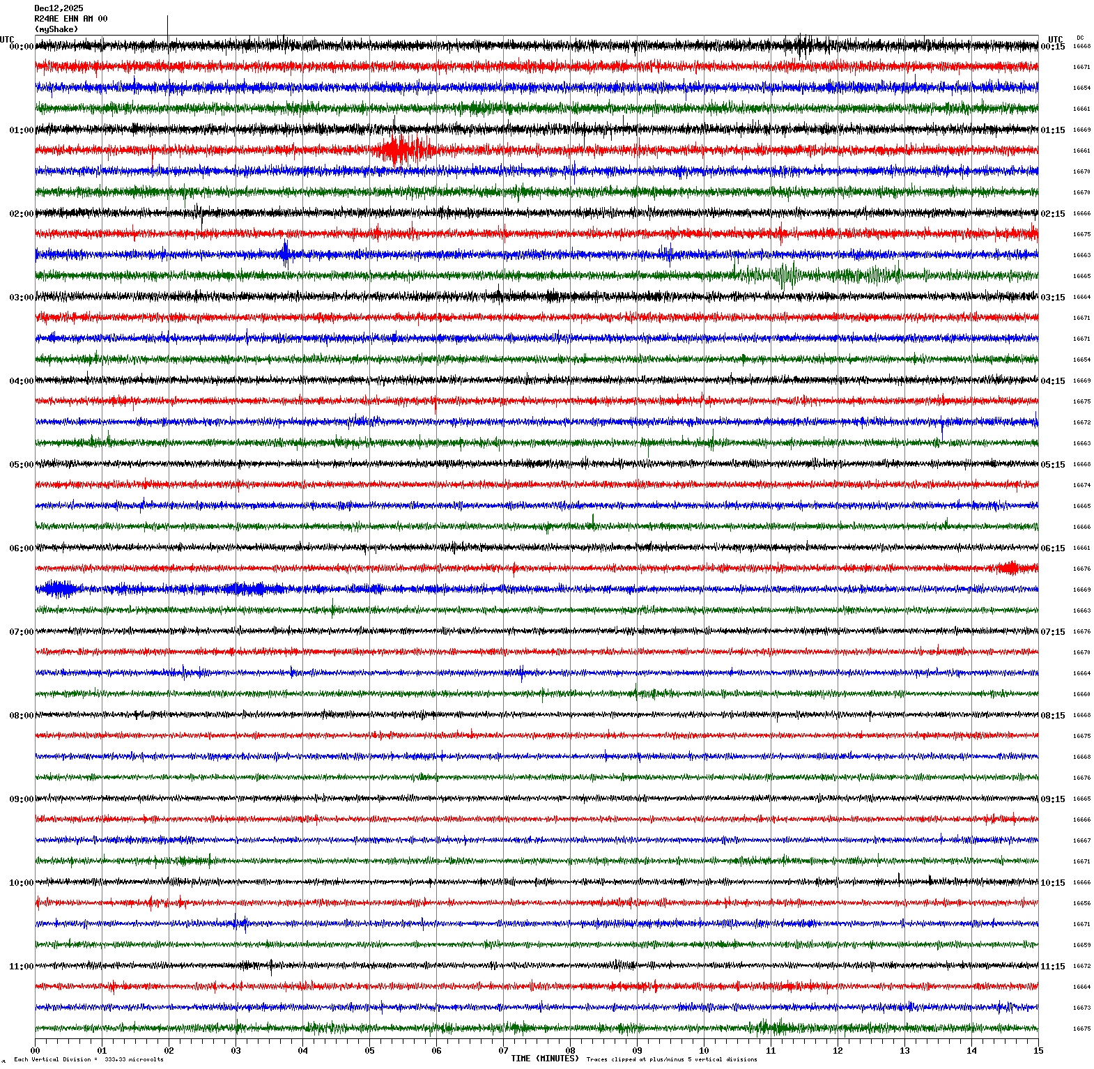
Magnitude 3.3
Depth 4.0 mi
6 mi SSE of San Juan Bautista, CA
36.771°N 121.500°W
December 12, 2025 01:19:44 UTC
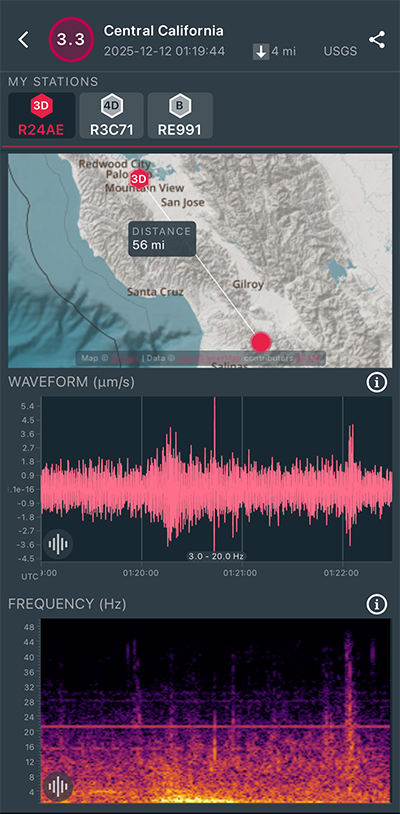
|
North/South Sensor
|
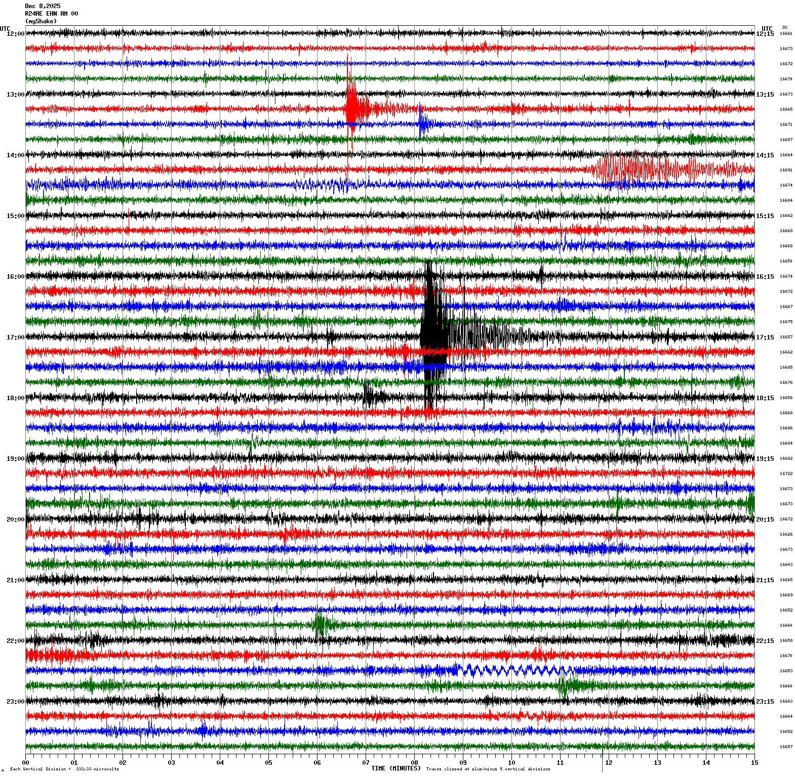
Magnitude 3.7
Depth 5.9 mi
2 mi SE of San Ramon, CA
37.759°N 121.941°W
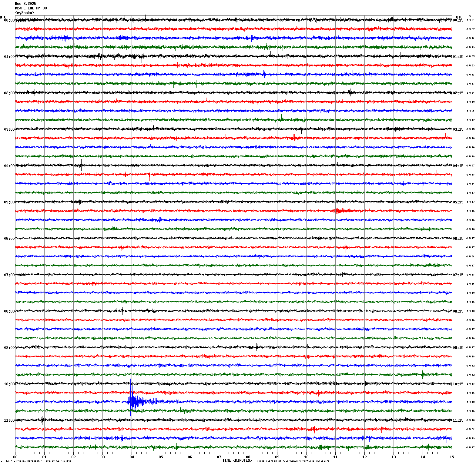
December 8, 2025 17:07:58 UTC
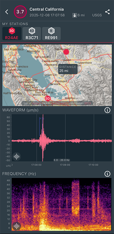
|
North/South Sensor
|
Magnitude 7.6
Depth 27.4 mi
46 mi ENE of Misawa, Japan
41.043°N 142.141°E
December 8, 2025 14:15:19 UTC
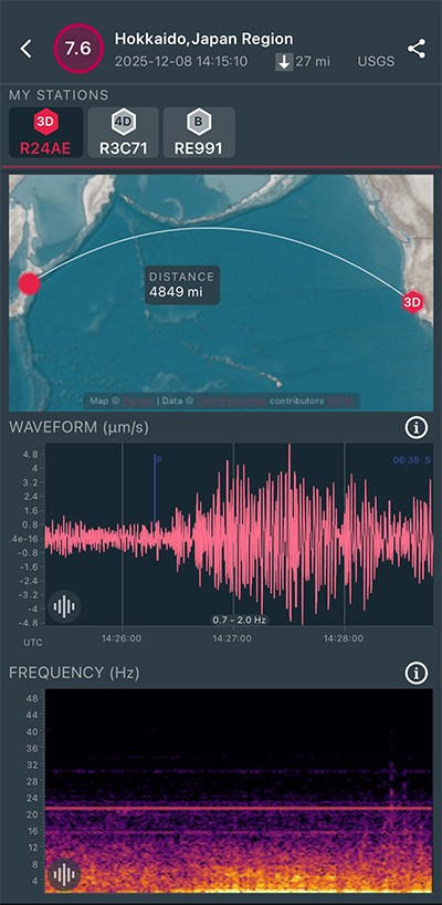
|
North/South Sensor
|
Magnitude 2.7
Depth 5.2 mi
2 mi SE of San Ramon, CA
37.751°N 121.943°W
December 8, 2025 13:21:23 UTC
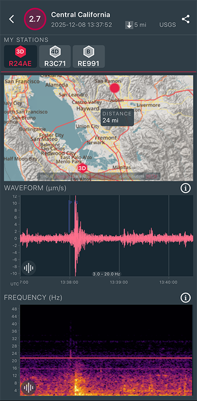
|
North/South Sensor
|
Magnitude 3.0
Depth 5.3 mi
2 mi SE of San Ramon, CA
37.754°N 121.941°W
December 8, 2025 13:21:23 UTC
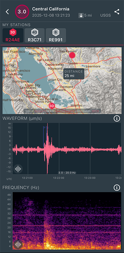
|
North/South Sensor
|
Magnitude 2.9
Depth 5.3 mi
2 mi SE of San Ramon, CA
37.756°N 121.940°W
December 8, 2025 10:33:41 UTC
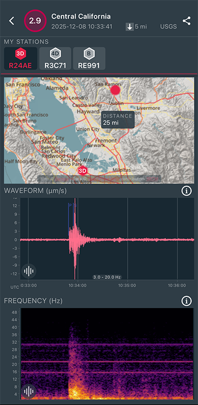
|
East/West Sensor
|
Magnitude 7.0
Depth 6.2 mi
2025 Hubbard Glacier Earthquake
60.359°N 139.546°W
December 6, 2025 20:41:49 UTC
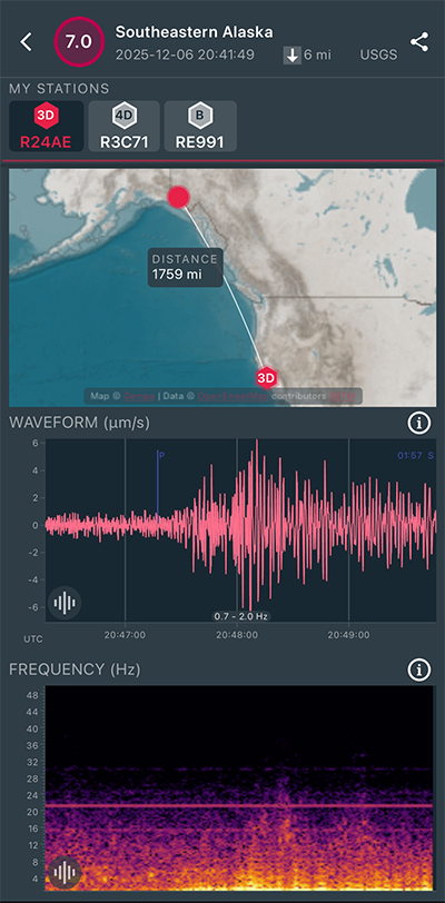
|
North/South Sensor

|
Magnitude 2.9
Depth 1.1 mi
4 mi WSW of Kenwood, CA
38.386°N 122.611°W
December 1, 2025 10:14:24 UTC
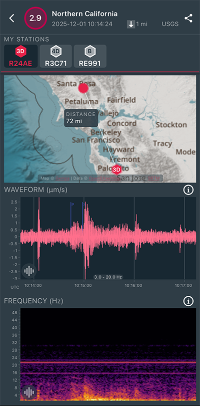
|
North/South Sensor

|
Magnitude 3.1
Depth 3.0 mi
4 mi WSW of Kenwood, CA
38.391°N 122.612°W
December 1, 2025 08:06:34 UTC
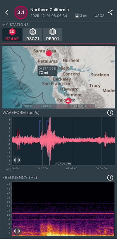
|
North/South Sensor
|
Magnitude 2.7
Depth 1.5 mi
4 mi WSW of Kenwood, CA
38.386°N 122.608°W
December 1, 2025 07:38:10 UTC
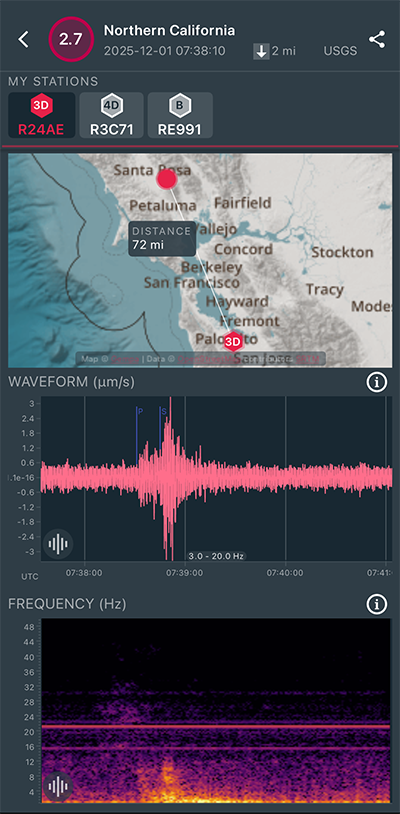
|
North/South Sensor
|
Magnitude 3.3
Depth 3.0 mi
4 mi WSW of Kenwood, CA
38.385°N 122.606°W
December 1, 2025 06:56:36 UTC
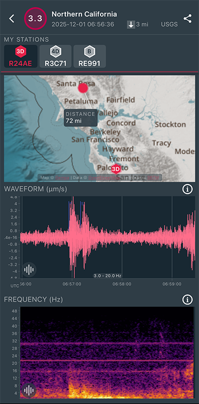
|
North/South Sensor
|
Magnitude 2.9
Depth 4.1 mi
3 mi W of San Juan Bautista, CA
36.845°N 121.592°W
November 29, 2025 07:47:52 UTC
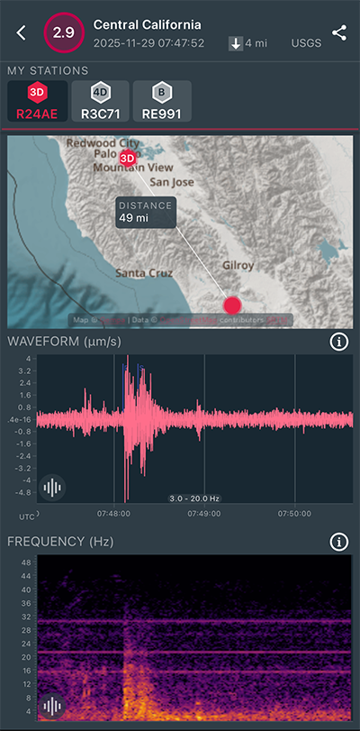
|
East/West Sensor

|
Magnitude 3.0
Depth 2.8 mi
2 mi SSW of Colma, CA
37.655°N 122.476°W
November 29, 2025 01:03:04 UTC
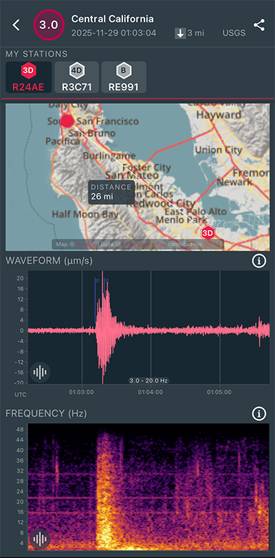
|
East/West Sensor
|
Magnitude 3.4
Depth 4.1 mi
3 mi W of San Juan Bautista, CA
36.845°N 121.591°W
November 28, 2025 15:40:01 UTC
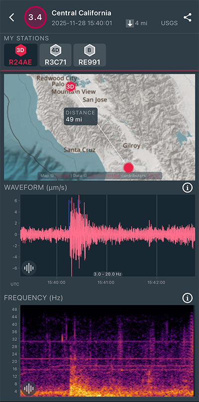
|
East/West Sensor
|
Magnitude 4.0
Depth 5.3 mi
3 mi S of San Juan Bautista, CA
36.801°N 121.548°W
November 27, 2025 20:57:37 UTC
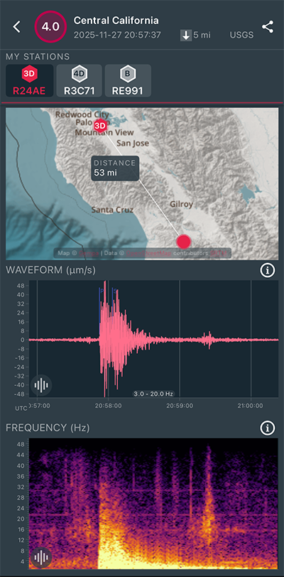
|
North/South Sensor
|
Magnitude 3.9
Depth 5.1 mi
4 mi S of San Juan Bautista, CA
36.796°N 121.543°W
November 27, 2025 20:48:48 UTC
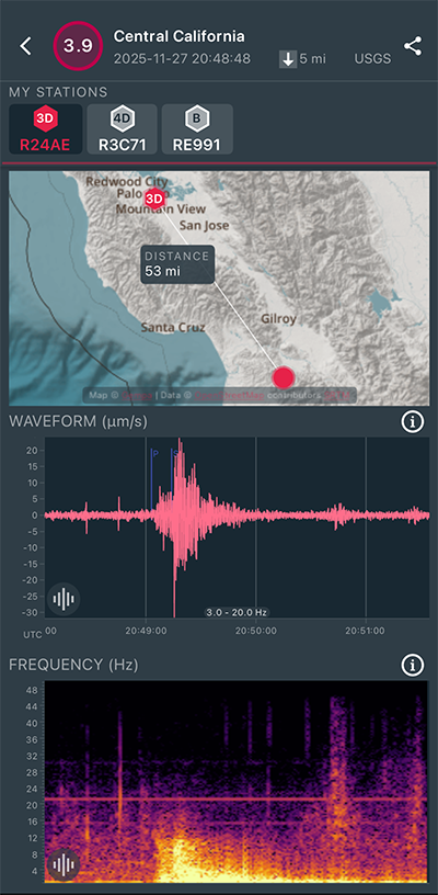
|
North/South Sensor
|
Magnitude 3.9
Depth 0.5 mi
1 mi NW of The Geysers, CA
38.784°N 122.767°W
November 27, 2025 17:11:43 UTC
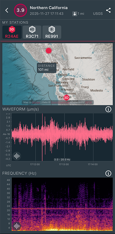
|
North/South Sensor
|
Magnitude 3.7
Depth -0.6 mi
2 mi SE of The Geysers, CA
38.761°N 122.736°W
November 27, 2025 12:21:45 UTC
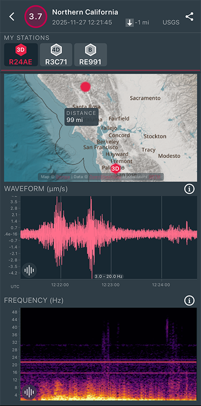
|
North/South Sensor
|
Magnitude 3.9
Depth 3.0 mi
3 mi SE of Gilroy, CA
36.978°N 121.520°W
November 26, 2025 14:20:01 UTC
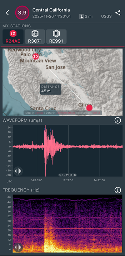
|
North/South Sensor
|
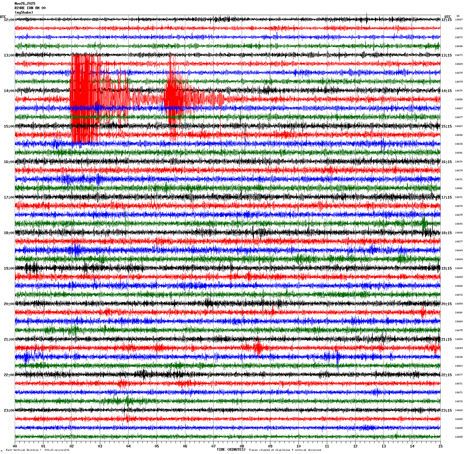
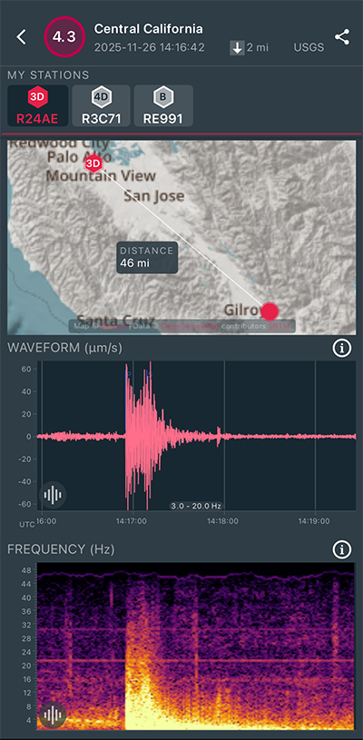
Magnitude 4.3
Depth 1.7 mi
5 mi E of Gilroy, CA
37.000°N 121.476°W
November 26, 2025 14:16:42 UTC
|
North/South Sensor
|
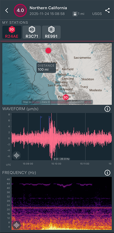
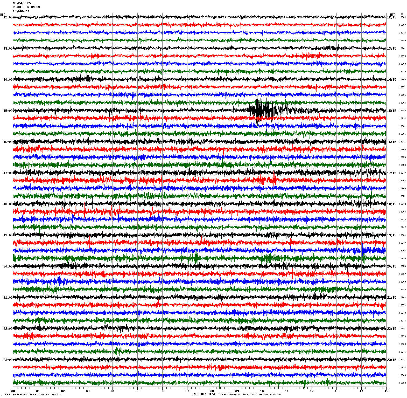
Magnitude 4.1
Depth 1.3 mi
1 mi NNW of The Geysers, CA
38.785°N 122.759°W
November 24, 2025 15:08:58 UTC
|
North/South Sensor
|
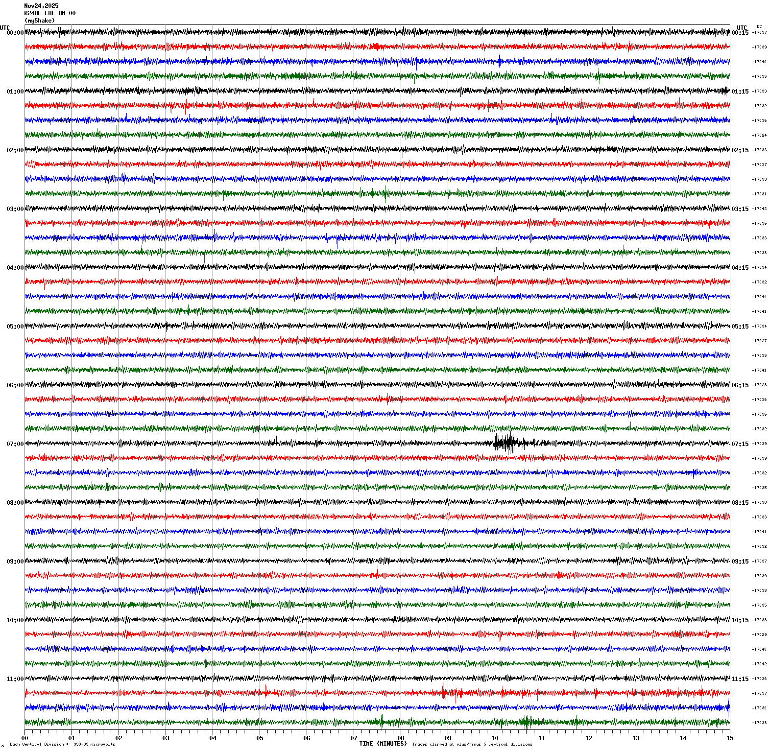
Magnitude 3.3
Depth 4.2 mi
5 mi NW of Pinnacles, CA
36.583°N 121.205°W
November 24, 2025 07:09:22 UTC
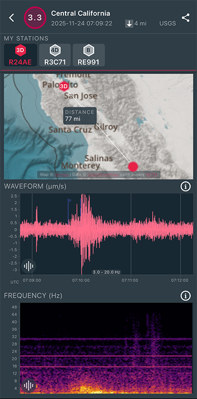
|
East/West Sensor
|
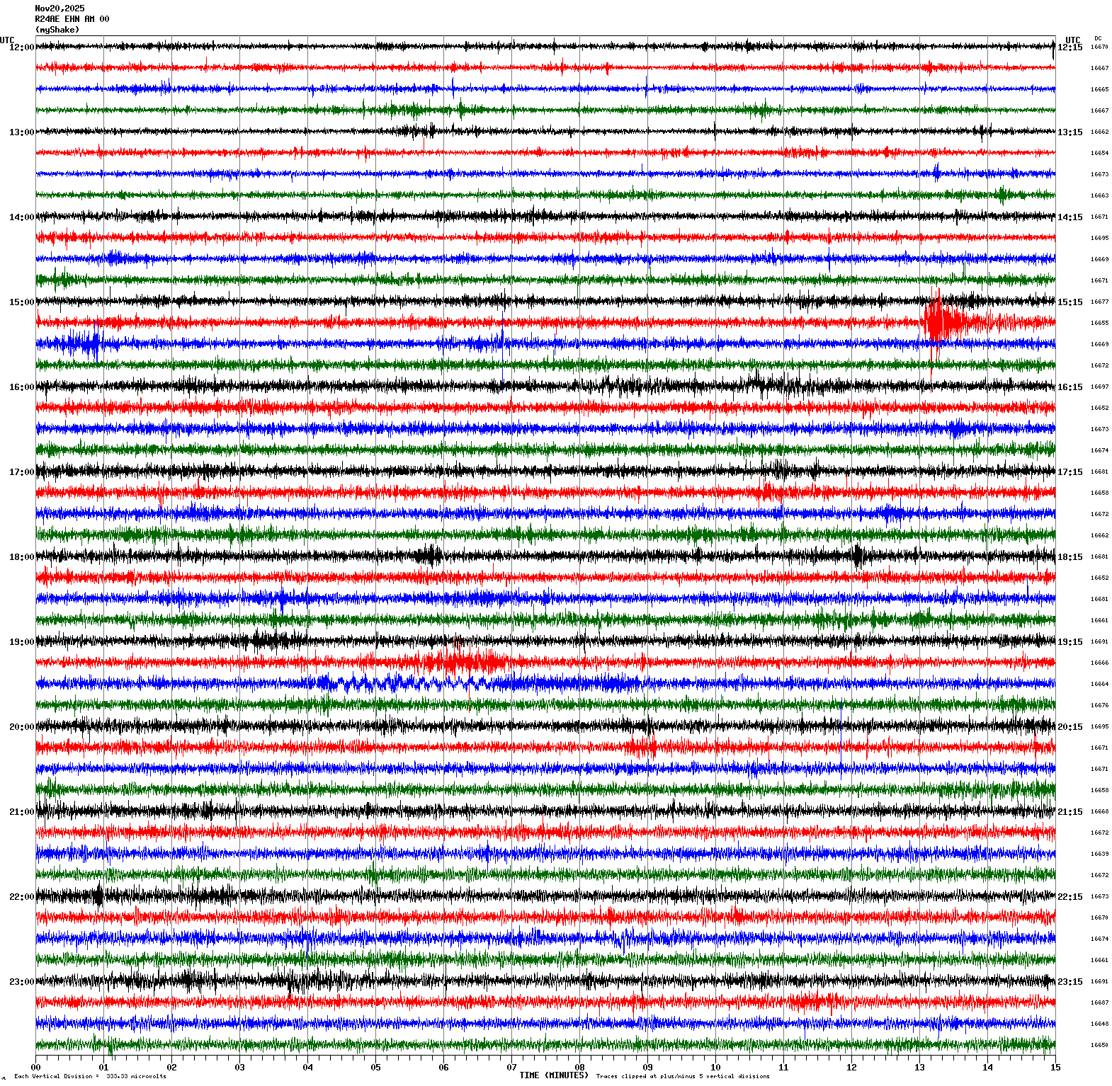
Magnitude 3.2
Depth 10.2 mi
4 km SE of San Ramon, CA
37.758°N 121.945°W
November 20, 2025 15:27:55 UTC
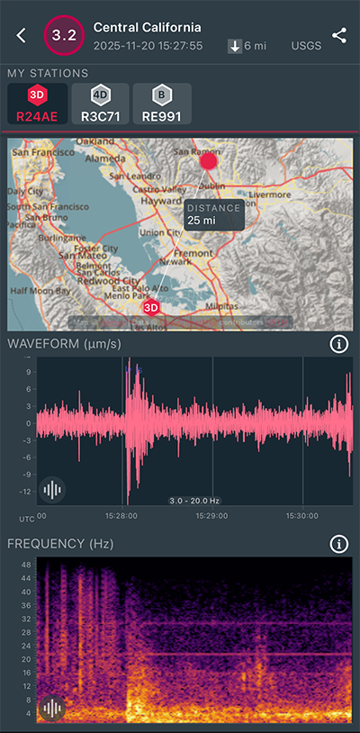
|
North/South Sensor
|
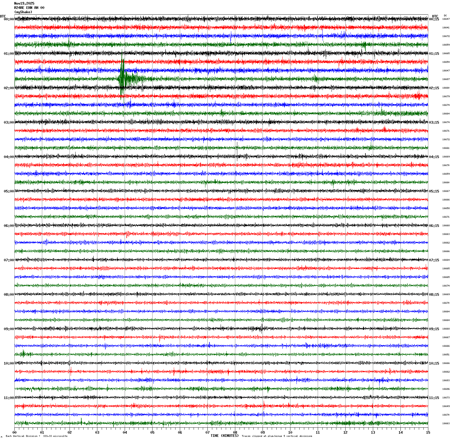
Magnitude 3.0
Depth 3.5 mi
10 mi E of Seven Trees, CA
37.286°N 121.659°W
November 19, 2025 01:48:36 UTC
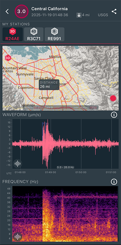
|
North/South Sensor
|
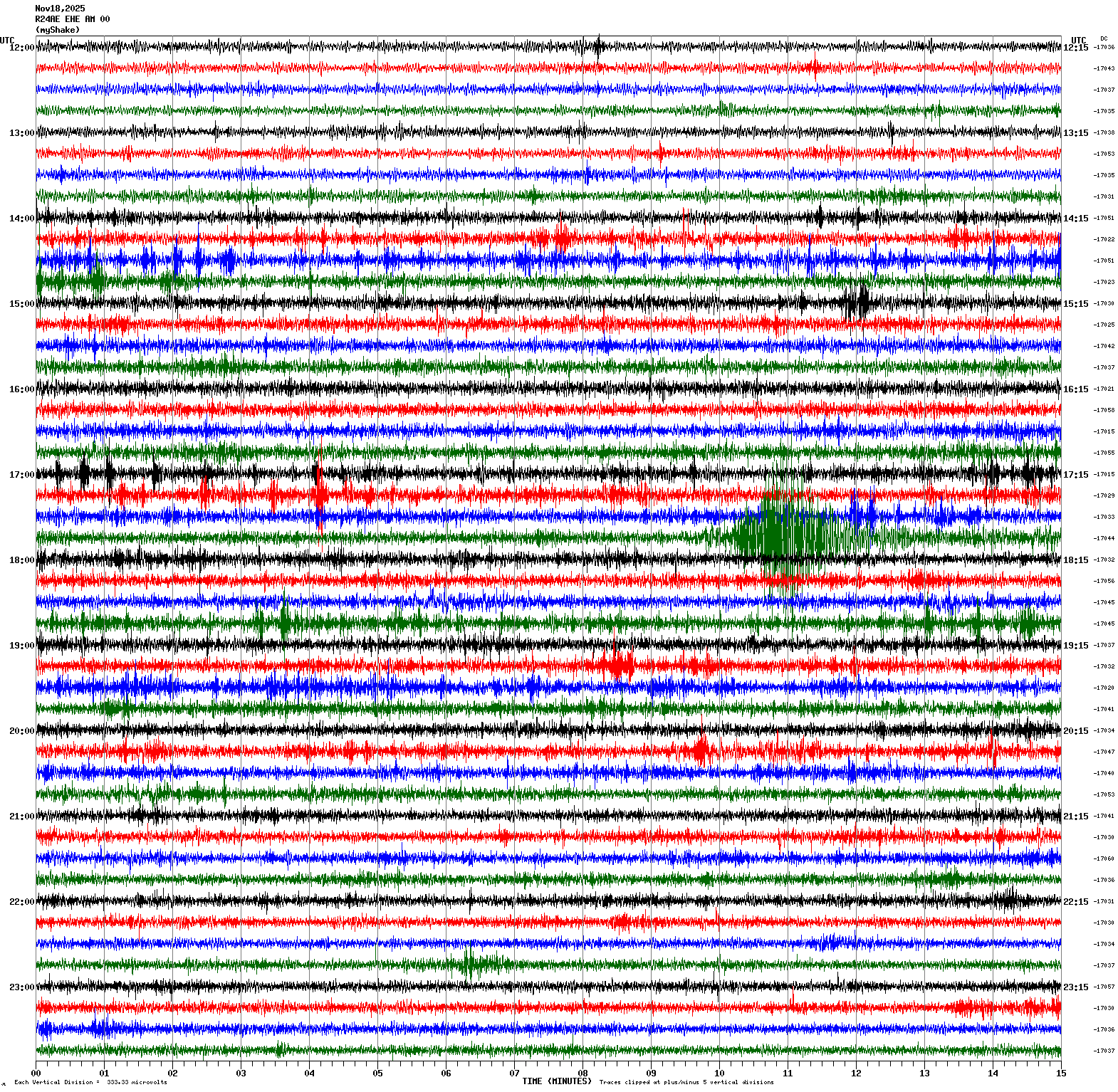
Magnitude 4.1
Depth 3.1 mi
5 mi W of Templeton, CA
35.553°N 120.794°W
November 18, 2025 17:54:30 UTC
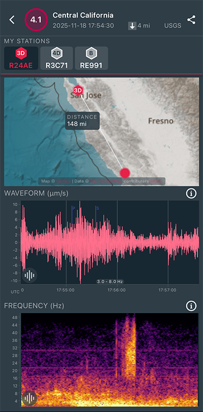
|
East/West Sensor
|
Magnitude 3.3
Depth 5.8 mi
2 mi SE of San Ramon, CA
37.756°N 121.952°W
November 18, 2025 06:47:34 UTC
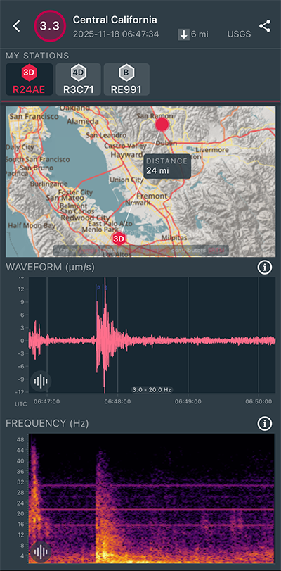
|
East/West Sensor
|
Magnitude 3.5
Depth 6.1 mi
2 mi S of Vallejo, CA
38.080°N 122.237°W
November 13, 2025 20:41:15 UTC
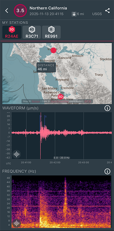
|
East/West Sensor
|
Magnitude 3.0
Depth 5.6 mi
2 mi SE of San Ramon, CA
37.761°N 121.948°W
November 9, 2025 19:50:34 UTC
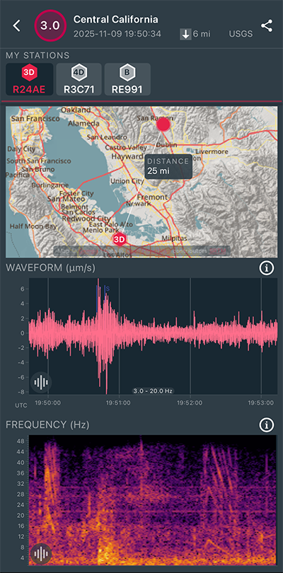
|
East/West Sensor
|
Magnitude 3.0
Depth 5.7 mi
1 mi W of San Ramon, CA
37.779°N 121.991°W
November 9, 2025 18:42:47 UTC
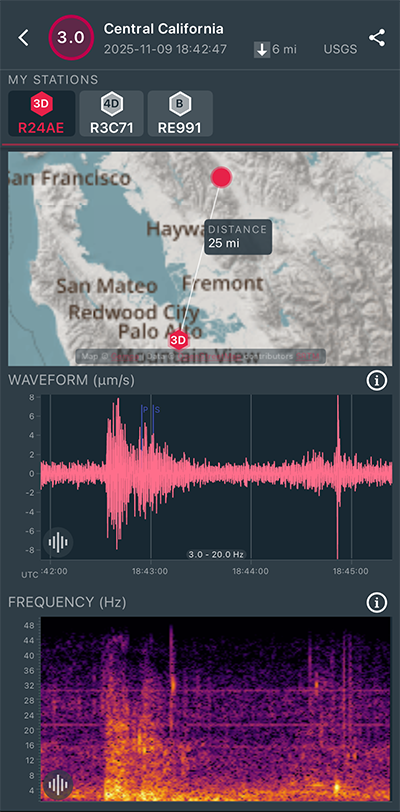
|
East/West Sensor
|
Magnitude 3.8
Depth 5.8 mi
2 mi SE of San Ramon, CA
37.761°N 121.946°W
November 9, 2025 17:38:45 UTC
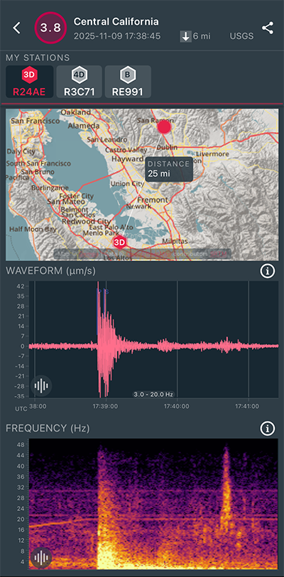
|
East/West Sensor
|
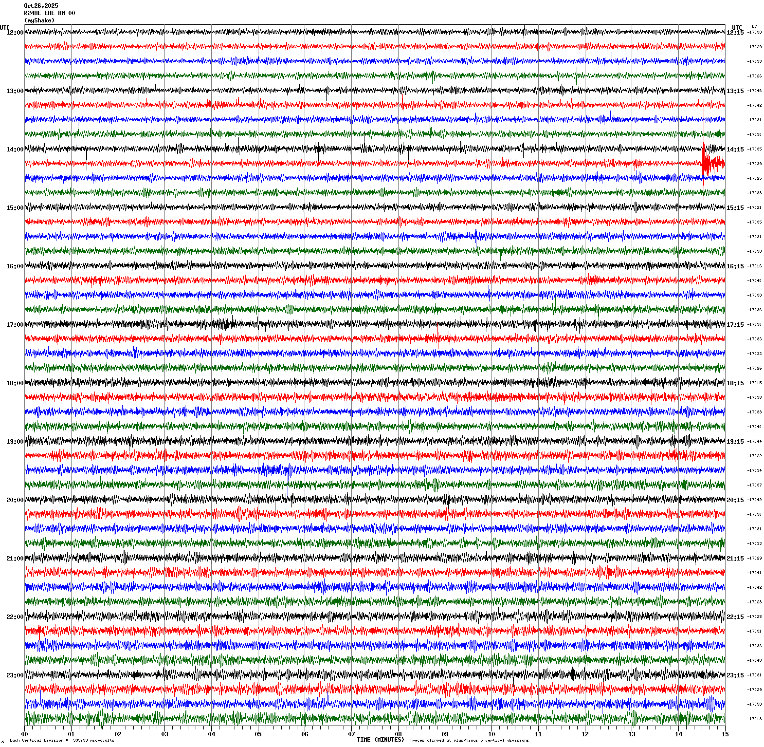
Magnitude 3.2
Depth 9.9 mi
4 mi NNW of Lafayette, CA
37.945°N 122.151°W
October 26, 2025 14:29:12 UTC
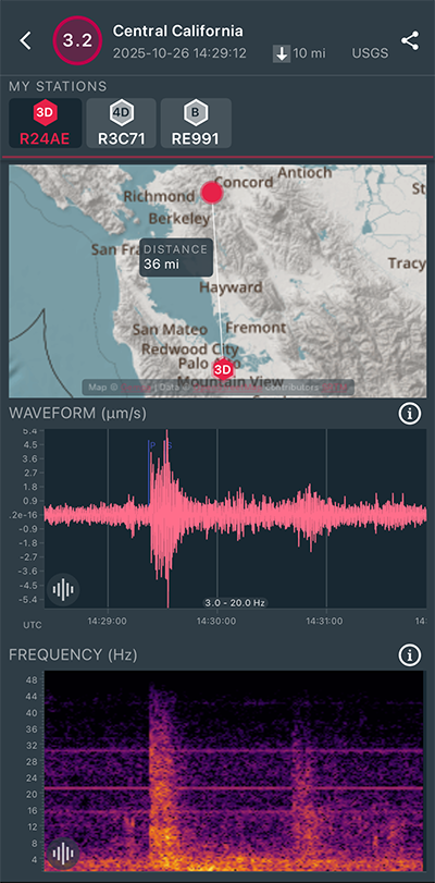
|
East/West Sensor
|
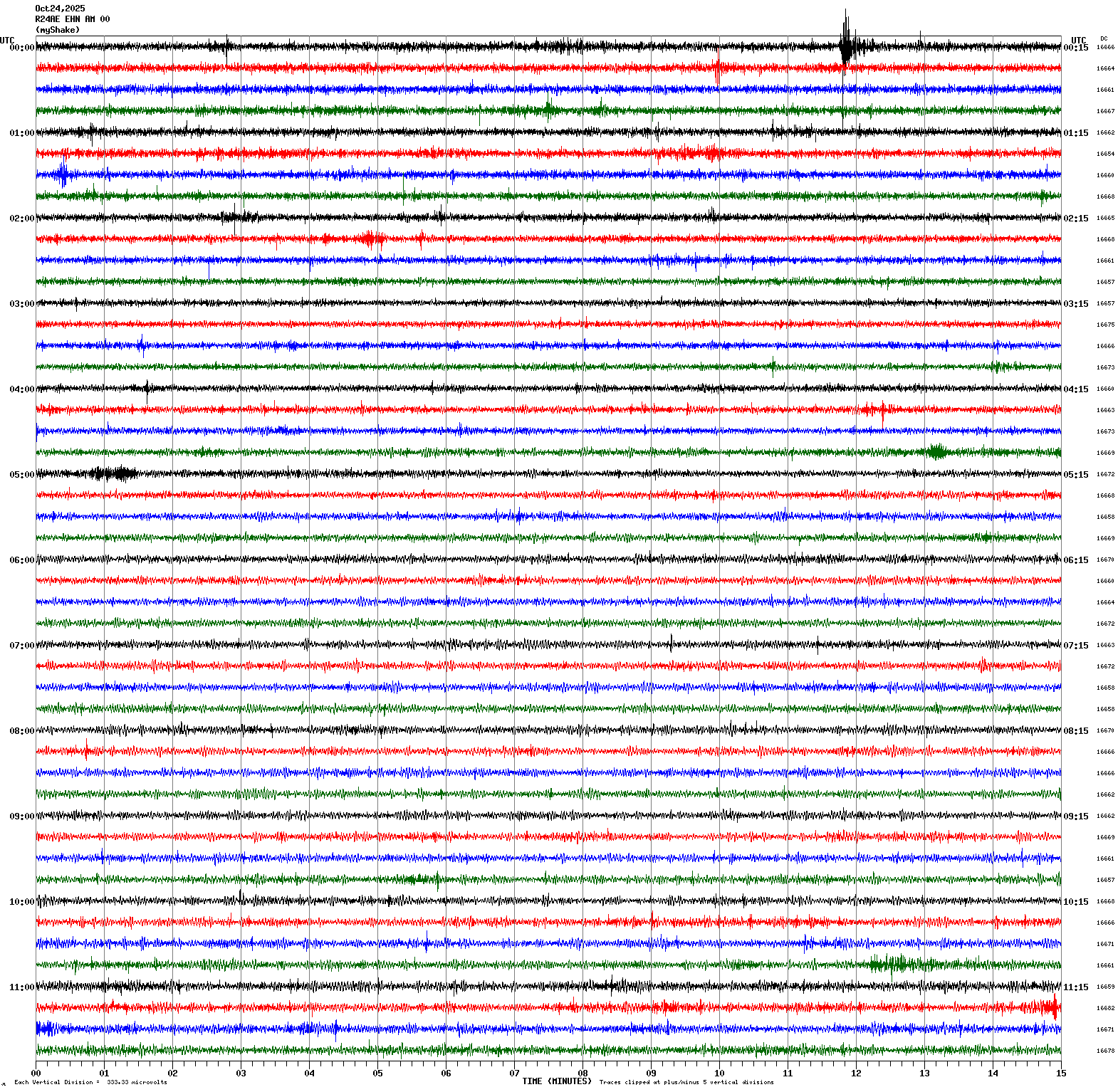
Magnitude 2.4
Depth 2.6 mi
1 mi E of Woodside, CA
37.428°N 122.241°W
October 24, 2025 00:11:43 UTC
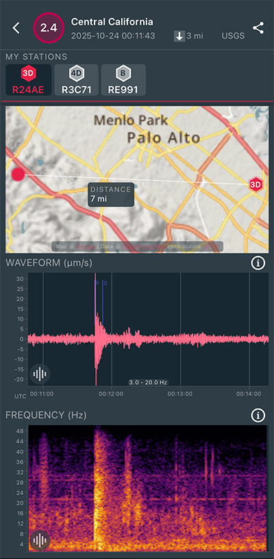
|
North/South Sensor
|
Magnitude 2.6
Depth 3.2 mi
1 mi ESE of Woodside, CA
37.427°N 122.245°W
October 23, 2025 23:45:00 UTC

|
East/West Sensor
|
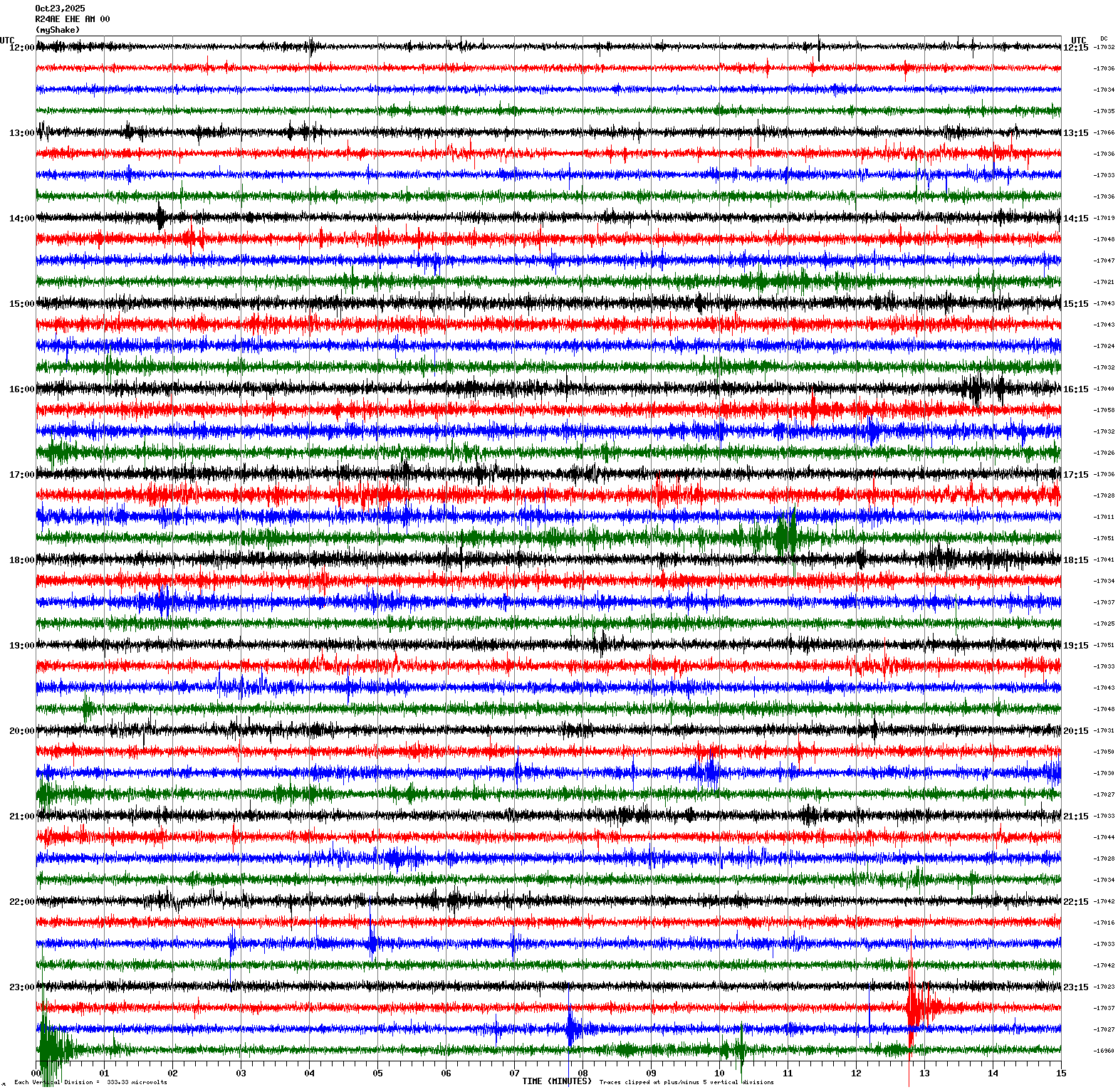
Magnitude 2.2
Depth 2.6 mi
1 mi E of Woodside, CA
37.431°N 122.244°W
October 23, 2025 23:37:42 UTC
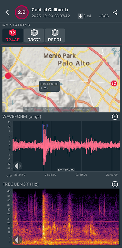
|
East/West Sensor
|
Magnitude 2.5
Depth 2.7 mi
1 mi E of Woodside, CA
37.431°N 122.240°W
October 23, 2025 23:27:41 UTC
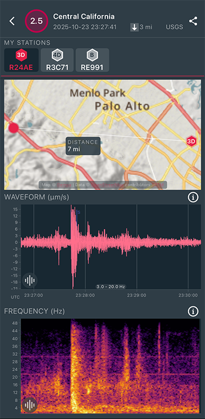
|
East/West Sensor
|
Magnitude 2.3
Depth 4.8 mi
7 mi ESE of Alum Rock, CA
37.344°N 121.704°W
October 18, 2025 09:23:17 UTC
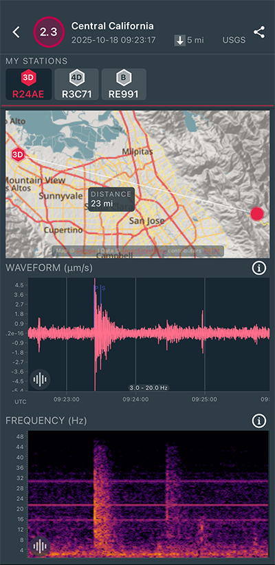
|
North/South Sensor
|
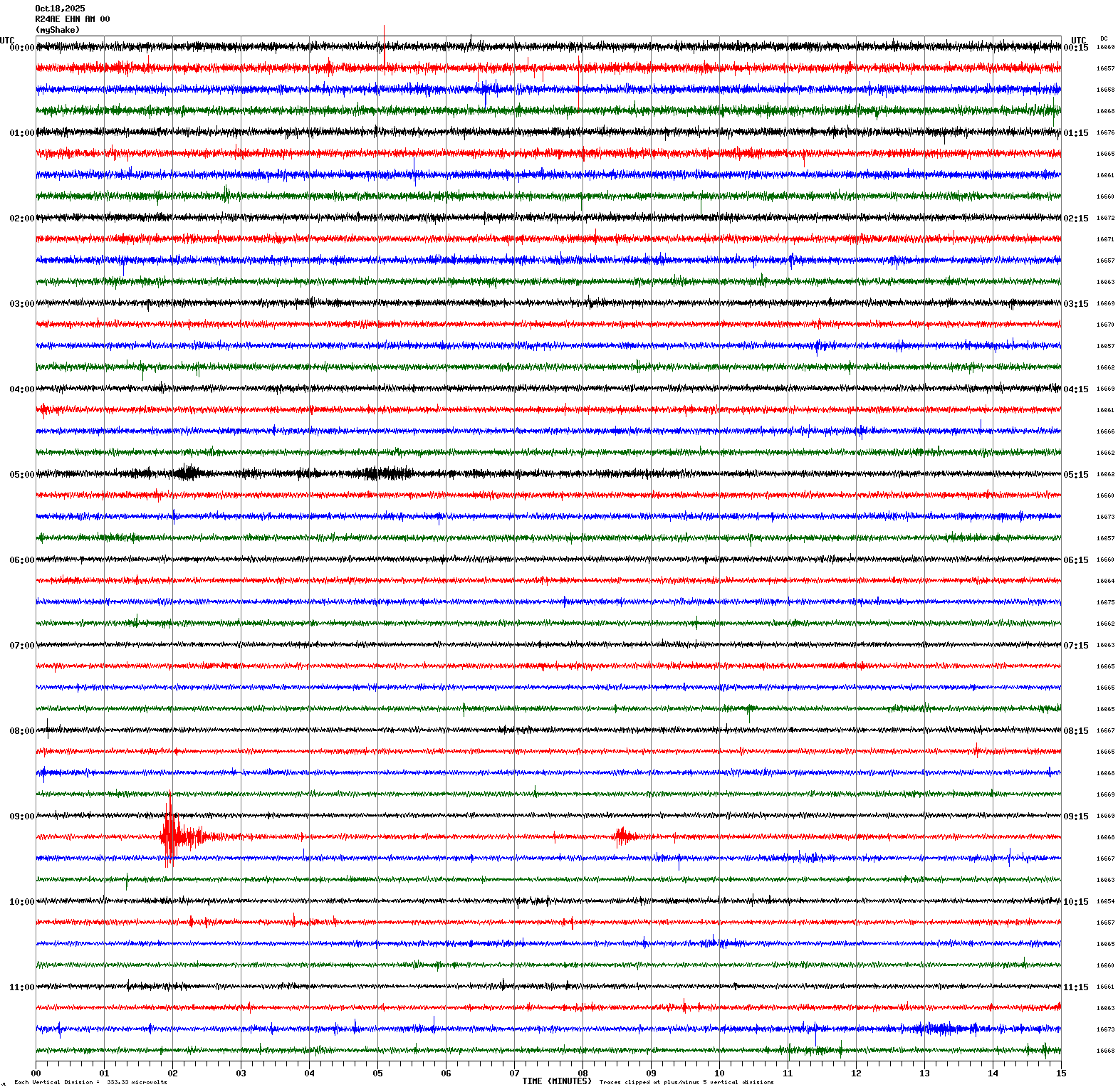
Magnitude 2.8
Depth 4.7 mi
7 mi ESE of Alum Rock, CA
37.346°N 121.708°W
October 18, 2025 09:16:41 UTC
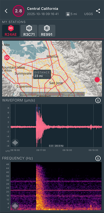
|
North/South Sensor
|
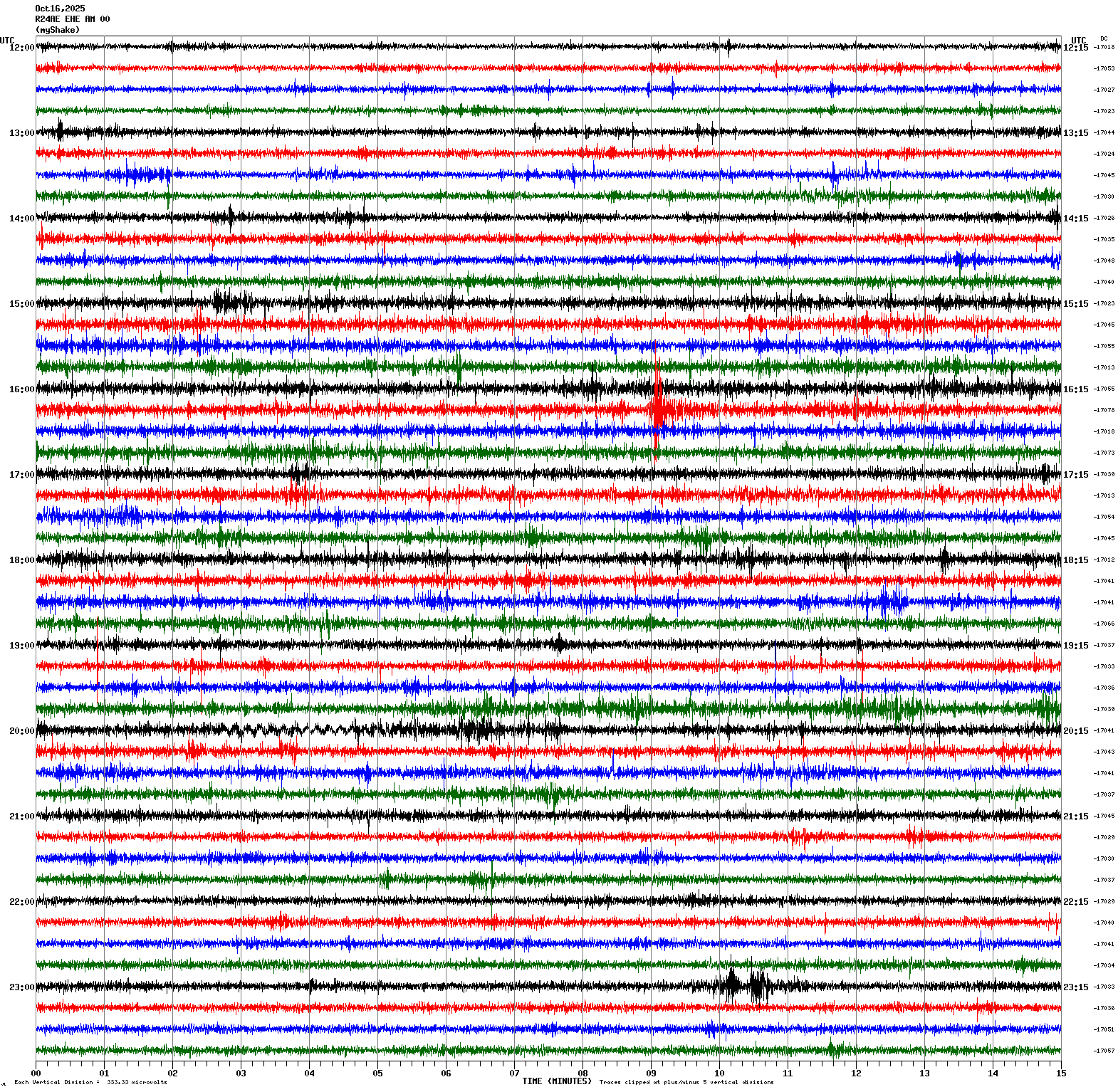
Magnitude 2.3
Depth 5.4 mi
1 mi E of Berkeley, CA
37.872°N 122.255°W
October 16, 2025 16:24:00 UTC
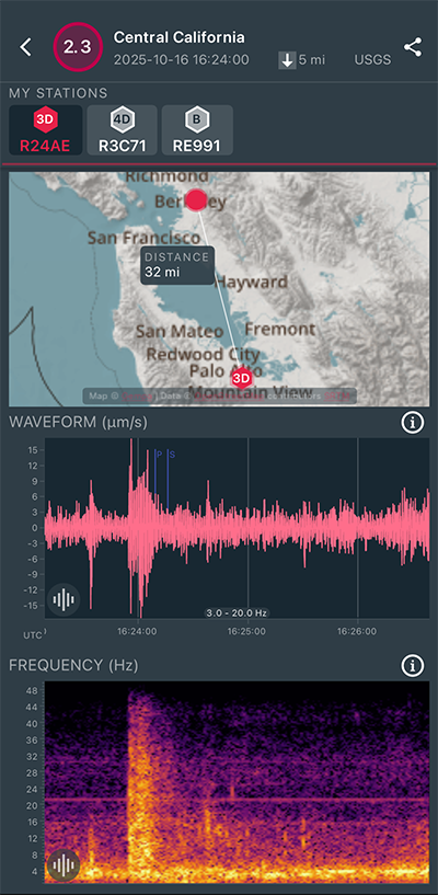
|
East/West Sensor
|
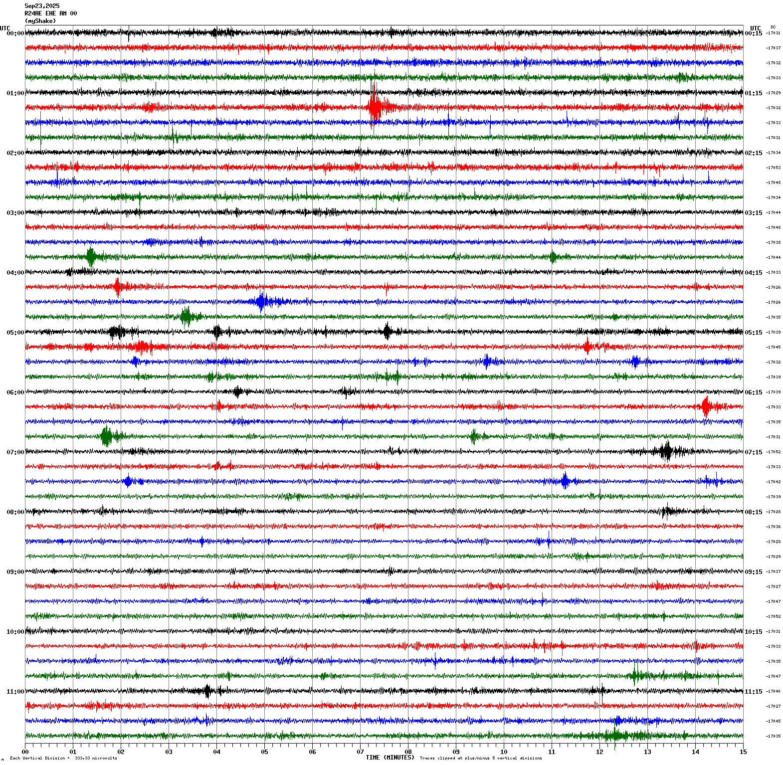
Magnitude 3.0
Depth 4.4 mi
2 mi SE of Berkeley, CA
37.858°N 122.245°W
September 23, 2025 01:21:57 UTC
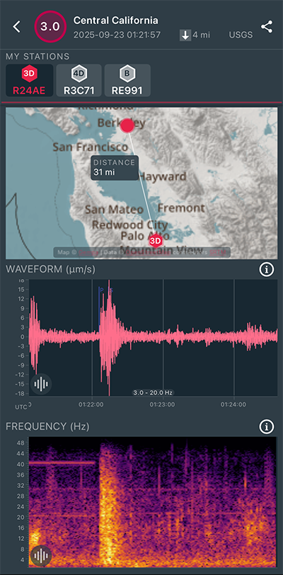
|
East/West Sensor
|
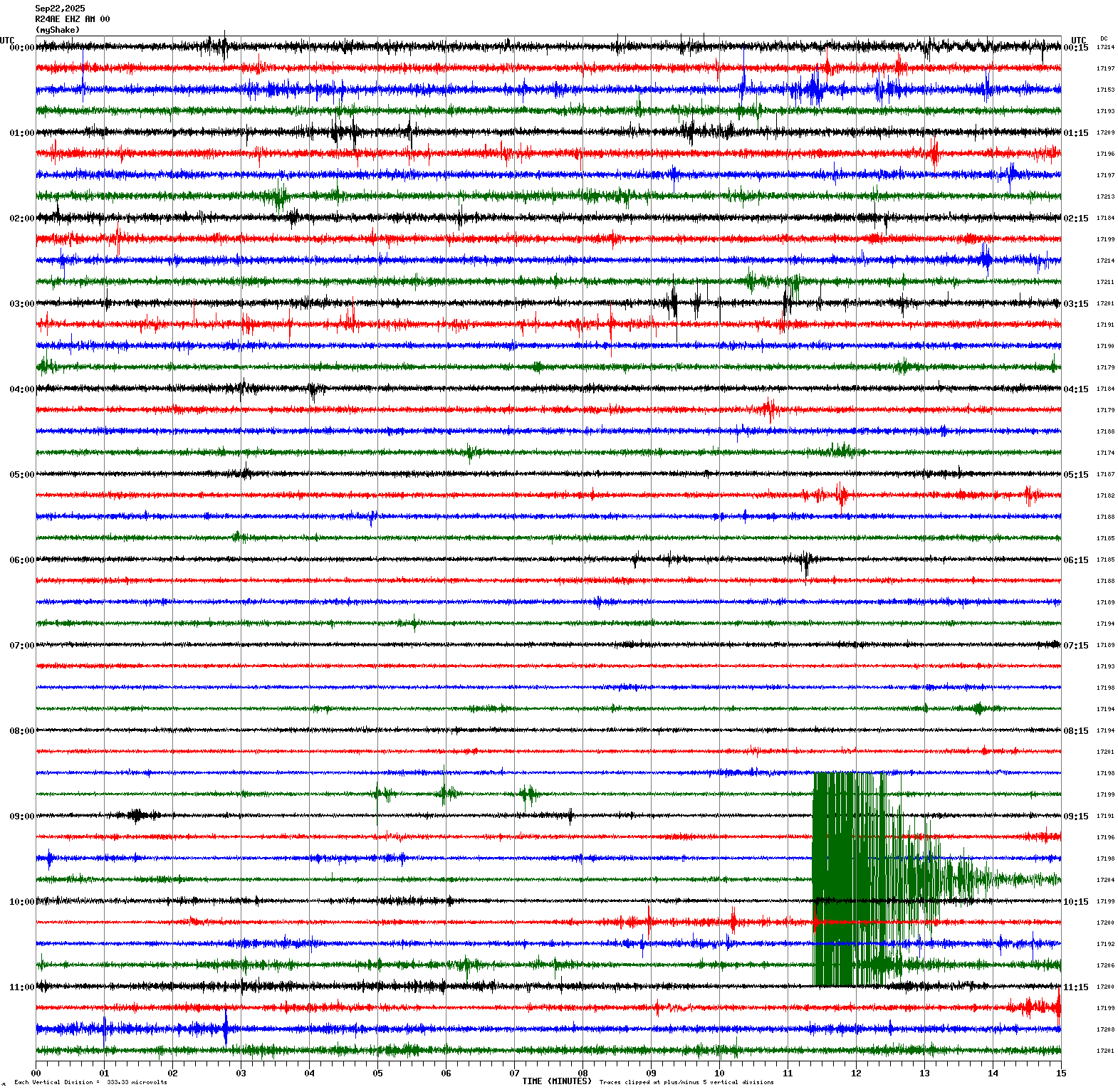
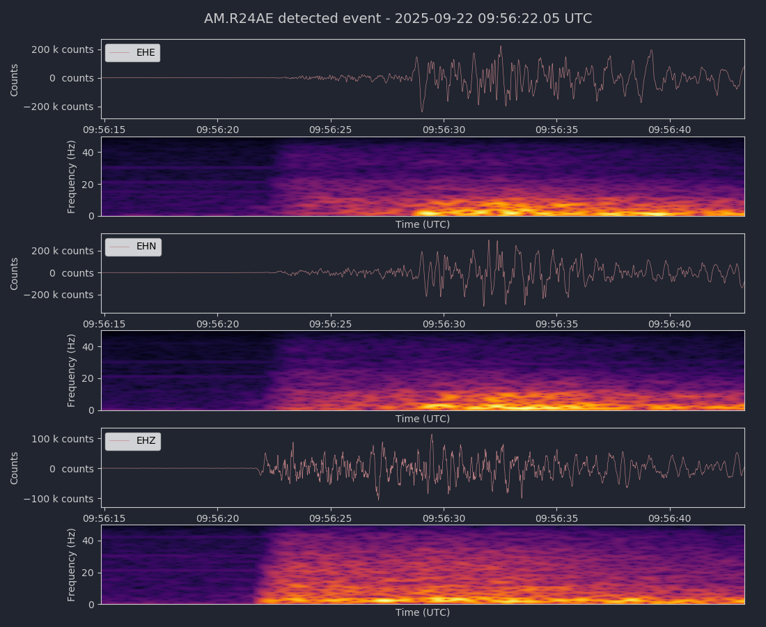
Magnitude 4.3
Depth 4.7 mi
1 mi ESE of Berkeley, CA
37.863°N 122.254°W
September 22, 2025 09:56:12 UTC
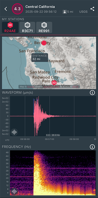
|
Vertical Sensor
|
|
Voltage Counts & Frequency for All Sensors (Magnitude 4.3 Earthquake)
|
Magnitude 3.3
Depth 4.7 mi
5 mi E of Clayton, CA
37.941°N 121.850°W
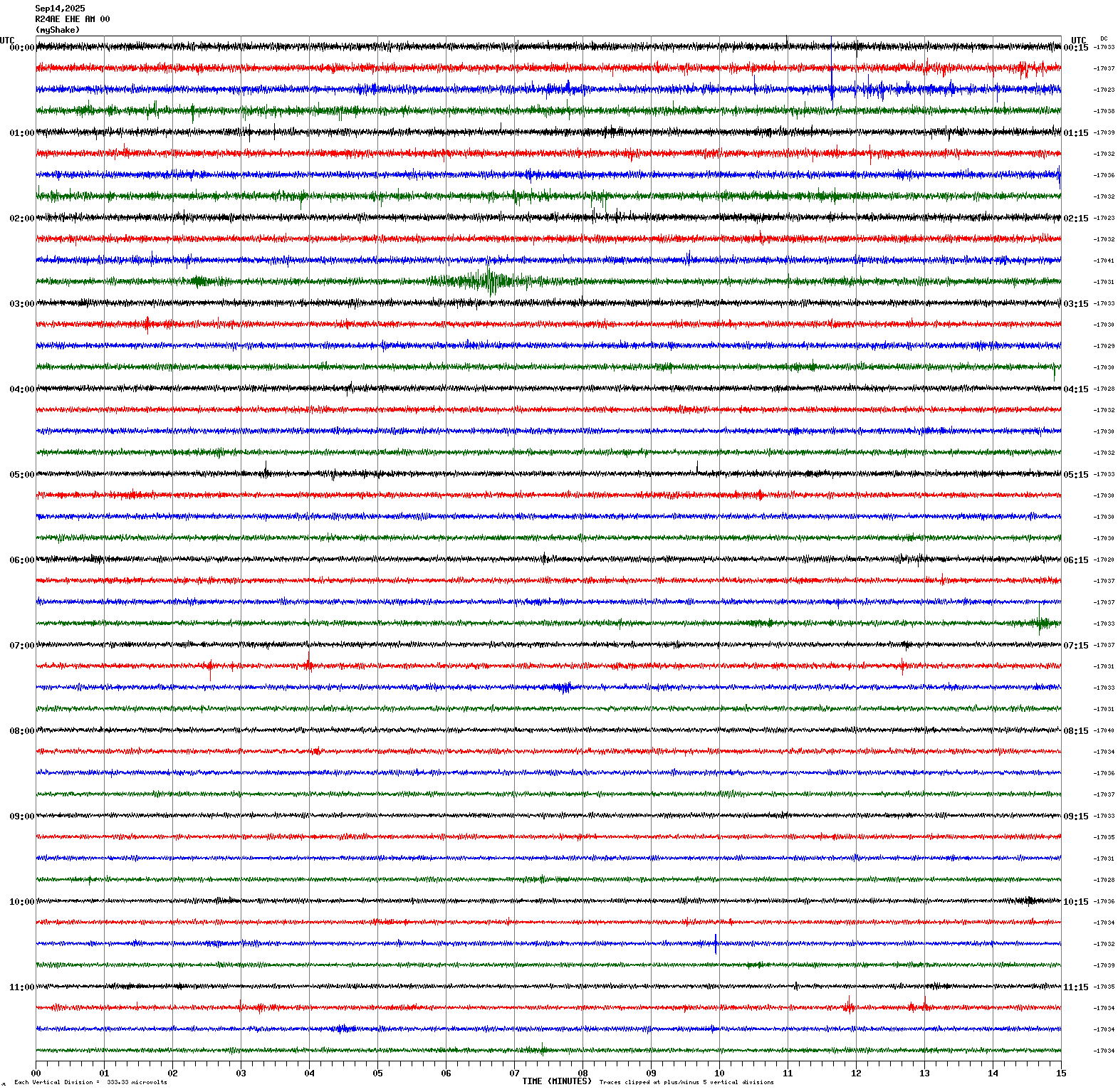
September 15, 2025 23:00:08 UTC
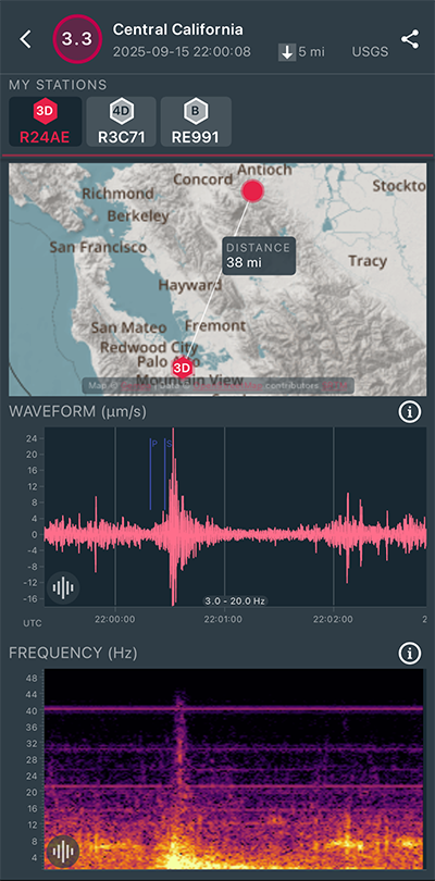
|
East/West Sensor
|
Magnitude 3.5
Depth 4.2 mi
4 mi SW of Atascadero, CA
35.438°N 120.721°W
September 14, 2025 02:50:00 UTC
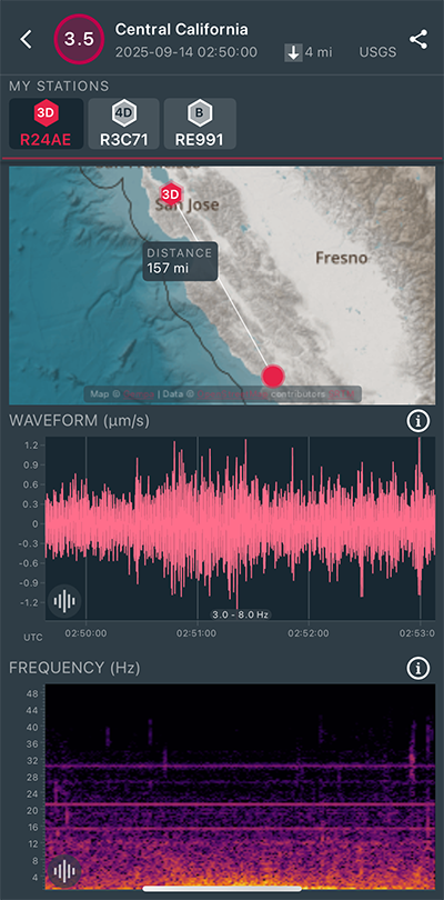
|
East/West Sensor
|
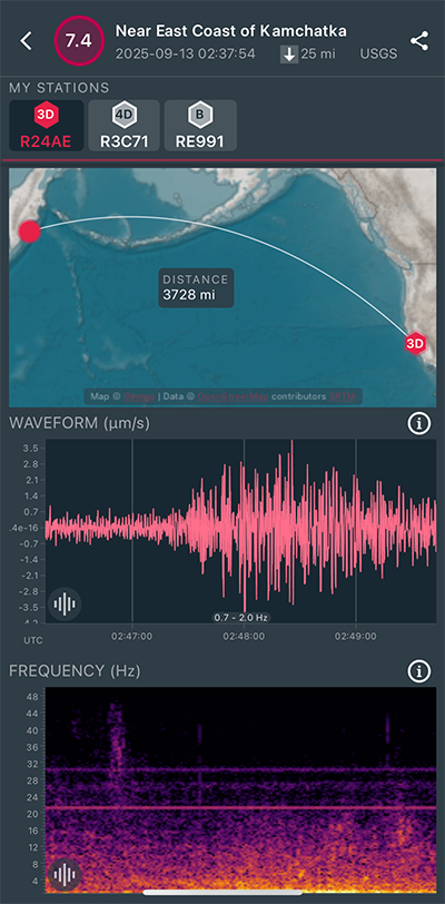
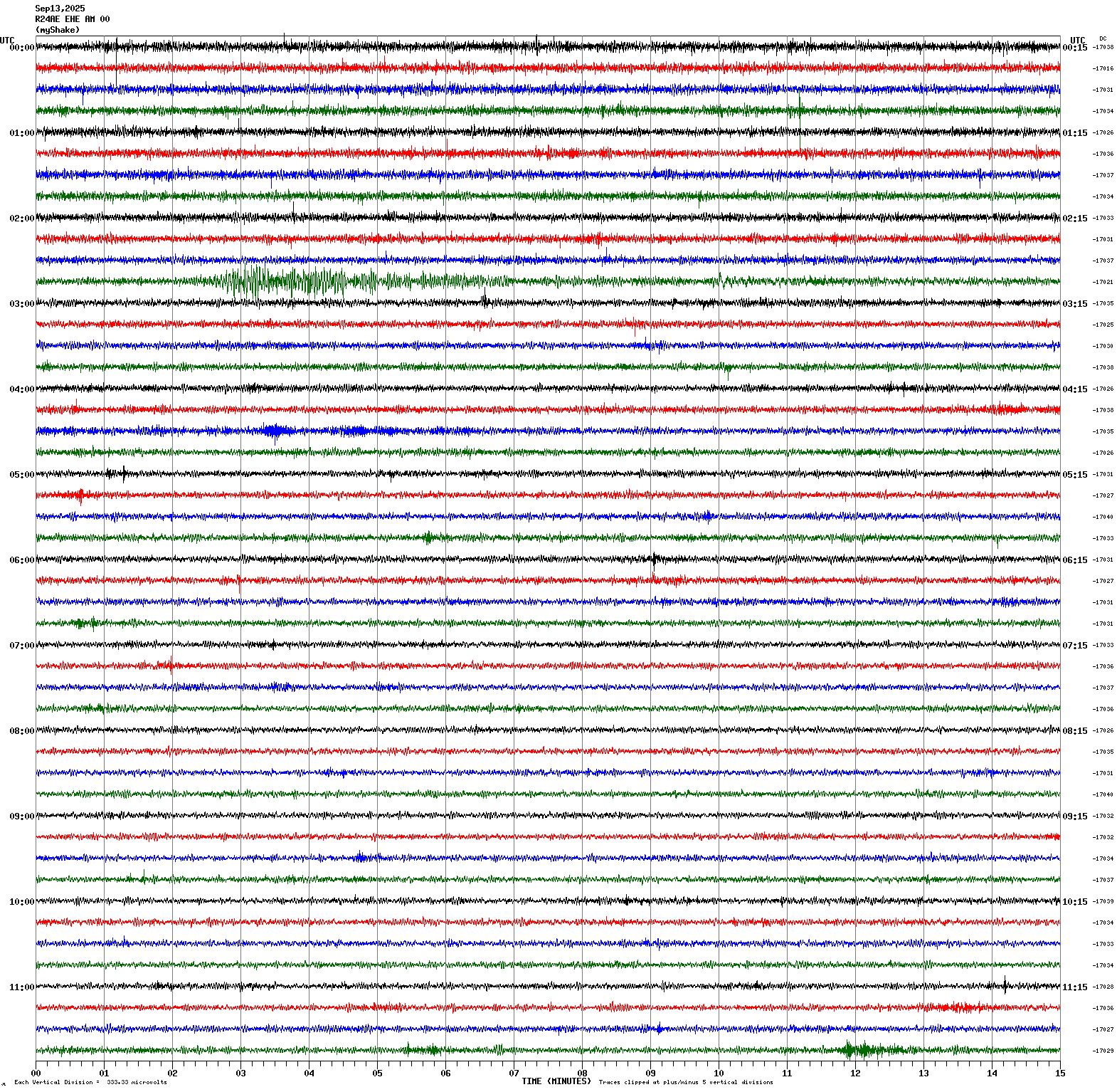
Magnitude 7.4
Depth 24.5 mi
69 mi E of Petropavlovsk-Kamchatsky, Russia
53.104°N 160.294°E
September 13, 2025 02:37:54 UTC
|
East/West Sensor
|
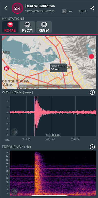
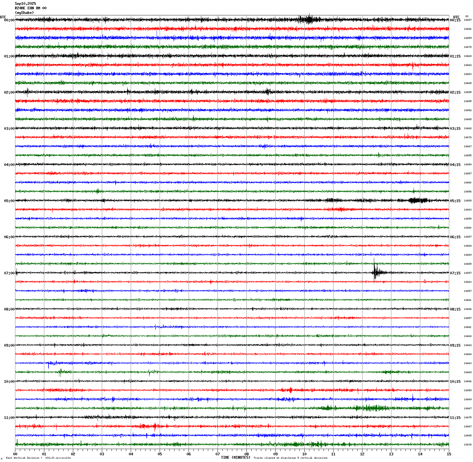
Magnitude 2.4
Depth 3.3 mi
6 mi E of Milpitas, CA
37.457°N 121.812°W
September 10, 2025 07:12:15 UTC
|
North/South Sensor
|
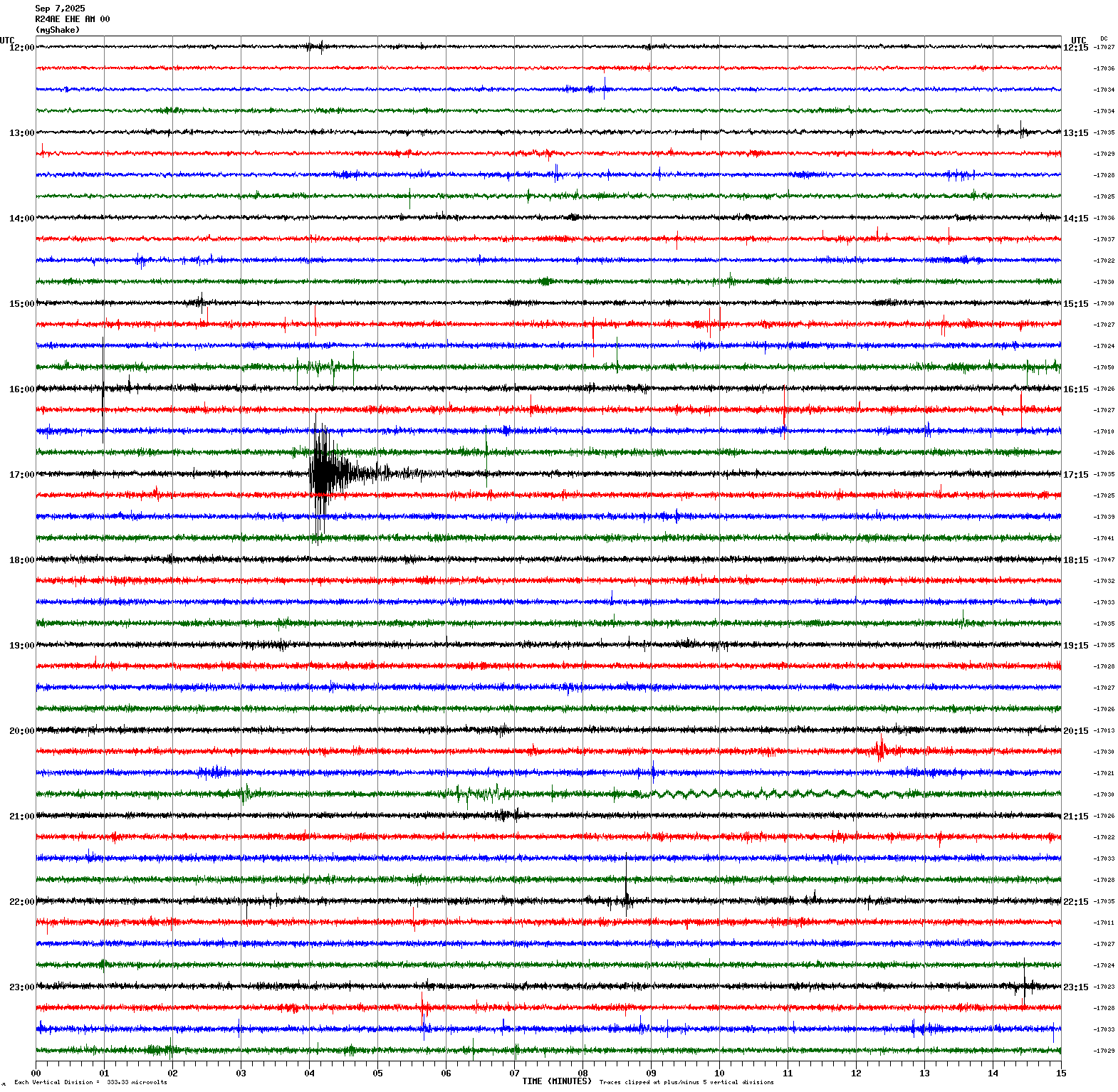
Magnitude 3.1
Depth 7.6 mi
2 mi N of Pleasanton, CA
37.699°N 121.881°W
September 7, 2025 17:03:51 UTC
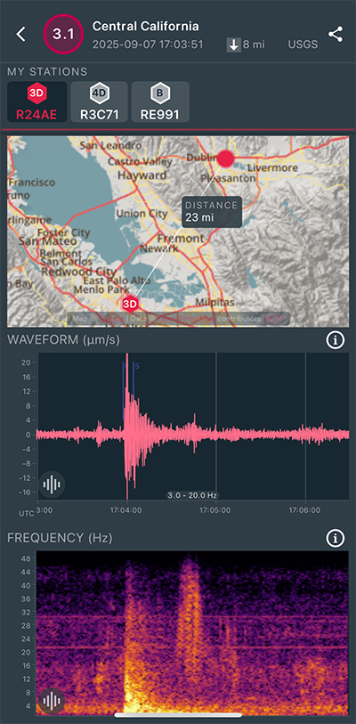
|
East/West Sensor
|
Magnitude 3.7
Depth 6.4 mi
7 mi S of Tres Pinos, CA
36.690°N 121.331°W
September 1, 2025 20:26:38 UTC
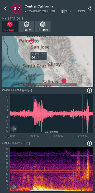
|
East/West Sensor
|
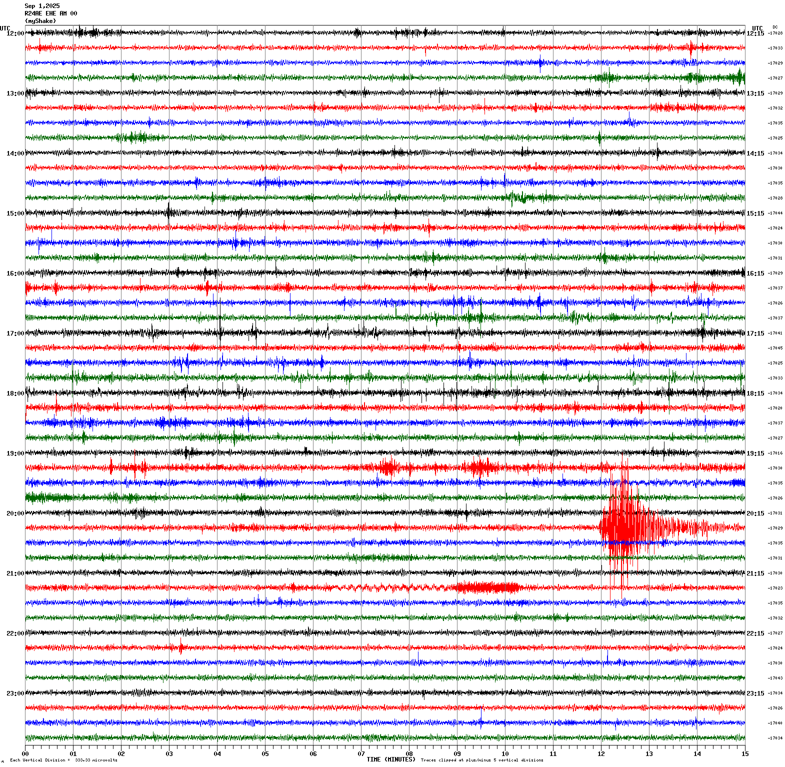
Magnitude 2.6
Depth 6.4 mi
2 mi ESE of Berkeley, CA
37.865°N 122.244°W
August 31, 2025 12:05:37 UTC
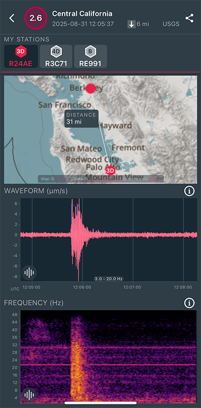
|
East/West Sensor
|
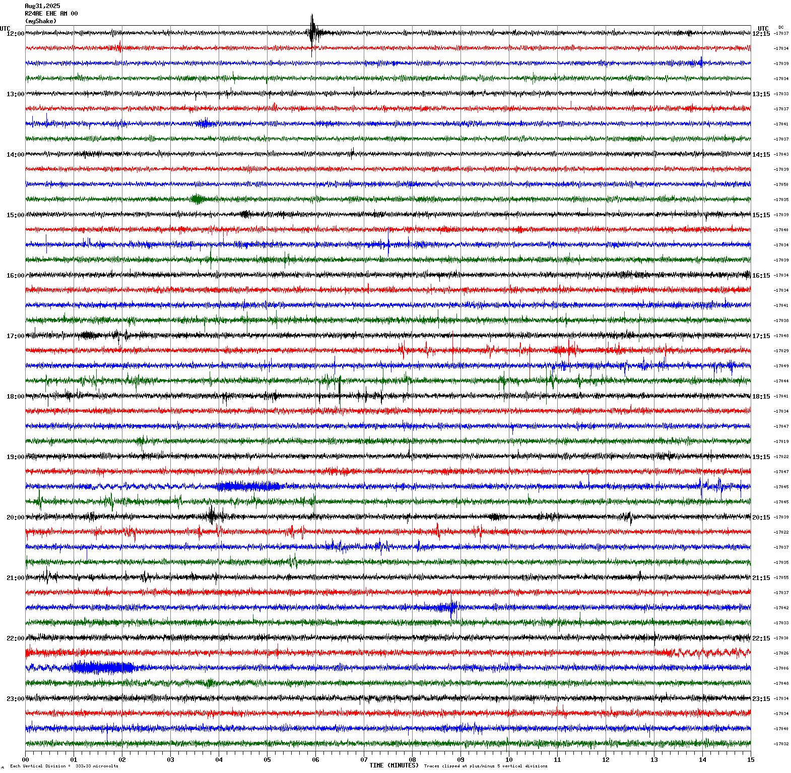
Magnitude 2.5
Depth 3.9 mi
2 mi SW of Loyola, CA
37.324°N 122.128°W
August 25, 2025 00:21:55 UTC
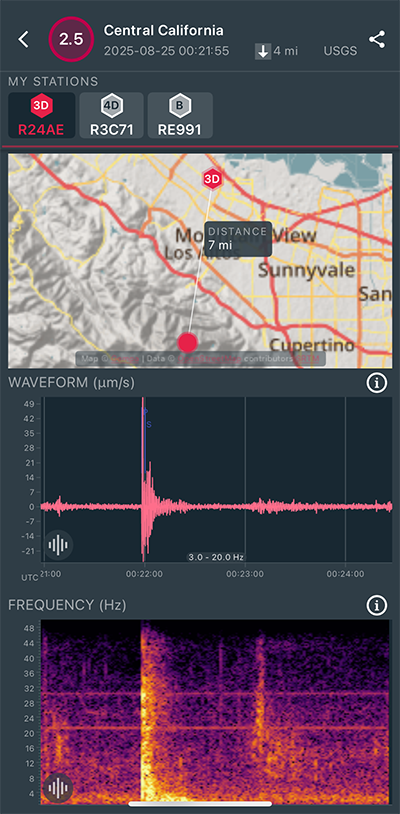
|
East/West Sensor
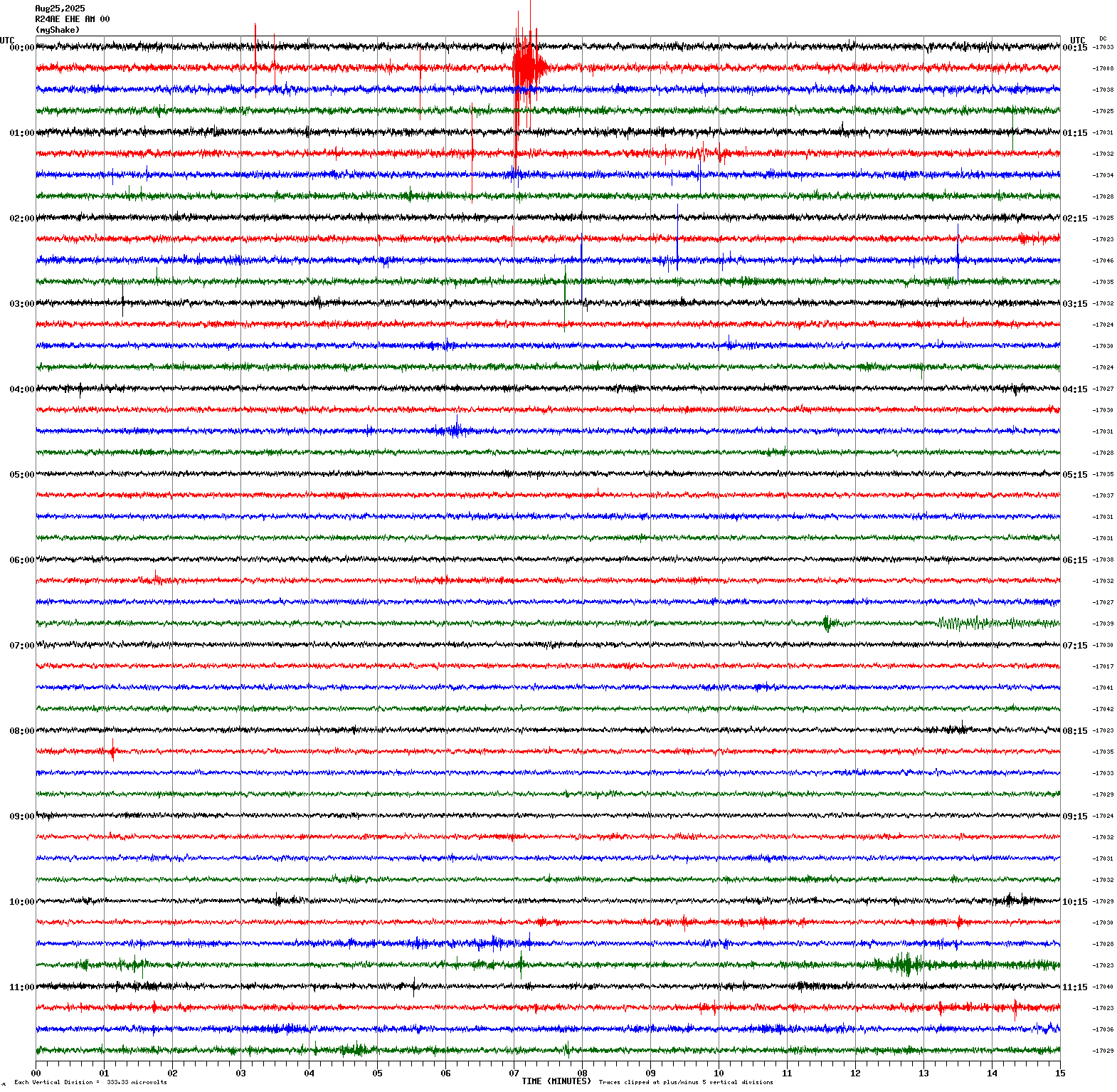
|
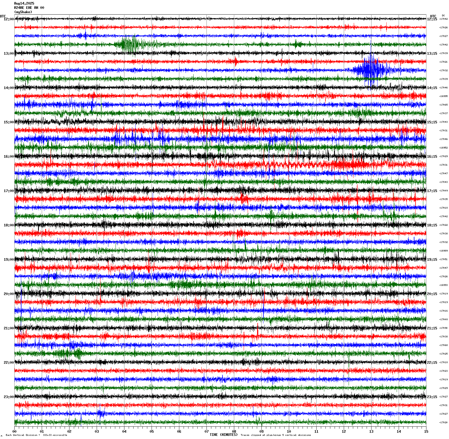
Magnitude 3.6
Depth 5.6 mi
14 mi NNW of San Simeon, CA
35.816°N 121.320°W
August 14, 2025 13:41:47 UTC
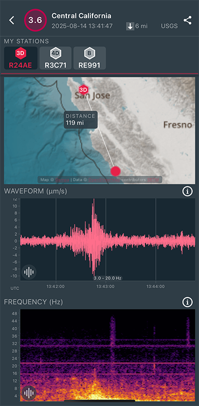
|
East/West Sensor
|
Magnitude 6.8
Depth 27.8 mi
73 mi E of Severo-Kuril’sk, Russia
50.580°N 157.799°E
August 3, 2025 05:37:55 UTC
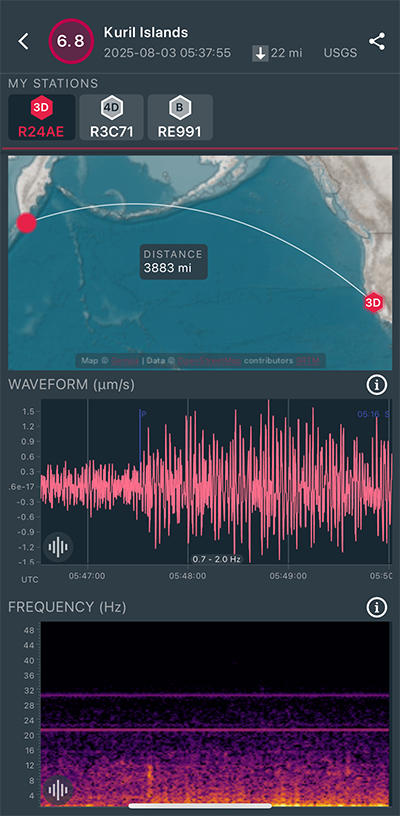
|
East/West Sensor
|
Magnitude 3.1
Depth 8.6 mi
19 mi SW of Portola Valley, CA
37.176°N 122.475°W
July 31, 2025 04:28:00 UTC
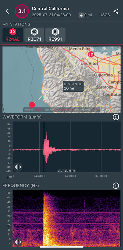
|
East/West Sensor
|
Magnitude 8.7
Depth 11.3 mi
78 mi ESE of Petropavlovsk-Kamchatsky, Russia
52.510°N 160.261°E
July 29, 2025 23:24:50 UTC
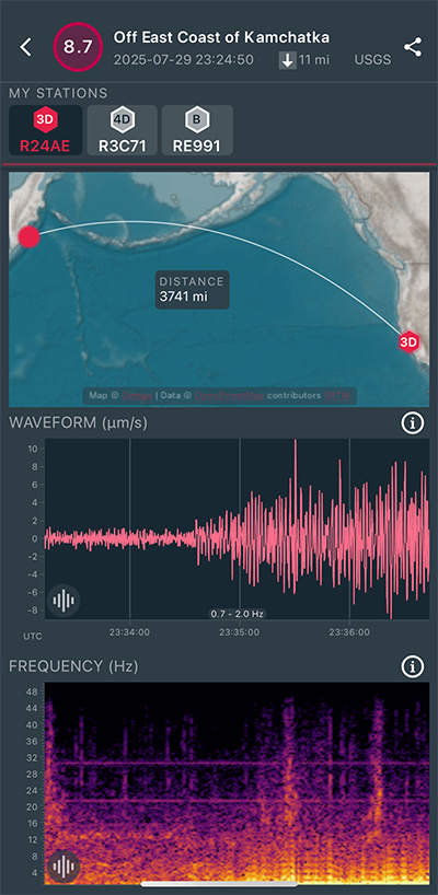
|
East/West Sensor
|
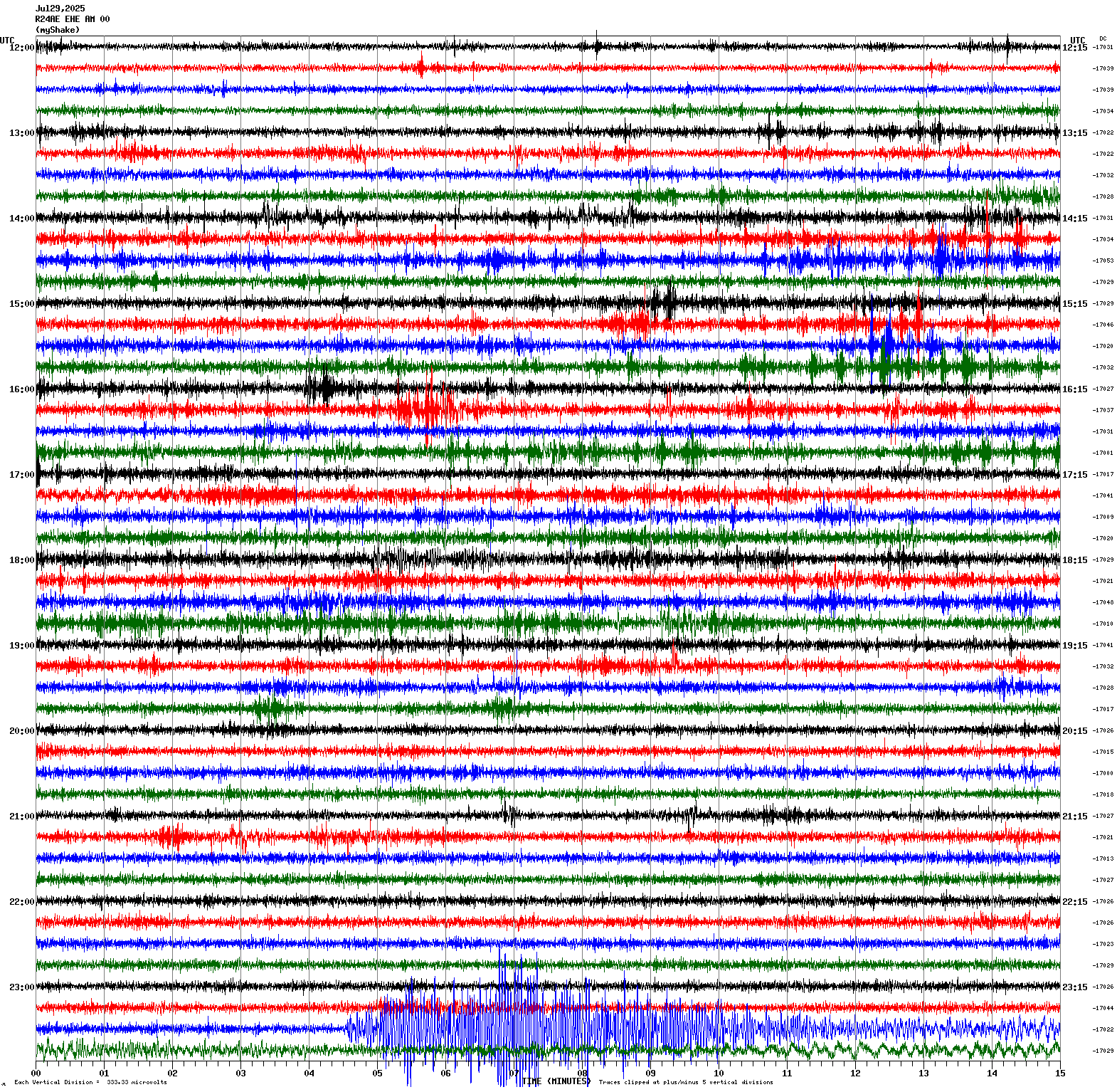
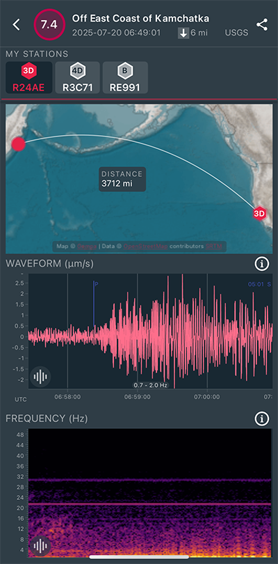
Magnitude 7.4
Depth 6.2 mi
2025 Eastern Kamchatka, Russia Earthquake
52.909°N 160.787°E
July 20, 2025 06:49:01 UTC
|
North/South Sensor
|
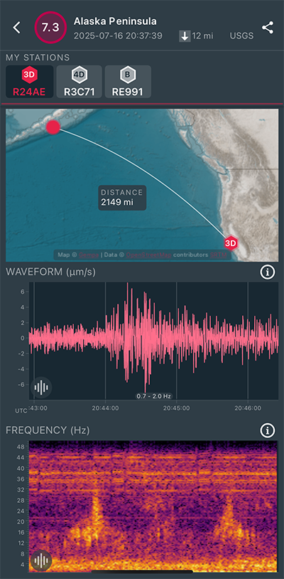
Magnitude 7.3
Depth 12.5 mi
54 mi S of Sand Point, Alaska
54.549°N 160.472°W
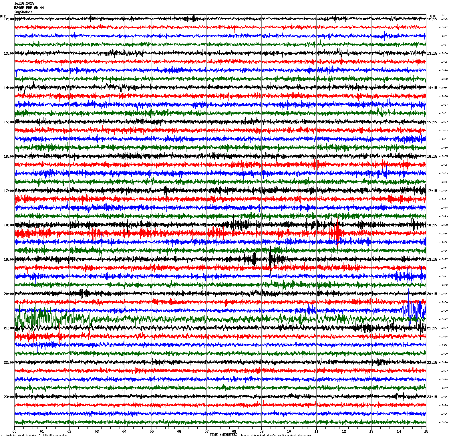
July 16, 2025 20:37:39 UTC
|
East/West Sensor
|
Magnitude 3.5
Depth 6.5 mi
4 mi E of Pinnacles, CA
36.548°N 121.076°W
July 12, 2025 08:31:00 UTC
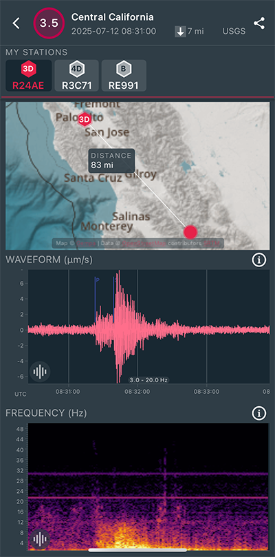
|
North/South Sensor
|
Magnitude 2.6
Depth 3.6 mi
2 mi SW of Loyola, CA
37.325°N 122.133°W
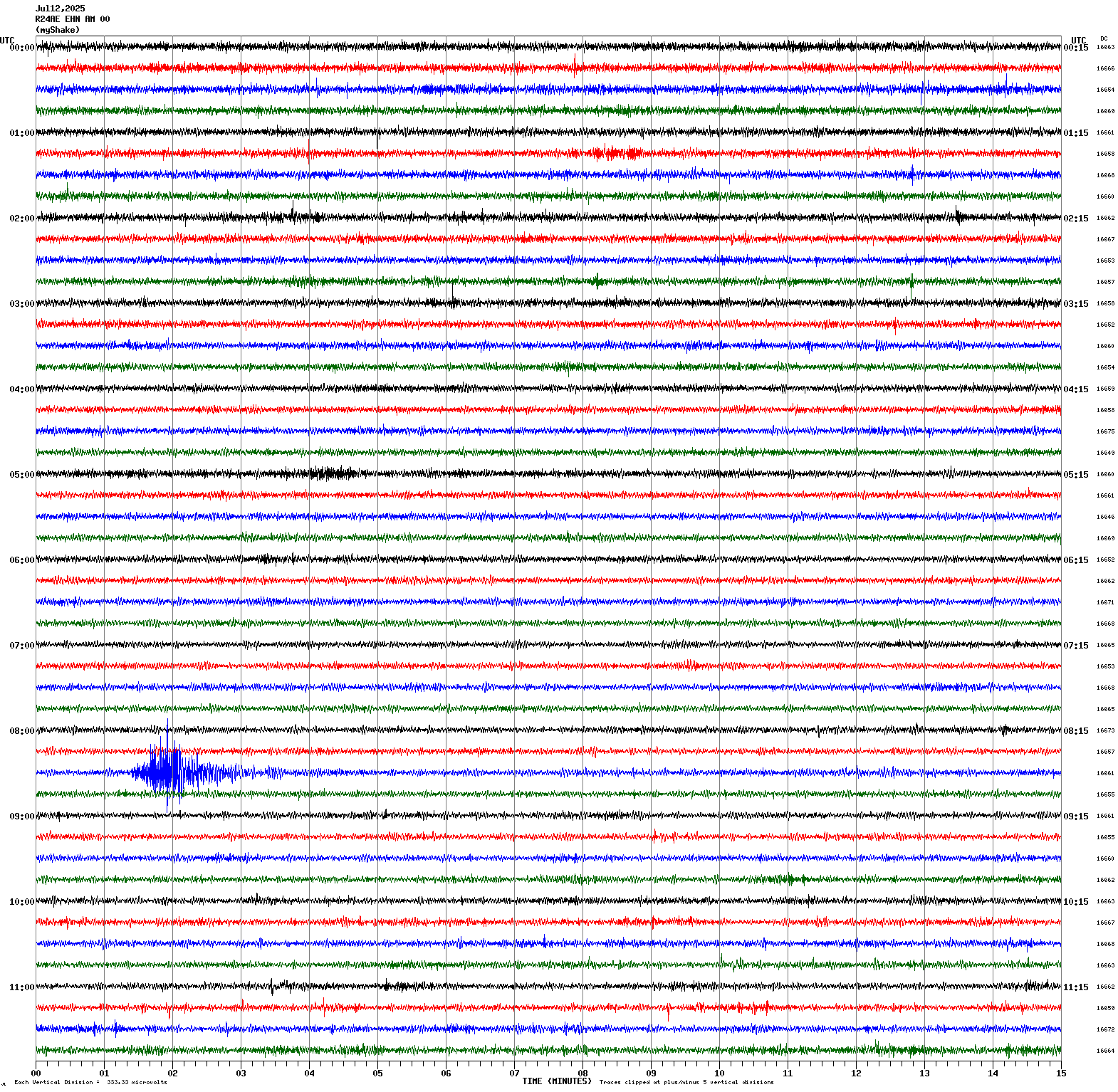
July 8, 2025 22:56:25 UTC
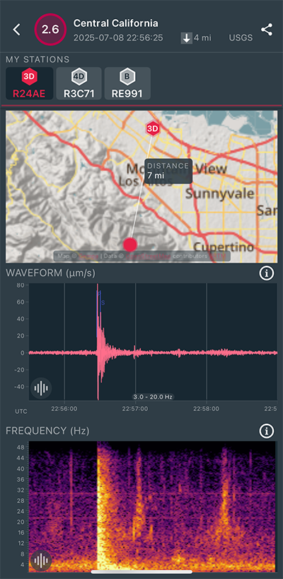
|
North/South Sensor
|
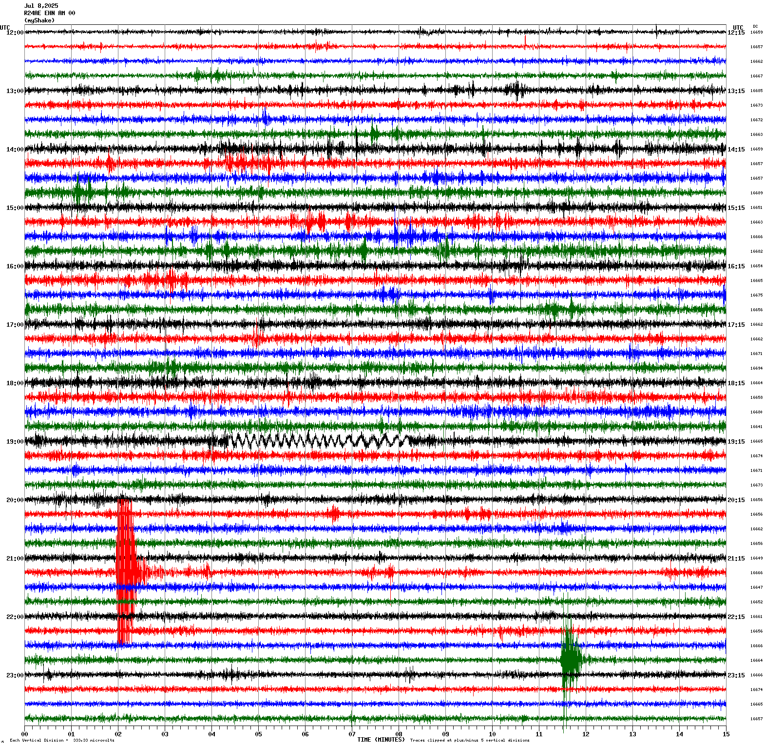
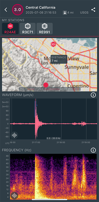
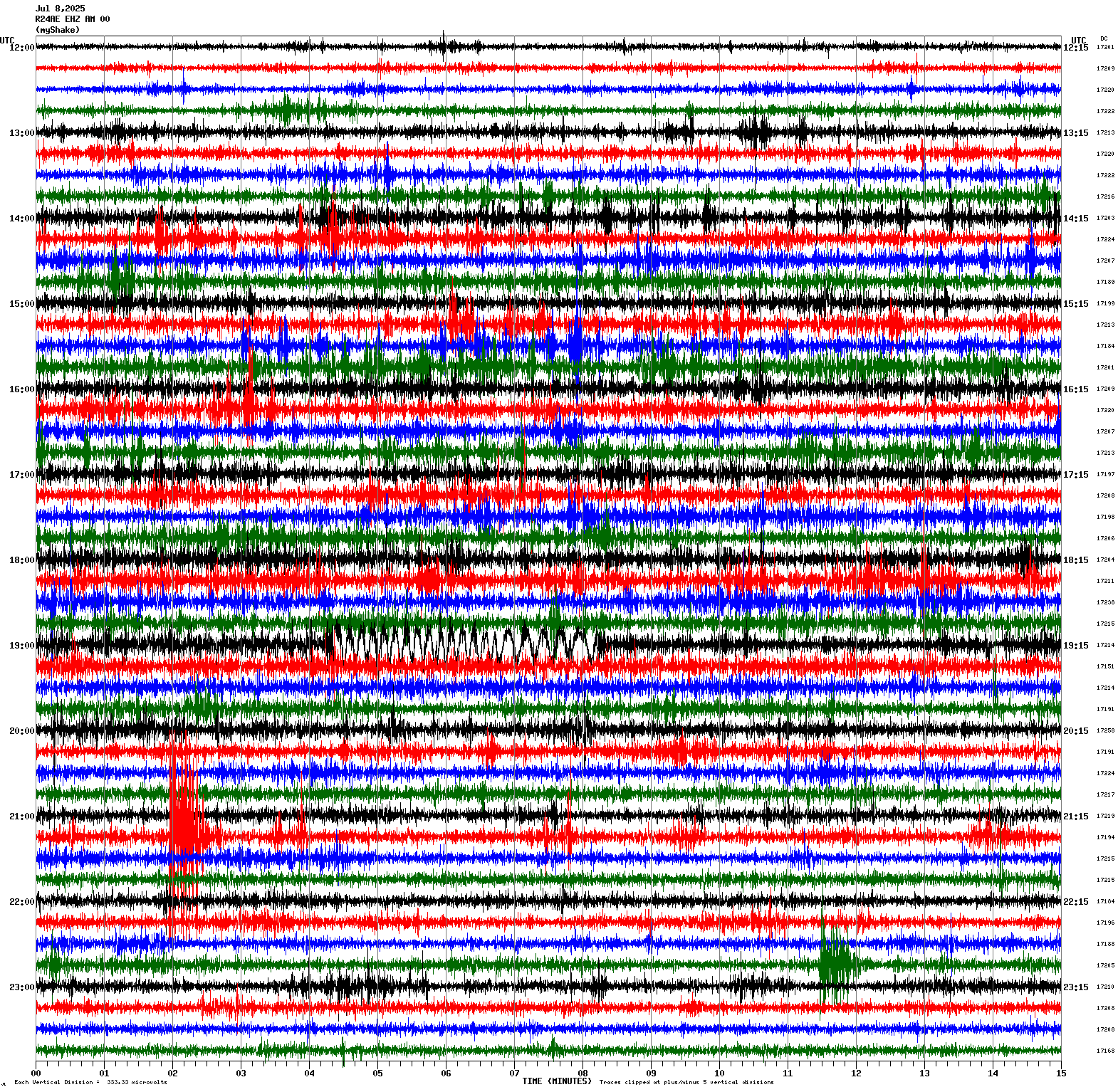
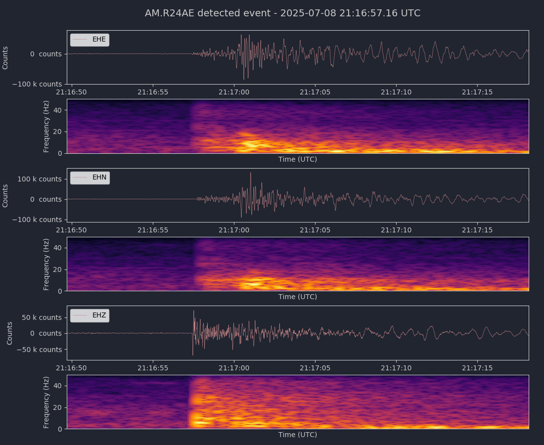
Magnitude 3.0
Depth 3.7 mi
2 mi SW of Loyola, CA
37.325°N 122.131°W
July 8, 2025 21:16:53 UTC
|
Vertical Sensor
|
|
Voltage Counts & Frequency for All Sensors (Magnitude 3.0 Earthquake)
|
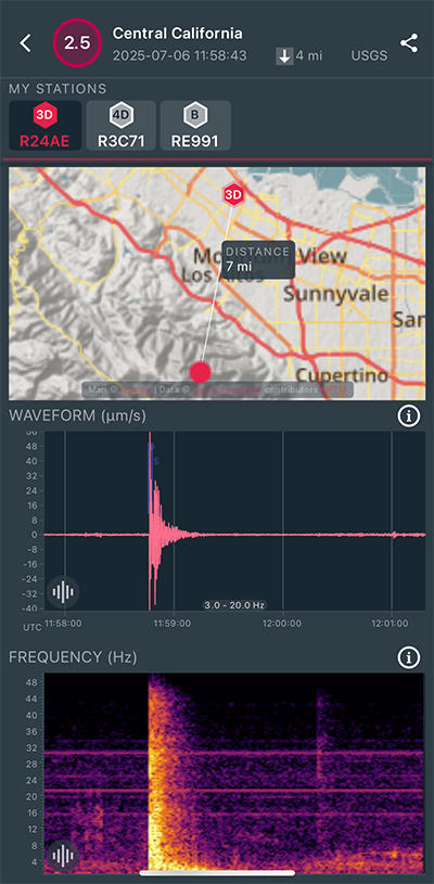
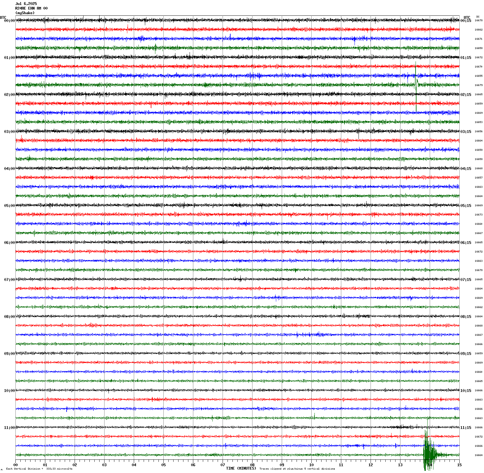
Magnitude 2.5
Depth 3.7 mi
2 mi SW of Loyola, CA
37.324°N 122.132°W
July 6, 2025 11:58:43 UTC
|
North/South Sensor
|
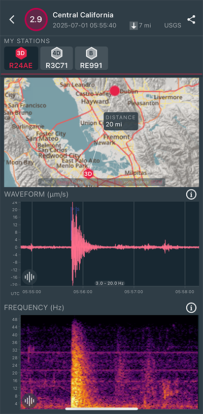
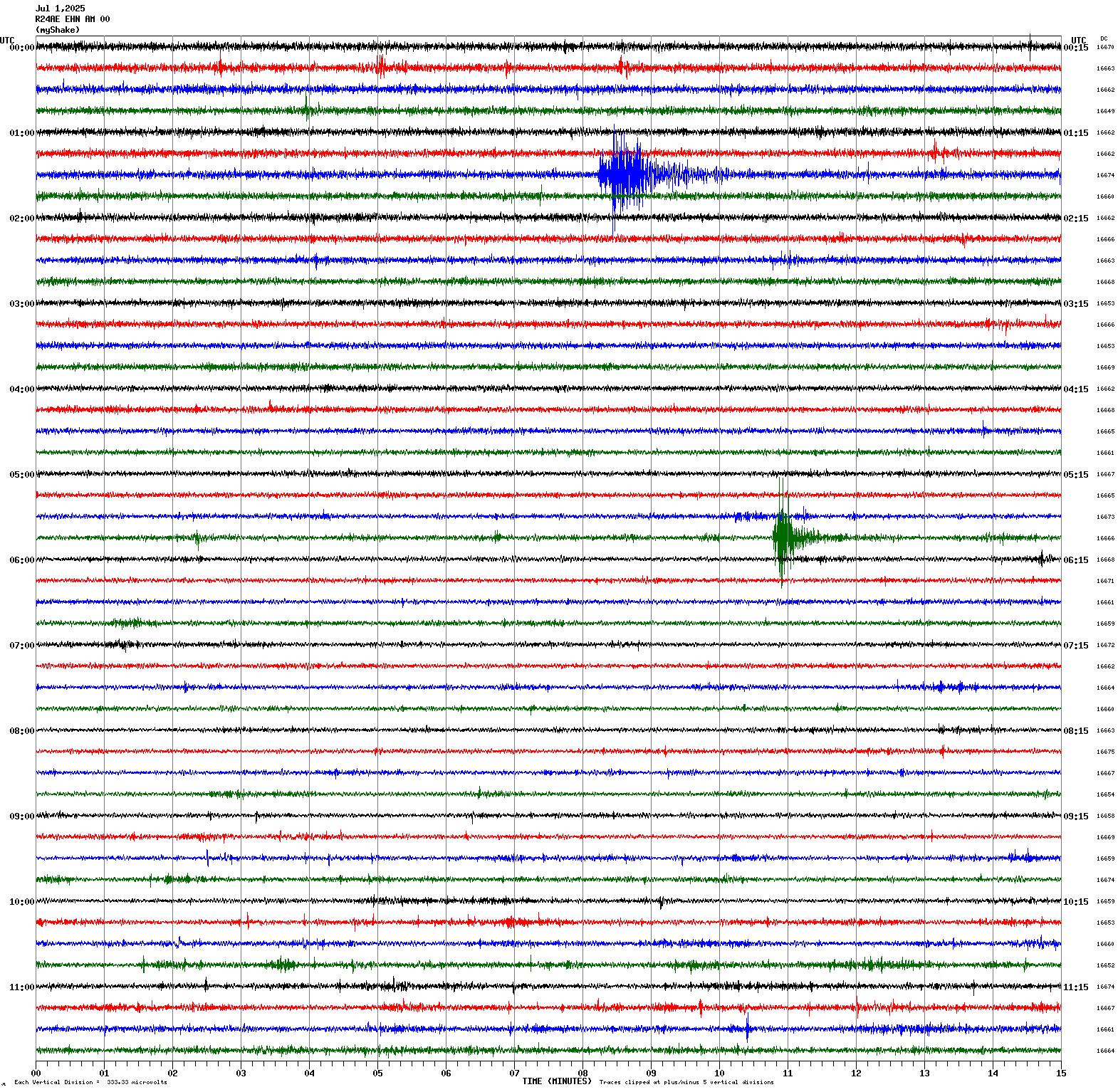
Magnitude 2.9
Depth 6.6 mi
3 mi ENE of Fairview, CA
37.704°N 121.997°W
July 1, 2025 05:55:40 UTC
|
North/South Sensor
|
Magnitude 3.6
Depth 1.4 mi
16 mi W of Los Banos, CA
37.043°N 121.135°W
July 1, 2025 01:37:54 UTC

|
North/South Sensor
|
Magnitude 2.9
Depth 4.8 mi
7 mi WSW of Ridgemark, CA
36.742°N 121.455°W
June 29, 2025 03:22:01 UTC
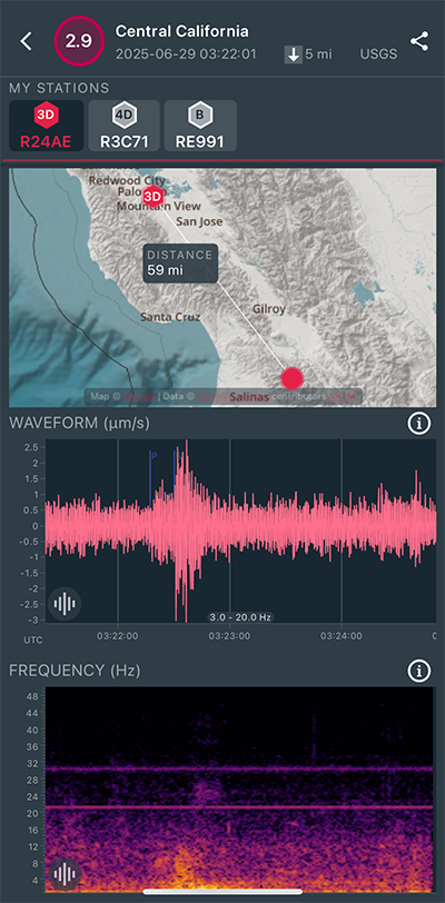
|
North/South Sensor
|
Magnitude 4.6
Depth 7.2 mi
5 mi SSE of Deep Springs, CA
37.316°N 117.921°W
June 29, 2025 02:37:58 UTC
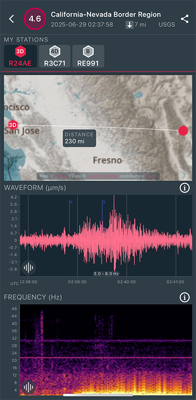
|
North/South Sensor
|
Magnitude 3.1
Depth 3.8 mi
2 mi WSW of San Juan Bautista, CA
36.827°N 121.569°W
June 29, 2025 02:34:27 UTC
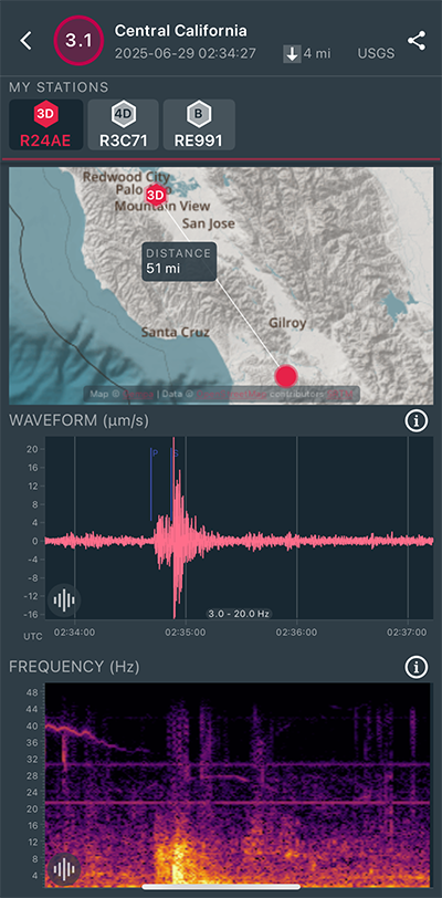
|
North/South Sensor
|
Magnitude 2.8
Depth 2.6 mi
4 mi ESE of Clayton, CA
37.935°N 121.855°W
June 15, 2025 07:42:55 UTC
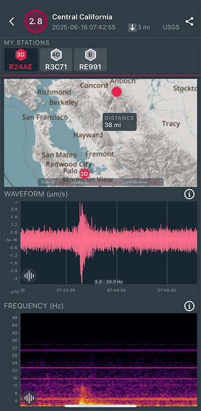
|
East/West Sensor
|
Magnitude 3.3
Depth 6.0 mi
1 mi NW of Pinole, CA
38.011°N 122.314°W
June 9, 2025 04:30:11 UTC
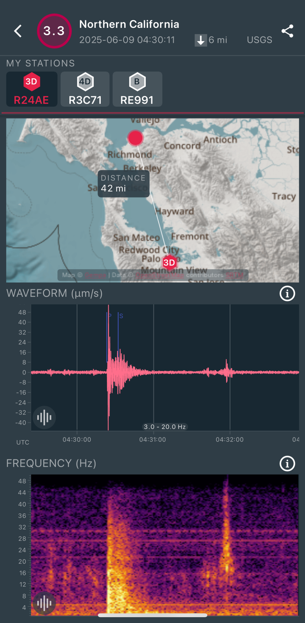
|
North/South Sensor
|
Magnitude 6.3
Depth 5.6 mi
10 mi NNE of Paratebueno, Colombia
4.512°N 73.155°W
June 8, 2025 13:08:05 UTC
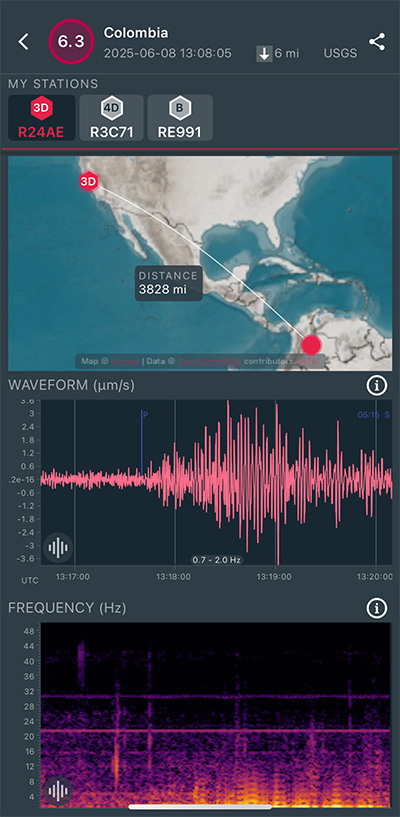
|
North/South Sensor
|
Magnitude 3.1
Depth 9.2 mi
1 mi SW of Concord, CA
37.949°N 122.031°W
May 30, 2025 19:11:42 UTC
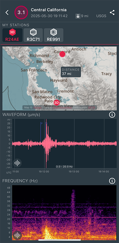
|
East/West Sensor
|
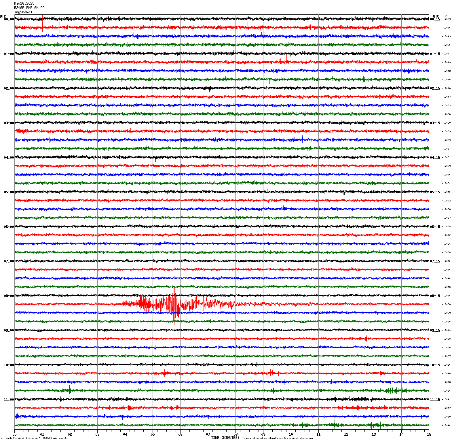
Magnitude 4.6
Depth 1.8 mi
19 mi W of Petrolia, CA
40.266°N 124.637°W
May 26, 2025 08:17:57 UTC
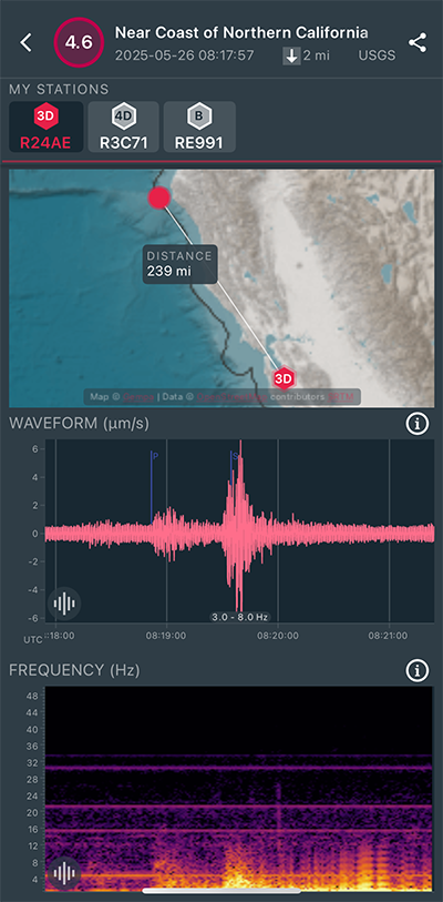
|
East/West Sensor
|
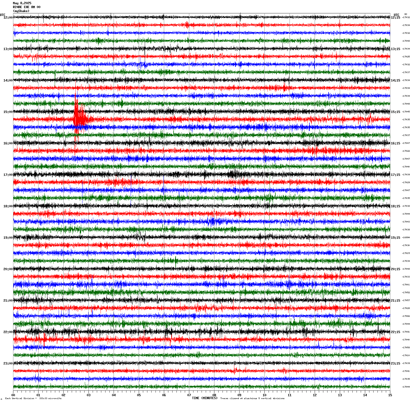
Magnitude 2.9
Depth 6.1 mi
1 mi E of Union City, CA
37.597°N 122.003°W
May 8, 2025 15:17:18 UTC
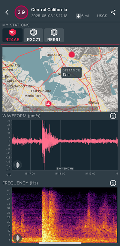
|
East/West Sensor
|
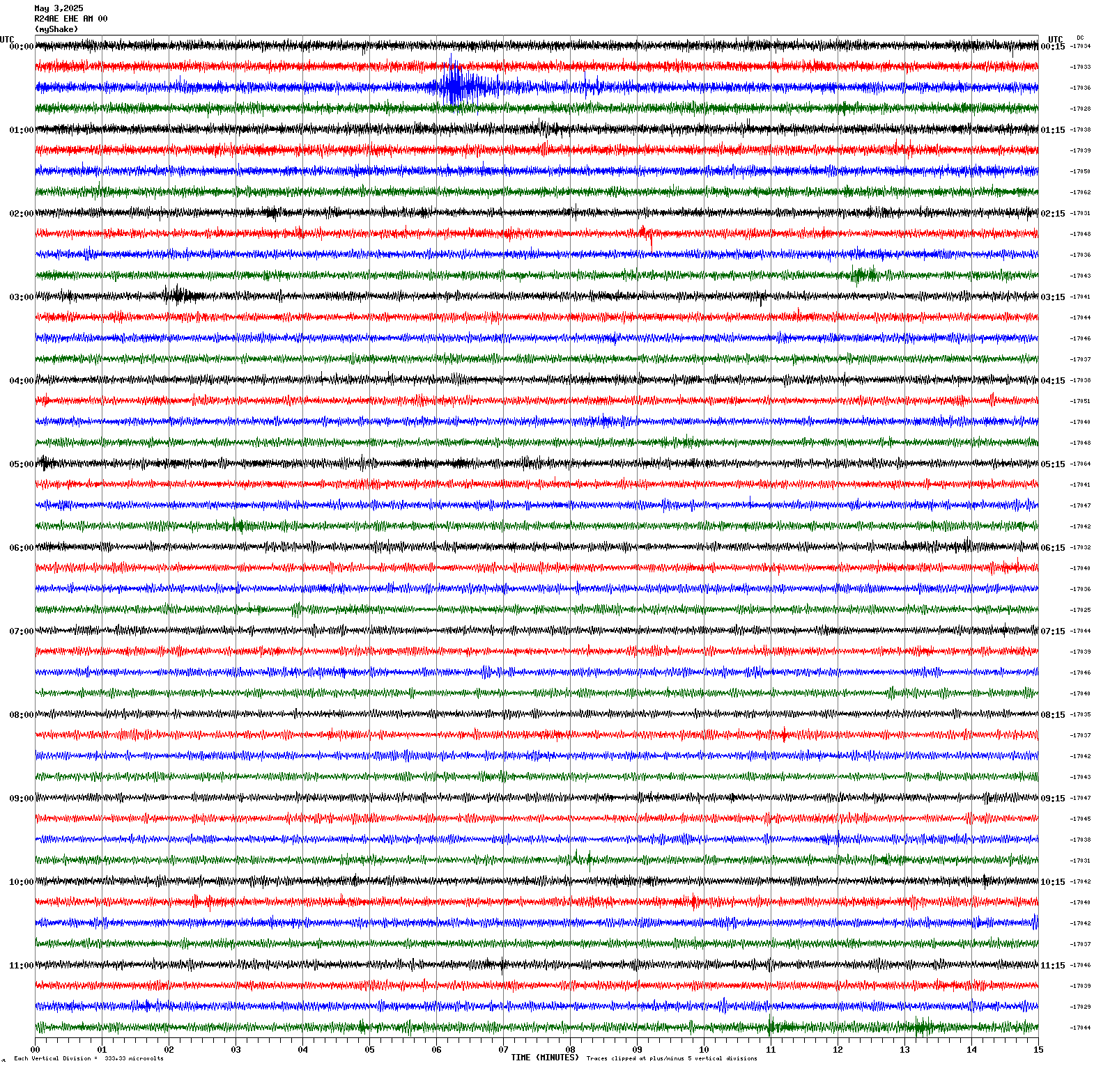
Magnitude 3.7
Depth 1.4 mi
1 mi N of The Geysers, CA
38.790°N 122.759°W
May 3, 2025 00:35:18 UTC
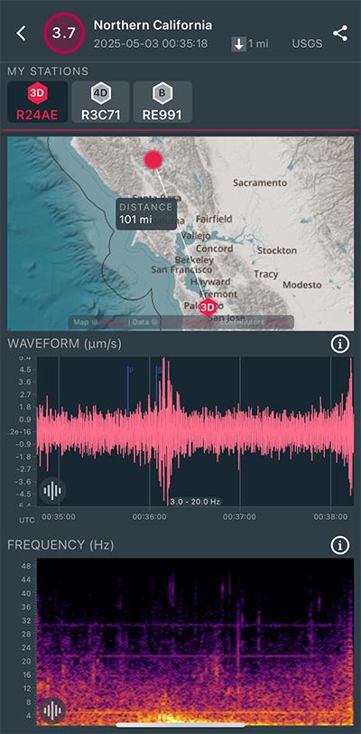
|
East/West Sensor
|
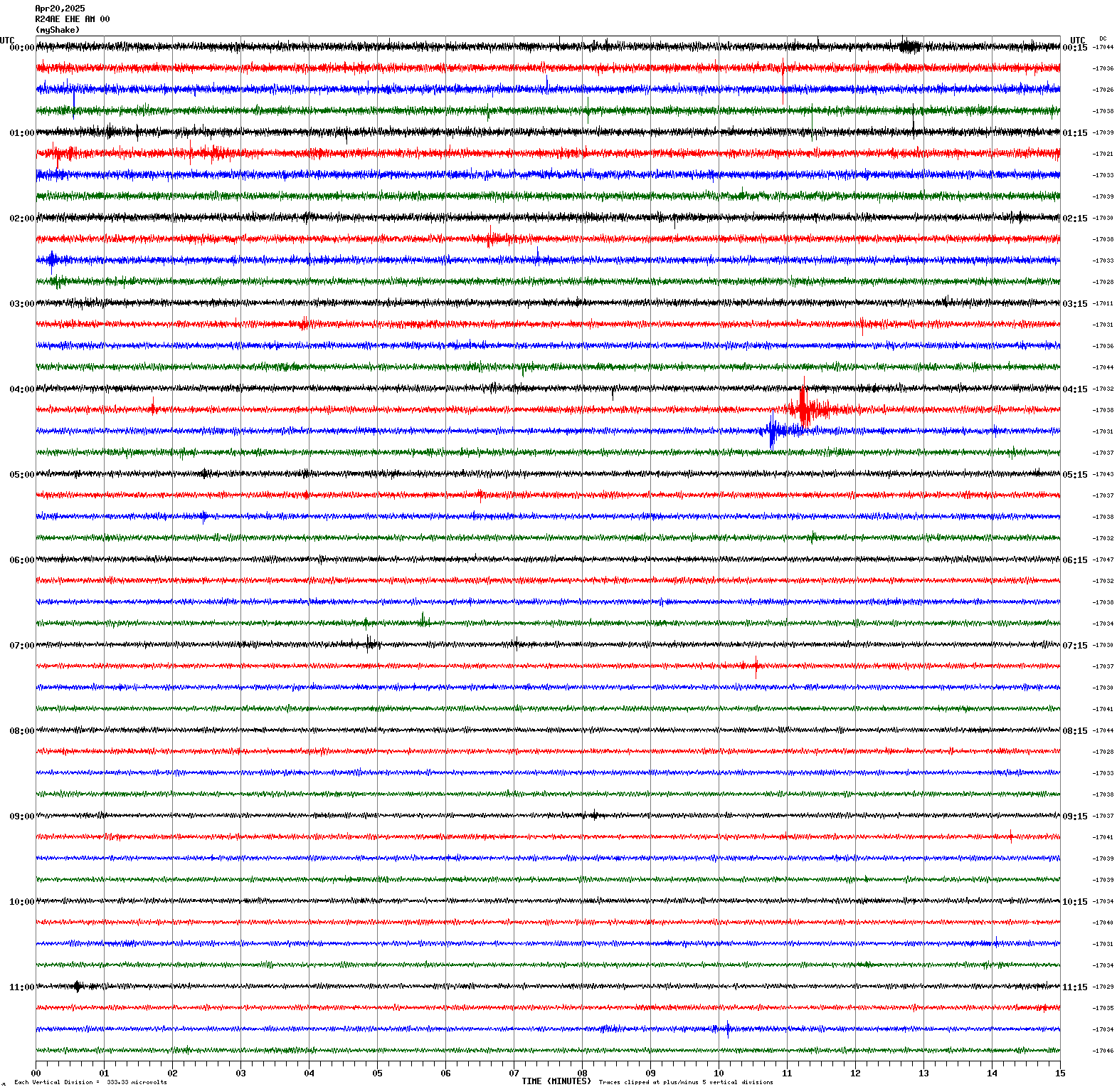
Magnitude 2.8
Depth 3.7 mi
2 mi WSW of San Juan Bautista, CA
36.824°N 121.565°W
April 20, 2025 04:40:18 UTC
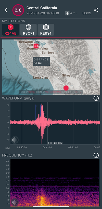
|
East/West Sensor
|
Magnitude 3.0
Depth 3.7 mi
2 mi WSW of San Juan Bautista, CA
36.826°N 121.569°W
April 20, 2025 04:25:45 UTC
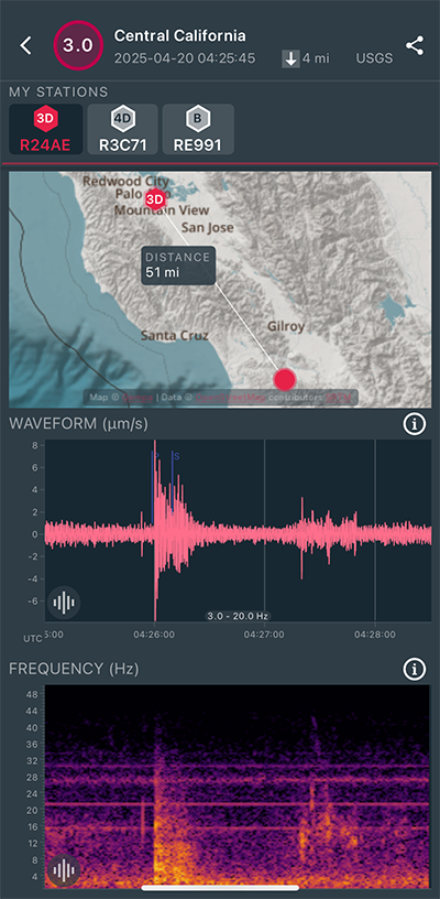
|
East/West Sensor
|
Magnitude 3.9
Depth 1.5 mi
6 mi NW of The Geysers, CA
38.821°N 122.841°W
April 4, 2025 06:31:48 UTC
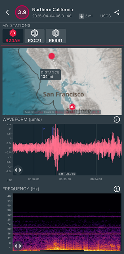
|
East/West Sensor
|
Magnitude 3.1
Depth 2.4 mi
2 mi S of Ridgemark, CA
36.788°N 121.359°W
April 4, 2025 04:23:42 UTC
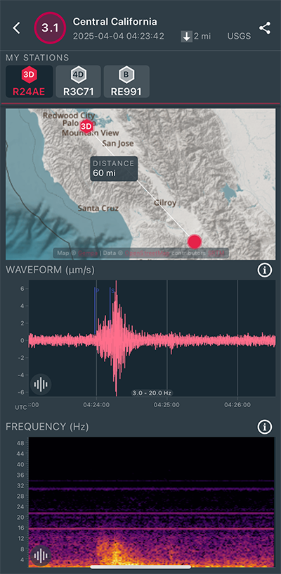
|
East/West Sensor
|
Magnitude 2.9
Depth 6.9 mi
3 mi WNW of Dublin, CA
37.709°N 121.987°W
March 18, 2025 04:46:13 UTC
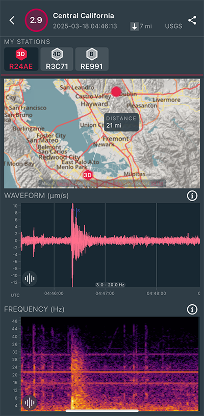
|
Vertical Sensor
|
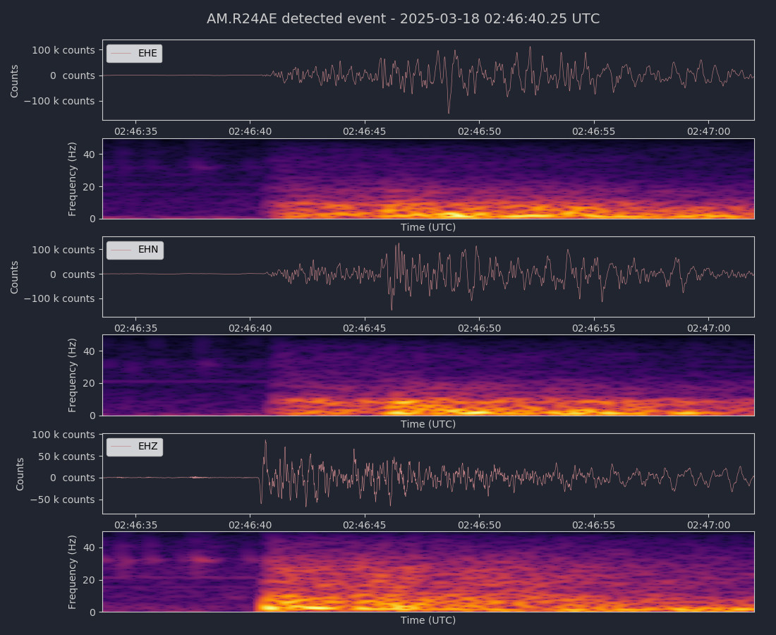
Magnitude 3.9
Depth 7.3 mi
3 mi WNW of Dublin, CA
37.709°N 121.988°W
March 18, 2025 02:46:33 UTC
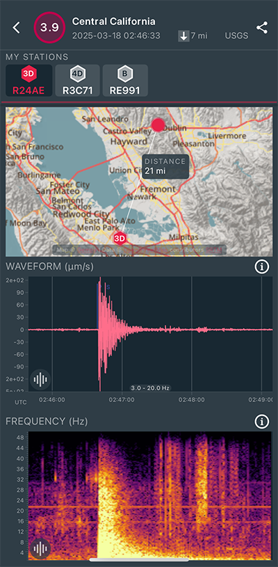
|
Vertical Sensor
|
|
Voltage Counts & Frequency for All Sensors (Magnitude 3.9 Earthquake)
|
Magnitude 3.3
Depth 3.2 mi
7 mi S of Tres Pinos, CA
36.684°N 121.313°W
February 26, 2025 05:46:24 UTC
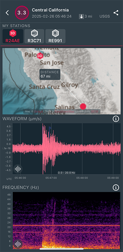
|
North/South Sensor
|
Magnitude 3.9
Depth 2.9 mi
7 mi SSW of Tres Pinos, CA
36.695°N 121.325°W
February 22, 2025 10:31:25 UTC
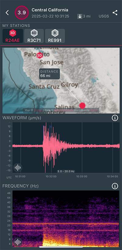
|
North/South Sensor
|
Magnitude 3.0
Depth 2.9 mi
7 mi SSW of Tres Pinos, CA
36.694°N 121.330°W
February 22, 2025 09:25:26 UTC
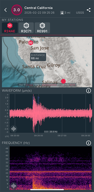
|
North/South Sensor
|
Magnitude 3.3
Depth 2.9 mi
7 mi SSW of Tres Pinos, CA
36.683°N 121.343°W
February 22, 2025 06:40:11 UTC
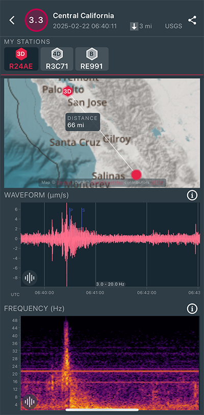
|
North/South Sensor
|
Magnitude 3.1
Depth 2.4 mi
6 mi SSW of Tres Pinos, CA
36.700°N 121.332°W
February 22, 2025 05:21:37 UTC
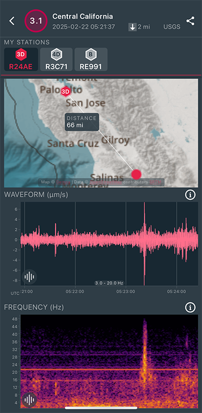
|
North/South Sensor
|
Magnitude 2.5
Depth 5.4 mi
3 mi S of Portola Valley, CA
37.339°N 122.233°W
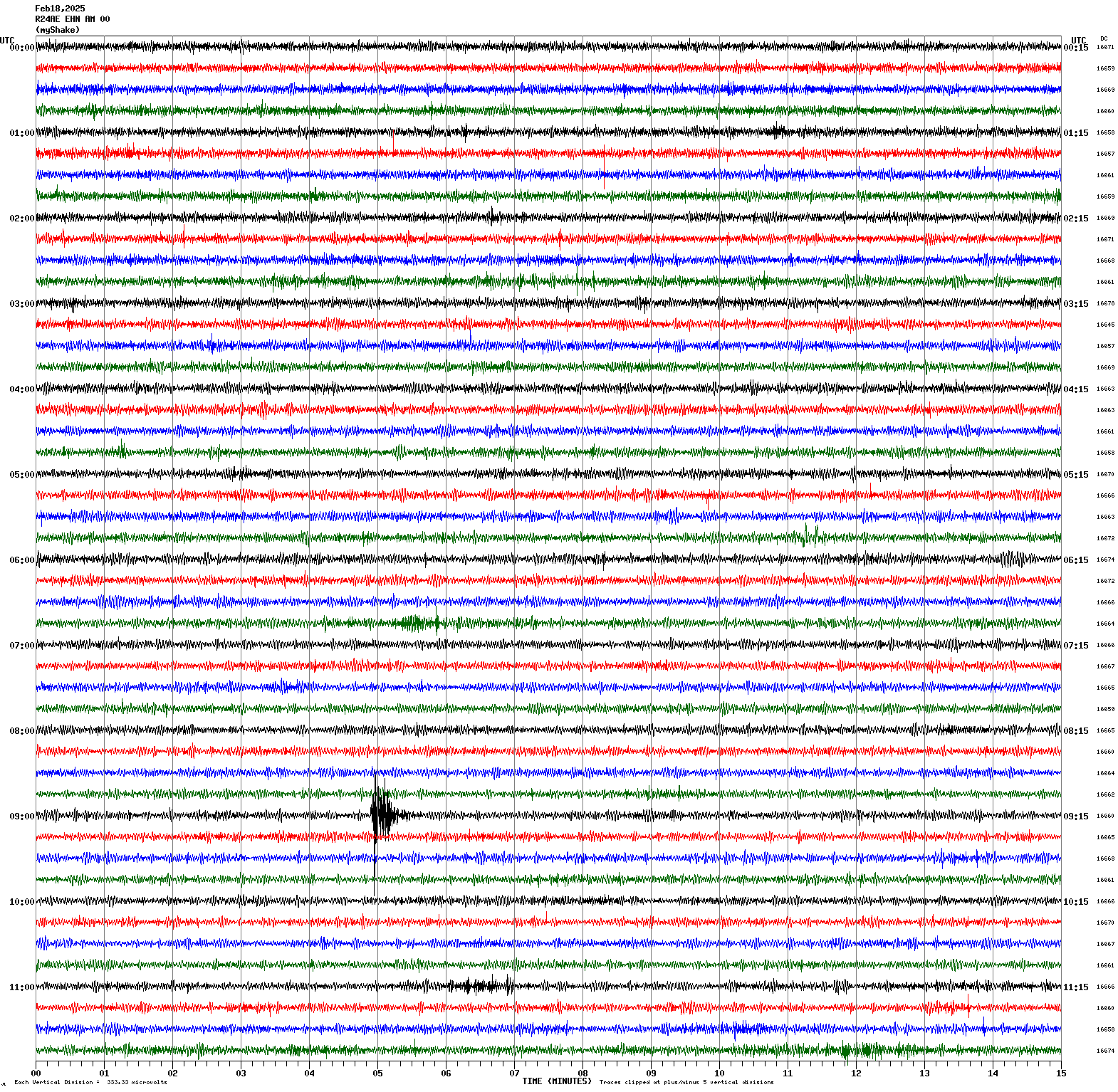
February 18, 2025 09:04:50 UTC
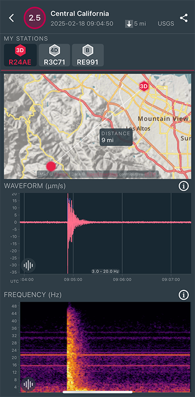
|
North/South Sensor
|
Magnitude 4.3
Depth 7.4 mi
6 mi NNW of Avenal, CA
36.083°N 120.184°W
February 14, 2025 00:17:04 UTC
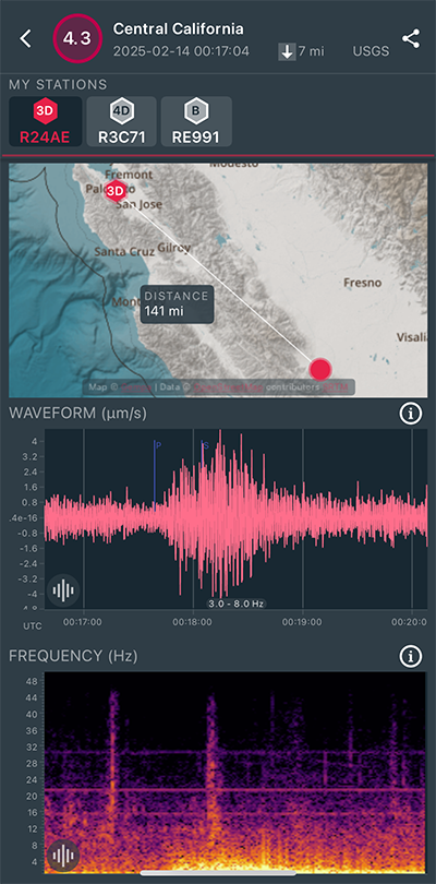
|
North/South Sensor
|
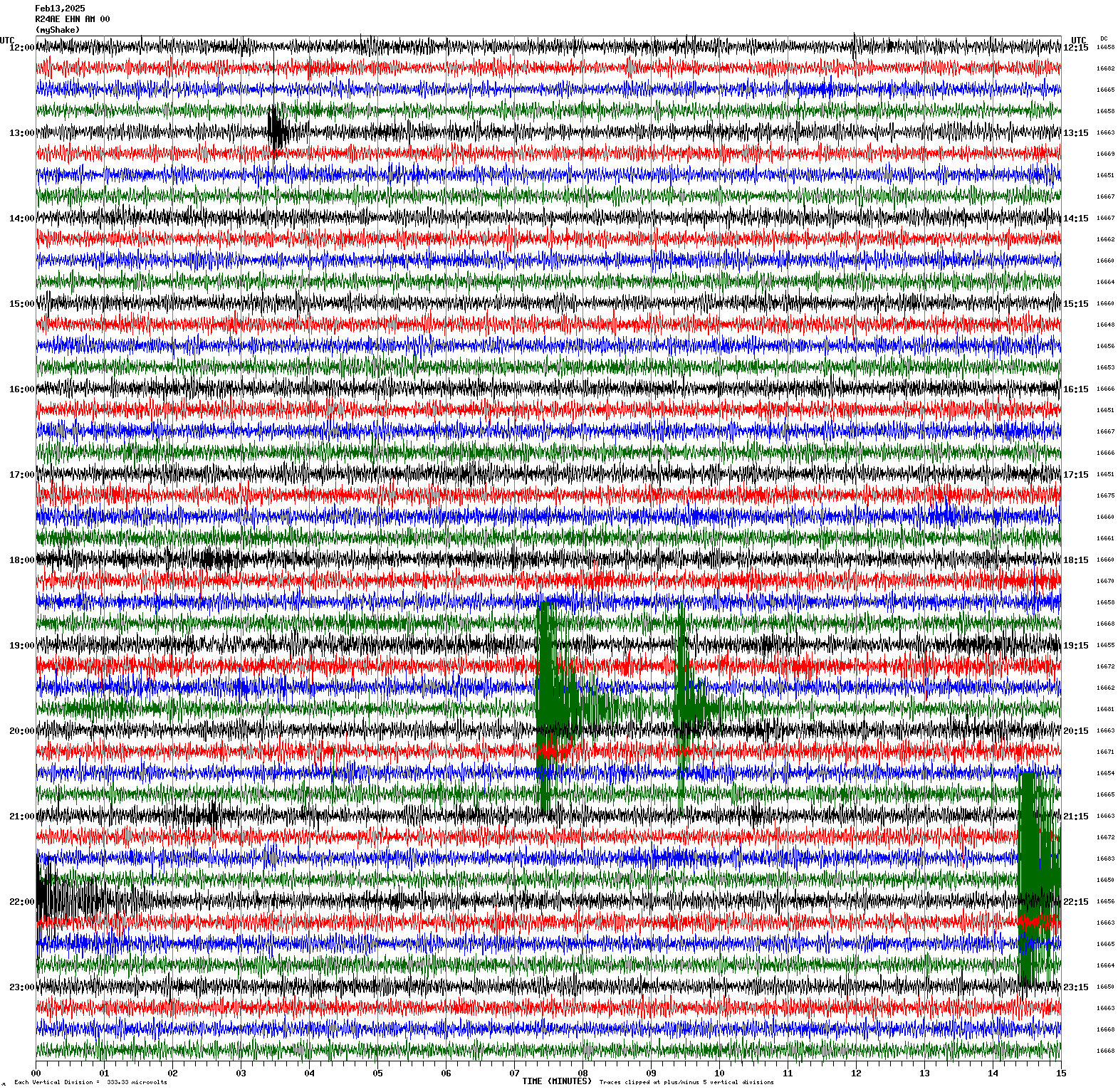
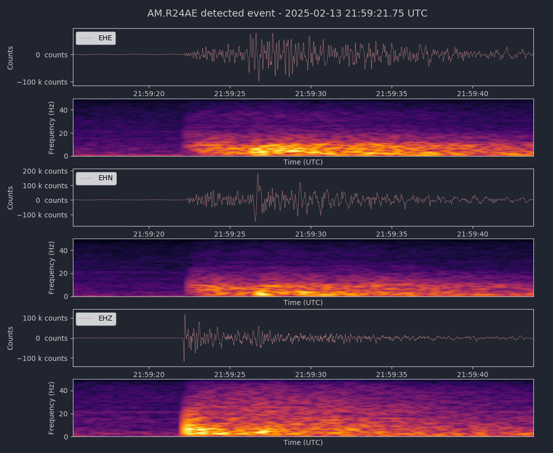
Magnitude 3.7
Depth 4.4 mi
1 mi E of Hayward, CA
37.648°N 122.054°W
February 13, 2025 21:59:16 UTC
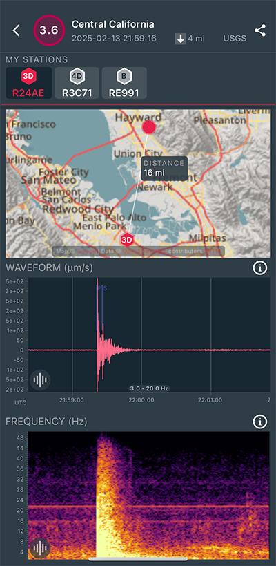
|
North/South Sensor
|
|
Voltage Counts & Frequency for All Sensors (Magnitude 3.7 Earthquake)
|
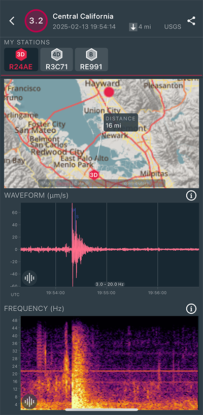
Magnitude 3.2
Depth 3.8 mi
1 mi E of Hayward, CA
37.645°N 122.059°W
February 13, 2025 19:54:14 UTC
|
North/South Sensor
|
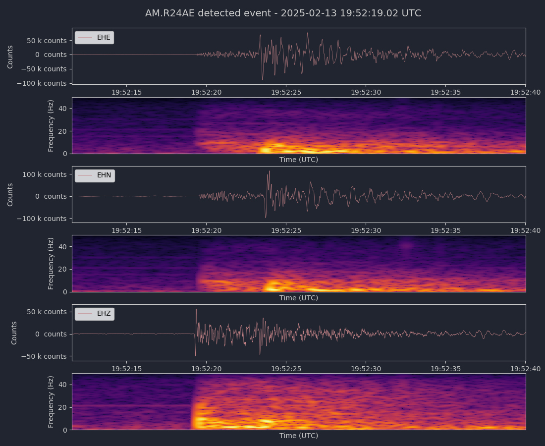
Magnitude 3.3
Depth 3.5 mi
1 mi E of Hayward, CA
37.648°N 122.054°W
February 13, 2025 19:52:13 UTC

|
North/South Sensor
|
|
Voltage Counts & Frequency for All Sensors (Magnitude 3.3 Earthquake)
|
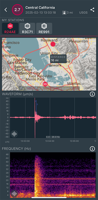
Magnitude 2.7
Depth 3.3 mi
1 mi E of Hayward, CA
37.646°N 122.054°W
February 13, 2025 13:03:18 UTC
|
North/South Sensor
|
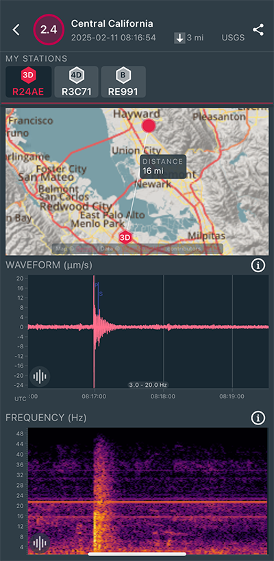
Magnitude 2.4
Depth 3.2 mi
1 mi E of Hayward, CA
37.644°N 122.051°W
February 11, 2025 08:16:54 UTC
|
North/South Sensor
|
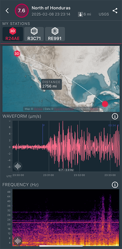
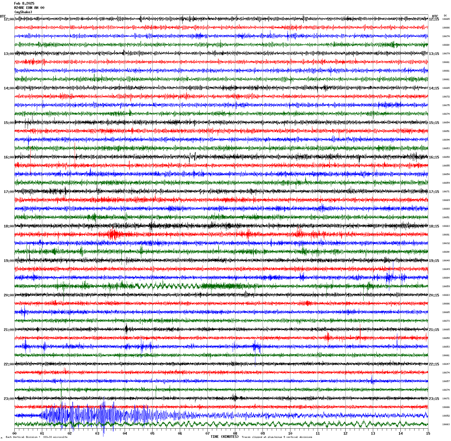
Magnitude 7.6
Depth 6.2 mi
130 mi SSW of George Town, Cayman Islands
17.702⪚N 82.456⪚W
February 8, 2025 23:23:14 UTC
|
North/South Sensor
|
Magnitude 3.3
Depth 3.7 mi
6 mi ENE of San Martin, CA
37.125°N 121.525°W
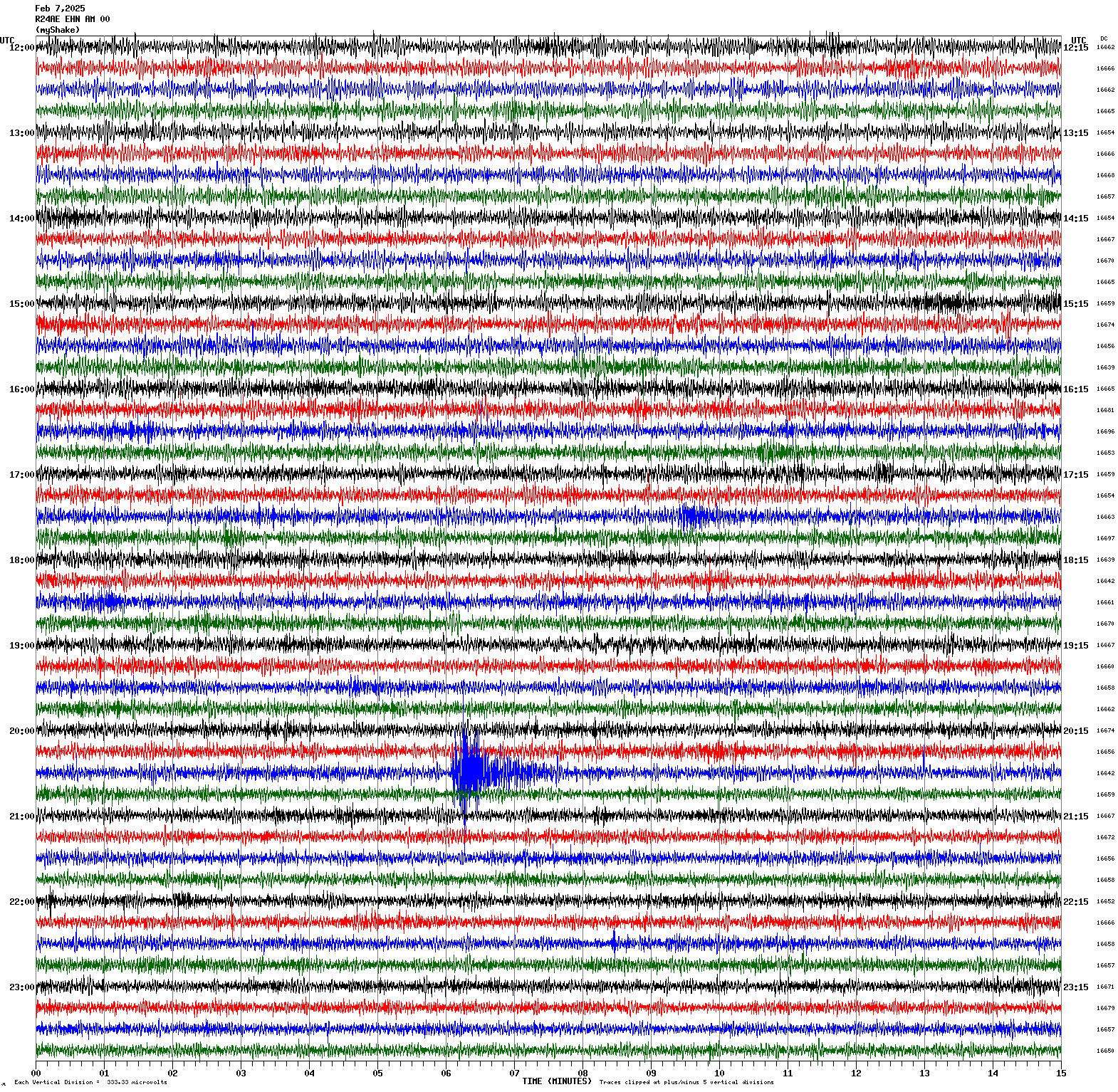
February 7, 2025 20:35:52 UTC
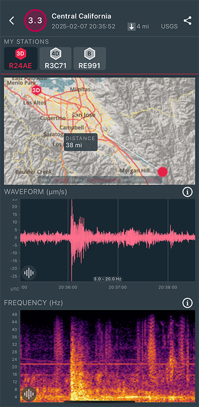
|
North/South Sensor
|
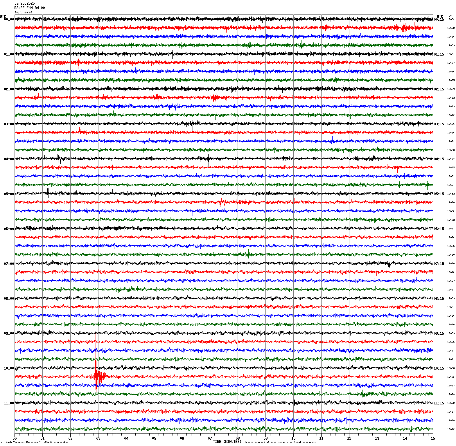
Magnitude 2.1
Depth 2.6 mi
1 mi S of Los Altos Hills, CA
37.363°N 122.132°W
January 25, 2025 10:17:49 UTC
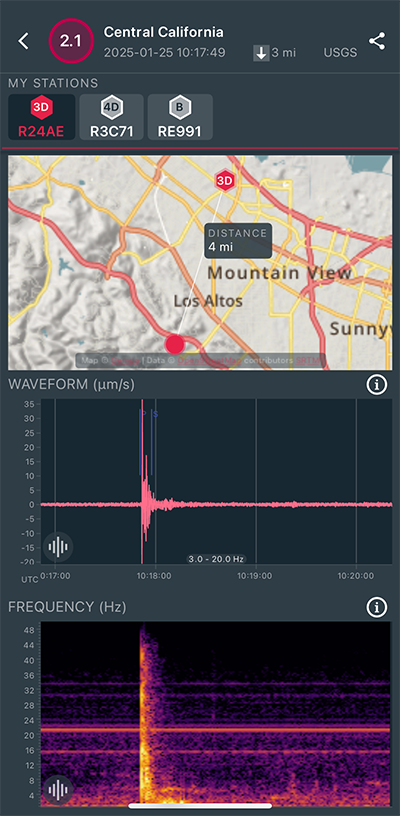
|
North/South Sensor
|
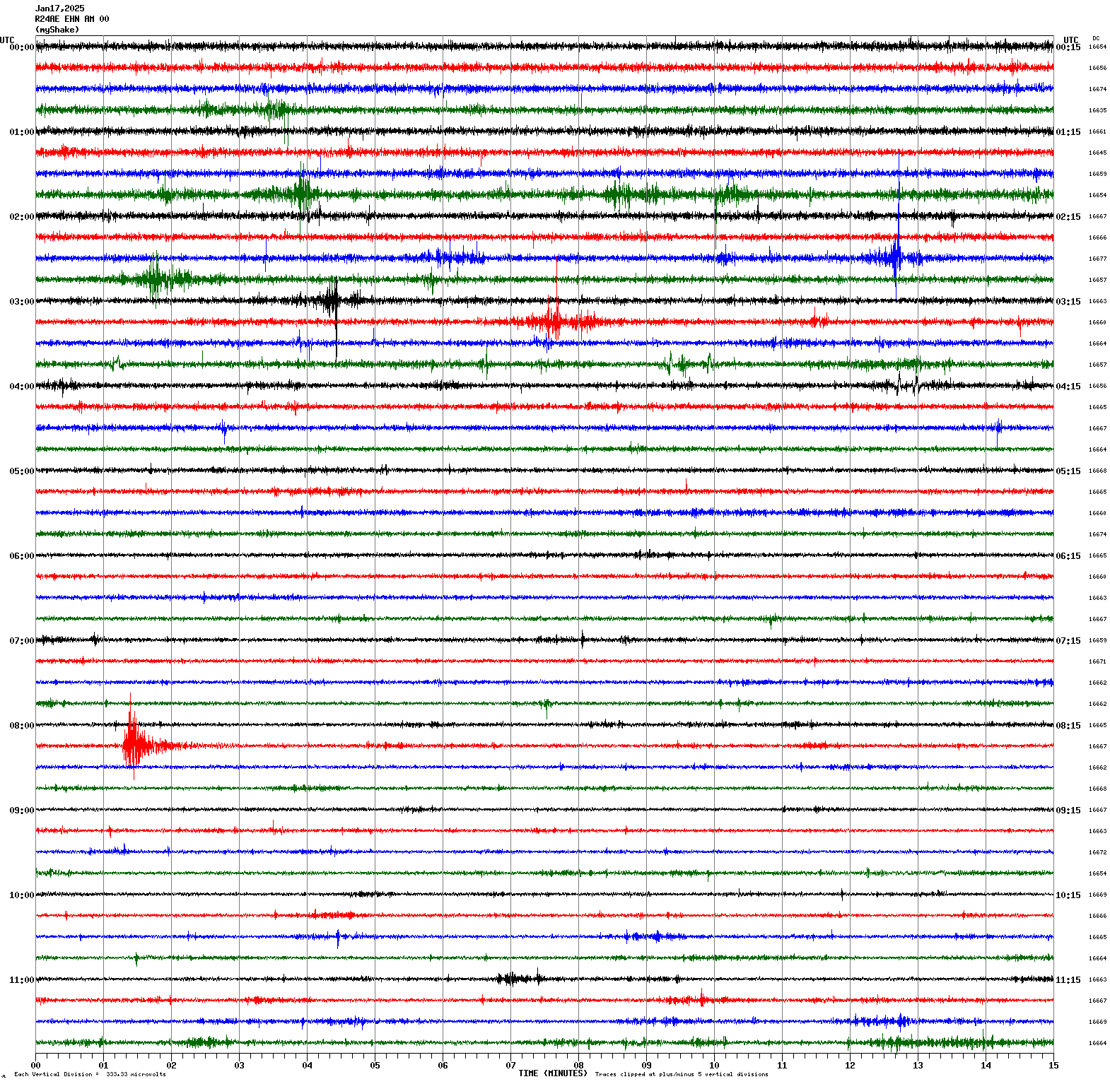
Magnitude 2.8
Depth 5.1 mi
6 mi ESE of Alum Rock, CA
37.361°N 121.717°W
January 17, 2025 08:16:10 UTC
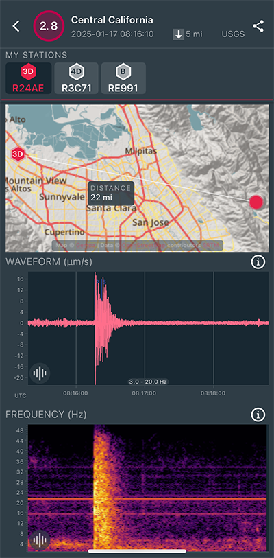
|
North/South Sensor
|
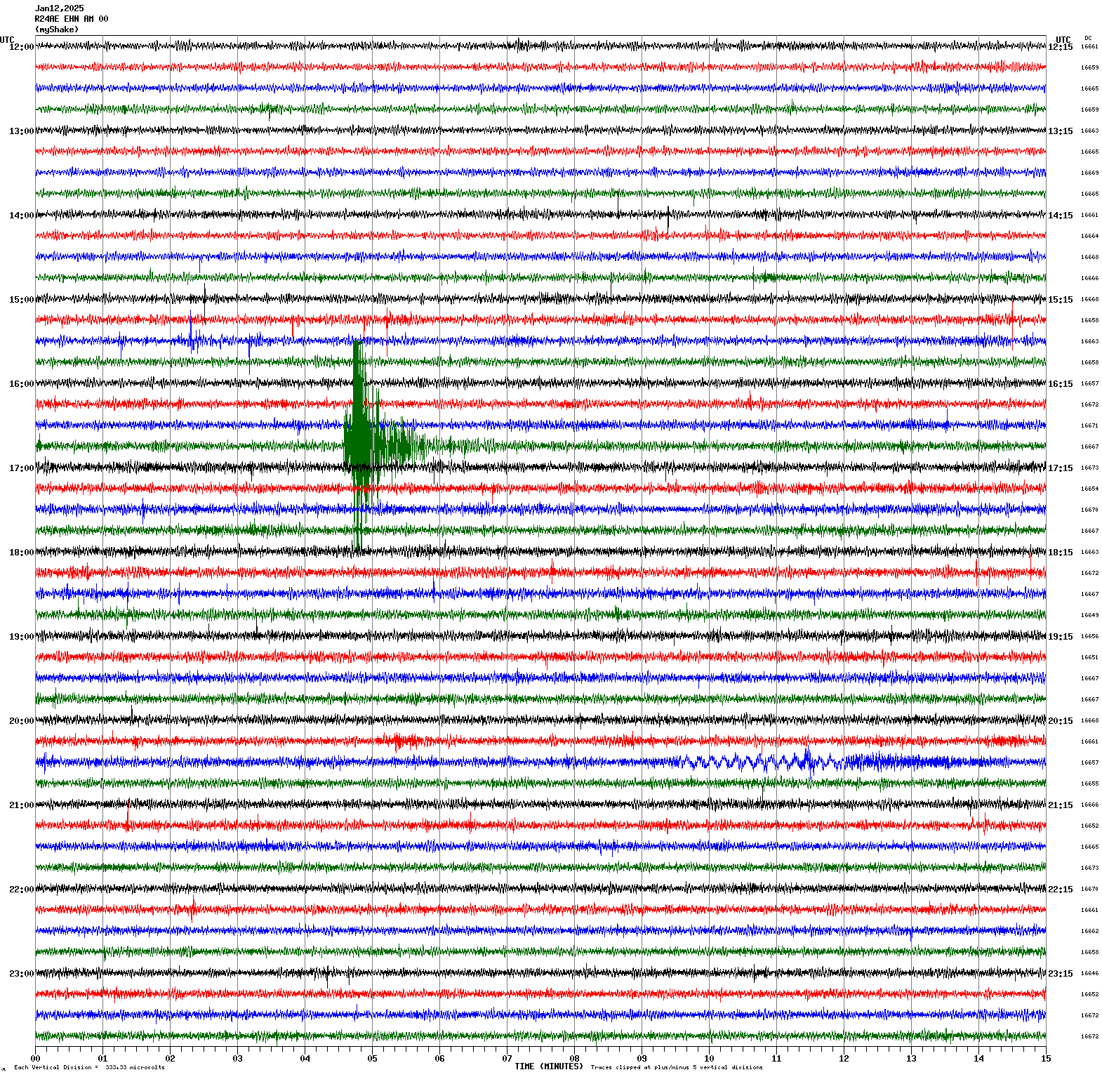
Magnitude 3.5
Depth 7.3 mi
1 mi ENE of Pleasant Hill, CA
37.960°N 122.043°W
January 12, 2025 16:49:21 UTC
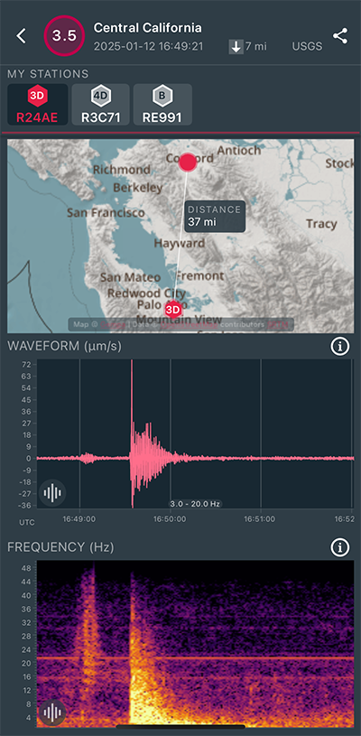
|
North/South Sensor
|
Magnitude 6.2
Depth 21.1 mi
13 mi ESE of Aquila, Mexico
18.525°N 103.316°W
January 12, 2025 08:32:50 UTC
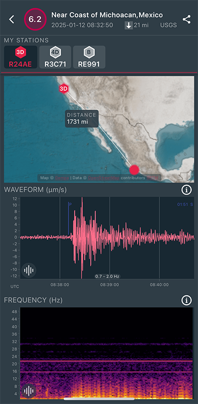
|
North/South Sensor
|
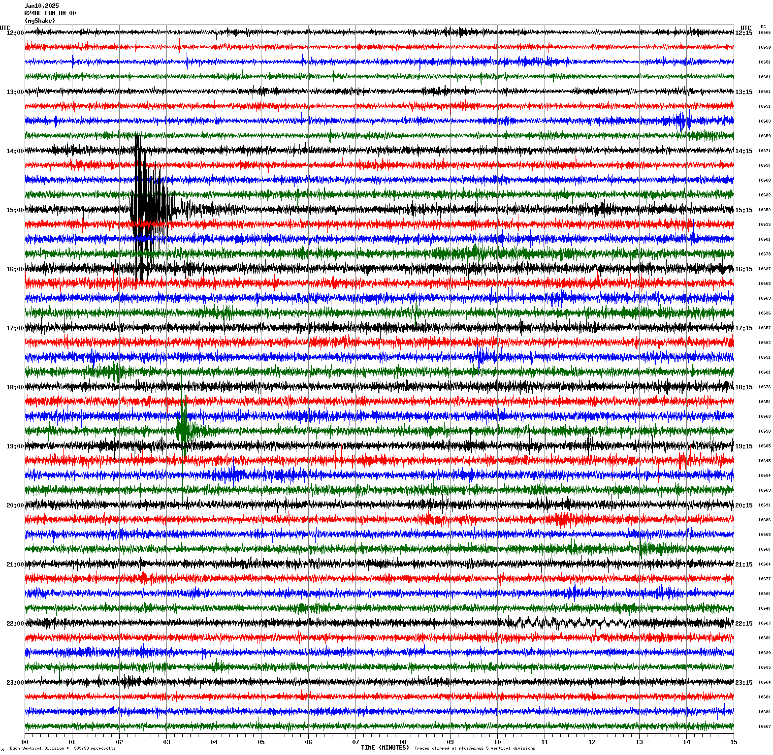
Magnitude 3.6
Depth 4.9 mi
3 mi NW of San Francisco Zoo, CA
37.755°N 122.552°W
January 10, 2025 15:02:03 UTC
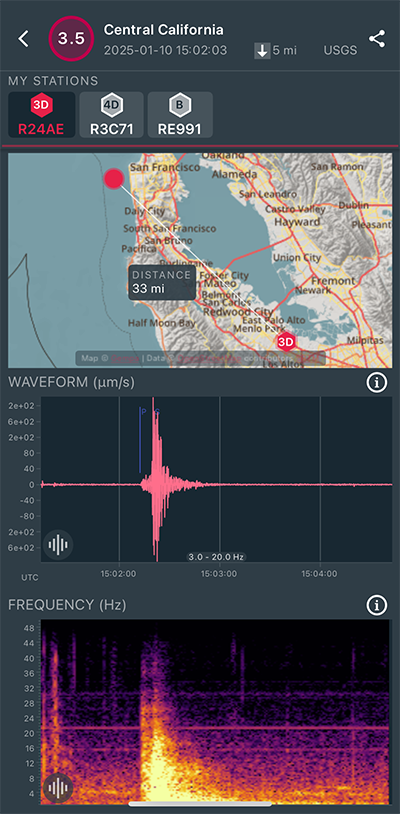
|
North/South Sensor
|
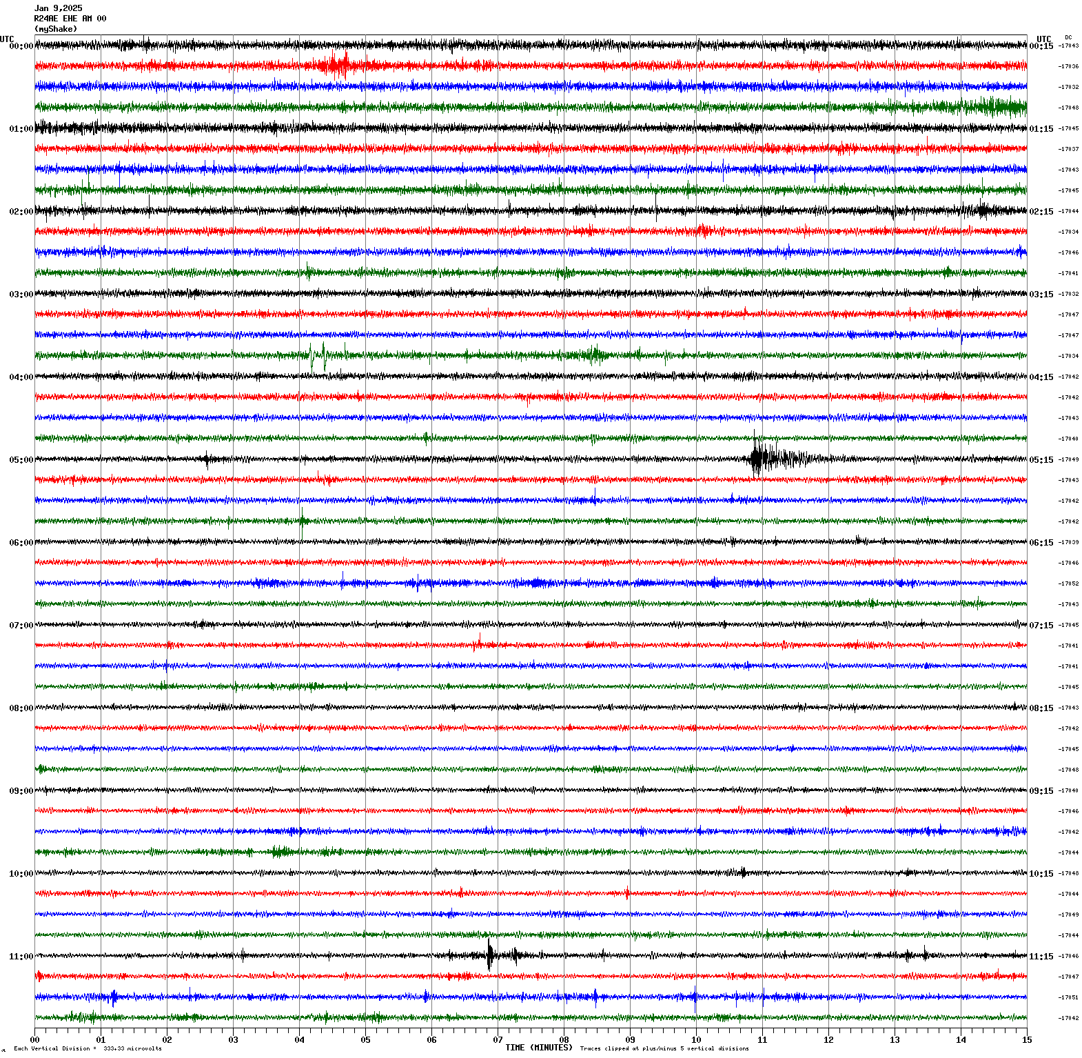
Magnitude 3.0
Depth 4.4 mi
0 mi E of Aromas, CA
36.889°N 121.639°W
January 9, 2025 05:10:28 UTC

|
East/West Sensor
|
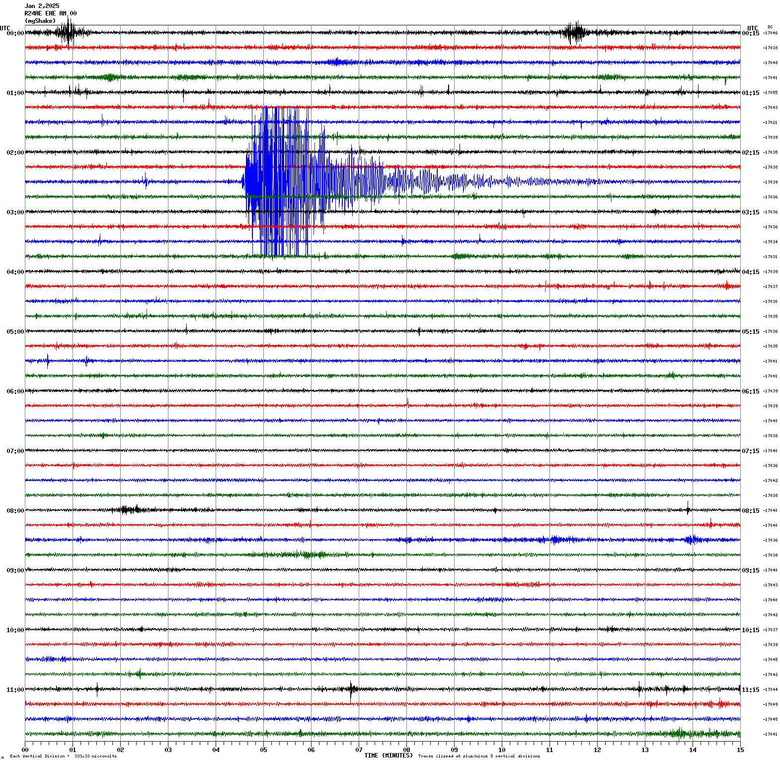
Magnitude 4.7
Depth 0.7 mi
2 mi NNW of Cobb, CA
38.846°N 122.752°W
January 2, 2025 02:34:04 UTC
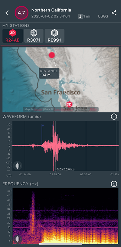
|
East/West Sensor
|
Magnitude 3.0
Depth 8.2 mi
4 mi SW of Clayton, CA
37.900°N 121.983°W
December 25, 2024 07:36:45 UTC
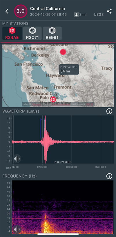
|
East/West Sensor

|
Magnitude 3.6
Depth 4.7 mi
7 mi NW of Pinnacles, CA
36.601°N 121.231°W
December 22, 2024 01:44:44 UTC

|
North/South Sensor
|
Magnitude 5.3
Depth 6.2 mi
48 mi WNW of Petrolia, CA
40.414°N 125.184°W
December 15, 2024 07:21:59 UTC
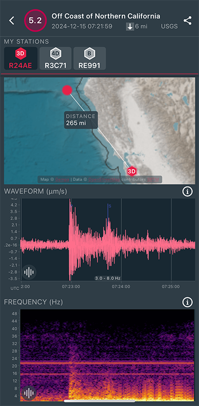
|
North/South Sensor
|
Magnitude 3.9
Depth 1.7 mi
4 mi NNW of The Geysers, CA
38.822°N 122.803°W
December 10, 2024 05:55:38 UTC
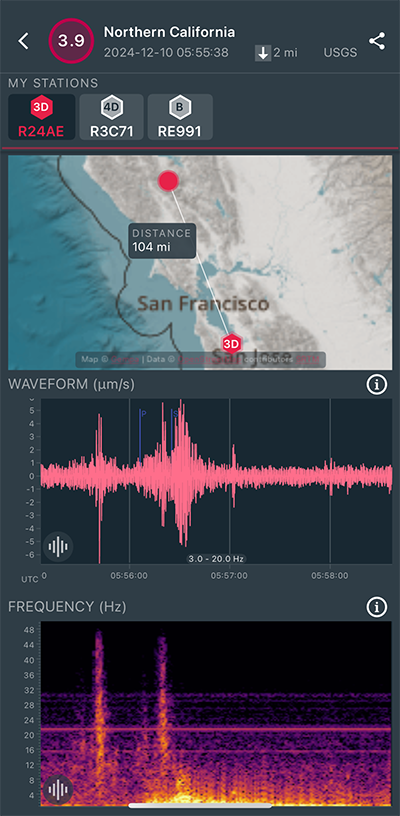
|
North/South Sensor
|
Magnitude 5.8
Depth 0.0 mi
15 mi NNE of Yerington, Nevada
39.174°N 119.018°W
December 9, 2024 23:08:31 UTC
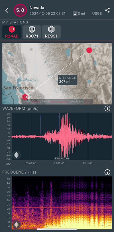
|
North/South Sensor
|
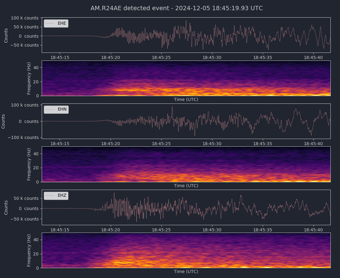
Magnitude 7.0
Depth 6.2 mi
62 mi WSW of Ferndale, California
40.299°N 125.377°W
December 5, 2024 18:44:16 UTC
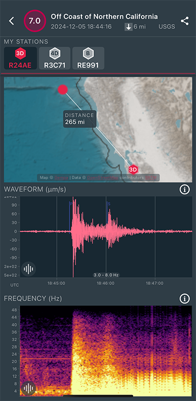
|
Vertical Sensor
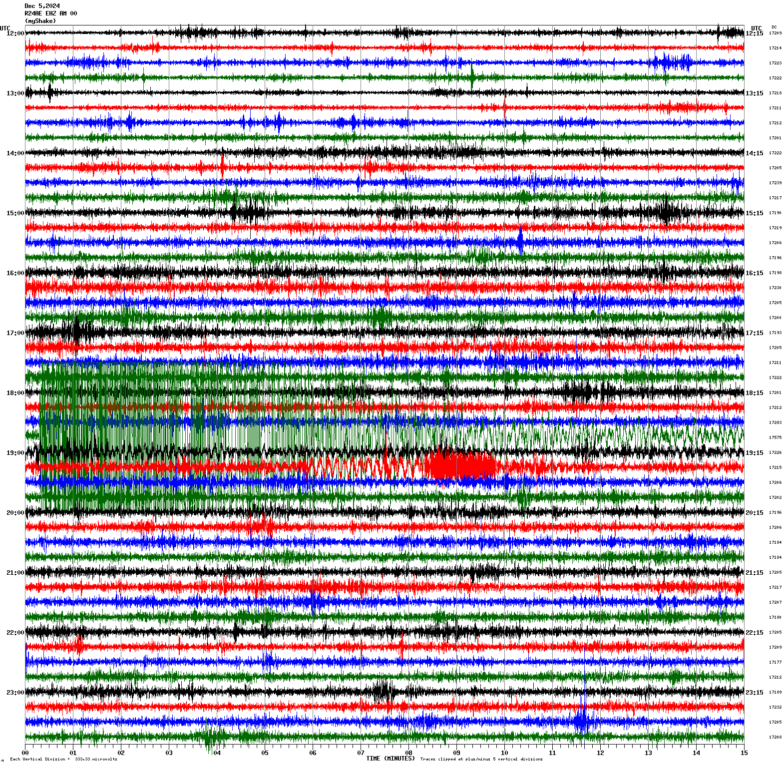
|
|
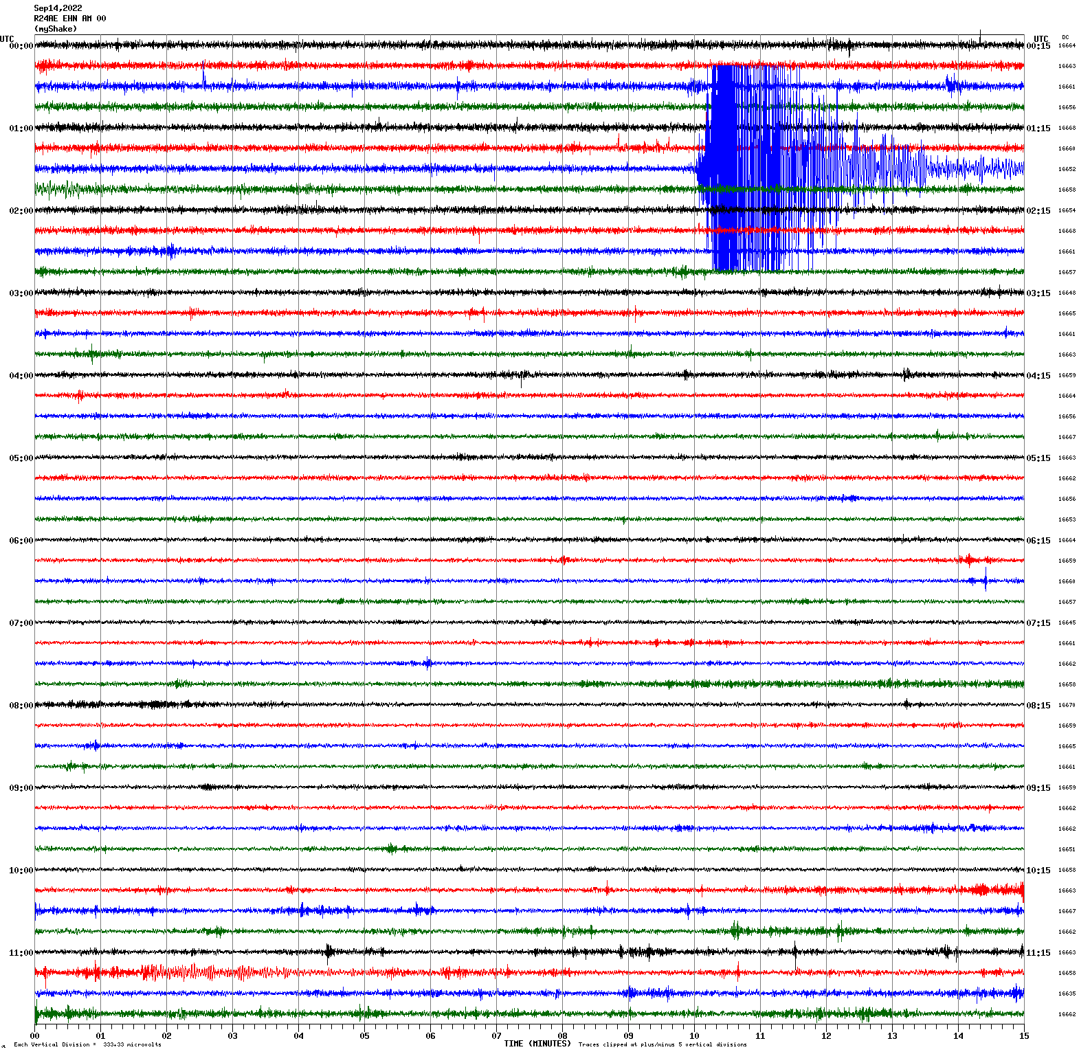
Voltage Counts & Frequency for All Sensors (Magnitude 7.0 Earthquake)
|
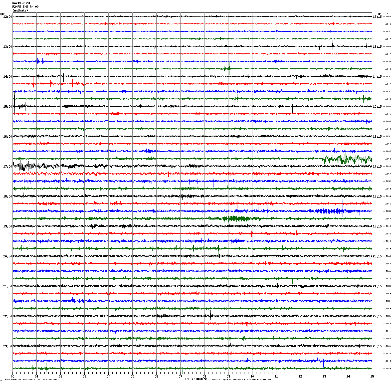
Magnitude 6.8
Depth 8.7 mi
25 mi SSW of Bartolomé Masó, Cuba
19.812°N 77.039°W
November 10, 2024 16:49:50 UTC
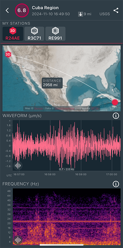
|
East/West Sensor
|
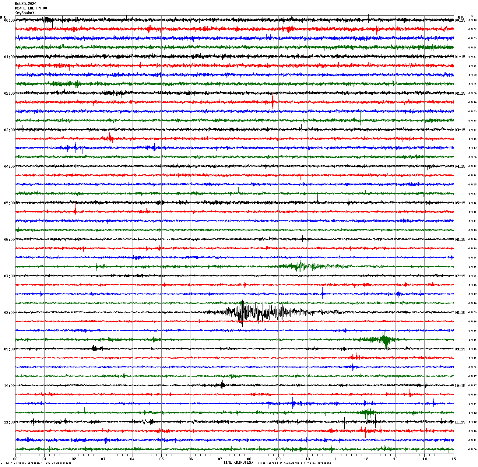
Magnitude 4.7
Depth -1.0 mi
4 mi E of Stovepipe Wells, CA
36.598°N 117.068°W
October 25, 2024 08:05:07 UTC
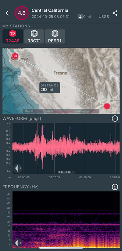
|
East/West Sensor
|
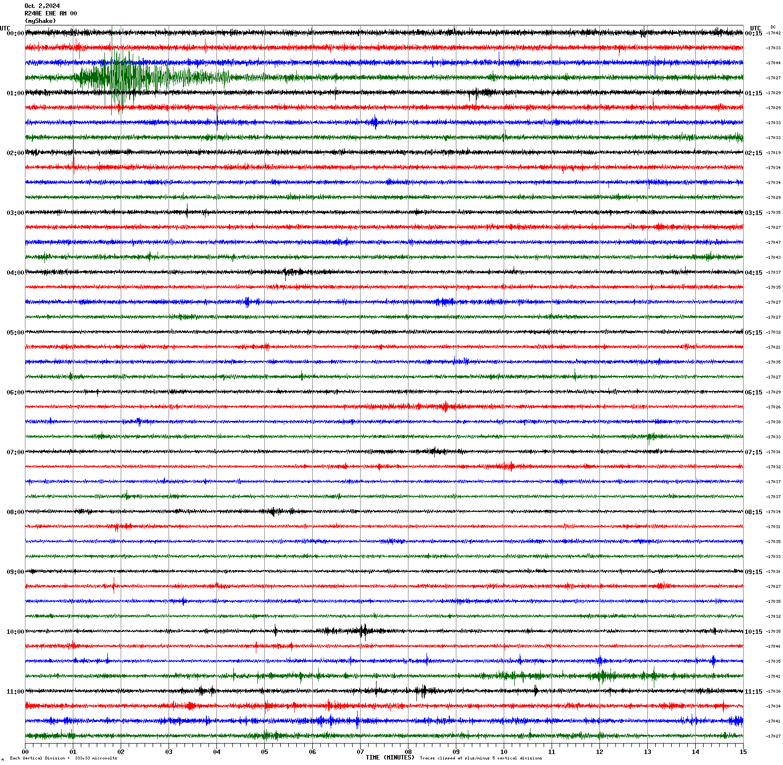
Magnitude 4.0
Depth 7.1 mi
7 mi NNW of Avenal, CA
36.084°N 120.195°W
October 2, 2024 00:45:18 UTC
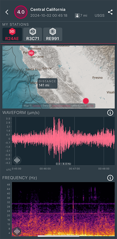
|
East/West Sensor
|
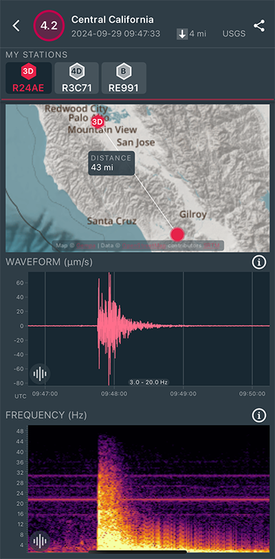
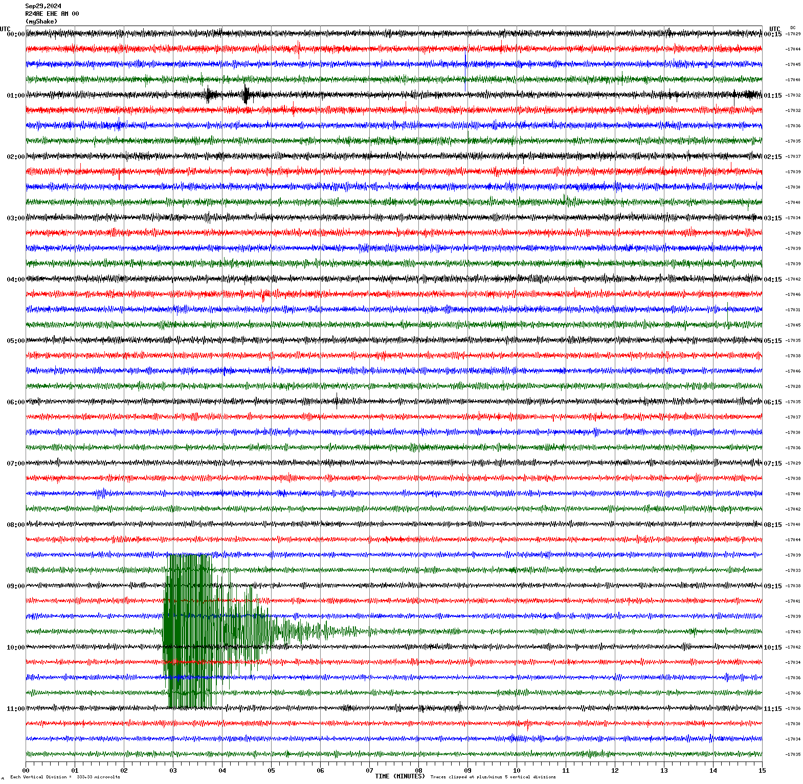
Magnitude 4.2
Depth 4.3 mi
2 mi NNW of Aromas, CA
36.912°N 121.653°W
September 29, 2024 09:47:33 UTC
|
East/West Sensor
|
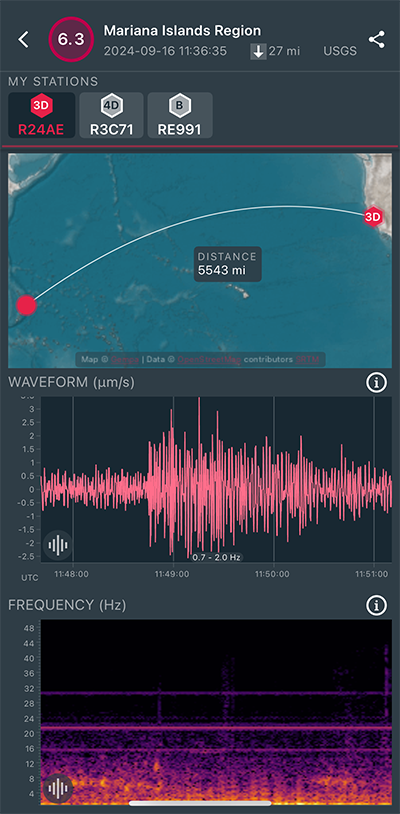
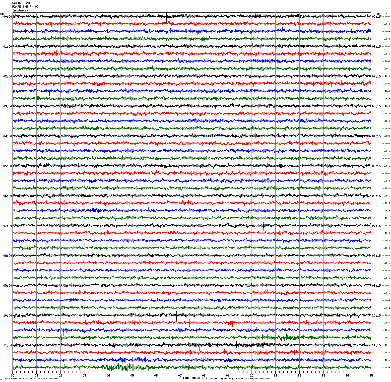
Magnitude 6.3
Depth 28.4 mi
163 mi NE of Saipan, Northern Mariana Islands
17.153°N 147.187°E
September 16, 2024 11:36:34 UTC
|
East/West Sensor
|
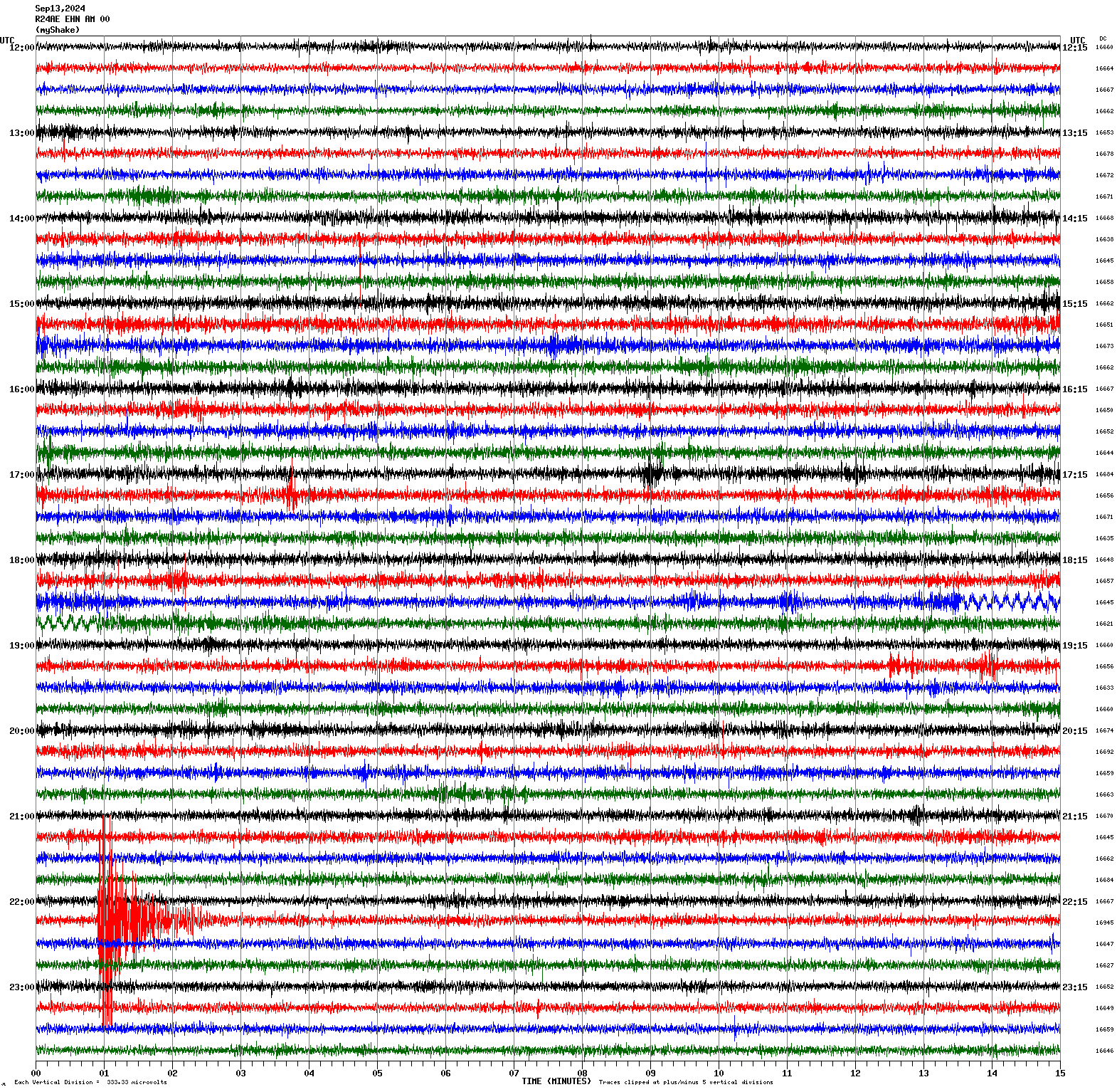
Magnitude 3.4
Depth 5.0 mi
5 mi ENE of Alum Rock, CA
37.410°N 121.757°W
September 13, 2024 22:15:47 UTC
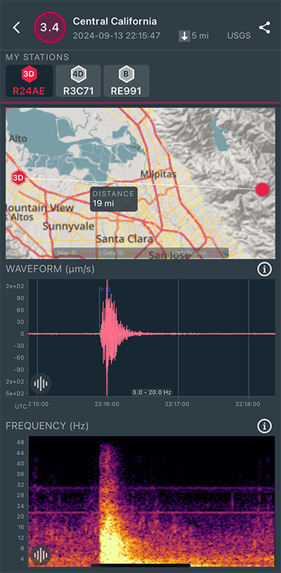
|
North/South Sensor
|
Magnitude 4.7
Depth 7.1 mi
4 mi N of Malibu, CA
34.057°N 118.813°W
September 12, 2024 14:28:21 UTC
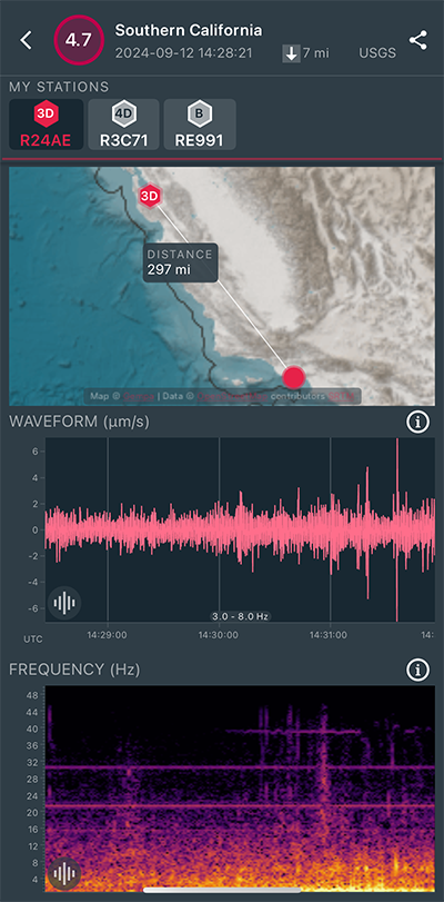
|
East/West Sensor
|
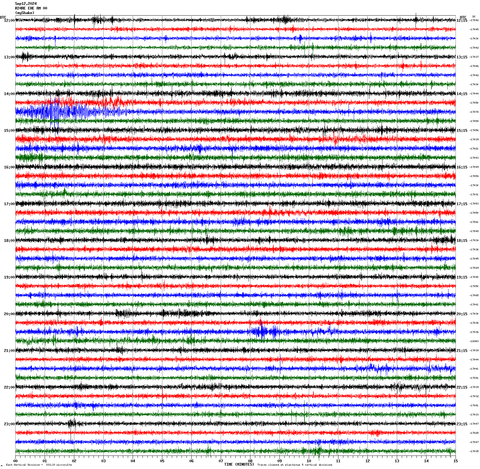
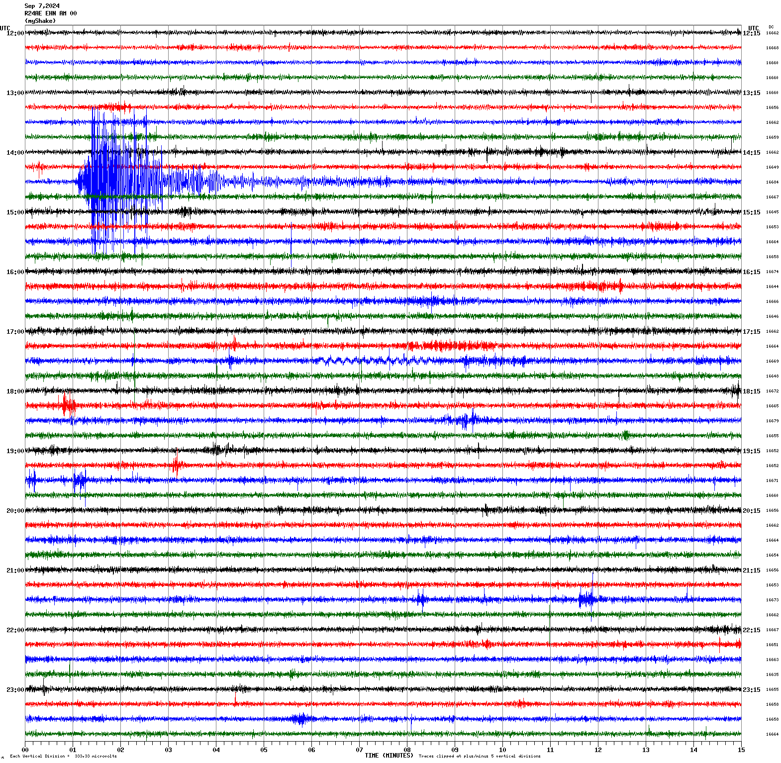
Magnitude 4.3
Depth -0.1 mi
1 mi ESE of The Geysers, CA
38.777°N 122.746°W
September 7, 2024 14:30:36 UTC
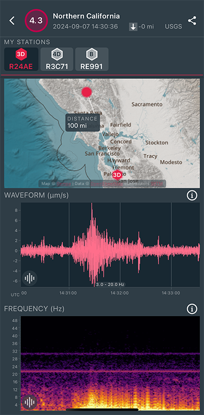
|
North/South Sensor
|
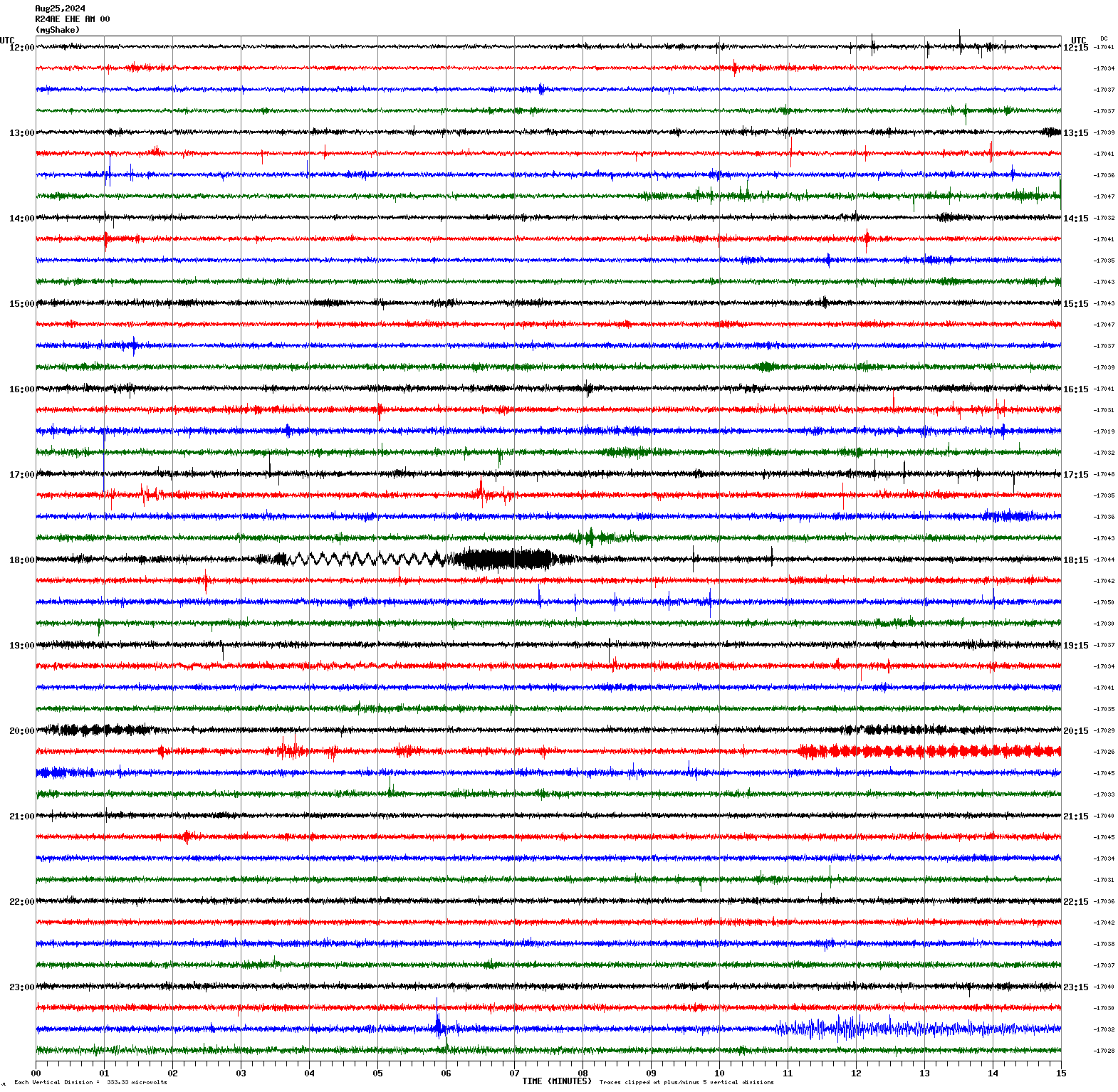
Magnitude 6.9
Depth 66.3 mi
45 mi W of Pangai, Tonga
19.755°S 175.041°W
August 25, 2024 23:29:08 UTC
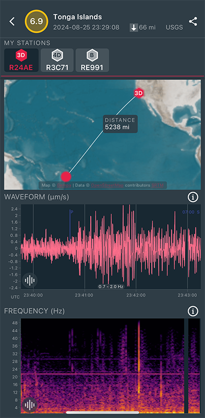
|
East/West Sensor
|
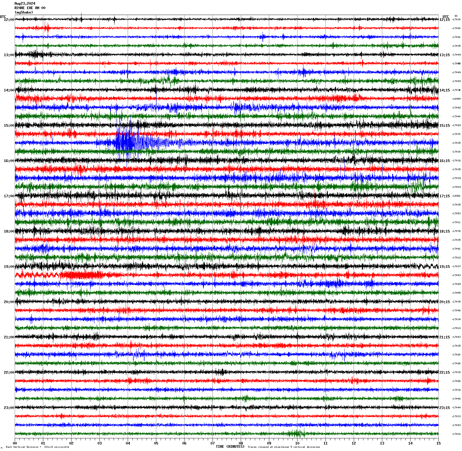
Magnitude 4.3
Depth 3.4 mi
10 mi ENE of Walker Lake, Nevada
38.686°N 118.567°W
August 23, 2024 15:31:58 UTC
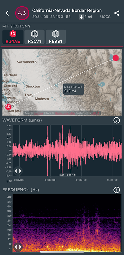
|
East/West Sensor
|
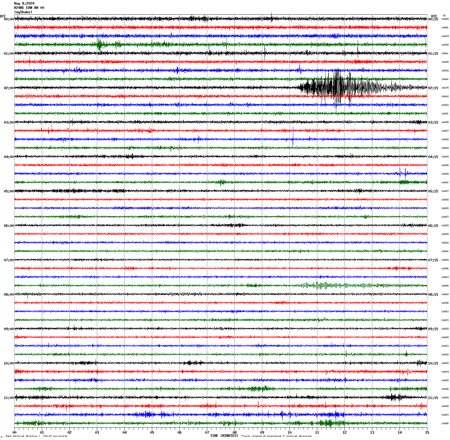
Magnitude 4.4
Depth 7.0 mi
14 mi NW of Grapevine, CA
35.102°N 119.071°W
August 8, 2024 02:09:15 UTC
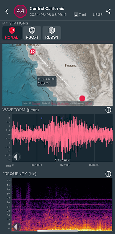
|
North/South Sensor
|
Magnitude 5.2
Depth 7.2 mi
15 mi SW of Lamont, CA
35.109°N 119.097°W
August 7, 2024 04:09:56 UTC
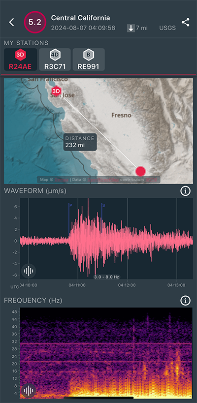
|
North/South Sensor
|
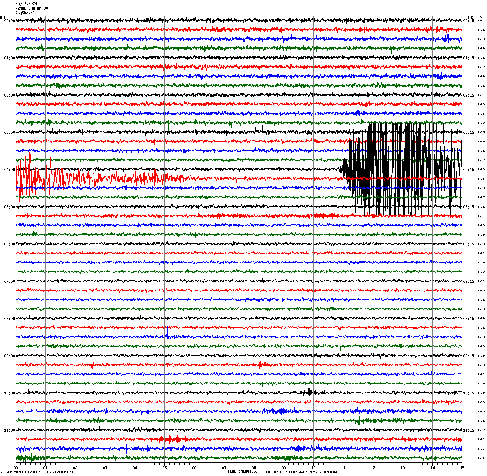
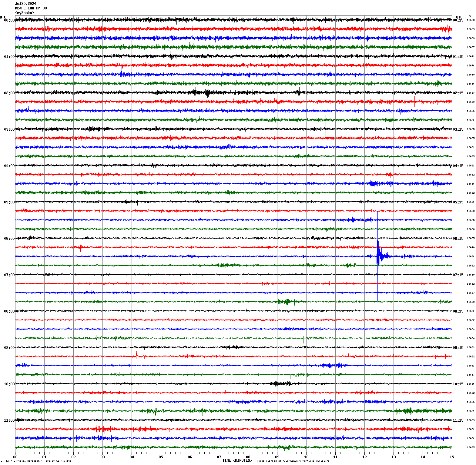
Magnitude 2.0
Depth 0.8 mi
1 mi WNW of Los Altos Hills, CA
37.384°N 122.160°W
July 30, 2024 06:42:22 UTC
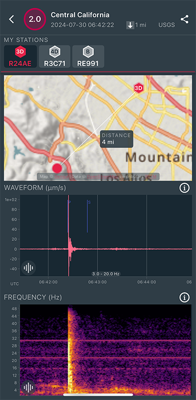
|
North/South Sensor
|
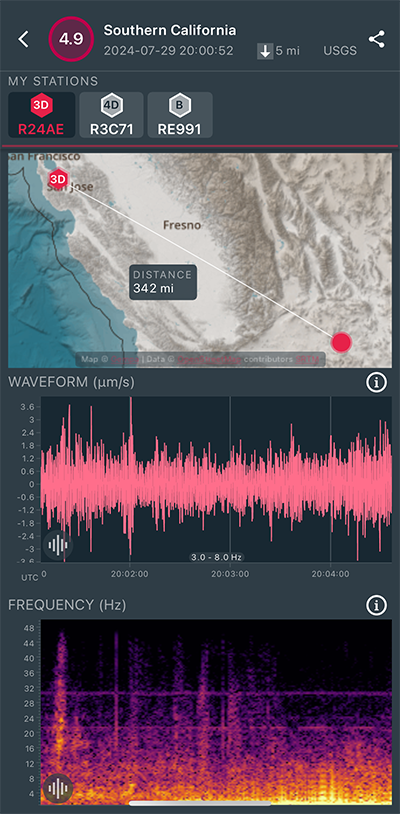
Magnitude 4.9
Depth 4.5 mi
14 mi ENE of Barstow, CA
34.950°N 116.787°W
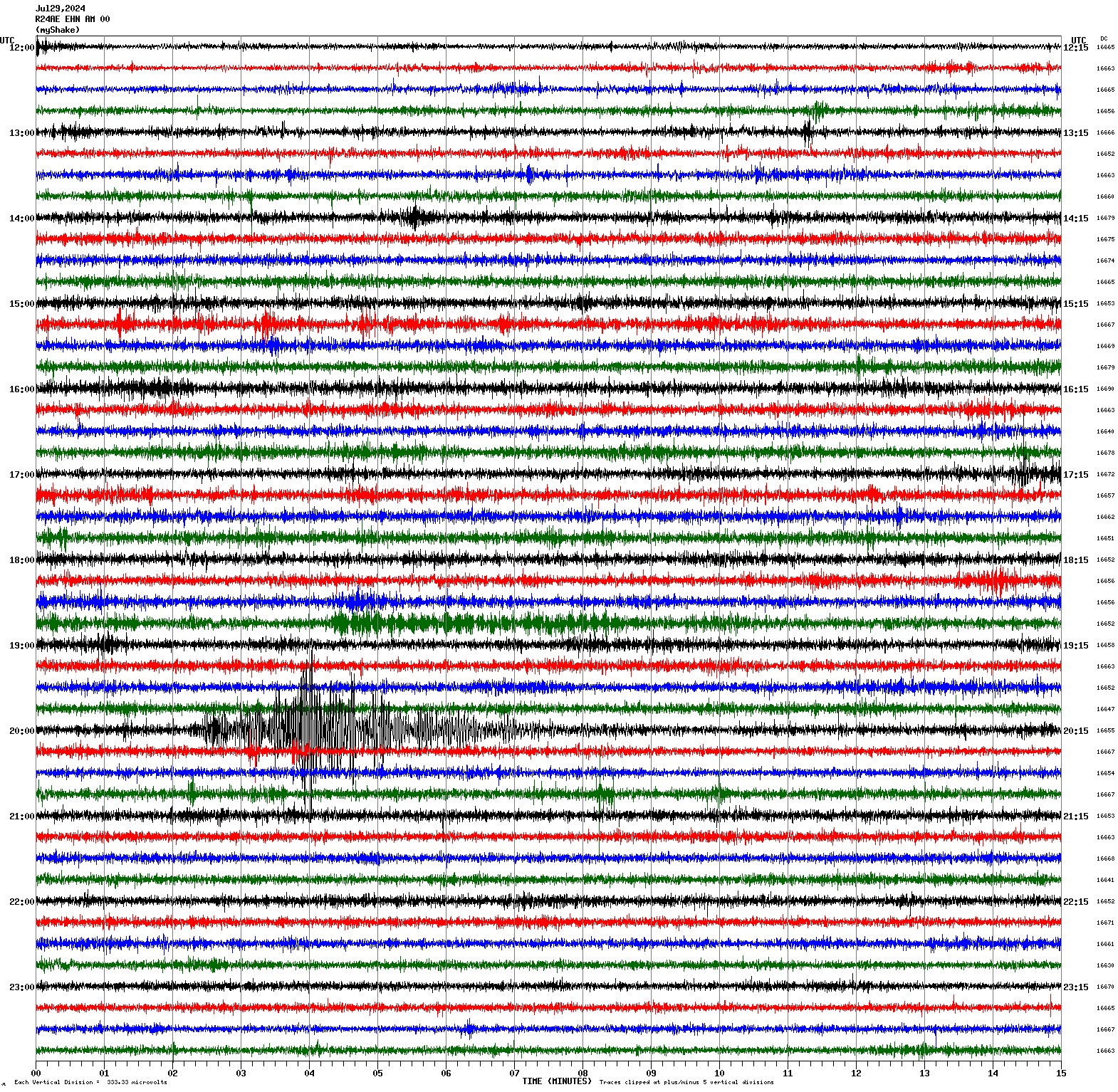
July 29, 2024 20:00:52 UTC
|
North/South Sensor
|
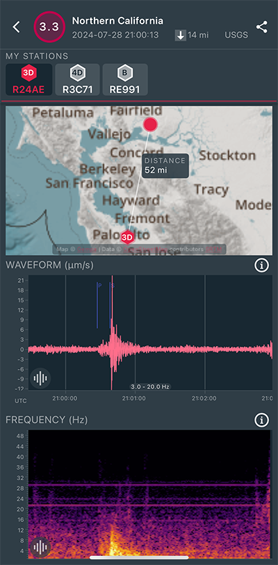
Magnitude 3.3
Depth 13.8 mi
8 mi SSE of Suisun City, CA
38.154°N 121.923°W
July 28, 2024 21:00:13 UTC
|
East/West Sensor
|
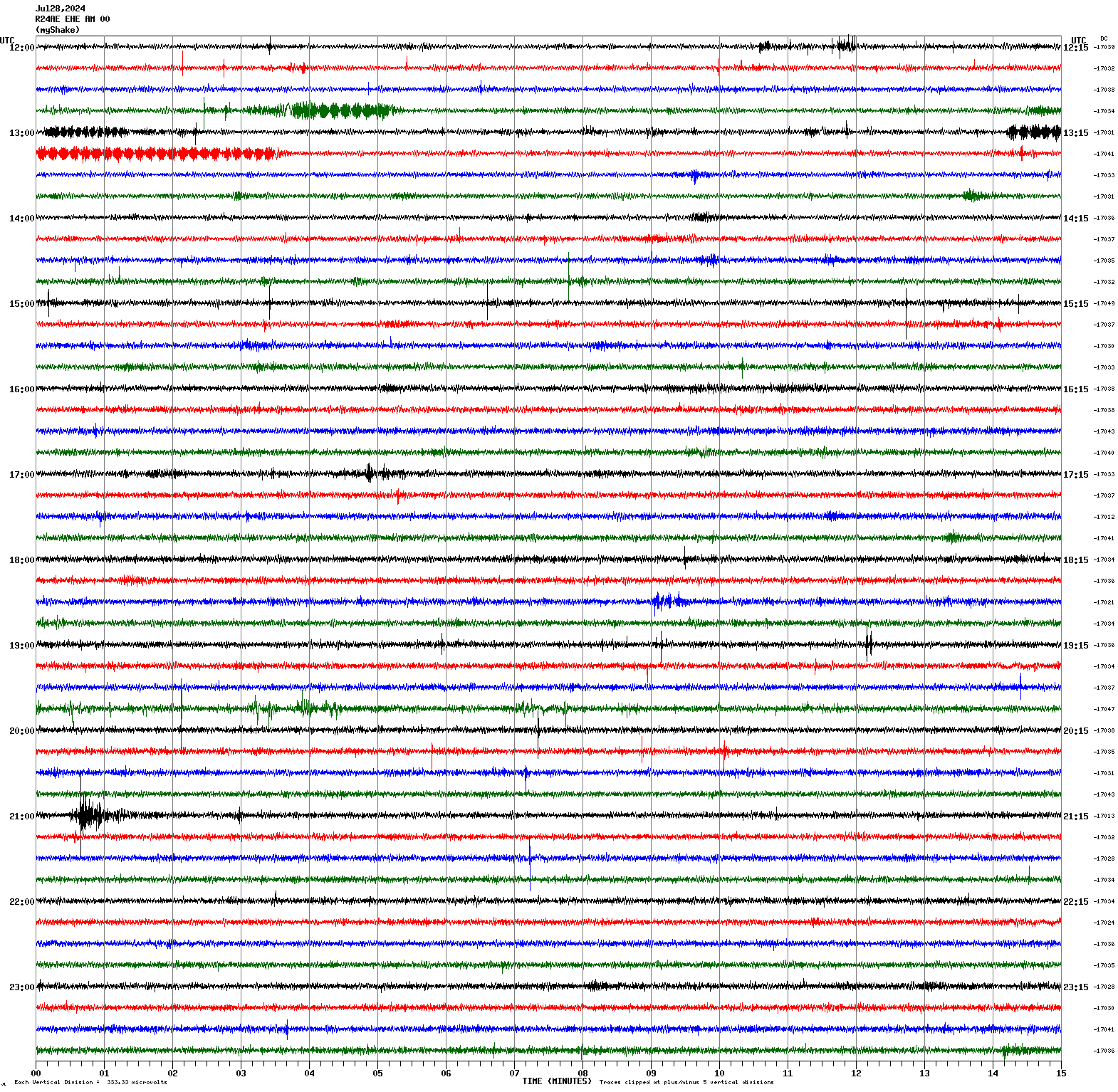
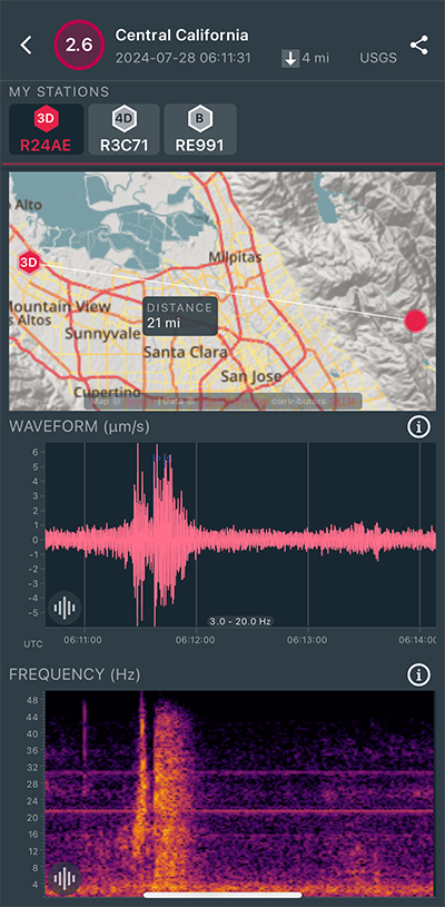
Magnitude 2.6
Depth 4.5 mi
6 mi E of Alum Rock, CA
37.378°N 121.730°W
July 28, 2024 06:11:31 UTC
|
East/West Sensor
|
Magnitude 7.4
Depth 73.0 mi
28 mi ESE of San Pedro de Atacama, Chile
23.047°S 67.782°W
July 19, 2024 01:50:47 UTC
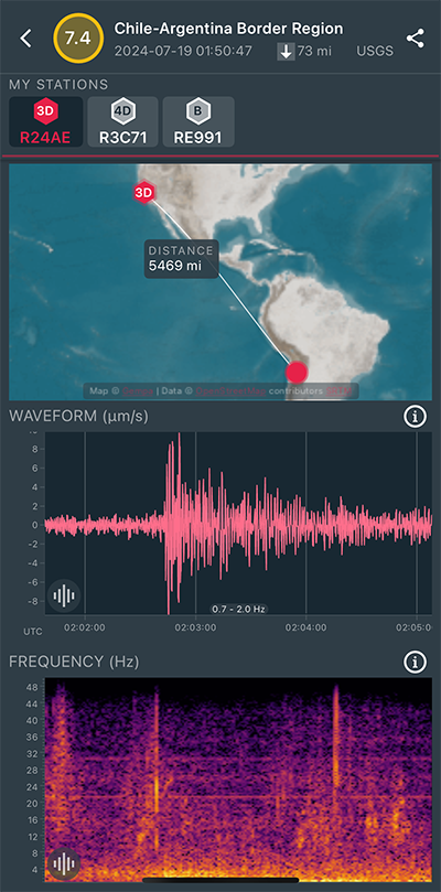
|
North/South Sensor
|
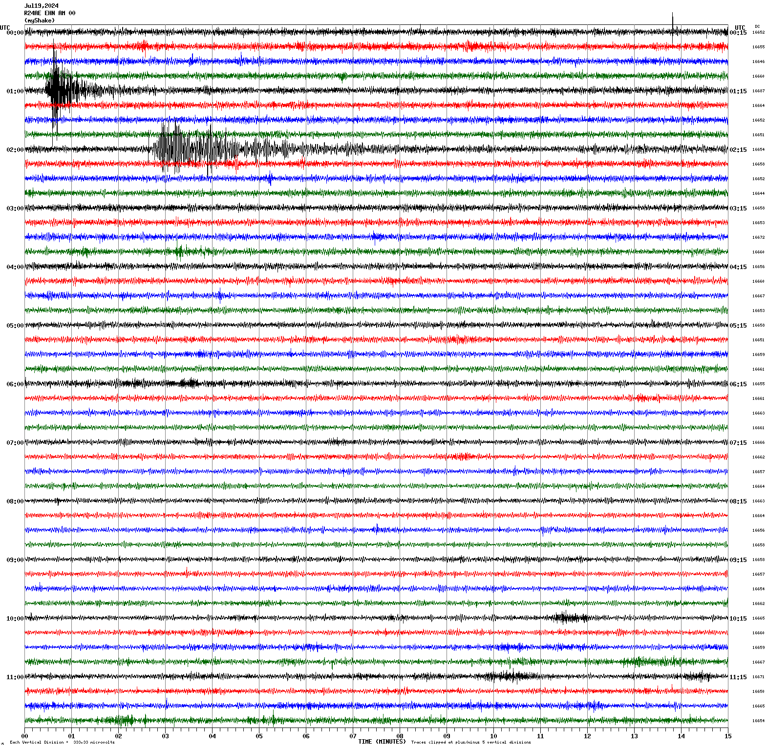
Magnitude 3.4
Depth 4.5 mi
16 mi NE of Morgan Hill, CA
37.312°N 121.490°W
July 19, 2024 01:00:15 UTC
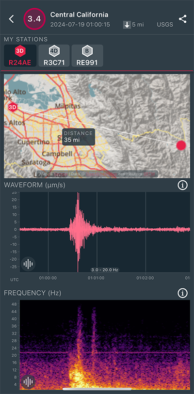
|
North/South Sensor
|
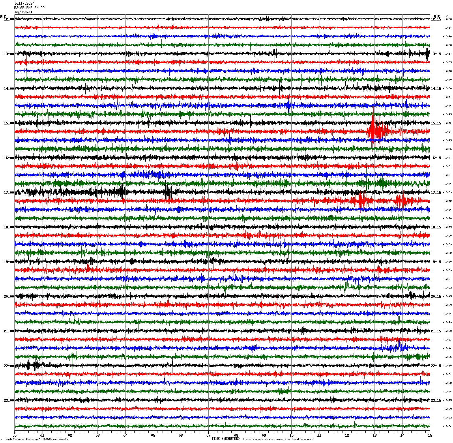
Magnitude 3.3
Depth 1.5 mi
6 mi ESE of Gilroy, CA
36.981°N 121.464°W
July 17, 2024 15:27:28 UTC
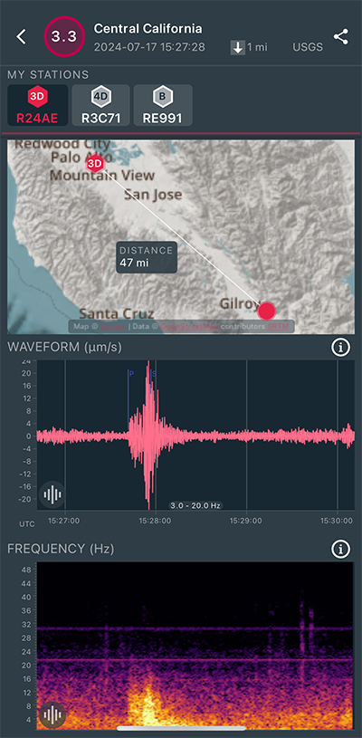
|
East/West Sensor
|
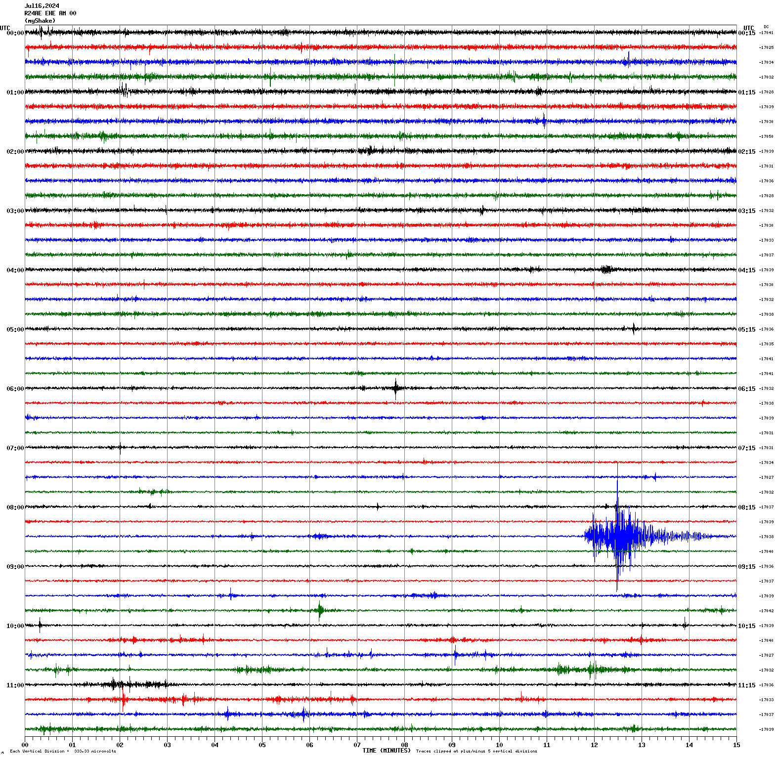
Magnitude 3.2
Depth 1.2 mi
6 mi ESE of Gilroy, CA
36.981°N 121.465°W
July 16, 2024 08:41:33 UTC
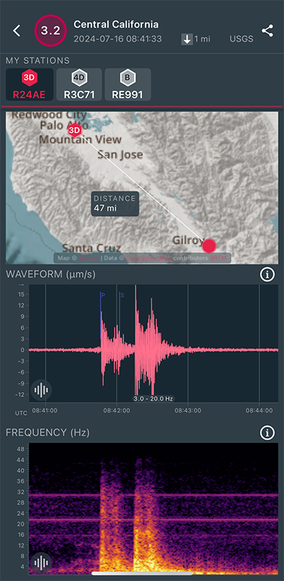
|
East/West Sensor
|
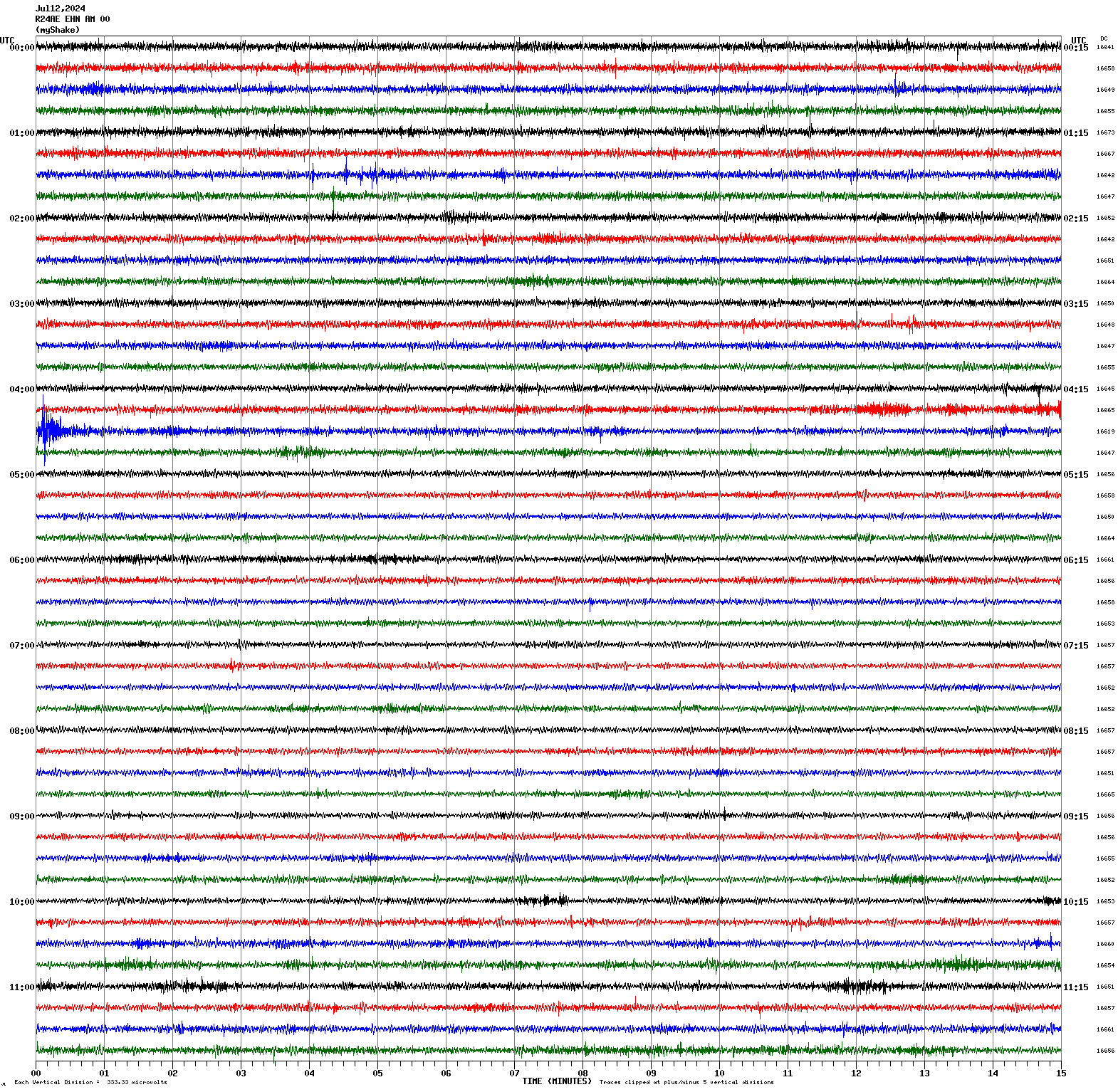
Magnitude 3.1
Depth 11.1 mi
5 mi SW of Brentwood, CA
37.866°N 121.771°W
July 12, 2024 04:29:46 UTC
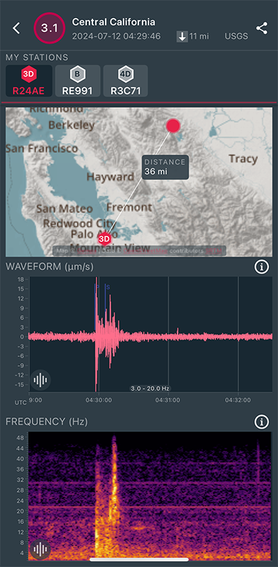
|
North/South Sensor
|
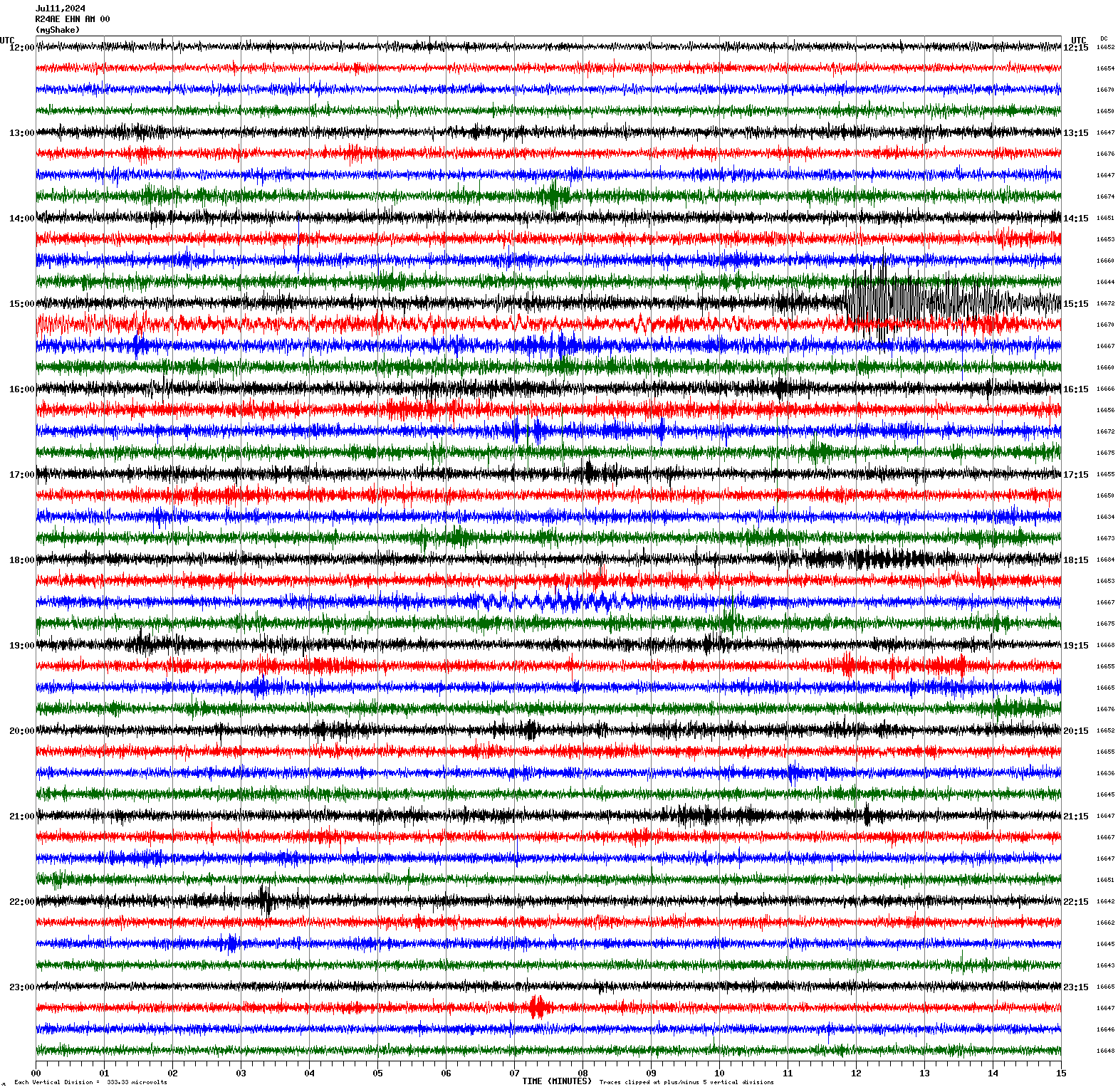
Magnitude 6.4
Depth 6.2 mi
130 mi WSW of Tofino, Canada
48.813°N 128.725°W
July 11, 2024 15:08:47 UTC
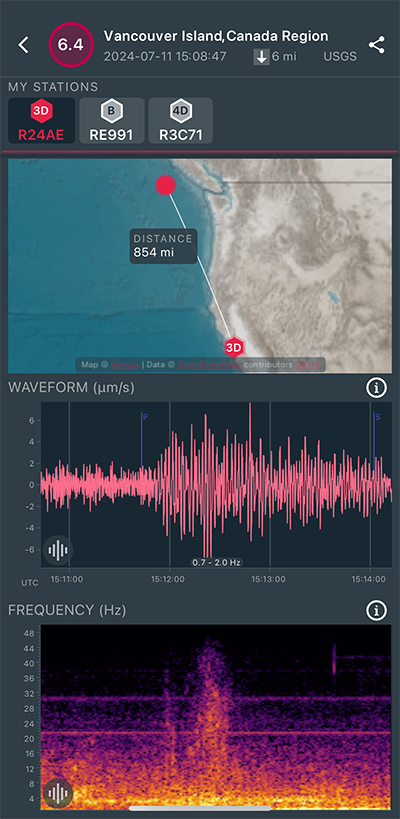
|
North/South Sensor
|
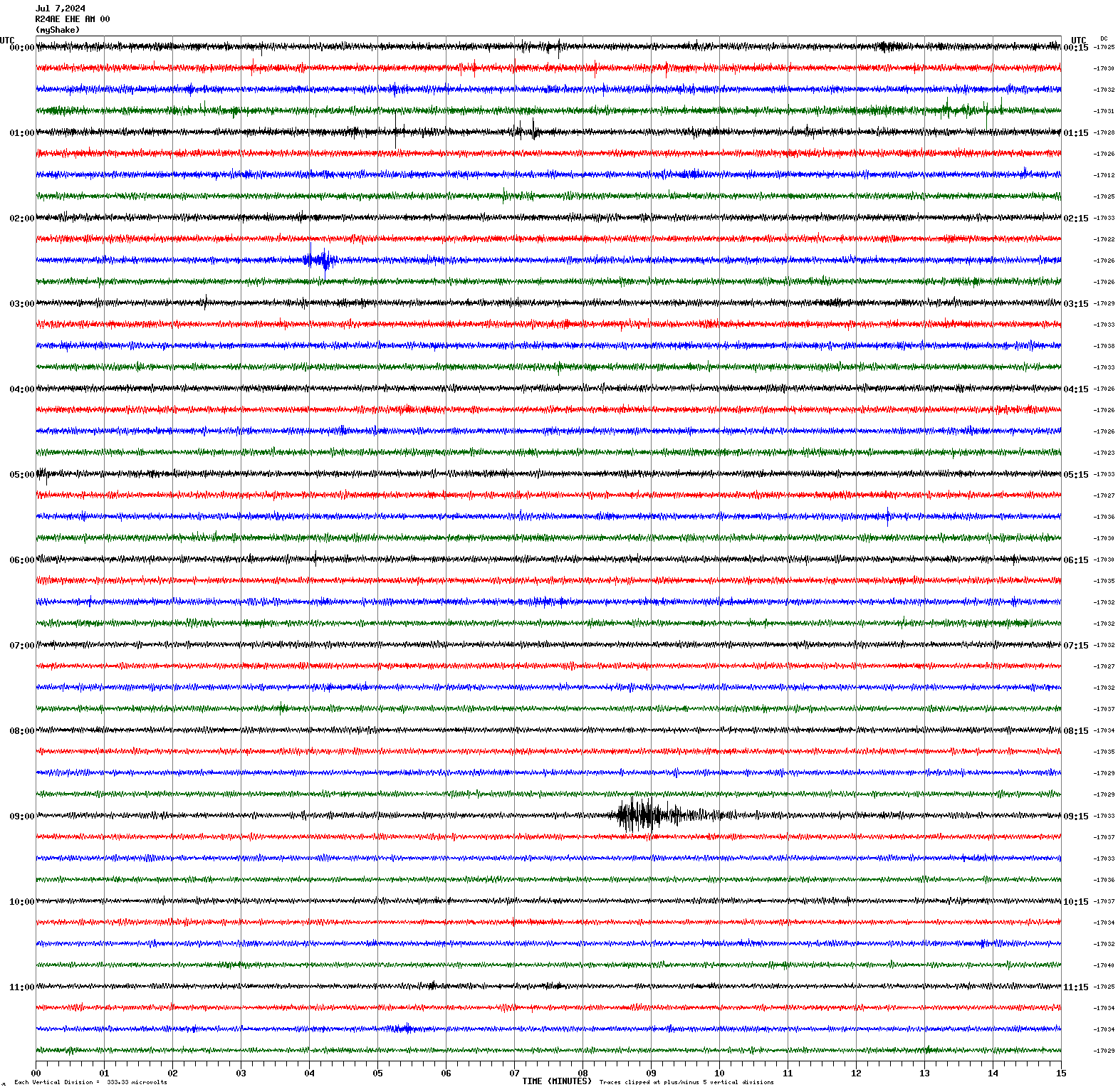
Magnitude 3.1
Depth 3.2 mi
4 mi WSW of Hollister, CA
36.825°N 121.459°W
July 7, 2024 09:08:02 UTC
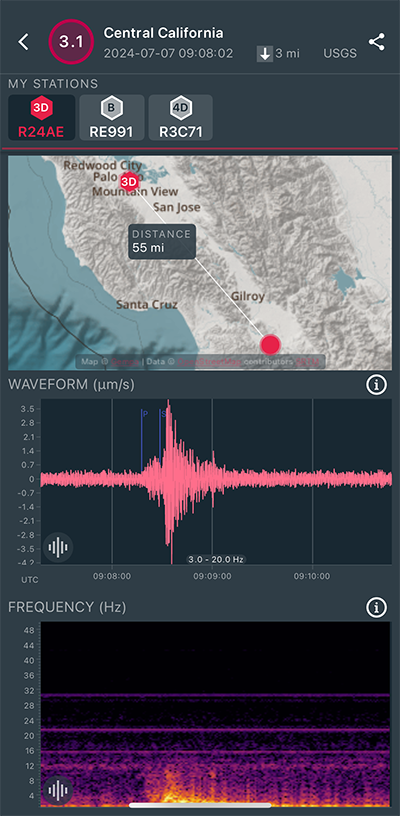
|
East/West Sensor
|
Magnitude 3.8
Depth 3.6 mi
20 mi SSW of Hawthorne, Nevada
38.259°N 118.790°W
July 6, 2024 11:14:53 UTC
|
North/South Sensor
|
Magnitude 3.4
Depth 5.1 mi
1 mi NW of Pinnacles, CA
36.539°N 121.159°W
July 4, 2024 01:20:06 UTC
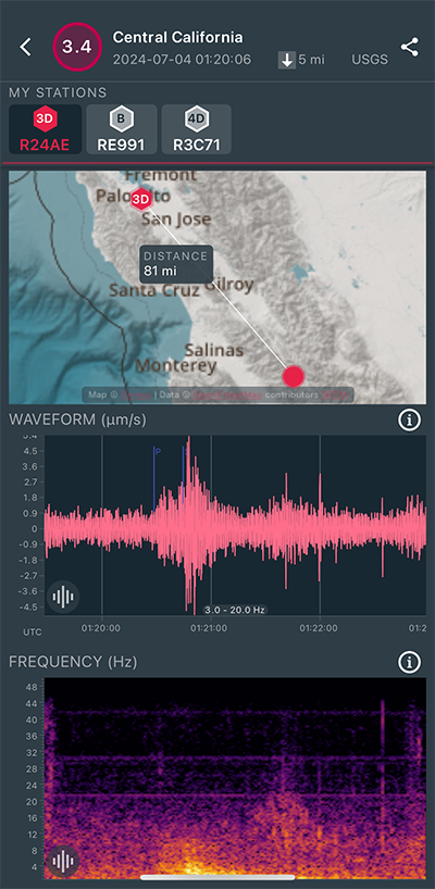
|
North/South Sensor
|
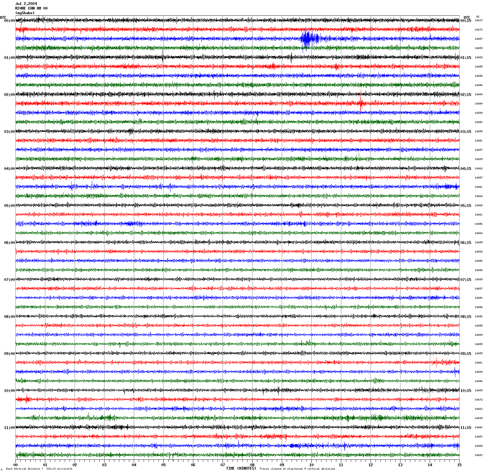
Magnitude 2.8
Depth 3.5 mi
10 mi E of Seven Trees, CA
37.290°N 121.662°W
July 2, 2024 00:39:27 UTC
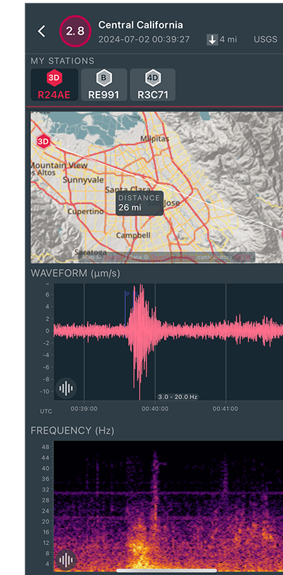
|
North/South Sensor
|
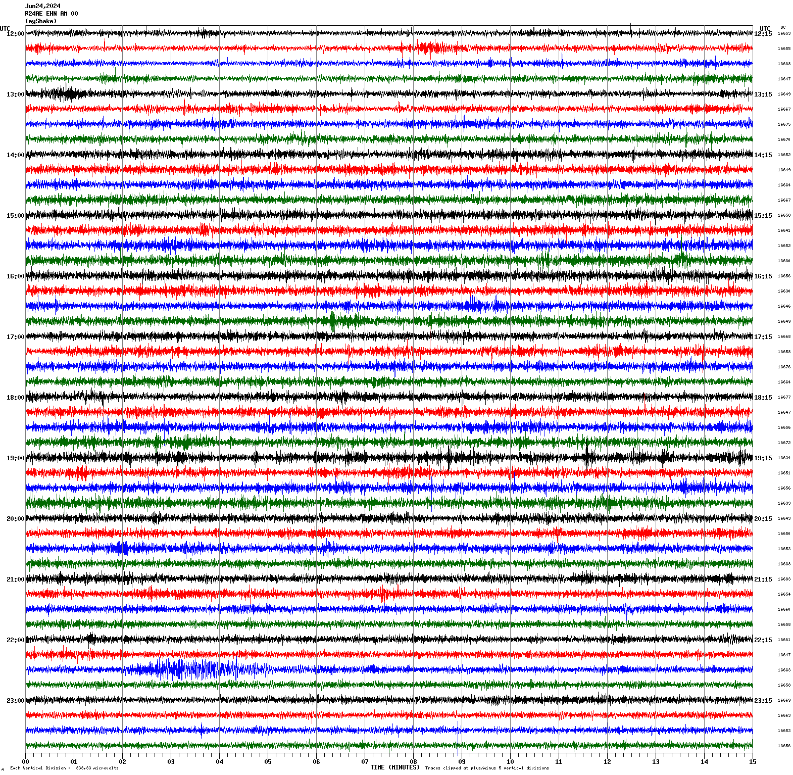
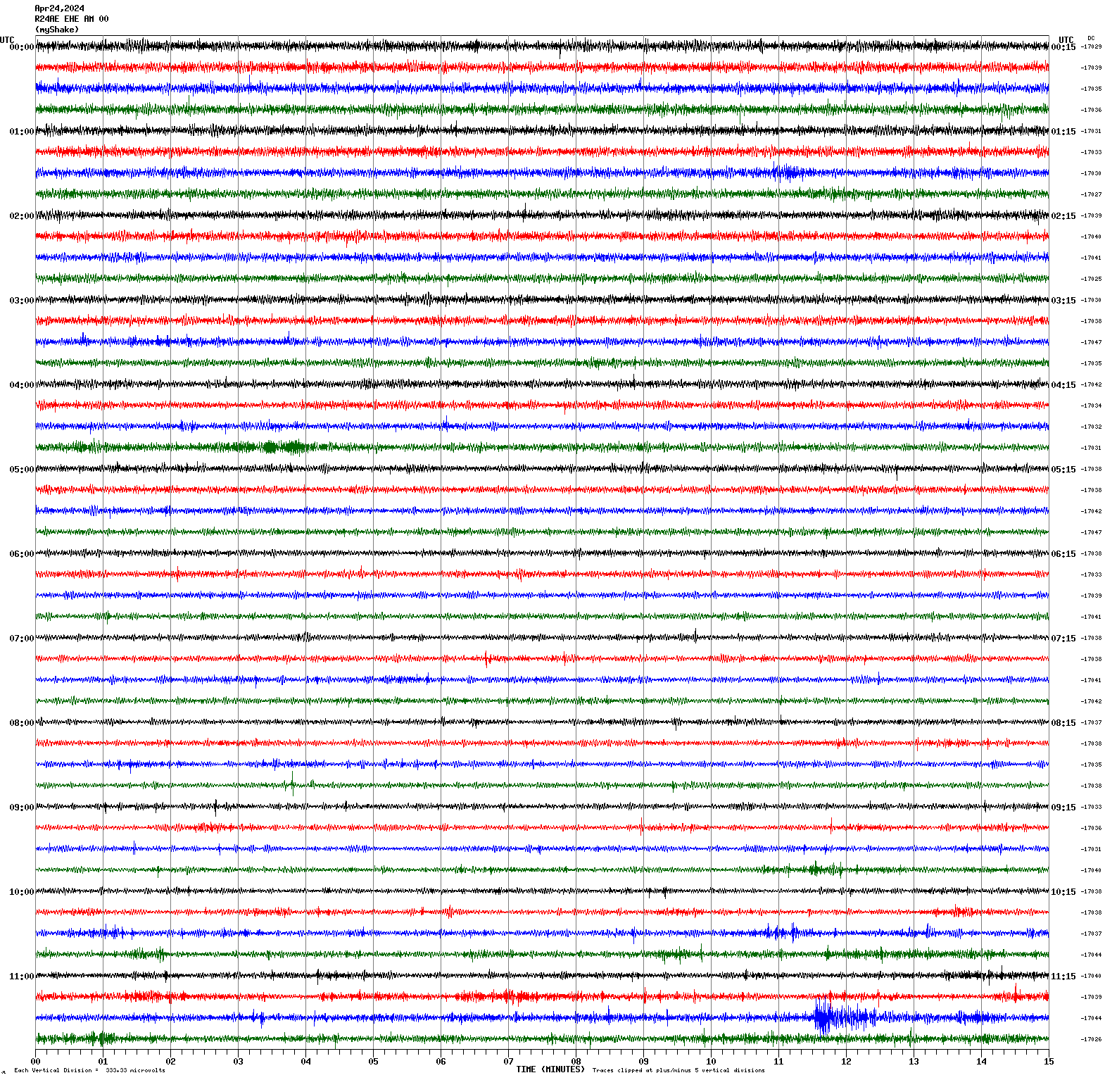
Magnitude 4.1
Depth 7.5 mi
15 mi SW of Lamont, CA
35.113°N 119.112°W
June 24, 2024 22:30:59 UTC
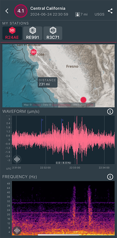
|
North/South Sensor
|
Magnitude 4.5
Depth 2.1 mi
3 mi WSW of Laytonville, CA
39.668°N 123.533°W
June 22, 2024 03:46:25 UTC
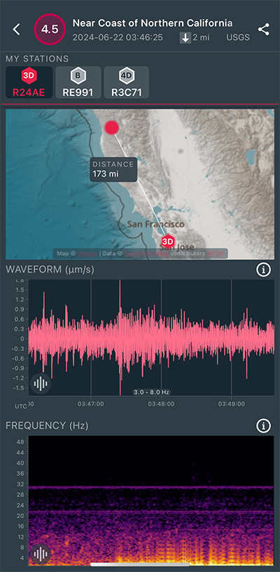
|
North/South Sensor
|
Magnitude 3.1
Depth 2.5 mi
9 mi NNE of Morgan Hill, CA
37.257°N 121.637°W
June 16, 2024 06:29:21 UTC
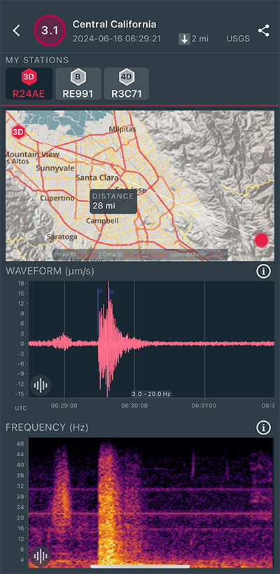
|
North/South Sensor
|
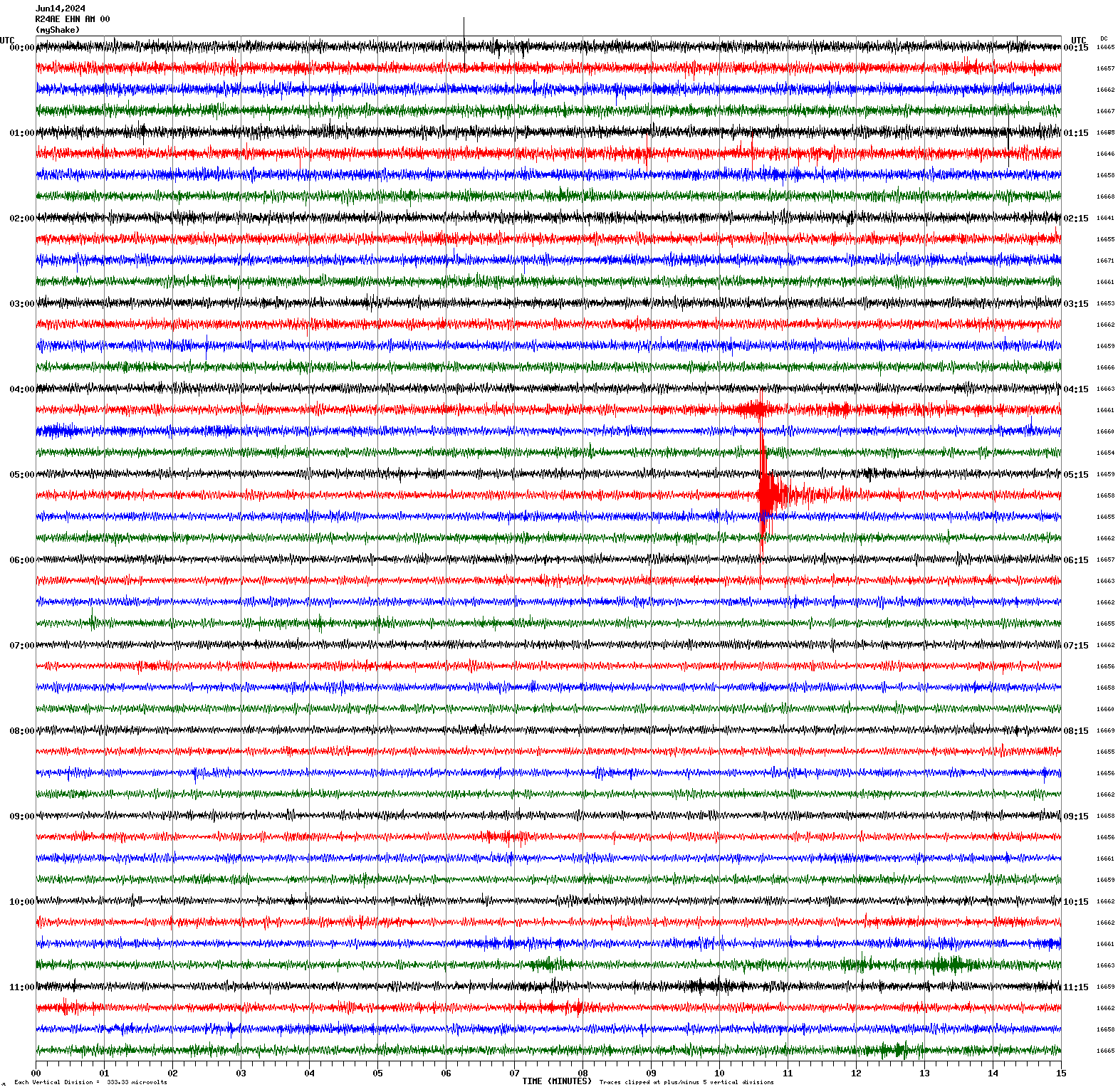
Magnitude 2.9
Depth 3.2 mi
7 mi ENE of Milpitas, CA
37.481°N 121.807°W
June 14, 2024 09:25:26 UTC
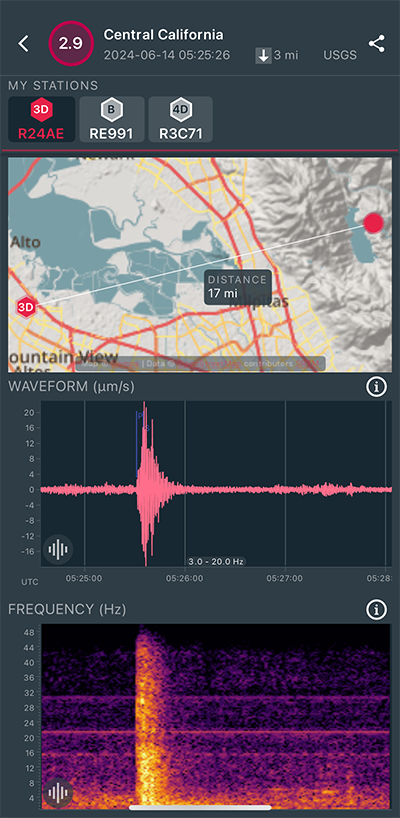
|
North/South Sensor
|
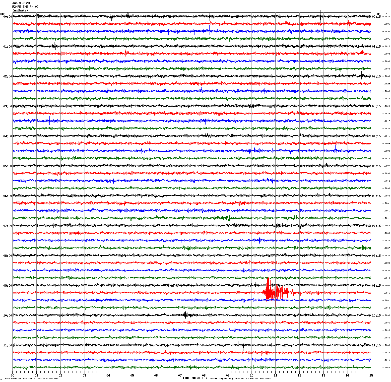
Magnitude 3.2
Depth 2.7 mi
4 mi SW of Gilroy, CA
36.966°N 121.613°W
June 9, 2024 09:25:14 UTC
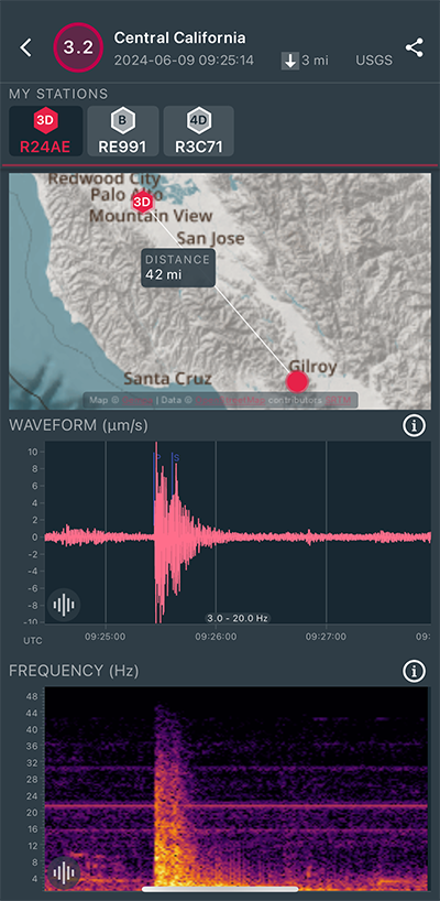
|
East/West Sensor
|
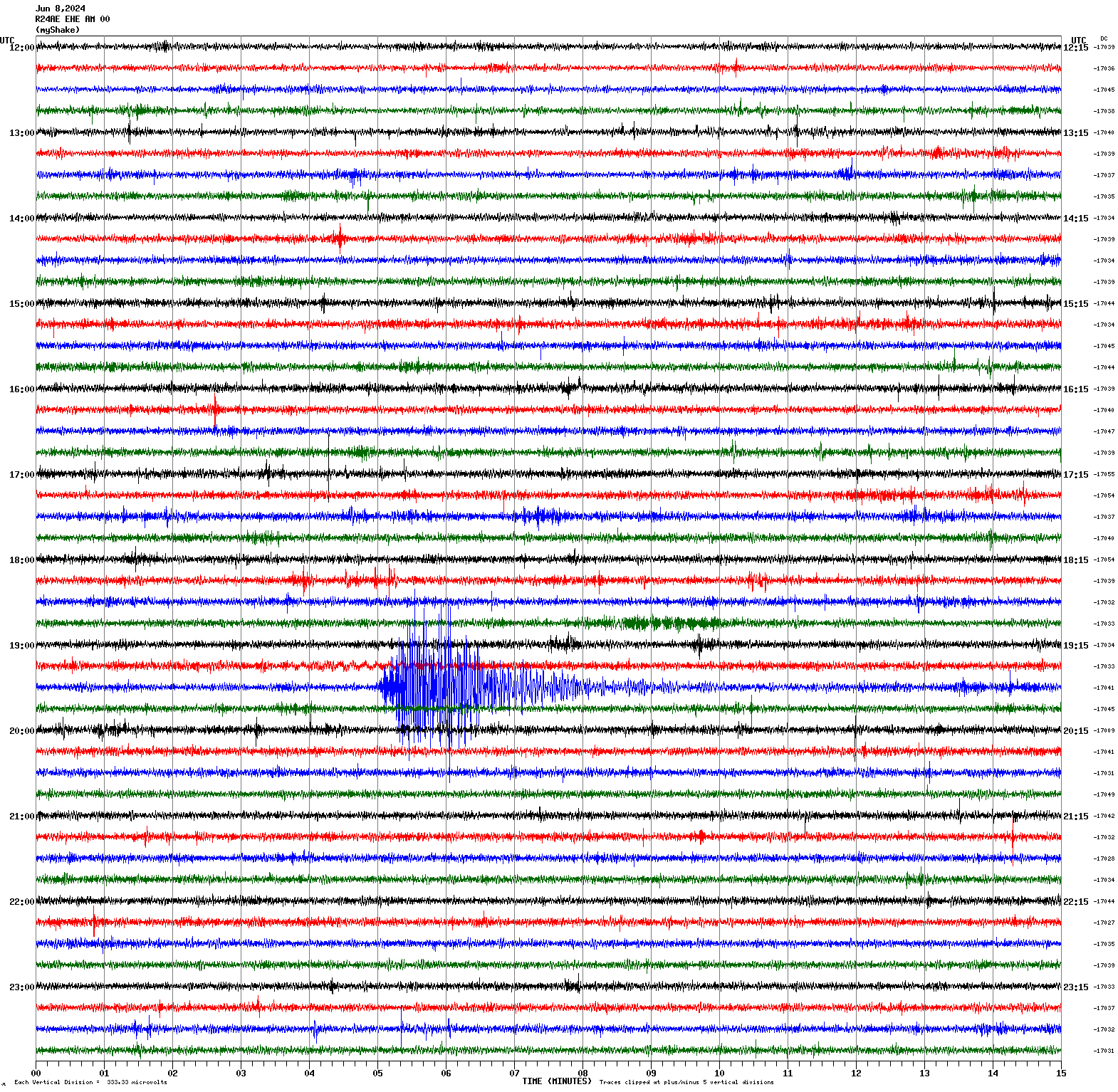
Magnitude 4.5
Depth 2.2 mi
4 mi NW of The Geysers, CA
38.814°N 122.822°W
June 8, 2024 19:34:29 UTC
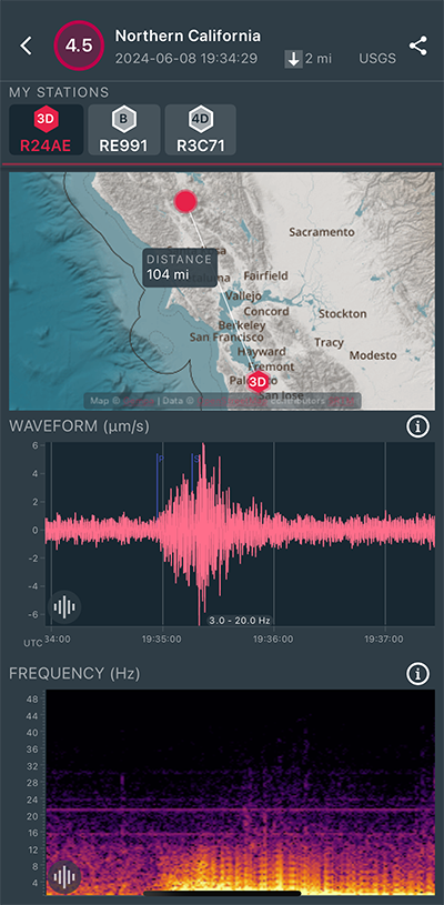
|
East/West Sensor
|
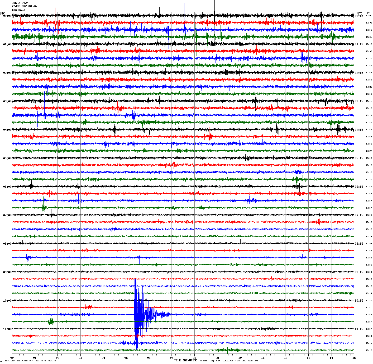
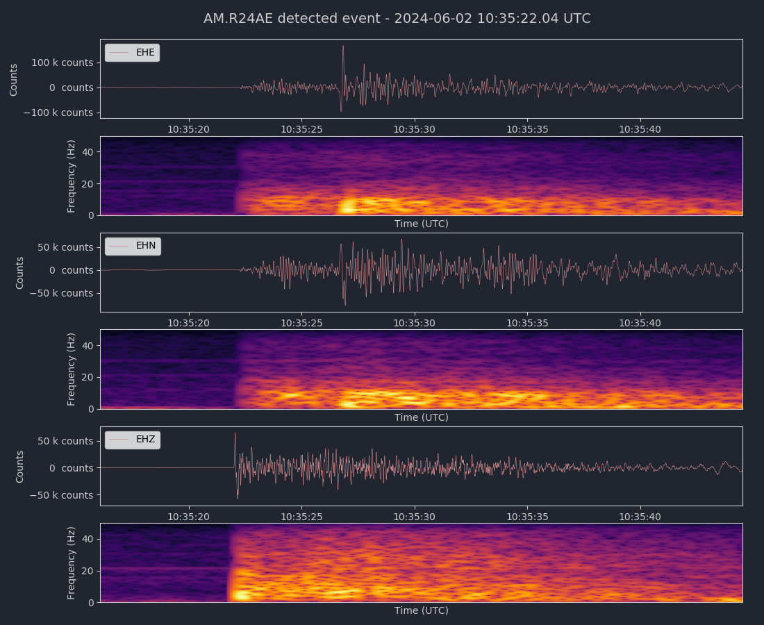
Magnitude 3.4
Depth 5.1 mi
5 mi NE of Alum Rock, CA
37.428°N 121.772°W
June 2, 2024 10:35:16 UTC
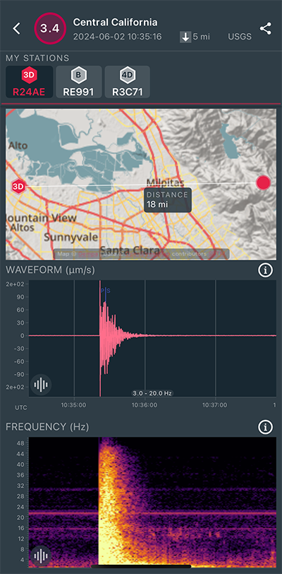
|
Vertical Sensor
|
|
Voltage Counts & Frequency for All Sensors (Magnitude 3.4 Earthquake)
|
Magnitude 6.4
Depth 46.9 mi
11 mi WSW of Brisas Barra de Suchiate, Mexico
14.452°N 92.363°W
May 12, 2024 11:39:14 UTC
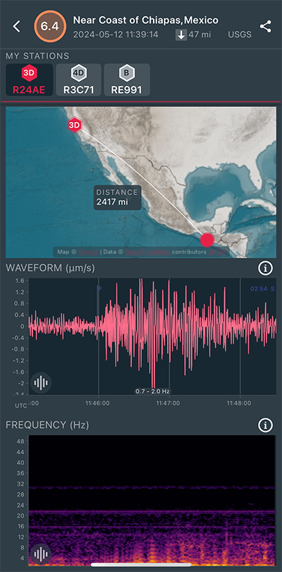
|
East/West Sensor
|
Magnitude 2.9
Depth 2.3 mi
10 mi E of Seven Trees, CA
37.287°N 121.662°W
April 24, 2024 11:41:18 UTC
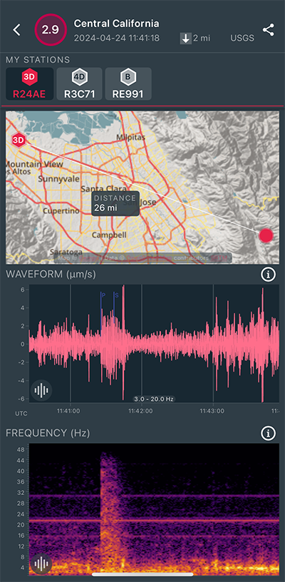
|
East/West Sensor
|
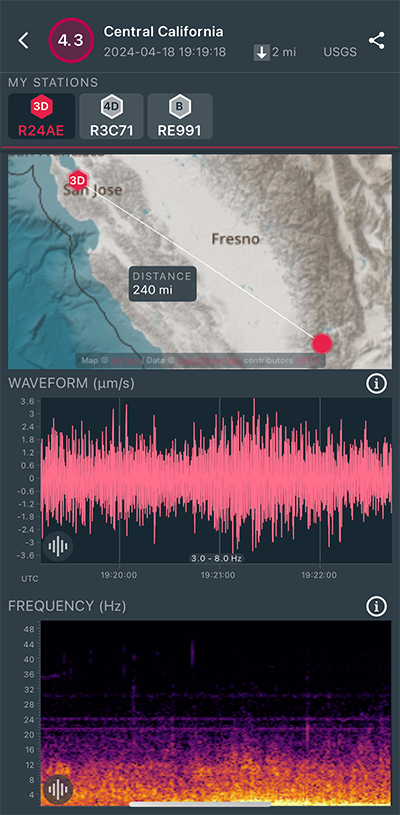
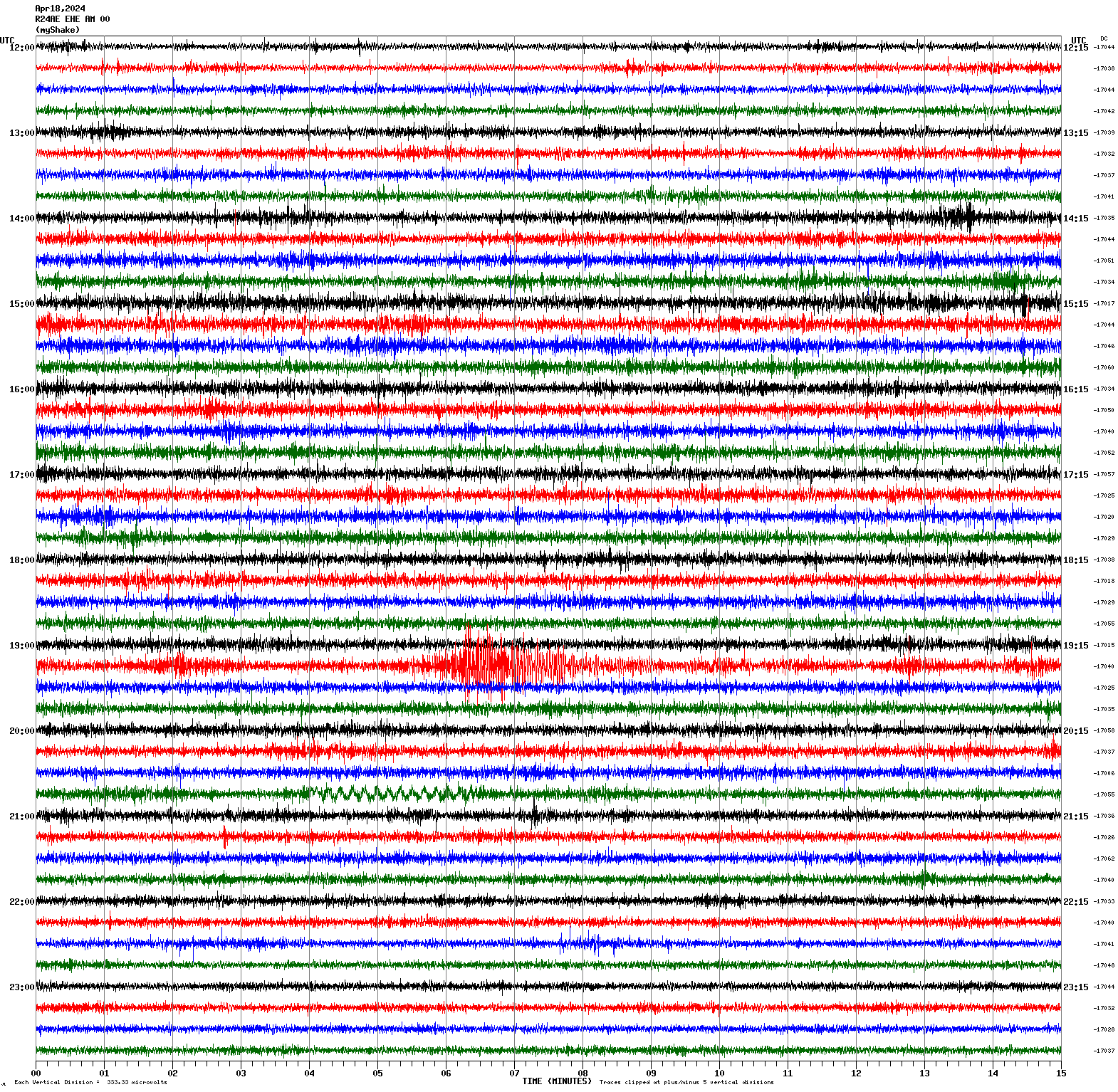
Magnitude 4.3
Depth 2.0 mi
7 mi S of Bodfish, CA
35.493°N 118.513°W
April 18, 2024 19:19:18 UTC
|
East/West Sensor
|
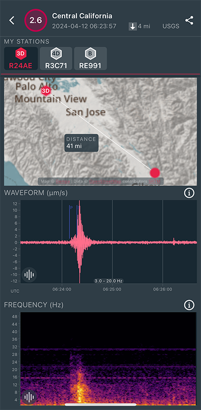
Magnitude 2.6
Depth 3.6 mi
5 mi NE of Gilroy, CA
37.066°N 121.511°W
April 12, 2024 06:23:57 UTC
|
East/West Sensor
|
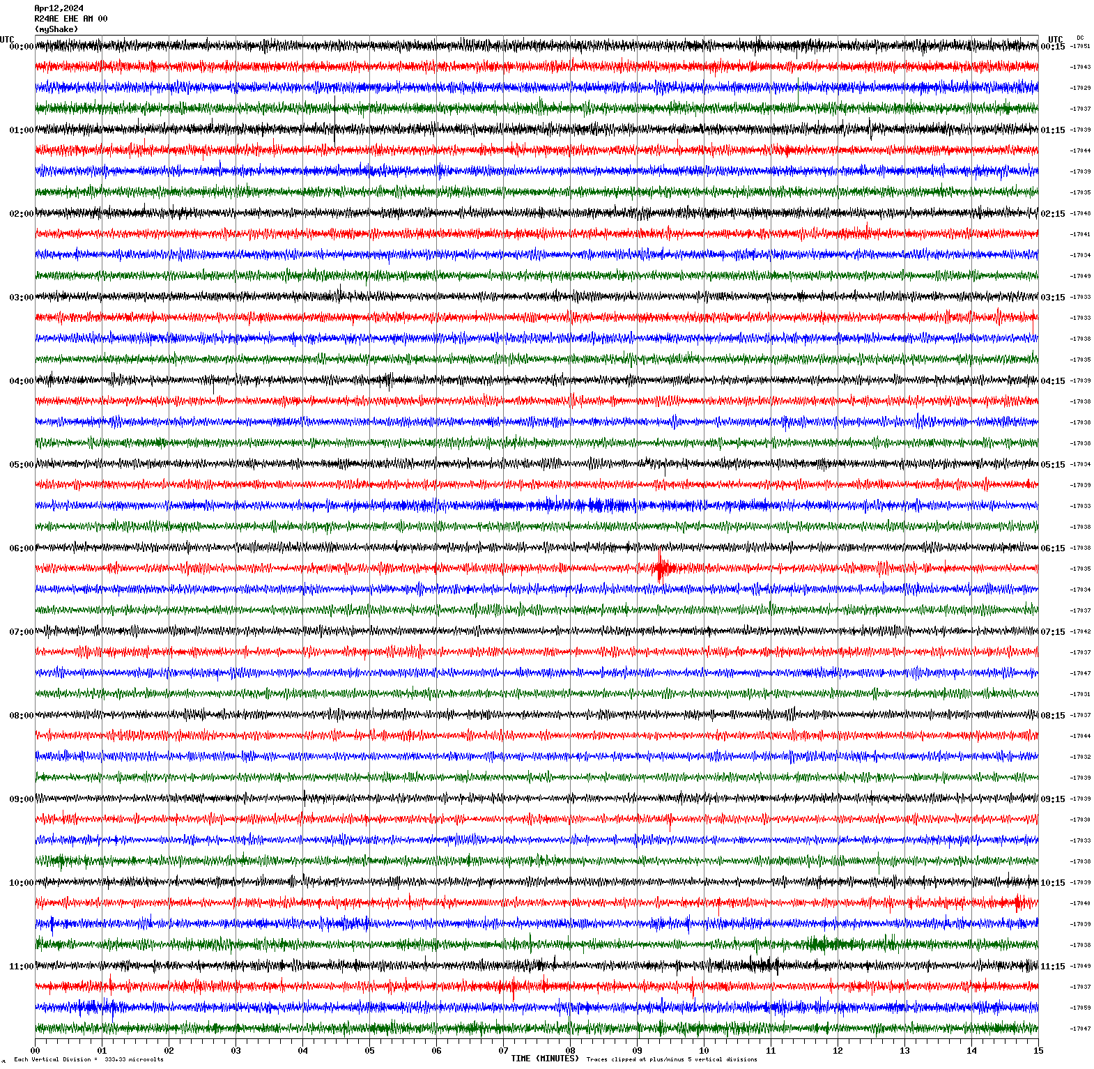
Magnitude 3.0
Depth 3.8 mi
9 mi N of Morgan Hill, CA
37.263°N 121.637°W
April 10, 2024 08:09:36 UTC
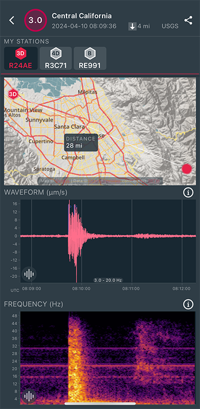
|
East/West Sensor
|
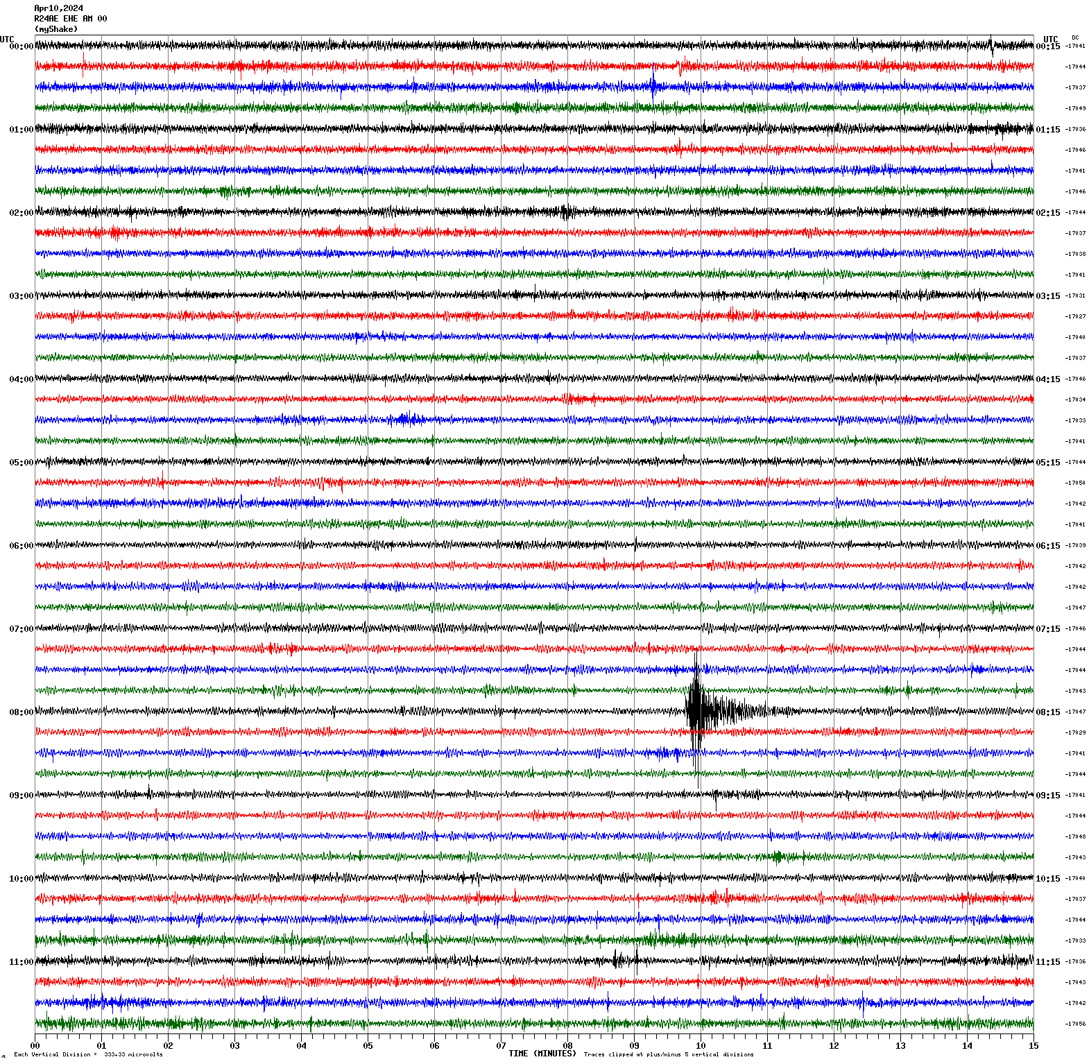
Magnitude 3.2
Depth 5.5 mi
2 mi ESE of Berkeley, CA
37.859°N 122.242°W
April 6, 2024 18:12:37 UTC
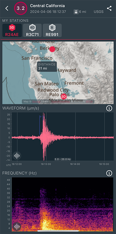
|
East/West Sensor
|
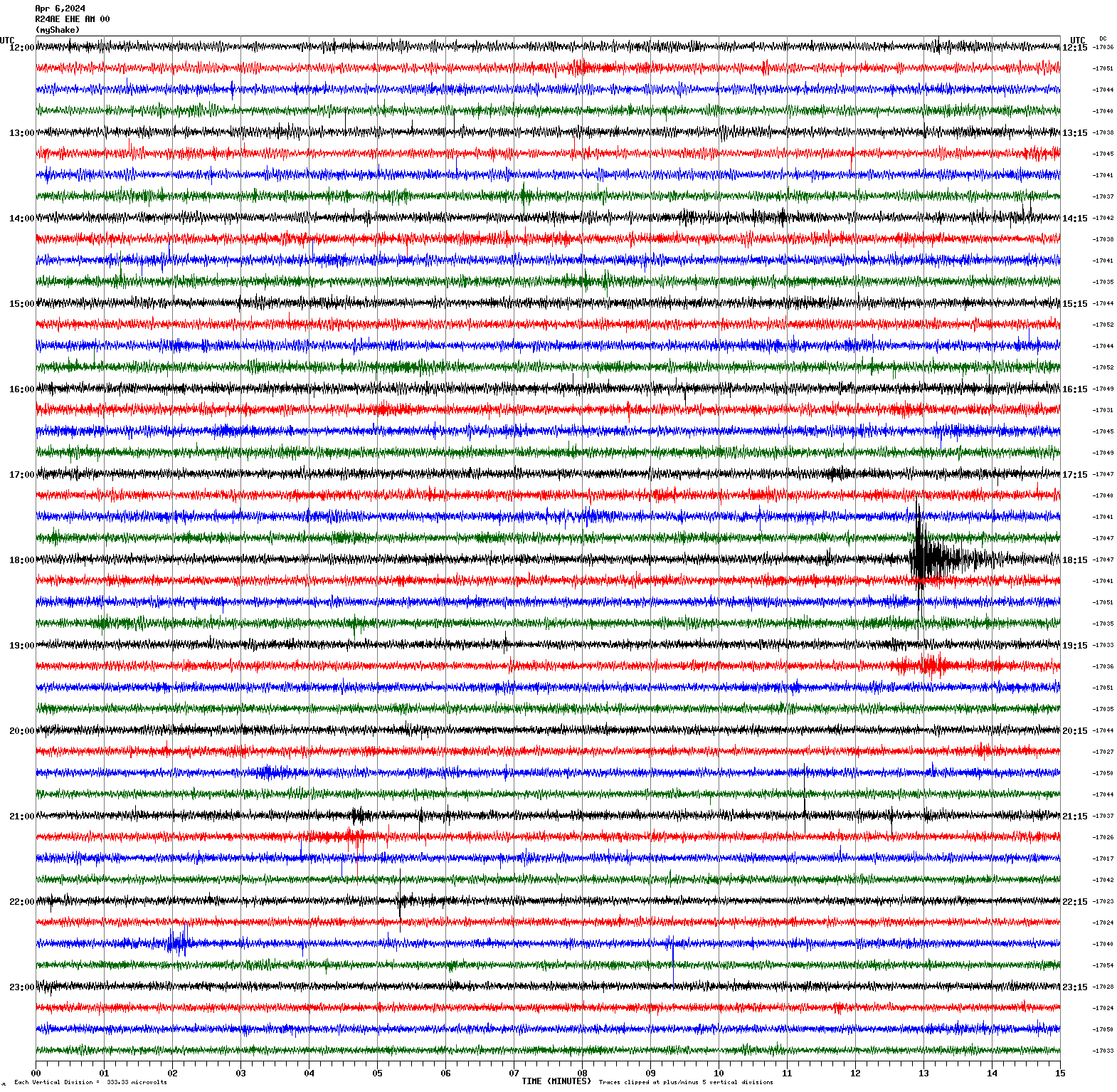
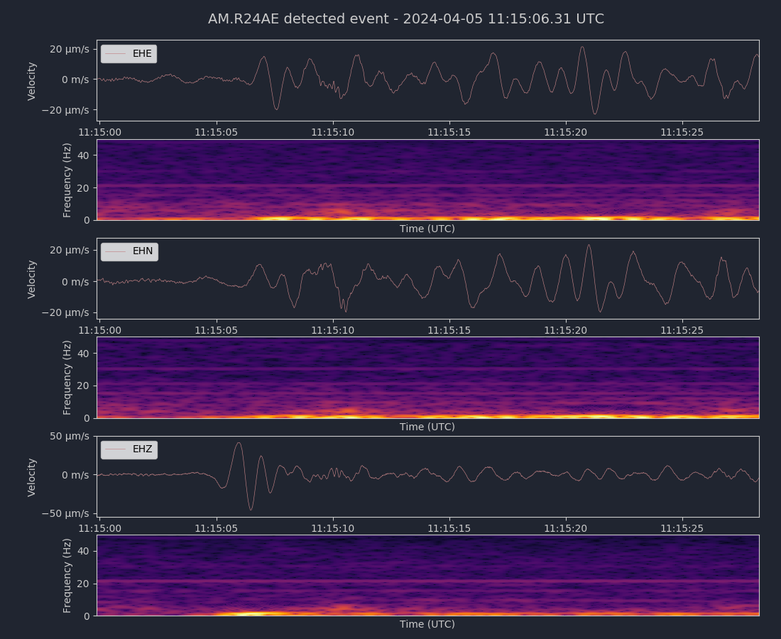
Magnitude 6.8
Depth 138.0 mi
Maug Islands region, Northern Mariana Islands
19.105°N 145.388°E
April 5, 2024 11:03:16 UTC
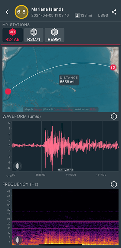
|
East/West Sensor
|
|
Voltage Counts & Frequency for All Sensors (Magnitude 6.8 Earthquake)
|
Magnitude 4.3
Depth 6.2 mi
4 mi WNW of Belden, California
40.028°N 121.314°W
April 5, 2024 01:34:49 UTC
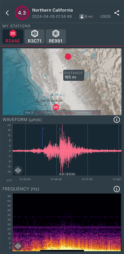
|
East/West Sensor
|
Magnitude 3.0
Depth 5.8 mi
2 mi NE of Santa Rosa, CA
38.475°N 122.668°W
April 3, 2024 03:25:38 UTC
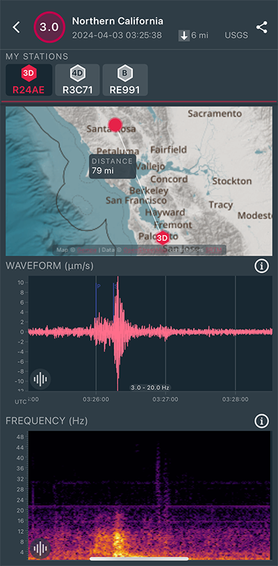
|
East/West Sensor
|
Magnitude 7.4
Depth 21.6 mi
11 mi SSW of Hualien City, Taiwan
23.819°N 121.562°E
April 2, 2024 23:58:11 UTC
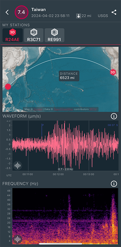
|
East/West Sensor
|
Magnitude 3.2
Depth 3.3 mi
16 mi SW of Gustine, CA
37.082°N 121.180°W
March 25, 2024 07:14:02 UTC
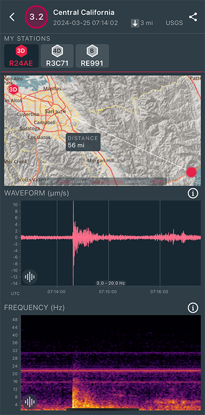
|
East/West Sensor
|
|
Voltage Counts & Frequency for All Sensors (Magnitude 3.2 Earthquake)
|
Magnitude 3.5
Depth 5.1 mi
1 mi NNE of Byron, CA
37.889°N 121.630°W
February 29, 2024 12:21:45 UTC
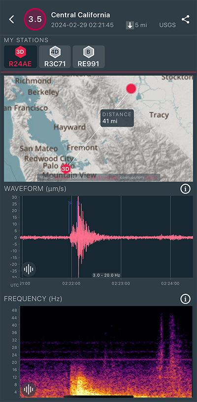
|
East/West Sensor
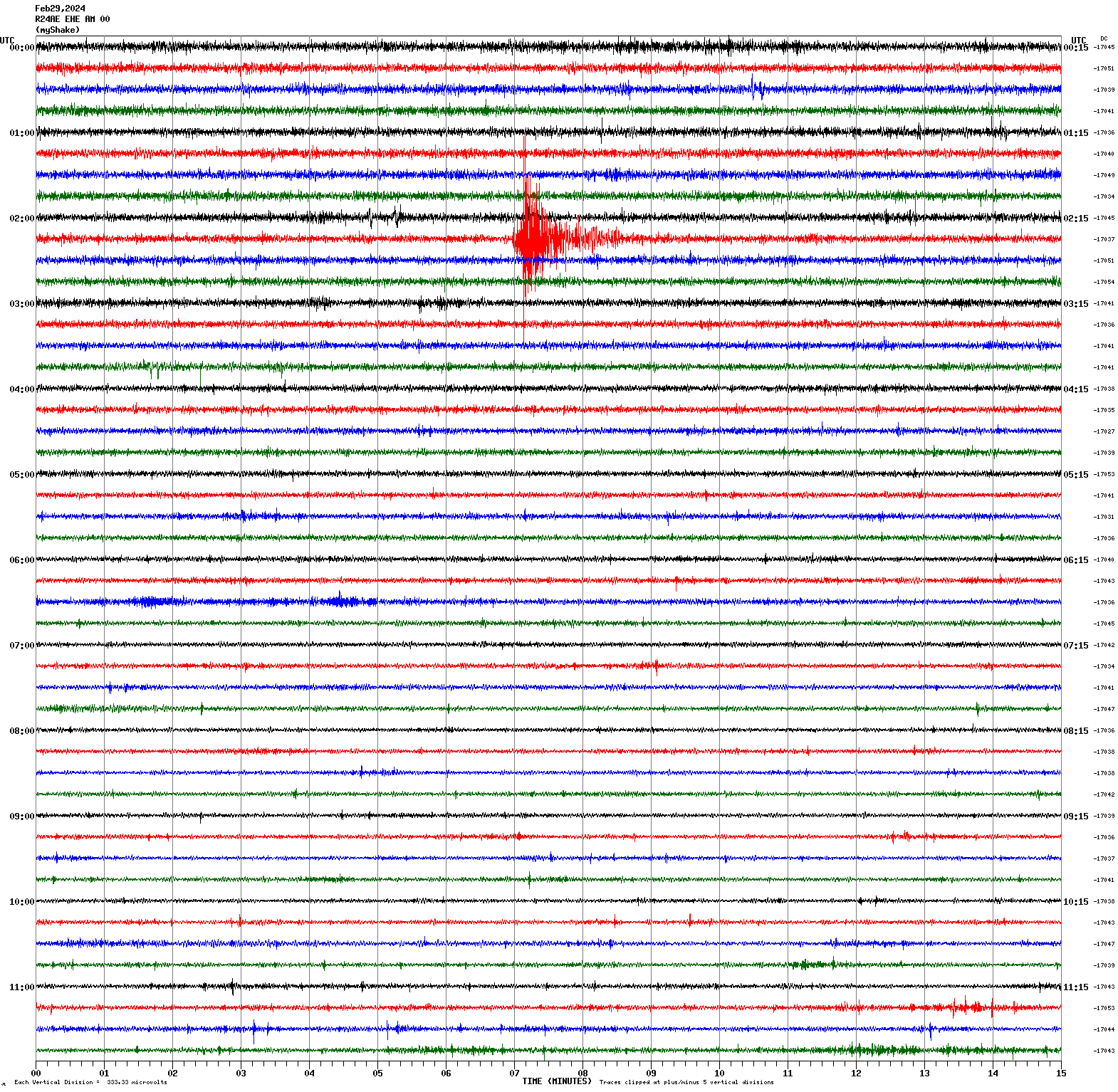
|
Magnitude 3.2
Depth 4.6 mi
4 mi E of Fremont, CA
37.534°N 121.907°W
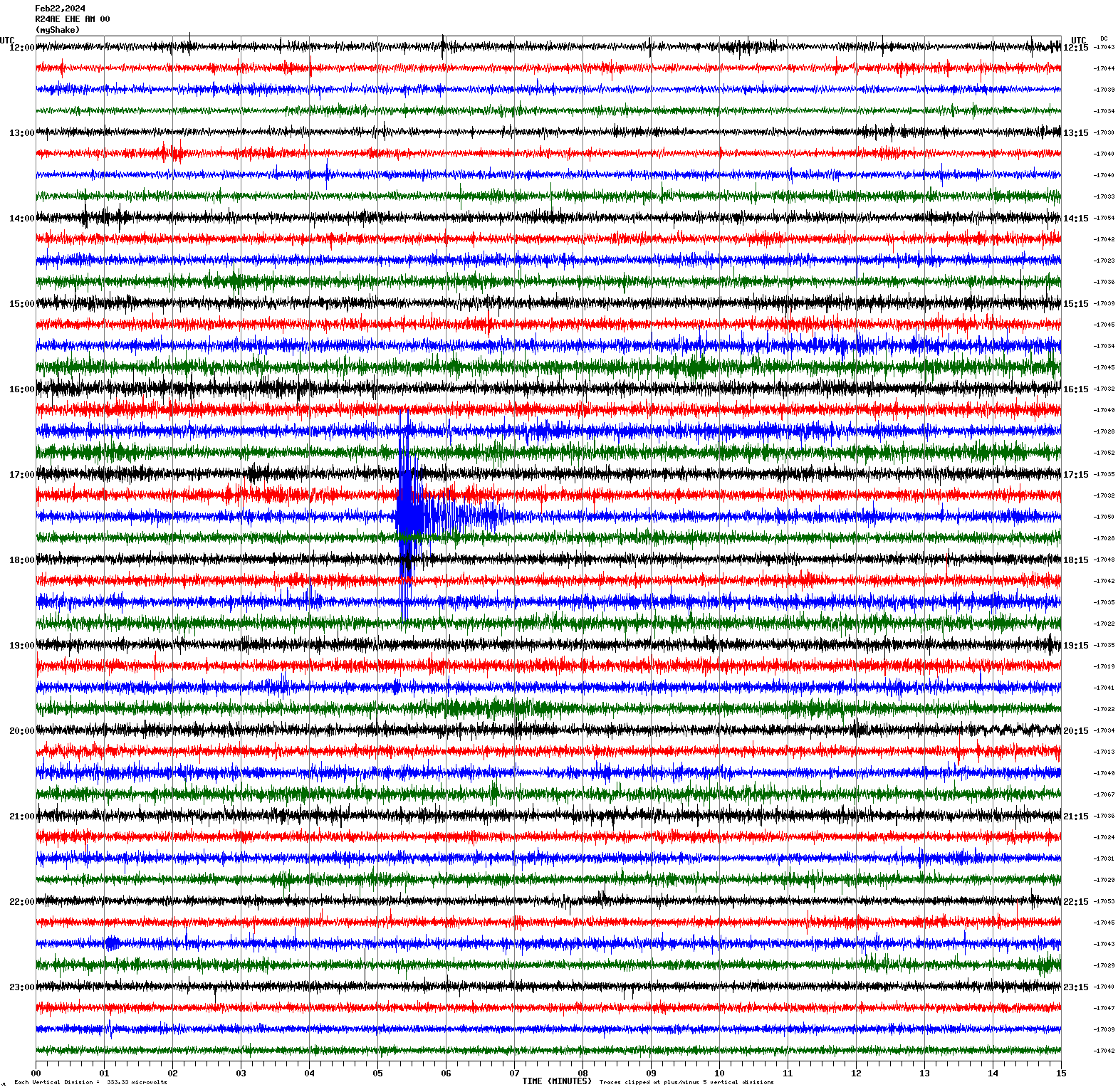
February 22, 2024 17:35:11 UTC
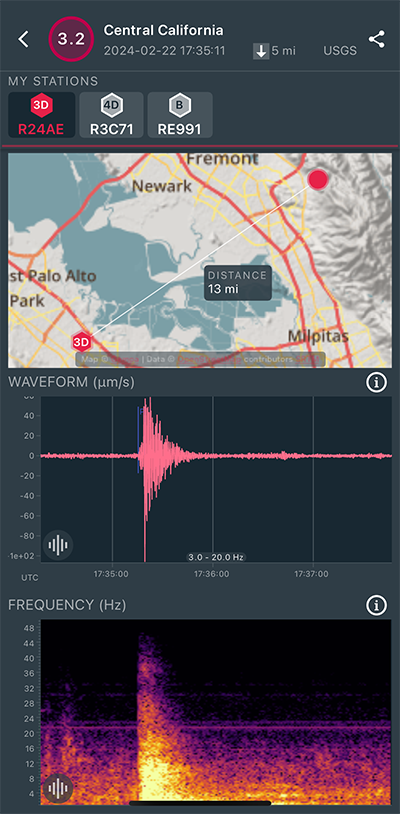
|
East/West Sensor
|
Magnitude 4.9
Depth 1.4 mi
58 mi W of Petrolia, CA
40.411°N 125.386°W
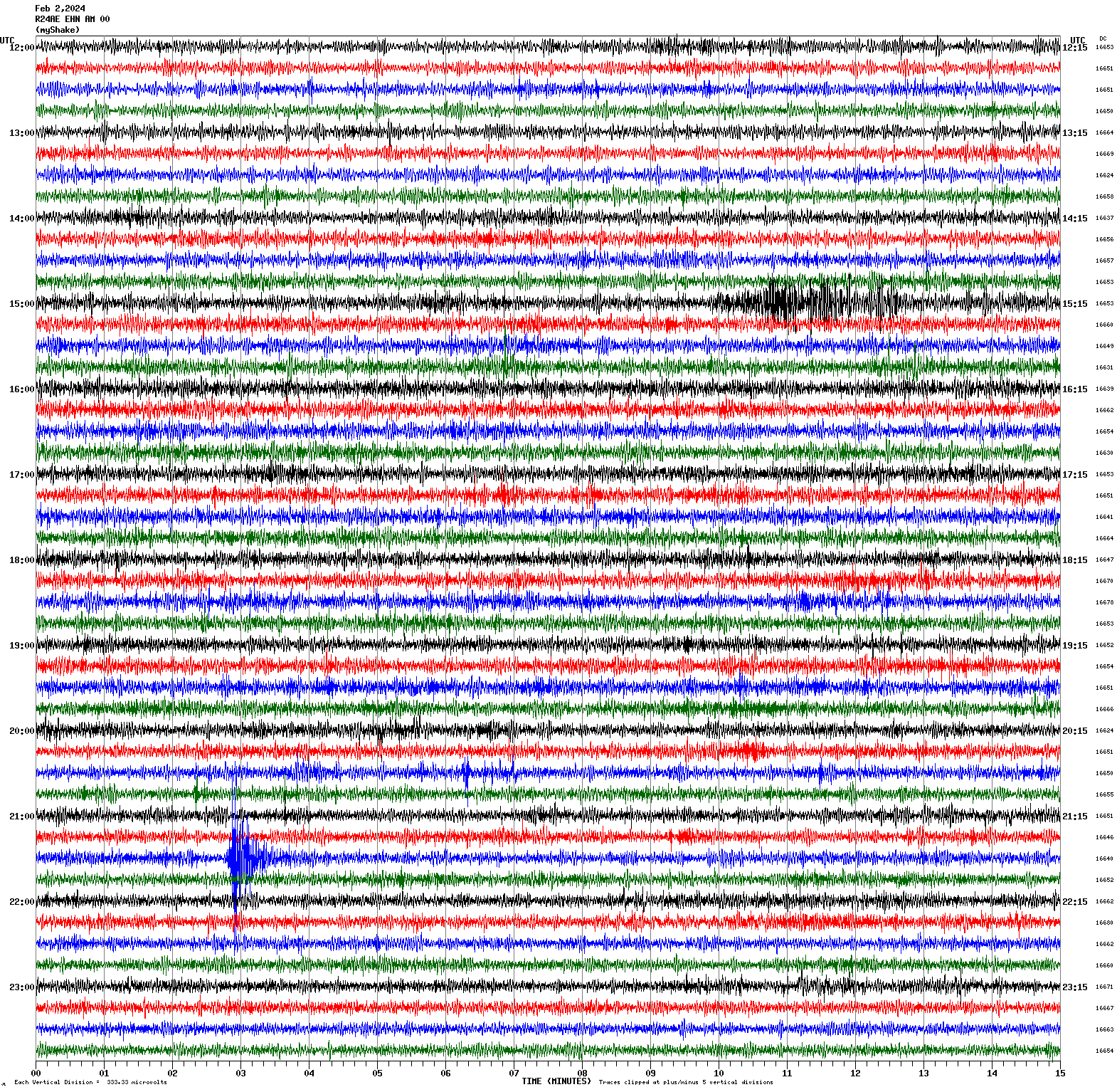
February 2, 2024 15:08:59 UTC
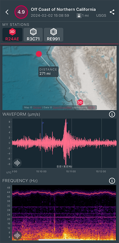
|
North/South Sensor
|
Magnitude 2.3
Depth 1.9 mi
2 mi ESE of Woodside, CA
37.419°N 122.224°W
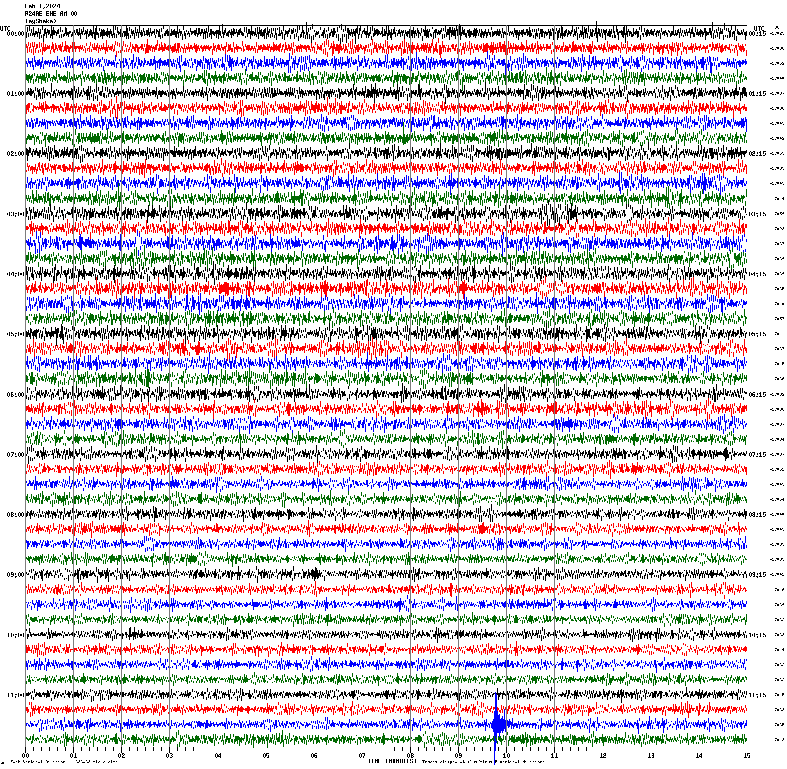
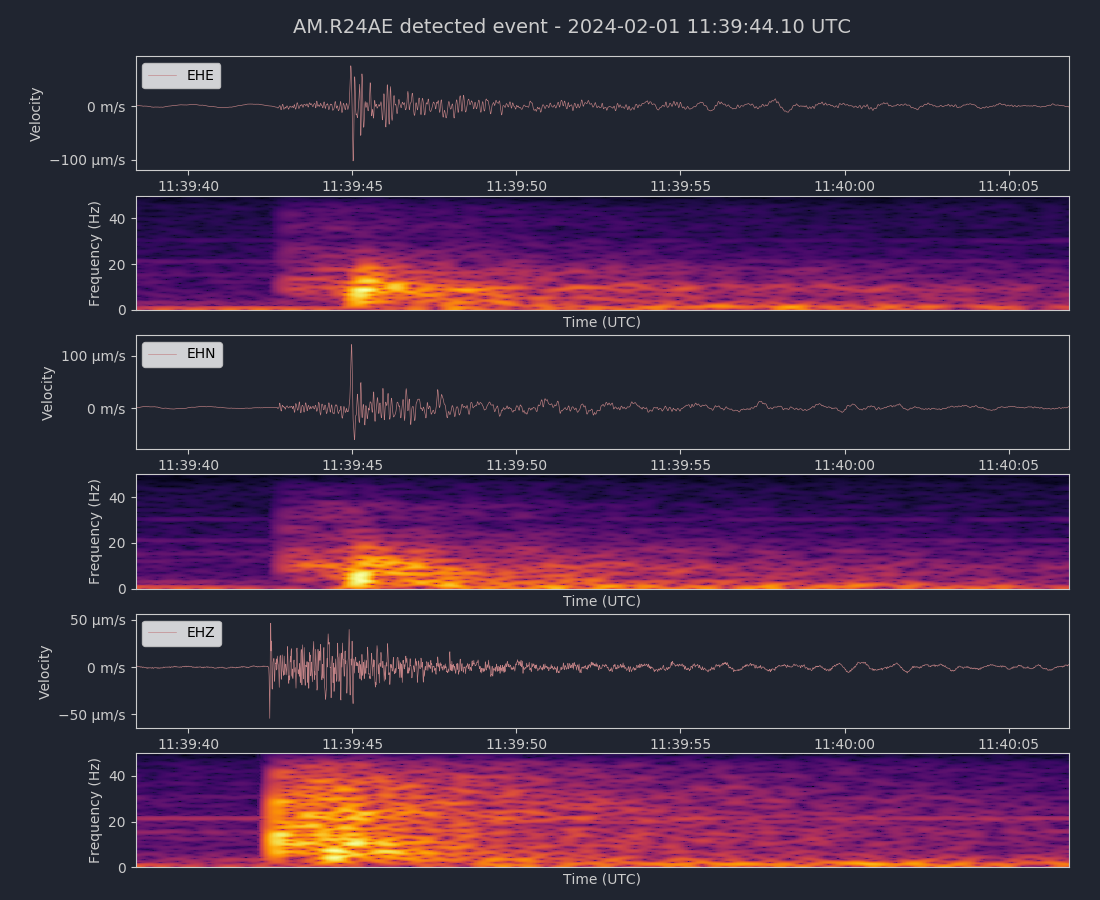
February 1, 2024 11:39:39 UTC
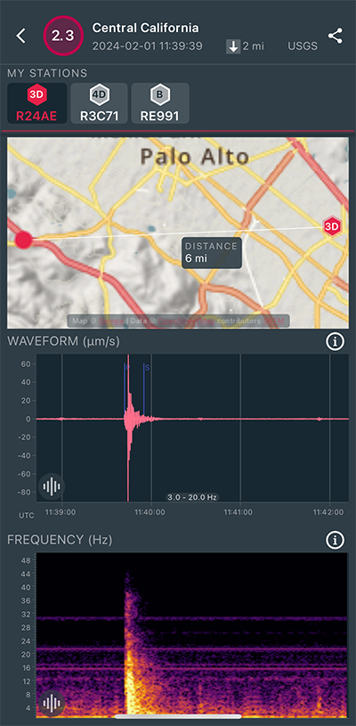
|
East/West Sensor
|
|
Voltage Counts & Frequency for All Sensors (Magnitude 2.3 Earthquake)
|
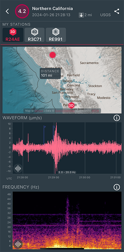
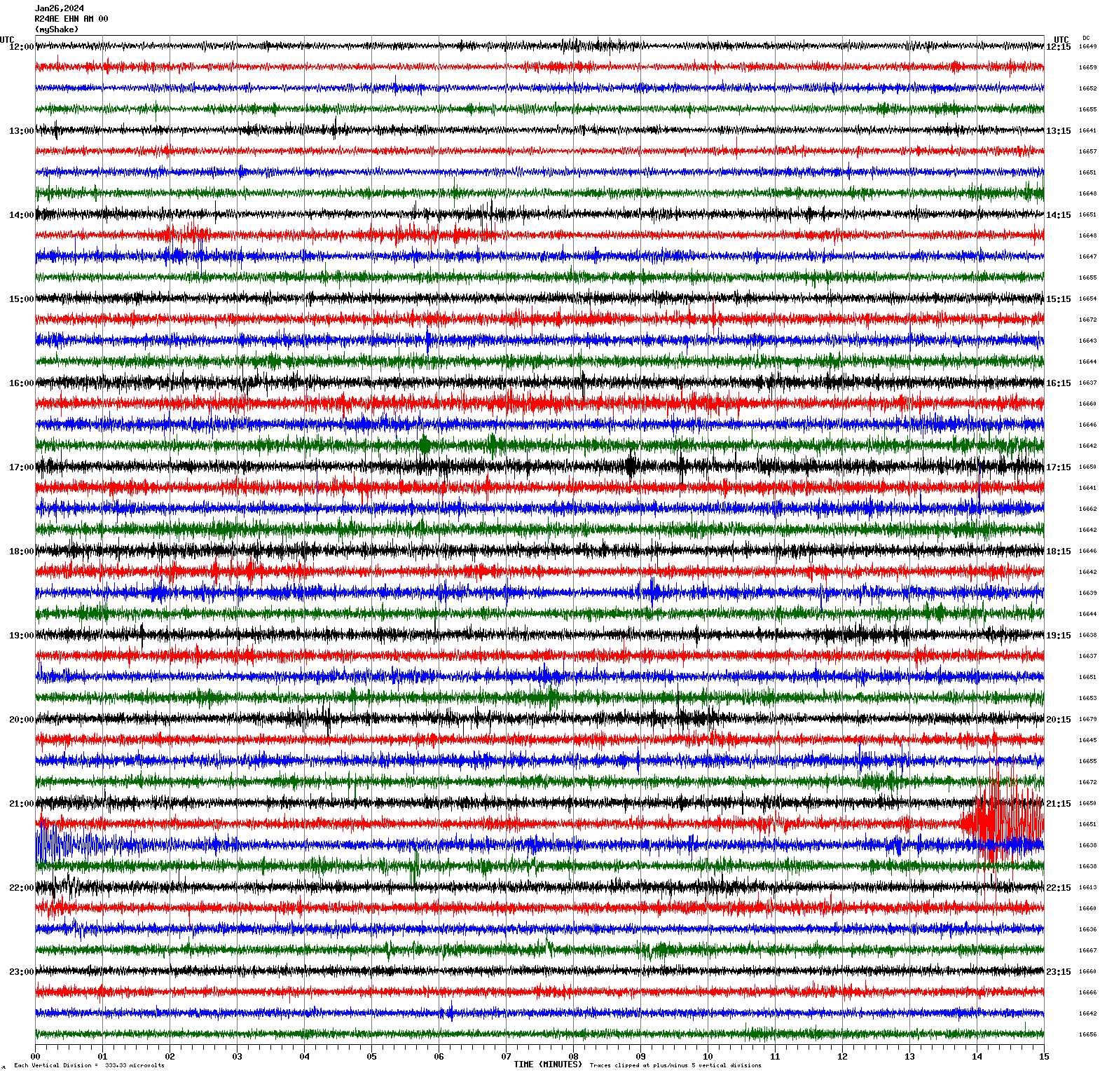
Magnitude 4.2
Depth 1.7 mi
1 mi N of The Geysers, CA
38.791°N 122.758°W
January 26, 2024 21:28:13 UTC
|
North/South Sensor
|
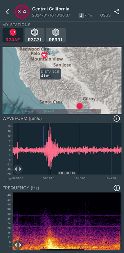
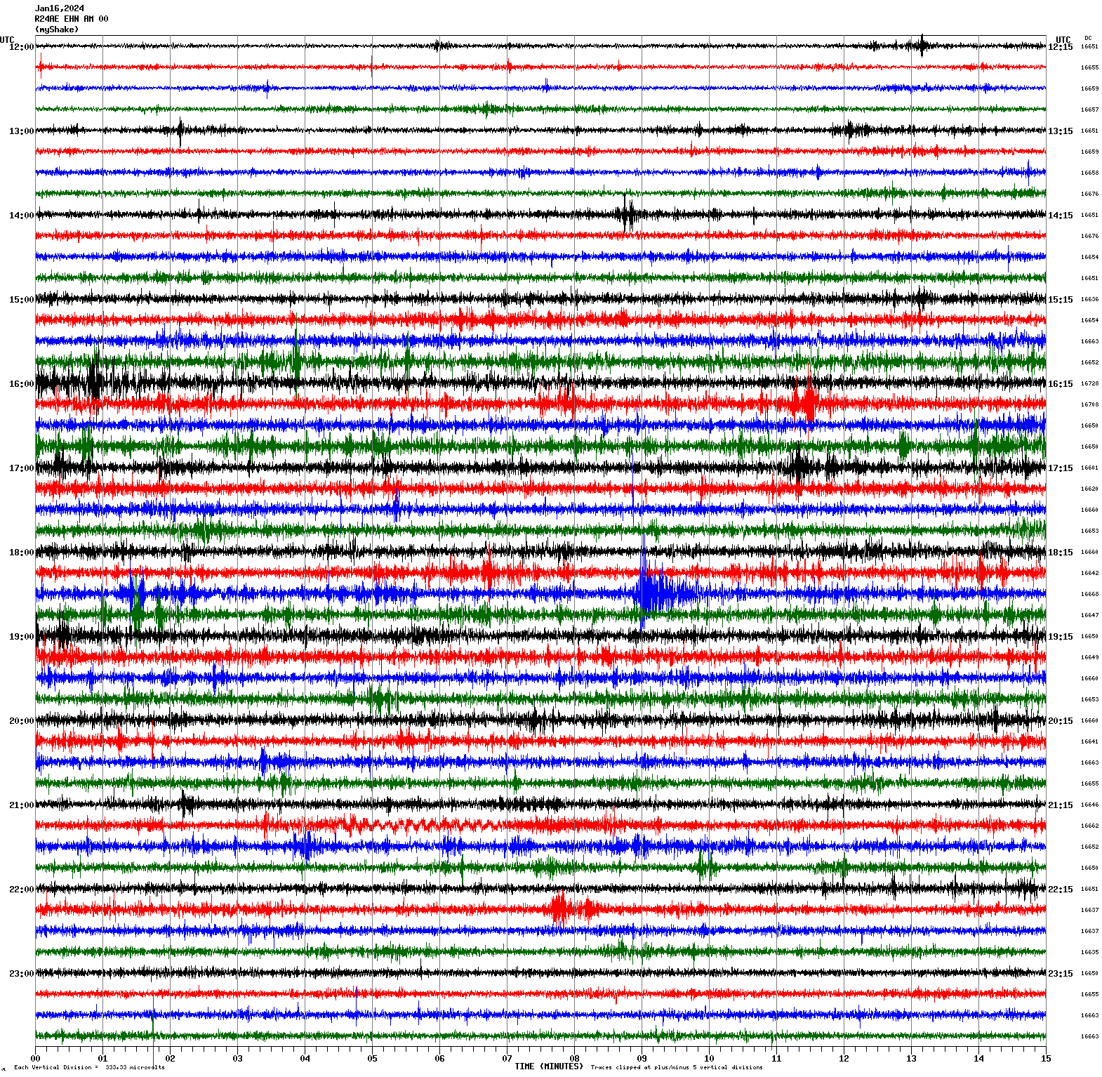
Magnitude 3.4
Depth 6.9 mi
3 mi ESE of Interlaken, CA
36.932°N 121.681°W
January 16, 2024 18:38:37 UTC
|
North/South Sensor
|
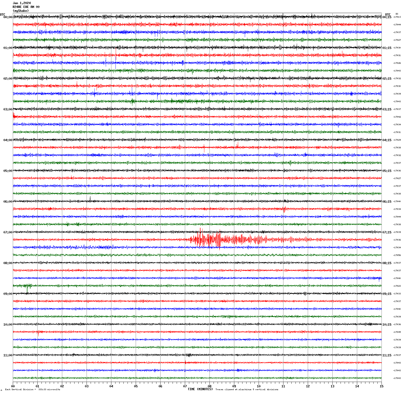
Magnitude 7.5
Depth 6.2 mi
26 mi NE of Anamizu, Japan
37.498°N 137.242°E
January 1, 2024 07:10:09 UTC
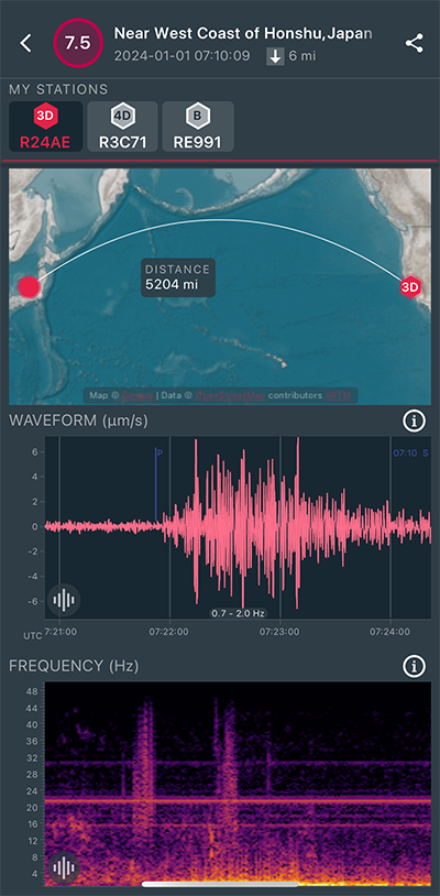
|
East/West Sensor
|
Magnitude 3.4
Depth 1.3 mi
4 mi NW of The Geysers, CA
38.814°N 122.799°W
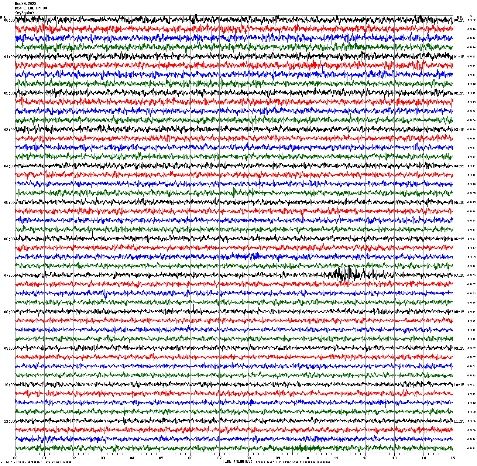
December 29, 2023 07:10:11 UTC

|
East/West Sensor
|
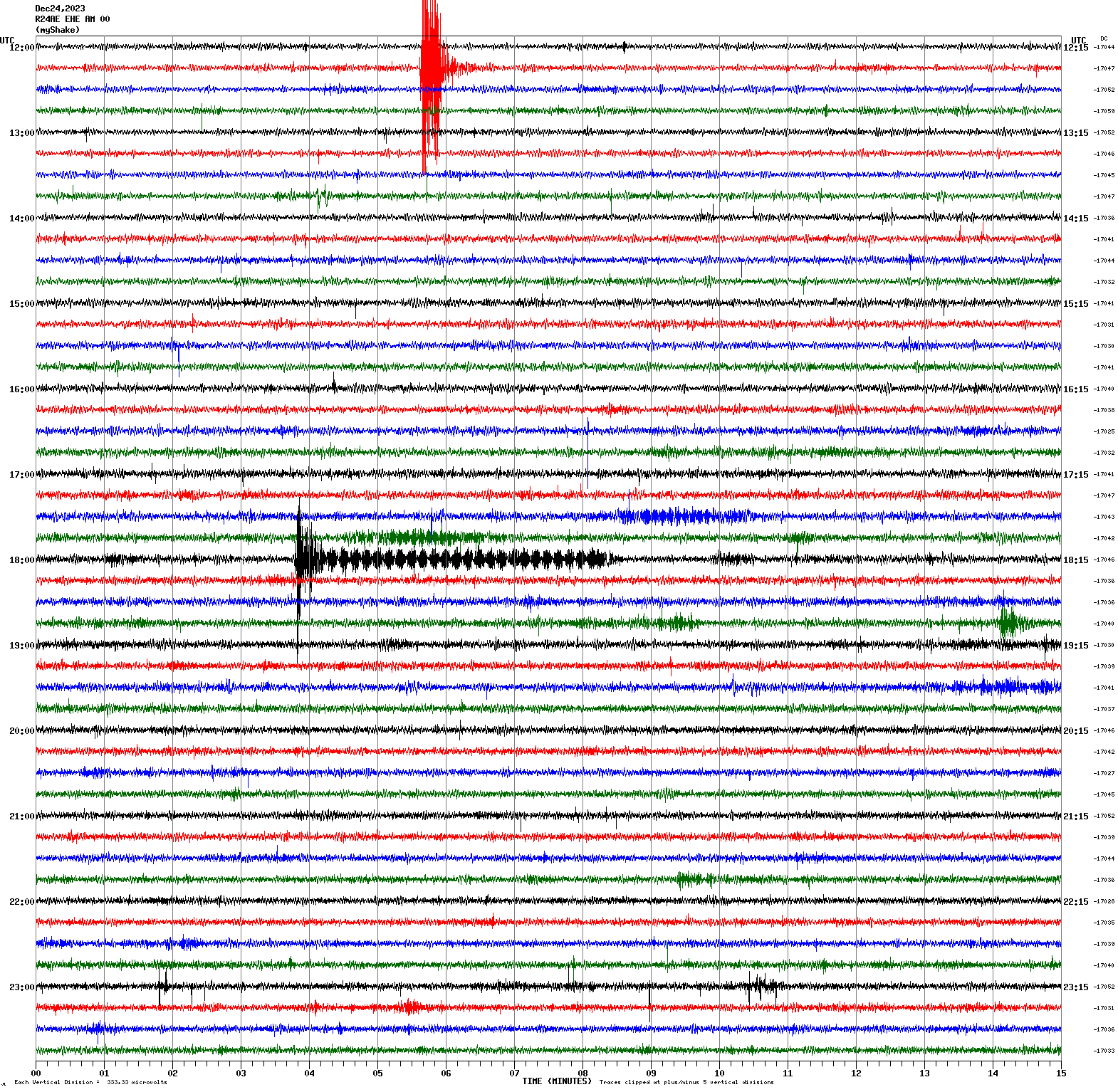
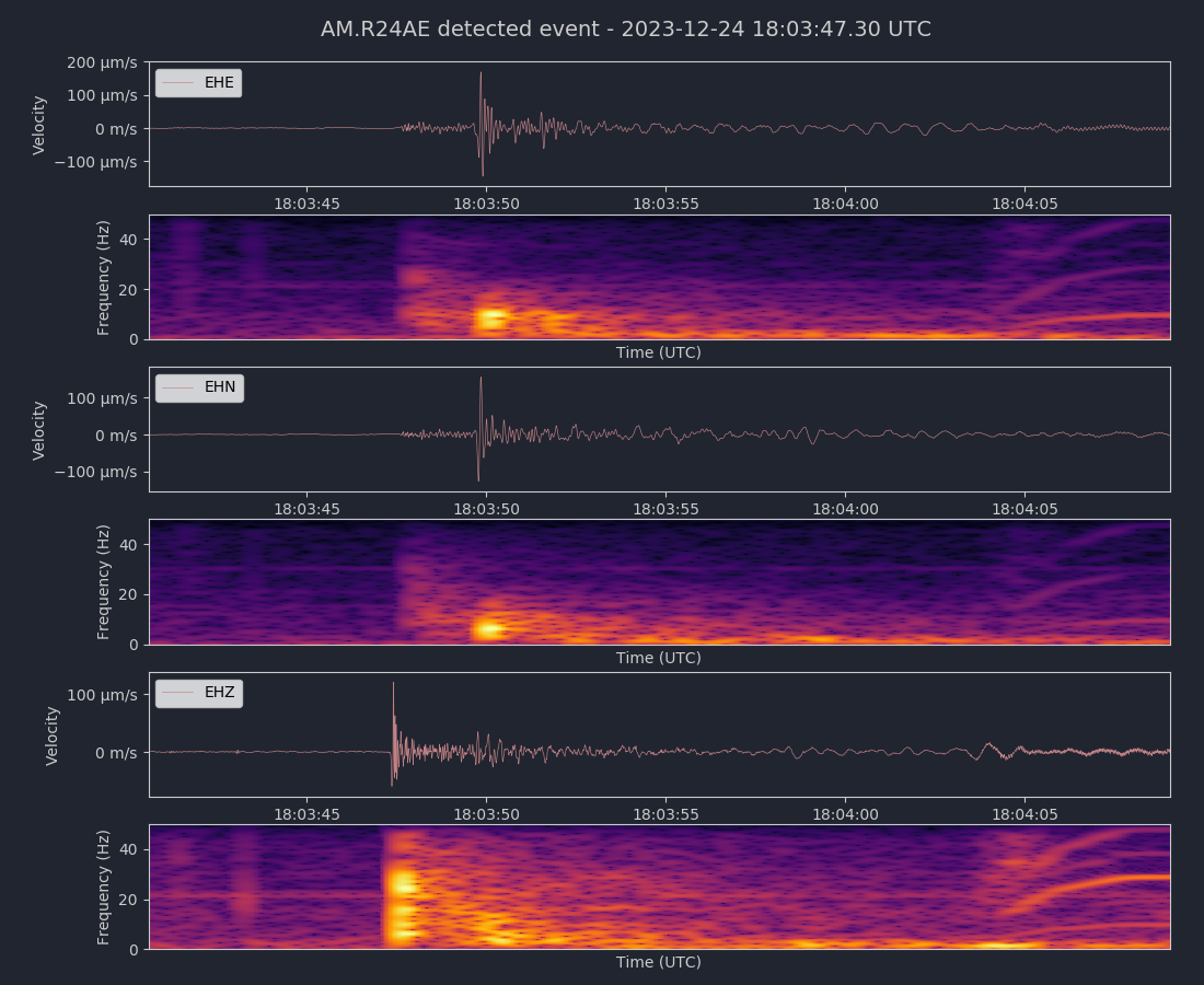
Magnitude 2.2
Depth 2.3 mi
1 mi SSE of Los Altos Hills, CA
37.371°N 122.131°W
December 24, 2023 18:03:45 UTC
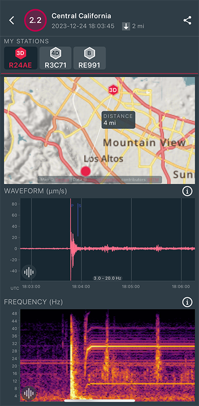
|
East/West Sensor
|
|
Voltage Counts & Frequency for All Sensors (Magnitude 2.2 Earthquake)
|
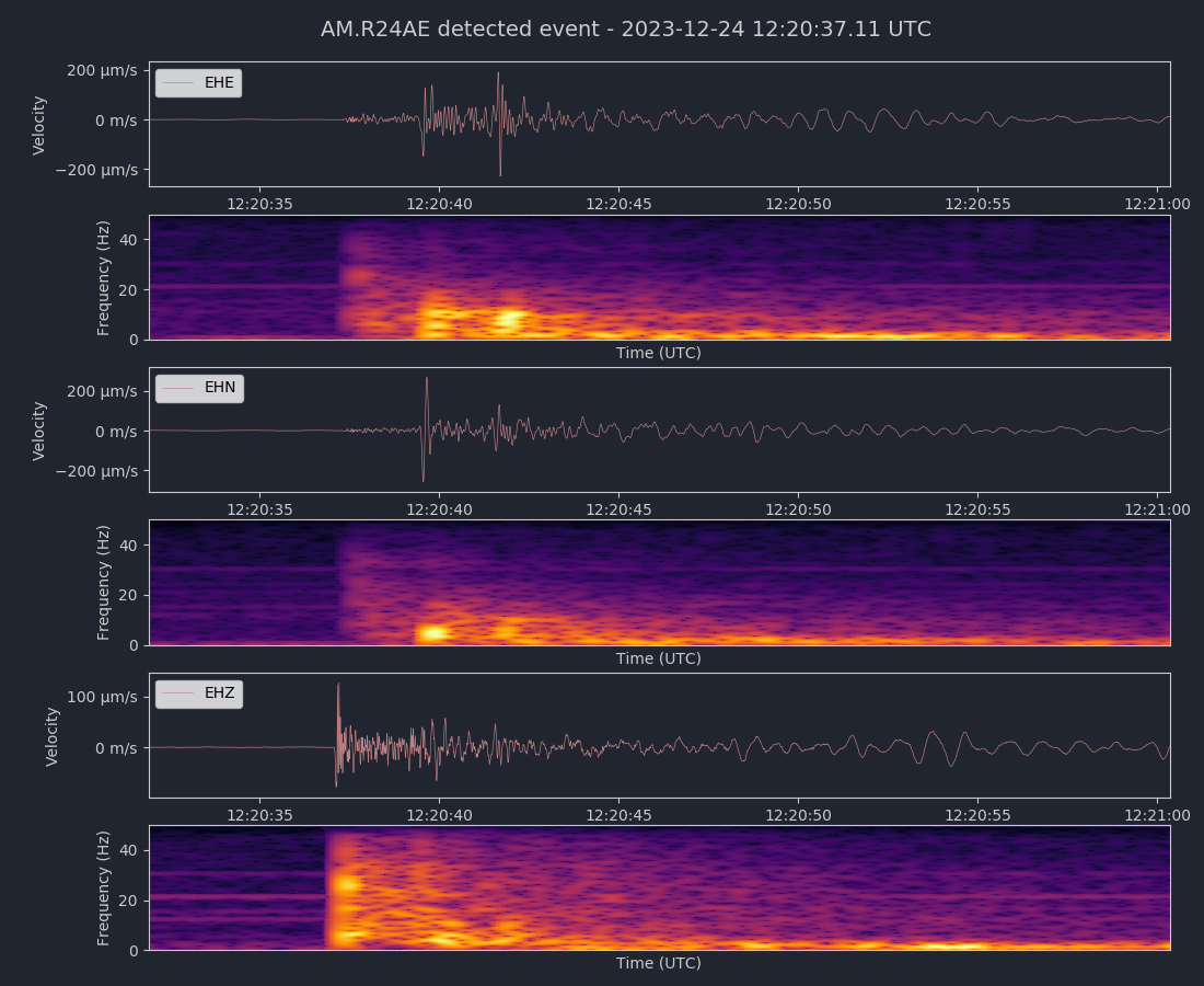
Magnitude 2.5
Depth 2.9 mi
1 mi SSE of Los Altos Hills, CA
37.368°N 122.130°W
December 24, 2023 12:20:34 UTC
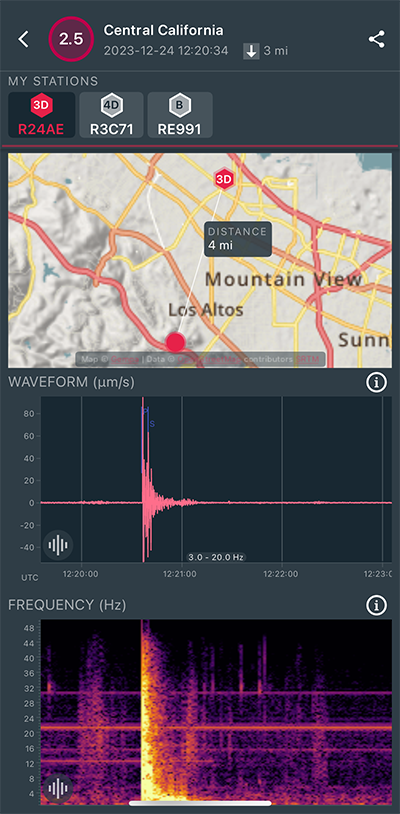
|
East/West Sensor
|
|
Voltage Counts & Frequency for All Sensors (Magnitude 2.5 Earthquake)
|
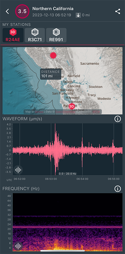
Magnitude 3.5
Depth 0.2 mi
1 mi NNE of The Geysers, CA
38.797°N 122.746°W
December 13, 2023 06:52:19 UTC
|
North/South Sensor
|
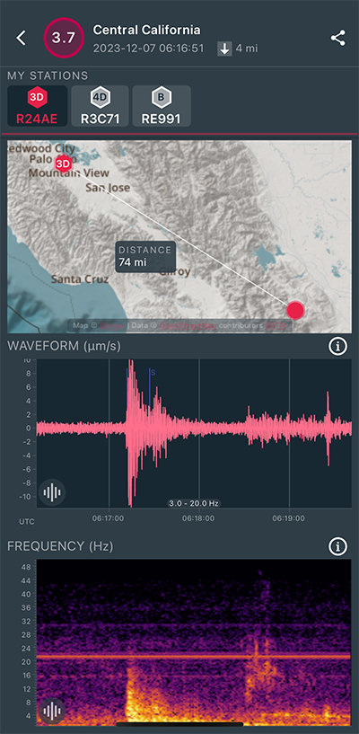
Magnitude 3.7
Depth 4.1 mi
16 mi SSW of Los Banos, CA
36.851°N 120.970°W
December 7, 2023 06:16:51 UTC
|
East/West Sensor
|
Magnitude 2.2
Depth 4.3 mi
2 mi WSW of Cupertino, CA
37.307°N 122.070°W
December 2, 2023 11:08:02 UTC
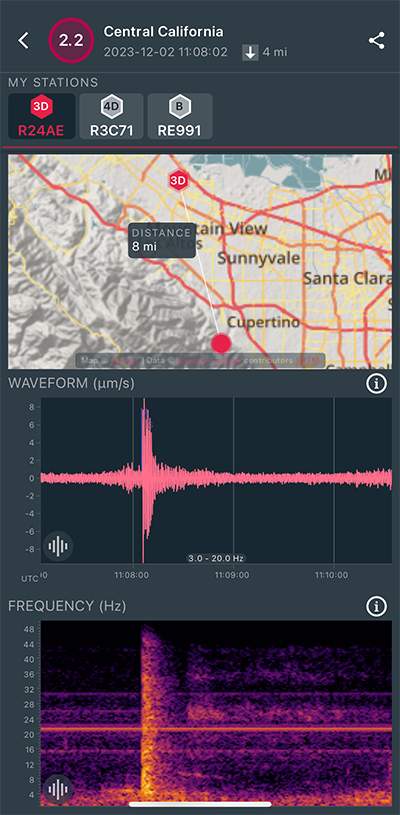
|
East/West Sensor
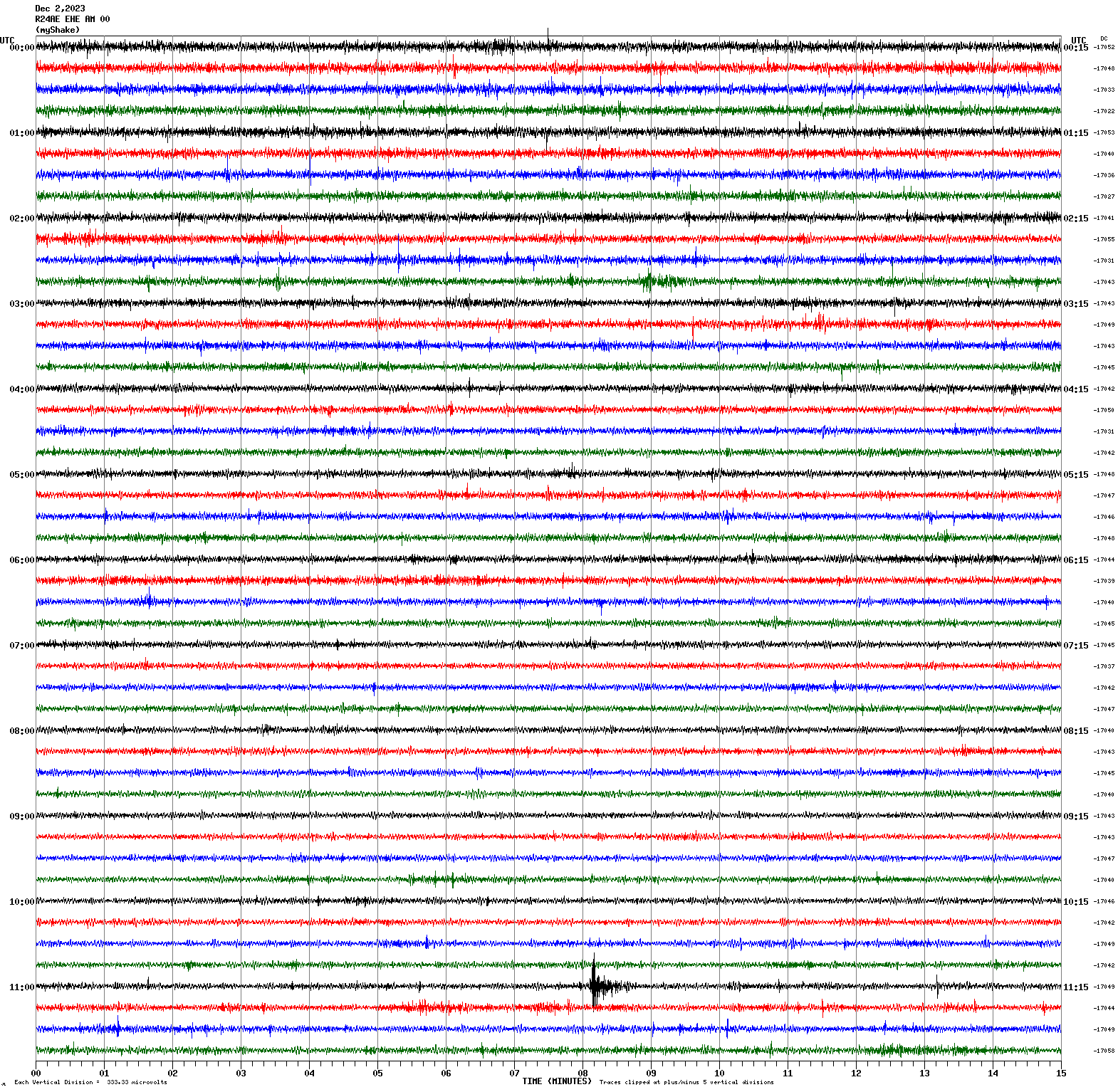
|
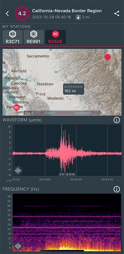
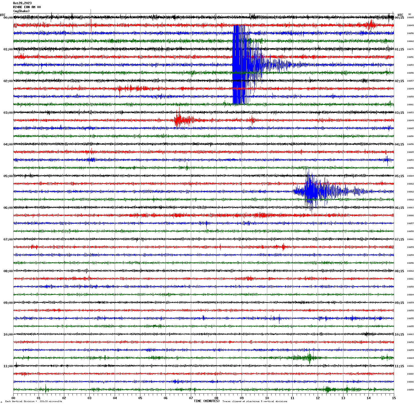
Magnitude 4.2
Depth 2.8 mi
3 mi NNW of Walker, CA
38.557°N 119.510°W
October 28, 2023 05:40:18 UTC
|
North/South Sensor
|
Magnitude 2.9
Depth 4.8 mi
7 mi ESE of Alum Rock, CA
37.343°N 121.702°W
October 28, 2023 03:31:13 UTC
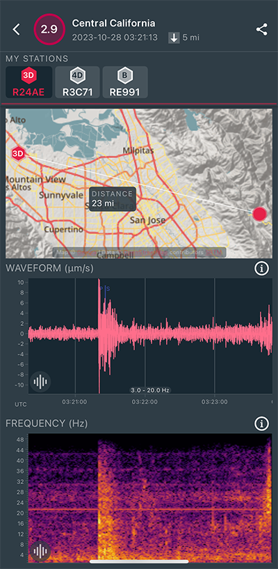
|
North/South Sensor
|
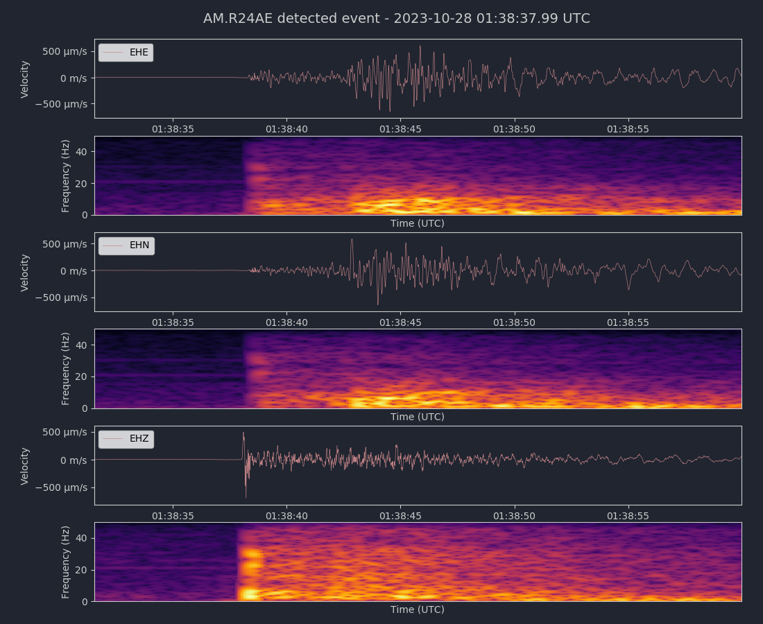
Magnitude 3.9
Depth 8.2 mi
1 mi NNE of Millbrae, CA
37.616°N 122.381°W
October 28, 2023 01:38:31 UTC
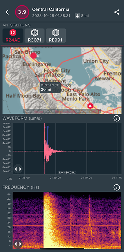
|
Vertical (Z) Sensor
|
|
Voltage Counts & Frequency for All Sensors (Magnitude 3.9 Earthquake)
|
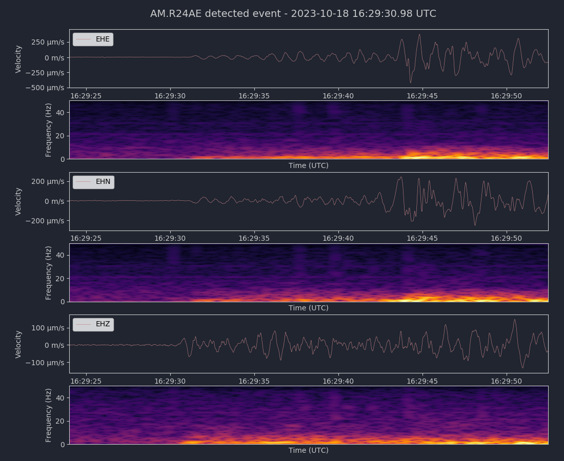
Magnitude 4.1
Depth 6.7 mi
2 mi SSW of Isleton, CA
38.126°N 121.632°W
October 18, 2023 16:29:14 UTC
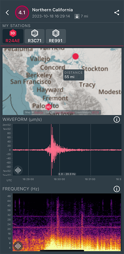
|
East/West Sensor
|
|
Voltage Counts & Frequency for All Sensors (Magnitude 4.1 Earthquake)
|
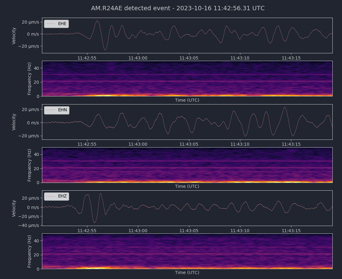
Magnitude 6.4
Depth 116.5 mi
40 mi NNW of Adak, Alaska
52.445°N 176.850°W
October 16, 2023 11:35:31 UTC
|
East/West Sensor
|
|
Voltage Counts & Frequency for All Sensors (Magnitude 6.4 Earthquake)
|
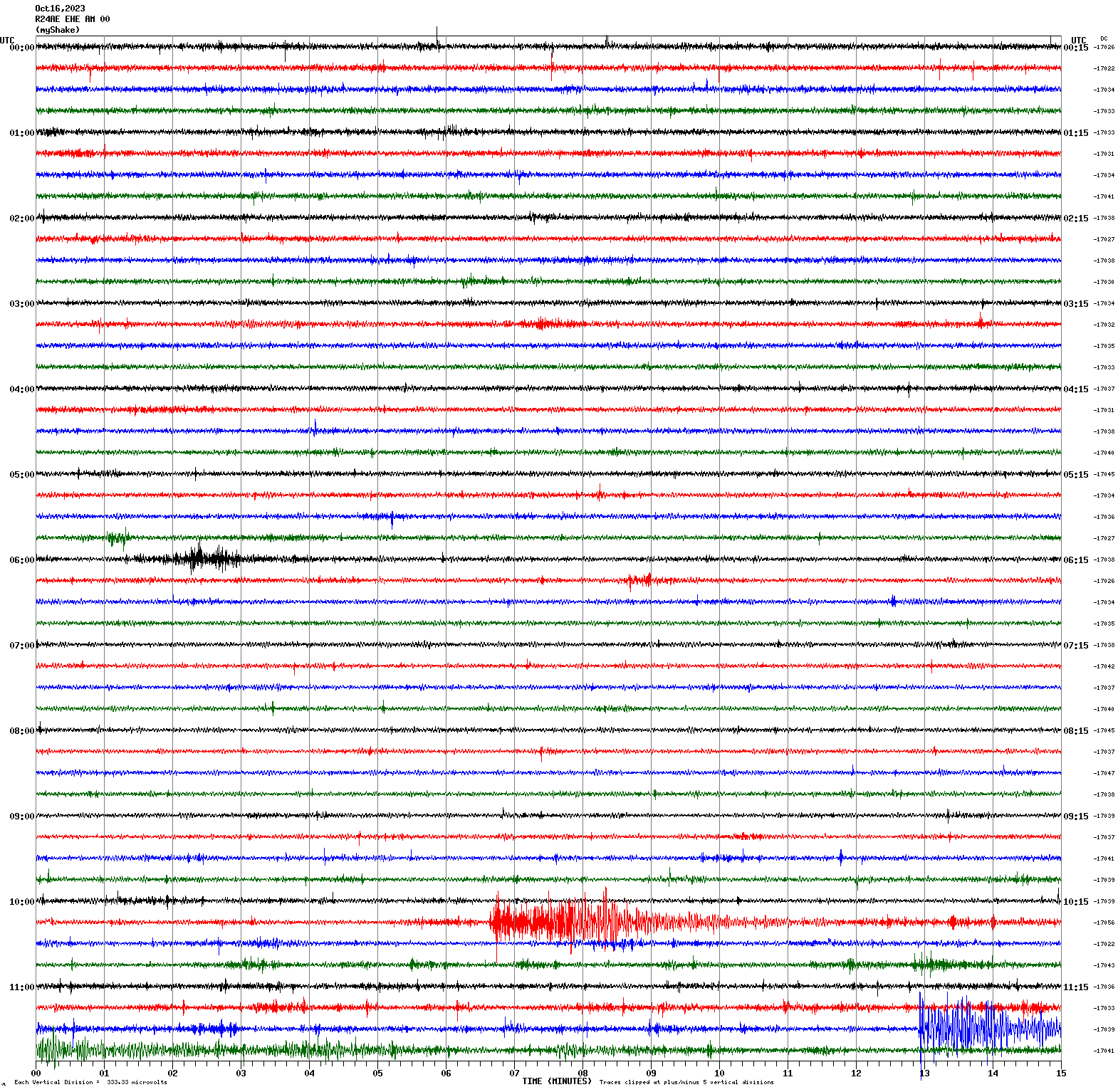
Magnitude 4.8
Depth 19.3 mi
12 mi E of Petrolia, CA
40.316°N 124.055°W
October 16, 2023 10:20:49 UTC
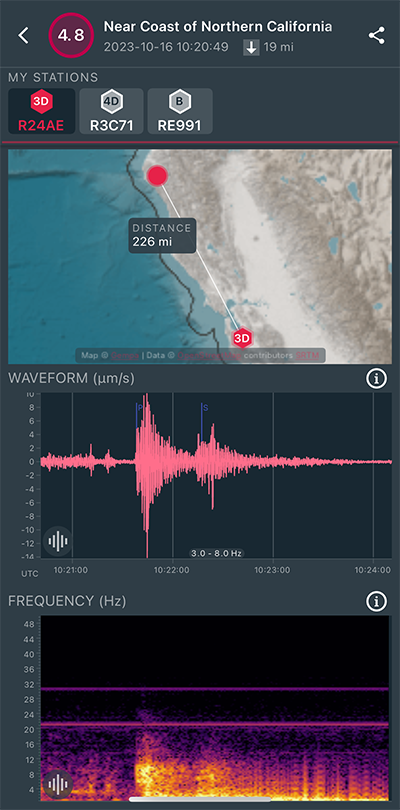
|
East/West Sensor
|
Magnitude 3.8
Depth 0.9 mi
4 mi NW of The Geysers, CA
38.828°N 122.803°W
October 8, 2023 21:30:23 UTC
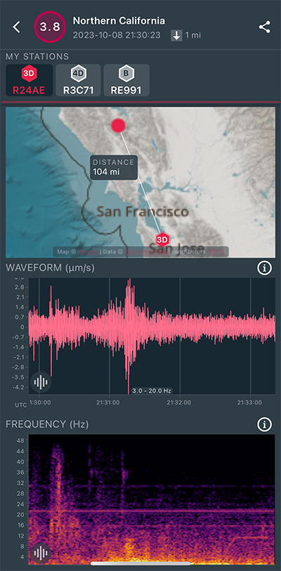
|
North/South Sensor
|
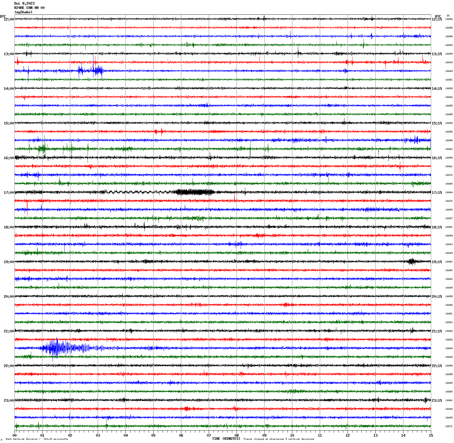
Magnitude 2.7
Depth 2.7 mi
5 mi ENE of Alum Rock, CA
37.398°N 121.751°W
October 8, 2023 07:00:14 UTC
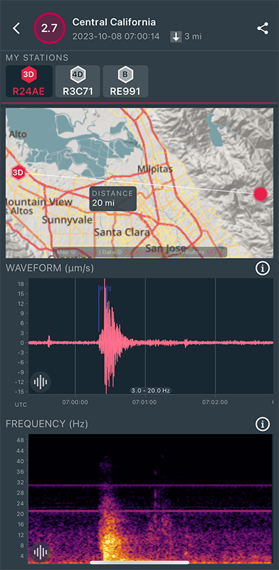
|
East/West Sensor
|
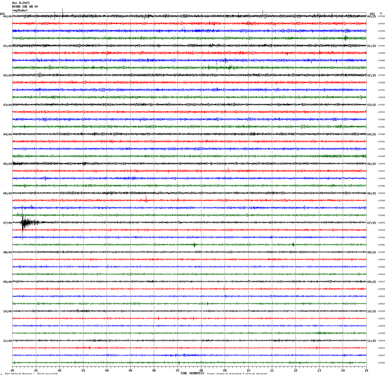
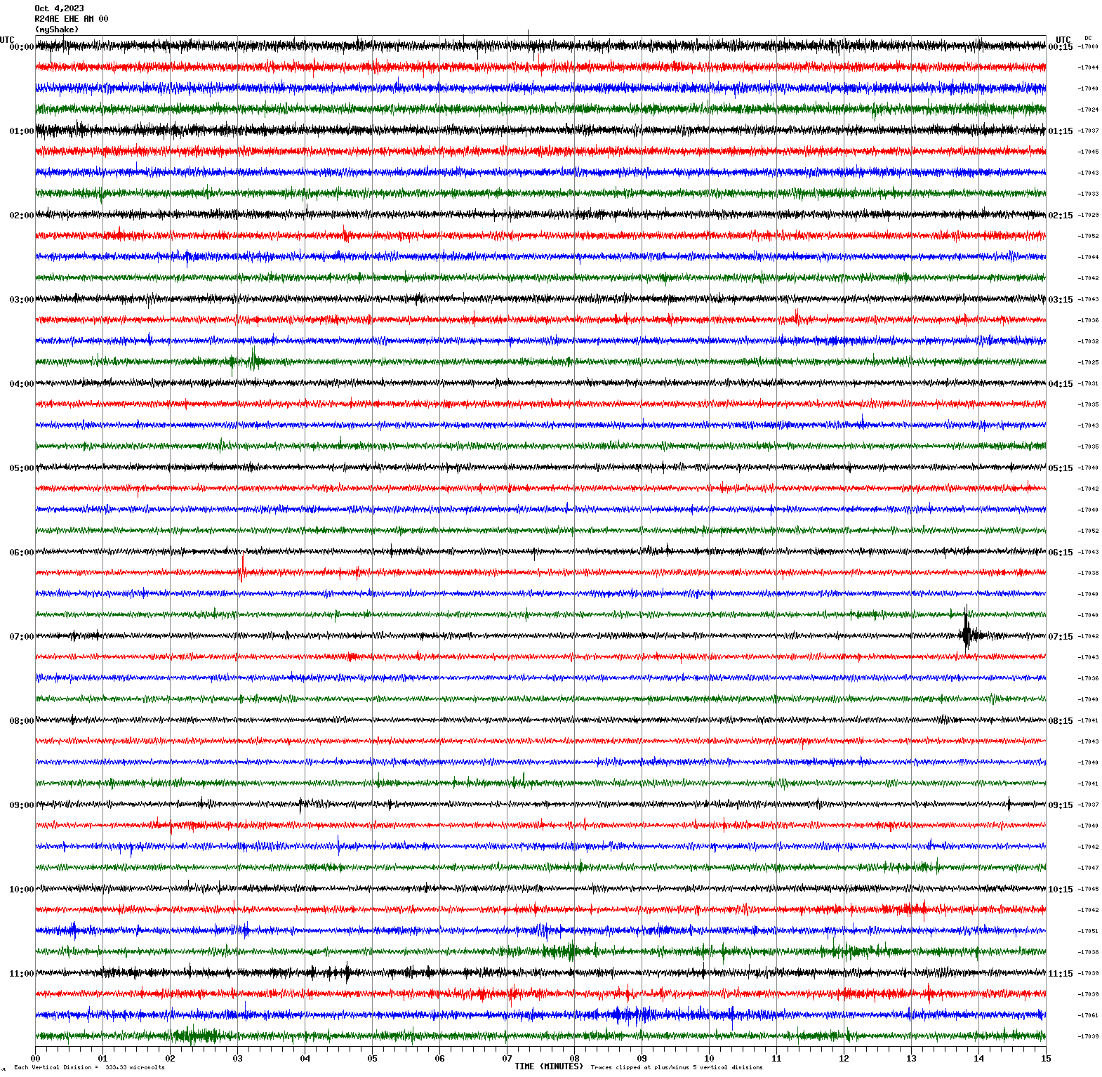
Magnitude 2.6
Depth 6.4 mi
2 mi N of Piedmont, CA
37.857°N 122.237°W
October 4, 2023 07:13:31 UTC
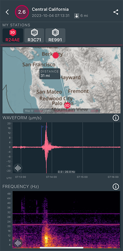
|
East/West Sensor
|
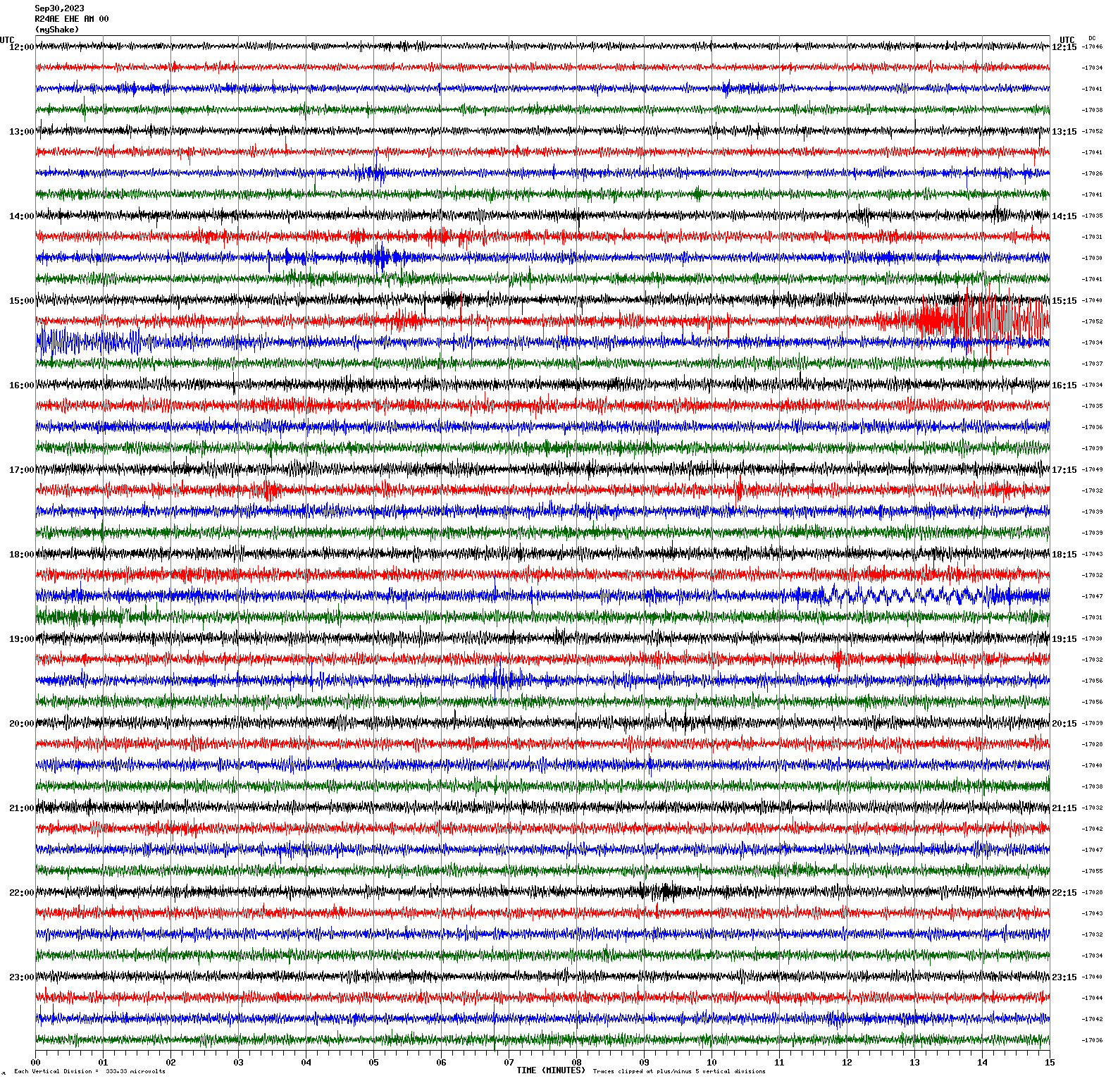
Magnitude 4.7
Depth 11.1 mi
2 mi SW of Ferndale, CA
40.559°N 124.289°W
September 30, 2023 15:26:26 UTC
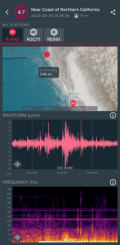
|
East/West Sensor
|
Magnitude 2.7
Depth 6.4 mi
6 mi NE of Alum Rock, CA
37.432°N 121.770°W
September 23, 2023 22:02:35 UTC
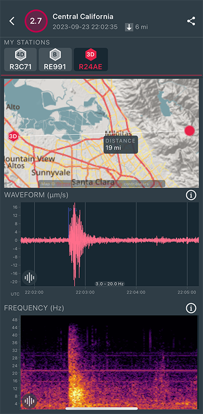
|
North/South Sensor
|
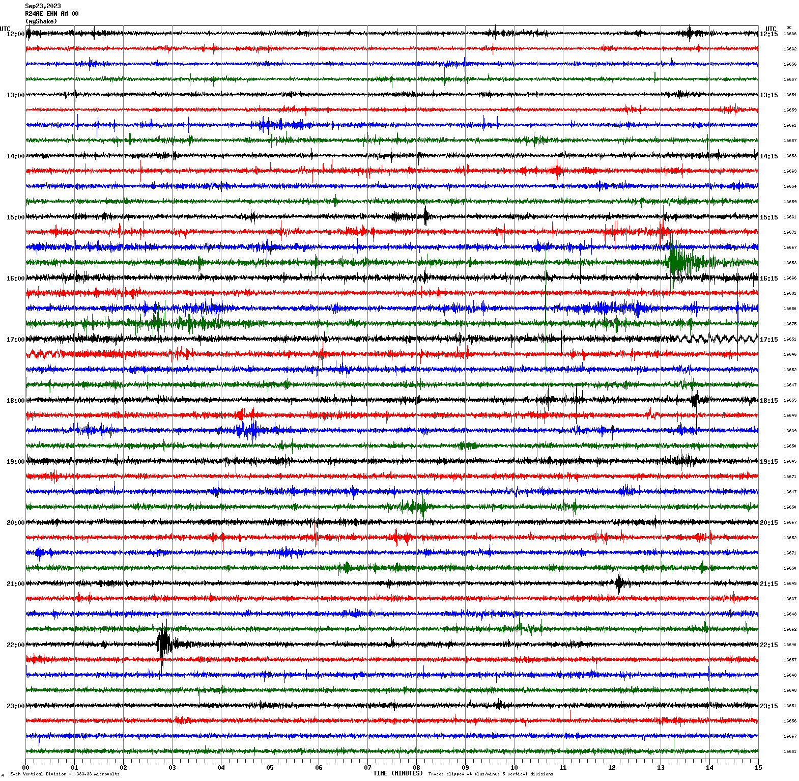
Magnitude 3.3
Depth 1.1 mi
10 mi WSW of Patterson, CA
37.423°N 121.299°W
September 23, 2023 15:57:47 UTC
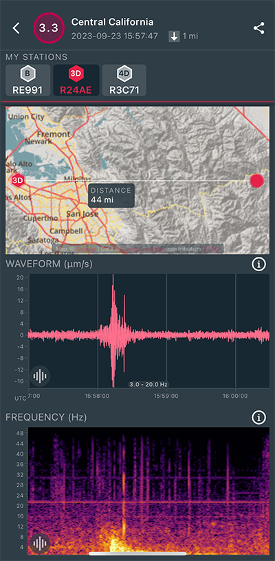
|
North/South Sensor
|
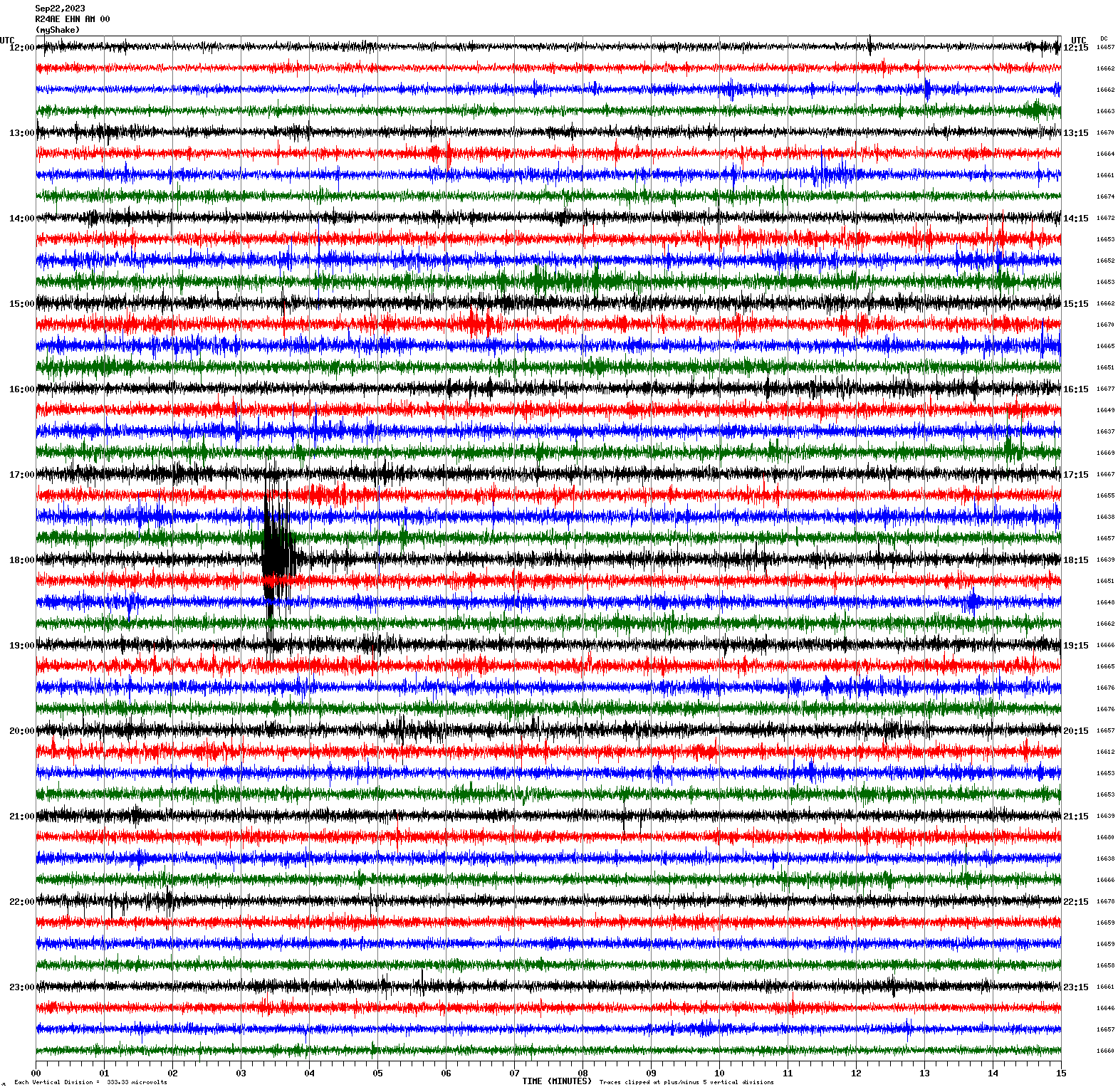
Magnitude 2.8
Depth 4.2 mi
2 mi WSW of Cupertino, CA
37.311°N 122.071°W
September 22, 2023 18:03:14 UTC
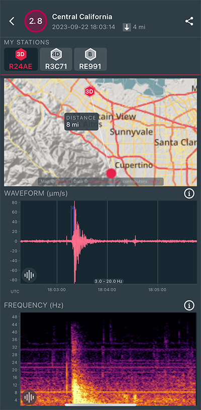
|
North/South Sensor
|
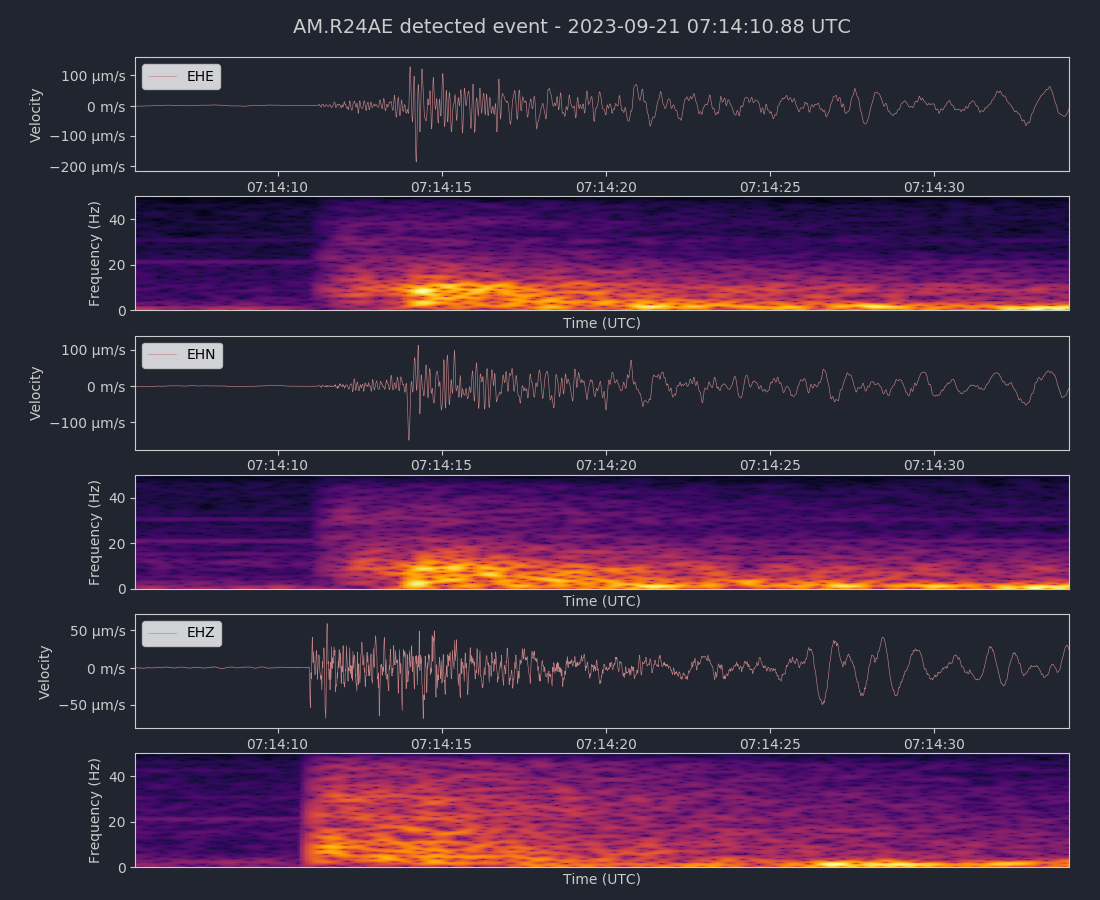
Magnitude 2.9
Depth 4.1 mi
2 mi WSW of Cupertino, CA
37.312°N 122.069°W
September 21, 2023 07:14:07 UTC
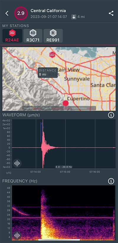
|
Vertical (Z) Sensor
|
|
Voltage Counts & Frequency for All Sensors (Magnitude 2.9 Earthquake)
|
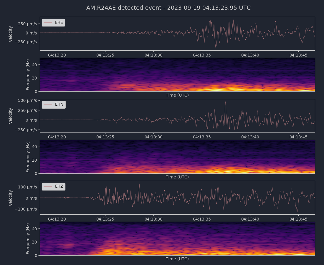
Magnitude 4.4
Depth 1.7 mi
9 mi SSW of Westley, CA
37.442°N 121.290°W
September 19, 2023 04:13:10 UTC
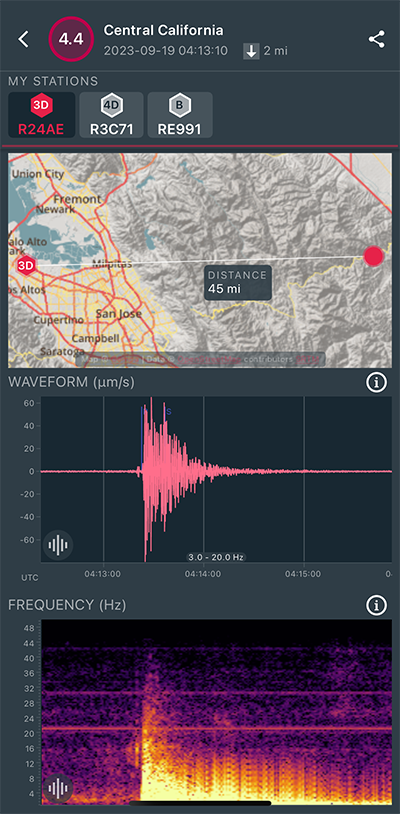
|
Vertical (Z) Sensor
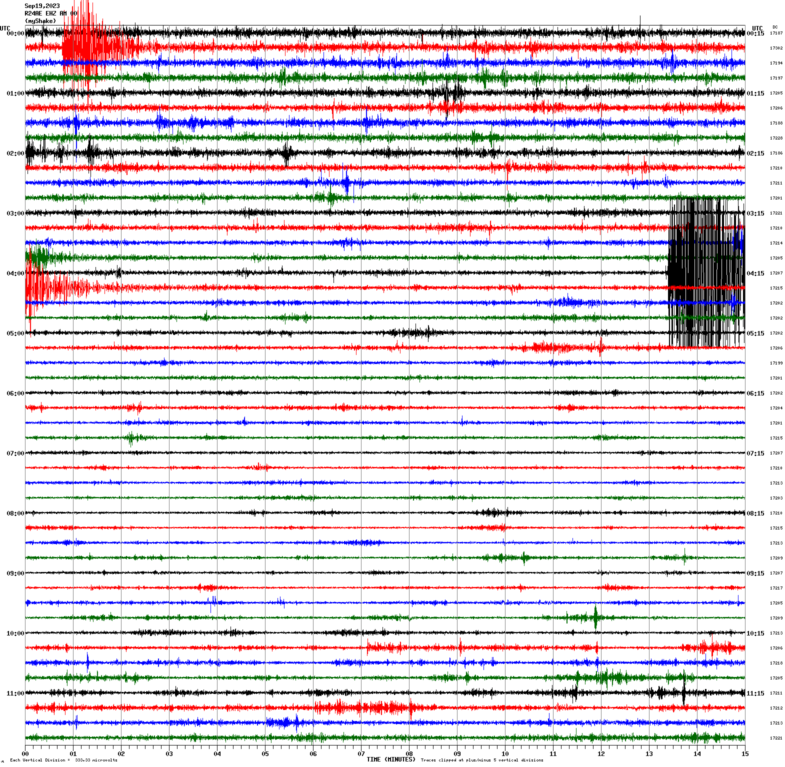
|
|
Voltage Counts & Frequency for All Sensors (Magnitude 4.4 Earthquake)
|
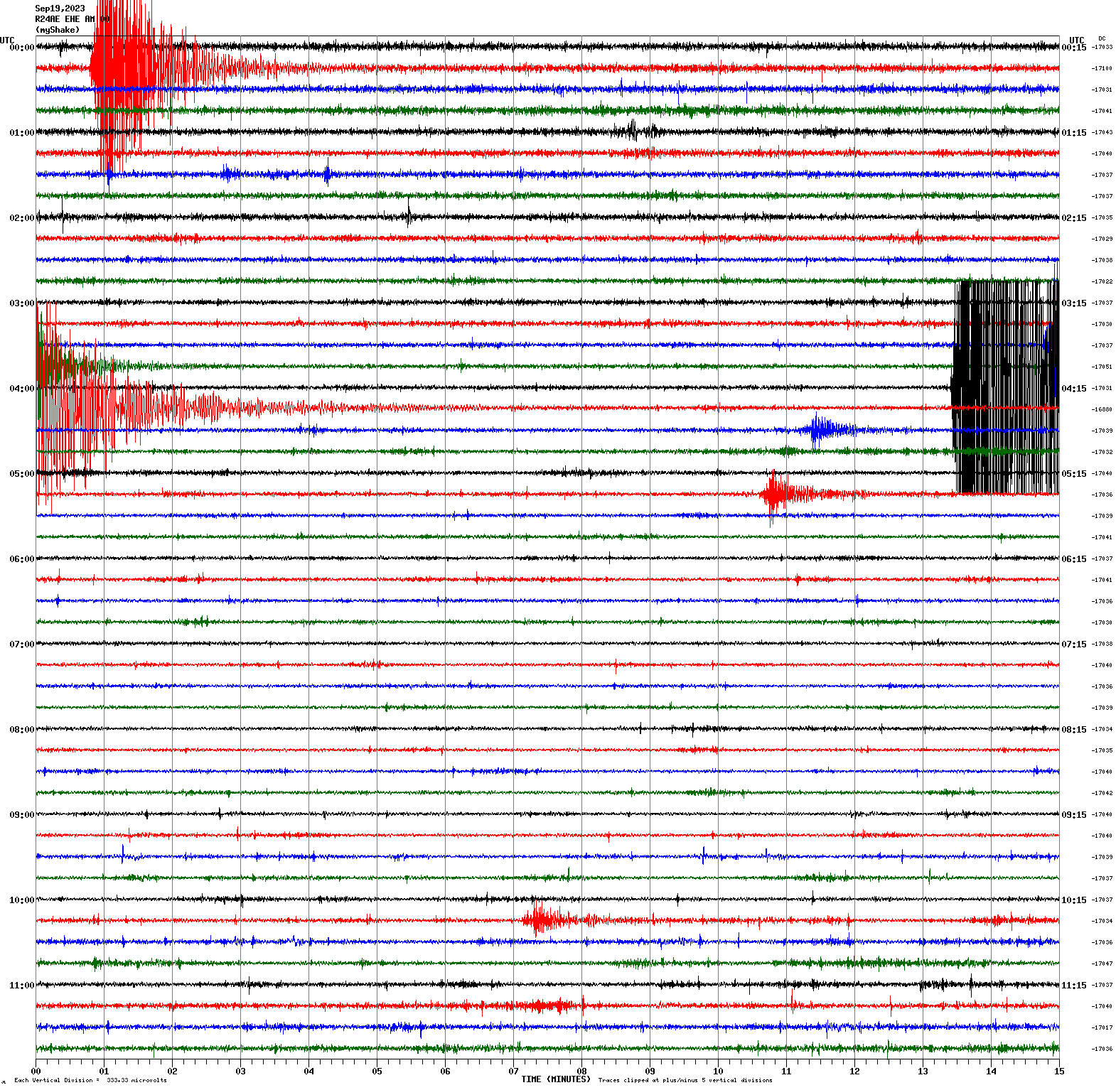
Magnitude 3.9
Depth 0.5 mi
9 mi SSW of Westley, CA
37.443°N 121.287°W
September 19, 2023 00:15:32 UTC
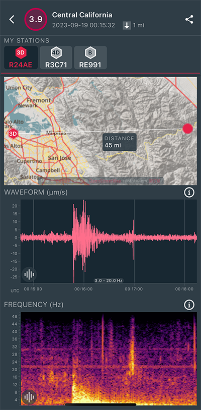
|
East/West Sensor
|
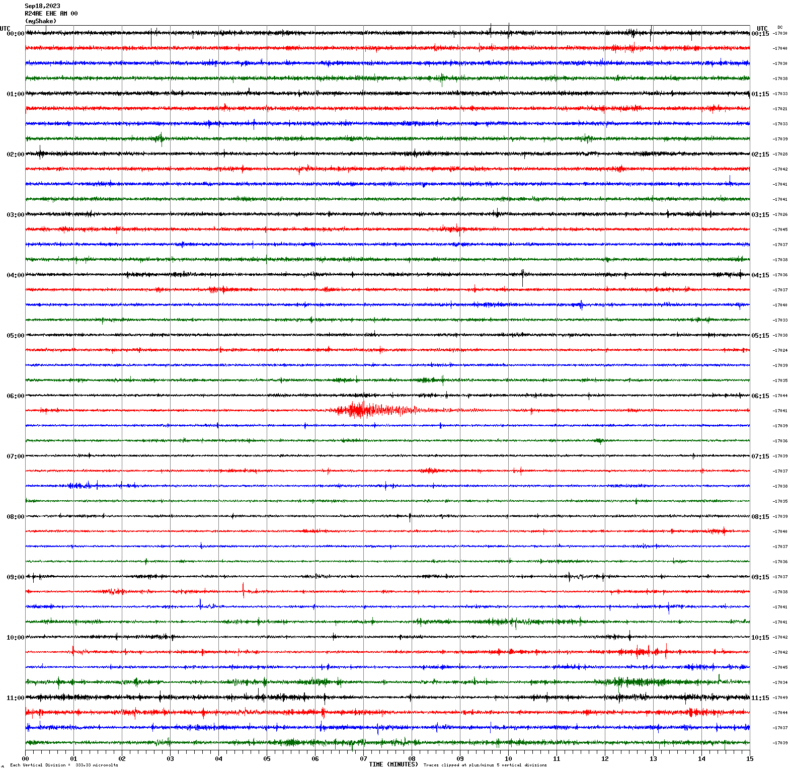
Magnitude 3.5
Depth 0.7 mi
3 mi NW of The Geysers, CA
38.812°N 122.794°W
September 18, 2023 06:20:52 UTC
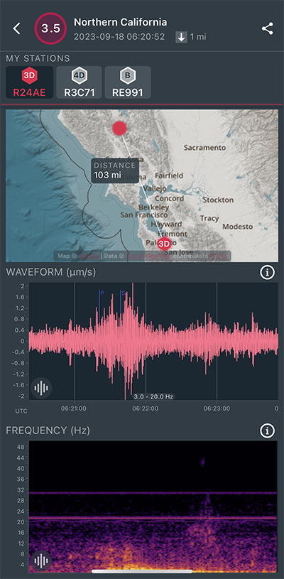
|
East/West Sensor
|
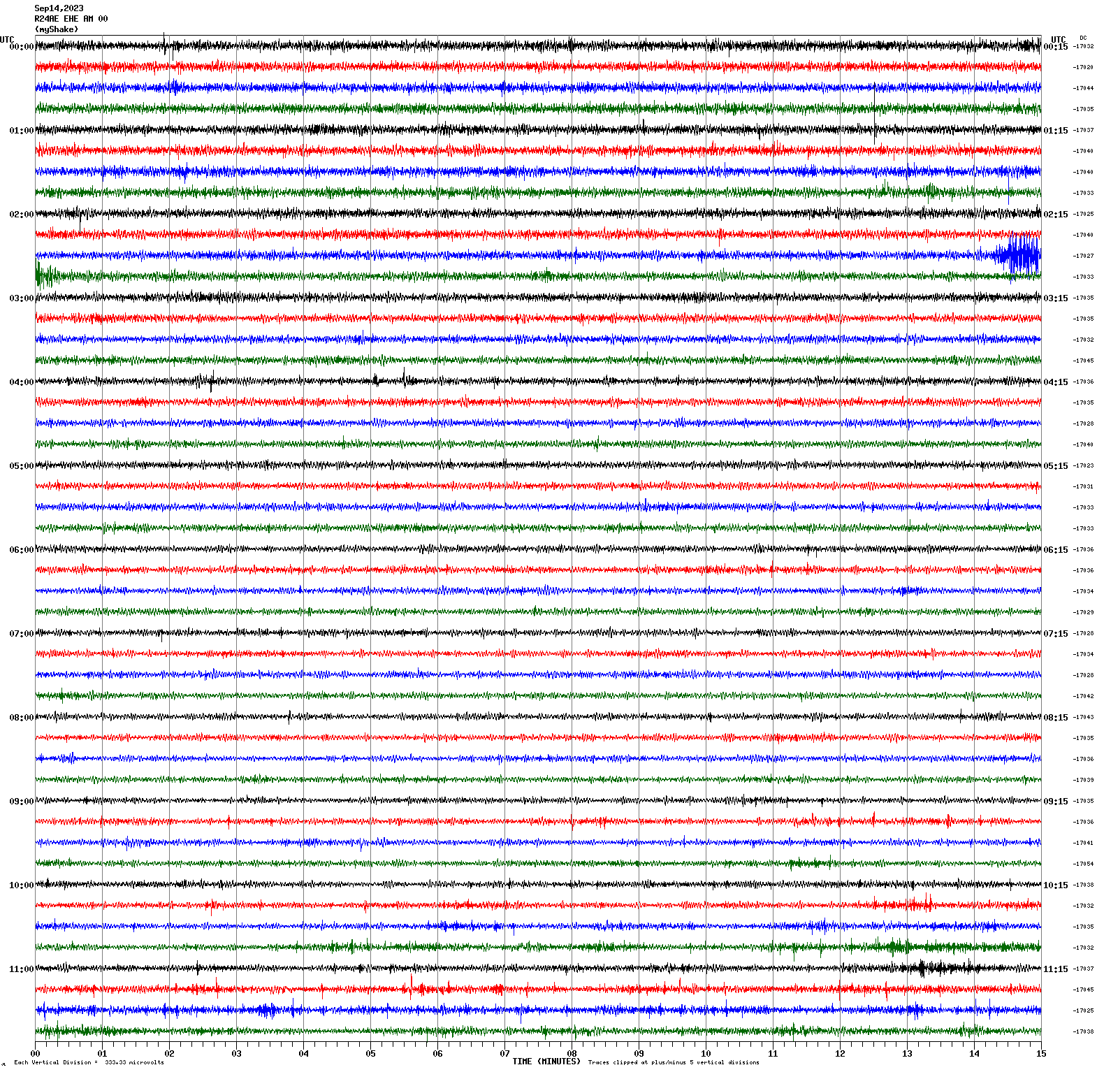
Magnitude 3.4
Depth 4.9 mi
3 mi NNW of Pinnacles, CA
36.573°N 121.176°W
September 14, 2023 02:43:54 UTC
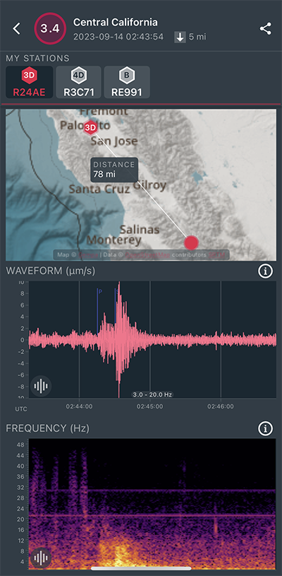
|
East/West Sensor
|
Magnitude 3.3
Depth 3.6 mi
6 mi NE of Morgan Hill, CA
37.188°N 121.573°W
September 12, 2023 08:32:21 UTC
|
Vertical (Z) Sensor
|
|
Voltage Counts & Frequency for All Sensors (Magnitude 3.3 Earthquake)
|
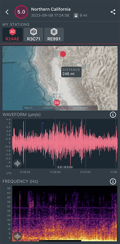
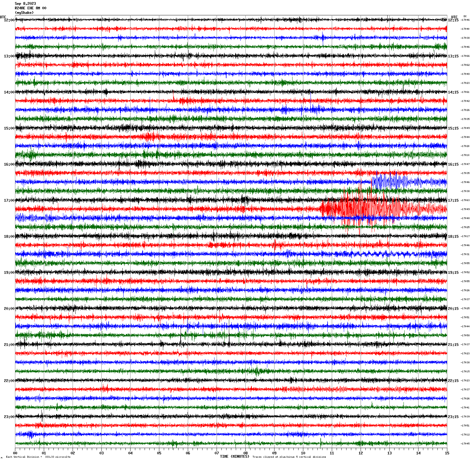
Magnitude 5.0
Depth 9.2 mi
7 mi WSW of Fall River Mills, CA
40.952°N 121.558°W
September 8, 2023 17:24:39 UTC
|
East/West Sensor
|
Magnitude 5.8
Depth 33.4 mi
2 mi NE of Emiliano Zapata, Mexico
19.417°N 104.935°W
September 8, 2023 16:37:16 UTC
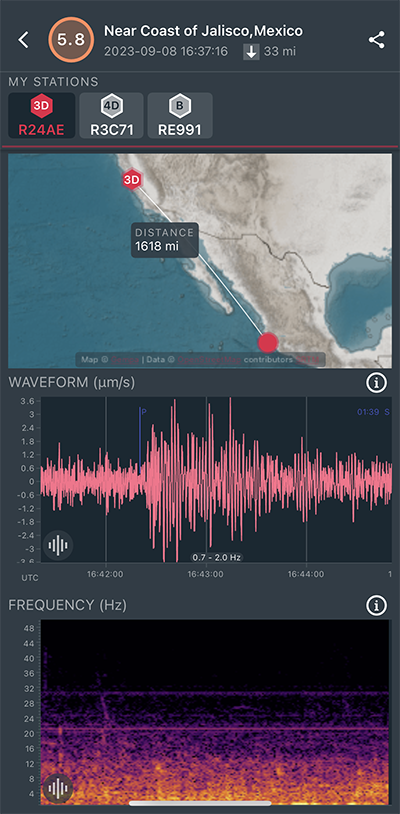
|
East/West Sensor
|
Magnitude 6.2
Depth 25.7 mi
25 mi SSW of Coquimbo, Chile
30.278°S 71.536°W
September 6, 2023 23:48:05 UTC
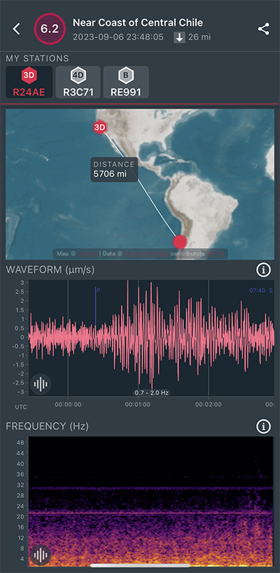
|
East/West Sensor
|
Magnitude 2.6
Depth 1.3 mi
4 mi NNE of Alum Rock, CA
37.415°N 121.790°W
September 1, 2023 01:35:48 UTC
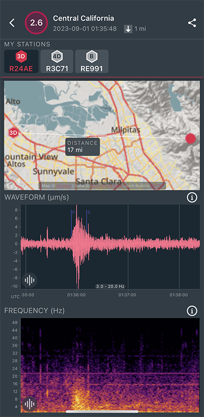
|
North/South Sensor
|
Magnitude 3.6
Depth -0.1 mi
9 mi SW of Westley, CA
37.436°N 121.300°W
August 31, 2023 00:59:36 UTC
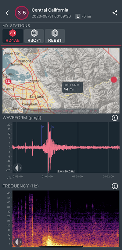
|
North/South Sensor
|
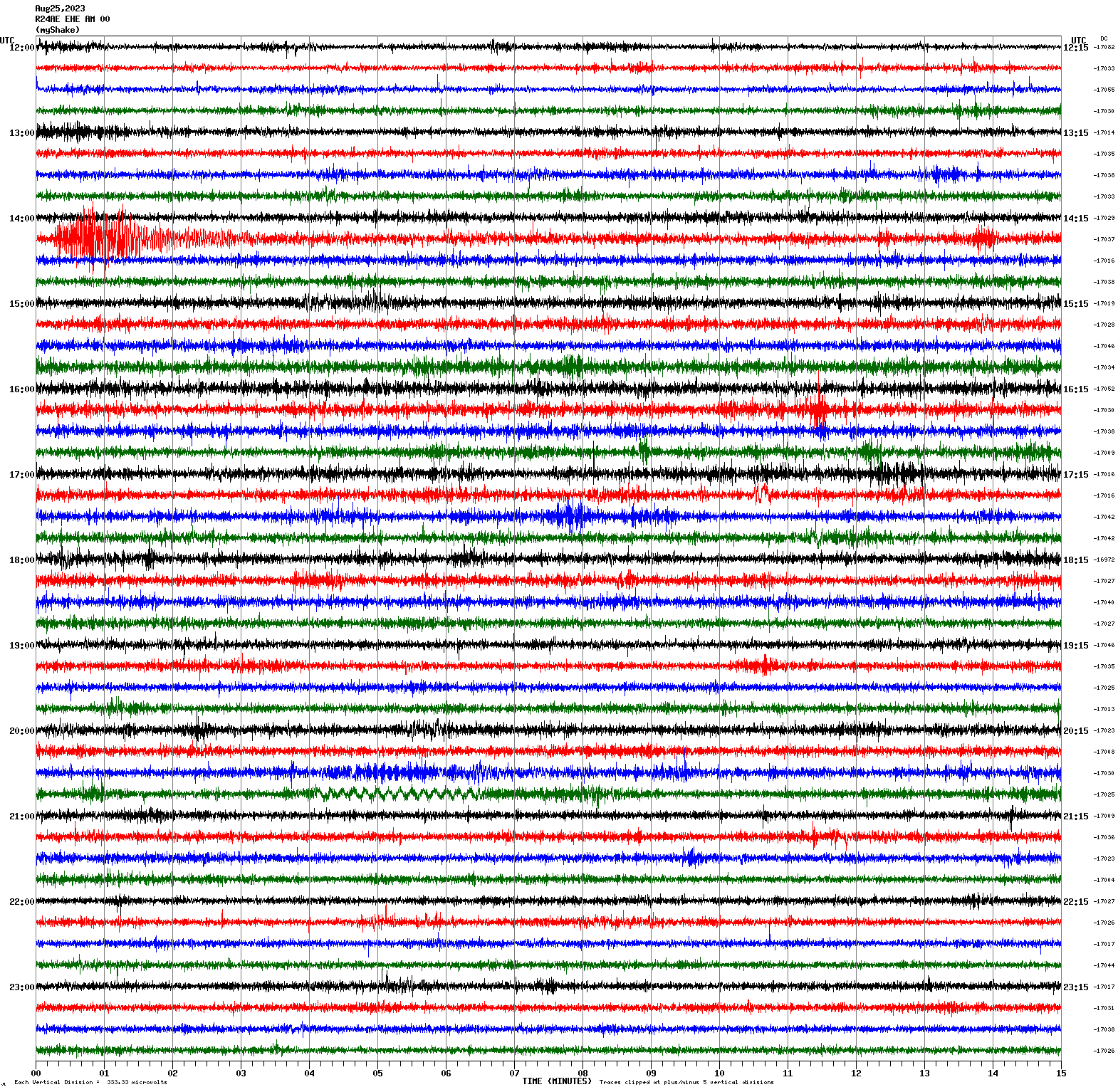
Magnitude 4.0
Depth 1.9 mi
4 mi NW of The Geysers, CA
38.825°N 122.811°W
August 25, 2023 14:14:45 UTC
East/West Sensor
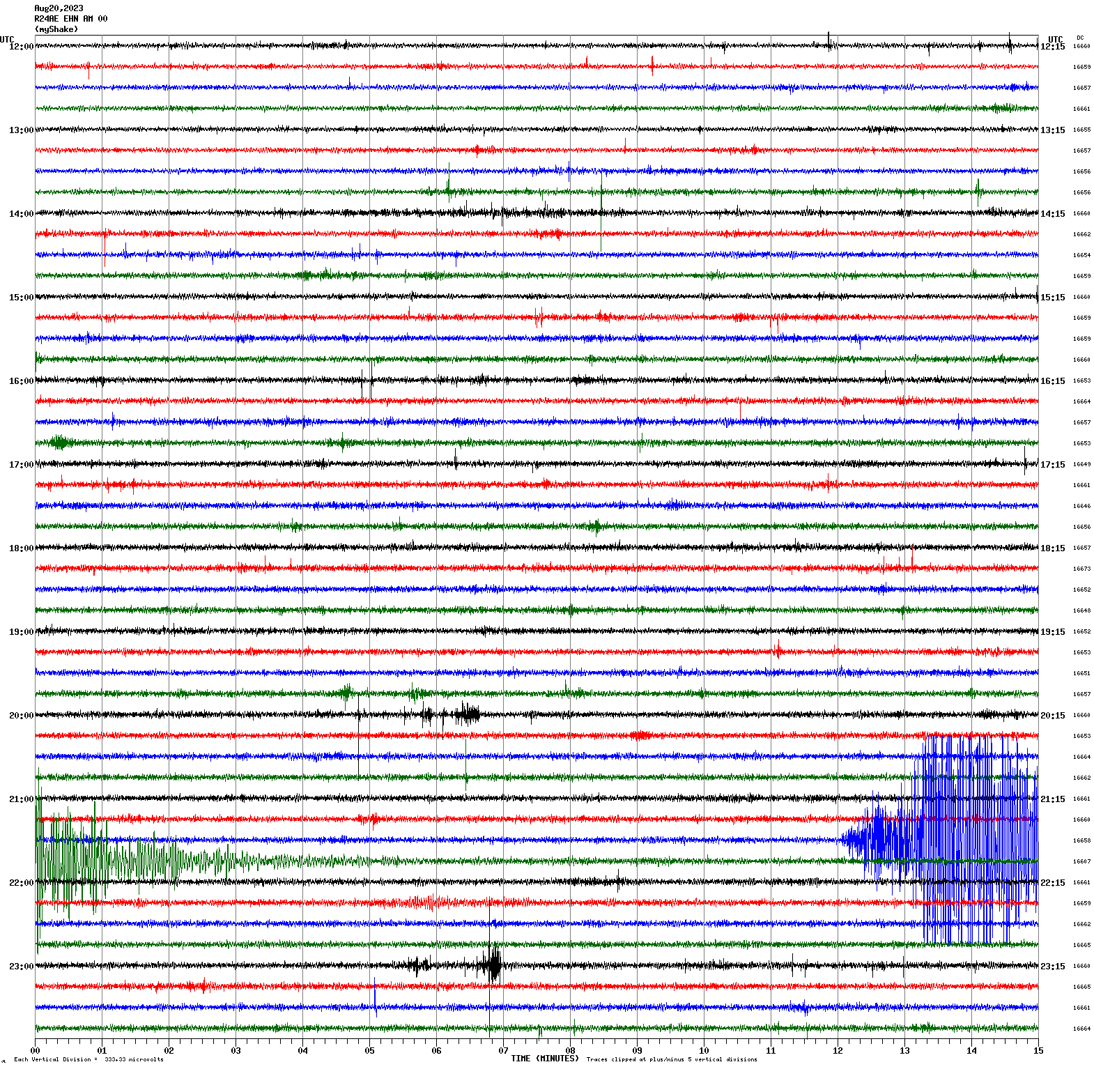
Magnitude 5.1
Depth 3.0 mi
4 mi SE of Ojai, CA
34.409°N 119.188°W
August 20, 2023 21:41:00 UTC
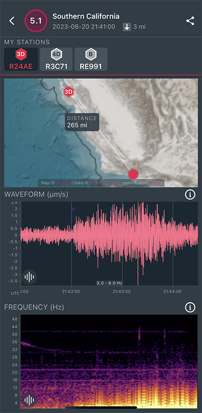
|
North/South Sensor
|
Magnitude 4.3
Depth 4.9 mi
4 mi NW of Parkfield, CA
35.935°N 120.484°W
August 10, 2023 19:17:18 UTC
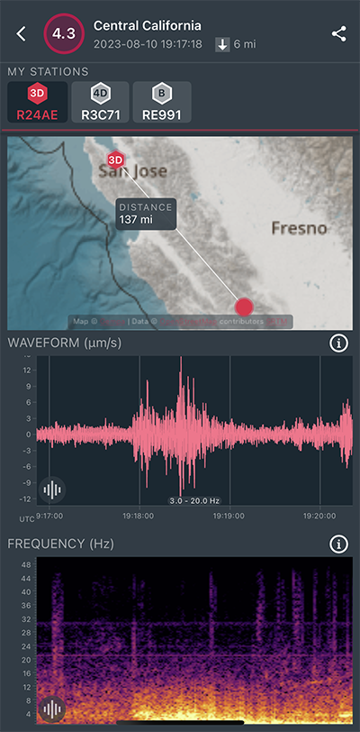
|
North/South Sensor
|
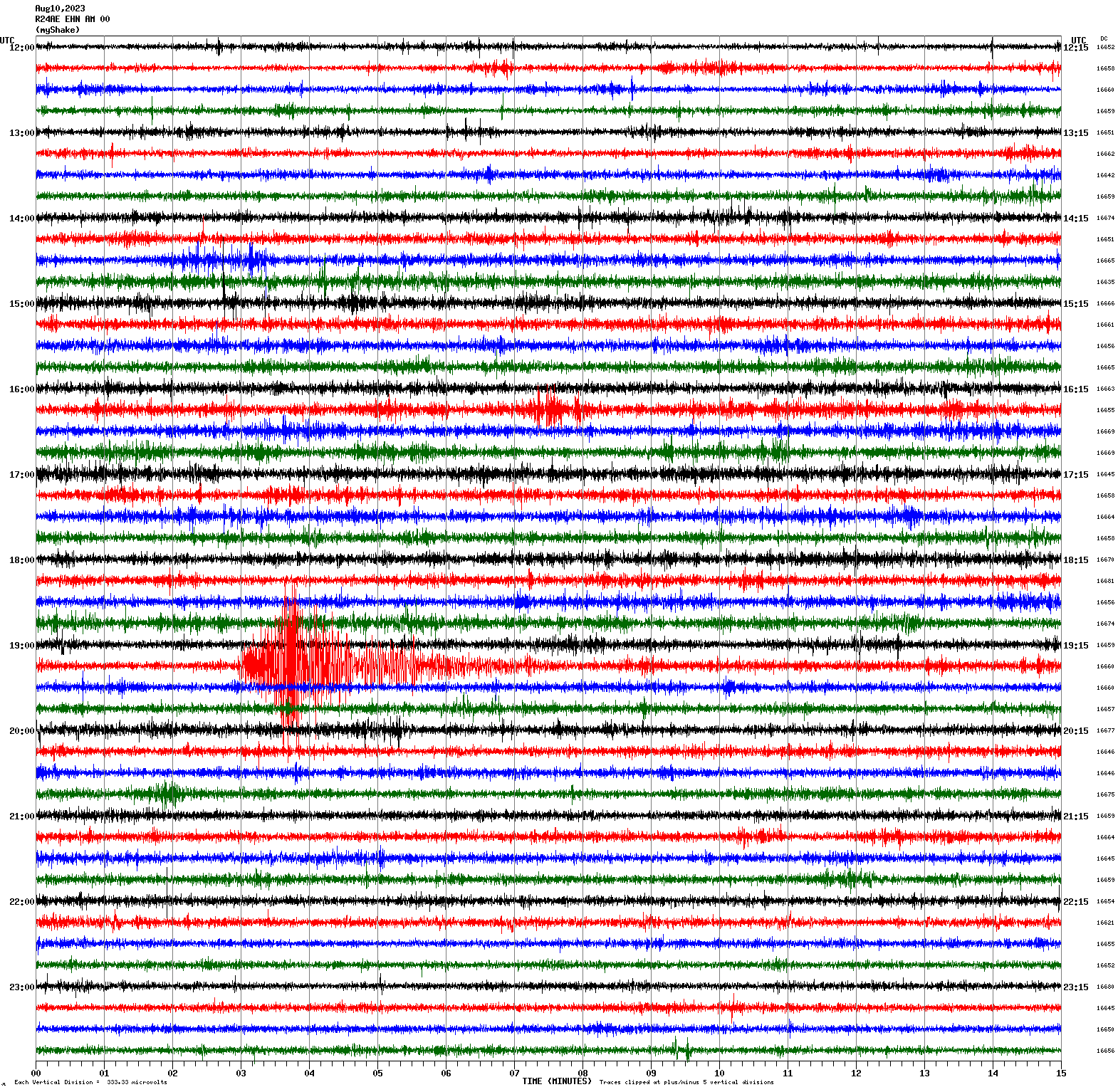
Magnitude 2.7
Depth 3.3 mi
2 mi ESE of Aromas, CA
36.874°N 121.614°W
August 10, 2023 06:53:10 UTC
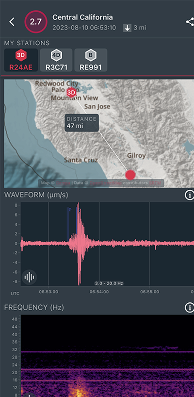
|
North/South Sensor
|
Magnitude 2.9
Depth 3.3 mi
2 mi ESE of Aromas, CA
36.875°N 121.613°W
August 6, 2023 09:49:20 UTC

|
North/South Sensor
|
Magnitude 3.6
Depth 3.7 mi
9 mi N of Morgan Hill, CA
37.256°N 121.632°W
July 30, 2023 13:49:04 UTC
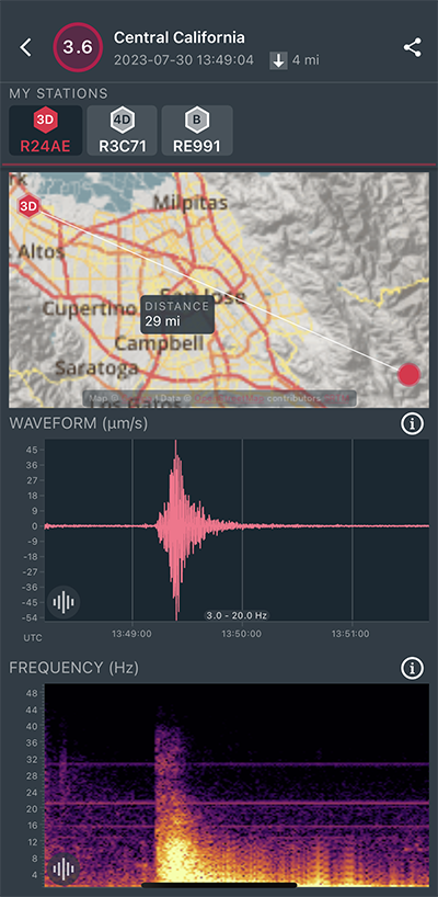
|
North/South Sensor
|
Magnitude 2.6
Depth 5.5 mi
2 mi N of Piedmont, CA
37.854°N 122.237°W
July 27, 2023 07:38:21 UTC
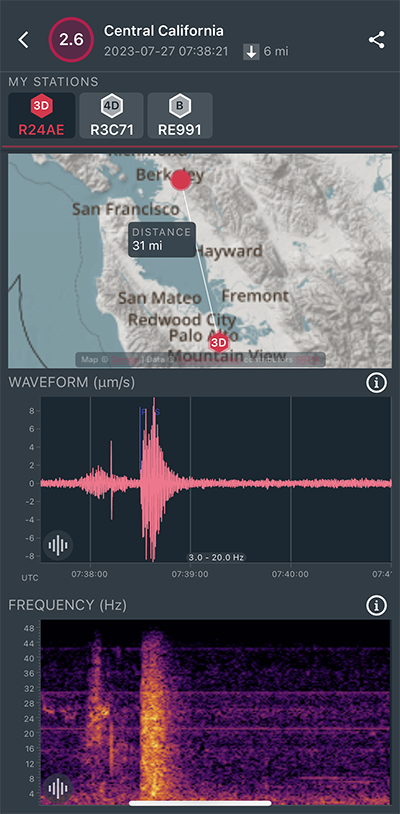
|
East/West Sensor
|
Magnitude 2.6
Depth 4.6 mi
7 mi ESE of Alum Rock, CA
37.347°N 121.708°W
July 24, 2023 04:35:00 UTC
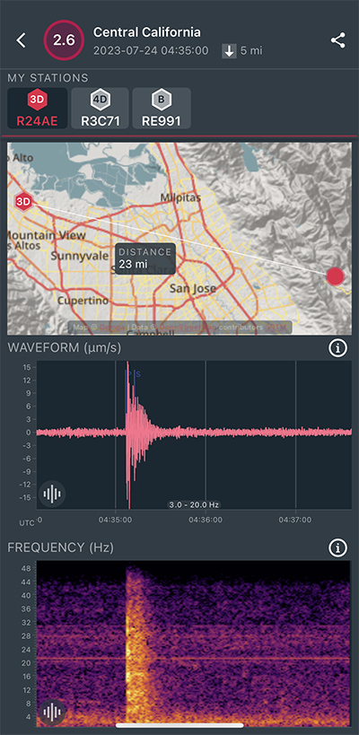
|
East/West Sensor
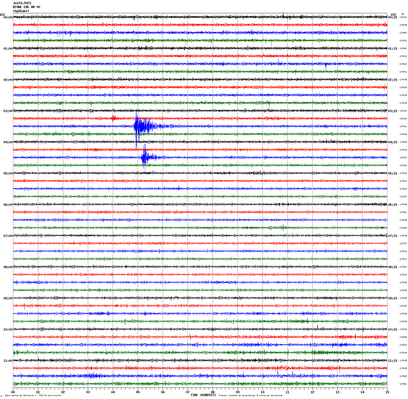
|
Magnitude 3.0
Depth 5.2 mi
6 mi E of Alum Rock, CA
37.352°N 121.710°W
July 24, 2023 03:34:43 UTC
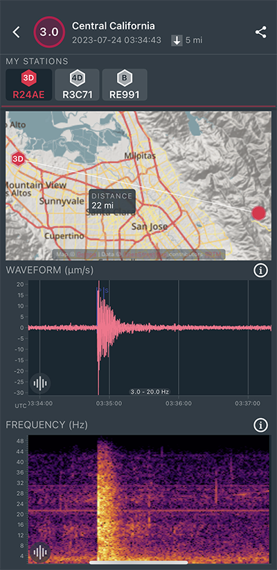
|
East/West Sensor
|
Magnitude 5.1
Depth 1.5 mi
29 mi E of Austin, Nevada
39.523°N 116.518°W
July 19, 2023 07:34:23 UTC
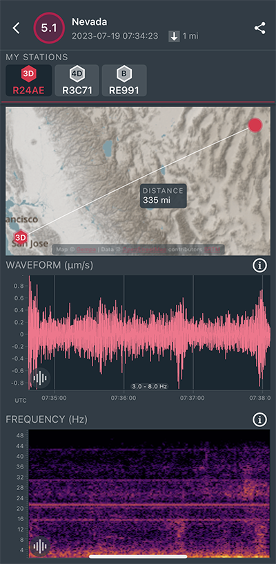
|
East/West Sensor
|
Magnitude 2.5
Depth 4.1 mi
9 mi SSE of Tres Pinos, CA
36.655°N 121.285°W
July 17, 2023 01:30:48 UTC
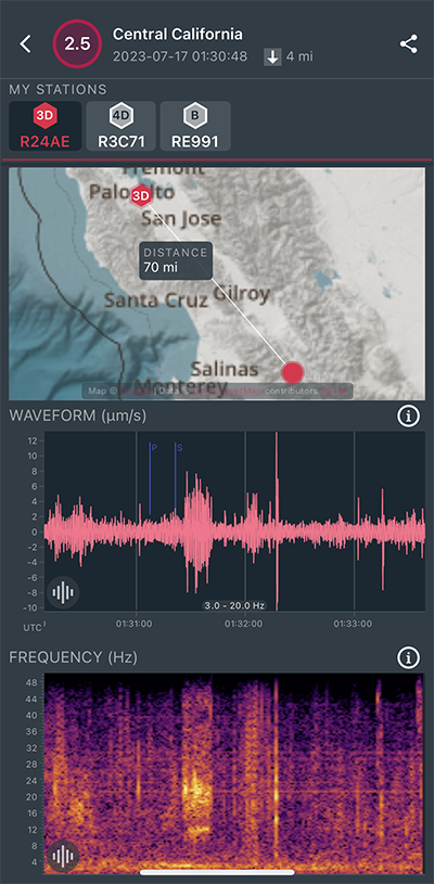
|
East/West Sensor
|
Magnitude 7.2
Depth 20.2 mi
Alaska Peninsula
54.460°N 160.760°W
July 16, 2023 06:48:22 UTC
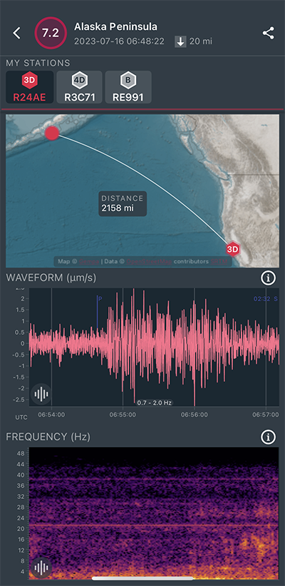
|
East/West Sensor
|
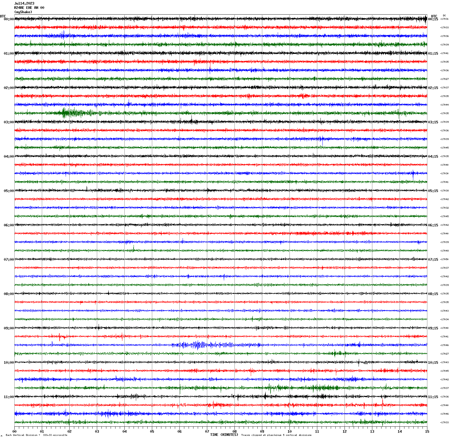
Magnitude 6.3
Depth 22.8 mi
near the coast of Chiapas, Mexico
15.034°N 93.877°W
July 14, 2023 09:29:01 UTC
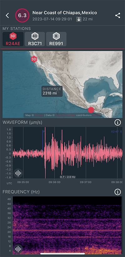
|
East/West Sensor
|
Magnitude 3.5
Depth 0.7 mi
2 mi SSE of The Geysers, CA
38.750°N 122.733°W
July 9, 2023 05:30:39 UTC
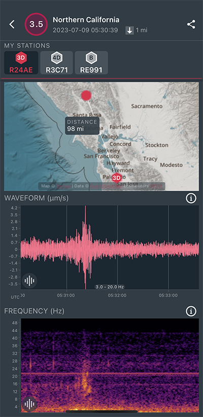
|
East/West Sensor
|
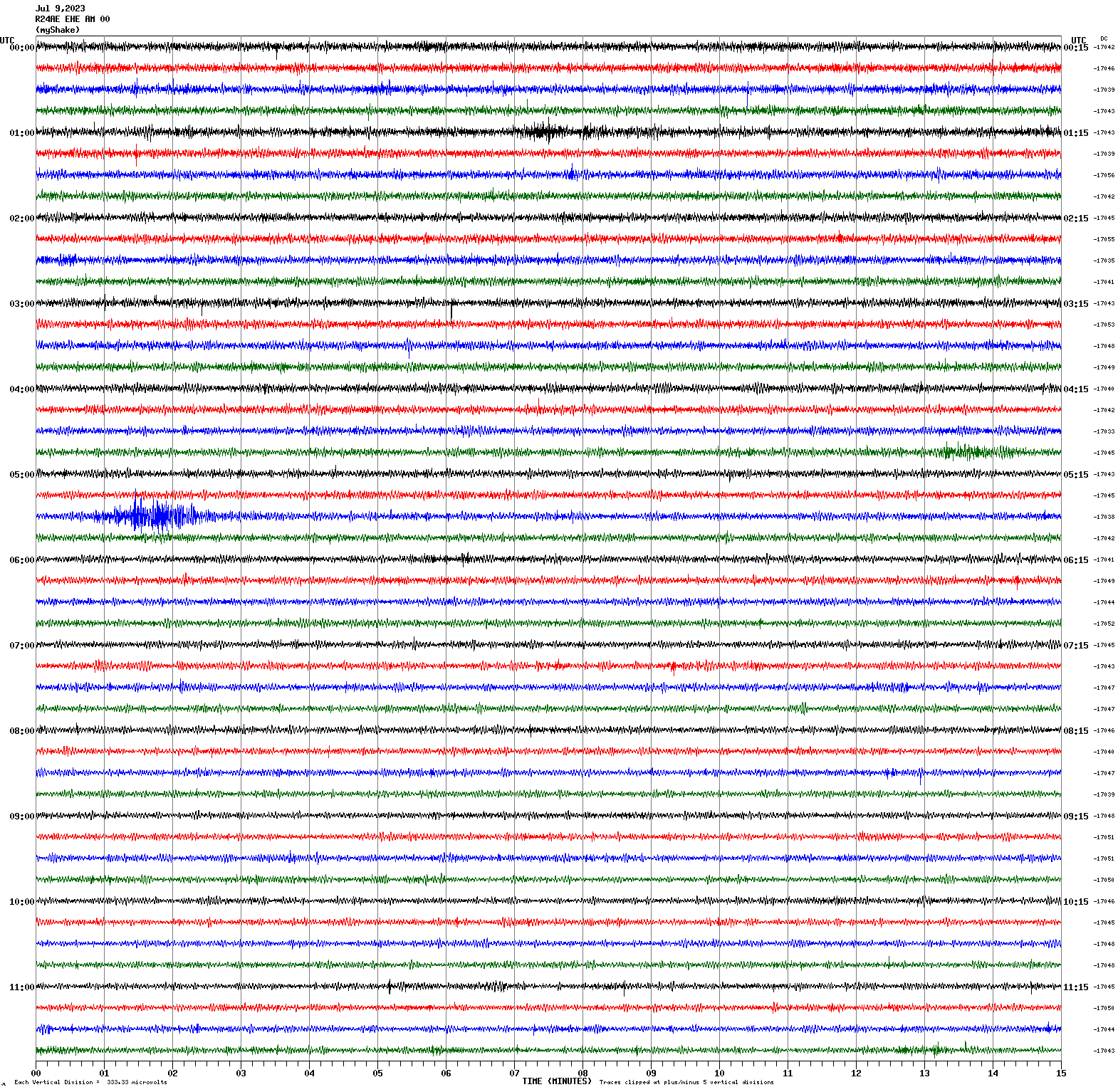
Magnitude 1.4
Depth 0.0 mi
2 mi W of Los Altos Hills, CA
37.376°N 122.172°W
July 5, 2023 09:28:34 UTC
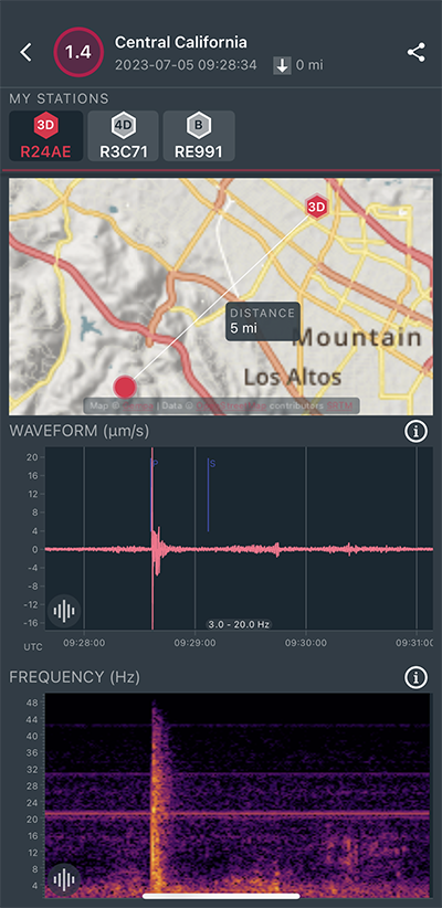
|
East/West Sensor
|
Magnitude 6.9
Depth 139.8 mi
Tonga
17.853°S 174.937°W
July 2, 2023 10:27:43 UTC
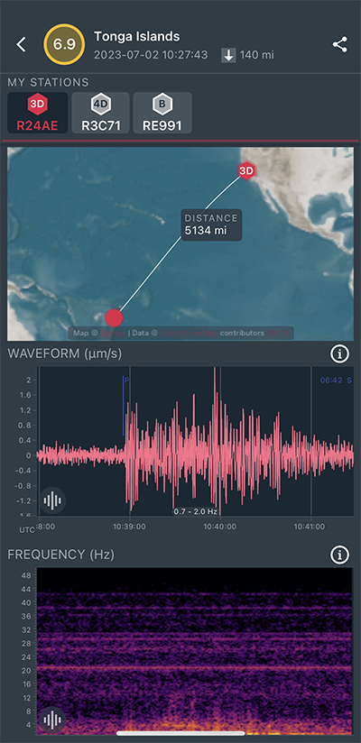
|
North/South Sensor
|
Magnitude 3.0
Depth 4.3 mi
5 mi NE of Gilroy, CA
37.054°N 121.507°W
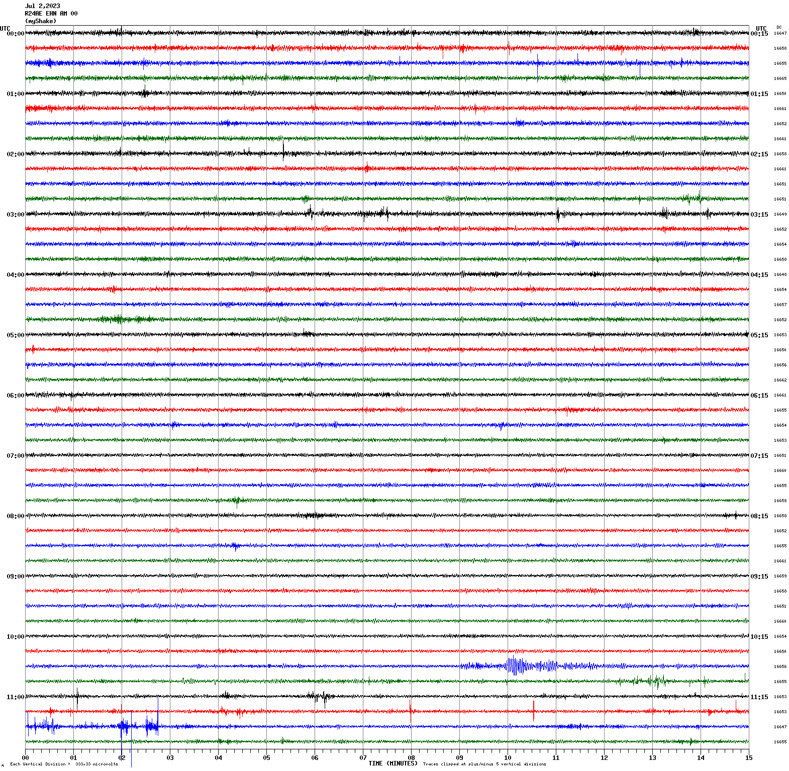
June 28, 2023 04:39:36 UTC
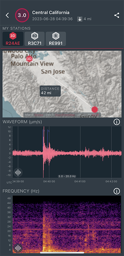
|
North/South Sensor
|
Magnitude 2.0
Depth 4.4 mi
1 mi SE of Portola Valley, CA
37.369°N 122.217°W
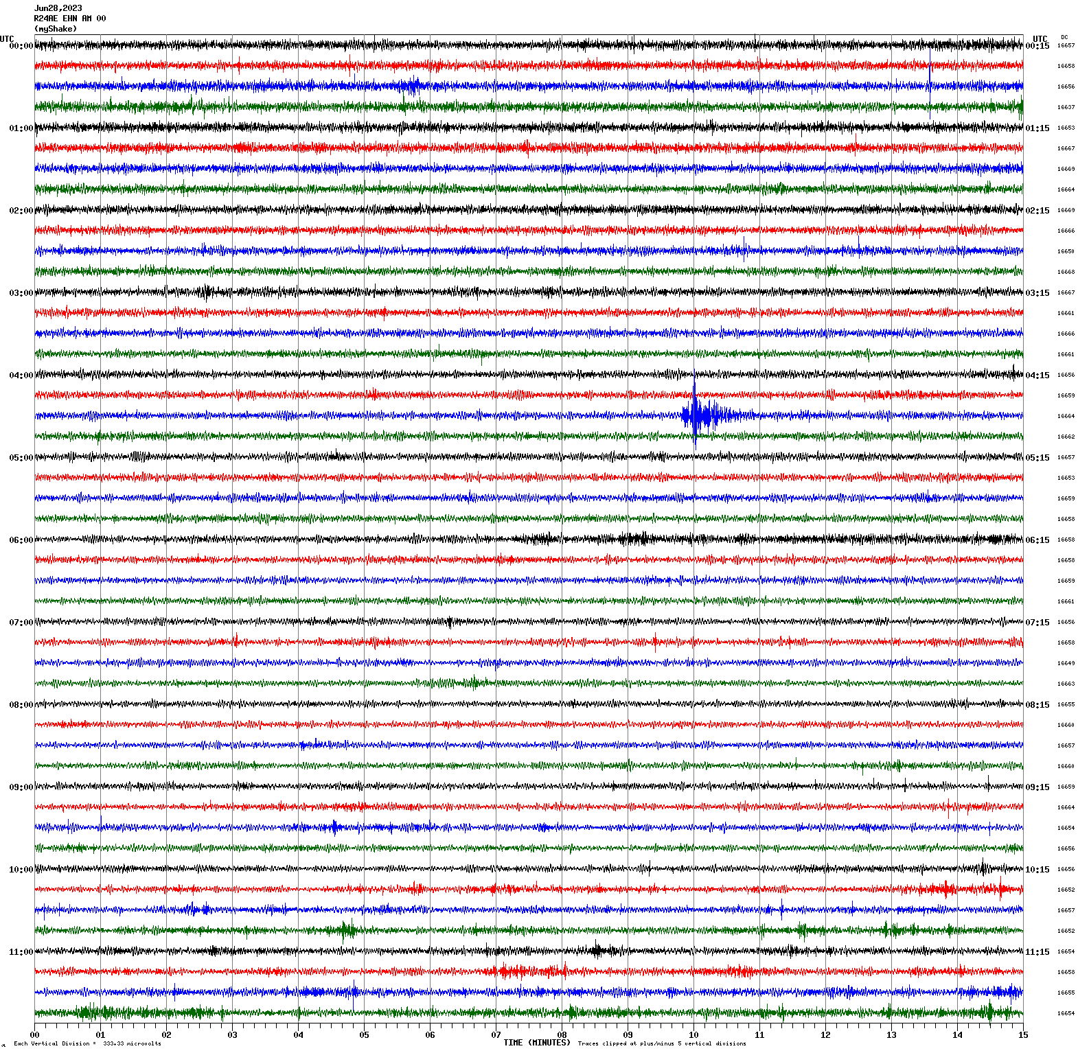
June 26, 2023 08:58:36 UTC
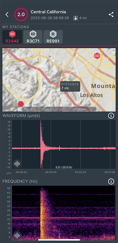
|
North/South Sensor
|
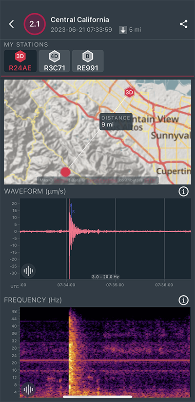
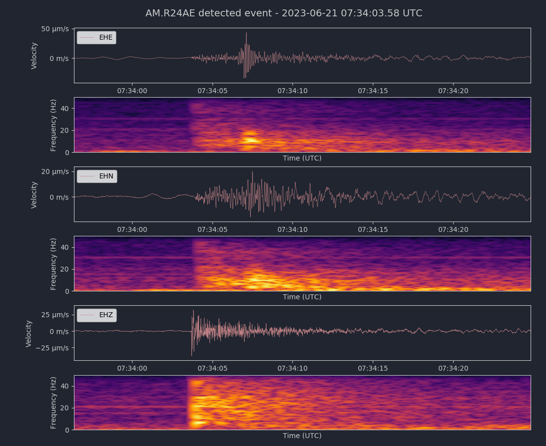
Magnitude 2.1
Depth 5.5 mi
4 mi SSE of Portola Valley, CA
37.321°N 122.212°W
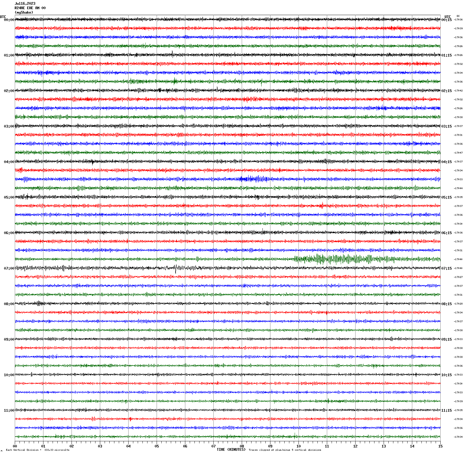
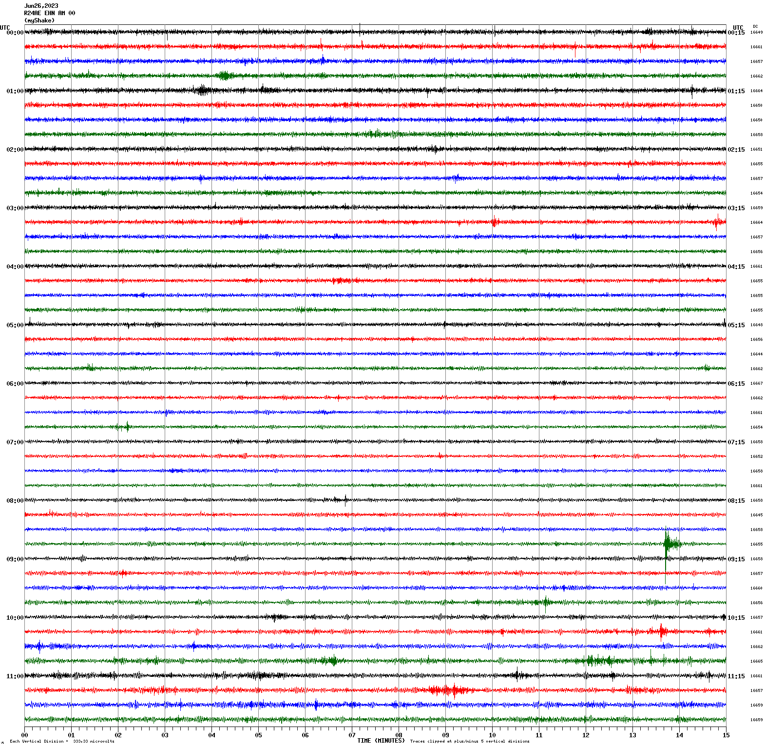
June 21, 2023 07:33:59 UTC
Magnitude 6.4
Depth 6.2 mi
65 mi ESE of La Rivera, Mexico
23.243°N 108.631°W
June 18, 2023 20:30:22 UTC
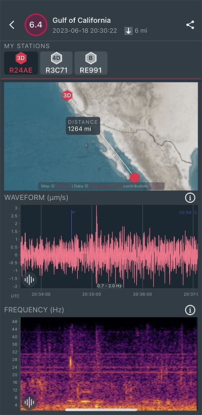
|
East/West Sensor
|
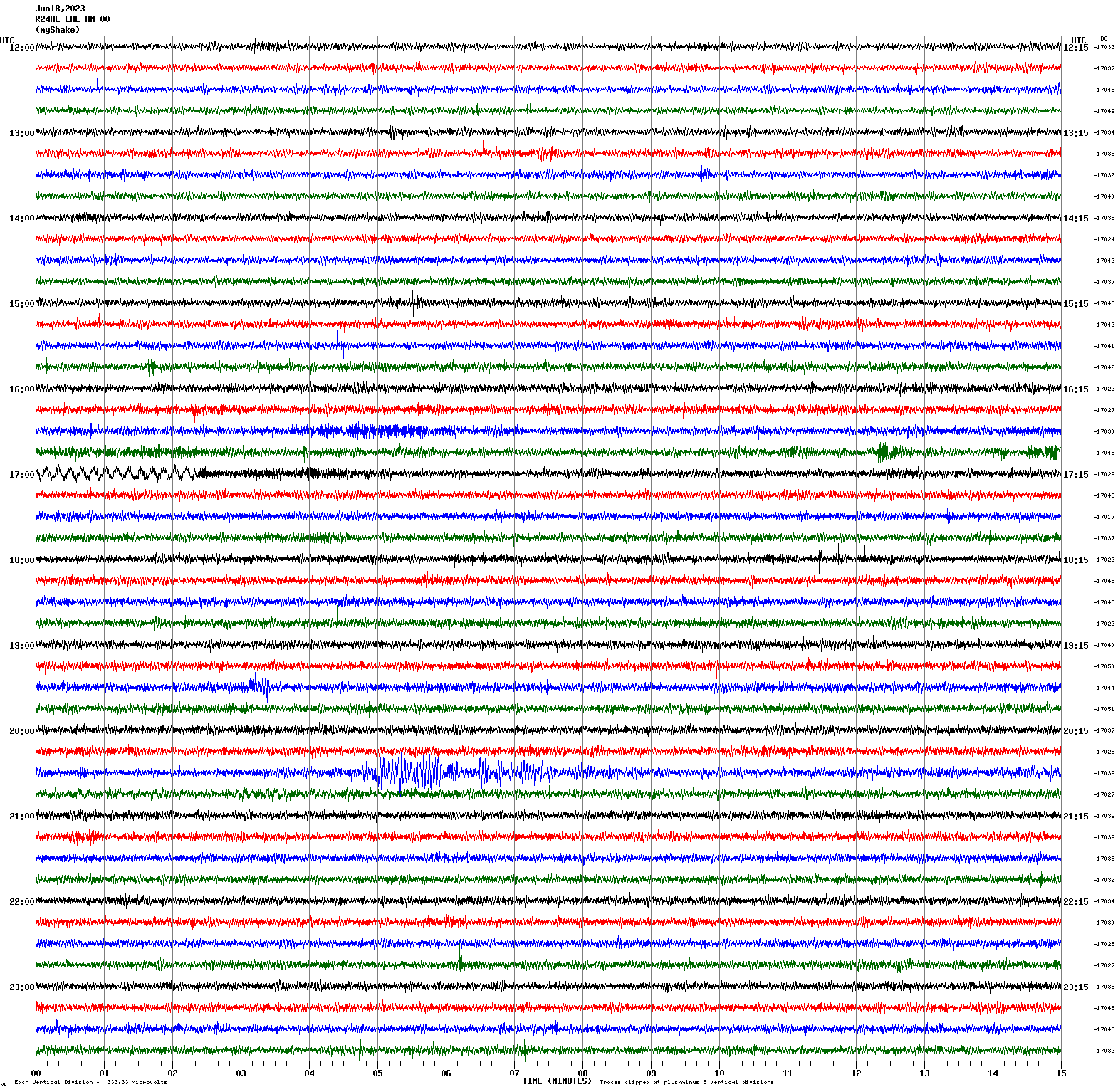
Magnitude 4.4
Depth 6.5 mi
5 mi SE of Talmage, CA
39.089°N 123.090°W
June 18, 2023 03:44:59 UTC
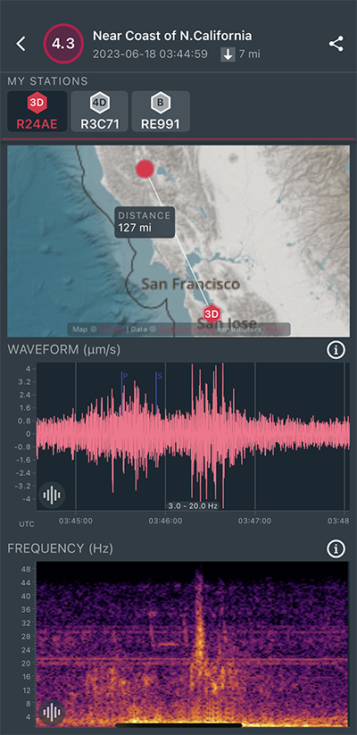
|
East/West Sensor
|
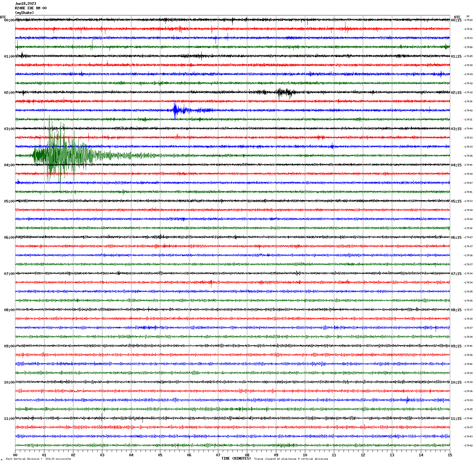
Magnitude 7.2
Depth 104.0 mi
south of the Fiji Islands
22.982°S 177.208°W
June 15, 2023 18:06:27 UTC
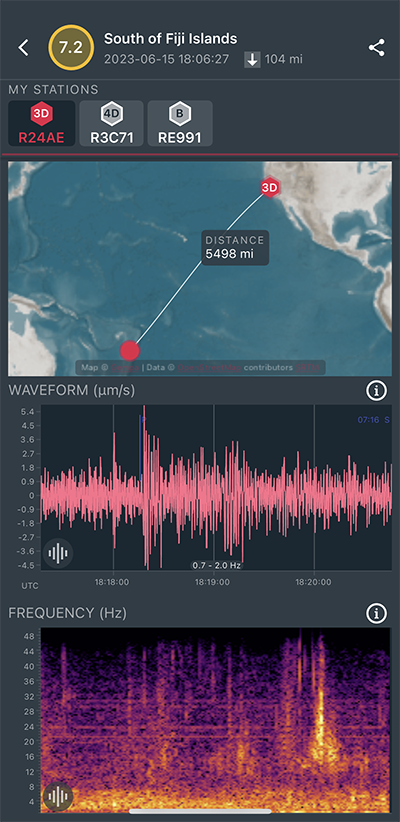
|
North/South Sensor
|
Magnitude 4.4
Depth 2.2 mi
1 mi NW of The Geysers, CA
38.792°N 122.778°W
June 3, 2023 12:01:18 UTC
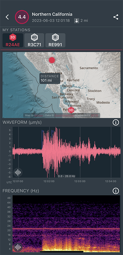
|
North/South Sensor
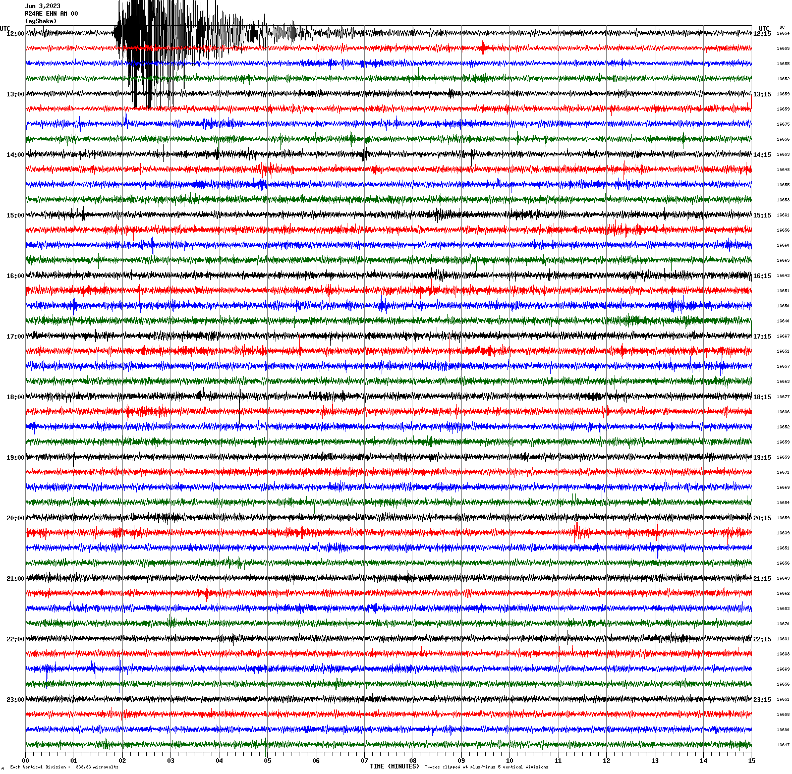
|
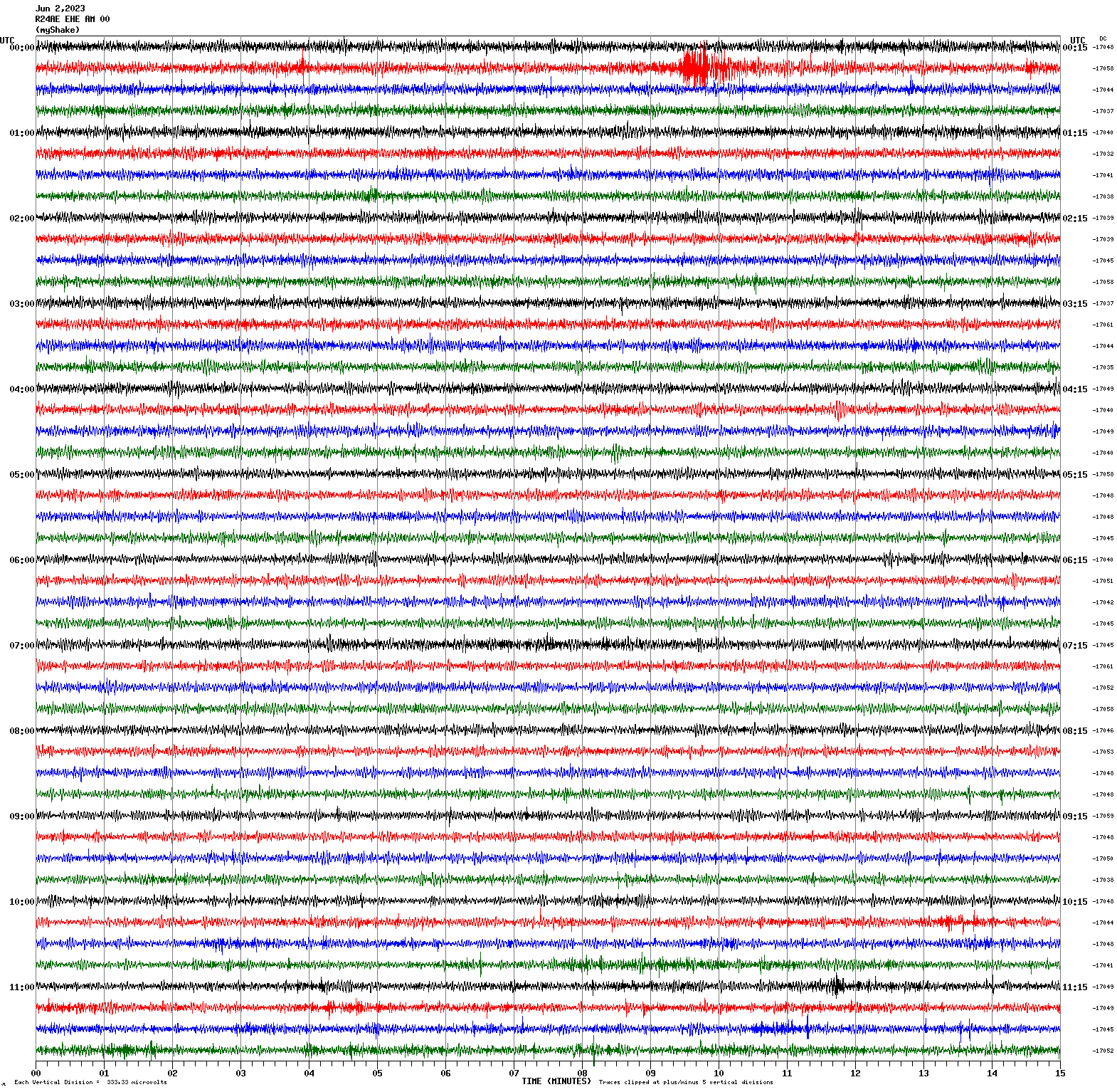
Magnitude 4.0
Depth 4.4 mi
4 mi S of Cold Springs, Nevada
39.614°N 119.980°W
June 2, 2023 00:23:05 UTC
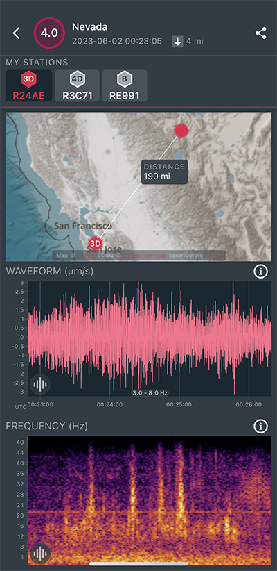
|
East/West Sensor
|
Magnitude 4.1
Depth -0.8 mi
2 mi NNE of Prattville, CA
40.237°N 121.137°W
May 26, 2023 11:26:24 UTC
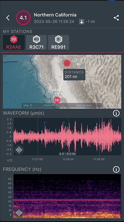
|
East/West Sensor
|
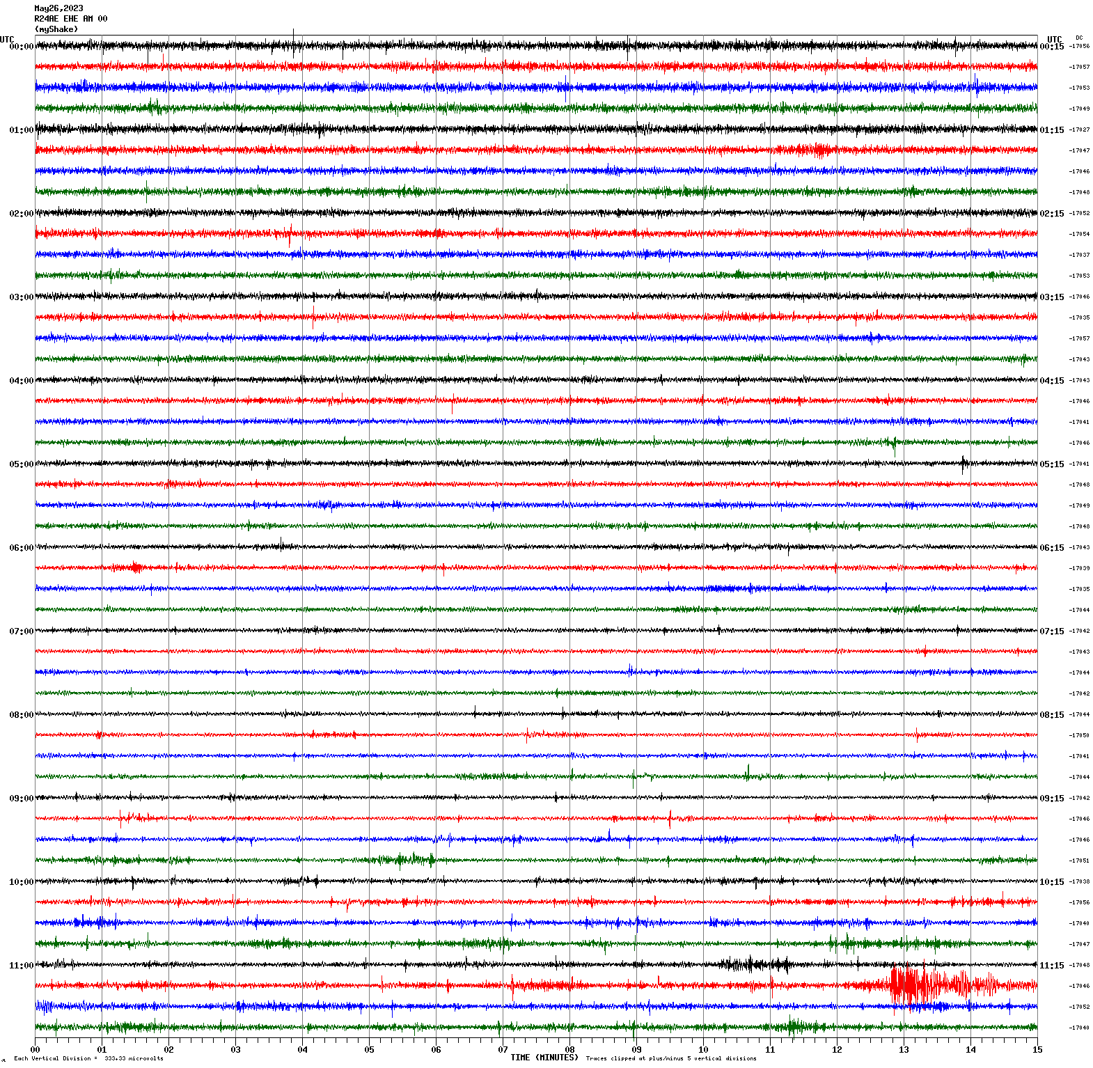
Magnitude 5.5
Depth 6.2 mi
67 mi W of Petrolia, CA
40.378°N 125.563°W
May 21, 2023 18:44:01 UTC
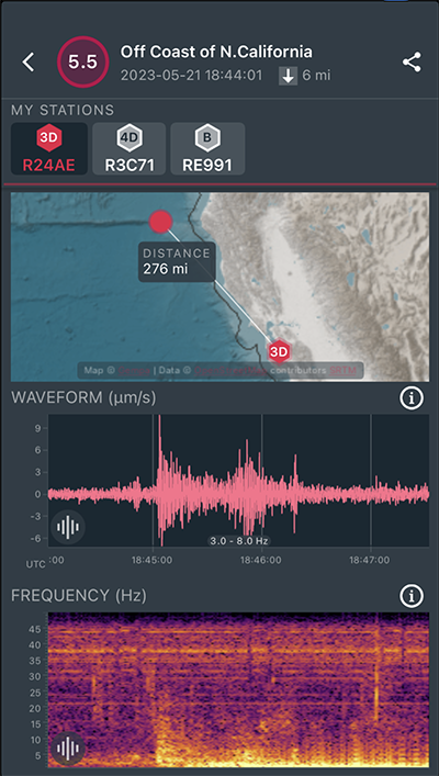
|
North/South Sensor
|
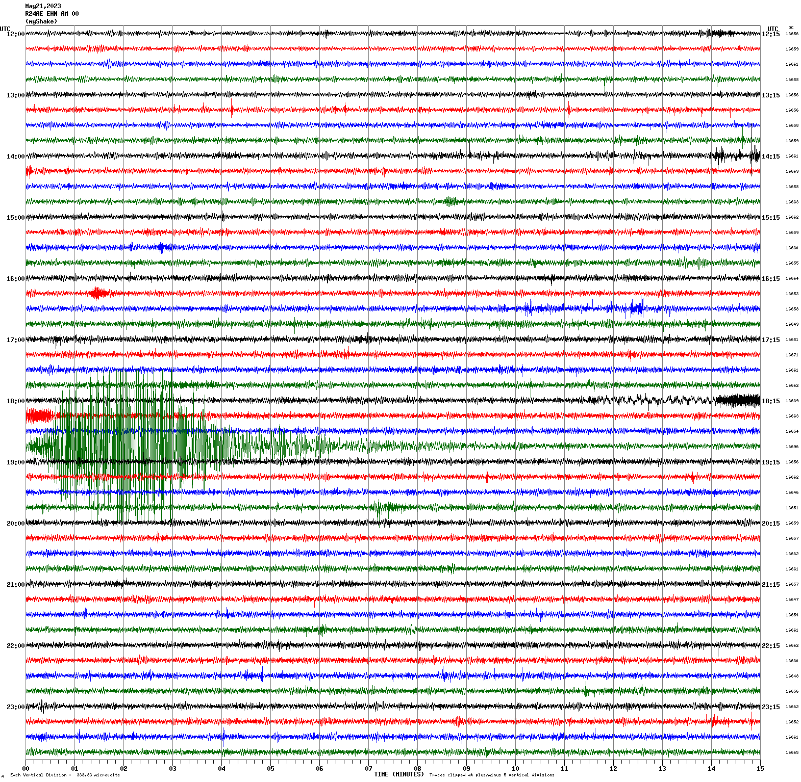
Magnitude 4.2
Depth 6.6 mi
34 mi S of Silver Peak, Nevada
37.263°N 117.601°W
May 21, 2023 03:26:29 UTC
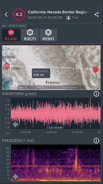
|
North/South Sensor
|
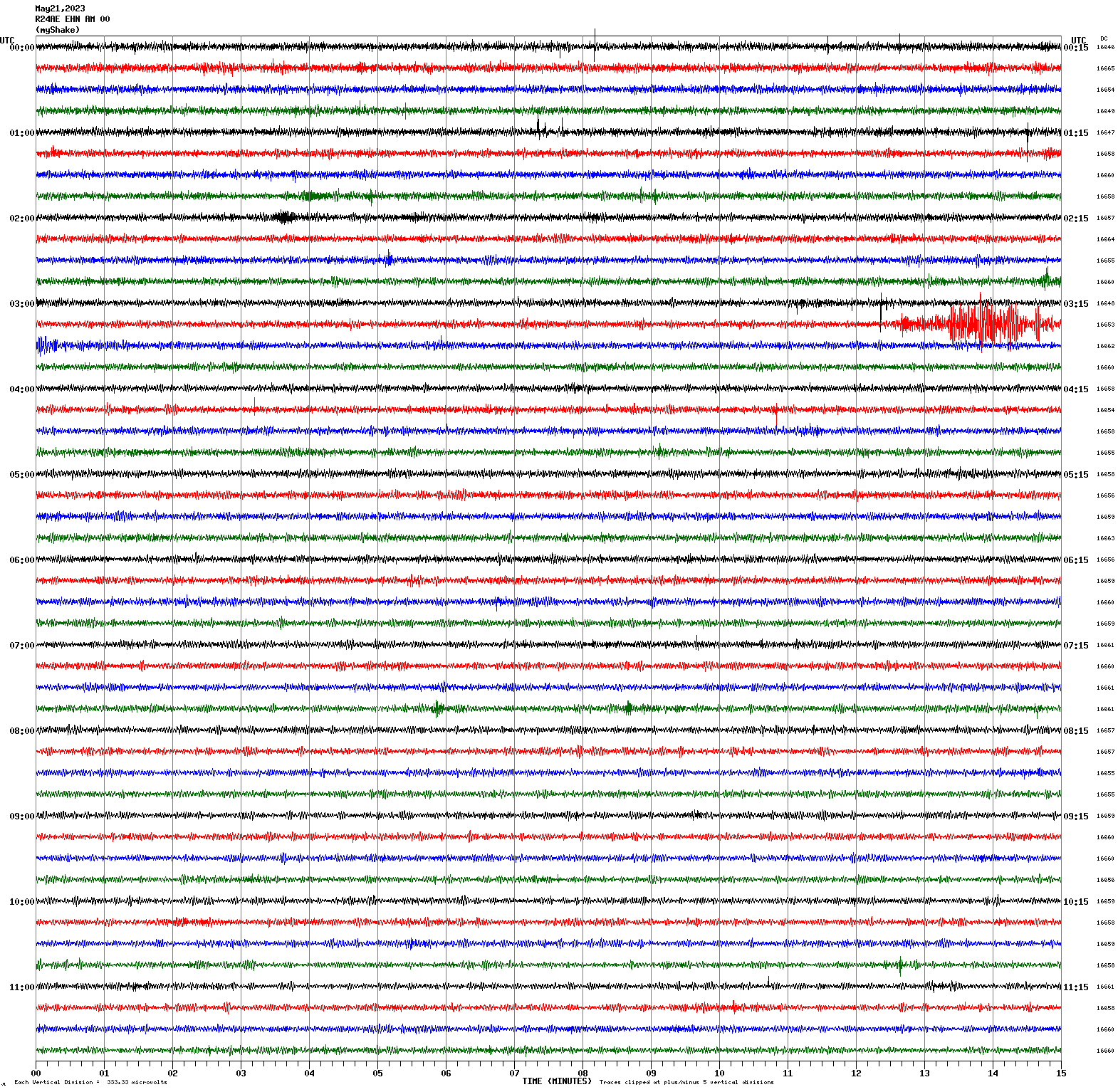
Magnitude 7.1
Depth 22.4 mi
southeast of the Loyalty Islands
23.062°S 170.456°E
May 20, 2023 01:51:01 UTC
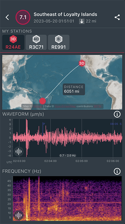
|
North/South Sensor
|
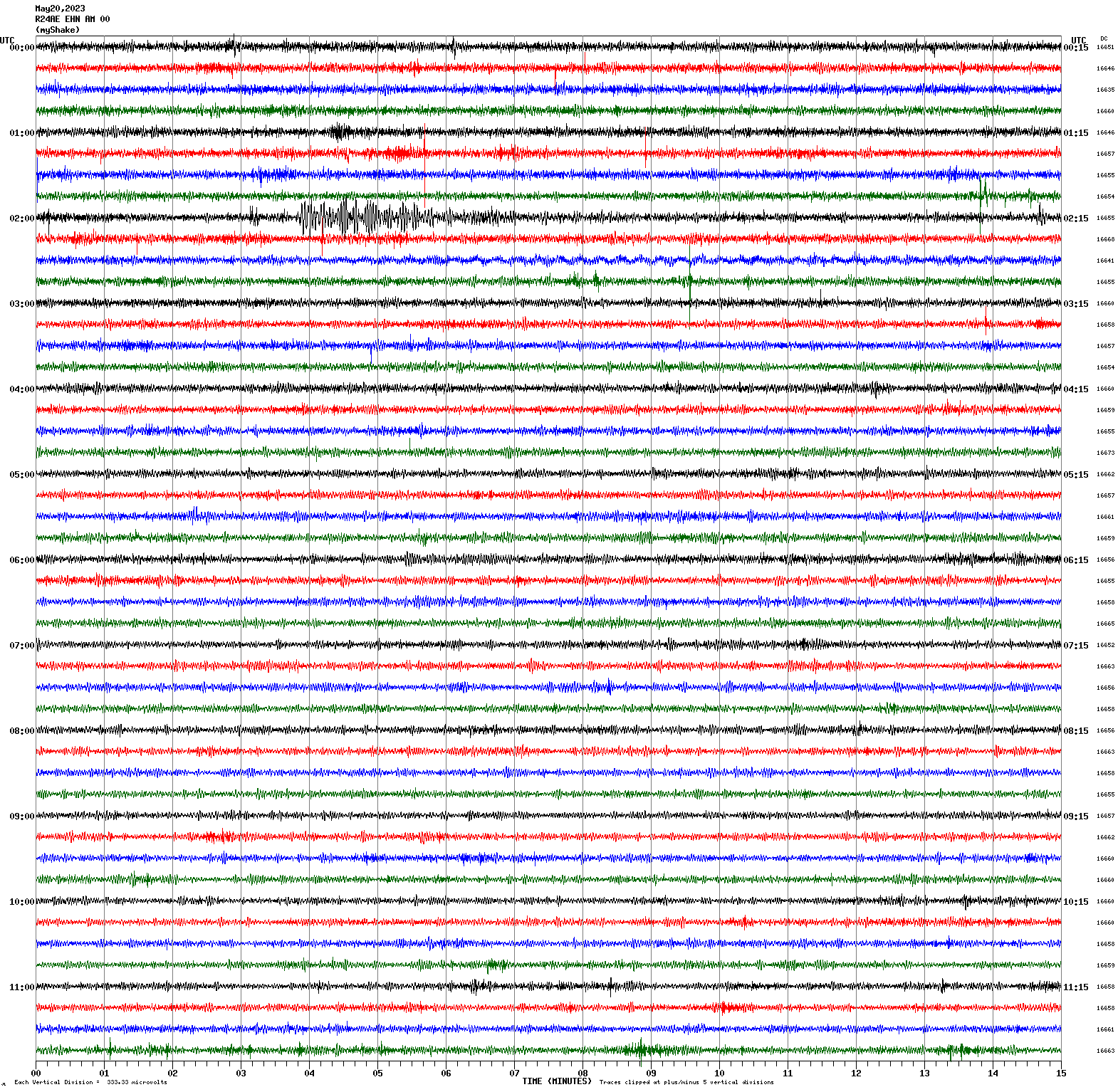
Magnitude 7.7
Depth 23.5 mi
southeast of the Loyalty Islands
23.229°S 170.694°E
May 19, 2023 02:57:06 UTC
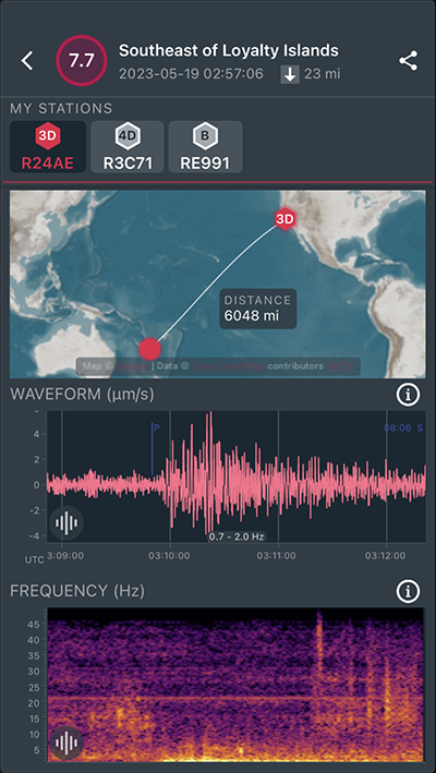
|
North/South Sensor
|
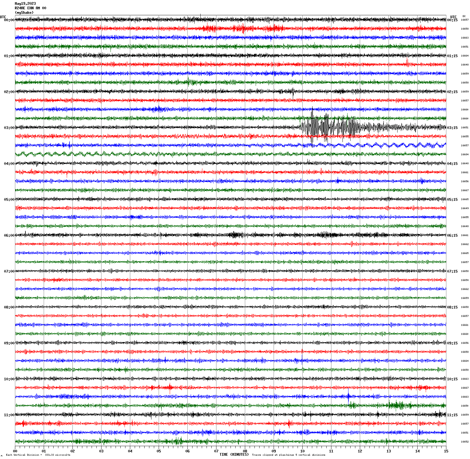
Magnitude 5.2
Depth 6.1 km
4km NW of Canyondam, CA
40.196°N 121.100°W
May 12, 2023 10:18:41 UTC
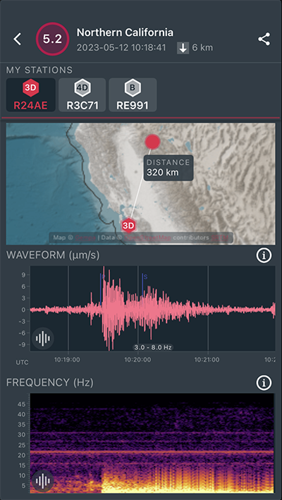
|
North/South Sensor
|
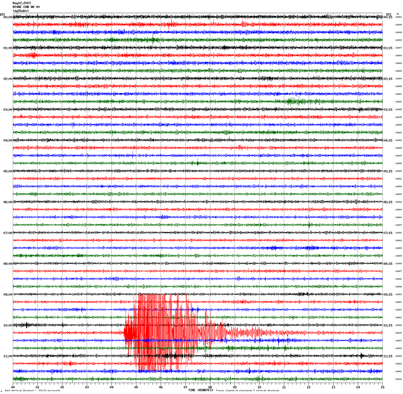
Magnitude 5.5
Depth -1.5 km
4km SW of East Shore, CA
40.216°N 121.109°W
May 11, 2023 23:19:41 UTC
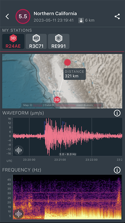
|
North/South Sensor
|
Magnitude 7.6
Depth 210.1 km
95 km WNW of Hihifo, Tonga
15.600°S 174.608°W
May 10, 2023 16:02:00 UTC
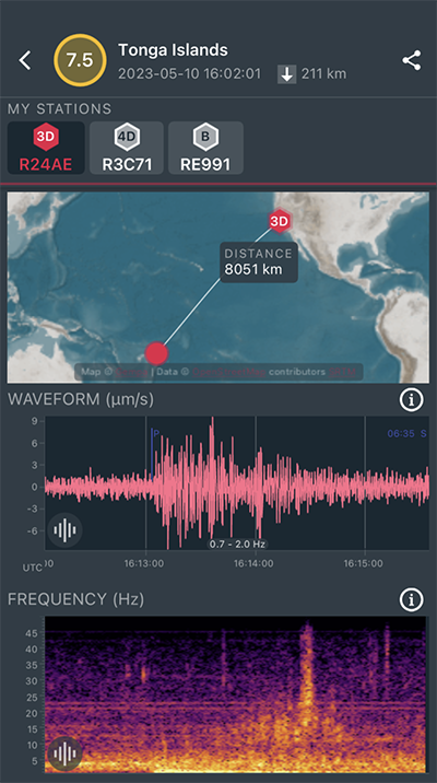
|
North/South Sensor
|
Magnitude 3.2
Depth 3.6 km
4km S of San Juan Bautista, CA
36.811°N 121.545°W
May 3, 2023 03:14:17 UTC
East/West Sensor
Magnitude 3.6
Depth 9.1 km
4km SE of Point Arena, CA
38.891°N 123.660°W
May 1, 2023 23:13:47 UTC
East/West Sensor
Magnitude 3.1
Depth 6.3 km
16km E of Seven Trees, CA
37.287°N 121.658°W
April 26, 2023 07:34:33 UTC
East/West Sensor
Magnitude 7.1
Depth 43.1 km
Kermadec Islands, New Zealand
29.968°S 177.826°W
April 24, 2023 00:41:55 UTC
East/West Sensor
Magnitude 3.2
Depth 3.3 km
11km NNW of Hollister, CA
36.937°N 121.437°W
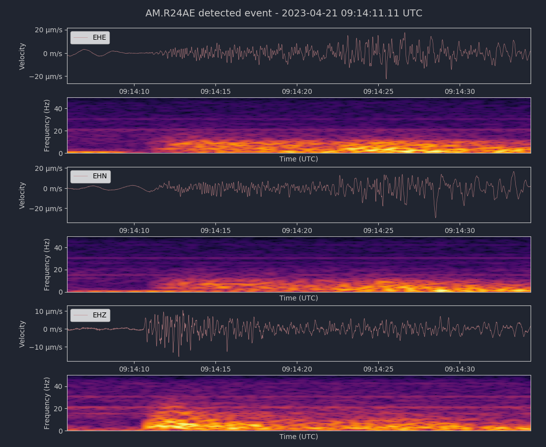
April 21, 2023 09:13:56 UTC
North/South Sensor
Voltage Counts & Frequency for All Sensors (Magnitude 3.2 Earthquake)
Magnitude 3.7
Depth 16.0 km
9km ESE of Clayton, CA
37.916°N 121.840°W
April 20, 2023 03:35:47 UTC
East/West Sensor
Magnitude 3.9
Depth 2.0 km
1km NNW of The Geysers, CA
38.787°N 122.764°W
April 13, 2023 07:42:10 UTC
East/West Sensor
Magnitude 4.4
Depth 2.0 km
7km WNW of Cobb, CA
38.836°N 122.807°W
April 12, 2023 05:39:51 UTC
East/West Sensor
Voltage Counts & Frequency for All Sensors (Magnitude 4.4 Earthquake)
Magnitude 2.5
Depth 7.7 km
12km ESE of Alum Rock, CA
37.337°N 121.698°W
April 9, 2023 09:09:10 UTC
Magnitude 2.6
Depth 7.5 km
12km ESE of Alum Rock, CA
37.338°N 121.698°W
April 9, 2023 10:21:21 UTC
East/West Sensor
Magnitude 4.5
Depth 9.2 km
2km N of Tres Pinos, CA
36.804°N 121.322°W
April 4, 2023 22:23:17 UTC
North/South Sensor
Voltage Counts & Frequency for All Sensors (Magnitude 4.5 Earthquake)
Magnitude 3.0
Depth 7.6 km
3km NNE of San Leandro, CA
37.751°N 122.143°W
April 1, 2023 16:24:56 UTC
Magnitude 2.7
Depth 7.6 km
3km NNE of San Leandro, CA
37.749°N 122.145°W
April 1, 2023 16:43:33 UTC
North/South Sensor
Magnitude 3.5
Depth 9.4 km
1km ENE of Pacifica, CA
37.617°N 122.479°W
March 28, 2023 13:01:18 UTC
North/South Sensor
Magnitude 3.4
Depth 5.1 km
11km SSW of Tres Pinos, CA
36.693°N 121.350°W
March 23, 2023 03:38:53 UTC
East/West Sensor
Magnitude 3.0
Depth 6.5 km
16km E of Seven Trees, CA
37.286°N 121.657°W
March 20, 2023 16:09:39 UTC
East/West Sensor
Magnitude 6.8
Depth 65.8 km
near the coast of Ecuador
2.837°S 79.844°W
March 18, 2023 17:12:52 UTC
East/West Sensor
Magnitude 3.9
Depth 14.9 km
15km N of Deep Springs, CA
37.507°N 117.977°W
March 18, 2023 07:03:42 UTC
East/West Sensor
Magnitude 2.9
Depth 3.0 km
19km SSE of Livermore, CA
37.525°N 121.696°W
March 16, 2023 12:35:12 UTC
East/West Sensor
Magnitude 7.0
Depth 22.1 km
Kermadec Islands region
30.115°S 176.112°W
March 16, 2023 00:56:02 UTC
North/South Sensor
Magnitude 3.5
Depth 6.2 km
13km NNW of San Simeon, CA
30.115°S 176.112°W
March 15, 2023 18:29:41 UTC
North/South Sensor
Magnitude 3.9
Depth 10.0 km
9km NW of Pinnacles, CA
36.594°N 121.200°W
March 7, 2023 14:33:12 UTC
East/West Sensor
Magnitude 3.6
Depth 2.7 km
2km WNW of The Geysers, CA
38.788°N 122.782°W
March 2, 2023 21:16:50 UTC
East/West Sensor
Magnitude 3.6
Depth 5.7 km
9km ENE of San Martin, CA
37.109°N 121.517°W
January 23, 2023 13:58:02 UTC
East/West Sensor
Magnitude 2.9
Depth 6.5 km
1km ESE of Portola Valley, CA
37.380°N 122.225°W
January 21, 2023 00:55:49 UTC
Magnitude 2.4
Depth 6.8 km
1km ESE of Portola Valley, CA
37.380°N 122.226°W
January 21, 2023 02:52:20 UTC
North/South Sensor
Voltage Counts & Frequency for All Sensors (Magnitude 2.9 Earthquake)
Magnitude 3.6
Depth 4.4 km
9km SW of Cloverdale, CA
38.750°N 123.097°W
January 20, 2023 01:18:07 UTC
Magnitude 2.9
Depth 6.8 km
1km SE of Portola Valley, CA
37.377°N 122.226°W
January 20, 2023 07:09:07 UTC
North/South Sensor
Voltage Counts & Frequency for All Sensors (Magnitude 2.9 Earthquake)
Magnitude 3.6
Depth 5.3 km
4km S of San Juan Bautista, CA
36.810°N 121.531°W
January 19, 2023 17:15:55 UTC
East/West Sensor
Magnitude 5.4
Depth 27.8 km
15km SE of Rio Dell, CA
40.412°N 123.970°W
January 1, 2023 18:35:04 UTC
East/West Sensor
Magnitude 4.0
Depth 7.7 km
9km NW of Pinnacles, CA
36.595°N 121.206°W
January 1, 2023 06:49:10 UTC
East/West Sensor
Magnitude 3.3
Depth 4.9 km
2km N of Union City, CA
37.617°N 122.024°W
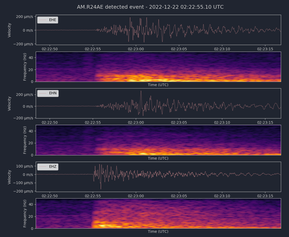
December 22, 2022 02:22:50 UTC
North/South Sensor
Voltage Counts & Frequency for All Sensors (Magnitude 3.3 Earthquake)
Magnitude 3.1
Depth 4.2 km
2km NE of San Leandro, CA
37.740°N 122.143°W
December 21, 2022 16:34:26 UTC
East/West Sensor
Magnitude 6.4
Depth 17.9 km
15km WSW of Ferndale, CA
40.525°N 124.423°W
December 20, 2022 10:34:24 UTC
North/South Sensor
Magnitude 3.6
Depth 5.8 km
1km NE of El Cerrito, CA
37.924°N 122.302°W
December 17, 2022 11:39:42 UTC
North/South Sensor
Voltage Counts & Frequency for All Sensors (Magnitude 3.6 Earthquake)
Magnitude 3.4
Depth 9.1 km
10km NW of Pinnacles, CA
36.602°N 121.210°W
December 13, 2022 12:31:28 UTC
East/West Sensor
Magnitude 3.9
Depth 8.9 km
7km SSW of Kettleman City, CA
35.952°N 119.998°W
December 6, 2022 00:10:37 UTC
North/South Sensor
Magnitude 3.7
Depth 6.9 km
13km ESE of Alum Rock, CA
37.325°N 121.689°W
December 5, 2022 23:13:16 UTC
North/South Sensor
Magnitude 3.0
Depth 5.5 km
16km E of Seven Trees, CA
37.290°N 121.664°W
November 23, 2022 22:34:02 UTC
North/South Sensor

Magnitude 2.8
Depth 10.5 km
3km S of Half Moon Bay, CA
37.440°N 122.424°W
November 16, 2022 05:22:16 UTC
East/West Sensor
Magnitude 2.8
Depth 9.5 km
2km SSW of Alamo, CA
37.833°N 122.043°W
November 12, 2022 04:31:09 UTC
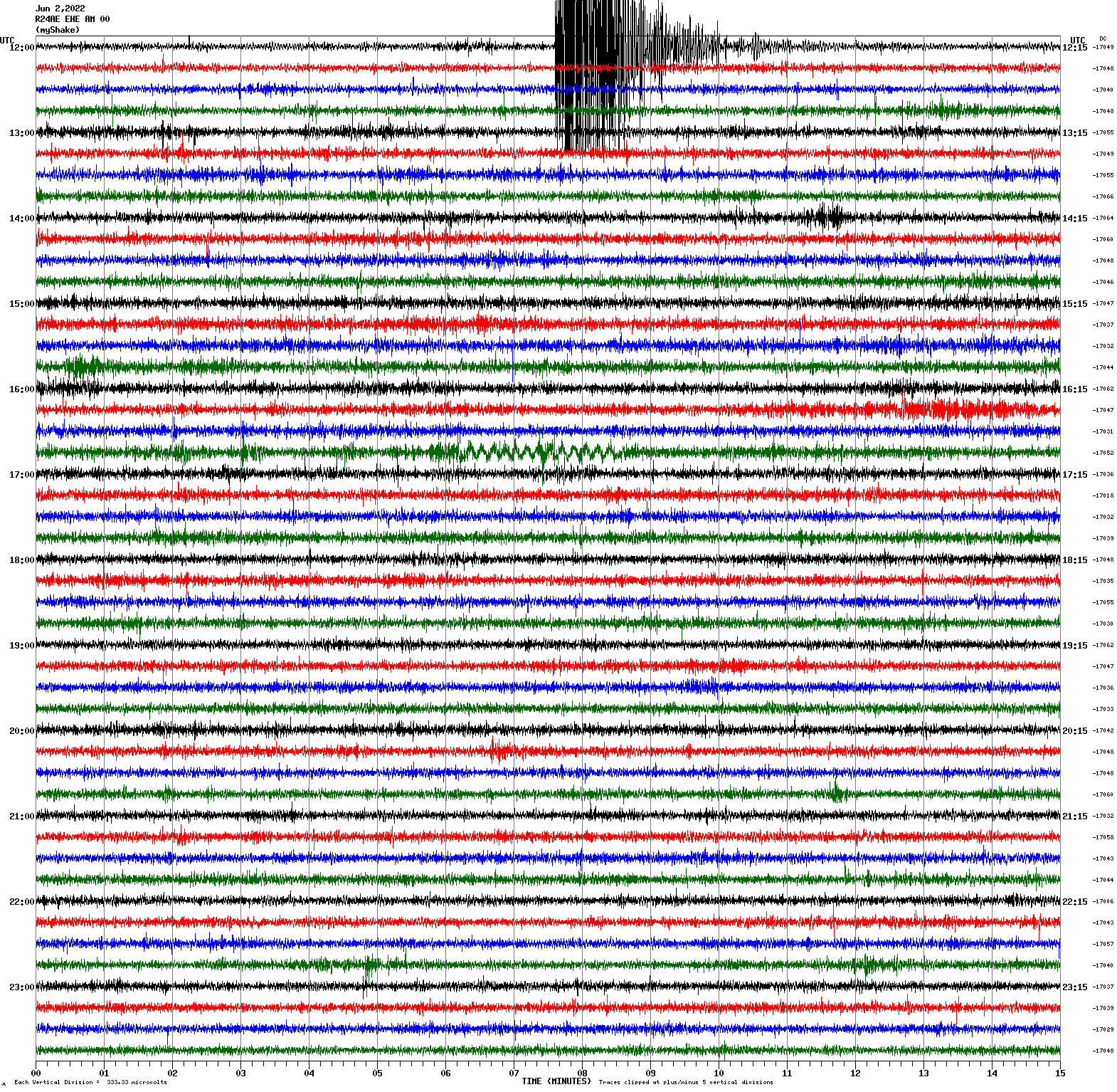
Magnitude 7.0
Depth 587.2 km
Fiji region
20.116°S 178.363°W
November 12, 2022 07:09:14 UTC
East/West Sensor
Magnitude 7.3
Depth 24.8 km
211 km ESE of Neiafu, Tonga
19.318°S 172.100°W
November 11, 2022 10:48:45 UTC
North/South Sensor
Magnitude 3.8
Depth 5.6 km
16km WNW of Lake Pillsbury, CA
39.483°N 123.117°W
November 7, 2022 02:01:27 UTC
North/South Sensor
Magnitude 2.8
Depth 8.8 km
9km NE of Alum Rock, CA
37.430°N 121.773°W
November 3, 2022 15:45:22 UTC
North/South Sensor
Magnitude 6.0
Depth 10.0 km
North Pacific Ocean
31.425°N 133.301°W
November 2, 2022 04:53:12 UTC
Magnitude 2.8
Depth 7.2 km
14km E of Seven Trees, CA
37.309°N 121.677°W
November 2, 2022 11:12:23 UTC
North/South Sensor
Magnitude 2.6
Depth 7.9 km
6km SE of Pleasanton, CA
37.626°N 121.817°W
October 31, 2022 06:06:05 UTC
Magnitude 2.8
Depth 7.8 km
6km SE of Pleasanton, CA
37.627°N 121.818°W
October 31, 2022 06:06:32 UTC
Magnitude 2.9
Depth 7.0 km
14km ESE of Alum Rock, CA
37.316°N 121.681°W
October 31, 2022 07:20:59 UTC
East/West Sensor
Magnitude 2.8
Depth 7.4 km
14km ESE of Alum Rock, CA
37.317°N 121.683°W
October 26, 2022 00:20:10 UTC
East/West Sensor
Magnitude 5.1
Depth 6.9 km
14km E of Seven Trees, CA
37.311°N 121.677°W
October 25, 2022 18:42:02 UTC
Magnitude 3.6
Depth 7.4 km
14km E of Seven Trees, CA
37.310°N 121.678°W
October 25, 2022 22:08:37 UTC
East/West Sensor
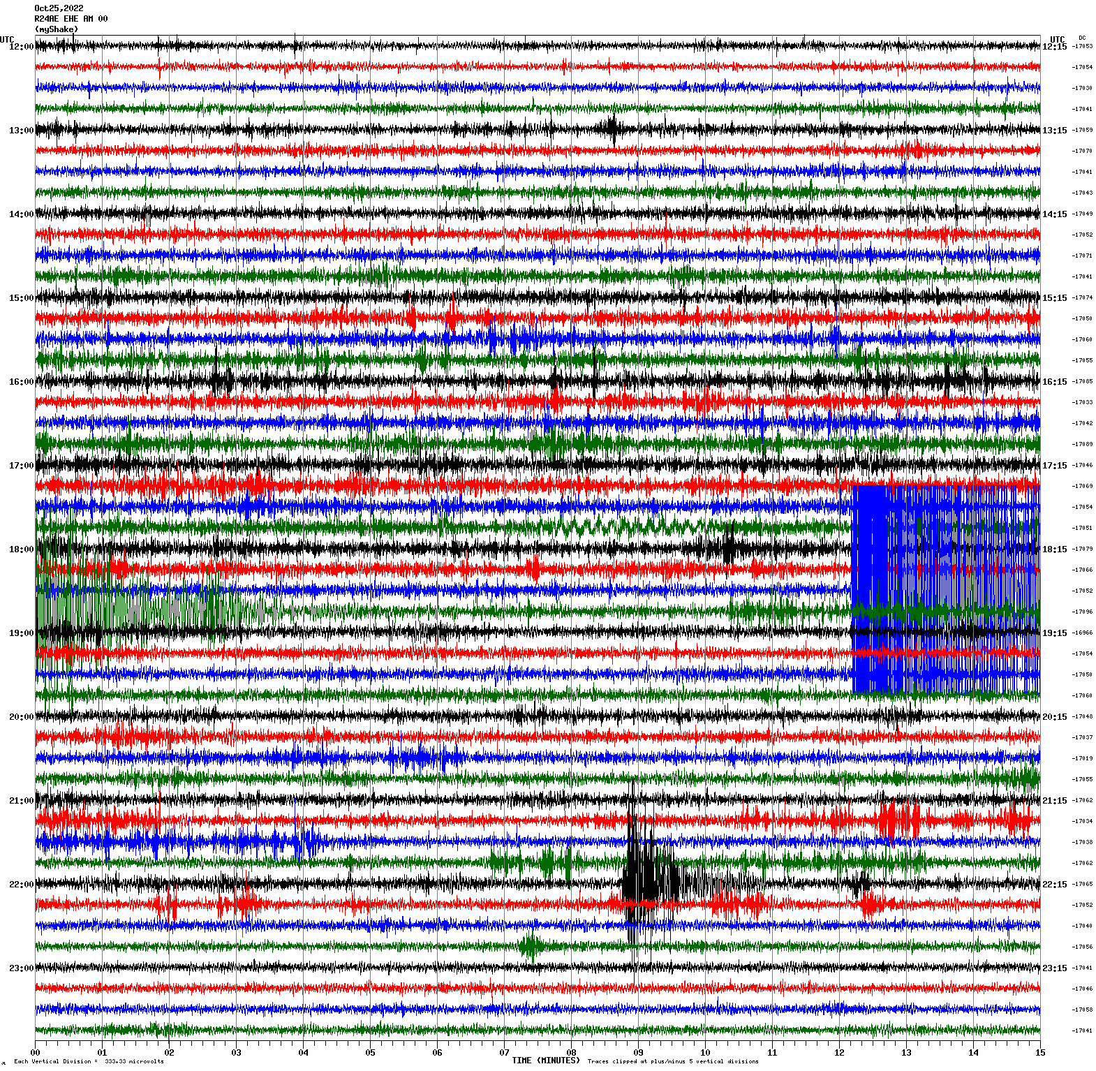
Voltage Counts & Frequency for All Sensors (Magnitude 5.1 Earthquake)
Magnitude 3.3
Depth 2.4 km
6km NW of The Geysers, CA
38.818°N 122.808°W
October 19, 2022 23:59:50 UTC
Magnitude 3.2
Depth 1.7 km
6km NW of The Geysers, CA
38.816°N 122.811°W
October 19, 2022 00:02:34 UTC
East/West Sensor
Magnitude 6.3
Depth 10 km
Off the coast of Central America
4.377°N 87.515°W
October 16, 2022 12:48:21 UTC
East/West Sensor
Magnitude 3.4
Depth 7.6 km
24km NE of Alum Rock, CA
37.500°N 121.621°W
September 28, 2022 17:02:02 UTC
East/West Sensor
Magnitude 4.8
Depth 2.4 km
44km W of Petrolia, CA
40.320°N 124.808°W
September 24, 2022 19:27:37 UTC
East/West Sensor
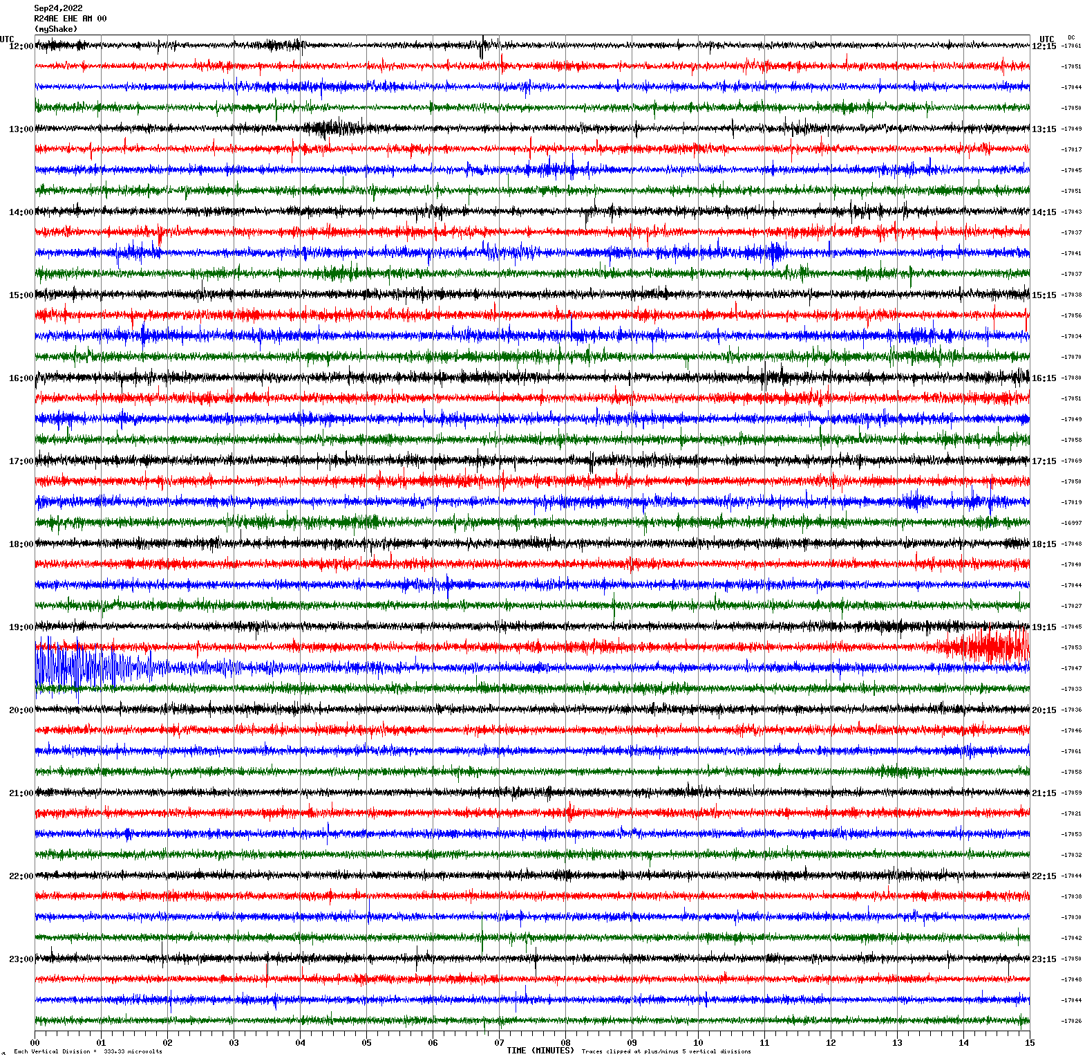
Magnitude 6.8
Depth 24.1 km
Michoacan, Mexico
18.308°N 102.923°W
September 22, 2022 06:16:09 UTC
North/South Sensor
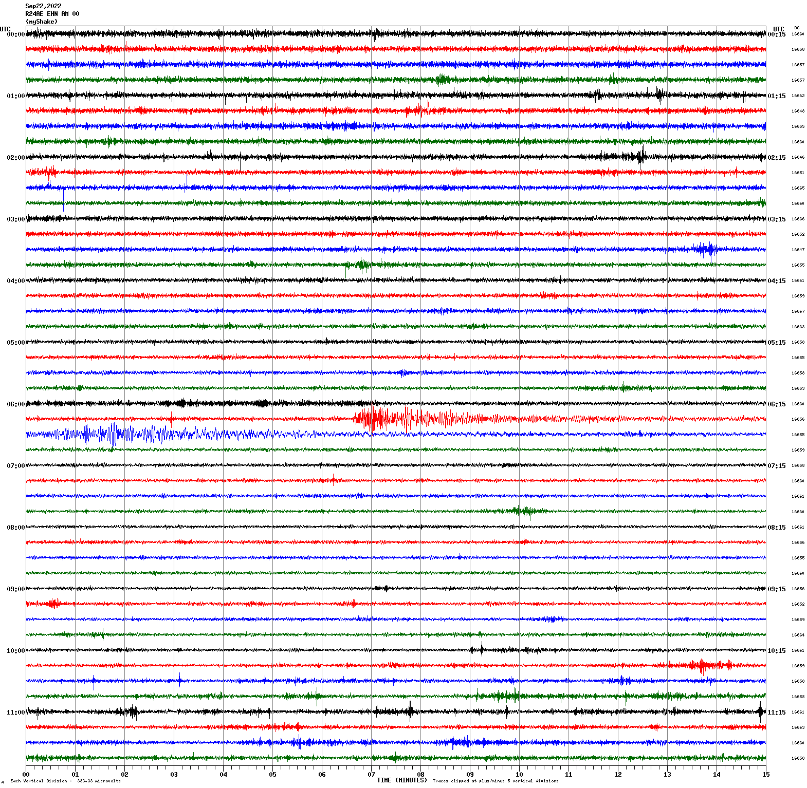
Magnitude 7.6
Depth 15.1 km
37 km SE of Aquila, Mexico
18.367°N 103.252°W
September 19, 2022 18:05:06 UTC
East/West Sensor
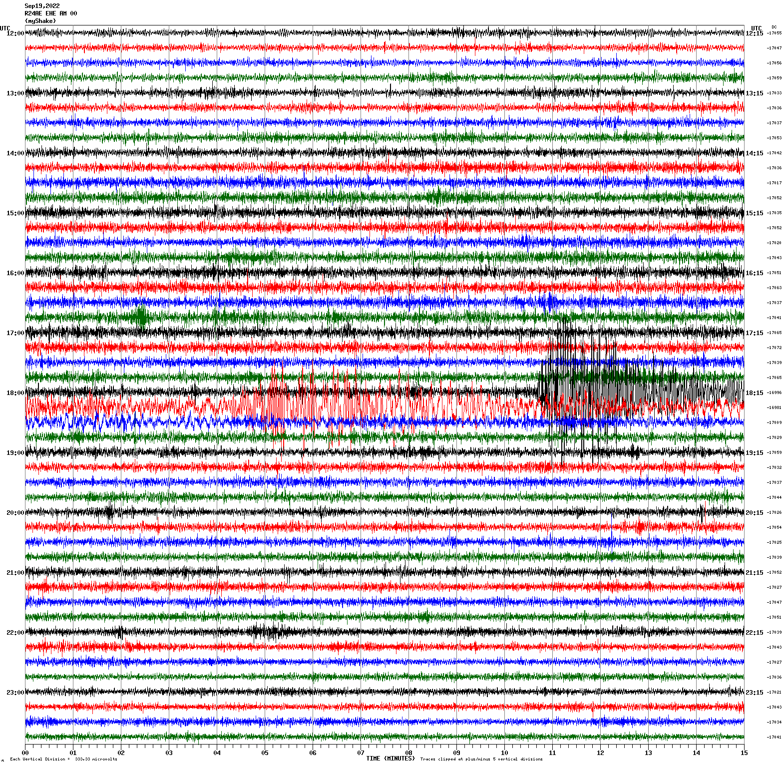
Magnitude 3.4
Depth 8.0 km
7km SSW of Tres Pinos, CA
36.728°N 121.350°W
September 19, 2022 04:47:18 UTC
East/West Sensor
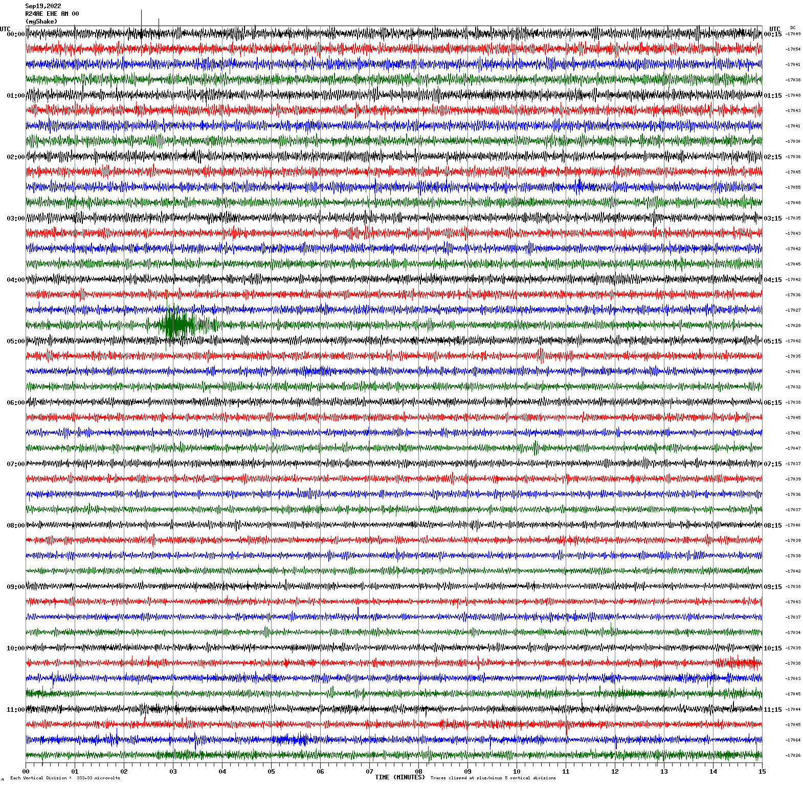
Magnitude 2.9
Depth 8.9 km
3km ESE of Berkeley, CA
37.861°N 122.242°W
September 15, 2022 09:41:16 UTC
North/South Sensor
Magnitude 4.4
Depth 5.6 km
3km N of Santa Rosa, CA
38.475°N 122.707°W
September 14, 2022 01:39:38 UTC
Magnitude 4.3
Depth 5.6 km
4km N of Santa Rosa, CA
38.481°N 122.704°W
September 14, 2022 01:40:20 UTC
North/South Sensor
Magnitude 2.9
Depth 10.0 km
3km N of Piedmont, CA
37.849°N 122.230°W
September 12, 2022 05:31:30 UTC
North/South Sensor
Magnitude 3.4
Depth 10.6 km
15km NW of Pinnacles, CA
36.635°N 121.256°W
September 11, 2022 06:55:21 UTC
East/West Sensor
Magnitude 3.5
Depth 9.9 km
4km NNE of Pinnacles, CA
36.569°N 121.131°W
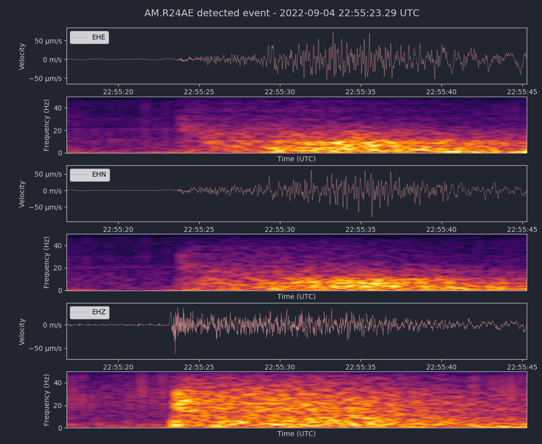
September 4, 2022 18:57:55 UTC
Magnitude 3.5
Depth 6.8 km
14km E of Seven Trees, CA
37.311°N 121.678°W
September 4, 2022 22:55:15 UTC
East/West Sensor
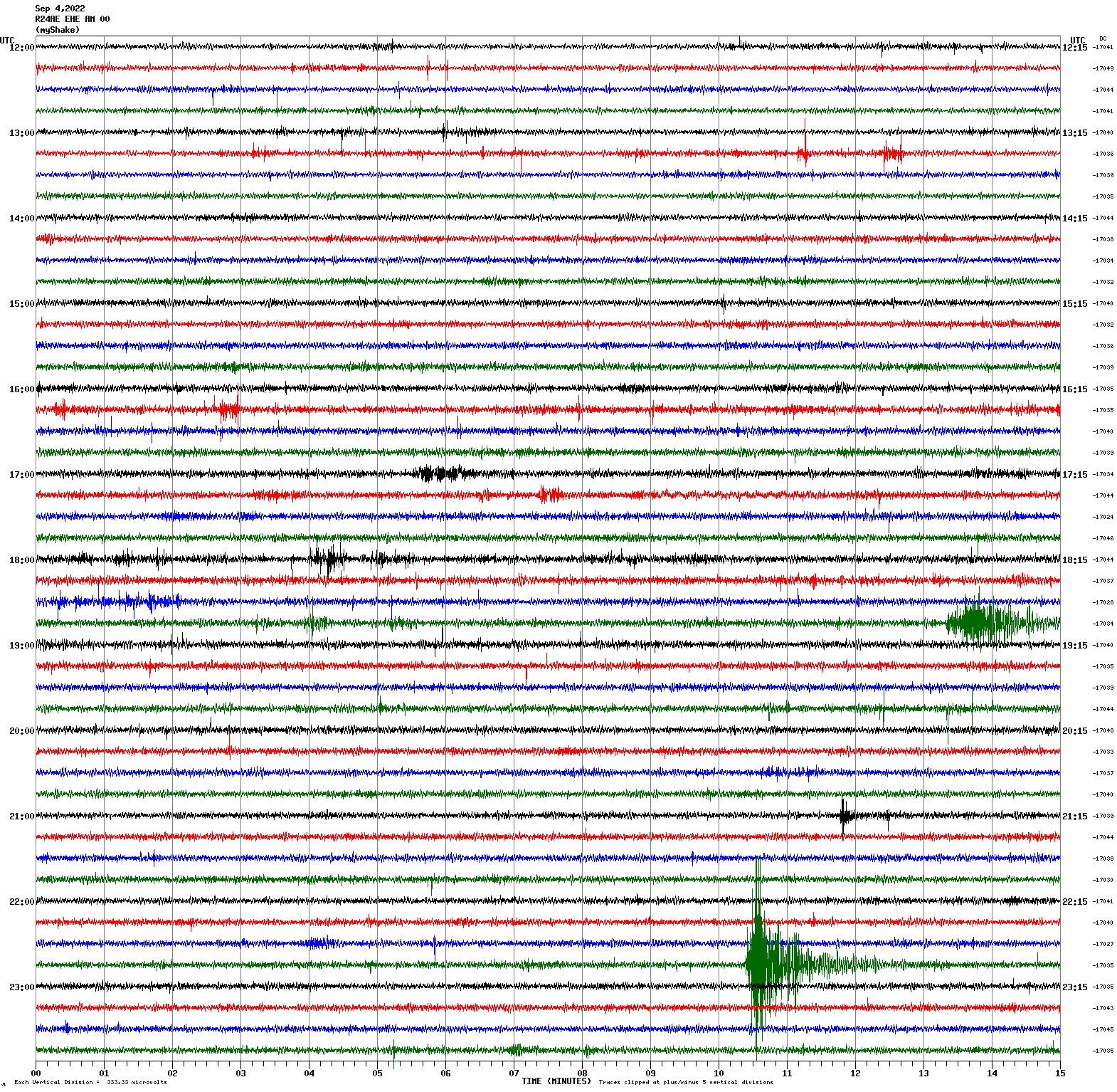
Voltage Counts & Frequency for All Sensors (Magnitude 3.5 Seven Trees, CA Earthquake)
Magnitude 4.0
Depth 1.6 km
5km ENE of Pinnacles, CA
36.549°N 121.097°W
September 1, 2022 13:36:22 UTC
North/South Sensor
Magnitude 3.0
Depth 8.1 km
10km E of Alum Rock, CA
37.357°N 121.713°W
August 27, 2022 19:42:52 UTC
East/West Sensor
Magnitude 4.4
Depth 5.1 km
8km NNE of Walker, CA
38.583°N 119.453°W
August 8, 2022 20:44:14 UTC
East/West Sensor
Magnitude 3.3
Depth 11.1 km
14km NNE of Pinnacles, CA
36.655°N 121.093°W
August 8, 2022 02:38:51 UTC
East/West Sensor
Magnitude 4.3
Depth 0.4 km
7km SSE of Oroville East, CA
39.458°N 121.438°W
July 23, 2022 01:41:04 UTC
East/West Sensor
Magnitude 3.5
Depth 2.8 km
7km NW of The Geysers, CA
38.819°N 122.822°W
July 17, 2022 08:19:59 UTC
East/West Sensor
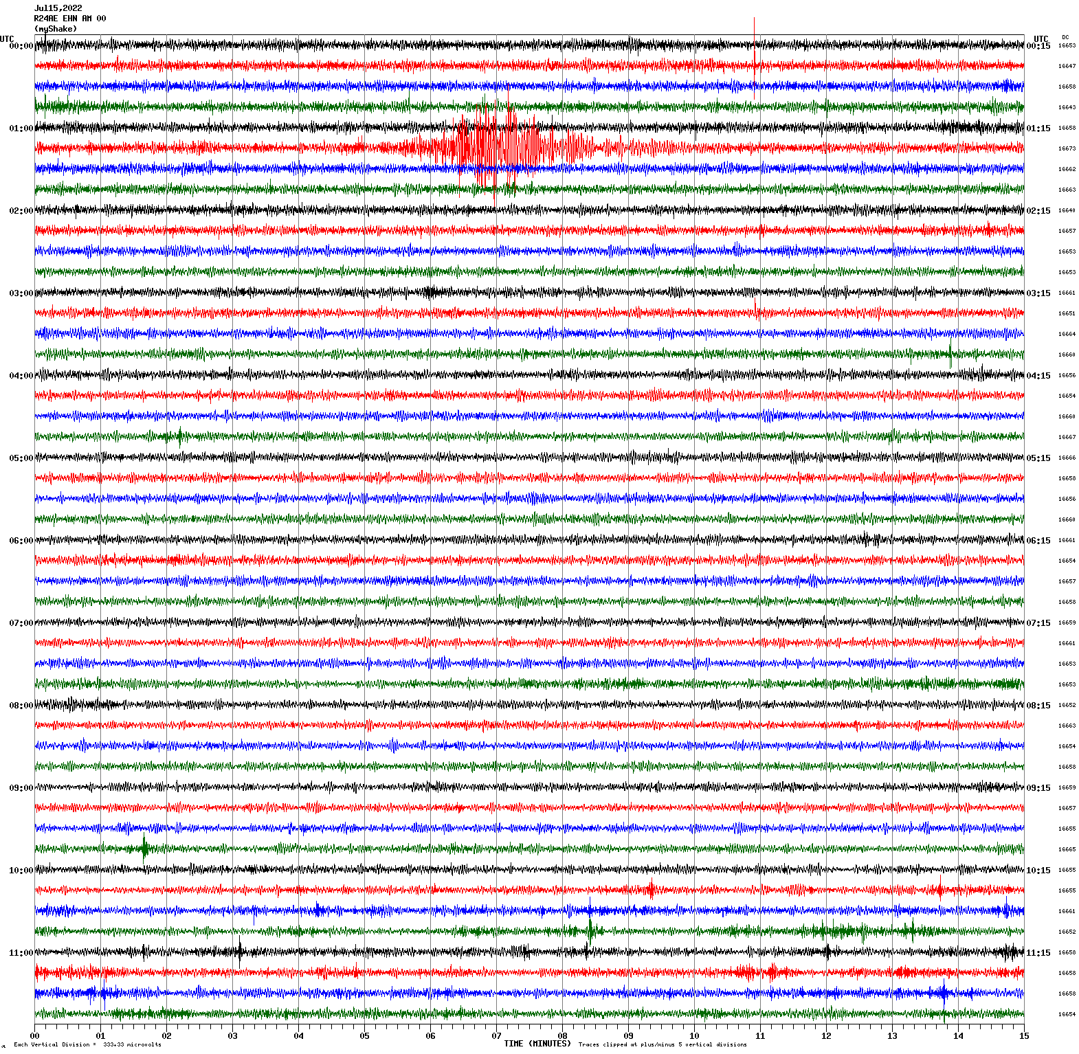
Magnitude 4.6
Depth 6.5 km
13km NE of Ridgecrest, CA
35.708°N 117.579°W
July 15, 2022 01:19:06 UTC
East/West Sensor
Magnitude 4.2
Depth 0.3 km
2km WNW of Cobb, CA
38.830°N 122.749°W
June 28, 2022 11:57:40 UTC
East/West Sensor
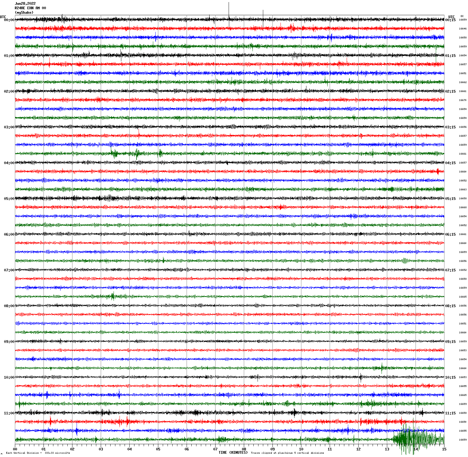
Magnitude 3.4
Depth 4.6 km
10km NE of Morgan Hill, CA
37.193°N 121.582°W
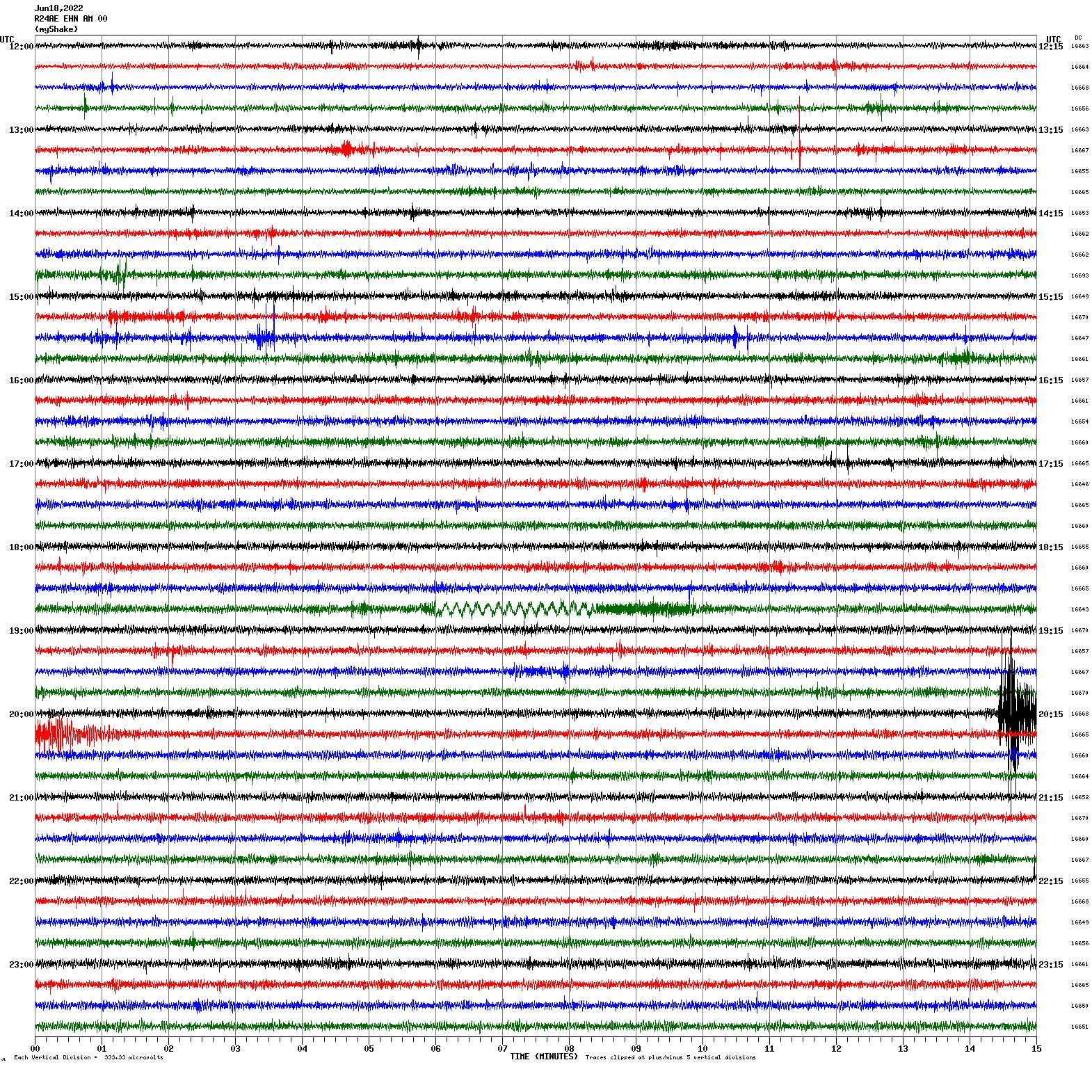
June 18, 2022 20:14:16 UTC
East/West Sensor
Magnitude 2.5
Depth 8.7 km
6km SSE of Portola Valley, CA
37.339°N 122.204°W
June 17, 2022 11:08:02 UTC
East/West Sensor
Magnitude 4.1
Depth 19.7 km
6km NNW of Bay Point, CA
38.079°N 121.979°W
June 2, 2022 12:07:21 UTC
East/West Sensor
Magnitude 7.2
Depth 217.8 km
13 km WNW of Azángaro, Peru
14.863°S 70.308°W
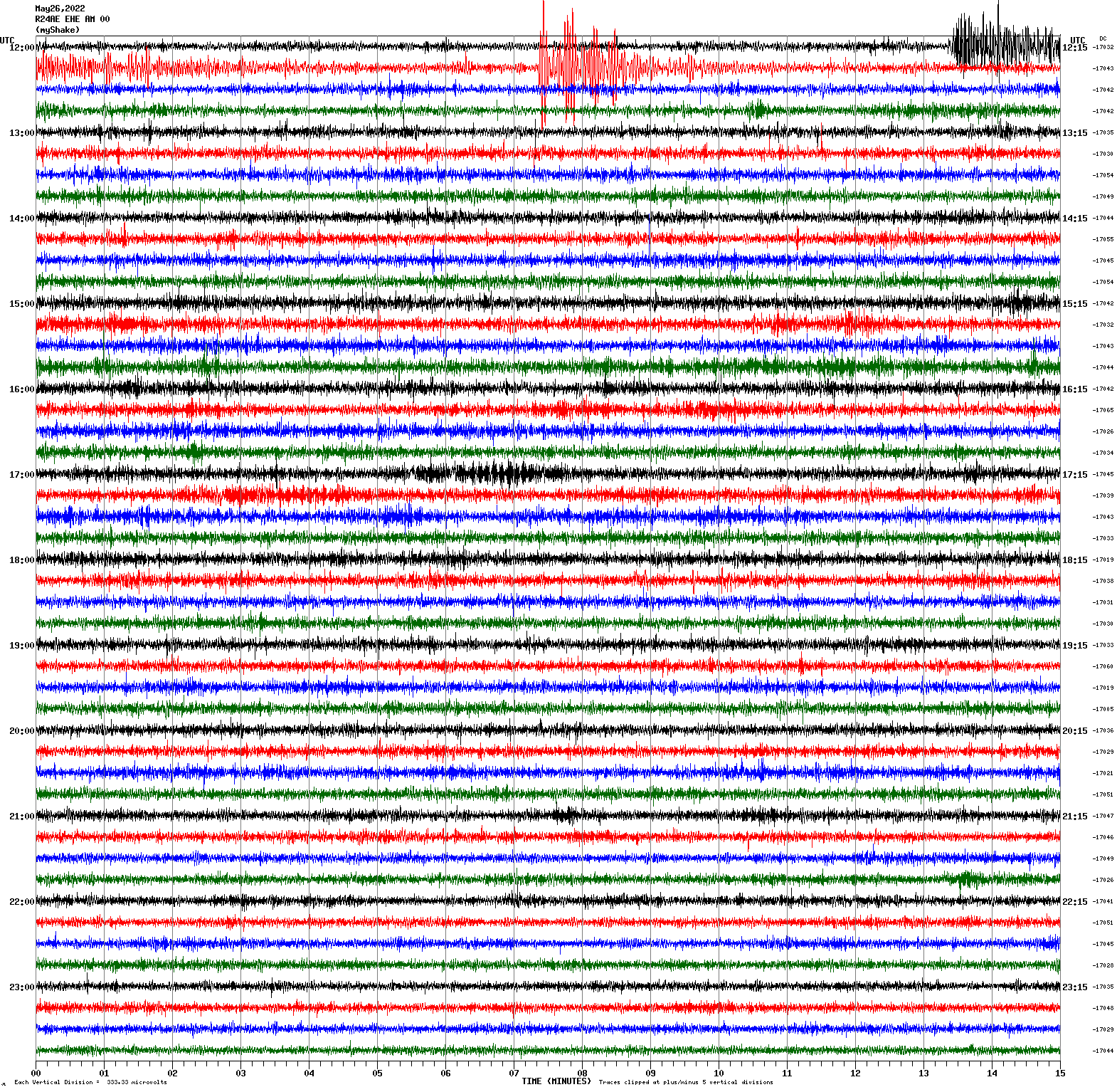
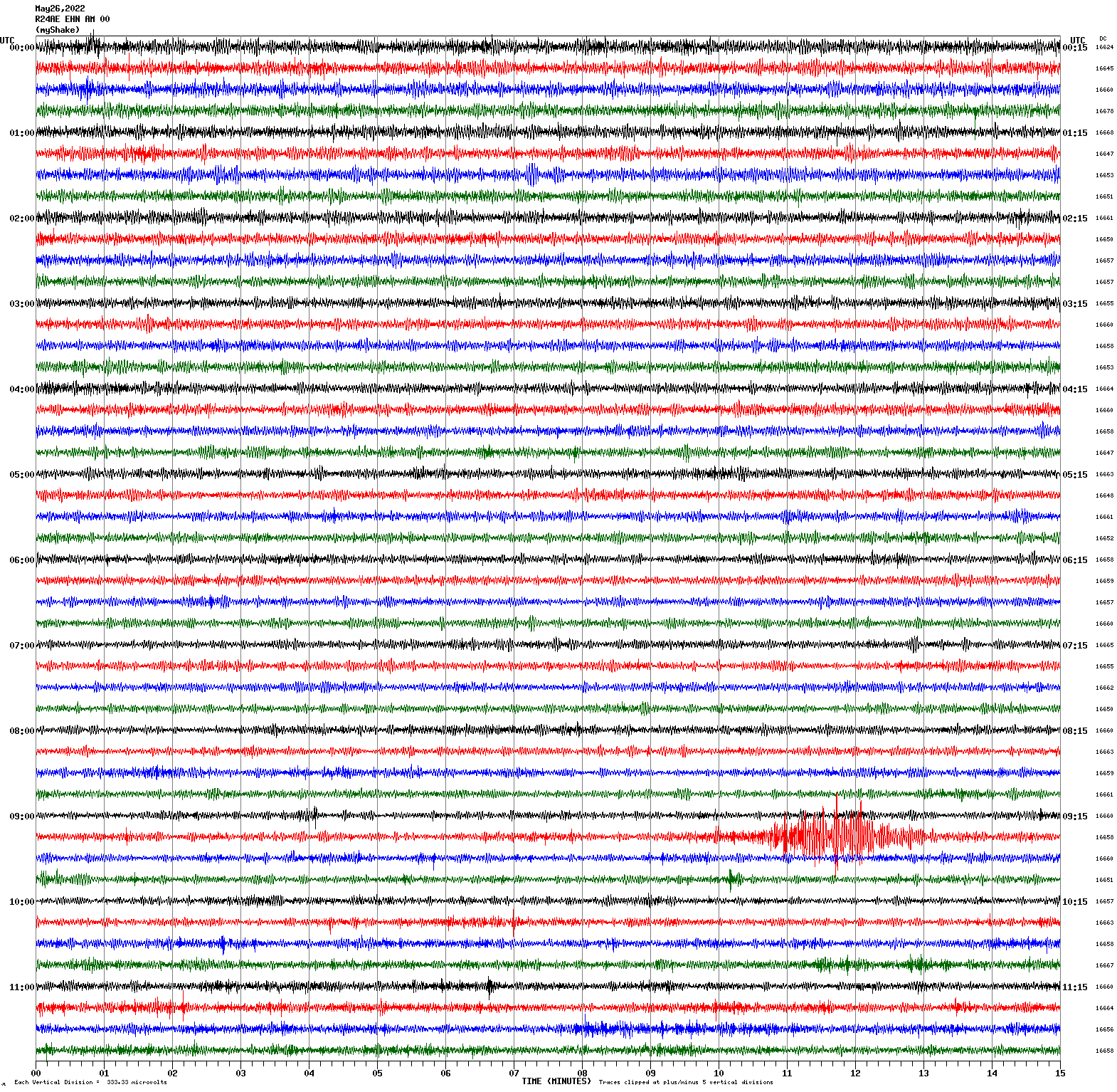
May 26, 2022 12:02:20 UTC
East/West Sensor
Magnitude 4.3
Depth 3.1 km
18km S of Trona, CA
35.604°N 117.406°W
May 26, 2022 09:23:32 UTC
North/South Sensor
Magnitude 6.8
Depth 193.8 km
78 km NNW of San Antonio de los Cobres, Argentina
23.614°S 66.724°W
May 10, 2022 23:06:29 UTC
East/West Sensor
Magnitude 3.4
Depth 2.8 km
5km WNW of The Geysers, CA
38.799°N 122.813°W
May 1, 2022 03:17:37 UTC
North/South Sensor
Magnitude 3.3
Depth 3.7 km
6km NW of The Geysers, CA
38.820°N 122.803°W
April 30, 2022 18:17:56 UTC
North/South Sensor
Magnitude 3.2
Depth 4.4 km
12km S of Tres Pinos, CA
36.678°N 121.304°W
April 22, 2022 05:02:34 UTC
North/South Sensor
Magnitude 3.4
Depth 5.9 km
4km S of San Juan Bautista, CA
36.810°N 121.544°W
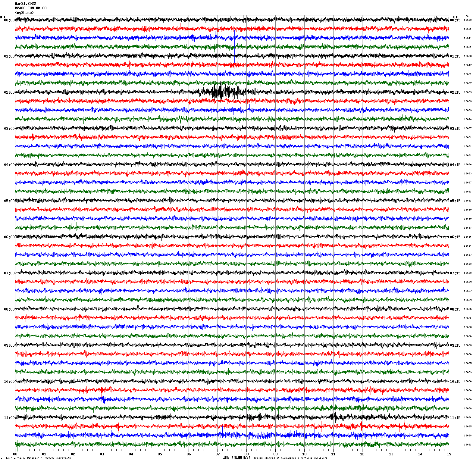
March 31, 2022 22:39:04 UTC
North/South Sensor
Magnitude 4.0
Depth 10.5 km
1km SW of Round Valley, CA
37.409°N 118.603°W
March 31, 2022 02:05:26 UTC
North/South Sensor
Magnitude 3.6
Depth 13.5 km
4km ENE of Corralitos, CA
37.002°N 121.762°W
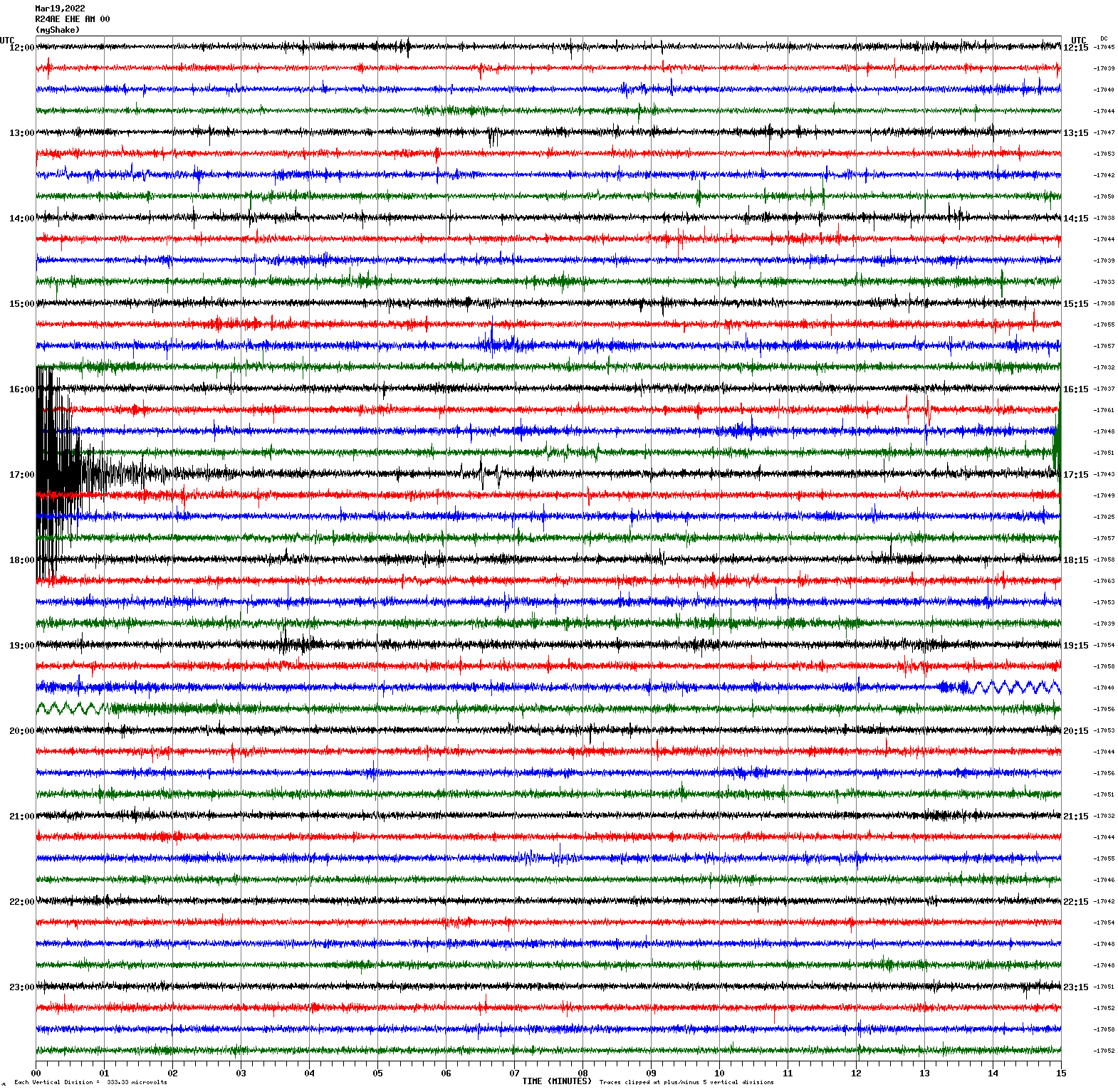
March 19, 2022 16:59:41 UTC
East/West Sensor
Magnitude 4.0
Depth -0.5 km
5km W of Walker, CA
38.521°N 119.541°W
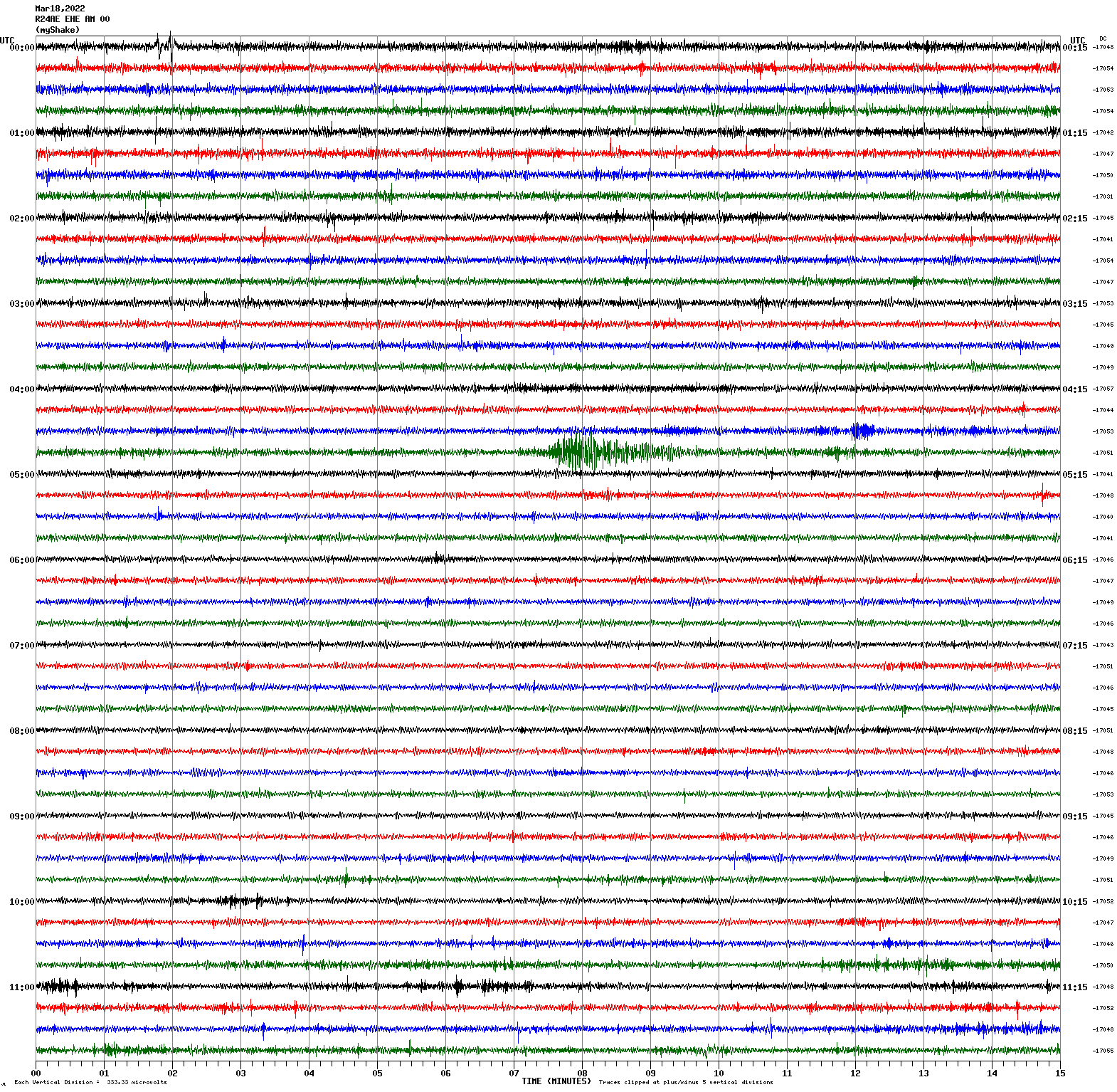
March 18, 2022 04:51:22 UTC
East/West Sensor
Magnitude 7.3
Depth 63.1 km
57 km ENE of Namie, Japan
37.702°N 141.587°E
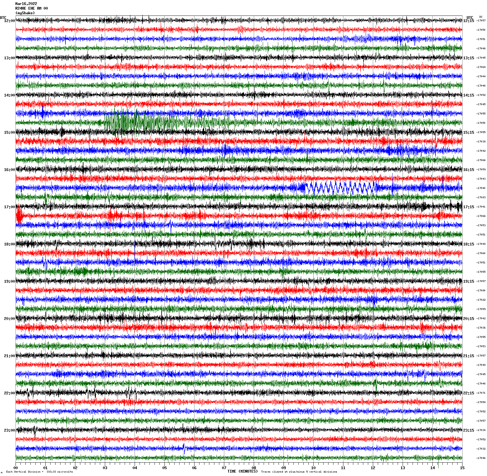
March 16, 2022 14:36:33 UTC
East/West Sensor
Magnitude 4.1
Depth 6.2 km
7km NW of Pinnacles, CA
36.587°N 121.189°W
March 13, 2022 20:51:30 UTC
East/West Sensor
Magnitude 2.8
Depth 5.0 km
1km ENE of El Cerrito, CA
37.919°N 122.299°W
March 11, 2022 17:44:30 UTC
East/West Sensor
Magnitude 3.9
Depth 0.6 km
0km WNW of The Geysers, CA
38.778°N 122.757°W
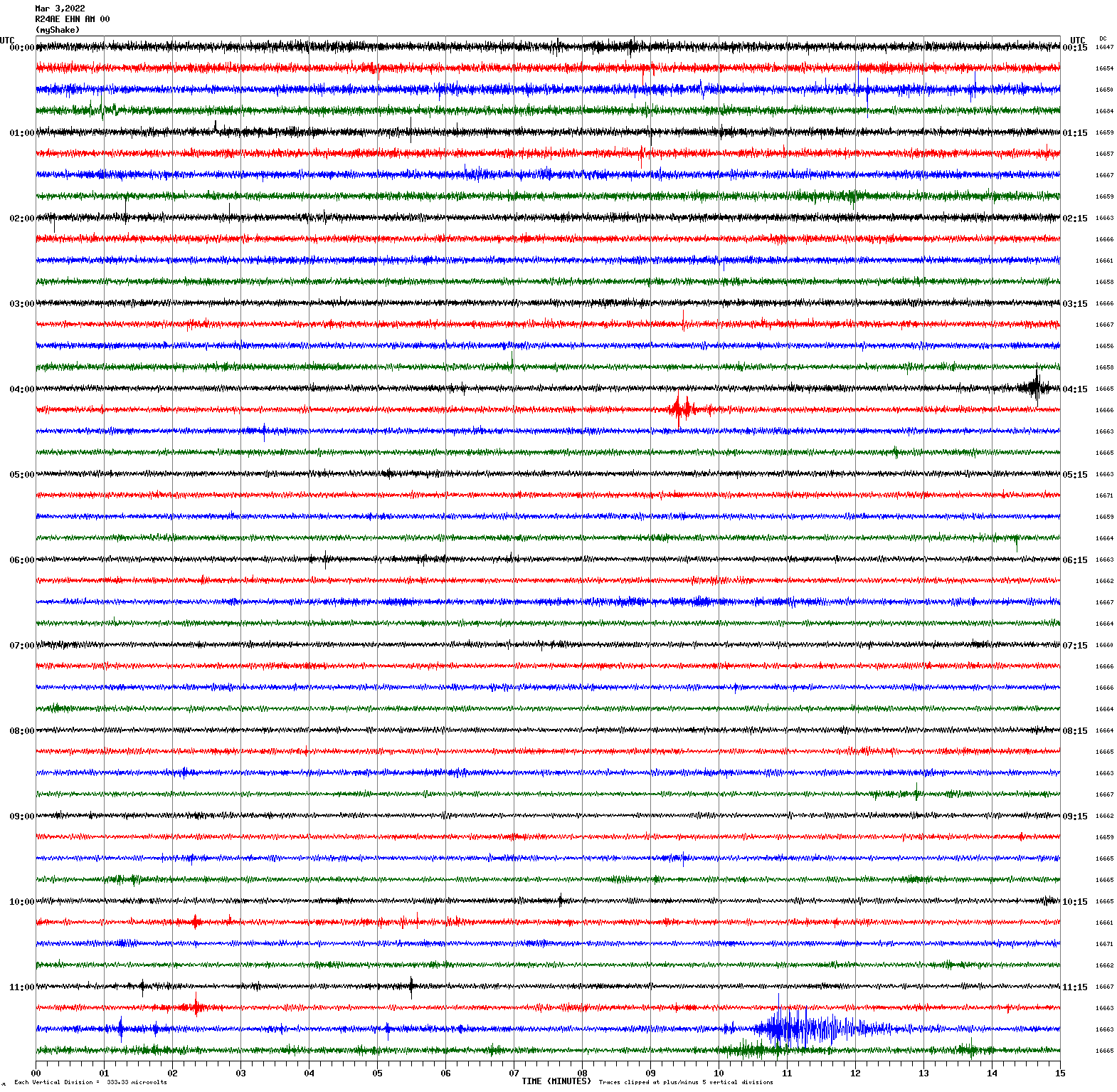
March 3, 2022 11:39:58 UTC
North/South Sensor
Magnitude 3.6
Depth 2.7 km
9km SSW of Tres Pinos, CA
36.721°N 121.371°W
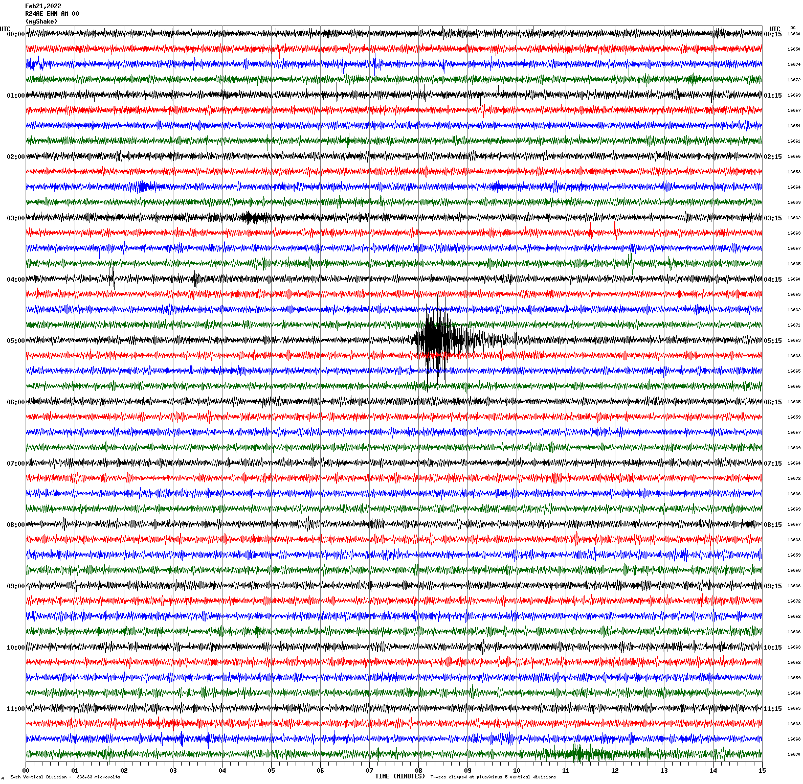
February 21, 2022 05:07:36 UTC
North/South Sensor
Magnitude 3.2
Depth 6.6 km
2km W of San Juan Bautista, CA
36.846°N 121.556°W
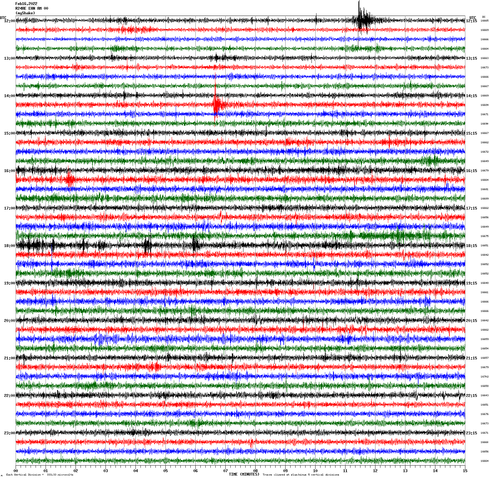
February 16, 2022 12:10:59 UTC
Magnitude 2.9
Depth 6.2 km
3km ENE of San Leandro, CA
37.734°N 122.126°W
February 16, 2022 14:21:25 UTC
North/South Sensor
Magnitude 3.1
Depth 3.8 km
2km NNE of San Leandro, CA
37.740°N 122.148°W
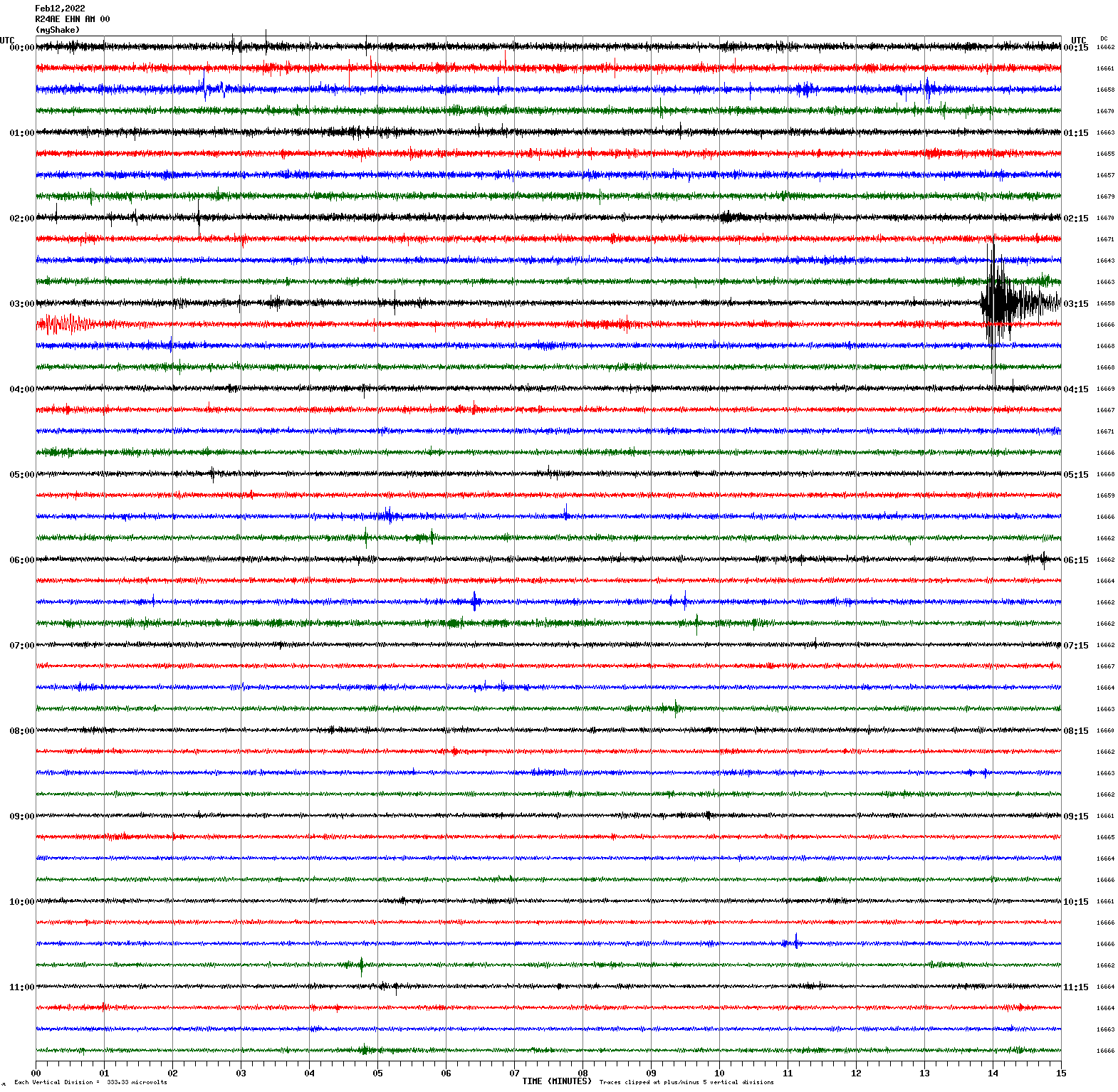
February 12, 2022 03:13:42 UTC
North/South Sensor
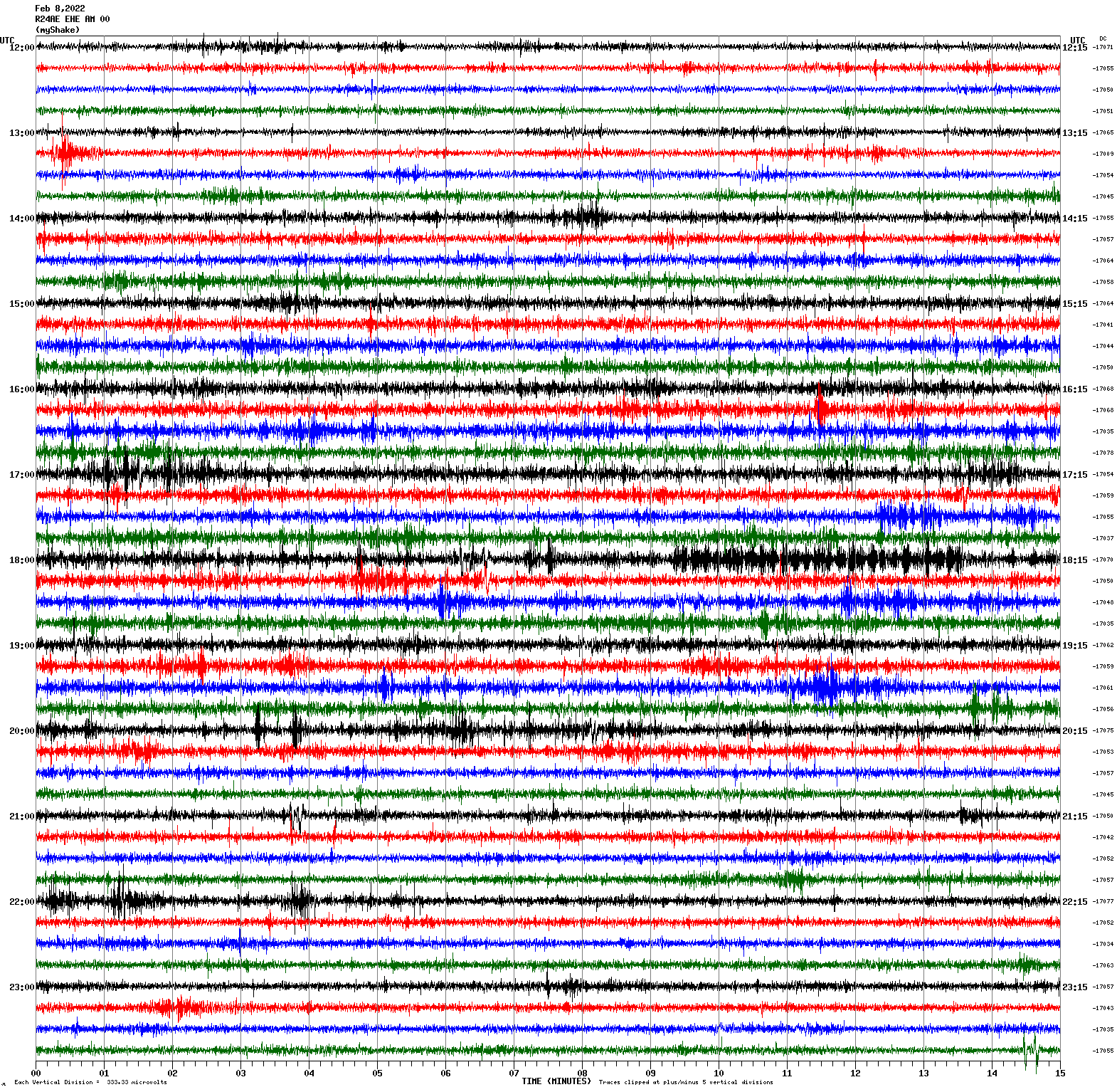
Magnitude 2.9
Depth 6.5 km
4km WSW of San Juan Bautista, CA
36.836°N 121.578°W
February 8, 2022 13:14:57 UTC
East/West Sensor
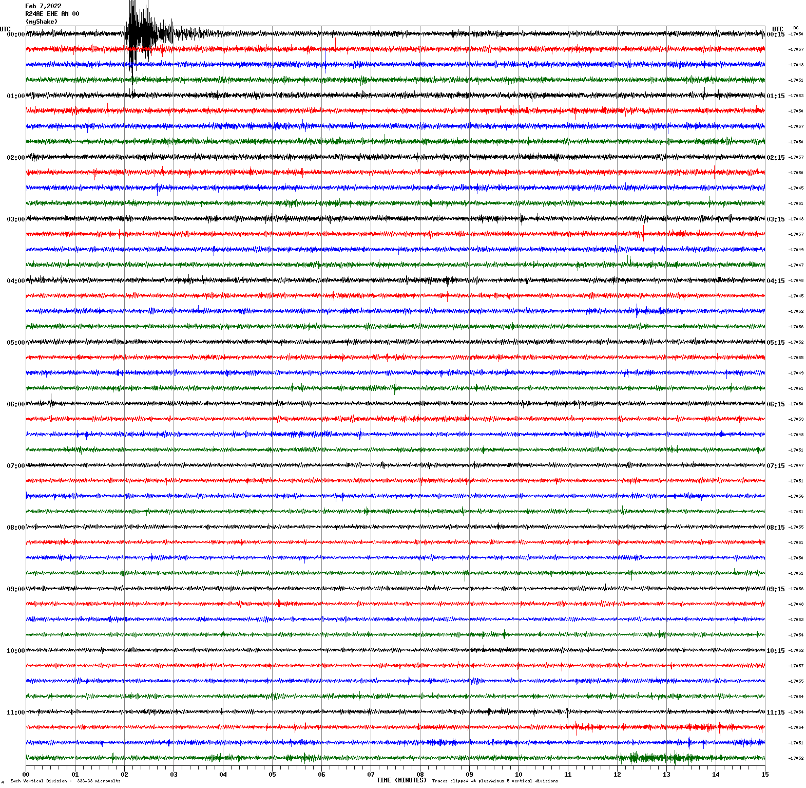
Magnitude 3.2
Depth 4.7 km
2km ENE of San Leandro, CA
37.733°N 122.139°W
February 7, 2022 00:01:53 UTC
East/West Sensor
Magnitude 4.3
Depth 11.6 km
25 km SW of Mina, Nevada
38.258°N 118.352°W
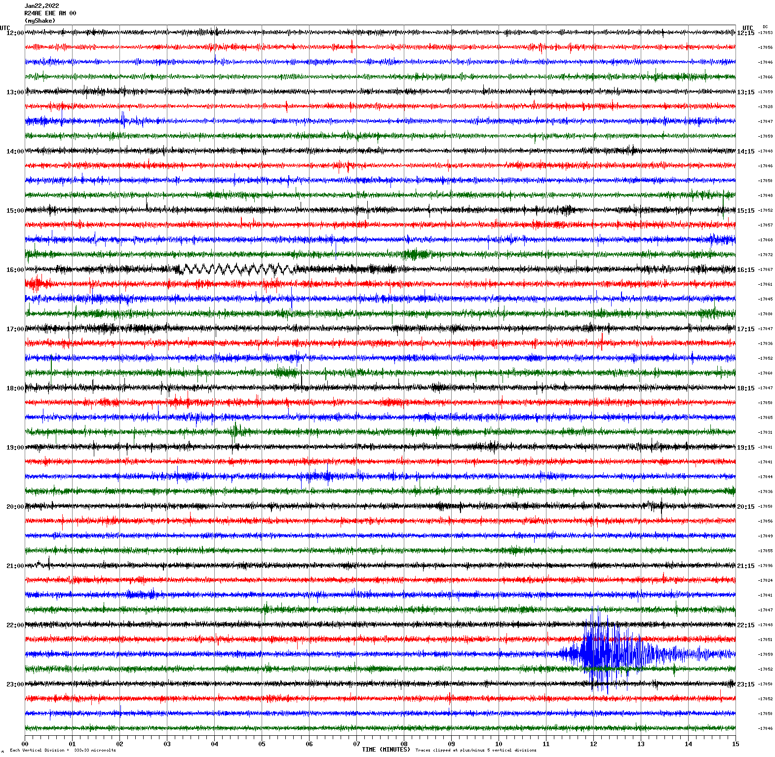
January 22, 2022 22:40:11 UTC
East/West Sensor
Magnitude 6.8
Depth 22.3 km
71 km ESE of Nikolski, Alaska
52.656°N 167.917°W
January 11, 2022 11:35:46 UTC
East/West Sensor
Magnitude 4.8
Depth 11.4 km
9km SE of Deep Springs, CA
37.327°N 117.901°W
January 6, 2022 00:28:07 UTC
East/West Sensor
Magnitude 4.8
Depth 9.9 km
35 km SE of Mina, Nevada
38.168°N 117.824°W
January 5, 2022 07:21:14 UTC
East/West Sensor
Magnitude 6.2
Depth 15.2 km
39km W of Petrolia, CA
40.307°N 124.749°W
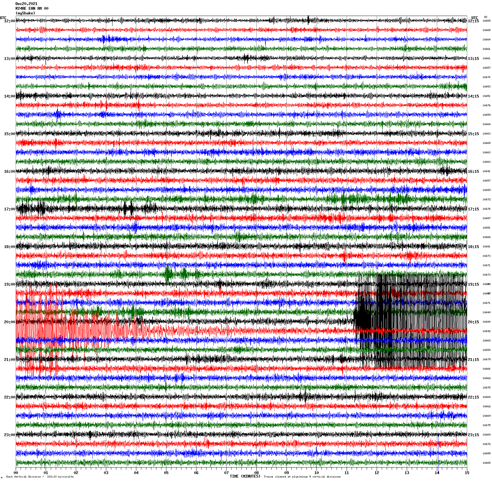
December 20, 2021 20:10:18 UTC
North/South Sensor
Magnitude 7.5
Depth 112.5 km
42 km NNW of Barranca, Peru
4.490°S 76.846°W
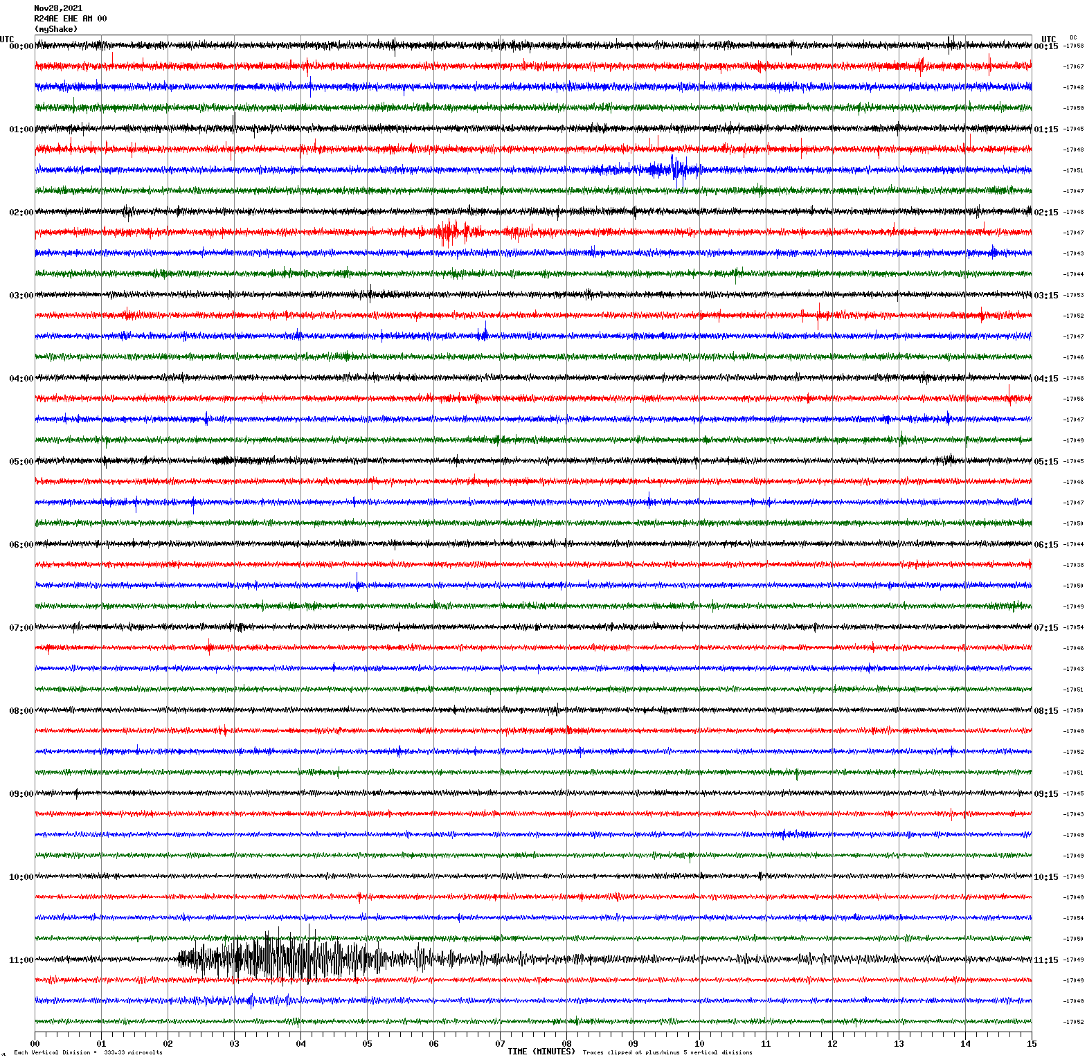
November 28, 2021 10:52:13 UTC
East/West Sensor
Magnitude 2.8
Depth 6.2 km
8km ENE of Alum Rock, CA
37.384°N 121.739°W
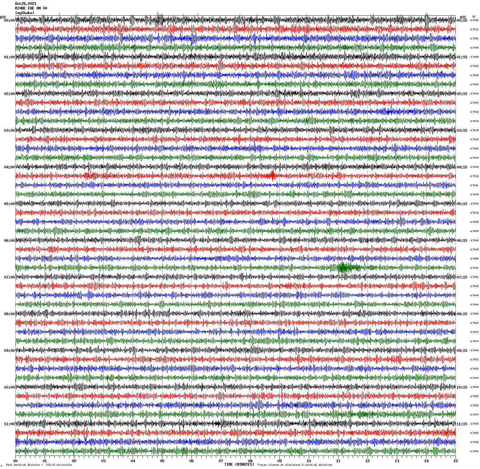
October 26, 2021 06:55:52 UTC
East/West Sensor
Magnitude 4.7
Depth 5.0 km
18km NW of San Simeon, CA
35.777°N 121.310°W
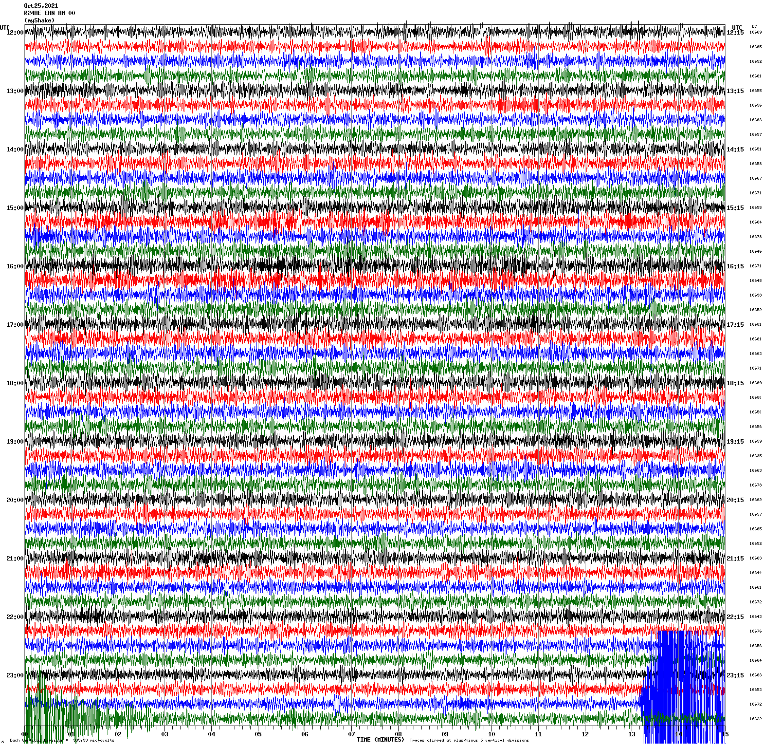
October 25, 2021 23:42:35 UTC
North/South Sensor
Magnitude 2.8
Depth 9.8 km
4km SE of Hercules, CA
37.994°N 122.251°W
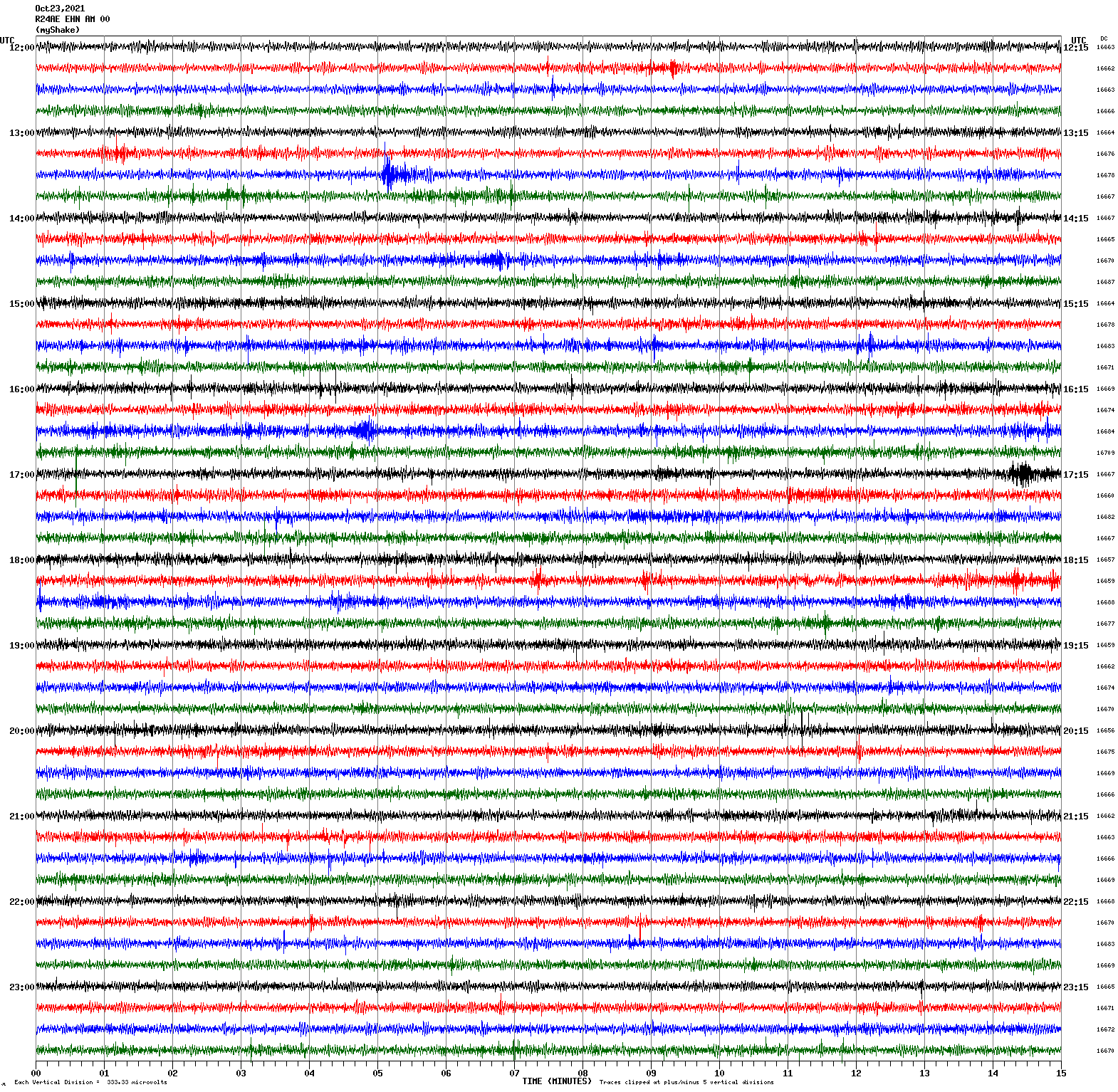
October 23, 2021 13:34:44 UTC
North/South Sensor
Magnitude 3.8
Depth 7.8 km
12km S of Tres Pinos, CA
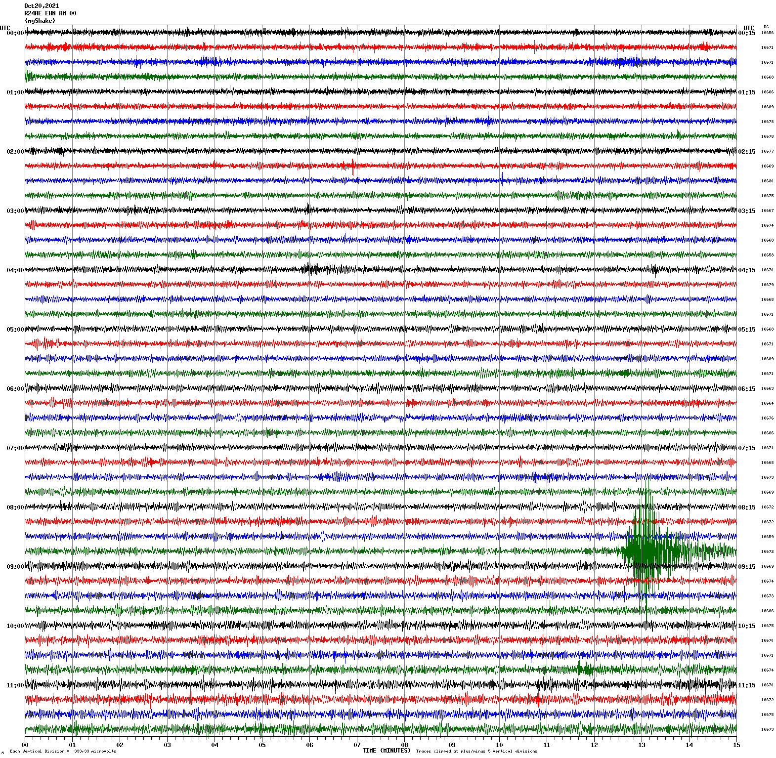
36.680°N 121.314°W
October 20, 2021 08:57:15 UTC
North/South Sensor
Magnitude 2.8
Depth 0.7 km
4km S of San Juan Bautista, CA
36.809°N 121.546°W
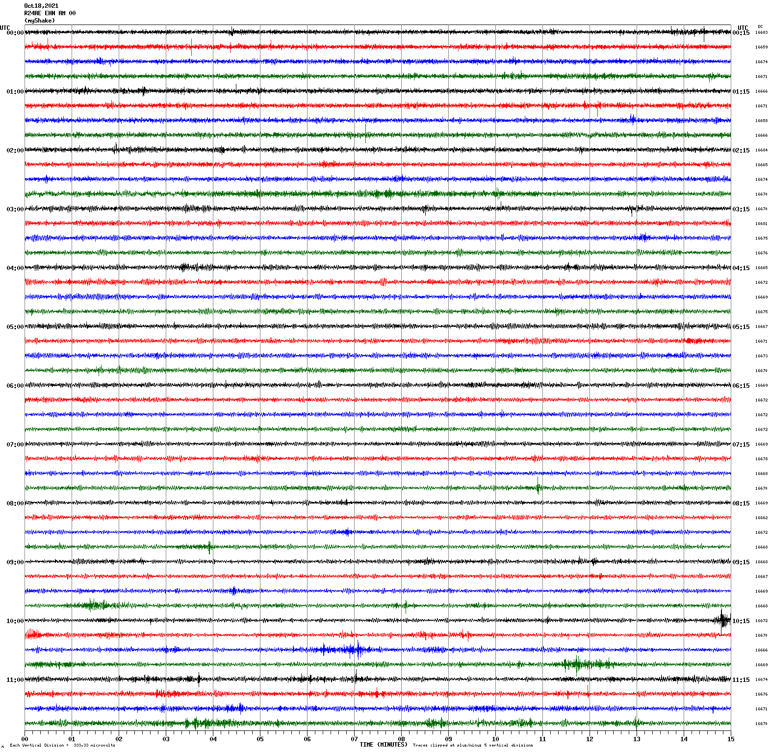
October 18, 2021 10:14:20 UTC
North/South Sensor
Magnitude 2.8
Depth 3.1 km
16km SSE of Livermore, CA
37.550°N 121.701°W
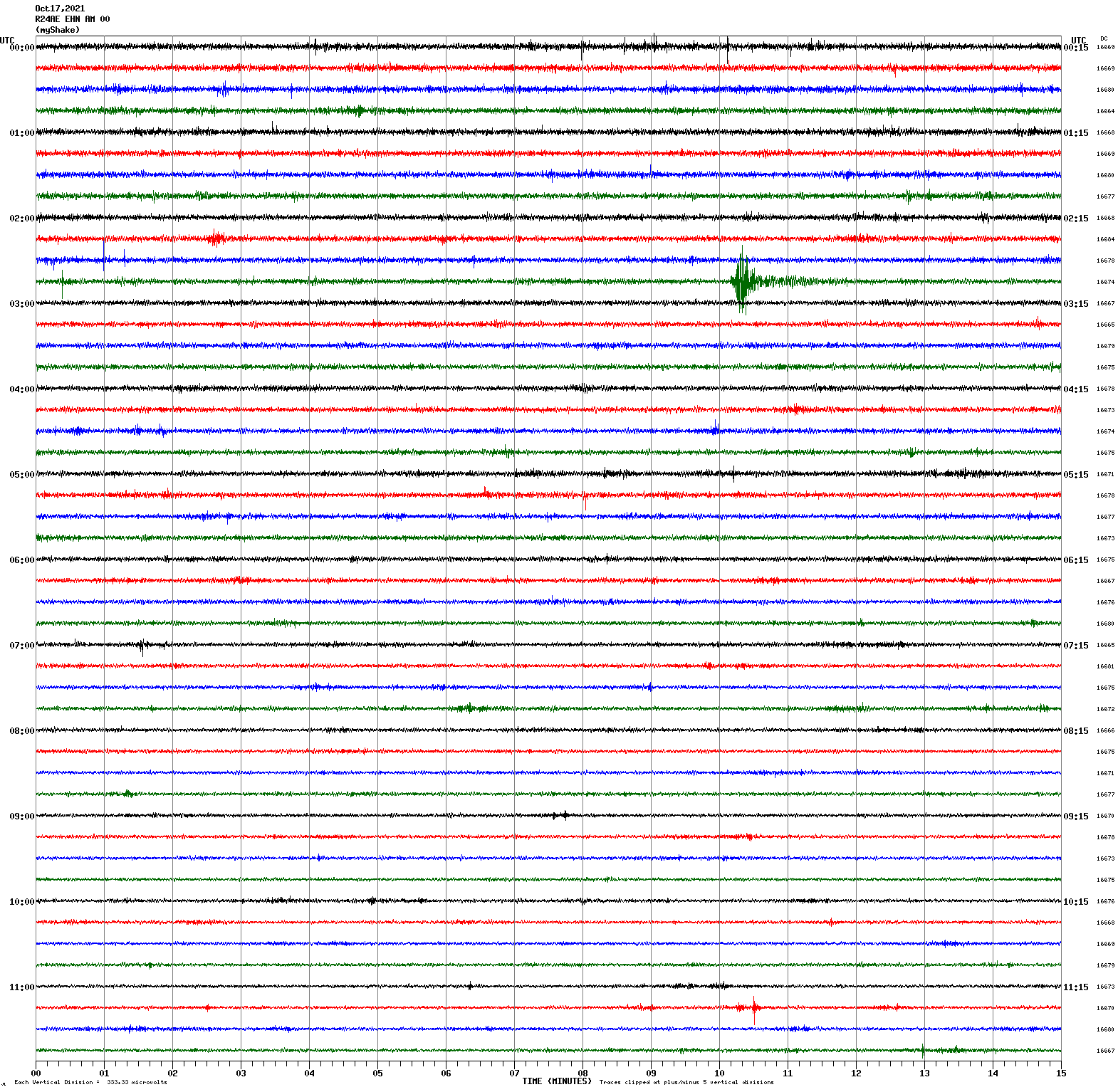
October 17, 2021 02:55:02 UTC
North/South Sensor
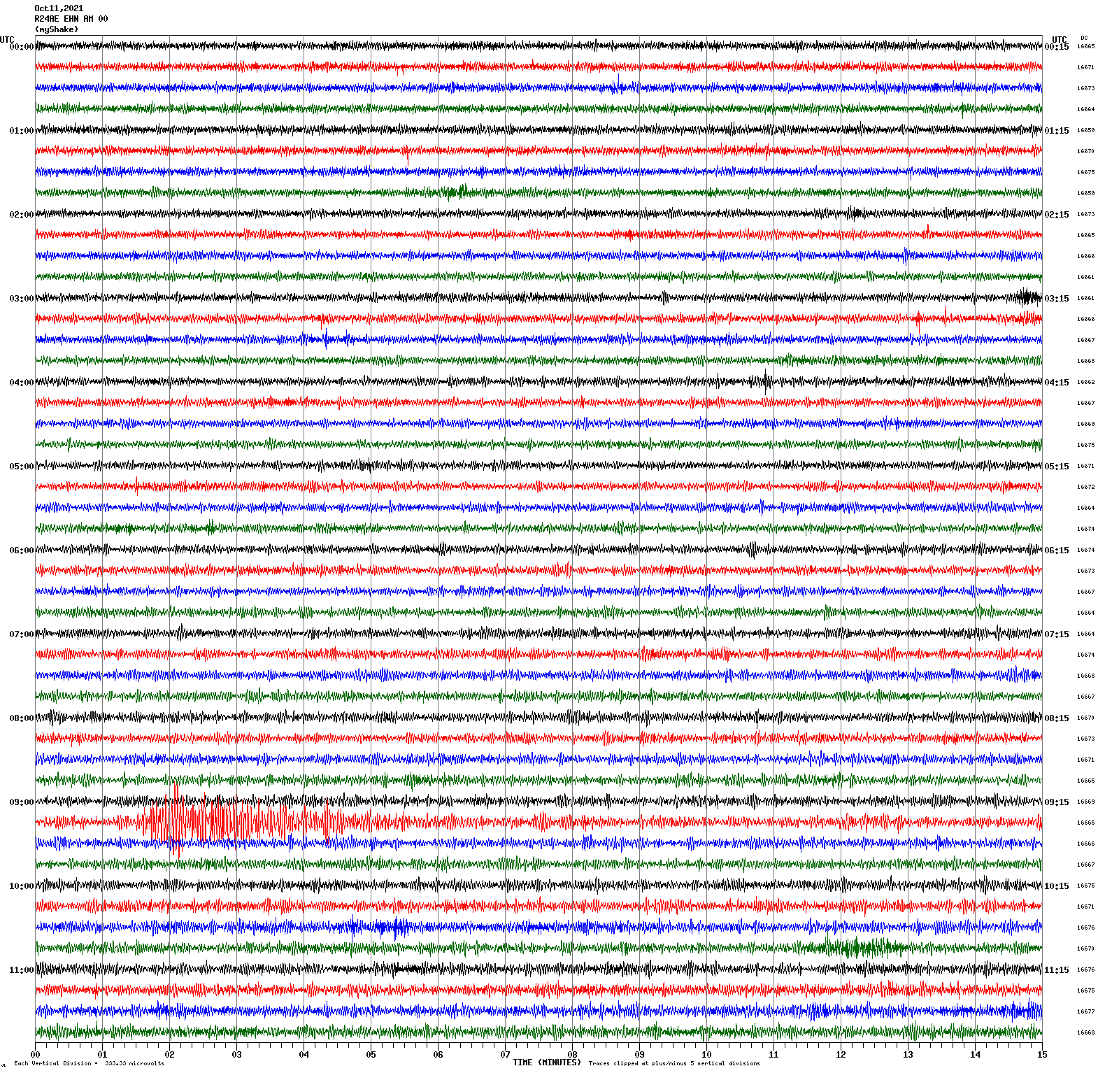
Magnitude 6.9
Depth 69.1 km
114 km E of Chignik, Alaska
56.258°N 156.553°W
October 11, 2021 09:10:24 UTC
North/South Sensor
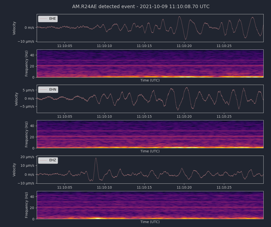
Magnitude 6.8
Depth 485.2 km
Vanuatu region
21.170°S 174.540°E
October 9, 2021 10:58:28 UTC
East/West Sensor
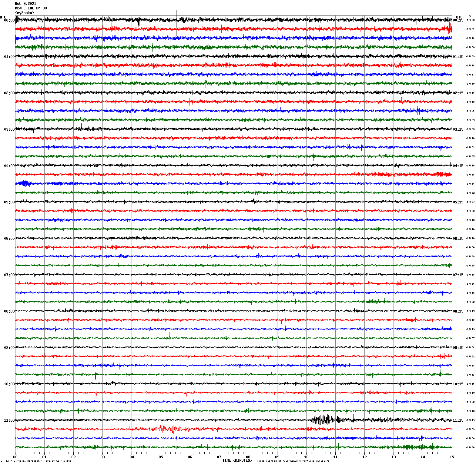
Voltage Counts & Frequency for All Sensors (Magnitude 6.8 Earthquake)
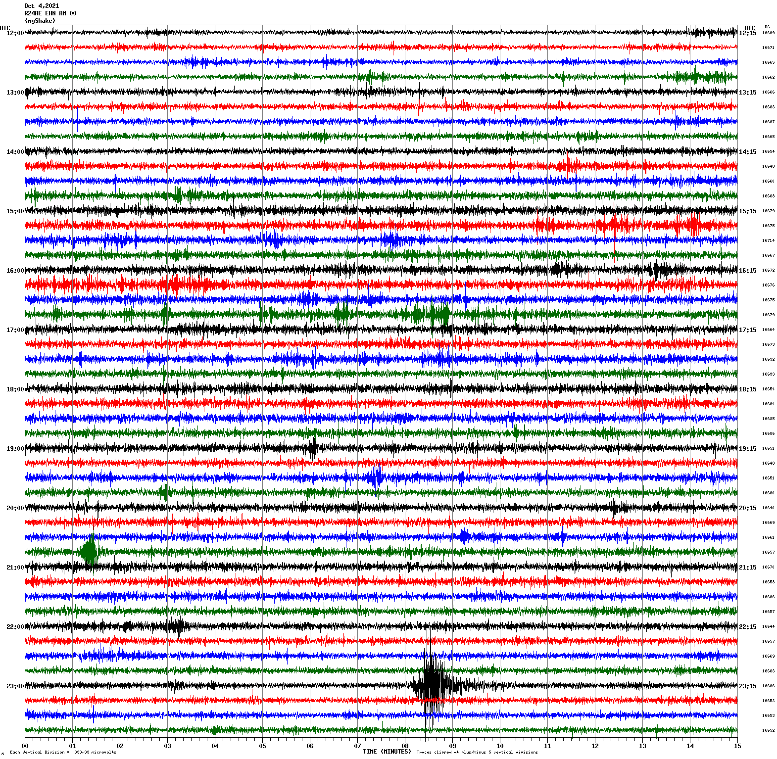
Magnitude 3.8
Depth 7.8 km
14km WNW of Pinnacles, CA
36.591°N 121.285°W
October 4, 2021 23:07:47 UTC
North/South Sensor
Magnitude 3.4
Depth 2.2 km
12km NNE of Morgan Hill, CA
37.233°N 121.618°W
October 3, 2021 12:02:00 UTC
North/South Sensor
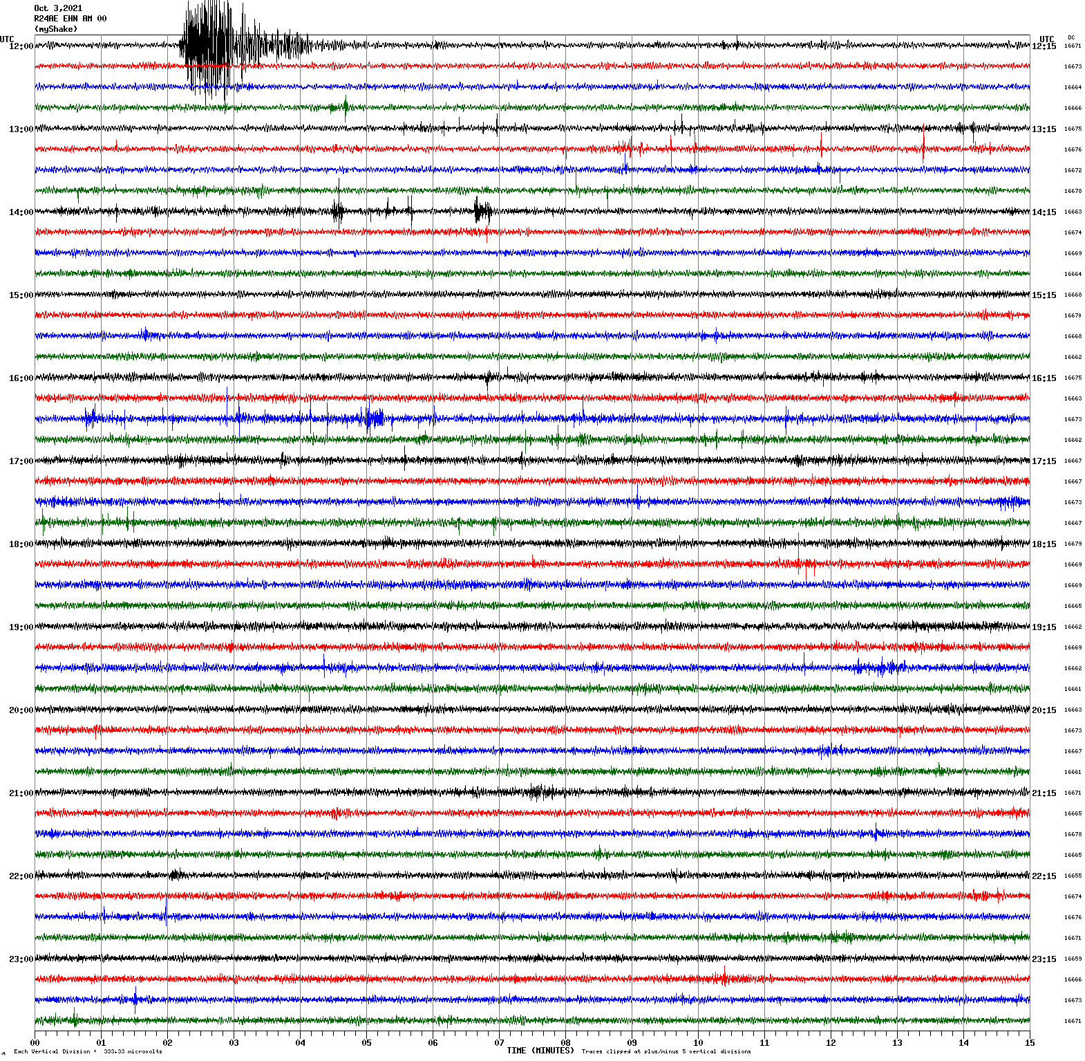
Magnitude 3.4
Depth 6.0 km
3km N of San Leandro, CA
37.753°N 122.158°W
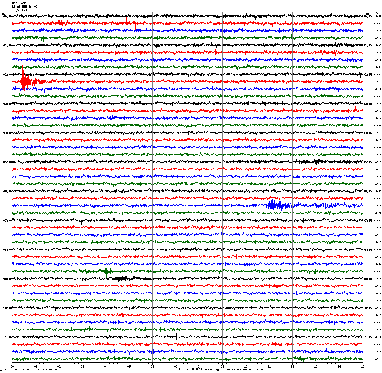
October 2, 2021 19:22:26 UTC
North/South Sensor
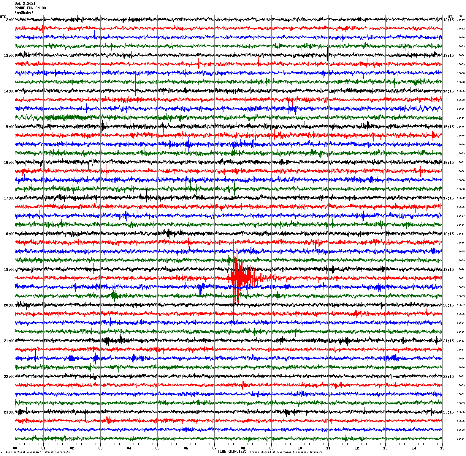
Magnitude 3.0
Depth 6.6 km
3km N of San Leandro, CA
37.751°N 122.157°W
October 2, 2021 02:15:14 UTC
Magnitude 7.3
Depth 535.8 km
Vanuatu region
21.104°S 174.895°E
October 2, 2021 06:29:18 UTC
East/West Sensor
Magnitude 3.4
Depth 9.4 km
3km ESE of Santa Rosa, CA
38.442°N 122.672°W
September 30, 2021 12:45:03 UTC
East/West Sensor
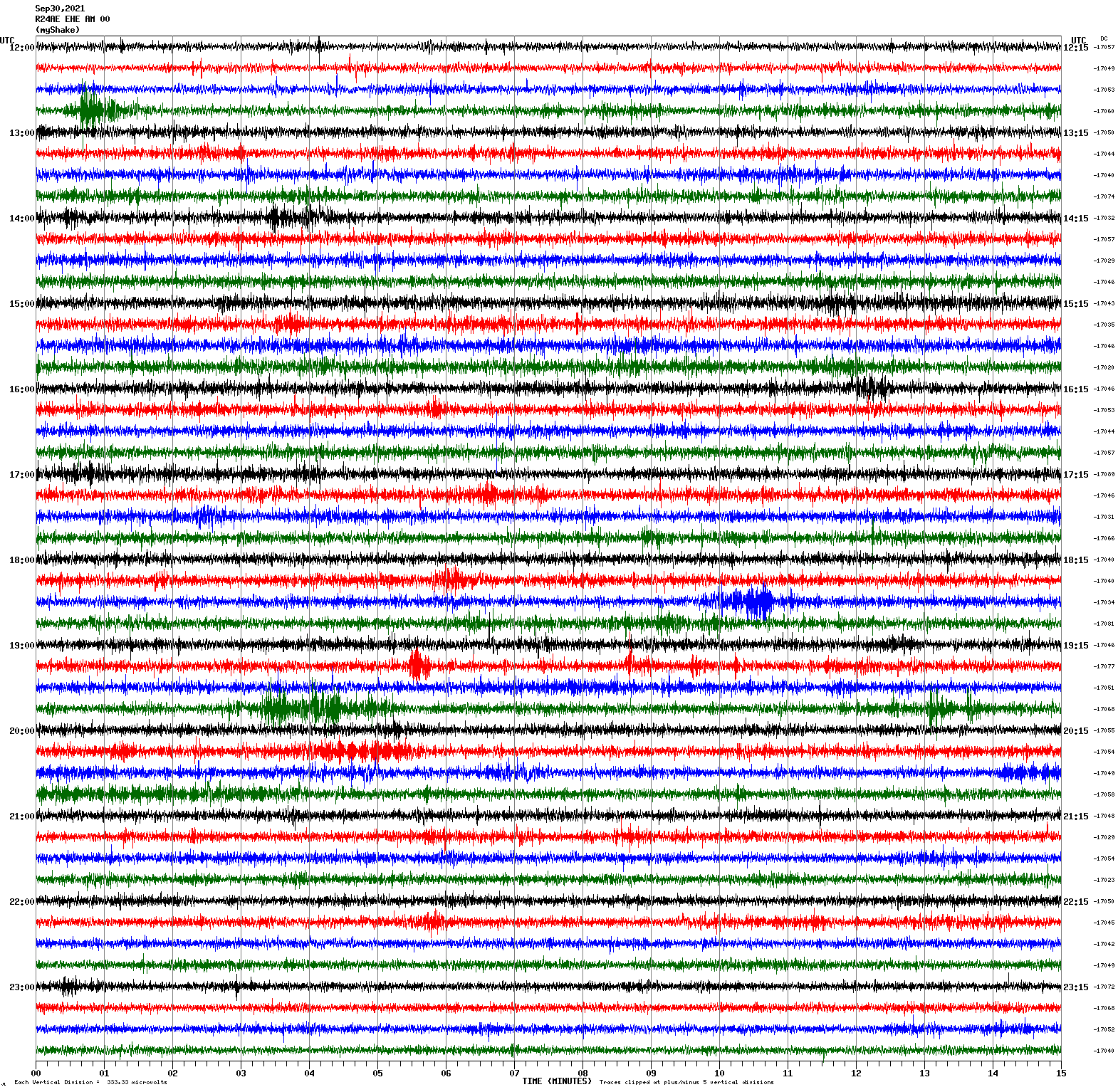
Magnitude 2.8
Depth 8.7 km
12km W of Moss Landing, CA
36.788°N 121.919°W
September 29, 2021 06:16:34 UTC
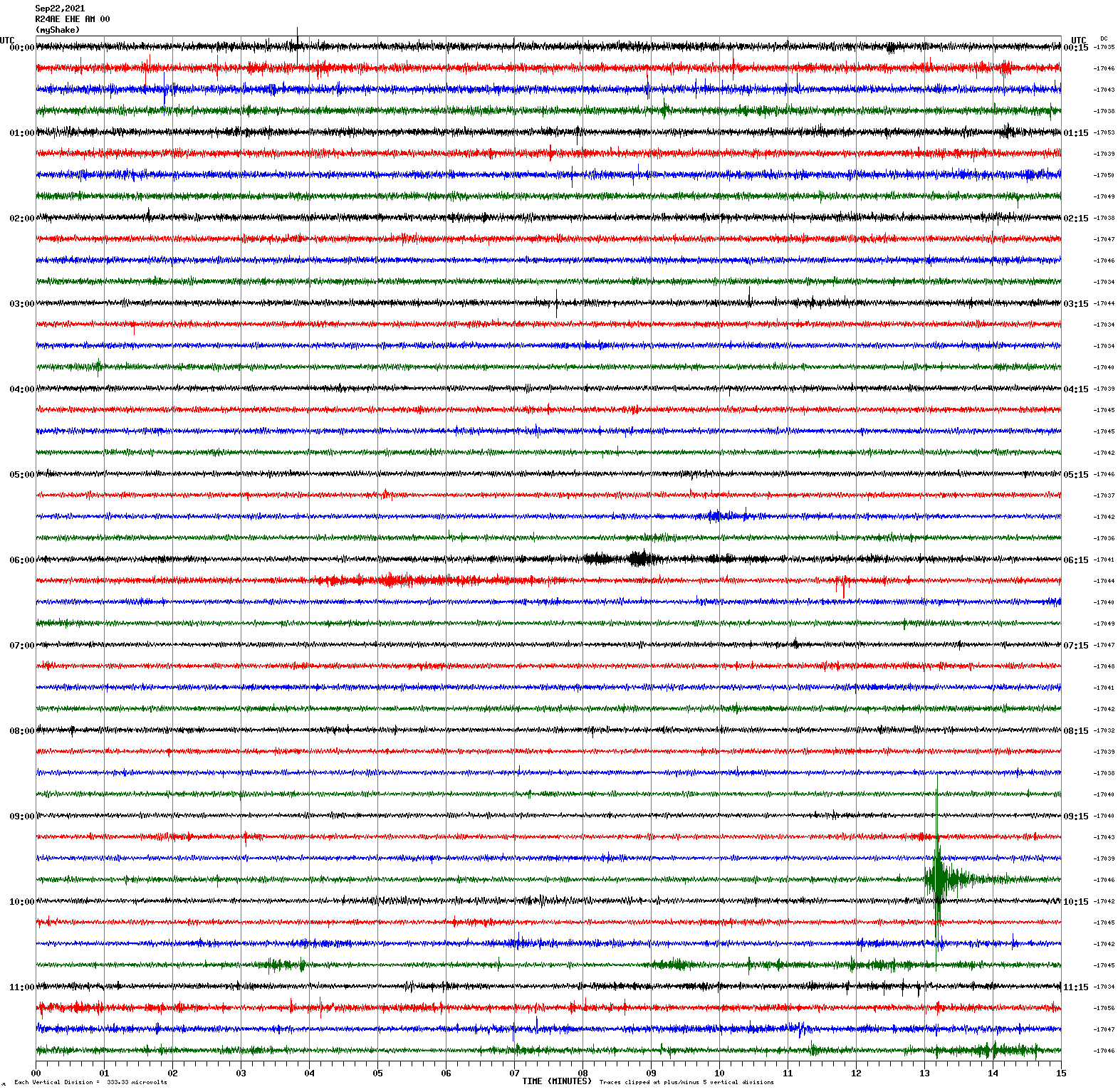
East/West Sensor
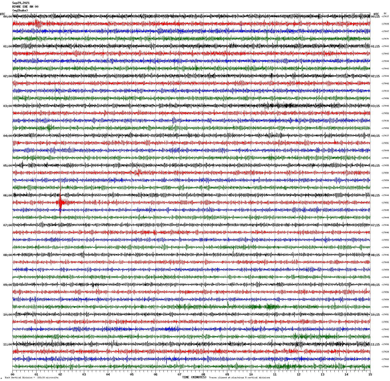
Magnitude 3.4
Depth 8.5 km
12km W of Moss Landing, CA
36.790°N 121.919°W
September 22, 2021 09:57:45 UTC
East/West Sensor
Magnitude 3.0
Depth 7.1 km
6km WNW of Dublin, CA
37.729°N 121.991°W
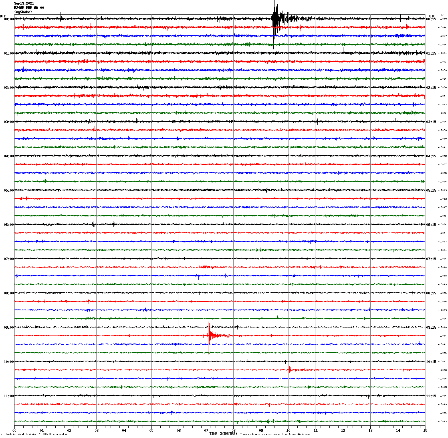
September 19, 2021 00:09:14 UTC
Magnitude 2.4
Depth 6.8 km
9km ESE of Fremont, CA
37.522°N 121.887°W
September 19, 2021 09:21:57 UTC
East/West Sensor
Magnitude 2.9
Depth 4.5 km
10km NE of Milpitas, CA
37.498°N 121.827°W
September 14, 2021 18:45:27 UTC
East/West Sensor
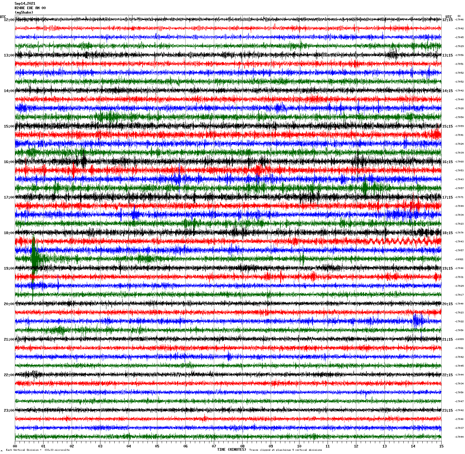
Magnitude 3.8
Depth 16.6 km
15km SSE of New Idria, CA
36.297°N 120.593°W
September 14, 2021 07:38:52 UTC
East/West Sensor
Magnitude 7.0
Depth 20.0 km
Acapulco, Mexico
16.994°N 99.783°W
September 8, 2021 01:47:48 UTC
East/West Sensor
Magnitude 4.1
Depth 8.5 km
6km NW of Pinnacles, CA
36.578°N 121.183°W
August 31, 2021 16:09:56 UTC
North/South Sensor
Magnitude 4.6
Depth -1.9 km
25km SSW of Smith Valley, NV
38.566°N 119.421°W
August 27, 2021 04:47:44 UTC
North/South Sensor
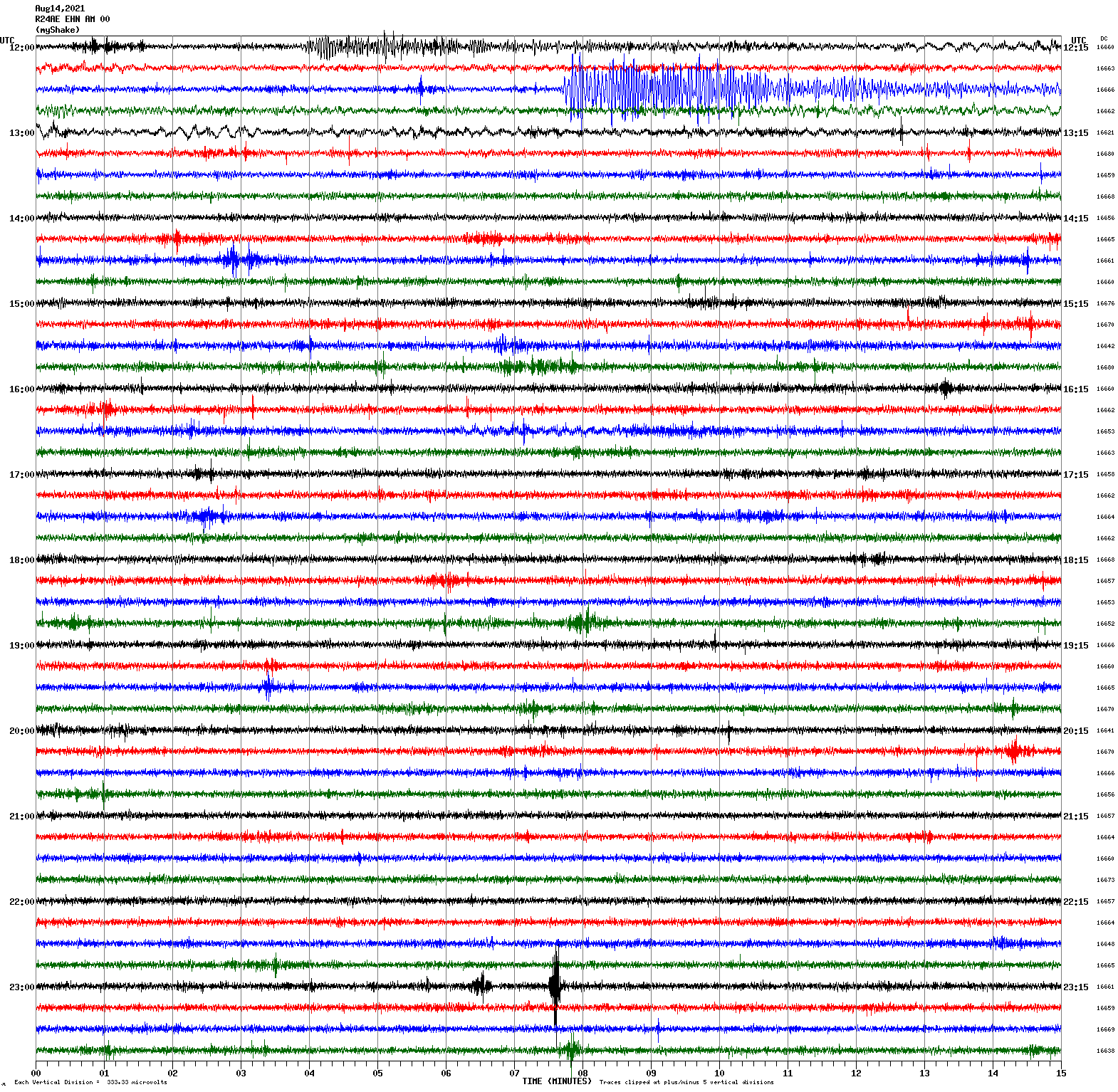
Magnitude 7.2
Depth 10.0 km
12 km NE of Saint-Louis du Sud, Haiti
18.352°N 73.480°W
August 14, 2021 12:29:09 UTC
North/South Sensor
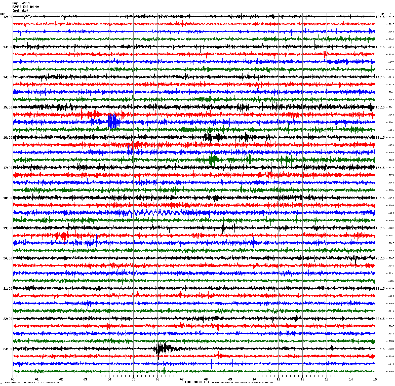
Magnitude 2.9
Depth 6.1 km
15km E of Seven Trees, CA
37.301°N 121.672°W
August 2, 2021 23:05:42 UTC
East/West Sensor
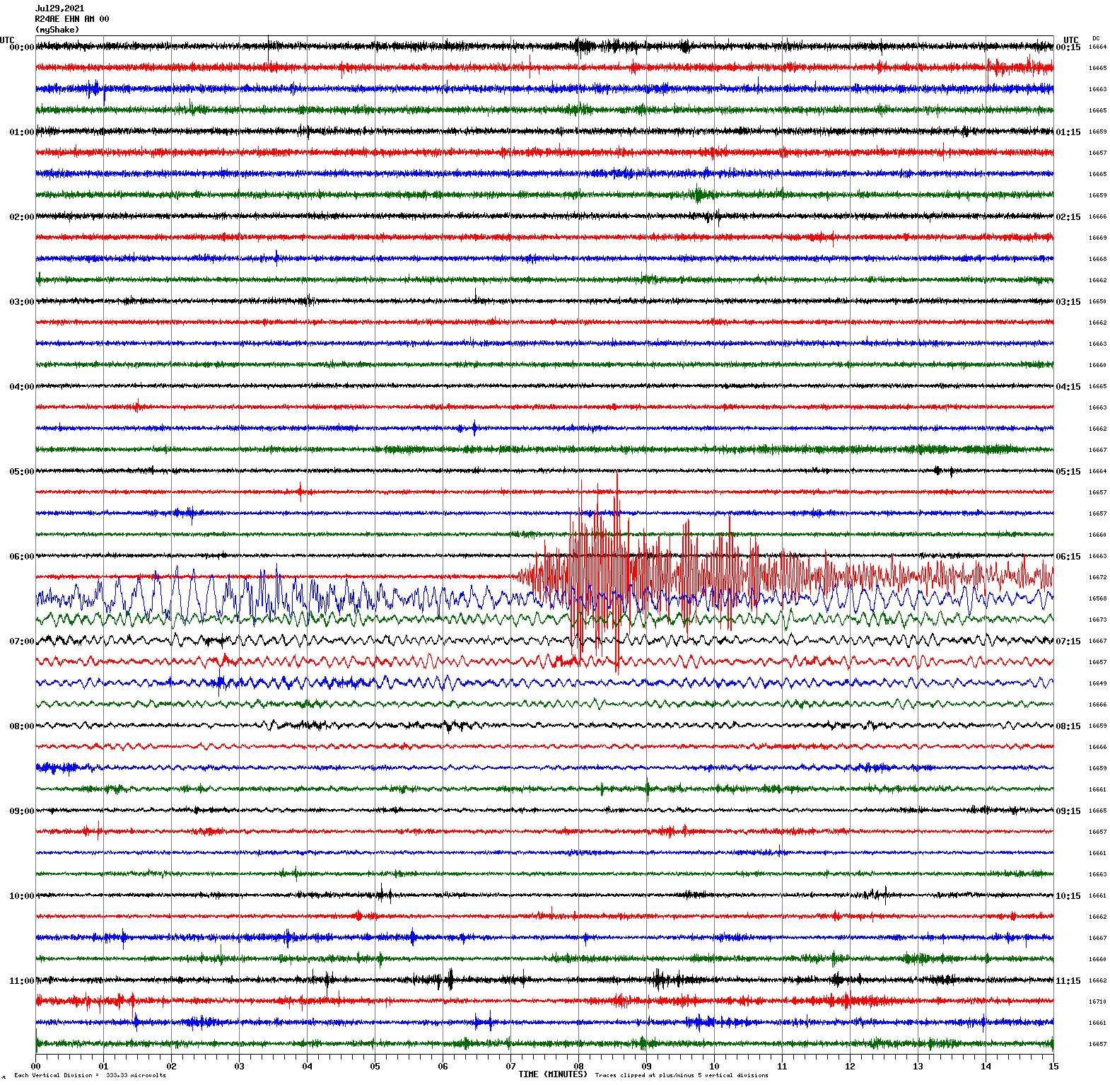
Magnitude 8.2
Depth 32.2 km
104 km SE of Perryville, Alaska
55.325°N 157.841°W
July 29, 2021 06:15:47 UTC
North/South Sensor
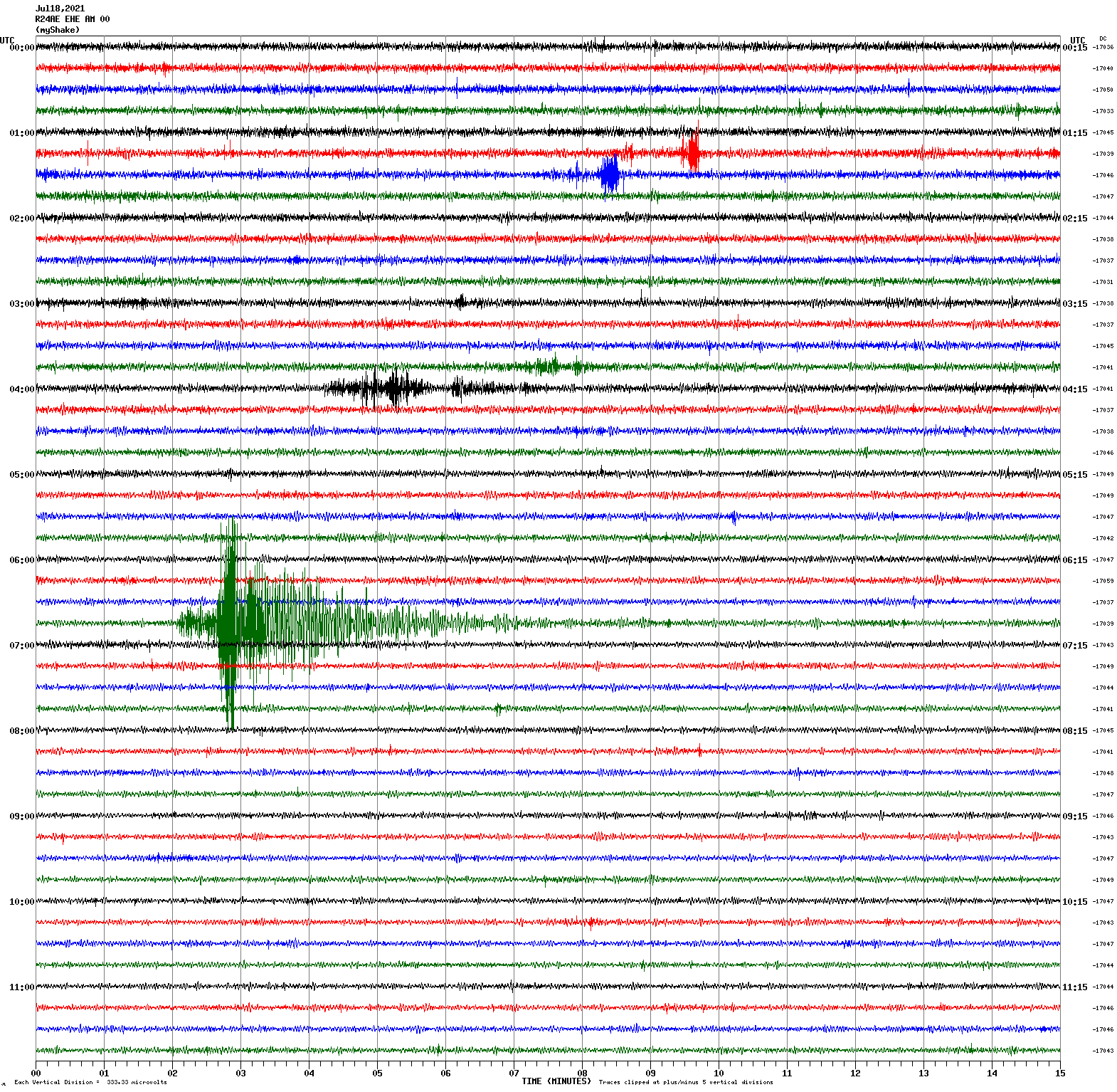
Magnitude 5.1
Depth 30.9 km
12km W of Petrolia, CA
40.324°N 124.426°W
July 18, 2021 06:46:12 UTC
East/West Sensor
Magnitude 4.5
Depth 3.3 km
30km SE of Markleeville, CA
38.535°N 119.518°W
July 8, 2021 23:58:53 UTC
Magnitude 4.4
Depth 6.5 km
19km ENE of Dardanelle, CA
38.436°N 119.648°W
July 9, 2021 00:27:48 UTC
Magnitude 4.6
Depth 8.3 km
31km SE of Markleeville, CA
38.514°N 119.526°W
July 9, 2021 01:46:00 UTC
Magnitude 4.1
Depth 5.3 km
31km SSW of Smith Valley, NV
38.533°N 119.499°W
July 9, 2021 05:04:18 UTC
Magnitude 4.3
Depth 1.7 km
27km SSW of Smith Valley, NV
38.564°N 119.481°W
July 9, 2021 05:10:35 UTC
East/West Sensor
Magnitude 5.9
Depth 9.8 km
32km SSW of Smith Valley, NV
38.523°N 119.497°W
July 8, 2021 22:48:48 UTC
Magnitude 4.6
Depth 9.3 km
30km ENE of Dardanelle, CA
38.523°N 119.497°W
July 8, 2021 23:33:41 UTC
East/West Sensor
Voltage Counts & Frequency for All Sensors (Magnitude 5.9 Earthquake)
Magnitude 3.6
Depth 4.6 km
12km ESE of Angwin, CA
38.550°N 122.313°W
July 8, 2021 07:36:25 UTC
East/West Sensor
Magnitude 3.7
Depth 5.8 km
2km WSW of Los Banos, CA
37.052°N 120.875°W
July 3, 2021 23:23:51 UTC
East/West Sensor
Magnitude 2.8
Depth 7.2 km
6km SSW of San Ramon, CA
37.730°N 121.991°W
June 30, 2021 08:49:46 UTC
East/West Sensor
Magnitude 3.9
Depth 10.6 km
3km N of San Lorenzo, CA
37.706°N 122.122°W
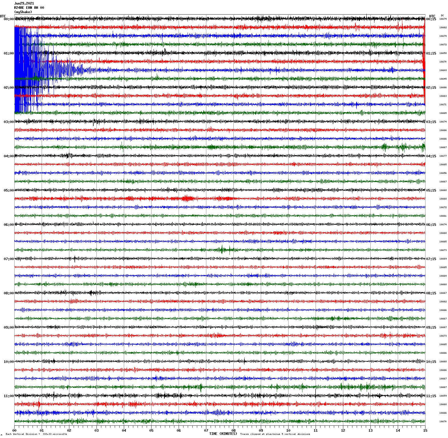
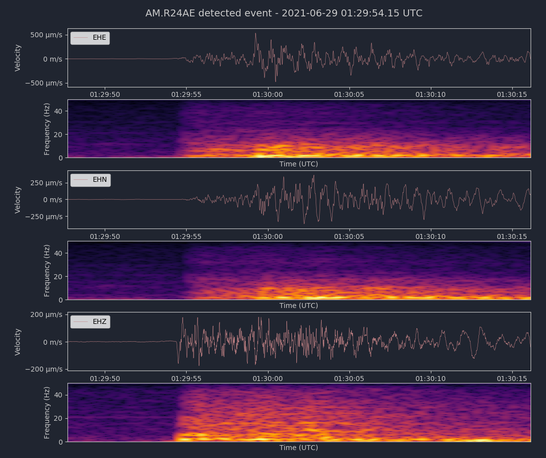
June 29, 2021 01:29:48 UTC
North/South Sensor
Voltage Counts & Frequency for All Sensors (Magnitude 3.9 Earthquake)
Magnitude 2.6
Depth 6.6 km
2km ENE of Hayward, CA
37.650°N 122.055°W
June 19, 2021 02:43:16 UTC
East/West Sensor
Magnitude 3.4
Depth 3.6 km
7km WNW of The Geysers, CA
38.805°N 122.828°W
June 14, 2021 03:16:24 UTC
East/West Sensor
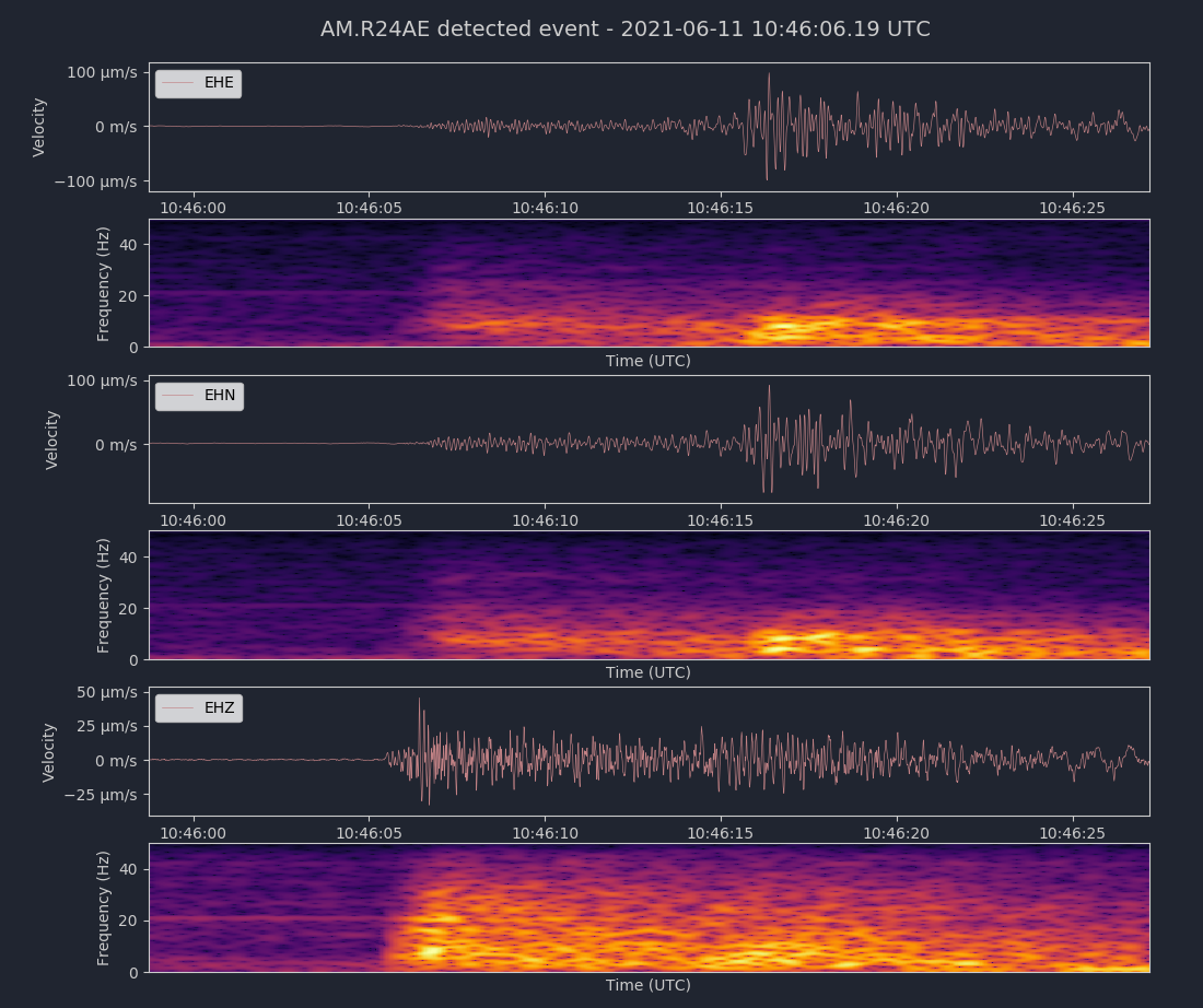
Magnitude 3.3
Depth 7.0 km
4km NNW of Aromas, CA
36.926°N 121.663°W
June 11, 2021 10:45:53 UTC
North/South Sensor
Voltage Counts & Frequency for All Sensors (Magnitude 3.3 Earthquake)
Magnitude 5.3
Depth 5.8 km
11km W of Calipatria, CA
33.140°N 115.635°W
June 5, 2021 17:55:58 UTC
East/West Sensor
Magnitude 3.6
Depth 6.0 km
9km E of Alum Rock, CA
37.368°N 121.730°W
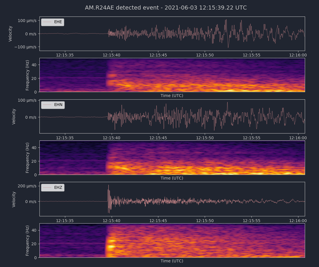
June 3, 2021 12:15:32 UTC
North/South Sensor
Voltage Counts & Frequency for All Sensors (Magnitude 2.8 Earthquake)
Magnitude 3.6
Depth 9.1 km
3km NE of Pinnacles, CA
36.550°N 121.115°W
June 3, 2021 04:34:42 UTC
East/West Sensor
Magnitude 4.2
Depth -2.0 km
8km SE of Dollar Point, CA
39.136°N 120.044°W
May 28, 2021 15:25:22 UTC
North/South Sensor
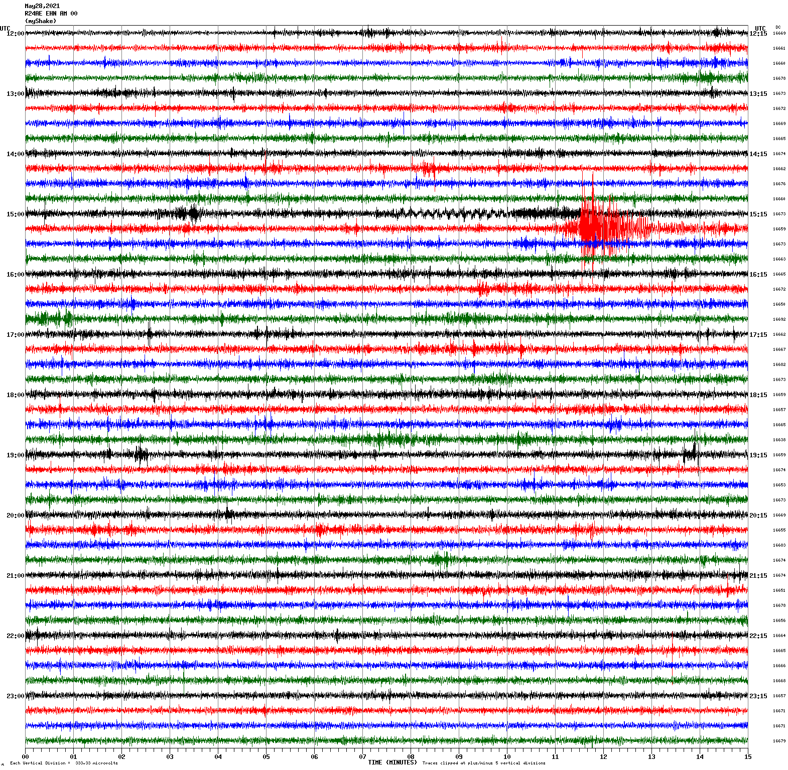
Magnitude 4.7
Depth 10.1 km
19km NW of Truckee, CA
39.461°N 120.315°W
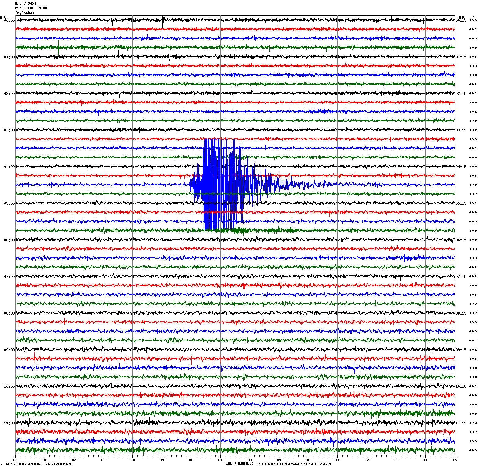
May 7, 2021 04:35:14 UTC
East/West Sensor
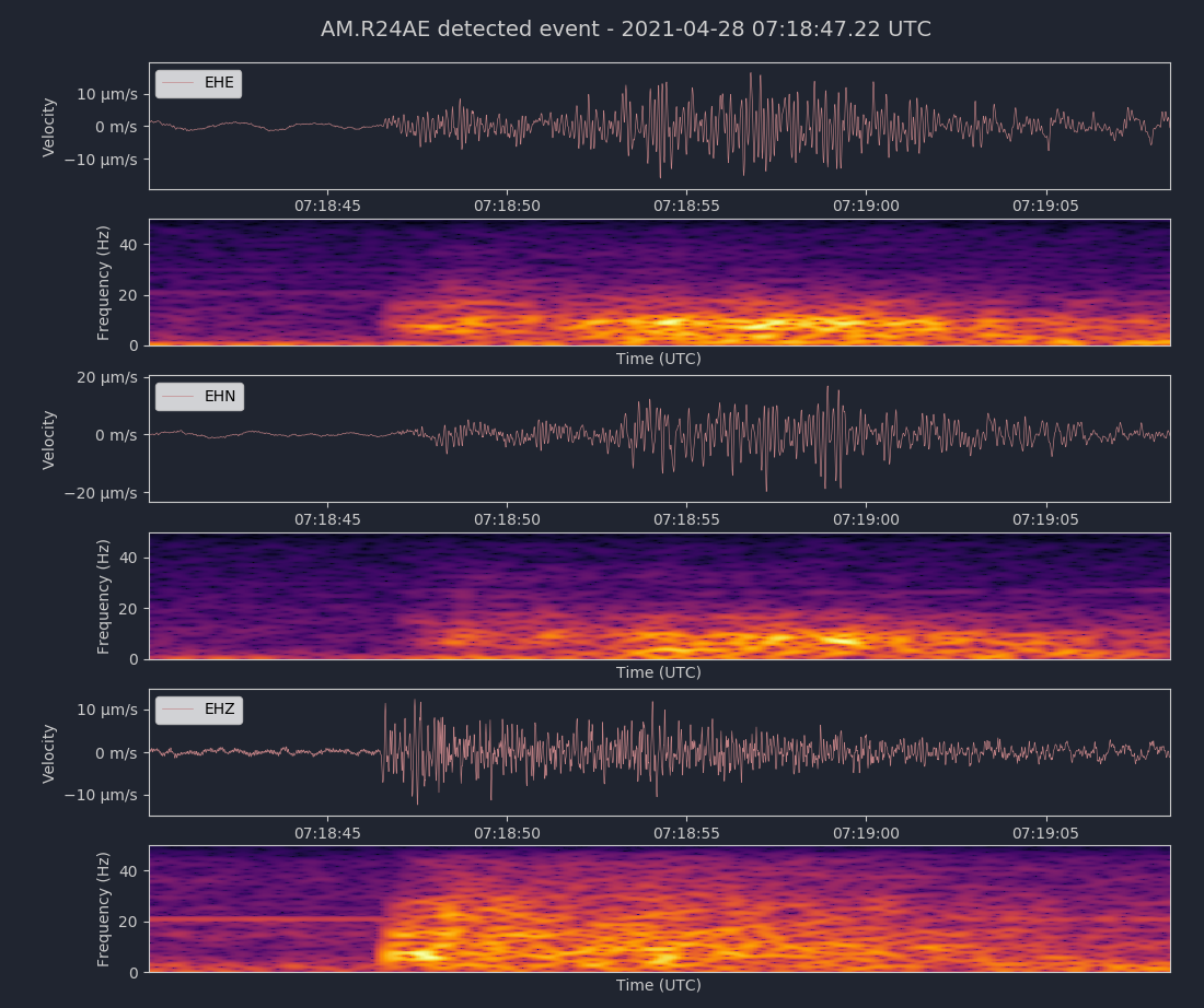
Magnitude 2.8
Depth 5.4 km
2km N of Piedmont, CA
37.846°N 122.235°W
April 28, 2021 07:18:37 UTC
East/West Sensor
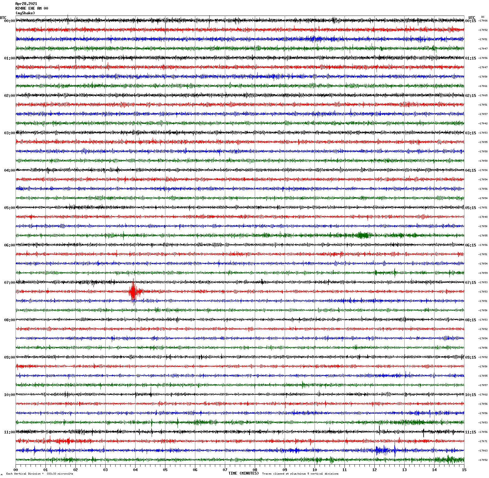
Voltage Counts & Frequency for All Sensors (Magnitude 2.8 Earthquake)
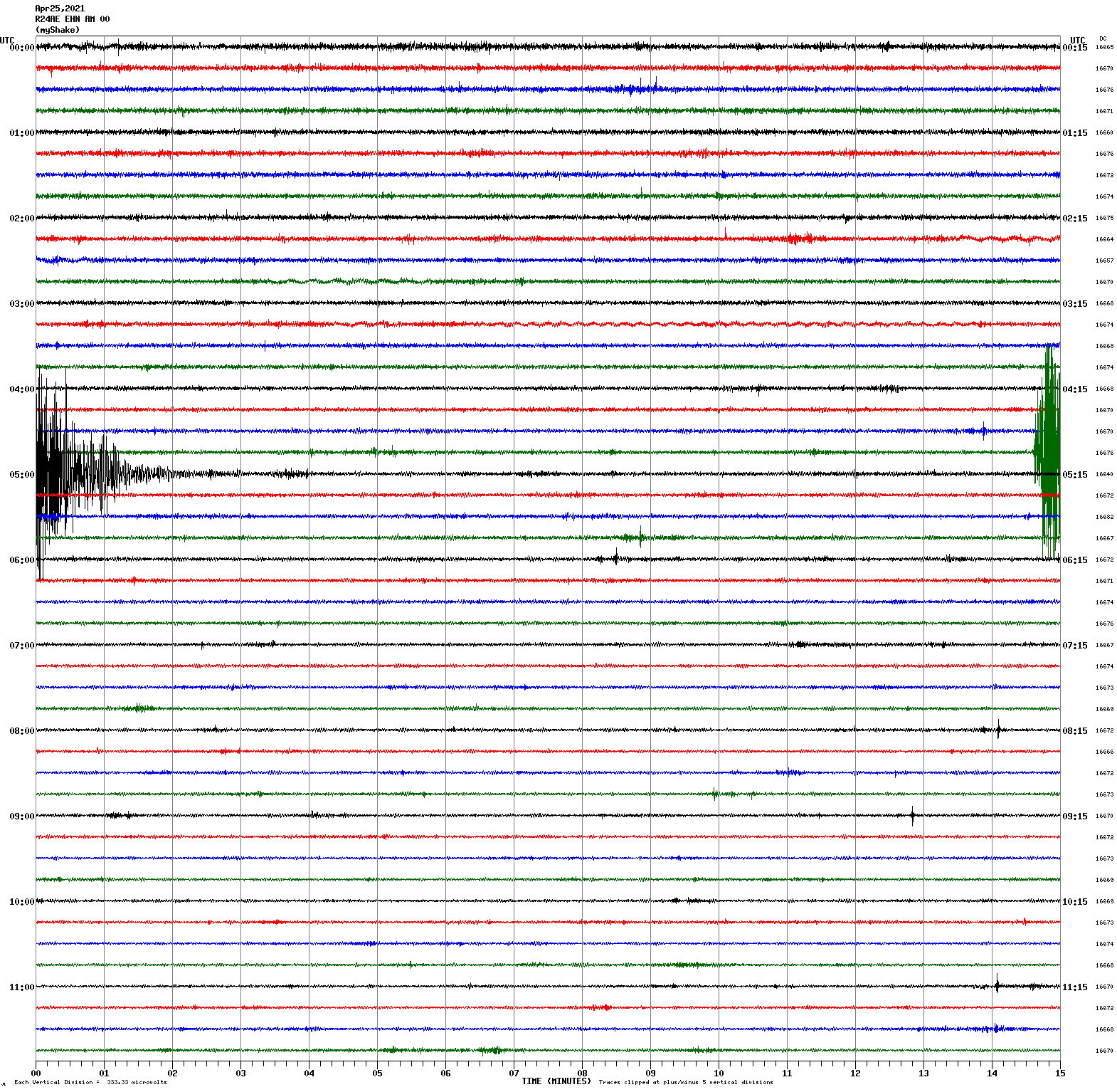
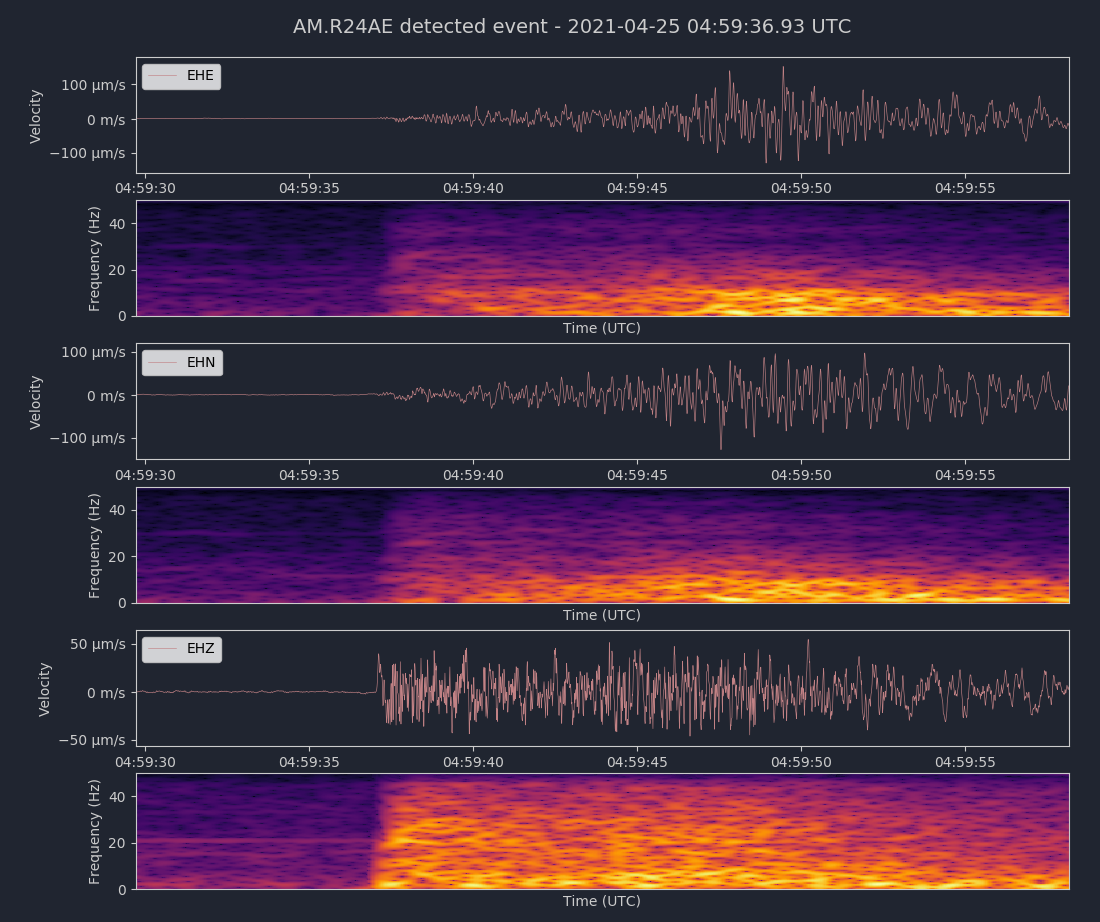
Magnitude 3.6
Depth 6.5 km
15km N of Morgan Hill, CA
37.268°N 121.642°W
April 25, 2021 04:59:28 UTC
North/South Sensor
Voltage Counts & Frequency for All Sensors (Magnitude 3.6 Earthquake)
Magnitude 3.1
Depth 5.2 km
3km SW of San Juan Bautista, CA
36.829°N 121.563°W
April 21, 2021 03:55:27 UTC
North/South Sensor
Magnitude 4.0
Depth 2.9 km
3km SW of Anderson Springs, CA
38.757°N 122.723°W
April 19, 2021 18:50:58 UTC
East/West Sensor
Magnitude 3.4
Depth 7.4 km
7km S of Calistoga, CA
38.520°N 122.589°W
April 10, 2021 14:13:21 UTC
East/West Sensor
Magnitude 3.0
Depth 3.8 km
14km SE of Livermore, CA
37.582°N 121.674°W
April 10, 2021 11:50:14 UTC
East/West Sensor
Magnitude 3.4
Depth 7.2 km
6km S of San Juan Bautista, CA
36.795°N 121.527°W
March 31, 2021 13:44:03 UTC
North/South Sensor
Magnitude 2.6
Depth 7.3 km
7km E of Alum Rock, CA
37.367°N 121.750°W
March 30, 2021 05:43:48 UTC
East/West Sensor
Magnitude 4.0
Depth 8.2 km
21km SSW of Willits, CA
39.245°N 123.474°W
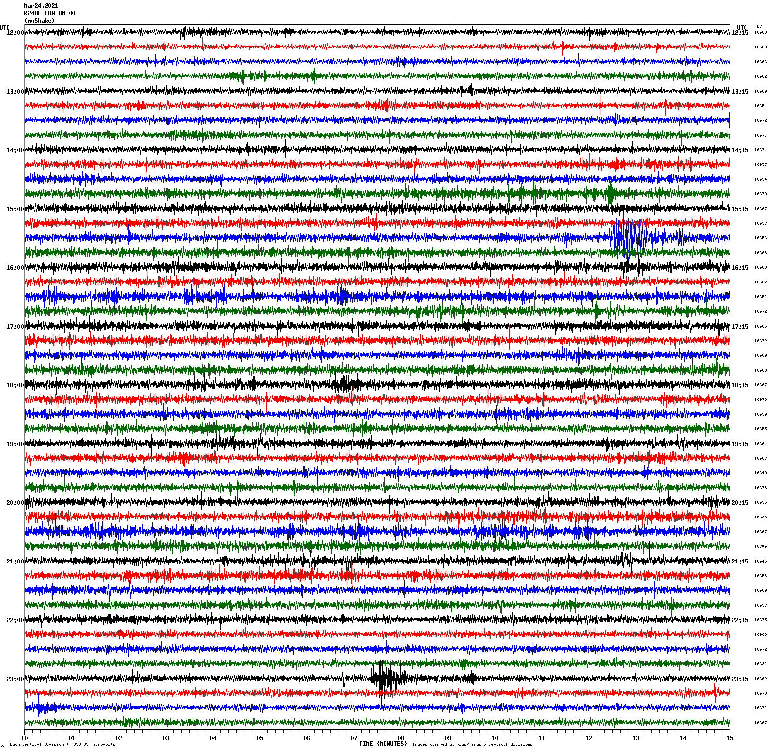
March 24, 2021 15:41:13 UTC
Magnitude 3.3
Depth 7.8 km
9km E of Gilroy, CA
37.003°N 121.465°W
March 24, 2021 23:07:08 UTC
North/South Sensor
Magnitude 3.7
Depth 1.2 km
22km SSE of Lopez Point, CA
35.842°N 121.468°W
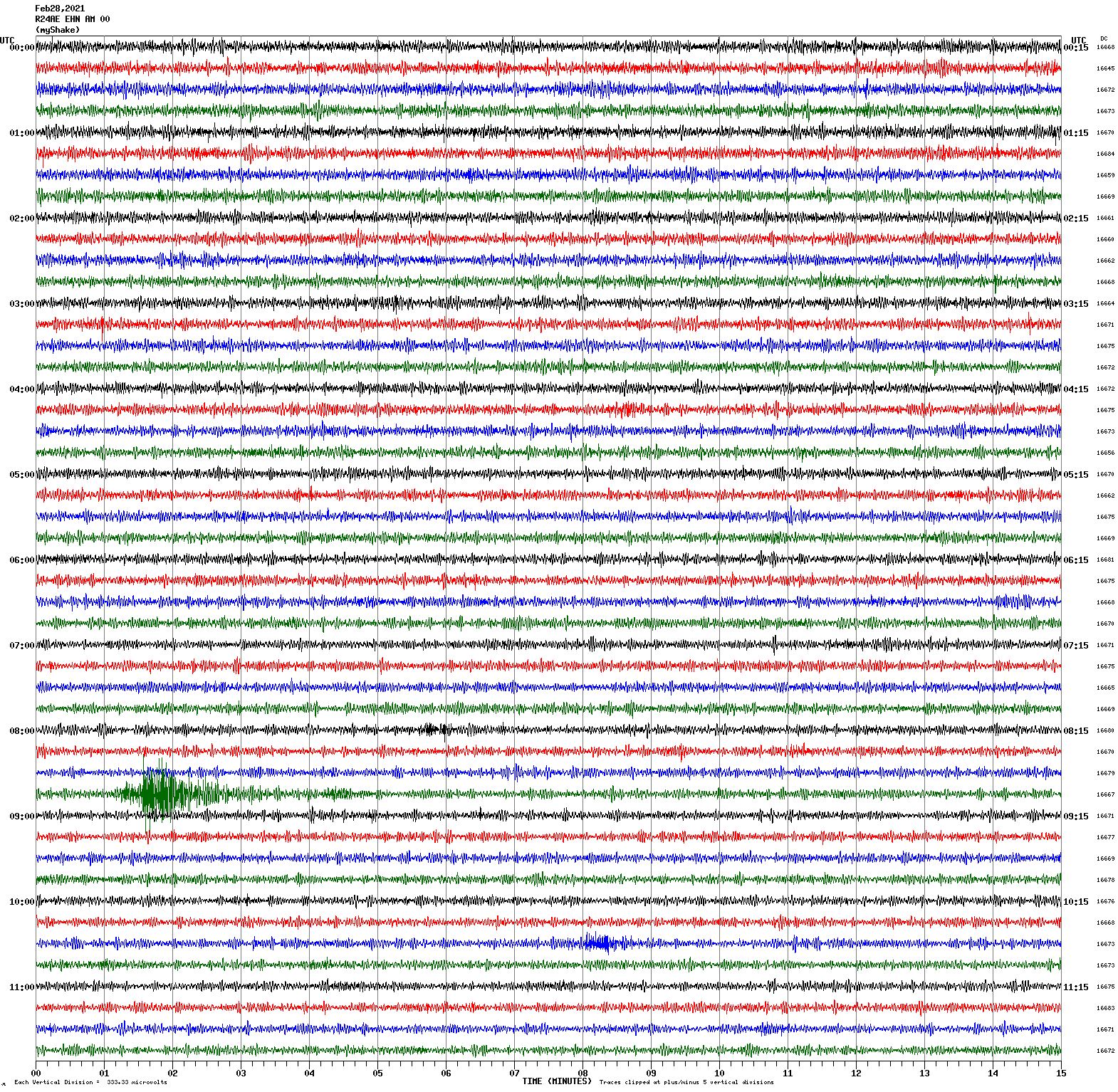
February 28, 2021 08:45:38 UTC
North/South Sensor
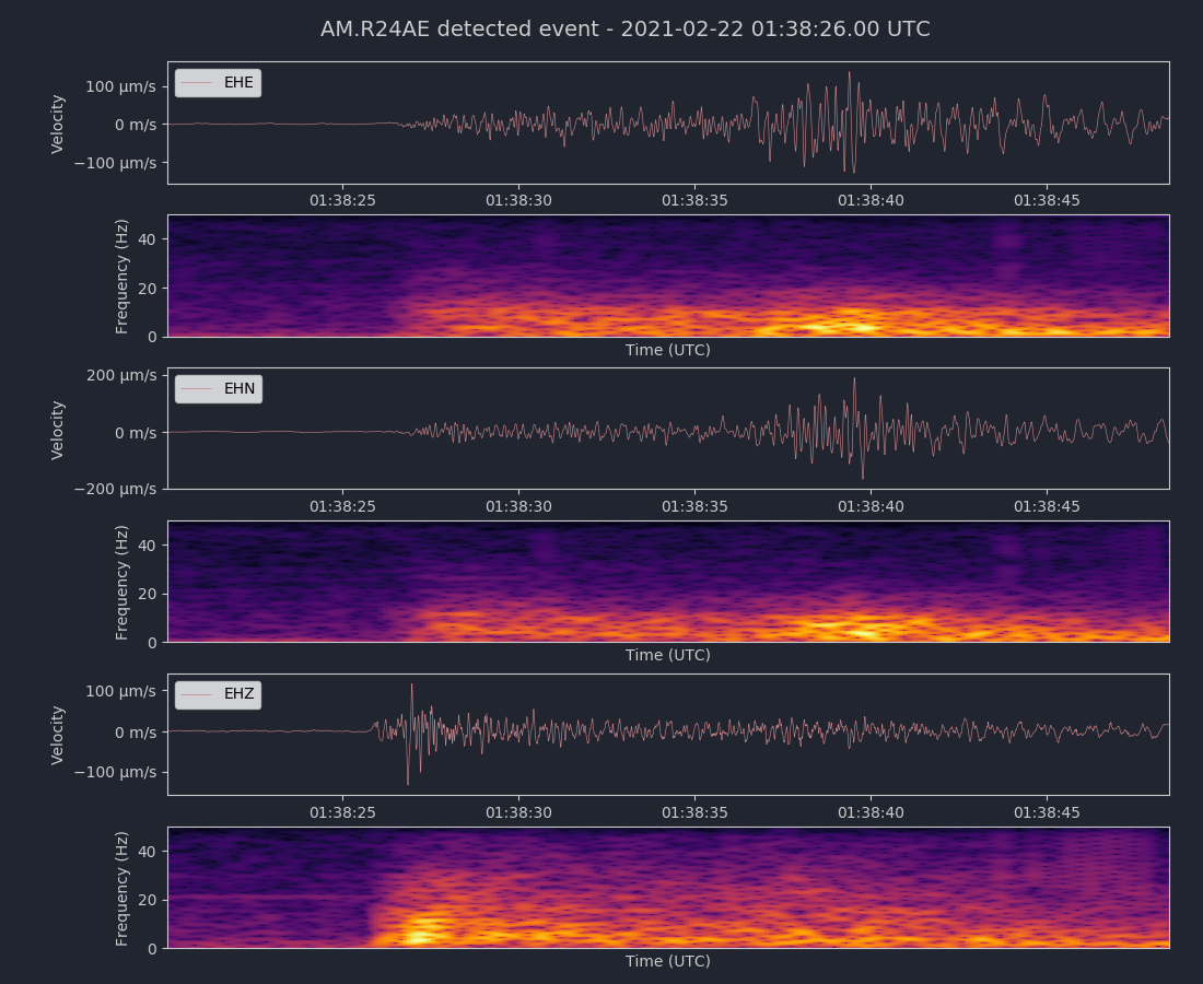
Magnitude 3.8
Depth 6.9 km
9km ENE of Gilroy, CA
37.045°N 121.481°W
February 22, 2021 01:38:13 UTC
North/South Sensor
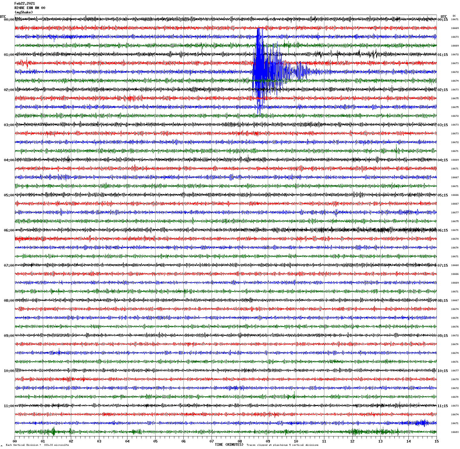
Voltage Counts & Frequency for All Sensors (Magnitude 3.8 Earthquake)
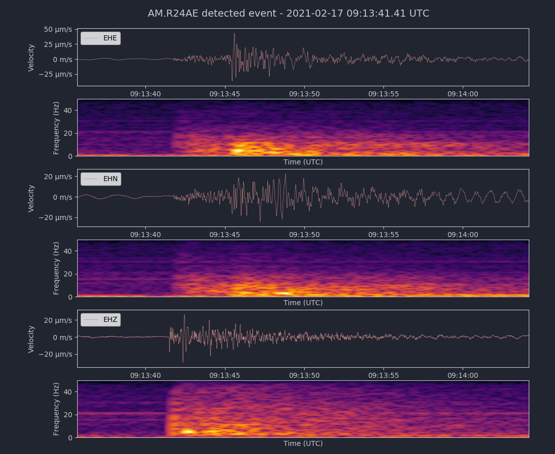
Magnitude 2.6
Depth 3.8 km
1km ENE of Union City, CA
37.599°N 122.007°W
February 17, 2021 09:13:36 UTC
East/West Sensor
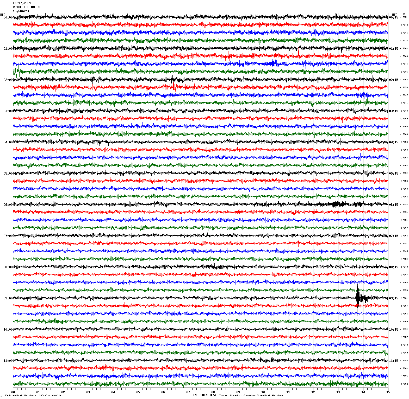
Voltage Counts & Frequency for All Sensors (Magnitude 2.6 Earthquake)
Magnitude 3.2
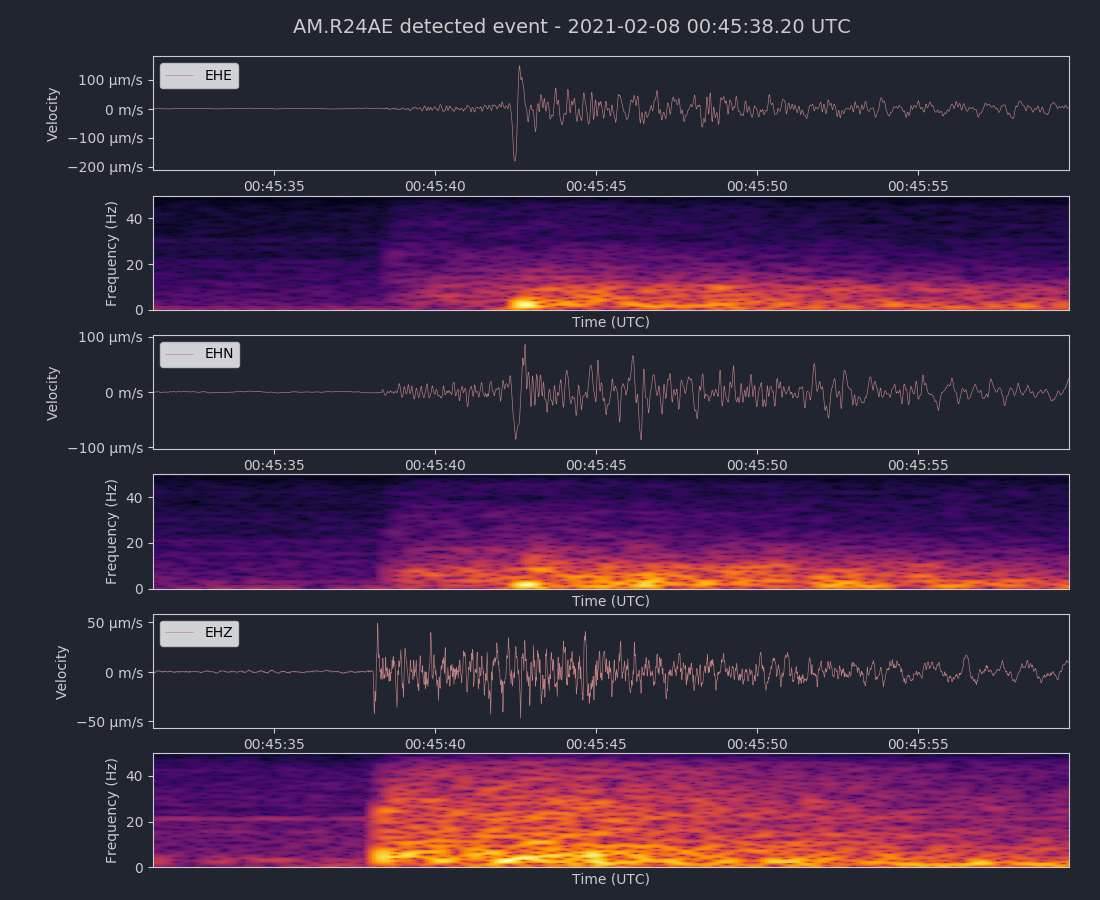
Depth 4.6 km
10km NE of Milpitas, CA
37.497°N 121.825°W
February 8, 2021 00:45:33 UTC
East/West Sensor
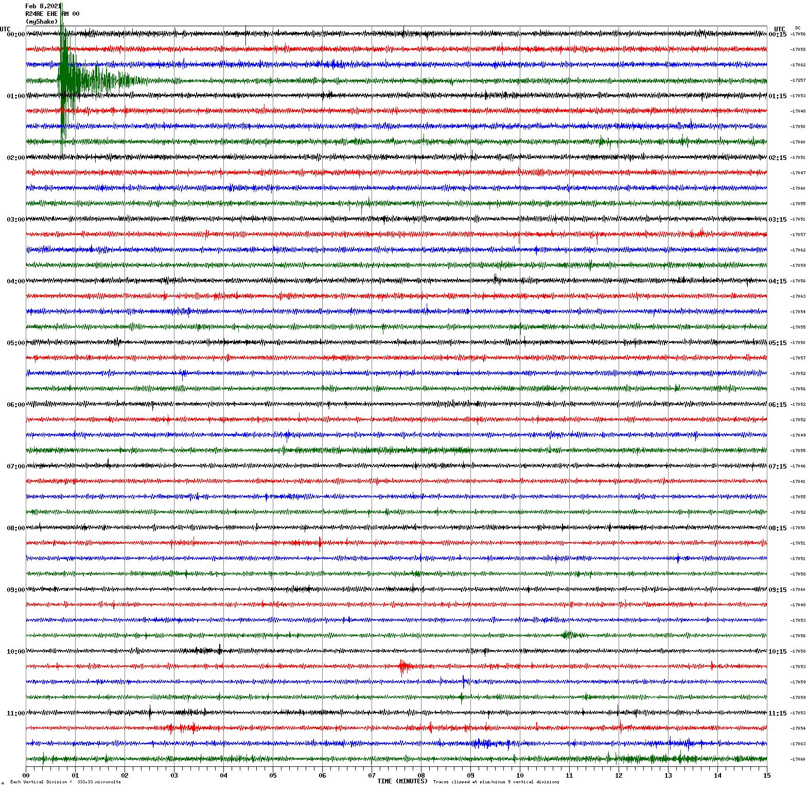
Voltage Counts & Frequency for All Sensors (Magnitude 3.2 Earthquake)
Magnitude 3.0
Depth 15.4 km
1km W of Concord, CA
37.969°N 122.027°W
January 22, 2021 00:48:11 UTC
North/South Sensor
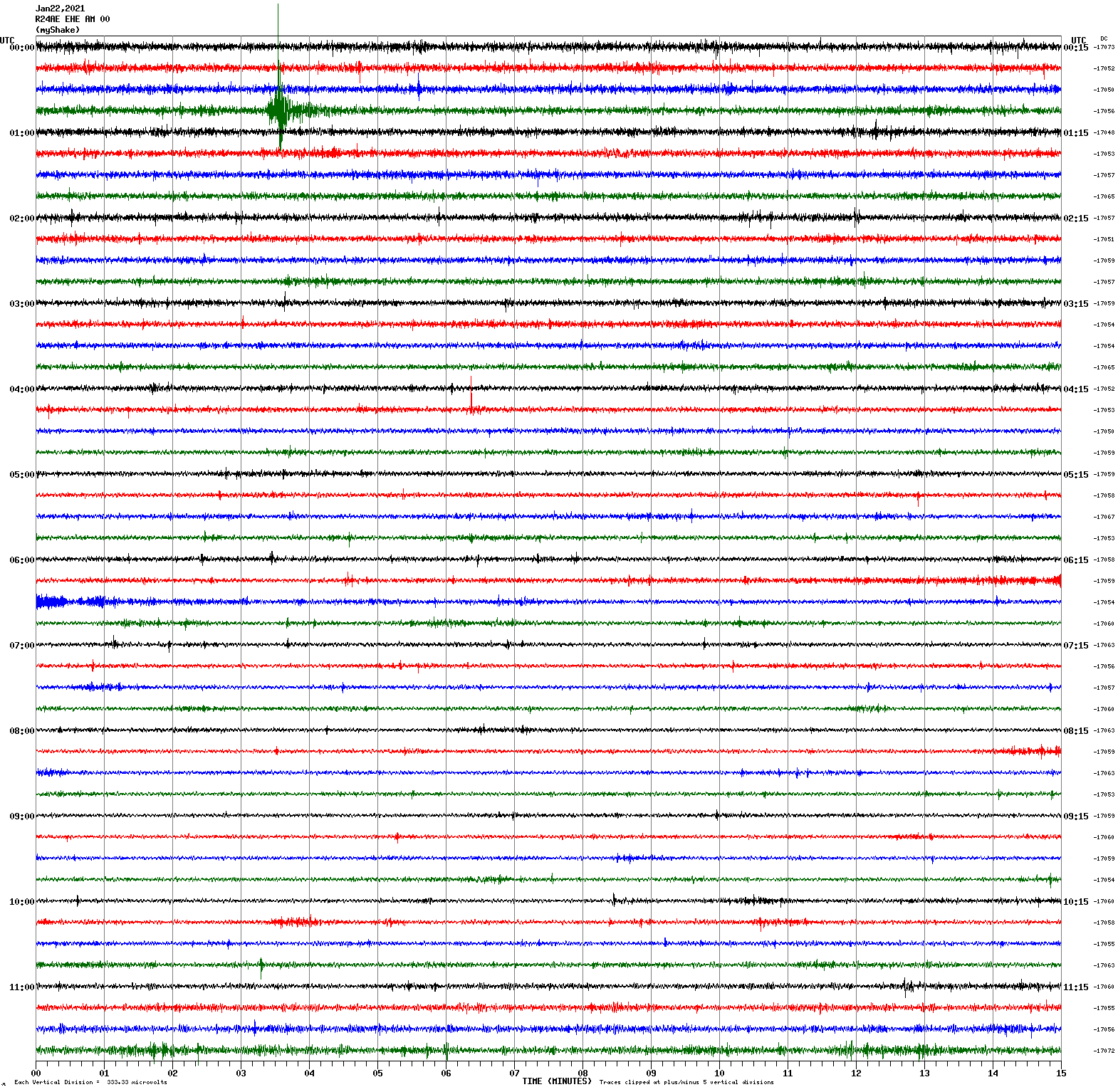
Magnitude 2.0
Depth 4.9 km
2km S of Los Altos Hills, CA
37.360°N 122.142°W
January 21, 2021 08:21:54 UTC
North/South Sensor
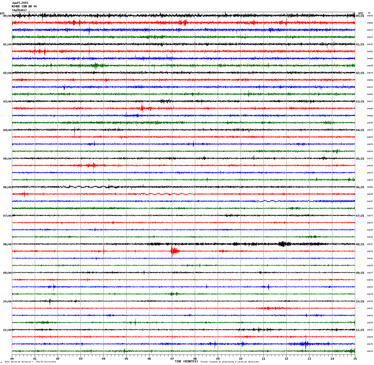
Voltage Counts & Frequency for All Sensors (Magnitude 2.0 Earthquake)
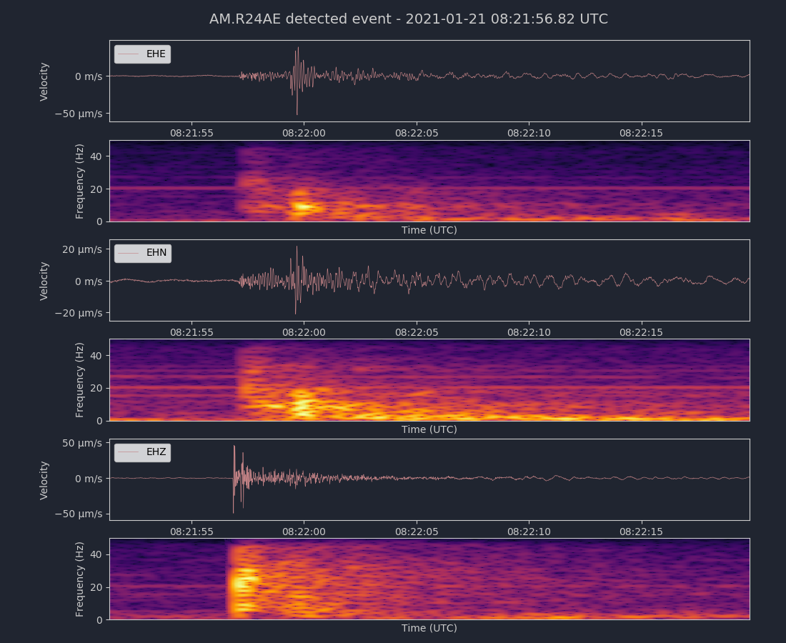
Magnitude 2.2
Depth 4.7 km
2km S of Los Altos Hills, CA
37.361°N 122.135°W
January 18, 2021 09:01:37 UTC
East/West Sensor
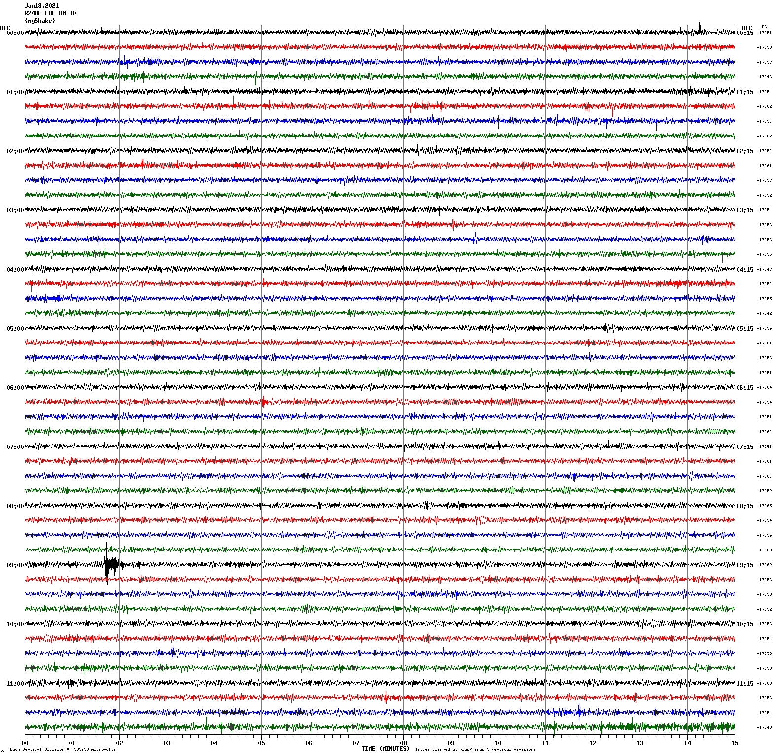
Voltage Counts & Frequency for All Sensors (Magnitude 2.2 Earthquake)
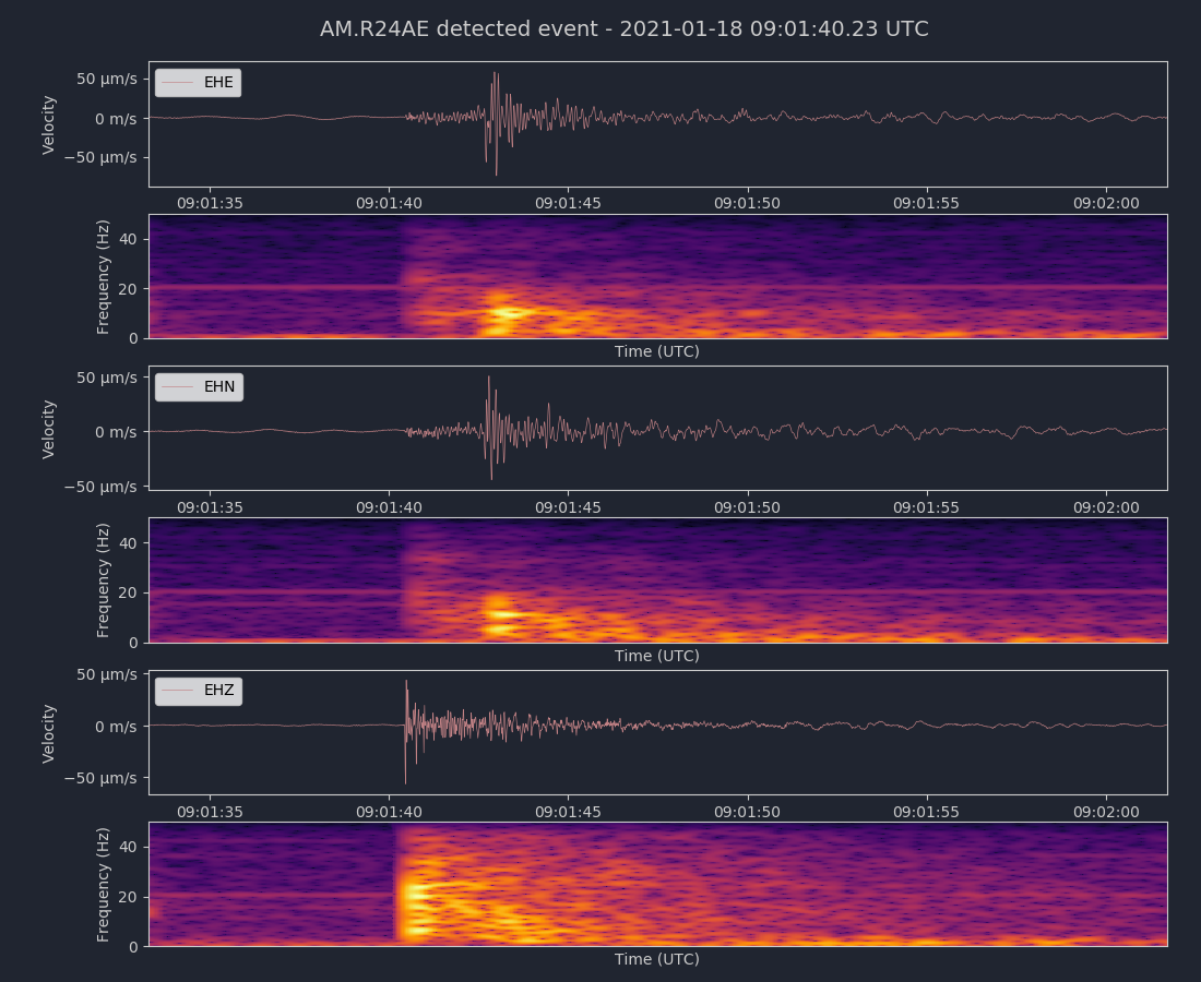
Magnitude 4.2
Depth 7.9 km
4km SE of Aromas, CA
36.868°N 121.611°W
January 17, 2021 04:01:27 UTC
North/South Sensor
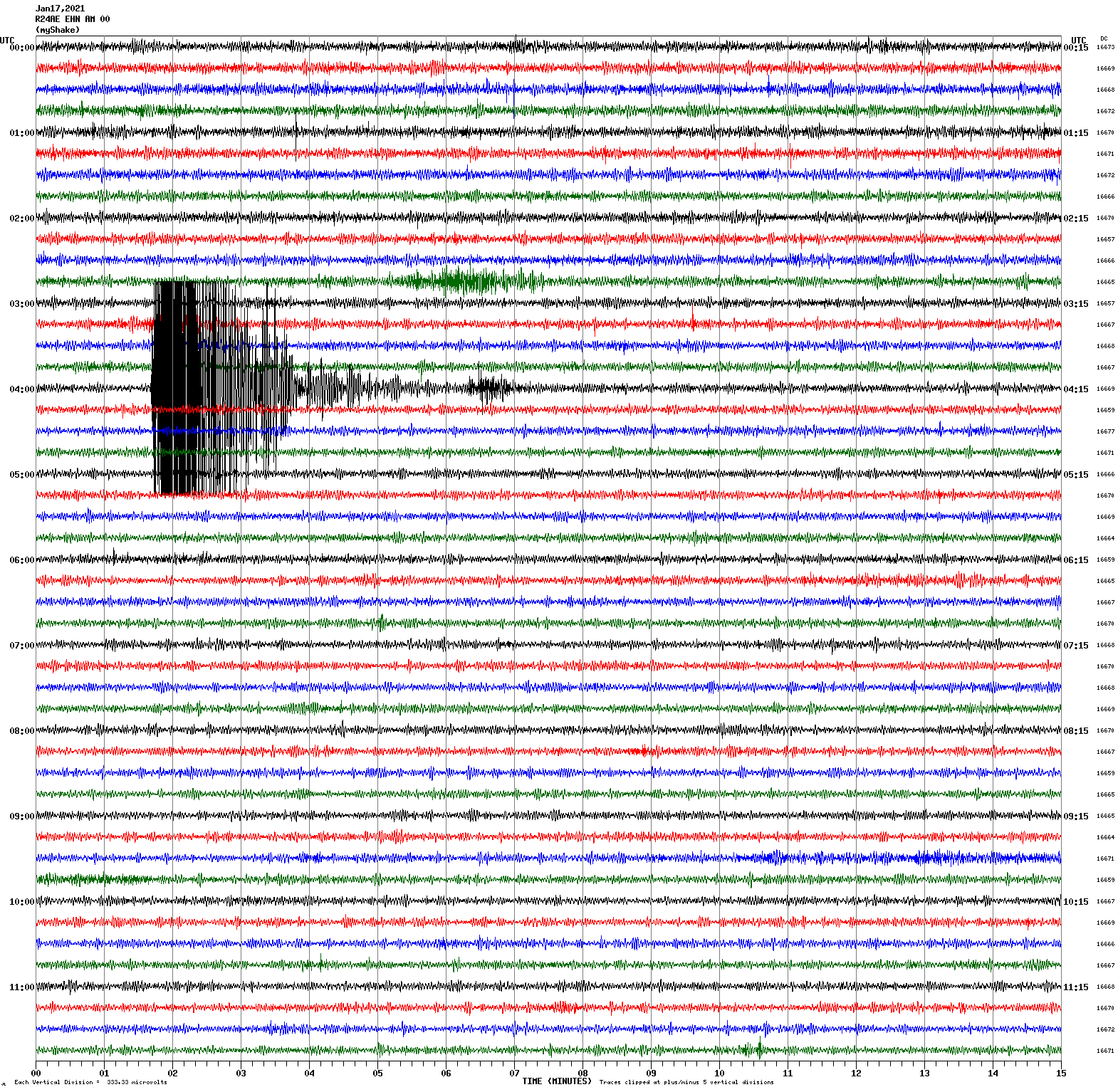
Voltage Counts & Frequency for All Sensors (Magnitude 4.2 Earthquake)
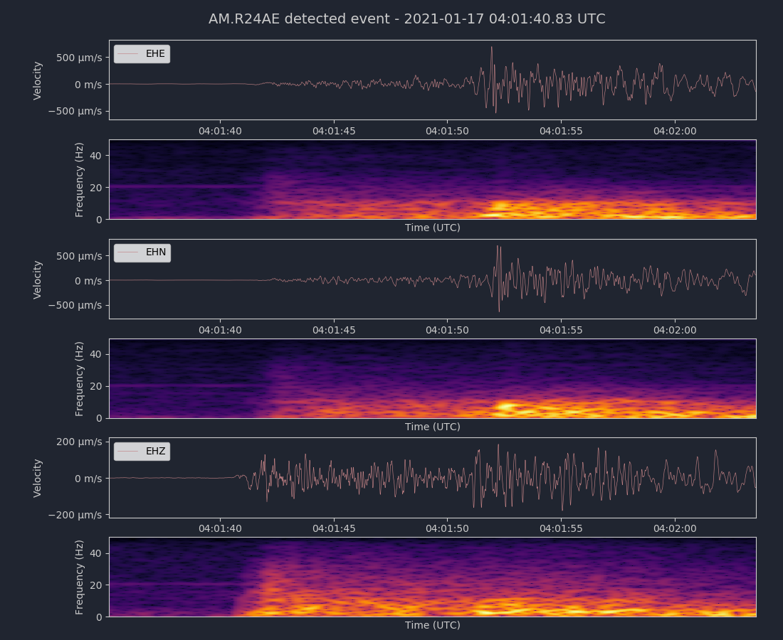
Magnitude 3.6
Depth 15.2 km
2km W of Concord, CA
37.971°N 122.041°W
January 14, 2021 19:18:10 UTC
North/South Sensor
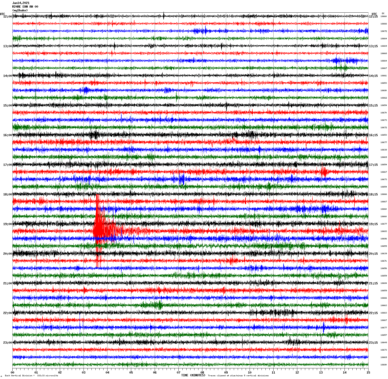
Magnitude 3.1
Depth 9.0 km
8km NE of Alum Rock, CA
37.428°N 121.771°W
January 7, 2021 11:44:06 UTC
North/South Sensor
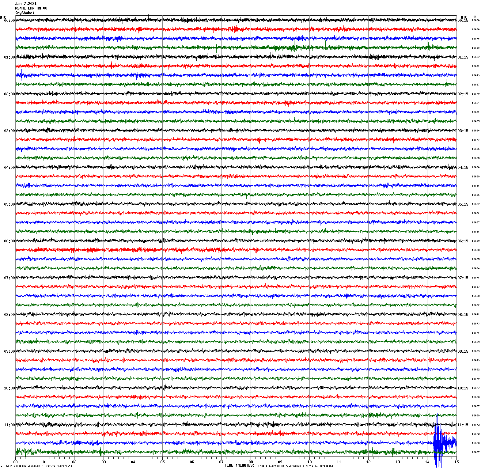
Voltage Counts & Frequency for All Sensors (Magnitude 3.1 Earthquake)
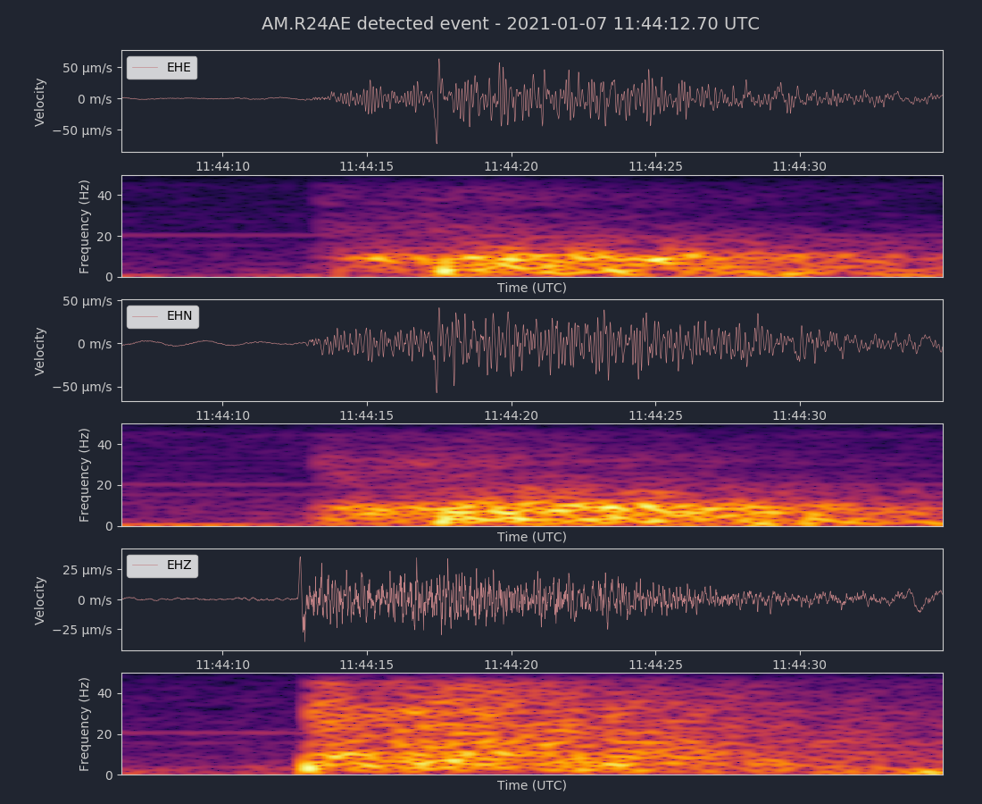
Magnitude 3.3
Depth 5.0 km
0 km N of Gonzales, California
36.515°N 121.443°W
January 3, 2021 05:21:56 UTC
East/West Sensor
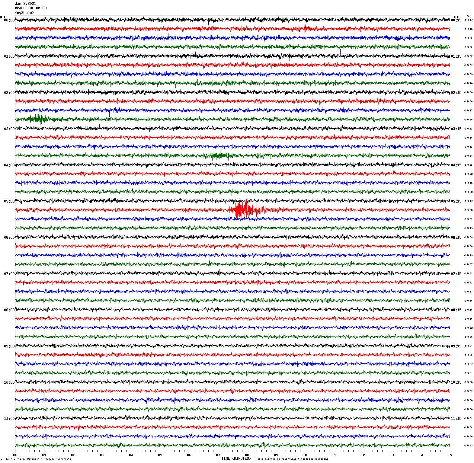
Magnitude 4.3
Depth 6.4 km
10km NW of Pinnacles, CA
36.608°N 121.213°W
January 2, 2021 14:42:23 UTC
North/South Sensor
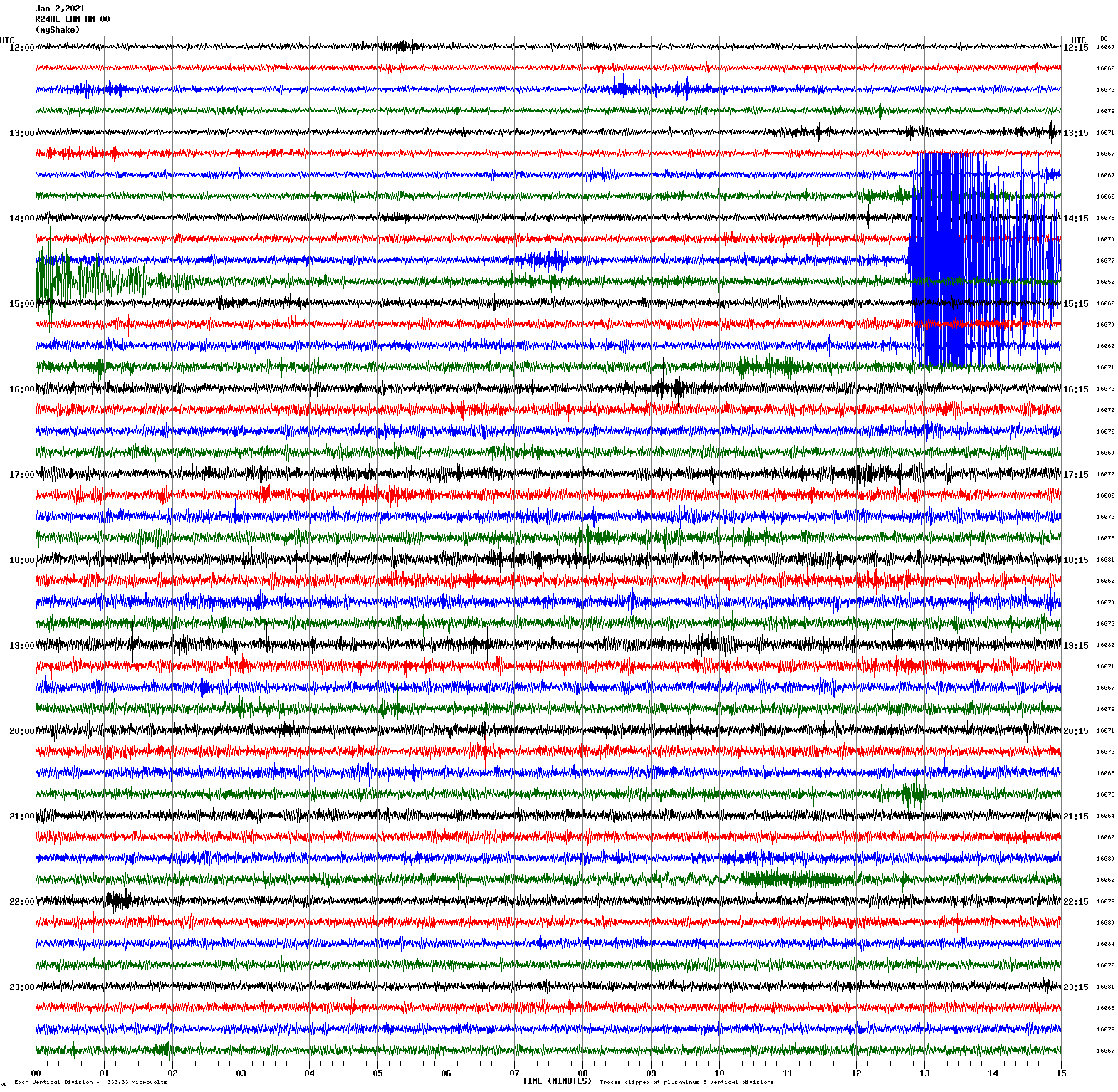
Voltage Counts & Frequency for All Sensors (Magnitude 4.3 Earthquake)
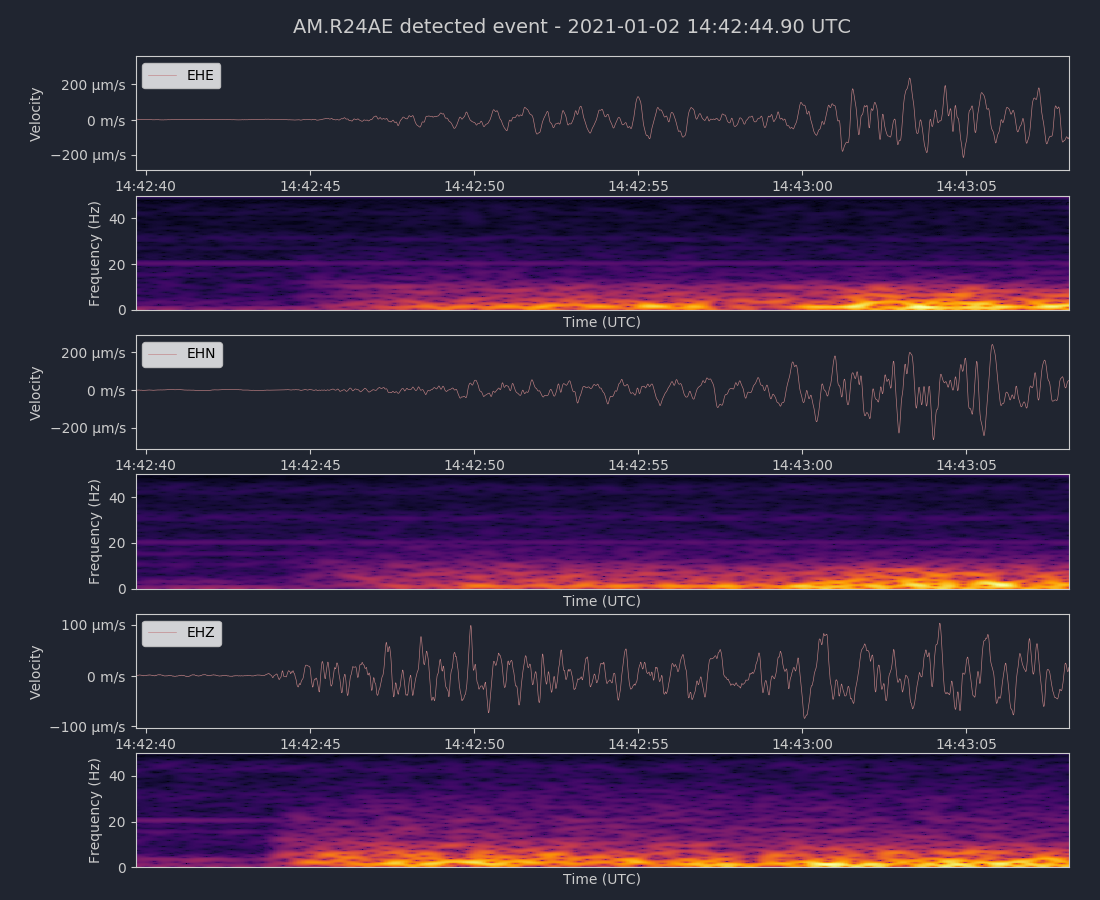
Magnitude 3.6
Depth 14.4 km
7km S of Muir Beach, CA
37.800°N 122.592°W
December 31, 2020 13:41:58 UTC
East/West Sensor
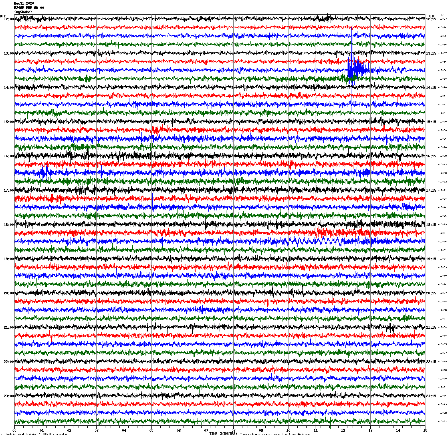
Voltage Counts & Frequency for All Sensors (Magnitude 3.6 Earthquake)
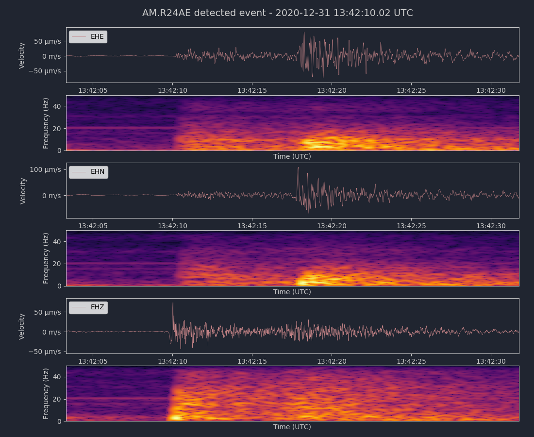
Magnitude 3.6
Depth 2.1 km
9km WNW of Cobb, CA
38.839°N 122.823°W
December 31, 2020 04:22:03 UTC
East/West Sensor
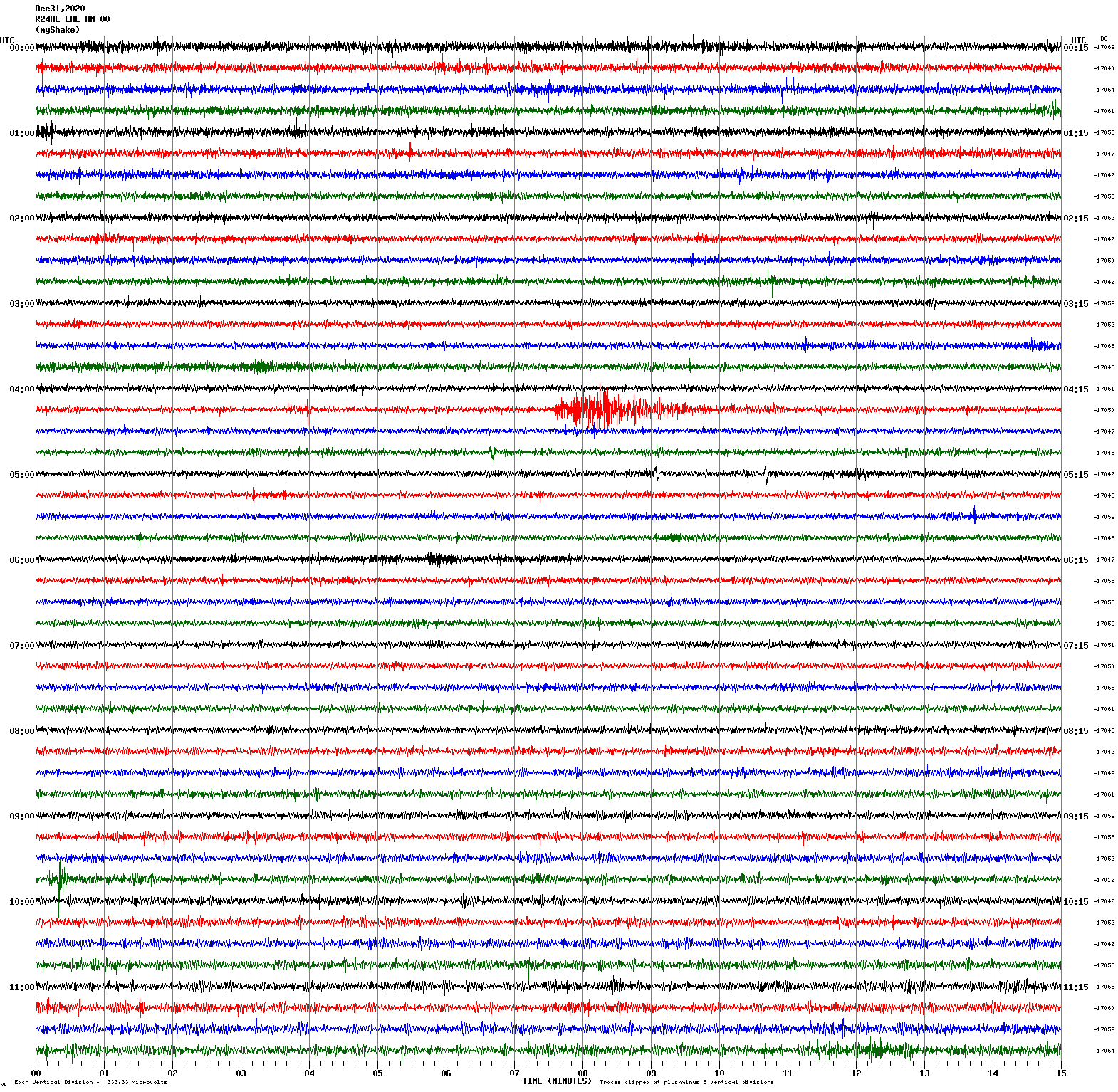
Magnitude 2.8
Depth 5.6 km
2km S of Los Altos Hills, CA
37.357°N 122.137°W
December 30, 2020 04:26:30 UTC
East/West Sensor
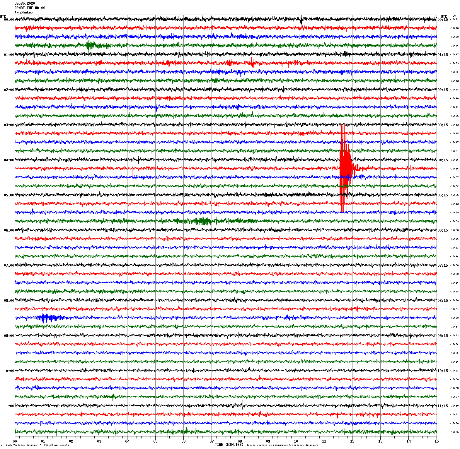
Voltage Counts & Frequency for All Sensors (Magnitude 2.8 Earthquake)
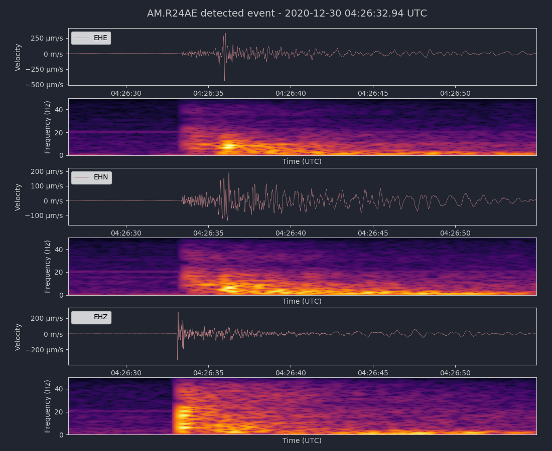
Magnitude 3.2
Depth 3.6 km
4km W of San Juan Bautista, CA
36.843°N 121.578°W
December 27, 2020 19:05:47 UTC
East/West Sensor
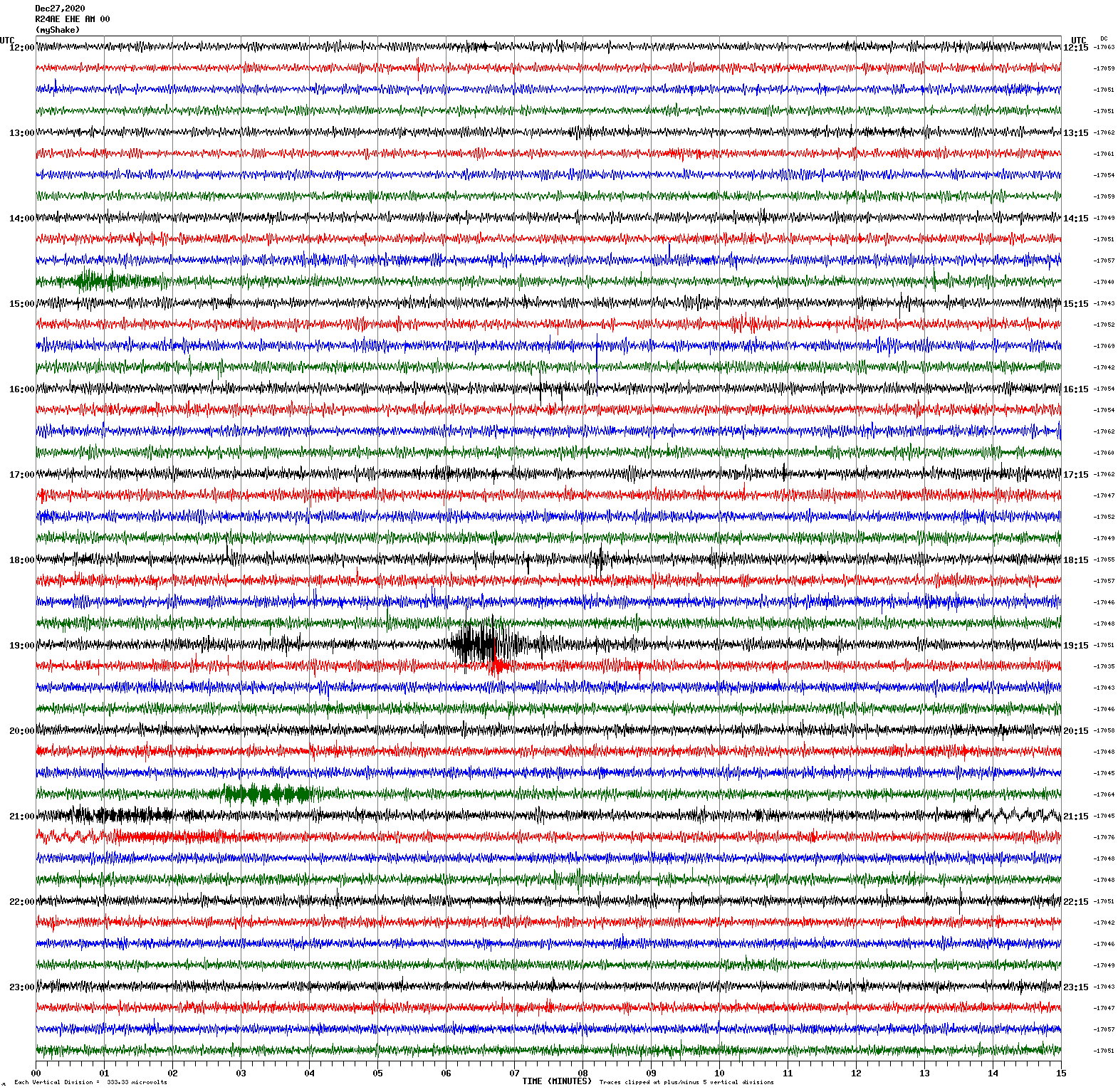
Magnitude 3.7
Depth 5.6 km
10km ENE of Morgan Hill, CA
37.165°N 121.552°W
December 15, 2020 14:58:40 UTC
East/West Sensor
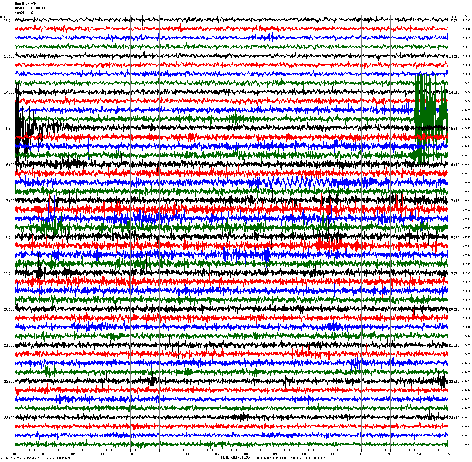
Voltage Counts & Frequency for All Sensors (Magnitude 3.7 Earthquake)
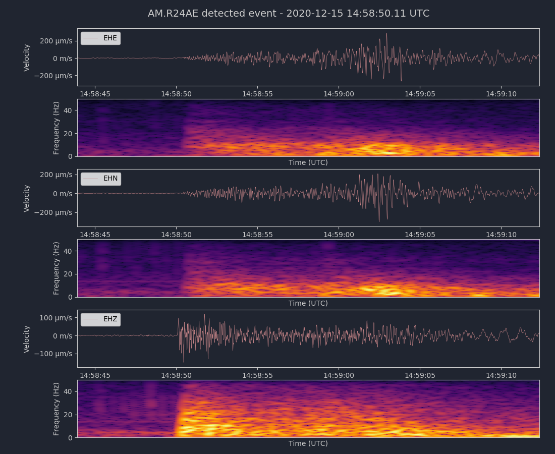
Magnitude 4.9
Depth 6.4 km
26 km S of Mina, Nevada
38.150°N 118.101°W
December 12, 2020 07:50:52 UTC
North/South Sensor
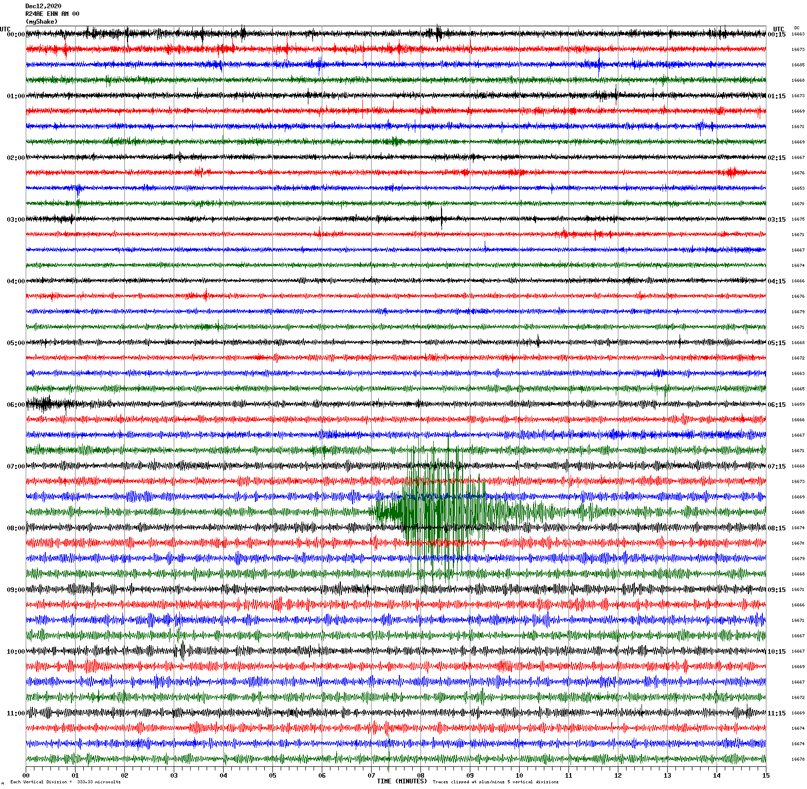
Magnitude 4.4
Depth 8.6 km
13km W of Lakeport, CA
39.034°N 123.067°W
December 6, 2020 15:03:33 UTC
North/South Sensor
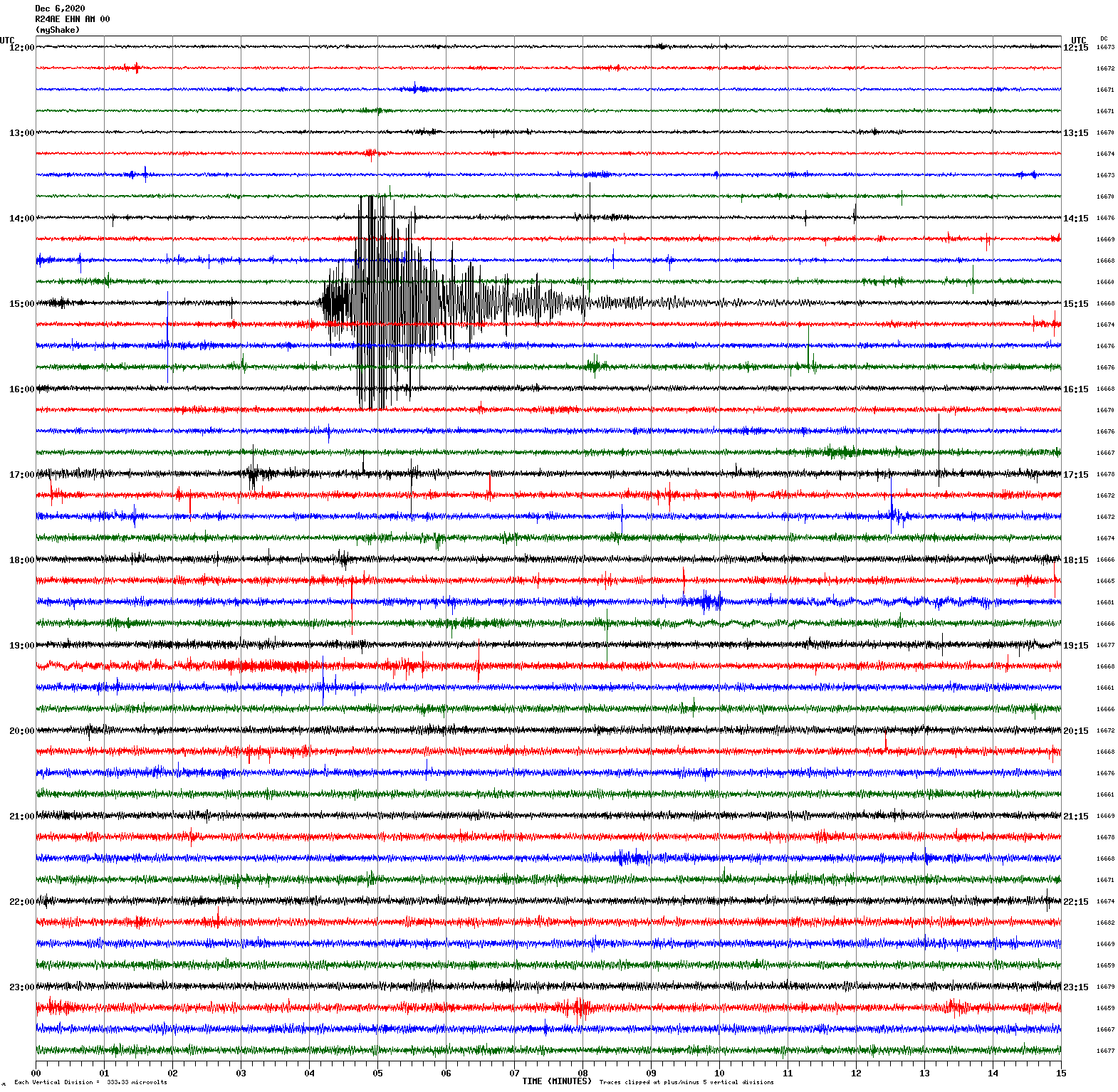
Magnitude 3.3
Depth 7.4 km
11km SW of Ridgemark, CA
36.745°N 121.450°W
December 4, 2020 03:18:25 UTC
Magnitude 3.5
Depth 2.4 km
7km NW of The Geysers, CA
38.821°N 122.808°W
December 4, 2020 10:45:06 UTC
East/West Sensor
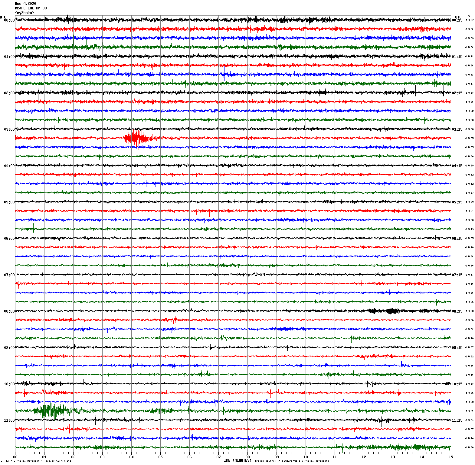
Magnitude 4.9
Depth 5.0 km
24 km S of Mina, Nevada
38.175°N 118.065°W
December 3, 2020 05:15:29 UTC
East/West Sensor
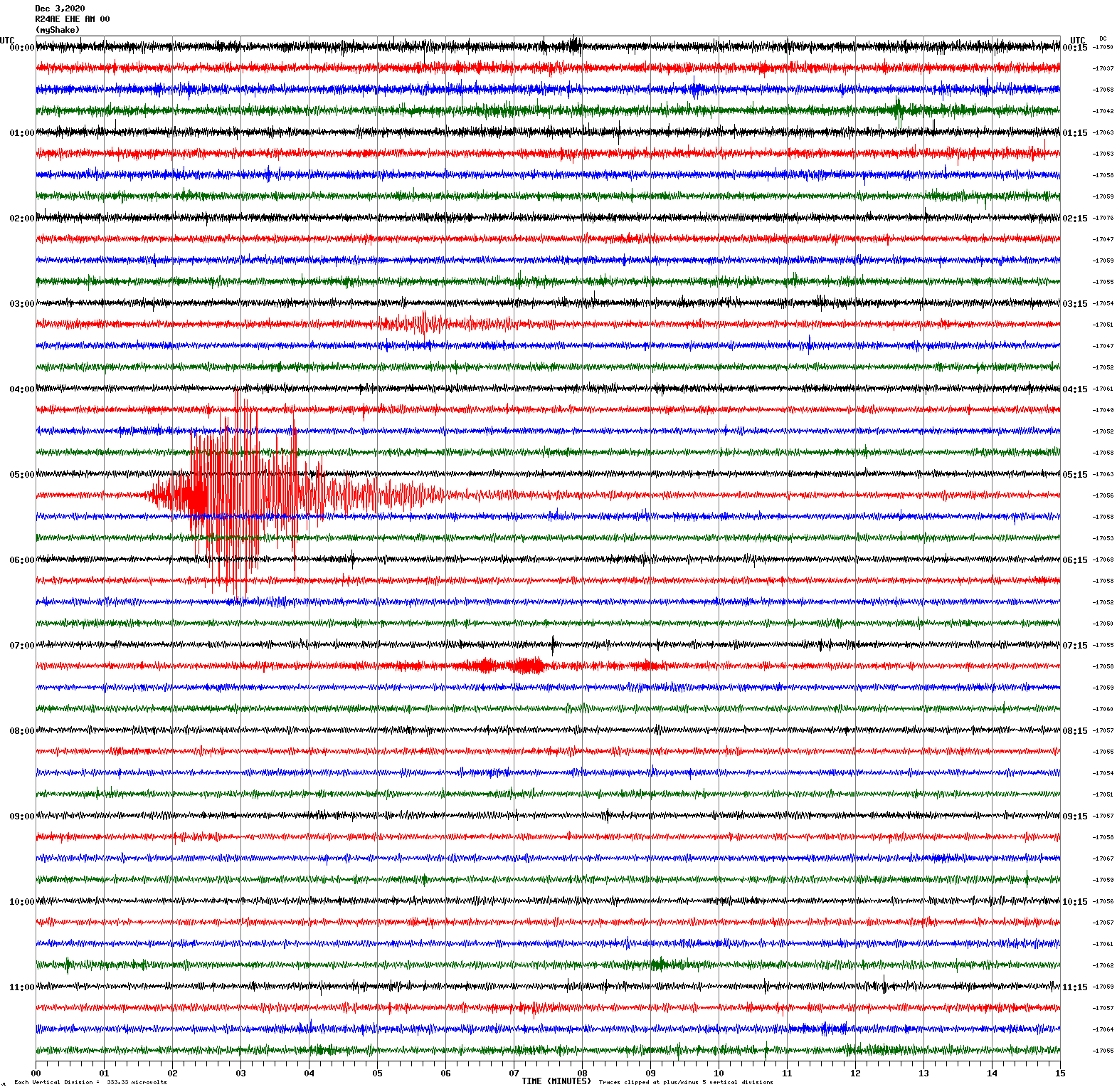
Magnitude 4.4
Depth 4.3 km
24 km S of Mina, Nevada
38.175°N 118.073°W
December 2, 2020 02:23:45 UTC
Magnitude 4.4
Depth 4.1 km
24 km S of Mina, Nevada
38.169°N 118.071°W
December 2, 2020 04:49:28 UTC
North/South Sensor
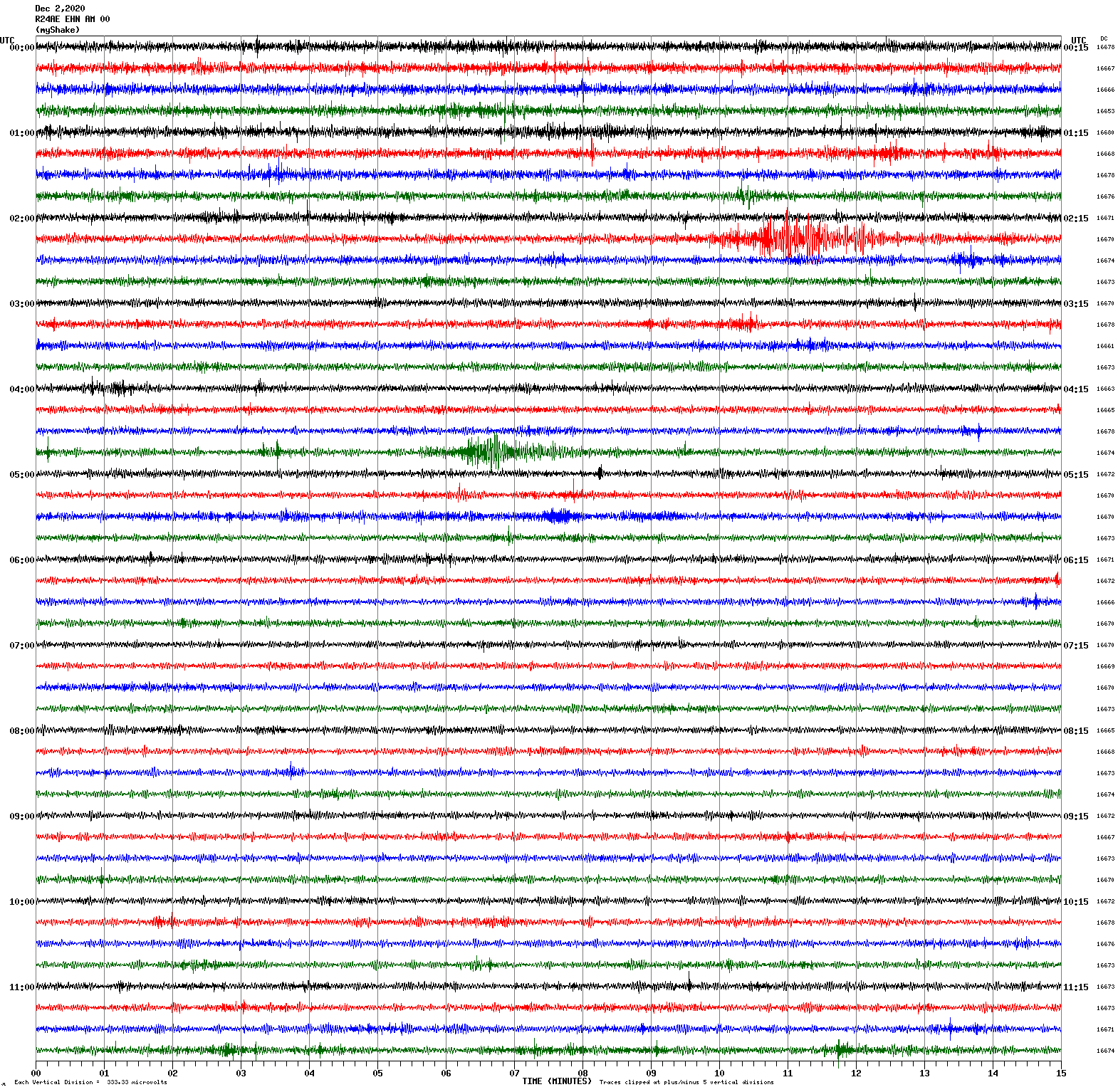
Magnitude 5.1
Depth 5.0 km
25 km S of Mina, Nevada
38.164°N 118.084°W
December 1, 2020 23:32:56 UTC
East/West Sensor
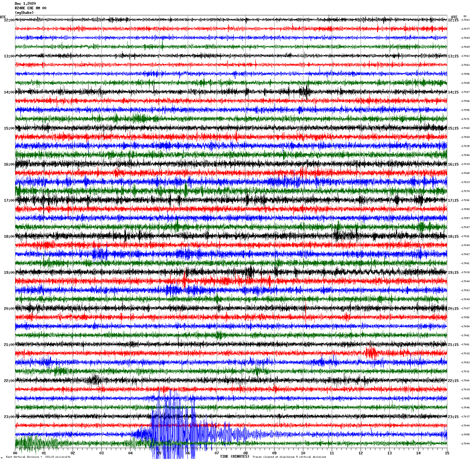
Magnitude 5.3
Depth 4.8 km
33 km SE of Mina, Nevada
November 13, 2020 09:13:51 UTC
North/South Sensor
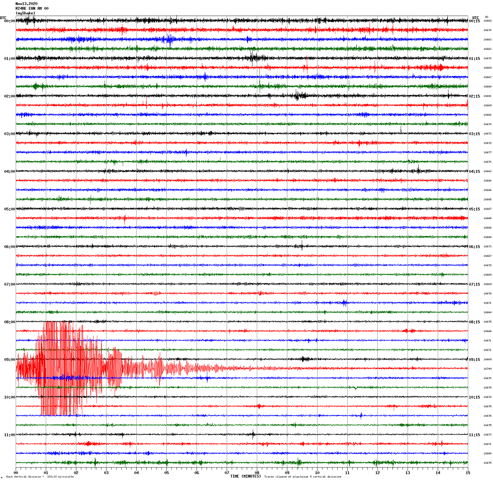
Magnitude 3.4
Depth 6.5 km
5km S of San Juan Bautista, CA
November 11, 2020 20:26:59 UTC
East/West Sensor
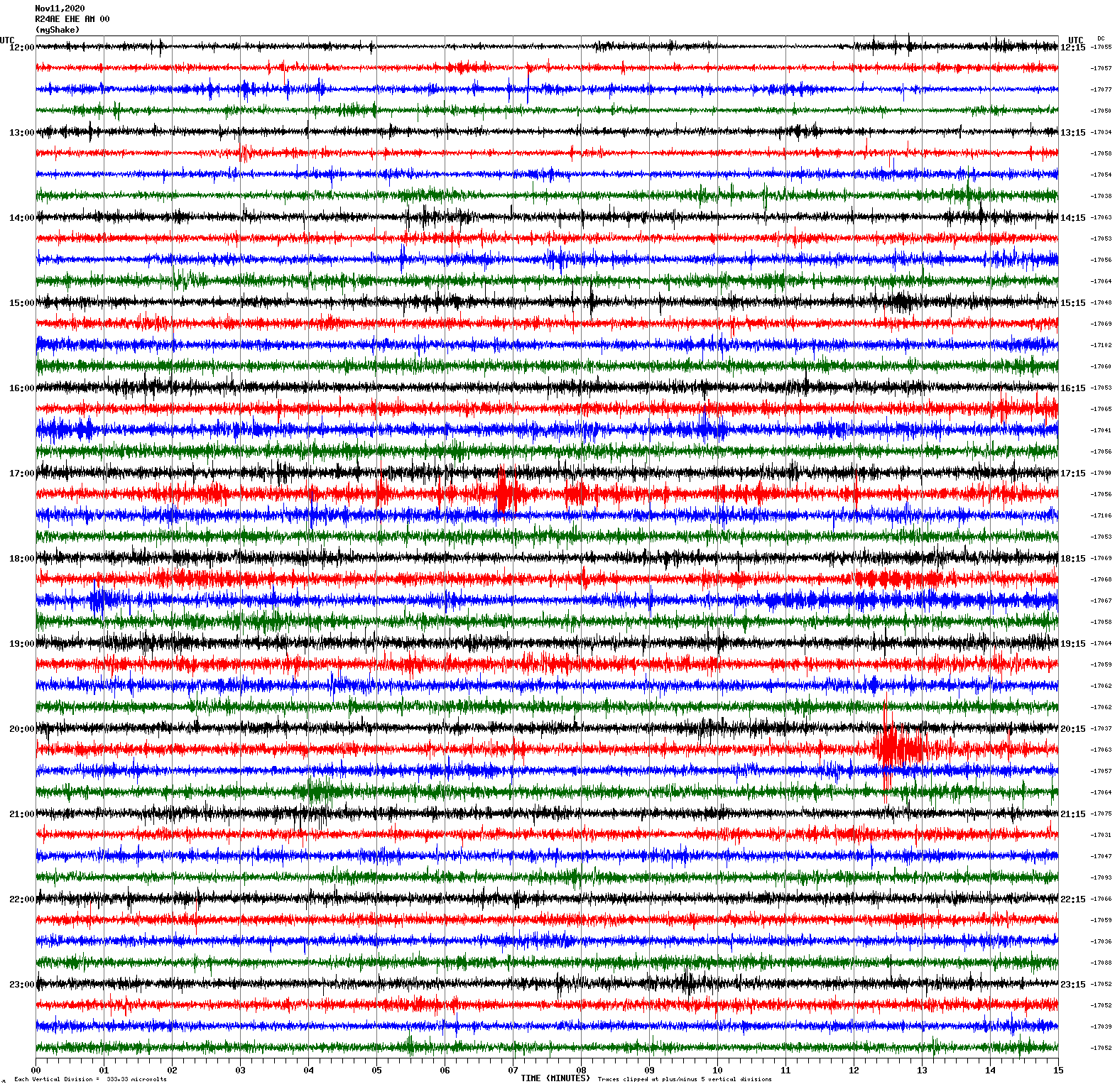
Magnitude 7.5
Depth 40.1 km
91 km SE of Sand Point, Alaska
October 19, 2020 20:54:40 UTC
North/South Sensor
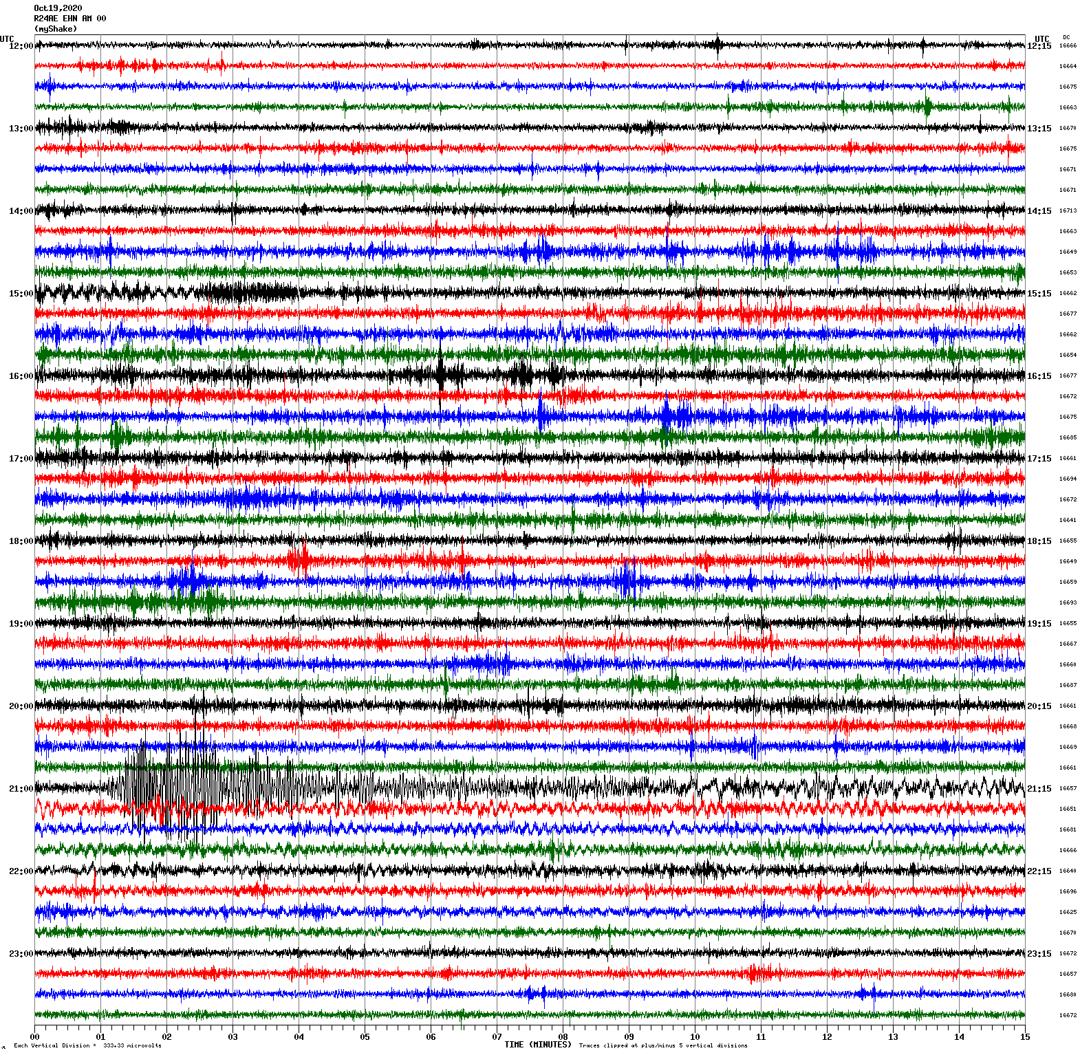
Magnitude 2.7
Depth 7.6 km
7km N of Boulder Creek, CA
October 11, 2020 16:36:46 UTC
East/West Sensor
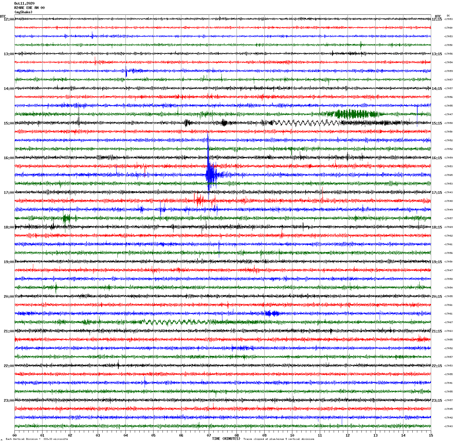
Magnitude 2.9
Depth 4.4 km
10km NE of Milpitas, CA
October 2, 2020 15:39:59 UTC
North/South Sensor
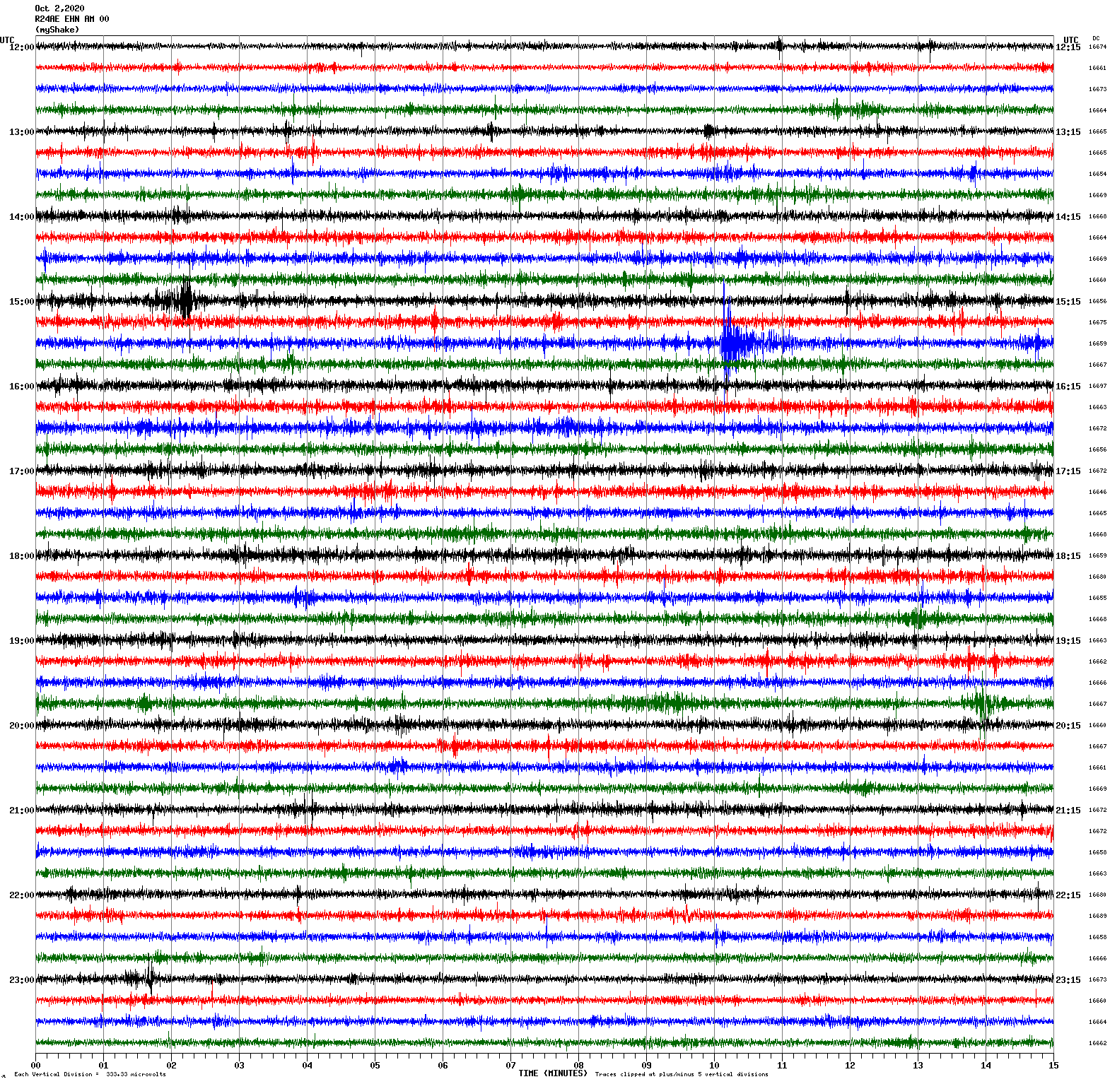
Magnitude 4.9
Depth 11.5 km
4km NE of Westmorland, CA
October 1, 2020 00:31:27 UTC
East/West Sensor
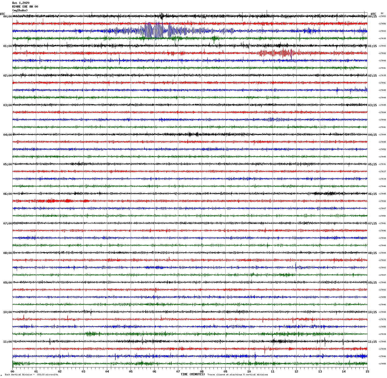
Magnitude 2.6
Depth 8.5 km
10km NNE of Milpitas, CA
September 30, 2020 08:38:37 UTC
East/West Sensor
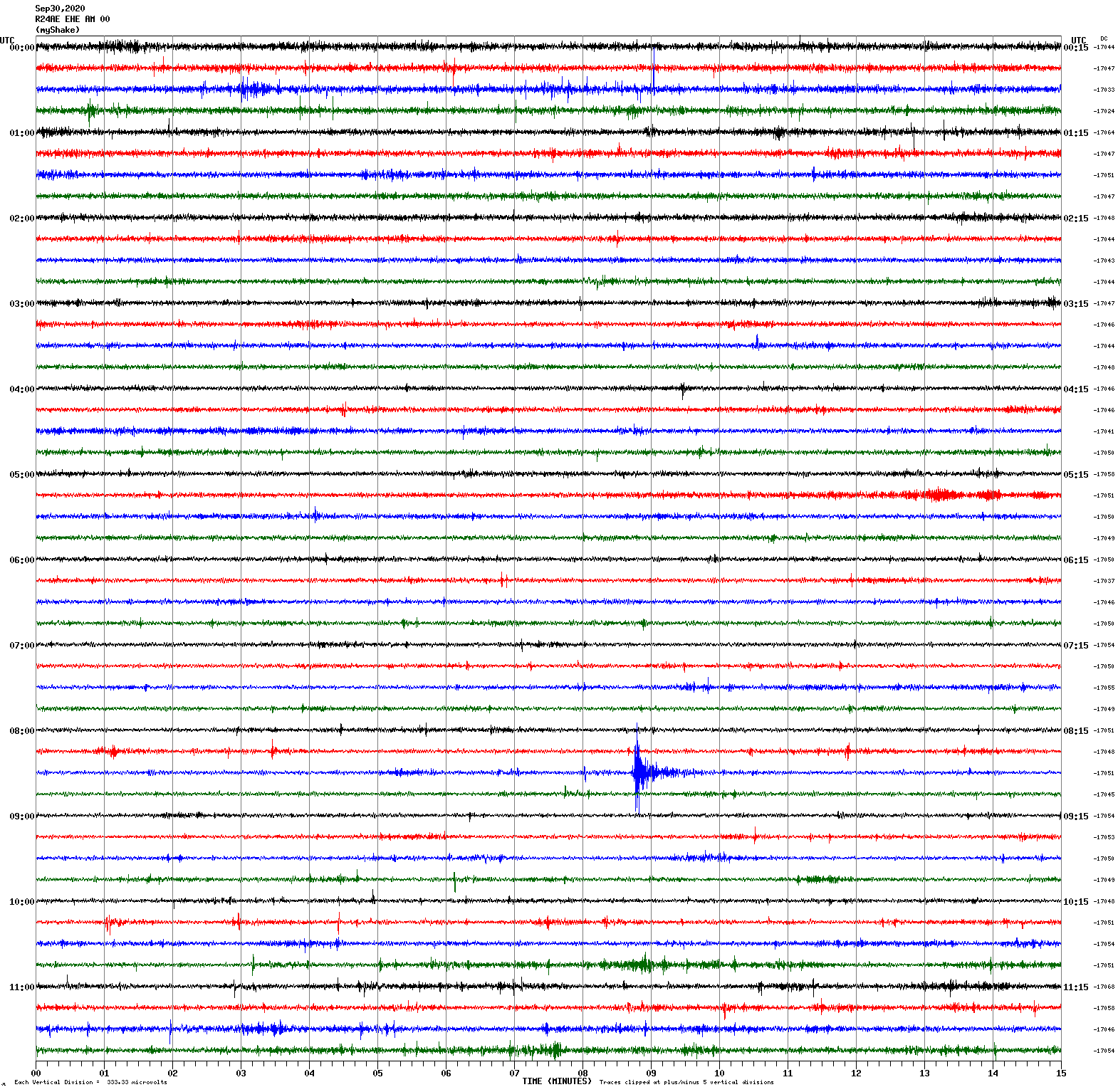
Magnitude 2.9
Depth 4.9 km
10km NE of Milpitas, CA
September 29, 2020 15:36:09 UTC
Magnitude 3.3
Depth 4.6 km
10km NE of Milpitas, CA
September 29, 2020 16:02:30 UTC
East/West Sensor
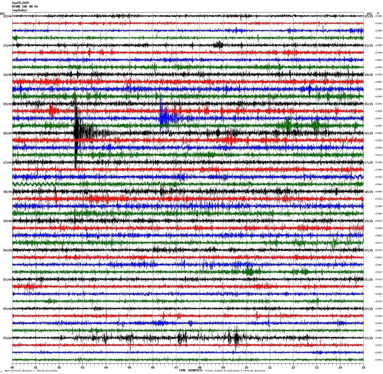
Magnitude 3.3
Depth 7.4 km
10km S of Tres Pinos, CA
September 29, 2020 02:22:20 UTC
East/West Sensor
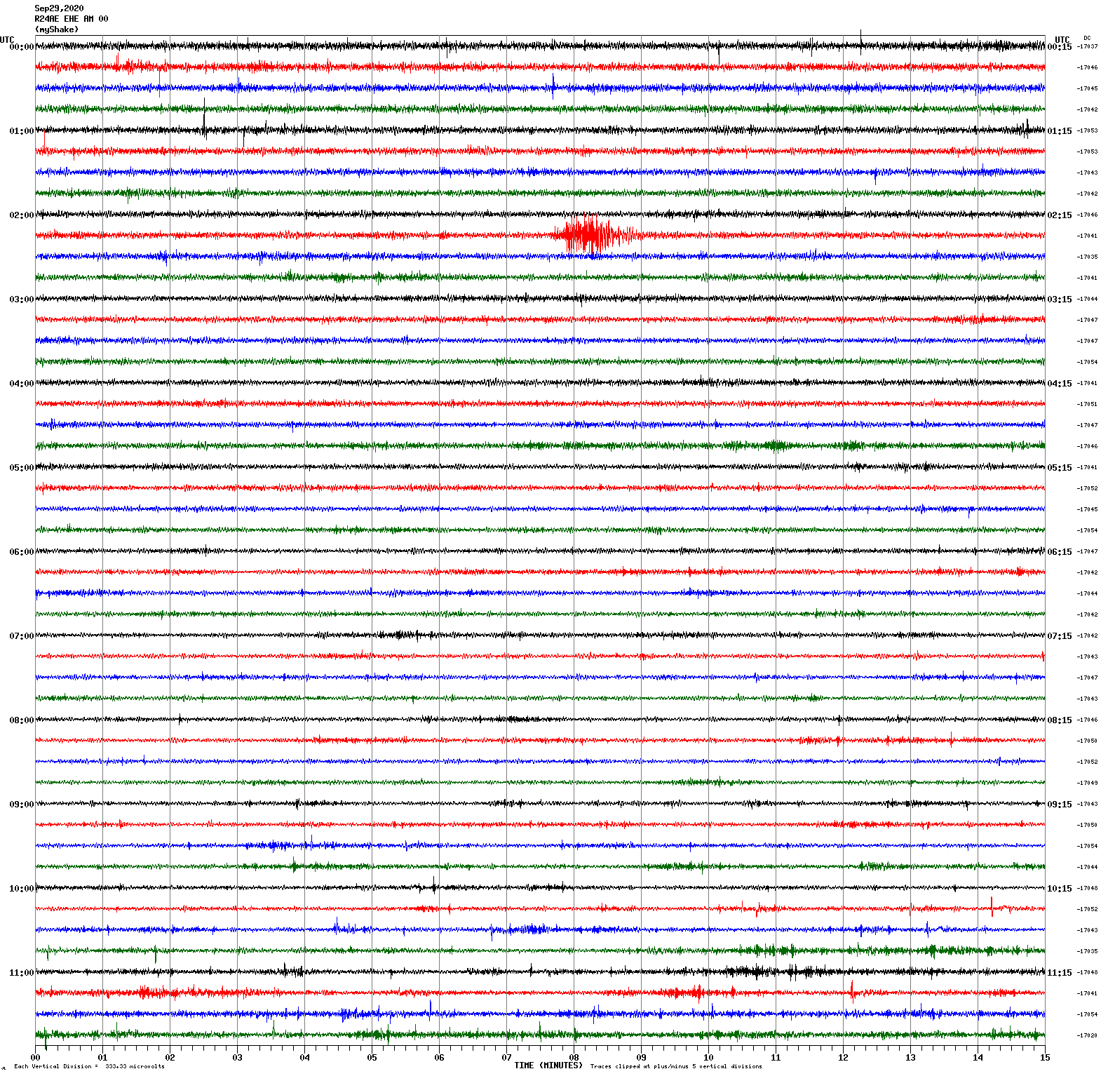
Magnitude 3.4
Depth 4.4 km
10km NE of Milpitas, CA
September 28, 2020 05:16:26 UTC
East/West Sensor
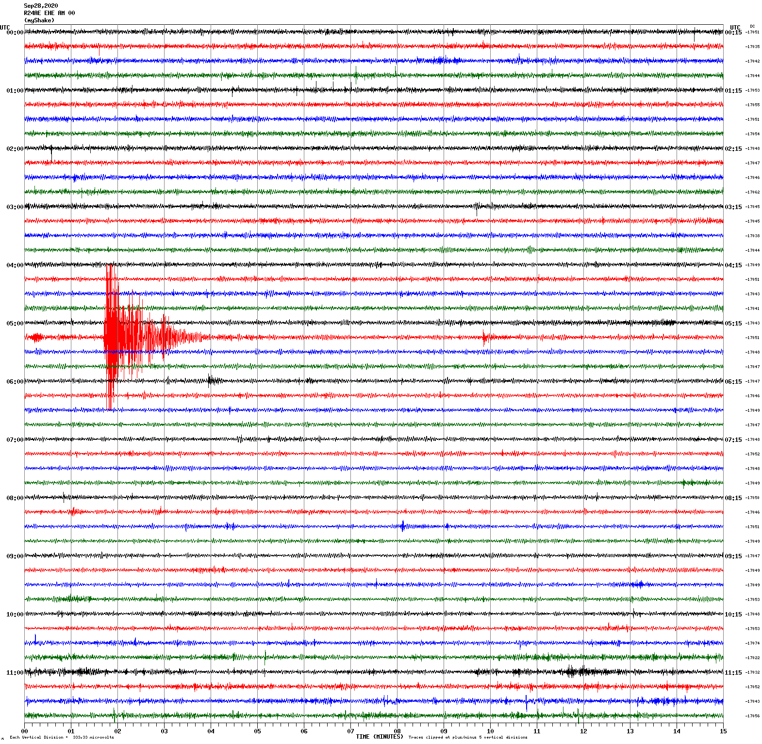
Magnitude 3.4
Depth 4.8 km
10km NE of Milpitas, CA
September 27, 2020 22:54:06 UTC
East/West Sensor
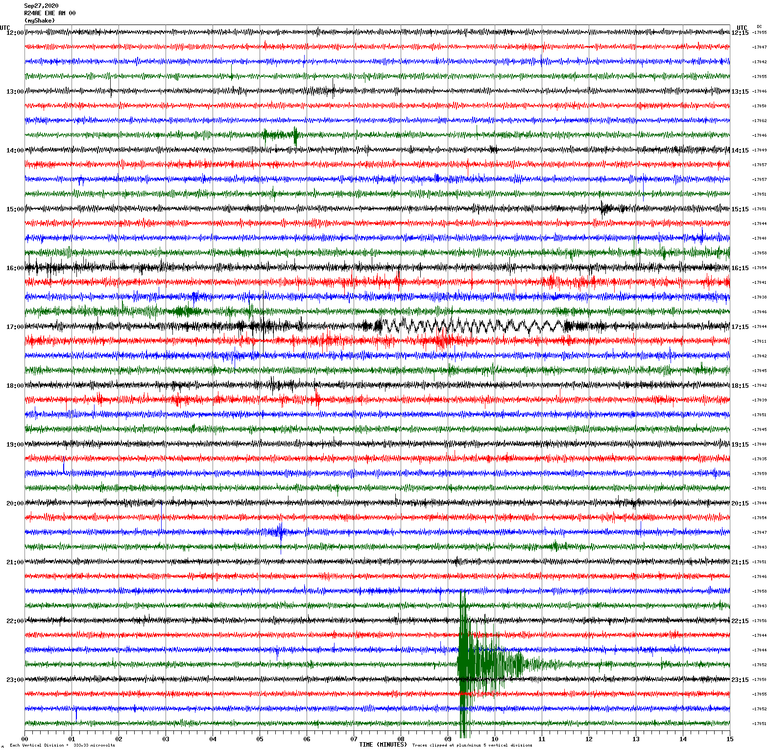
Voltage Counts & Frequency for All Sensors (Magnitude 3.4 Earthquake)
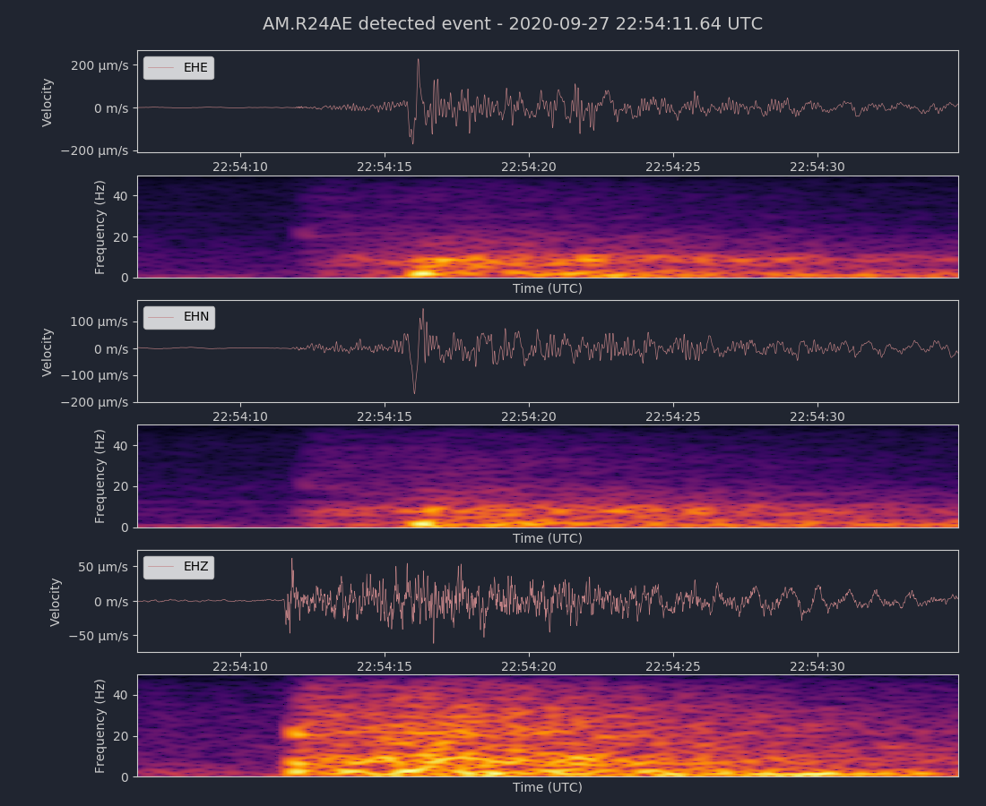
Magnitude 4.5
Depth 16.9 km
3km WSW of South El Monte, CA
September 19, 2020 06:38:46 UTC
East/West Sensor
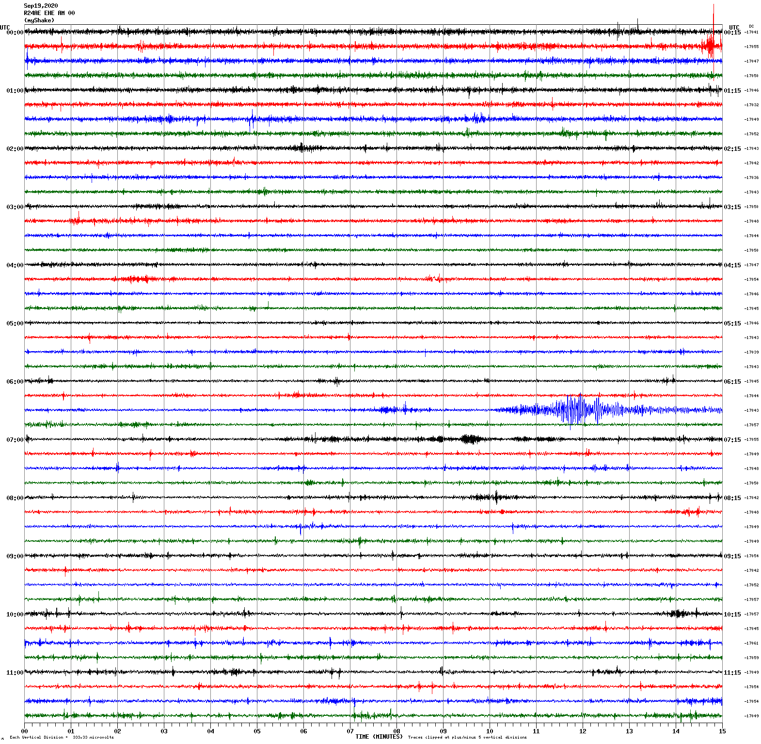
Magnitude 4.0
Depth 3.8 km
18 km SSE of Lone Pine, CA
September 11, 2020 07:55:45 UTC
North/South Sensor
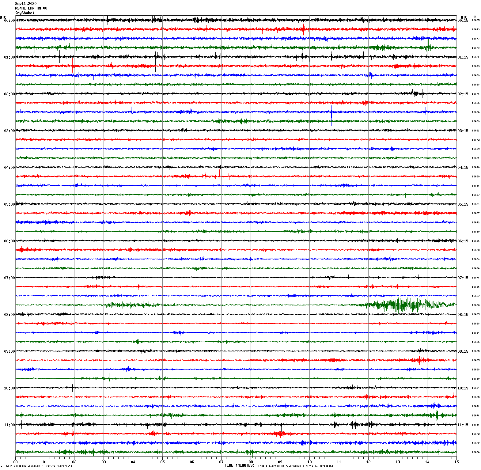
Magnitude 2.6
Depth 9.4 km
3 km ESE of San Leandro, CA
September 6, 2020 18:36:03 UTC
Magnitude 3.4
Depth 10.1 km
3 km ESE of San Leandro, CA
September 6, 2020 18:43:57 UTC
East/West Sensor
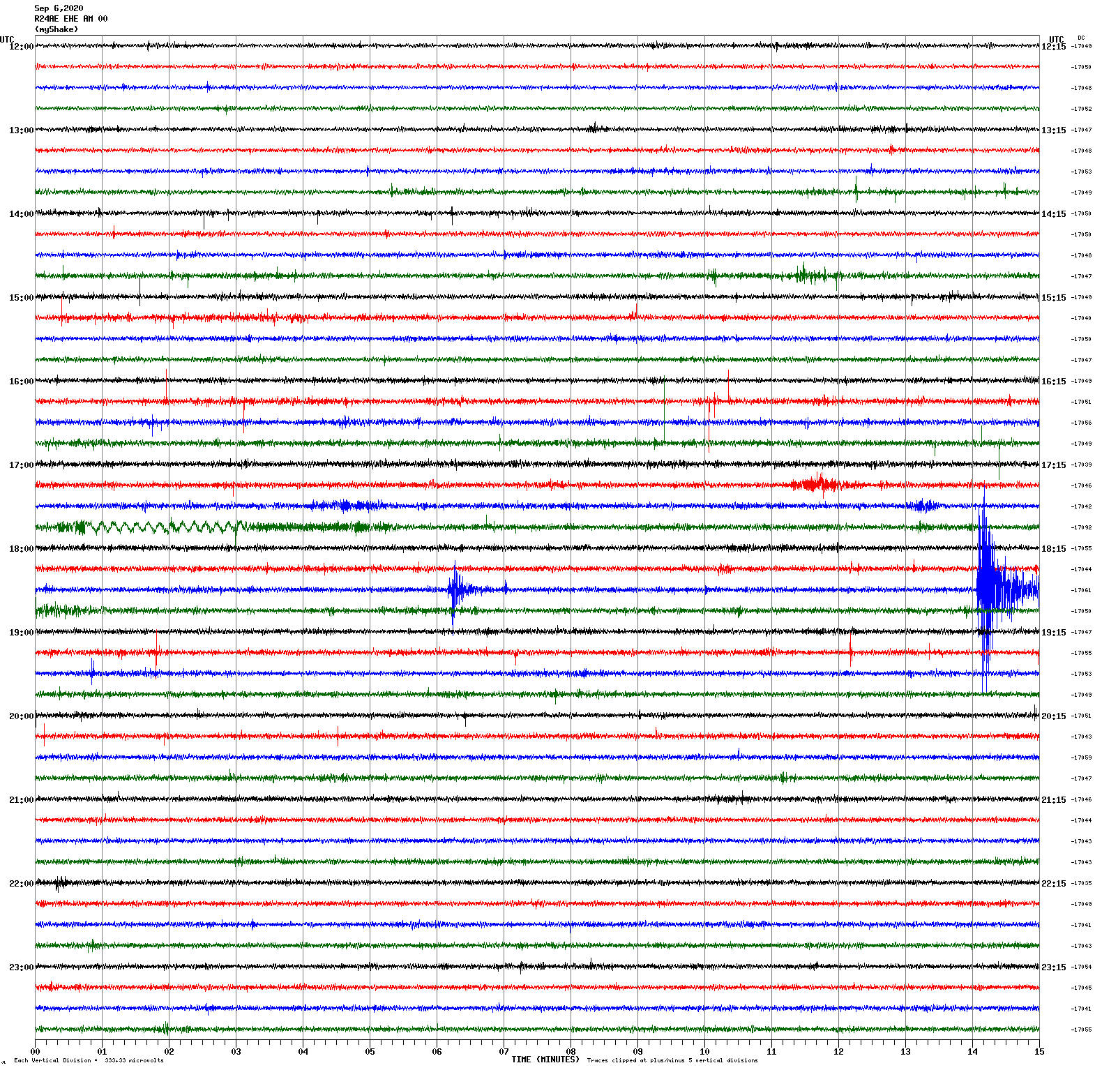
Voltage Counts & Frequency for All Sensors (Magnitude 3.4 Earthquake)
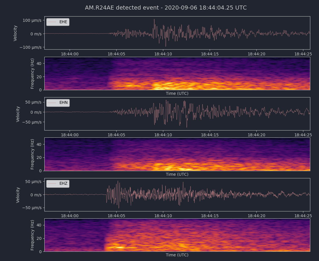
Magnitude 4.8
Depth -0.6 km
36 km WSW of Stovepipe Wells, CA
August 19, 2020 17:32:11 UTC
East/West Sensor
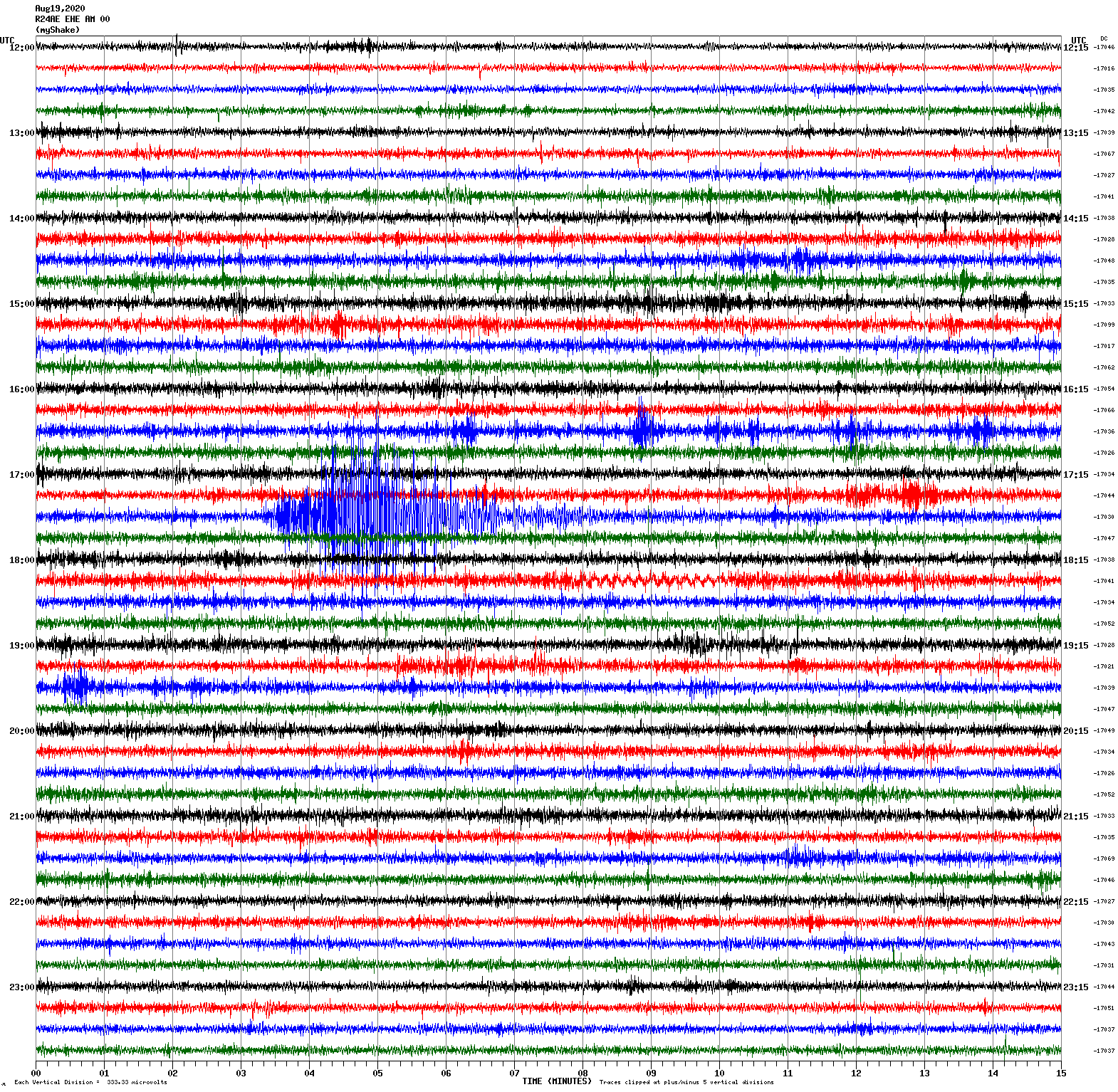
Magnitude 3.8
Depth 8.2 km
11 km ESE of Willits, CA
August 19, 2020 00:55:23 UTC
Magnitude 4.0
Depth 7.6 km
11 km ESE of Willits, CA
August 19, 2020 01:59:33 UTC
North/South Sensor
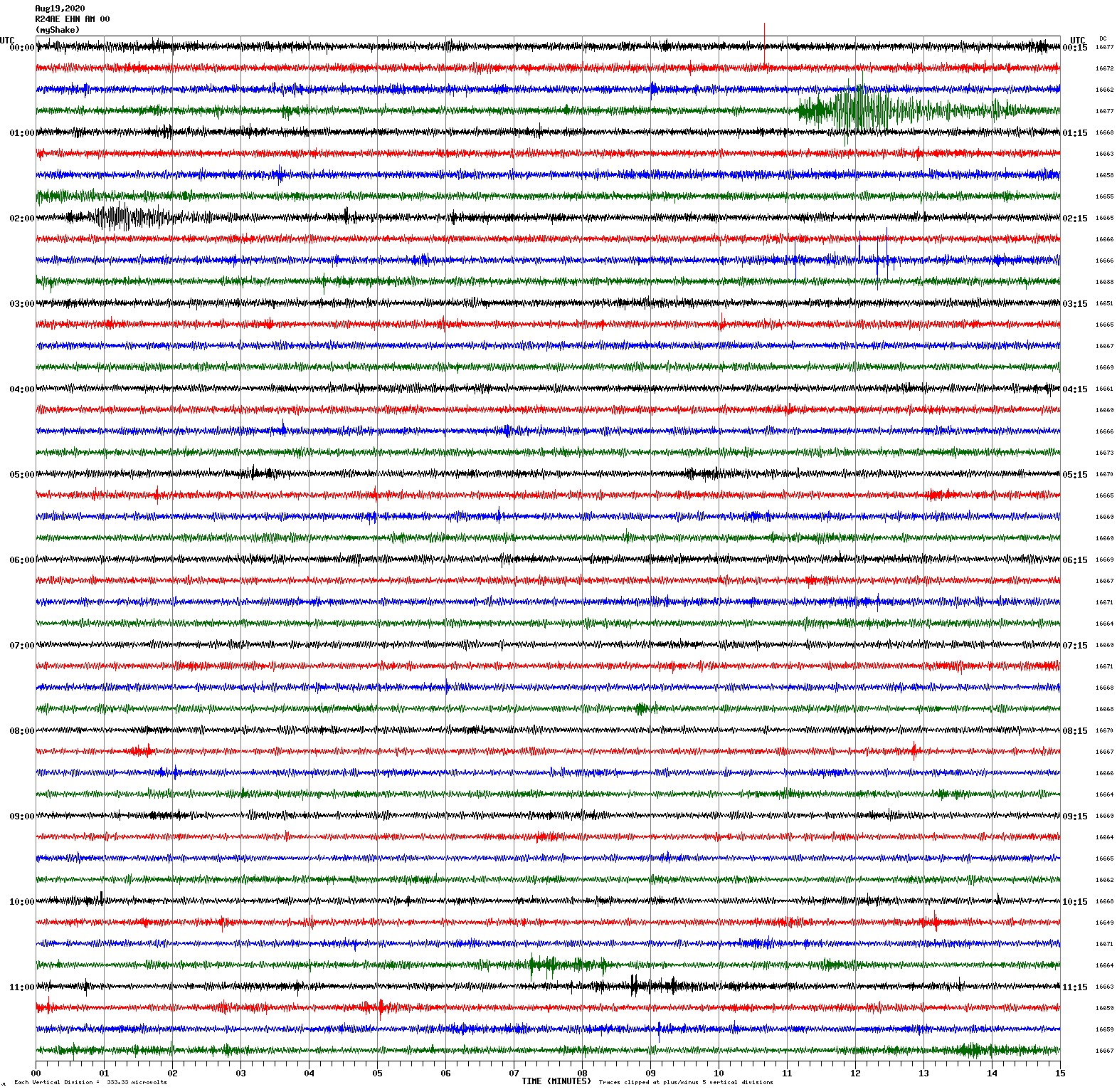
Magnitude 3.3
Depth 4.2 km
10 km NE of Milpitas, CA
August 17, 2020 20:27:49 UTC
East/West Sensor
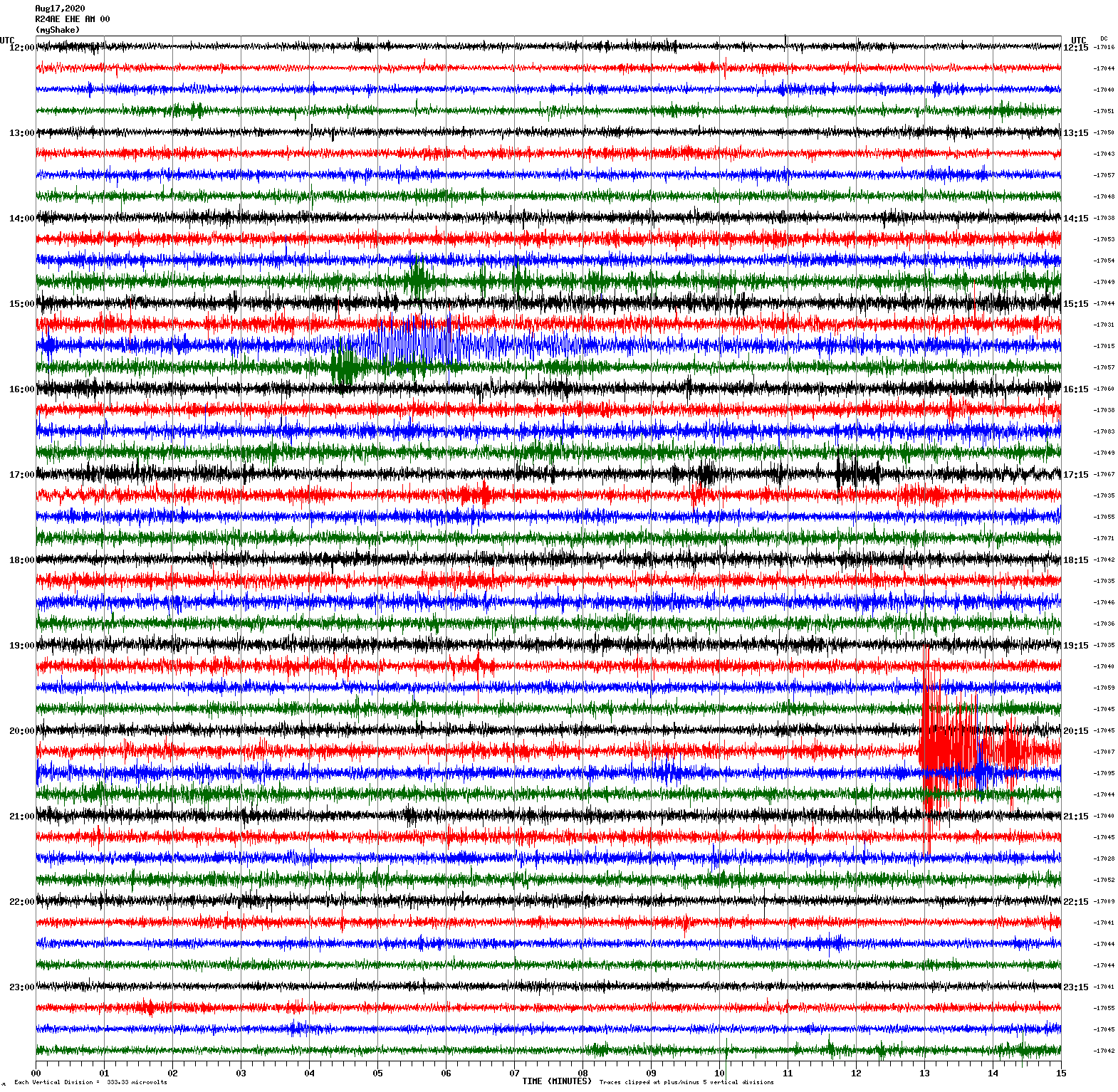
Magnitude 3.9
Depth 4.1 km
1 km NNE of The Geysers, CA
August 12, 2020 11:45:43 UTC
North/South Sensor
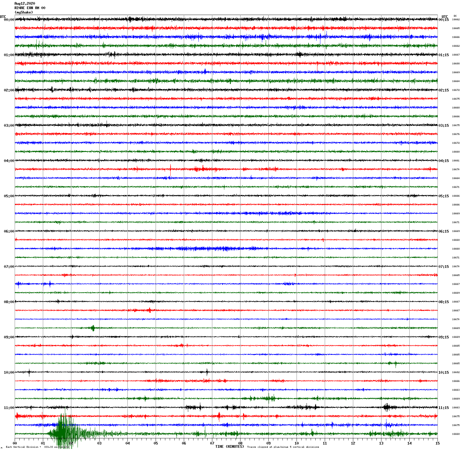
Magnitude 3.0
Depth 9.0 km
8 km NE of Alum Rock, CA
August 2, 2020 12:40:24 UTC
East/West Sensor
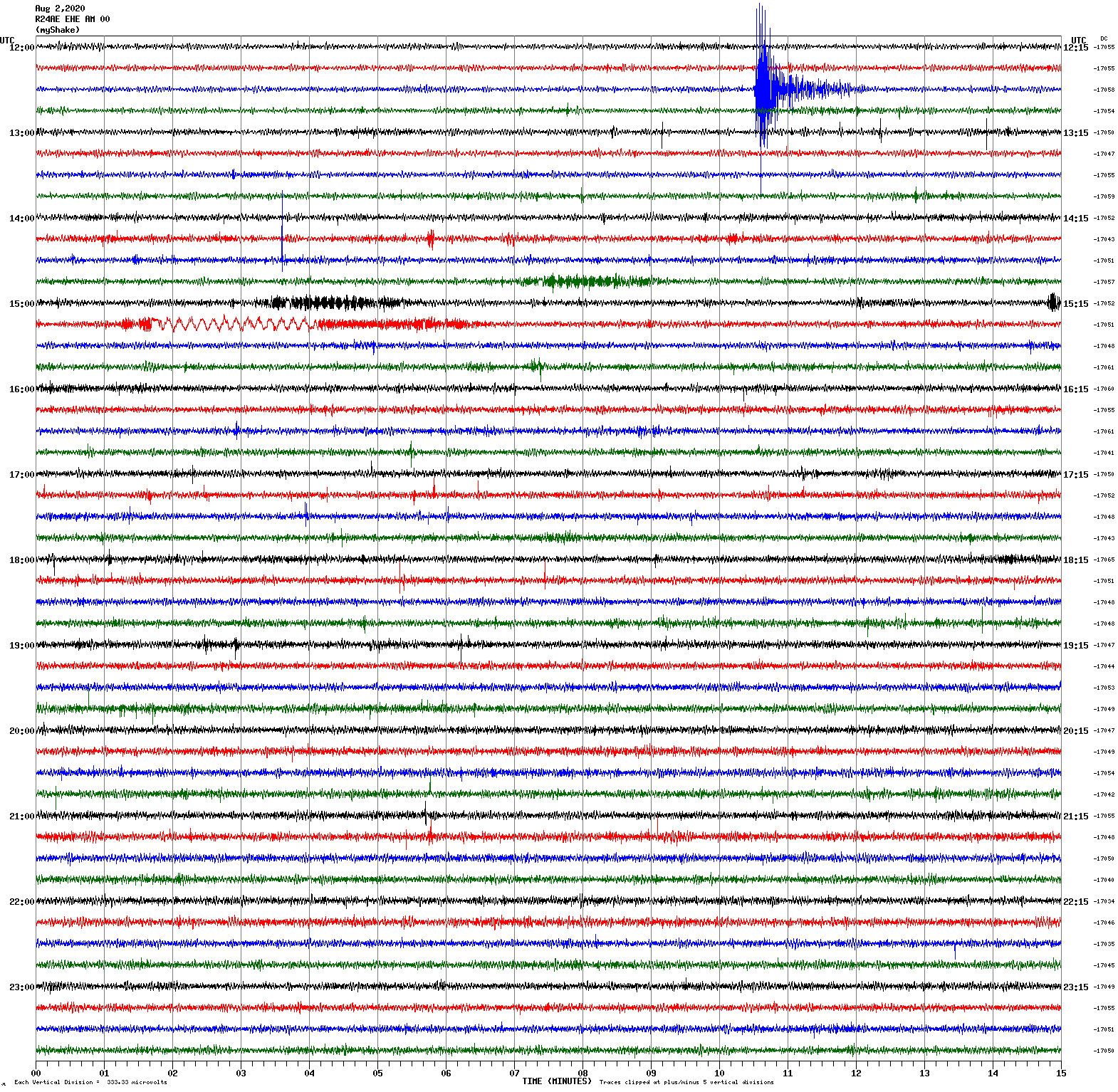
Voltage Counts & Frequency for All Sensors
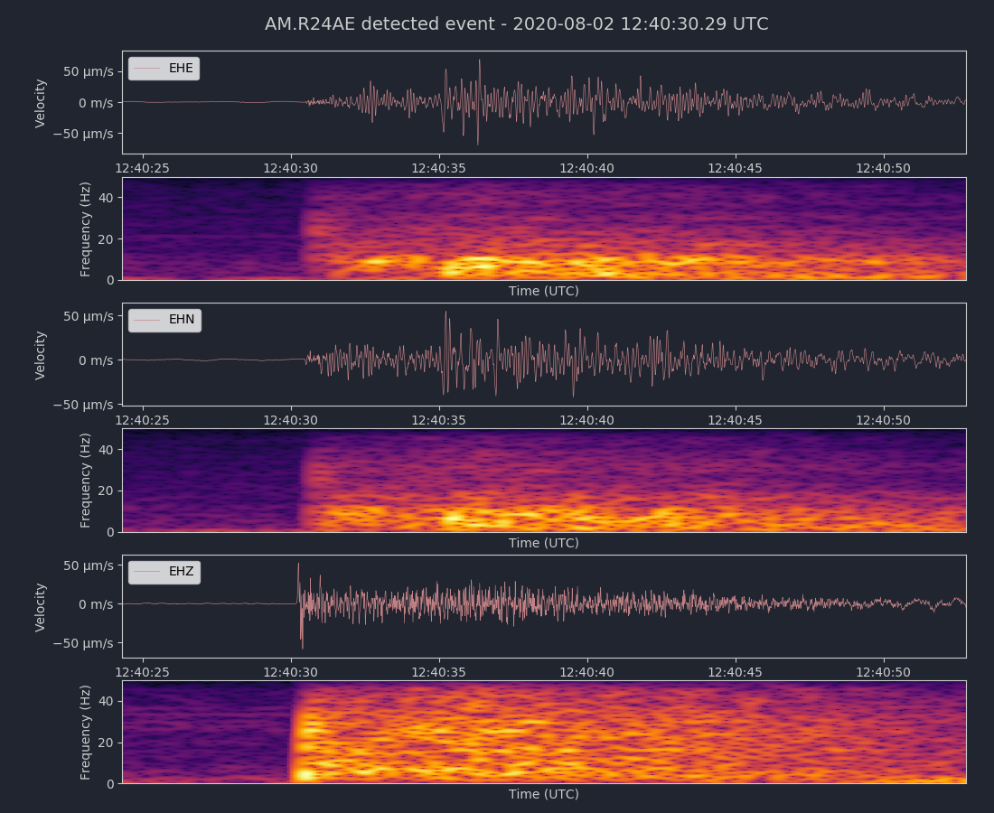
Magnitude 3.9
Depth 8.7 km
22 km NE of San Ardo, CA
July 30, 2020 03:23:01 UTC
East/West Sensor
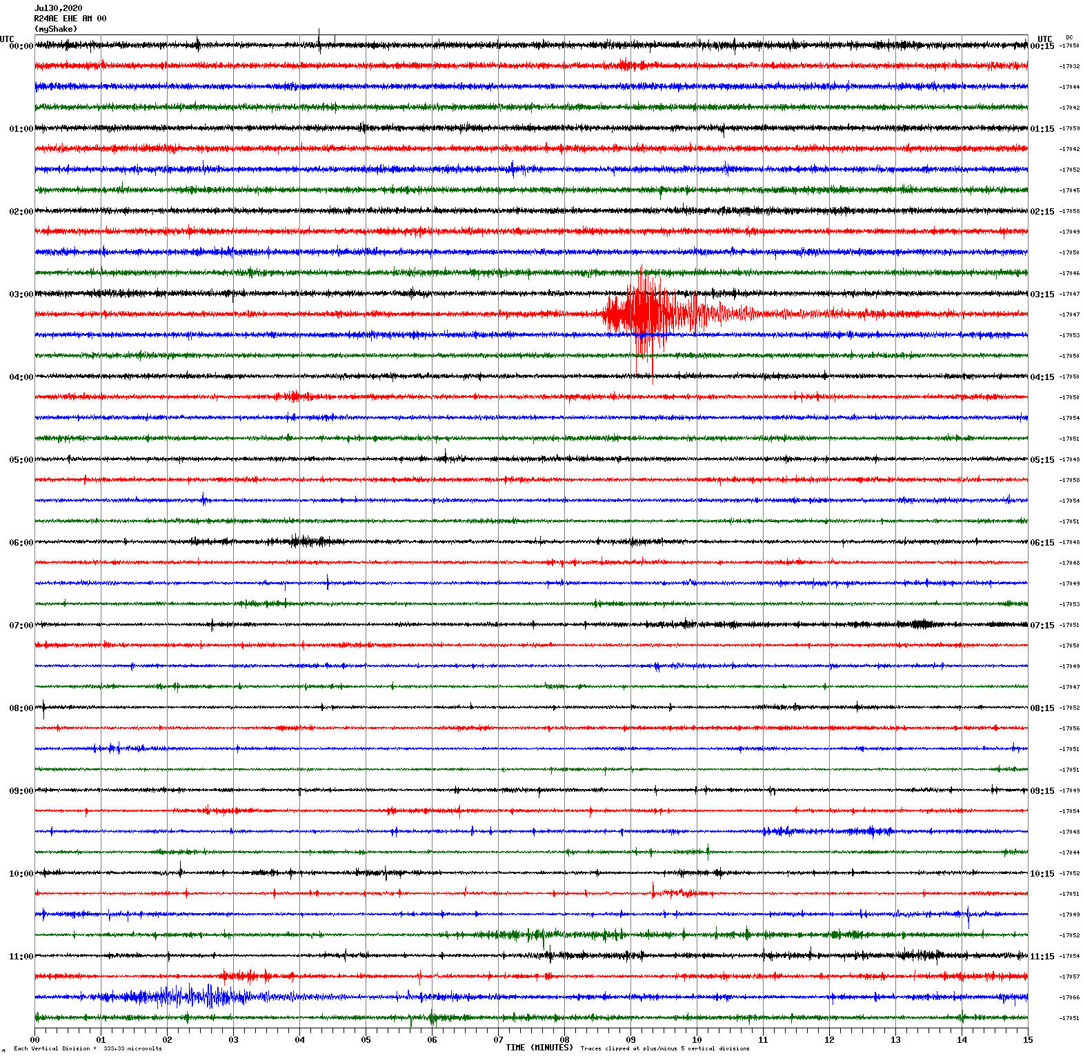
Magnitude 2.6
Depth 8.4 km
11 km ENE of Milpitas, CA
July 26, 2020 06:53:28 UTC
North/South Sensor
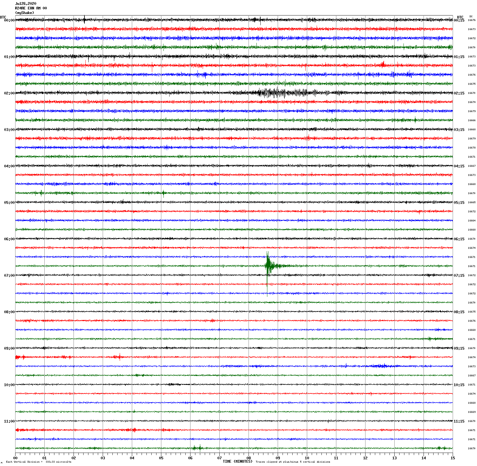
Magnitude 3.3
Depth 4.8 km
12 km S of Tres Pinos, CA
July 22, 2020 04:57:09 UTC
Magnitude 7.8
Depth 28.0 km
105 km SSE of Perryville, Alaska
July 22, 2020 06:12:44 UTC
North/South Sensor
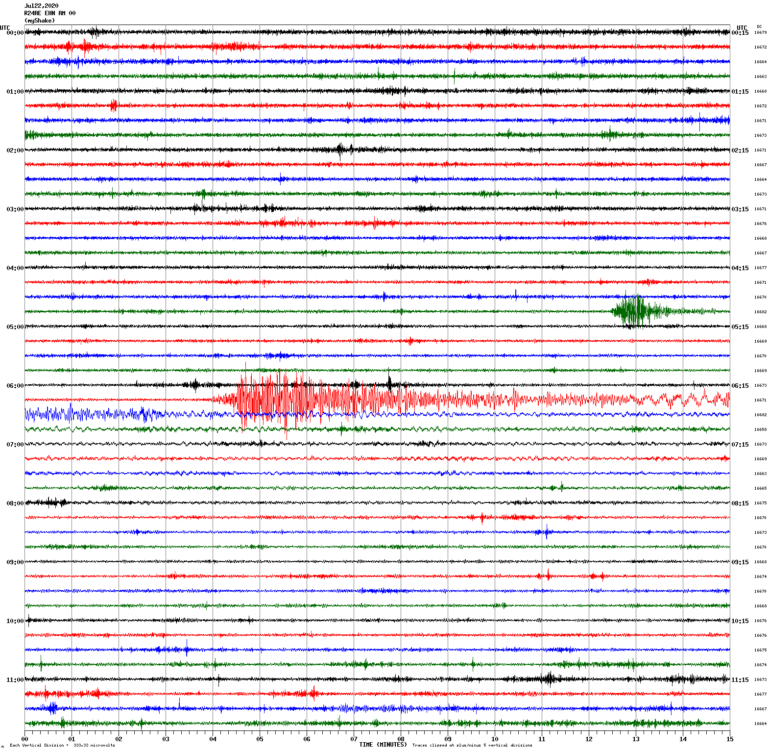
Magnitude 4.5
Depth 5.6 km
29 km SE of Mina, Nevada
July 6, 2020 06:12:54 UTC
East/West Sensor
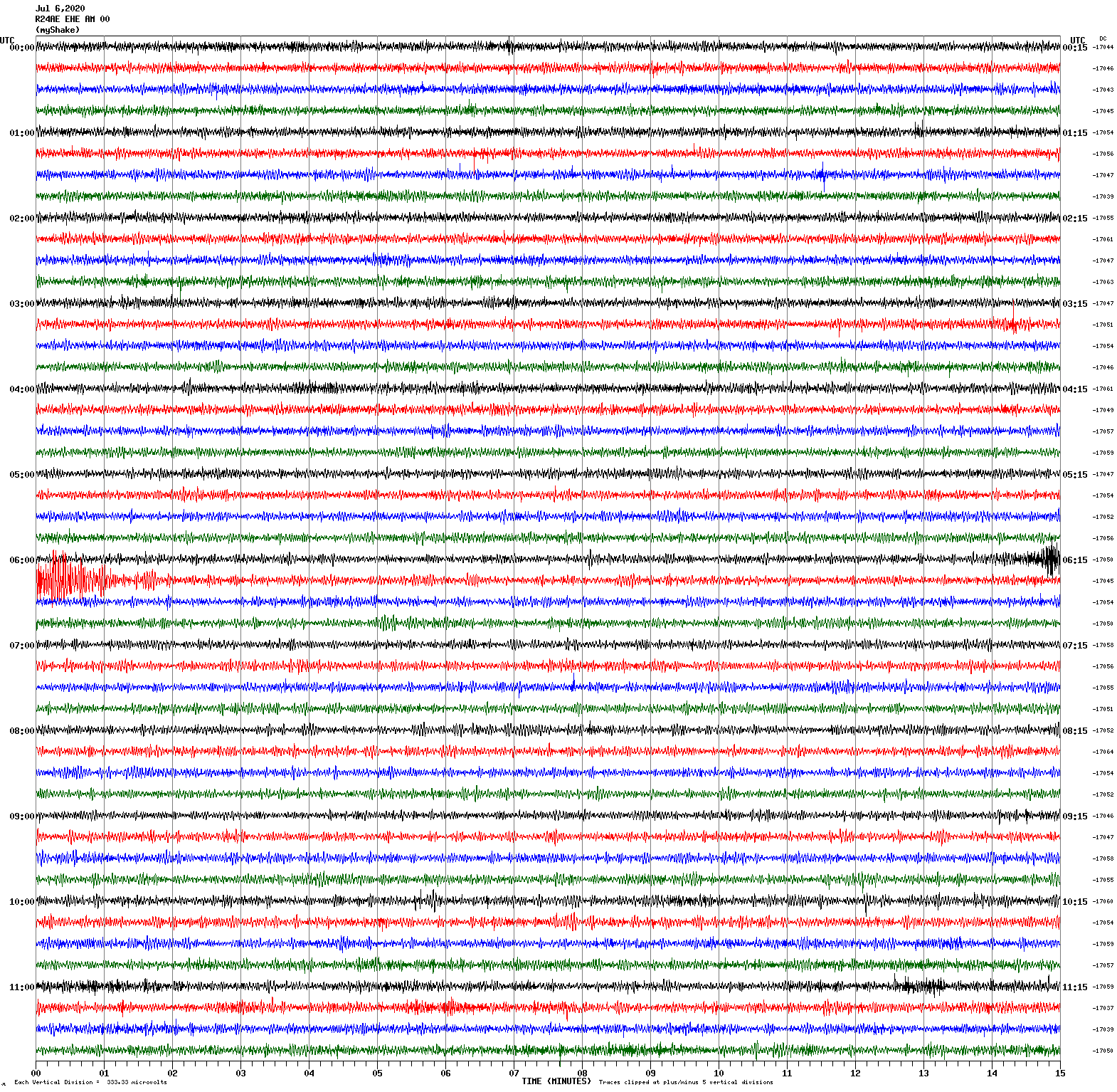
Magnitude 4.0
Depth 0.7 km
2 km NW of The Geysers, CA
July 5, 2020 16:14:07 UTC
East/West Sensor
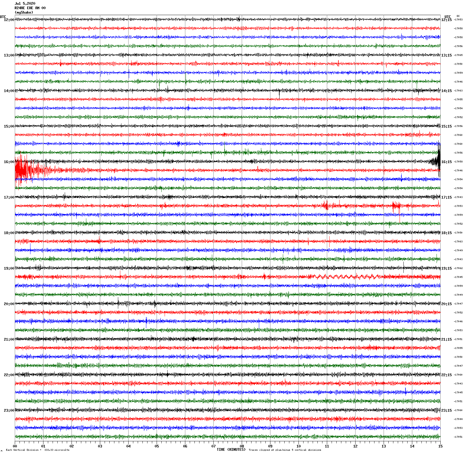
Magnitude 5.0
Depth 8.3 km
29 km SSE of Mina, Nevada
June 30, 2020 09:24:23 UTC
North/South Sensor
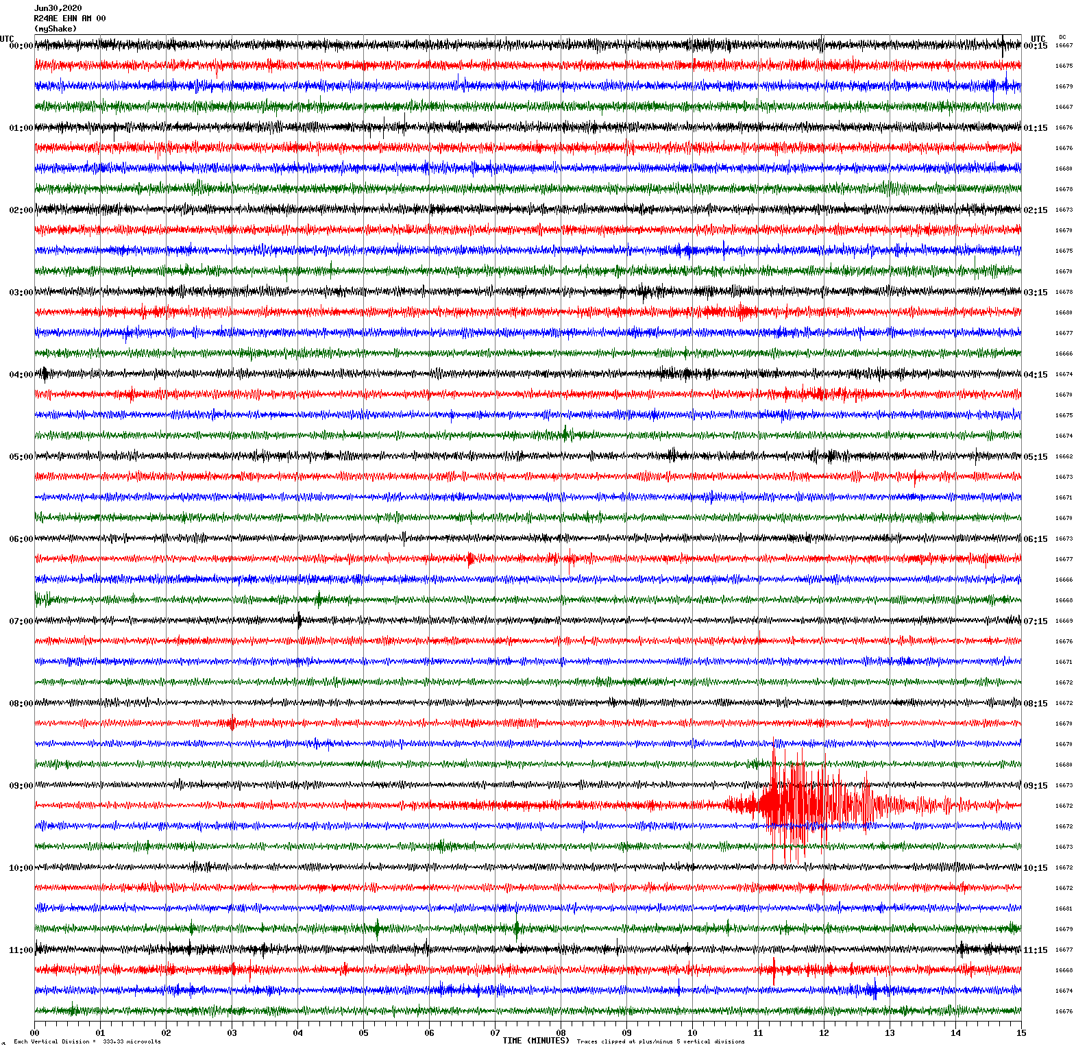
Magnitude 5.8
Depth 2.9 km
17 km SSE of Lone Pine, CA
June 24, 2020 17:40:49 UTC
Magnitude 4.6
Depth 9.6 km
19 km SE of Lone Pine, CA
June 24, 2020 17:59:19 UTC
East/West Sensor
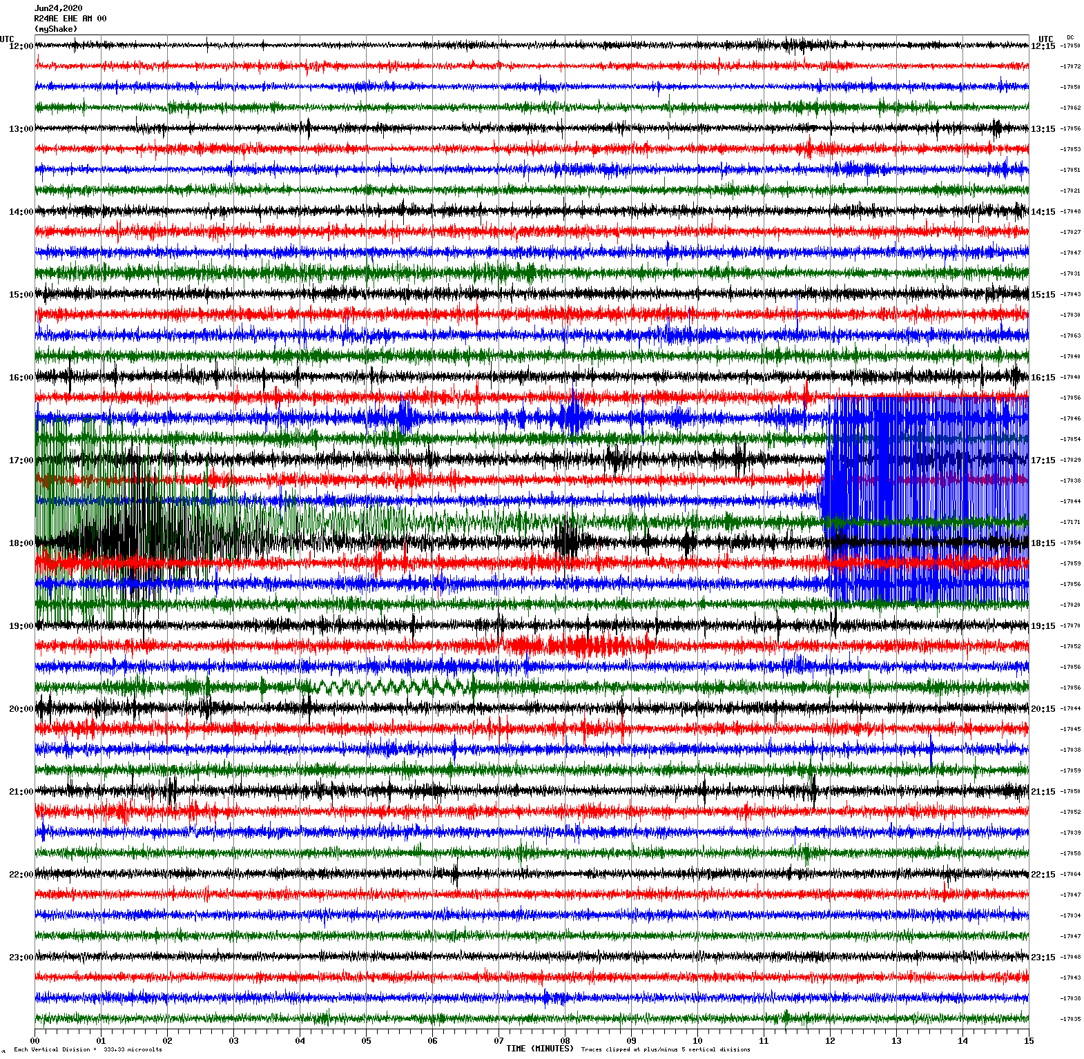
Magnitude 4.6
Depth 2.3 km
17 km SSE of Lone Pine, CA
June 23, 2020 00:25:46 UTC
Magnitude 2.8
Depth 9.4 km
3 km W of Portola Valley, CA
June 23, 2020 03:09:20 UTC
East/West Sensor
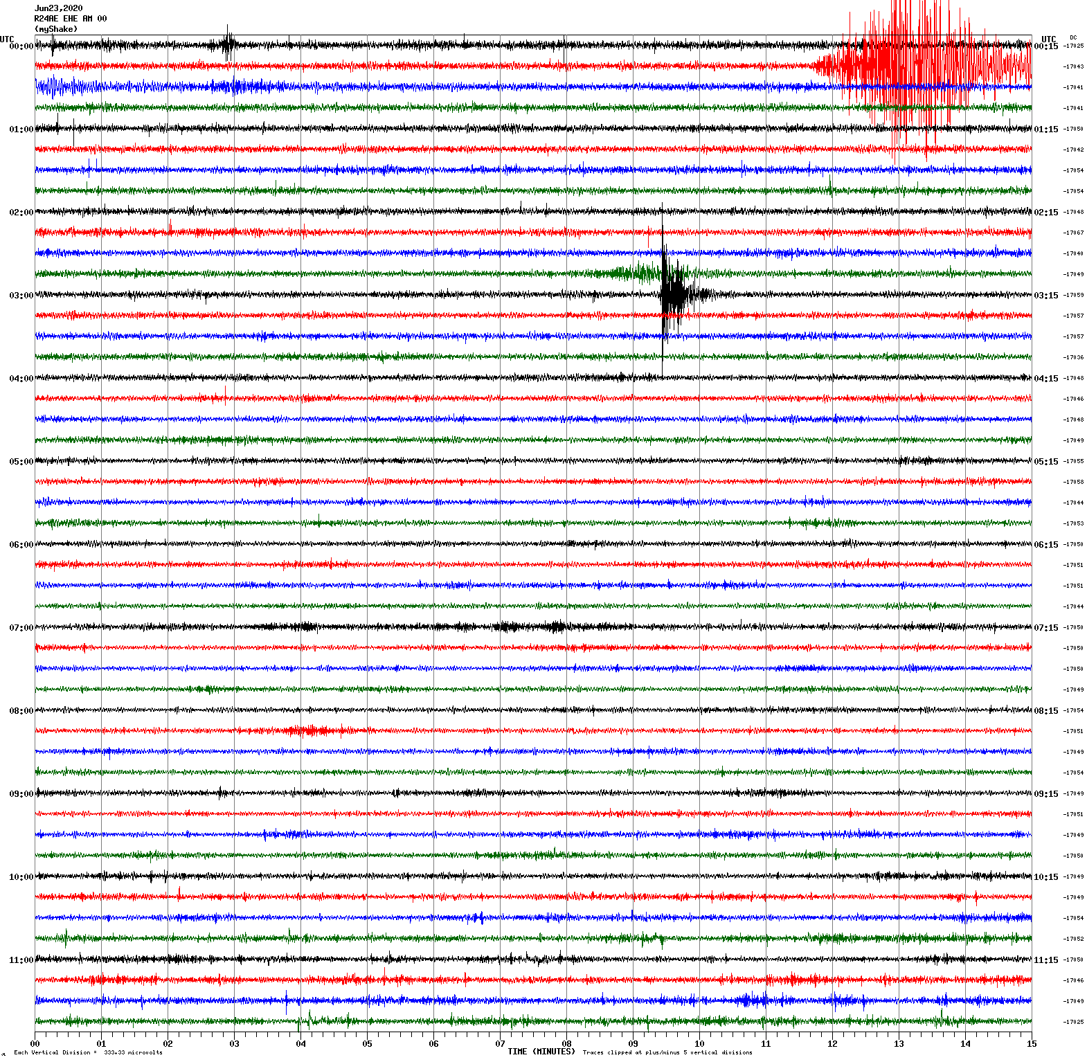
Magnitude 4.9
Depth 6.5 km
34 km SE of Mina, Nevada
June 19, 2020 20:42:21 UTC
North/South Sensor
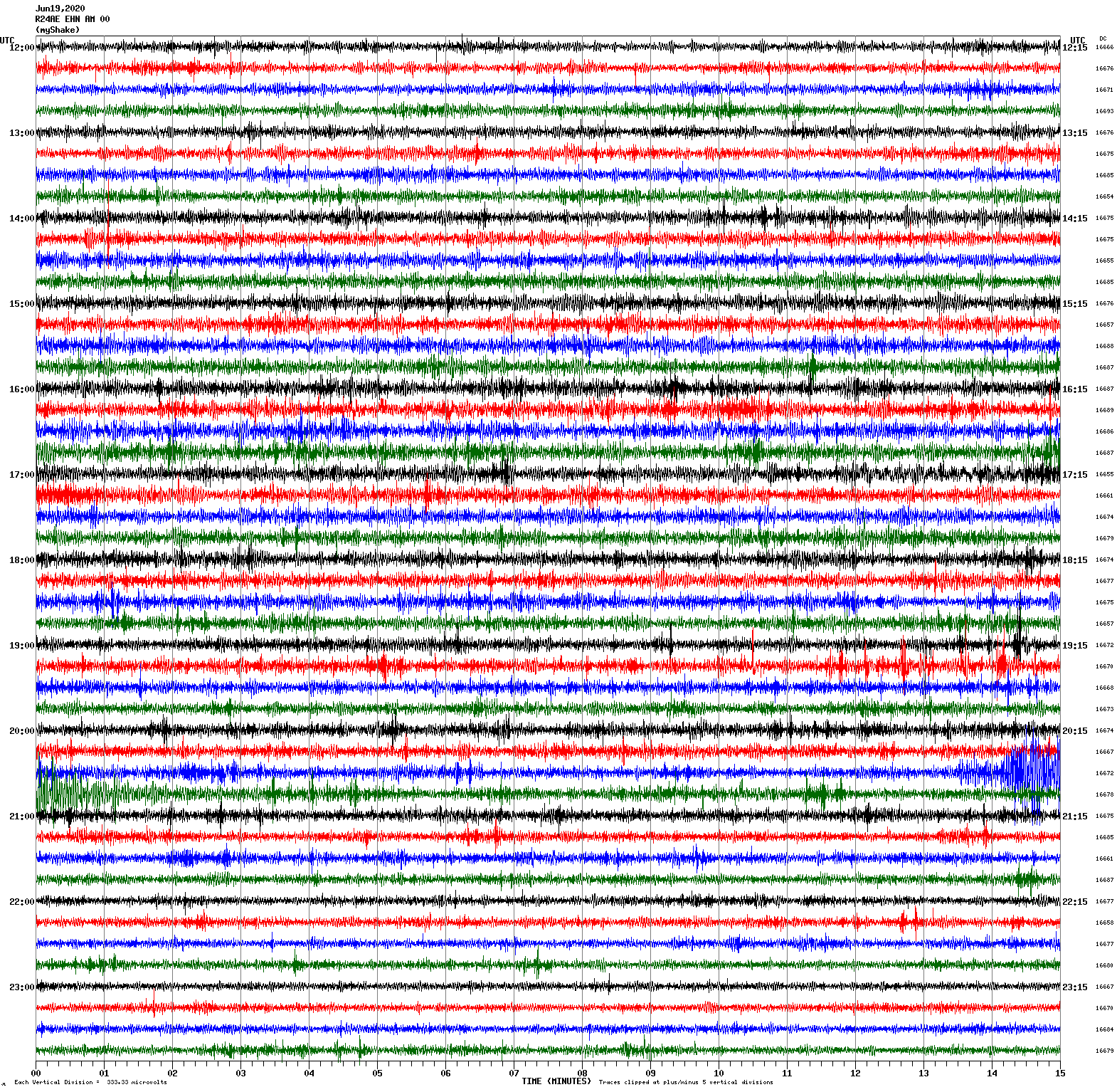
Magnitude 3.6
Depth 7.4 km
8 km NE of Alum Rock, CA
June 17, 2020 17:35:02 UTC
North/South Sensor
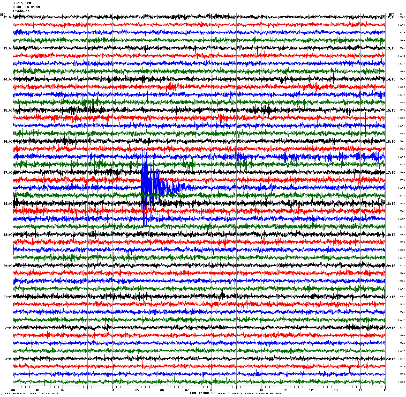
Voltage Counts & Frequency for All Sensors
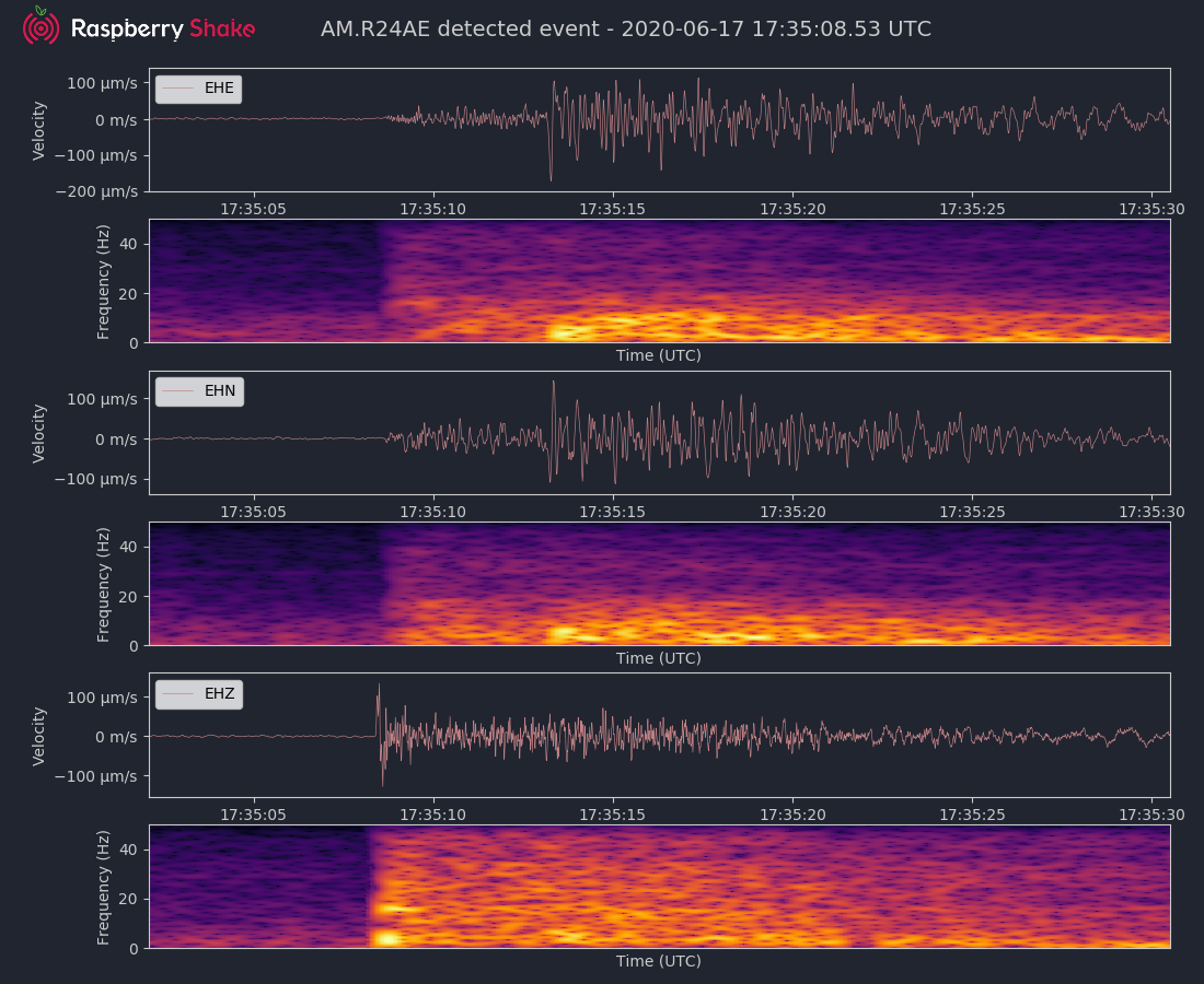
Magnitude 3.5
Depth 5.8 km
10 km SW of Tres Pinos, CA
June 10, 2020 13:25:46 UTC
East/West Sensor
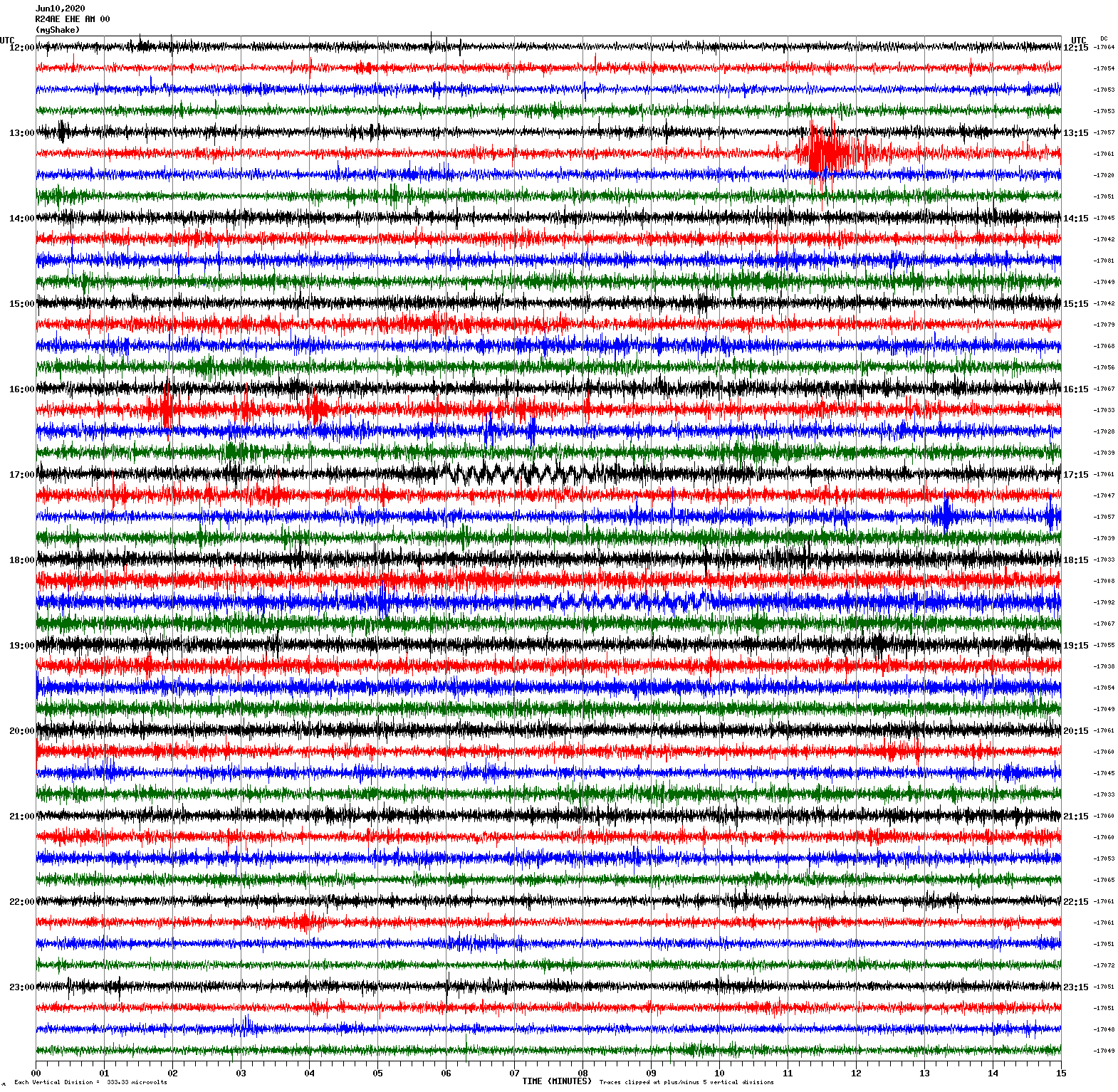
Magnitude 4.8
Depth 5.2 km
34 km SE of Mina, Nevada
June 8, 2020 03:24:05 UTC
North/South Sensor
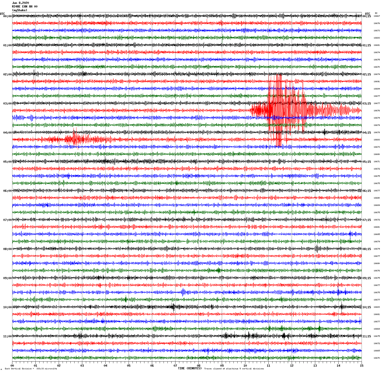
Magnitude 3.3
Depth 6.5 km
6 km E of Interlaken, CA
June 5, 2020 23:09:19 UTC
East/West Sensor
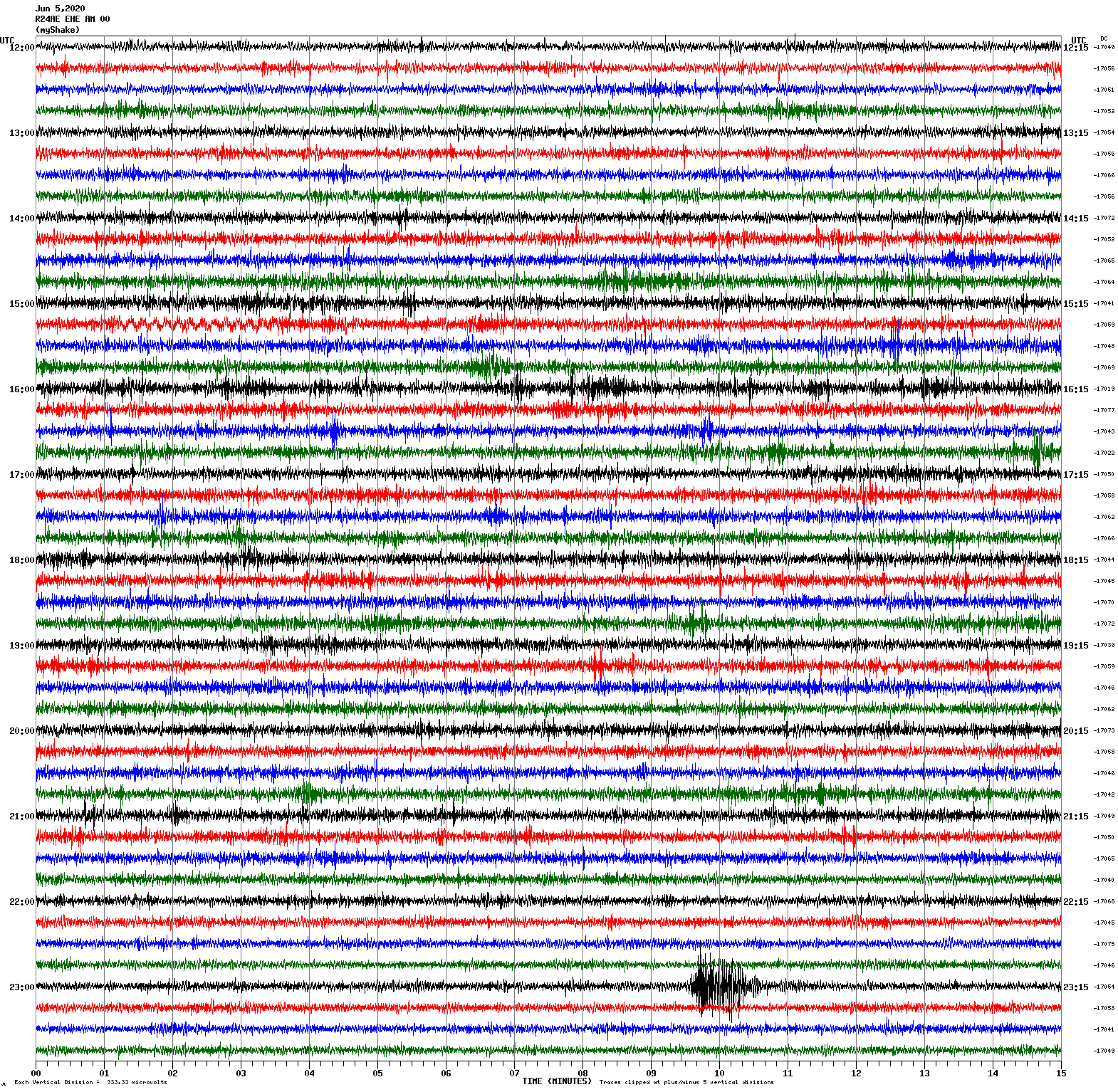
Magnitude 5.5
Depth 8.4 km
17 km S of Searles Valley, CA
June 4, 2020 01:32:11 UTC
Magnitude 4.2
Depth 2.0 km
12 km NNW of Coso Junction, CA
June 4, 2020 02:27:54 UTC
North/South Sensor
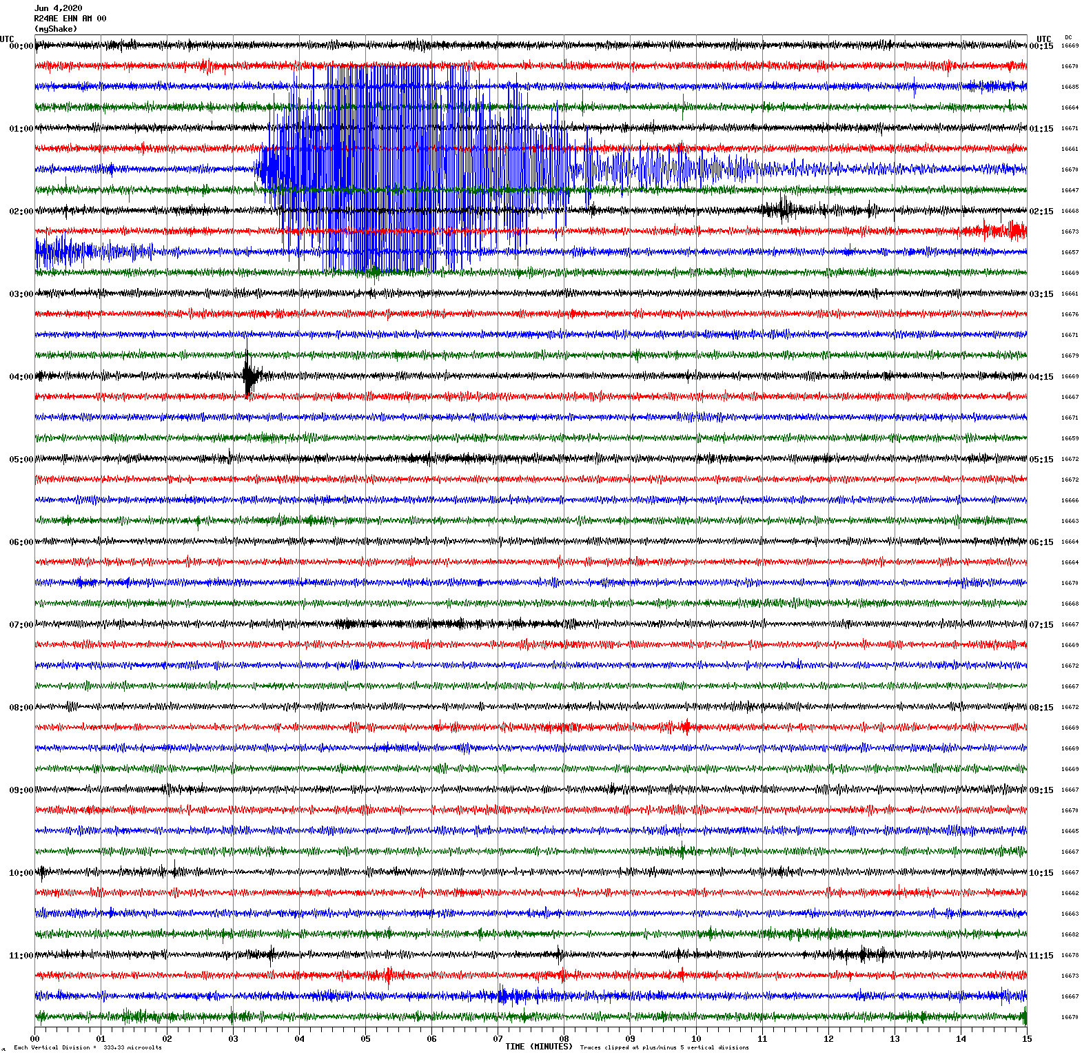
Magnitude 4.3
Depth 8.1 km
29 km SE of Bodie, CA
May 31, 2020 01:07:15 UTC
North/South Sensor
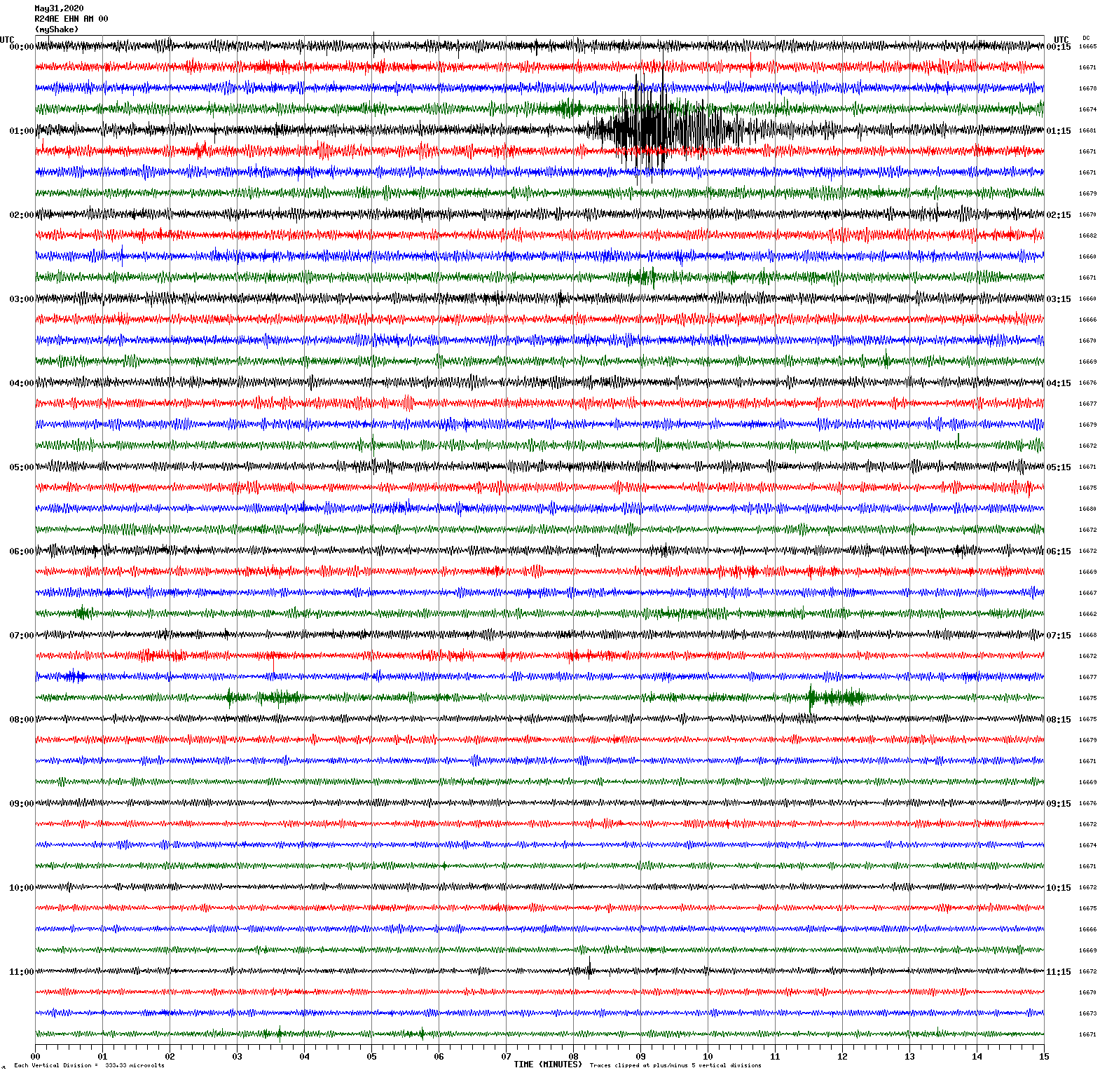
Magnitude 3.5
16 km NW of Pinnacles, CA
May 28, 2020 19:19:13 UTC
East/West Sensor
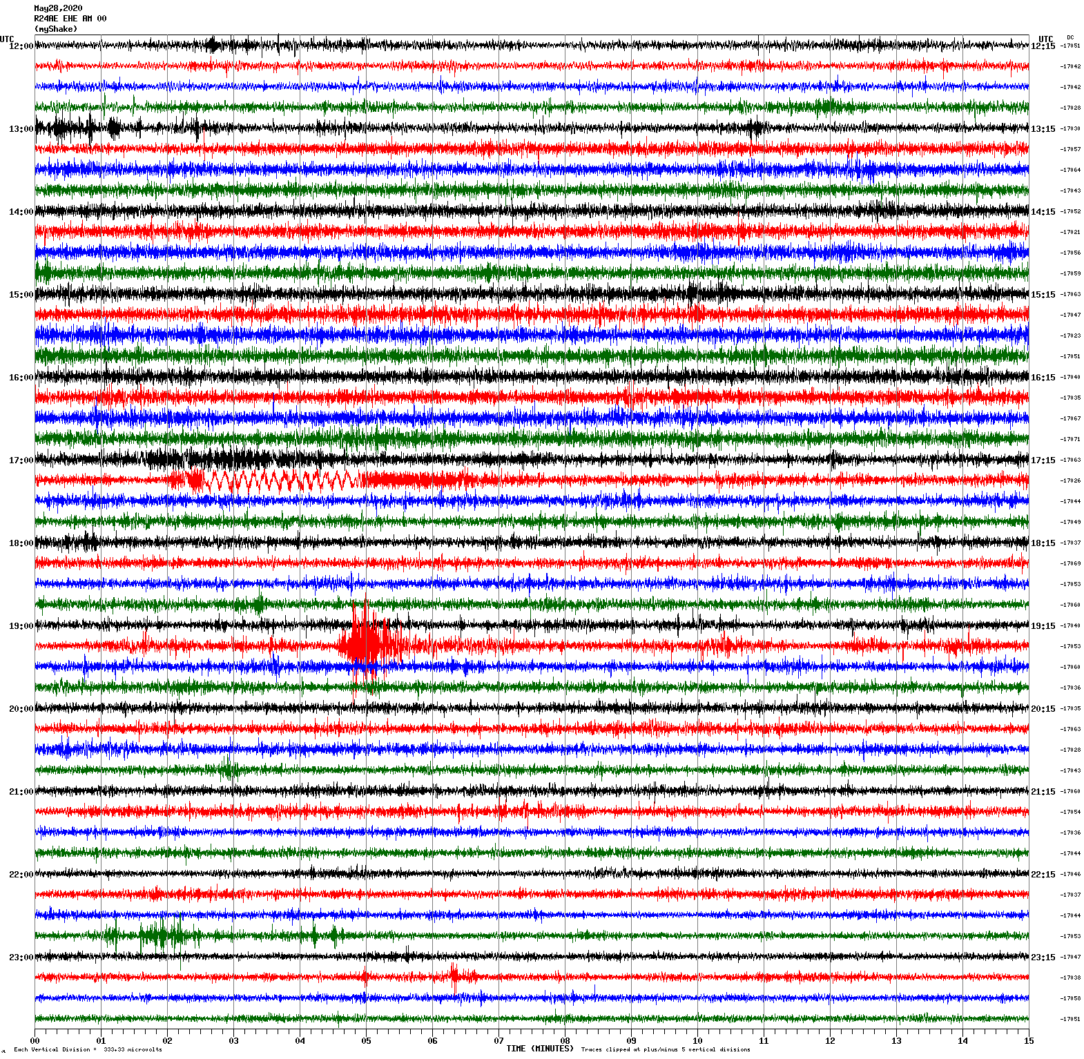
Magnitude 5.3
53 km WNW of Tonopah, Nevada
May 22, 2020 00:22:00 UTC
East/West Sensor
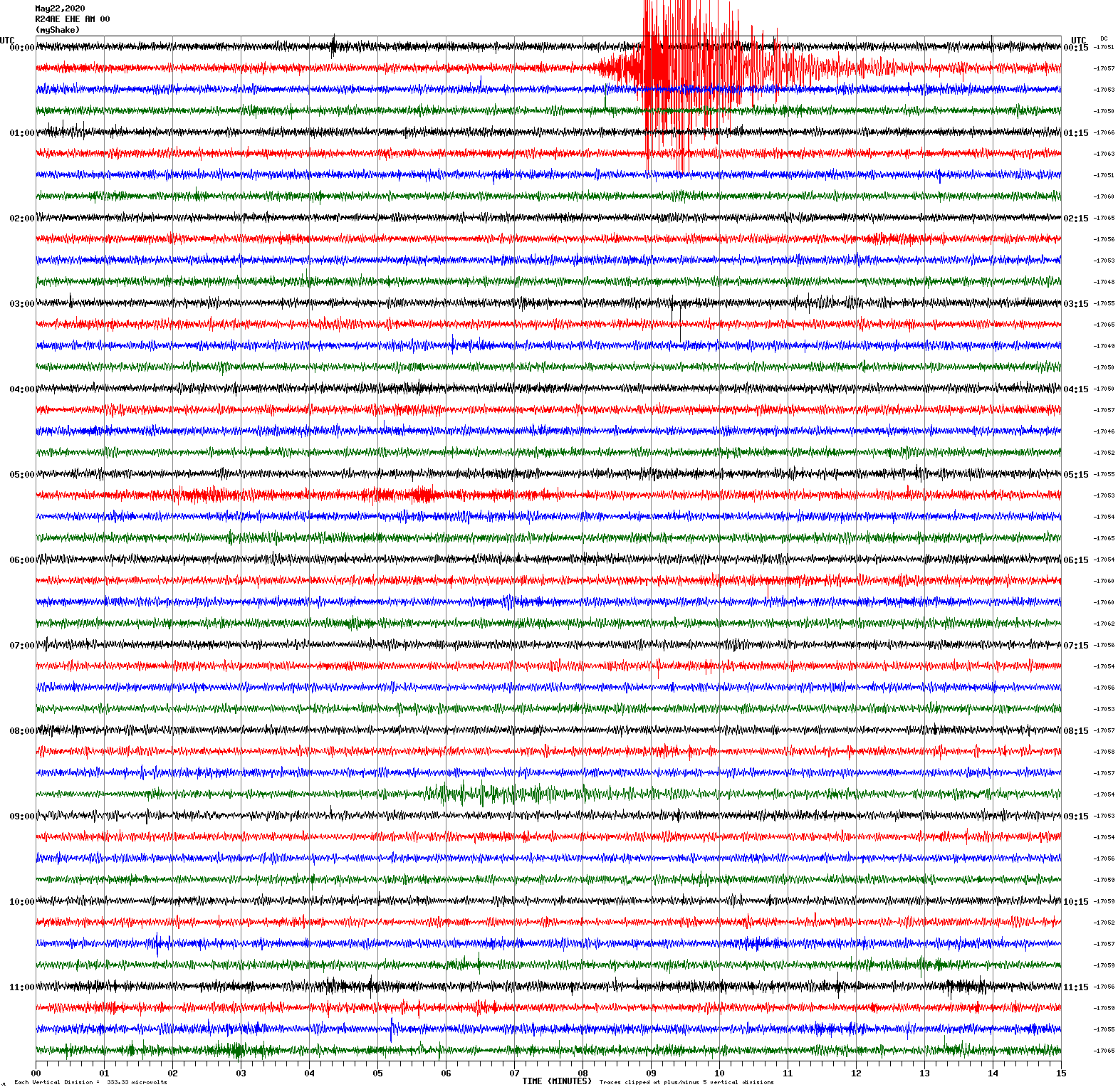
Magnitude 5.0
46 km WNW of Tonopah, Nevada
May 20, 2020 12:36:53 UTC
North/South Sensor
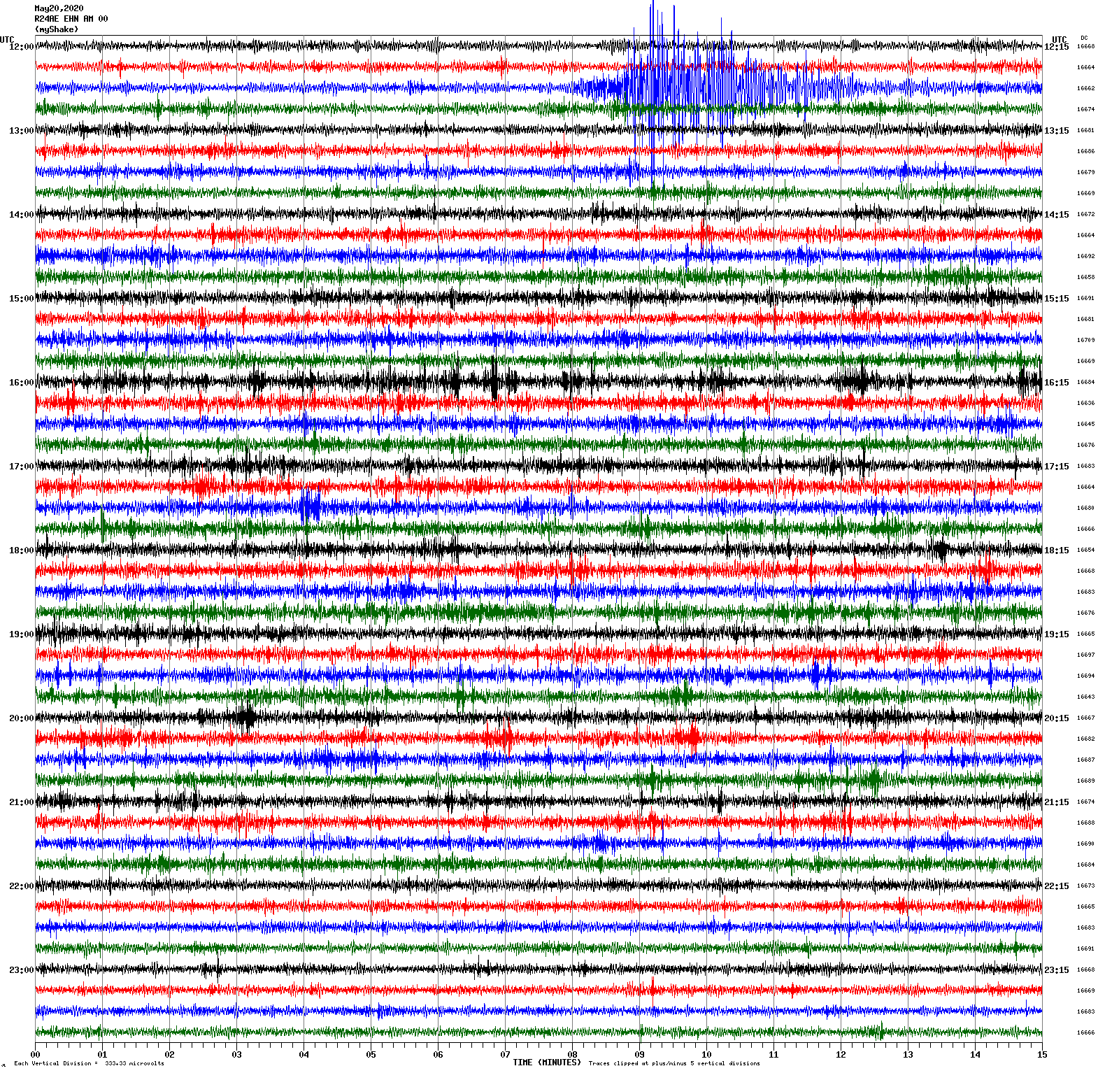
Magnitude 5.5
252 km W of Ferndale, California
May 18, 2020 07:02:34 UTC
East/West Sensor
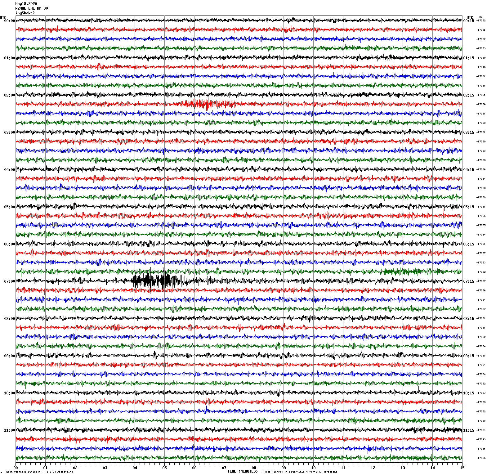
Magnitude 4.5
57 km WNW of Tonopah, Nevada
May 17, 2020 11:53:52 UTC
North/South Sensor
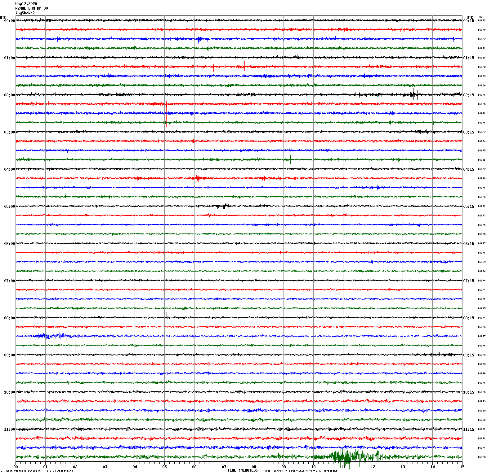
Magnitude 4.5
45 km WNW of Tonopah, Nevada
May 16, 2020 11:50:54 UTC
North/South Sensor
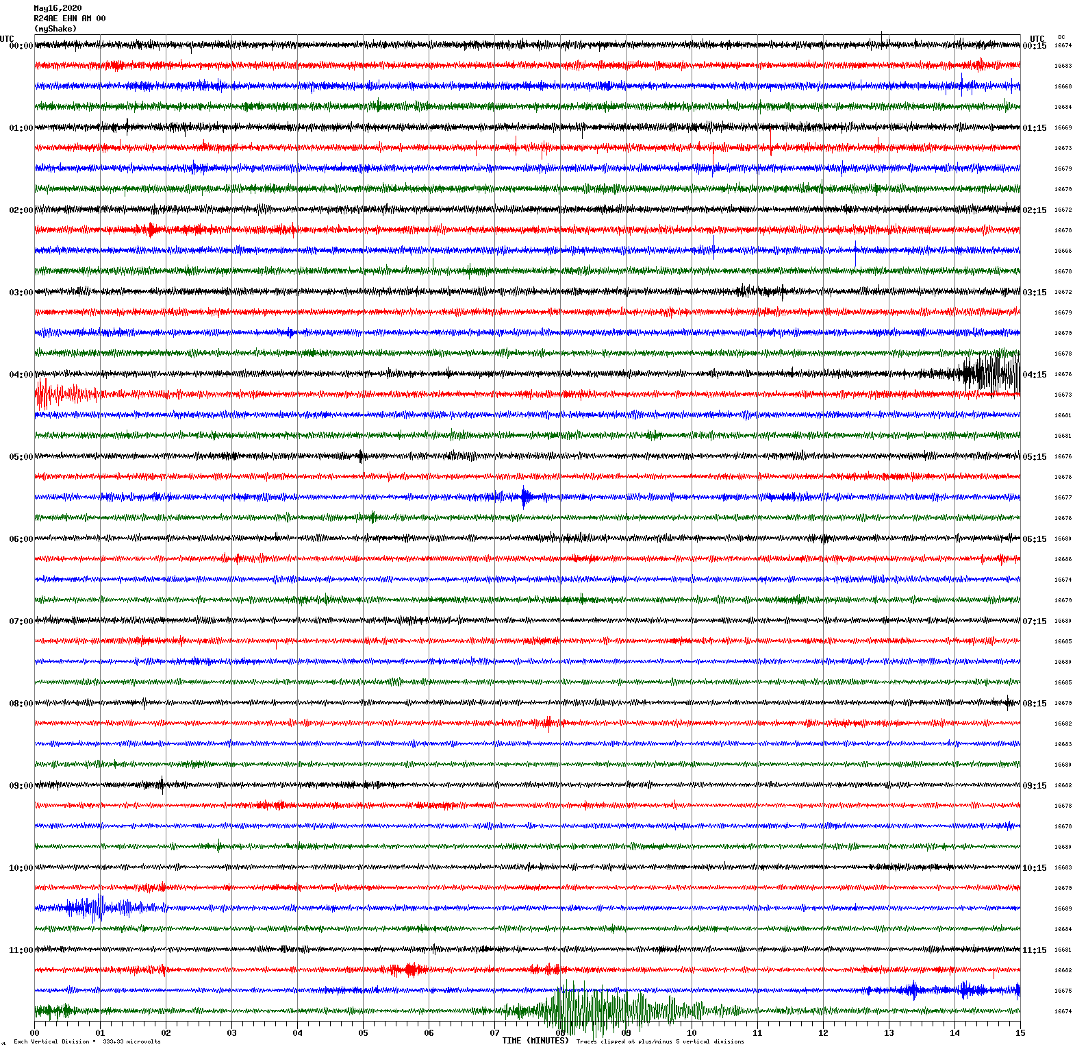
Magnitude 6.5
Depth 2.7 km
56 km W of Tonopah, Nevada
May 15, 2020 11:03:27 UTC
Magnitude 4.9
Depth 3.8 km
64 km W of Tonopah, Nevada
May 15, 2020 11:18:12 UTC
Magnitude 5.1
Depth 6.8 km
55 km WNW of Tonopah, Nevada
May 15, 2020 11:26:01 UTC
Magnitude 4.8
Depth 5.8 km
59 km WNW of Tonopah, Nevada
May 15, 2020 11:52:07 UTC
North/South Sensor
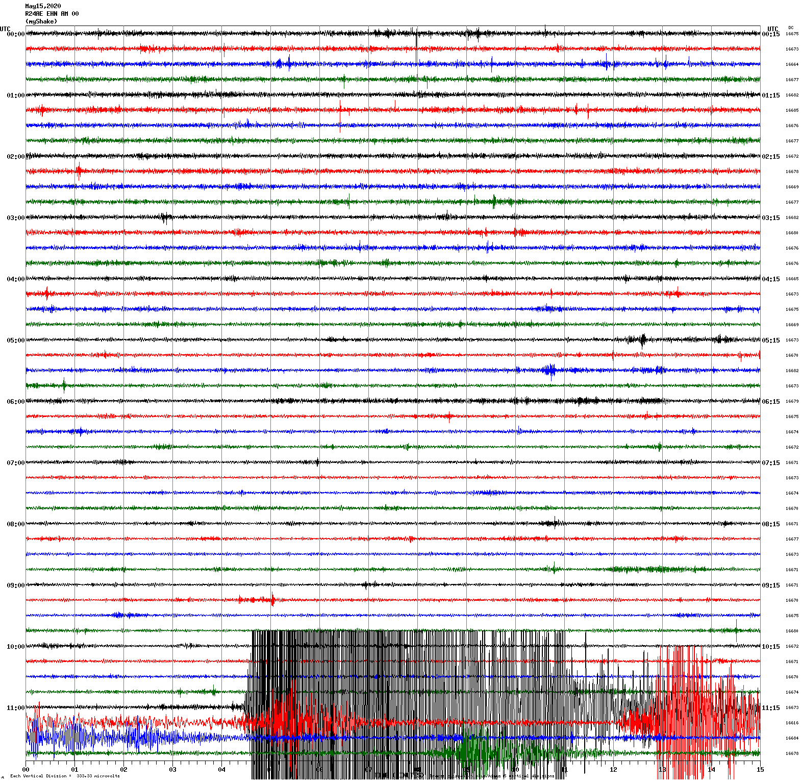
Magnitude 5.2
Depth 8.5 km
30 km SE of Bodie, California
April 11, 2020 14:36:37 UTC
Magnitude 4.6
Depth 8.9 km
29 km SE of Bodie, California
April 11, 2020 16:22:50 UTC
North/South Sensor
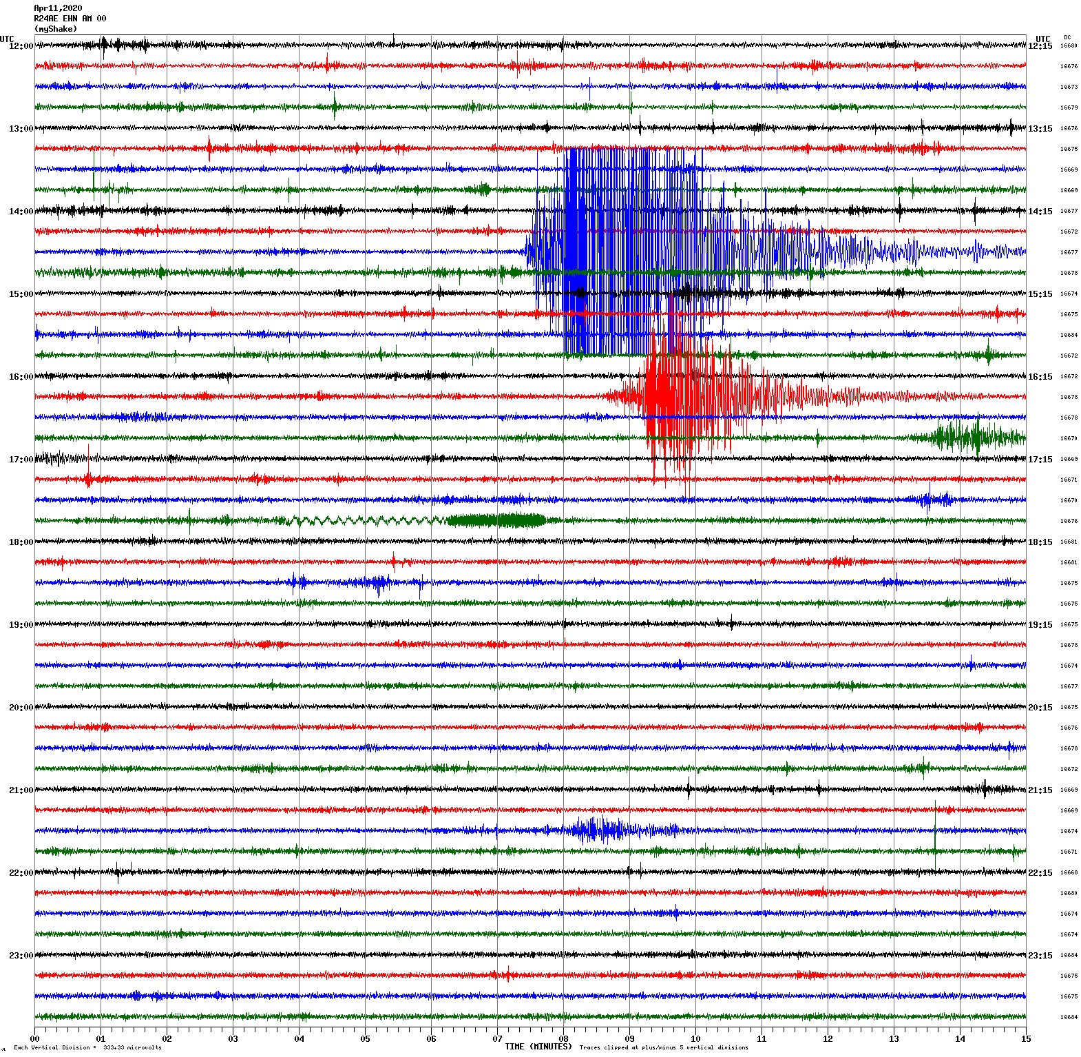
Magnitude 4.1
Depth 7.8 km
16 km WSW of Toms Place, California
April 5, 2020 19:20:46 UTC
North/South Sensor
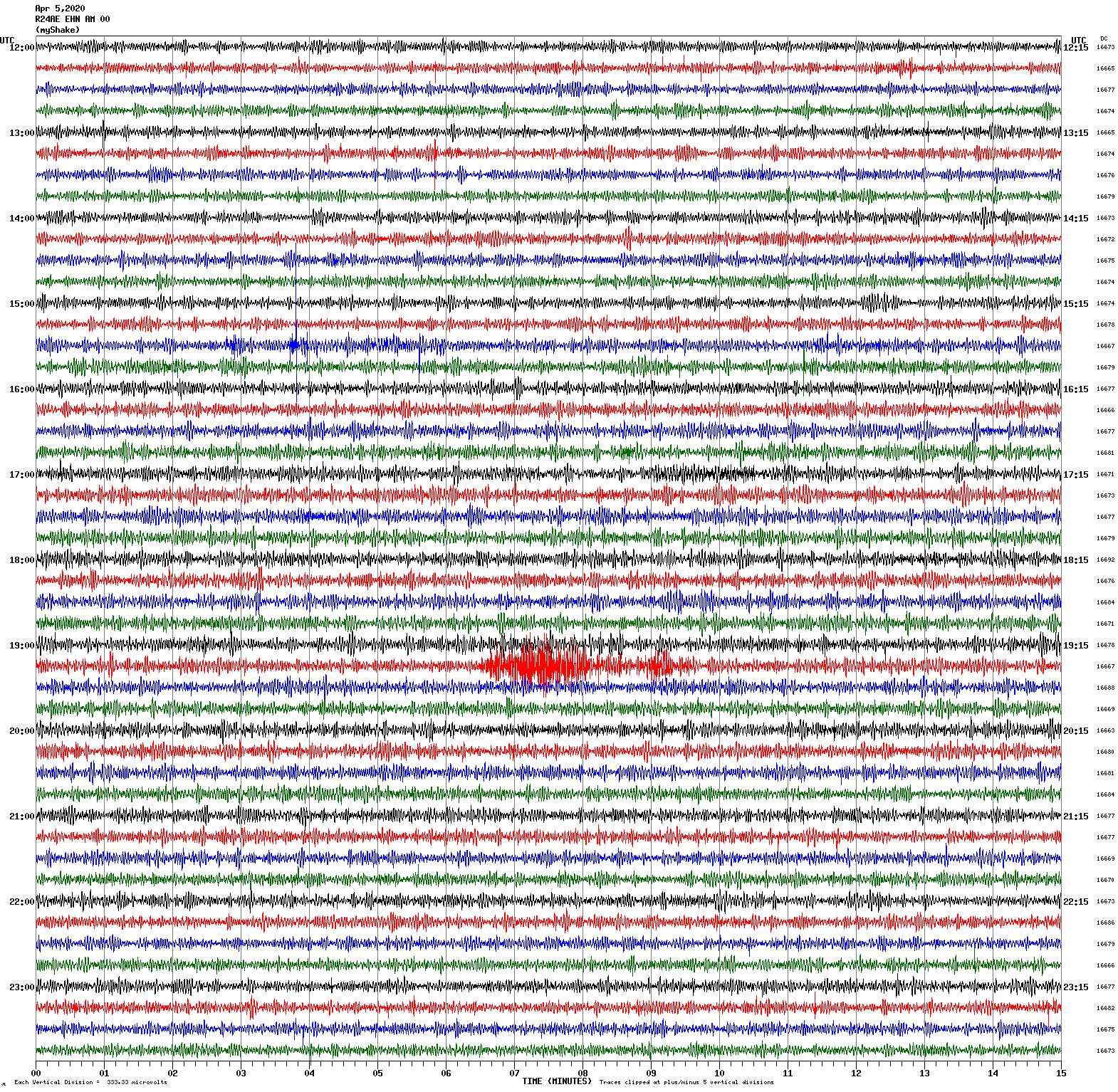
Magnitude 4.9
Depth 10.5 km
17 km ESE of Anza, California
April 4, 2020 01:53:18 UTC
North/South Sensor
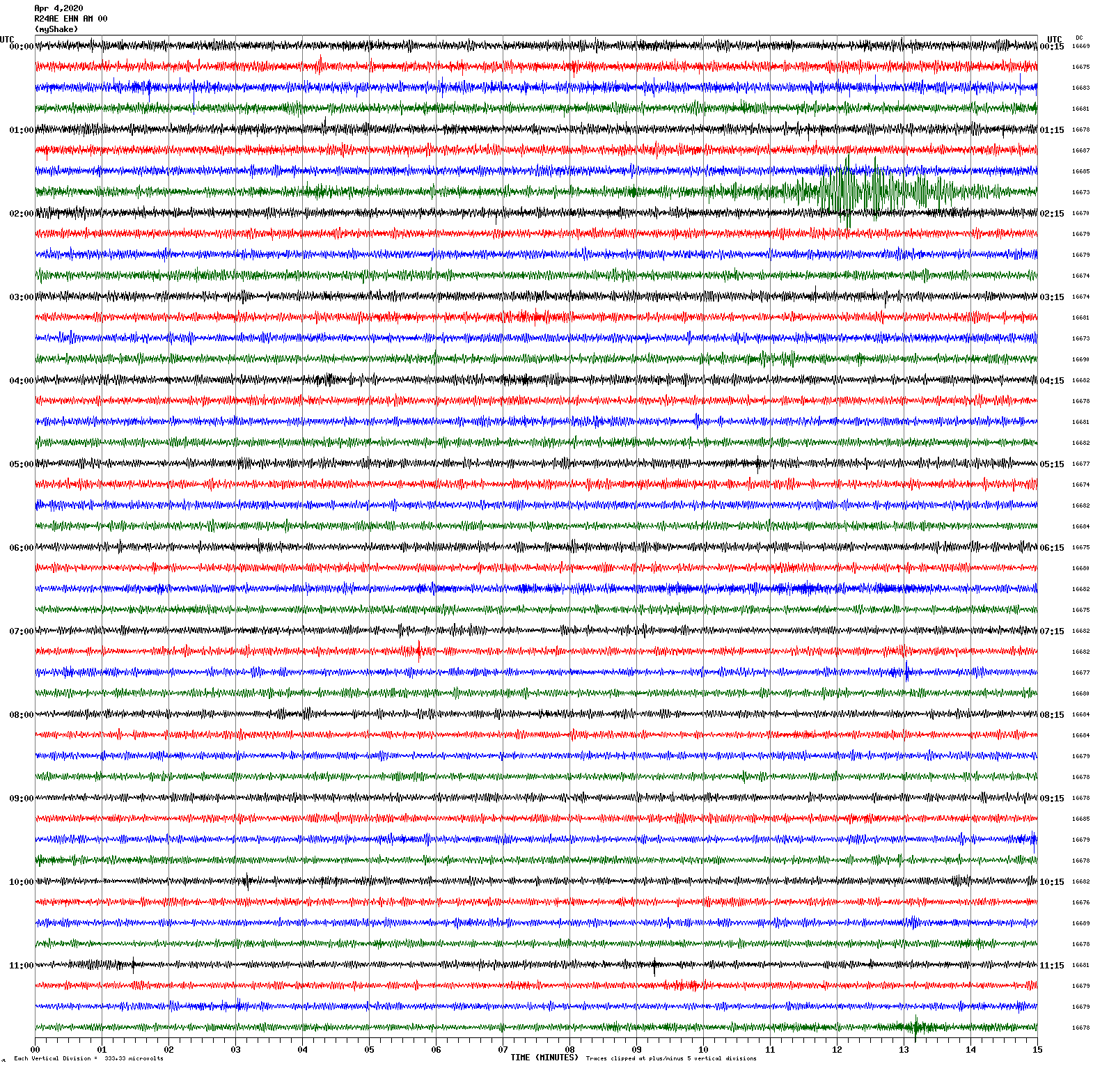
Magnitude 6.5
Depth 6.1 km
72 km W of Challis, Idaho
March 31, 2020 23:52:30 UTC
East/West Sensor
Note: This earthquake spans two graphs.
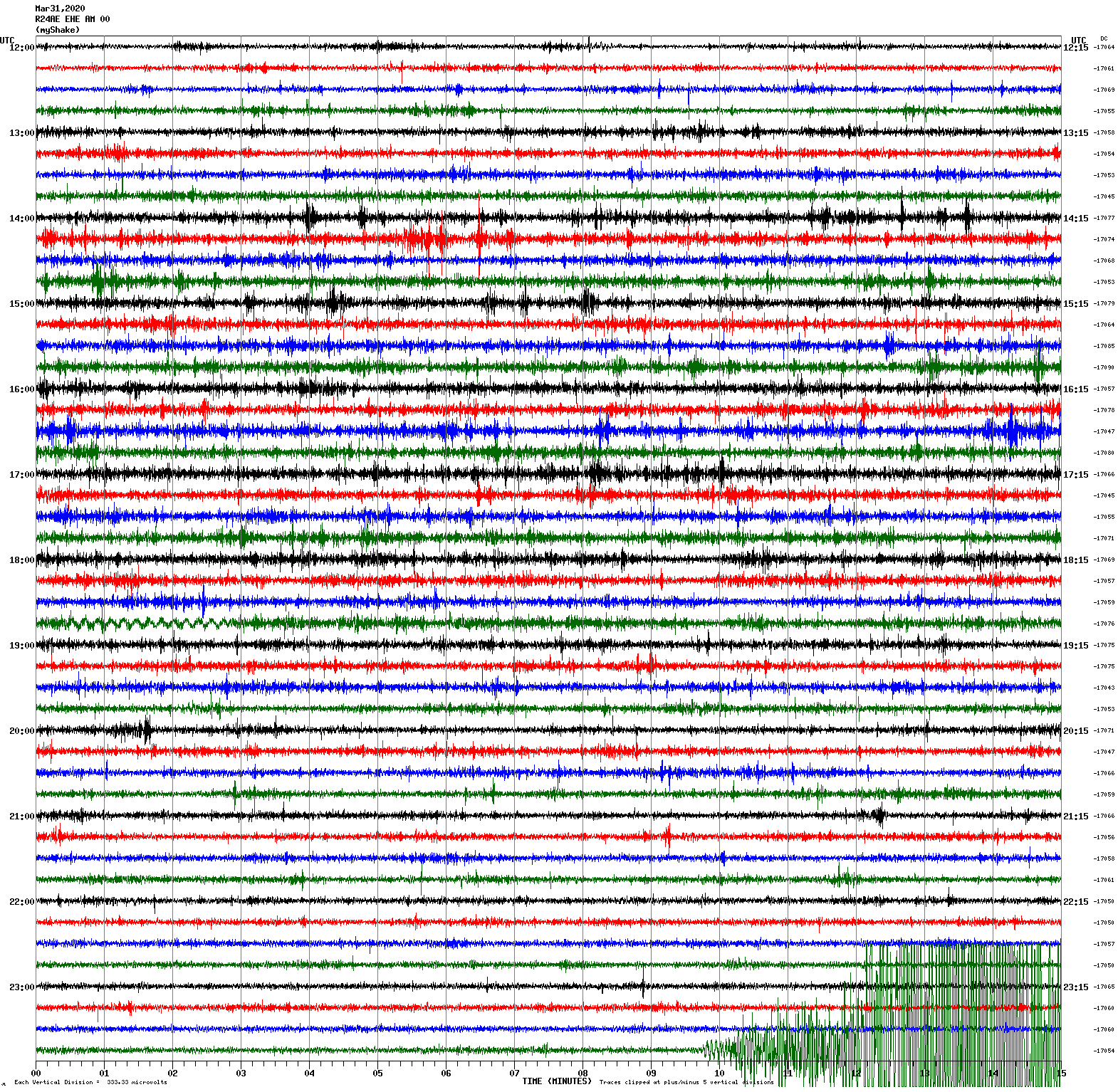
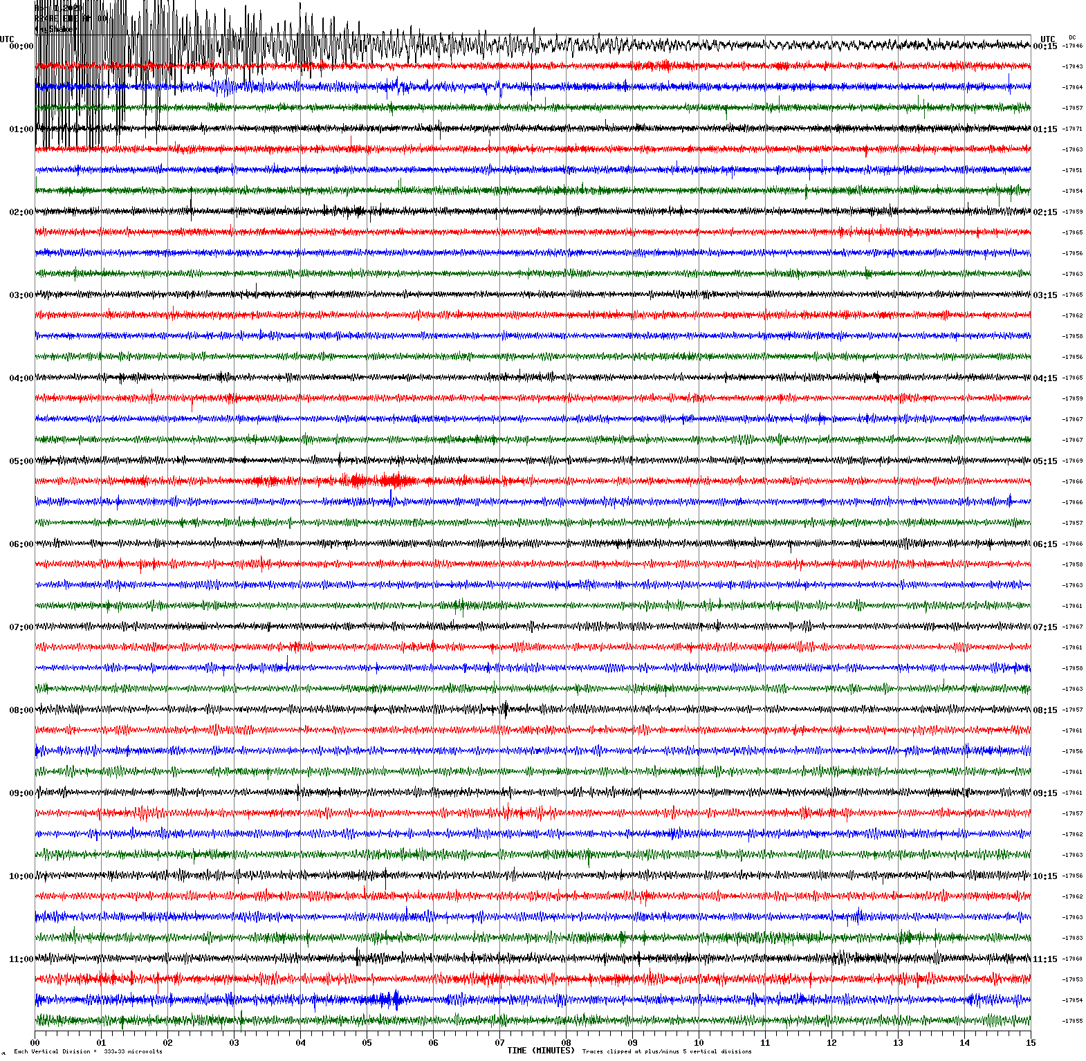
Magnitude 4.5
Depth 8.4 km
6 km N of Johnson Lane, Nevada
March 21, 2020 01:33:35 UTC
North/South Sensor
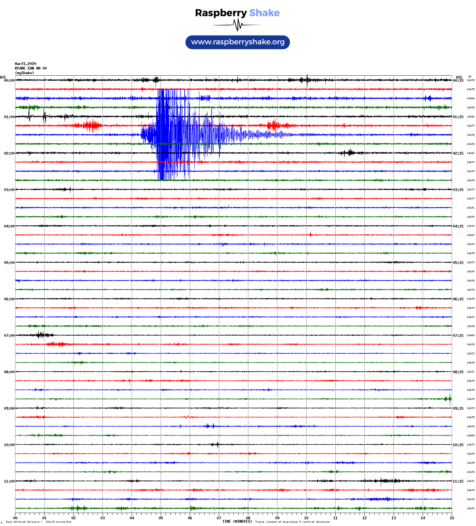
Magnitude 2.9
Depth 2.5 km
5 km NE of Alum Rock, California
March 19, 2020 10:17:04 UTC
East/West Sensor
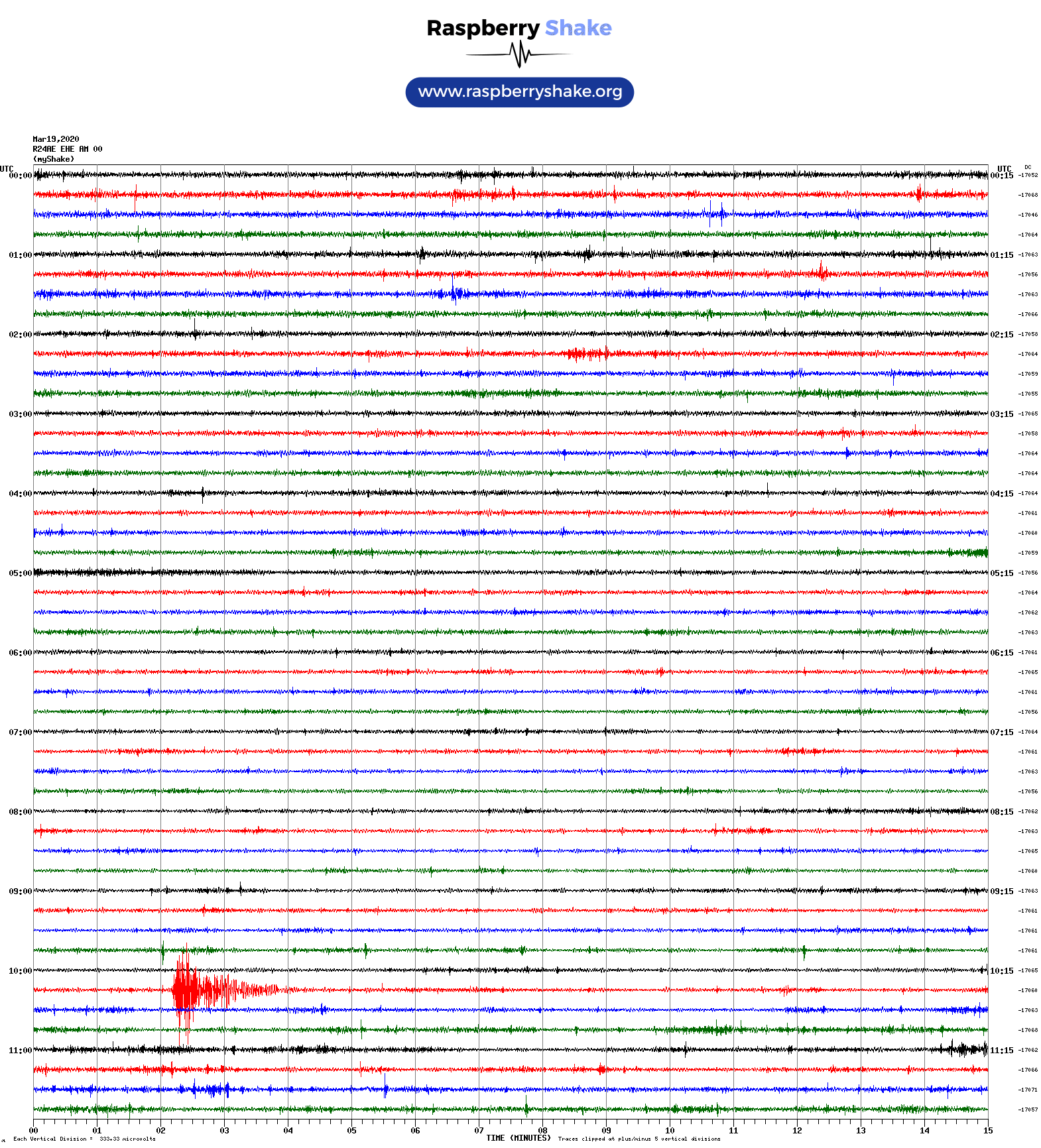
Magnitude 5.7
Depth 11.9 km
6 km NNE of Magna, Utah
March 18, 2020 13:09:31 UTC
Magnitude 5.2
Depth 28.6 km
15 km W of Petrolia, California
March 18, 2020 22:08:20 UTC
North/South Sensor
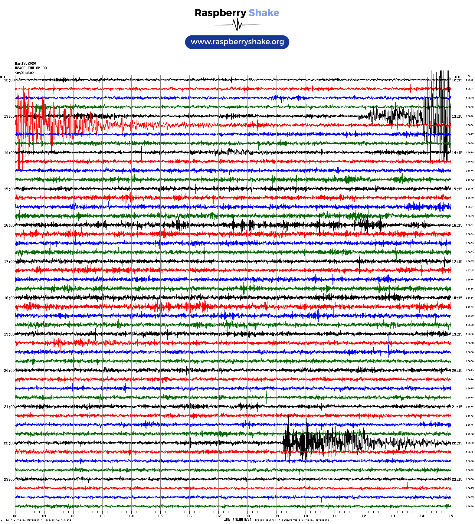
Magnitude 5.8
Depth 3.2 km
86 km W of Petrolia, California
March 9, 2020 02:59:06 UTC
Magnitude 4.9
Depth 7.2 km
73 km W of Petrolia, California
March 9, 2020 06:32:59 UTC
East/West Sensor
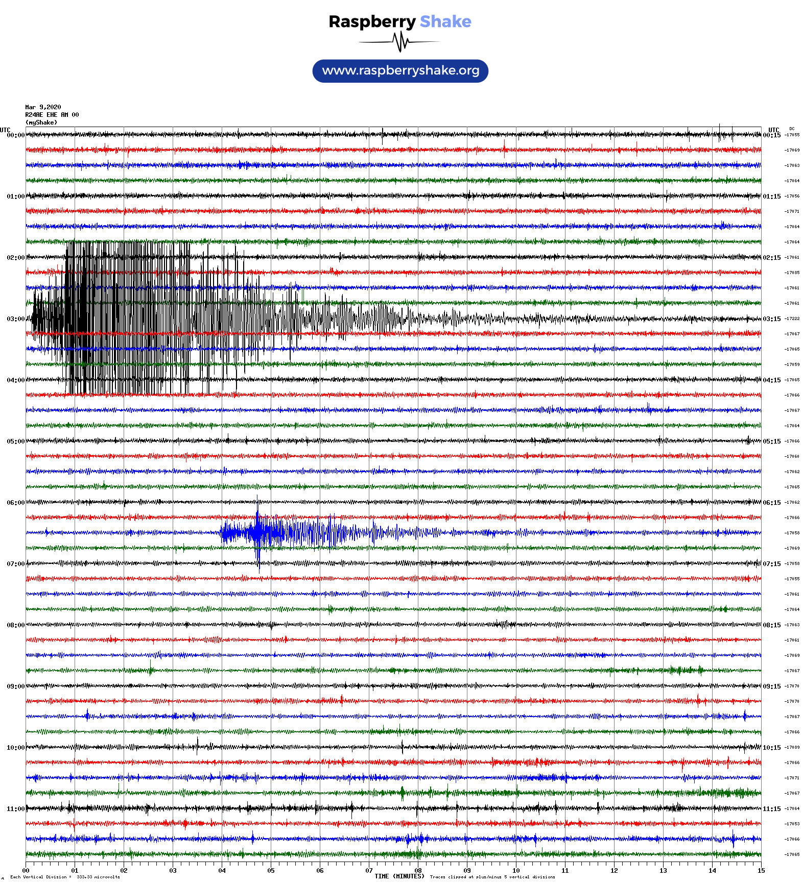
Magnitude 3.9
Depth 5.3 km
10km ENE of Morgan Hill, CA
January 2, 2020 07:16:31 UTC
North/South Sensor
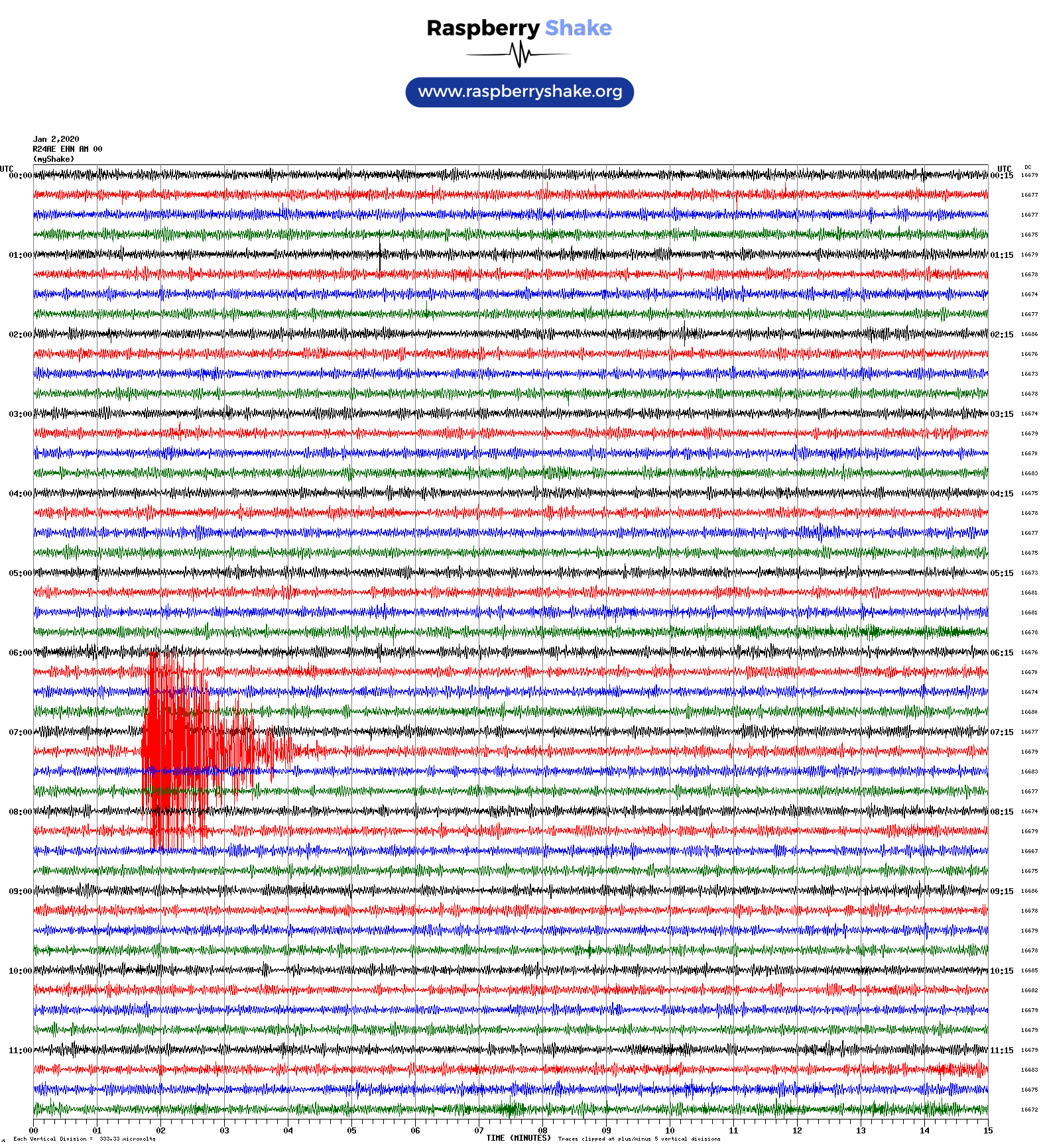
Voltage Counts & Frequency for All Sensors